Agen Allwedd Grand Circle trip 21/01/2023
Unless otherwise stated, camera, setups, lighting, edits and gallery effects by Tarquin. Modelling and lighting at various points will be Gwenllian Tawy and Dinny Davies.
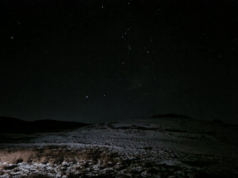
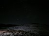 Orion, seen over the snow at Penwyllt.
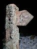 Snow and lichen.
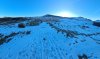 Snow on Carreg Lwyd, from Penwyllt.
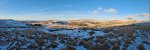 Snow over the Tawe valley. Mynydd y Drum (297 metres), Mynydd Marchywel (418 metres and 369 metres), Mynydd Allt-y-grug (338 metres), Cribarth (428 metres), Carreg Goch (558 metres) and Fan Hir (761 metres).
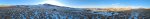 Carreg Cadno (538 metres) and its Carreg Lwyd outcrop, Mynydd y Drum, Mynydd Marchywel, Mynydd Allt-y-grug, Cribarth, Carreg Goch and Fan Hir.
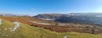 Clydach Gorge from Mynydd Llangatwg. Sugar Loaf (596 metres), Skirrid (486 metres), Gilwern Hill (441 metres) and Llanelly Hill (about 500 metres).
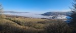 Inversion over Abergavenny. Sugar Loaf, Skirrid, Gilwern Hill, the Blorenge (561 metres) and Llanelly Hill.
 Snow Crystals.
 Inversion over the Usk. Mynydd Llangatwg (530 metres), Tor y Foel (551 metres), Mynydd Llangorse (515 metres), Mynydd Troed (609 metres), Pen Allt-mawr (719 metres), Pen Cerrig-calch (701 metres), Crug Mawr (550 metres), Hatterall Hill (531 metres), Gaer (427 metres) and the Sugar Loaf.
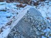 Frosty rock.
 Inversion with Mynydd Llangorse and Mynydd Troed.
 Mynydd Llangatwg in the snow. In the background are Mynydd Llangorse, Mynydd Troed, Pen Allt-mawr, Pen Cerrig-calch and Crug Mawr.
Modelling by two random walkers, Dinny and Gwenllian
Mynydd Llangatwg in the snow. In the background are Mynydd Llangorse, Mynydd Troed, Pen Allt-mawr, Pen Cerrig-calch and Crug Mawr.
Modelling by two random walkers, Dinny and Gwenllian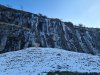 Ice on the cliff.
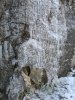 Iced cave entrance.
 Cliff ice.
 Start of Southern Stream Passage.
Modelling by Dinny and Gwenllian, lighting by Tarquin, Dinny and Gwenllian
Start of Southern Stream Passage.
Modelling by Dinny and Gwenllian, lighting by Tarquin, Dinny and Gwenllian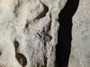 Dorsal fin spine of a Ctenacanthus proto-shark, in the wall of Southern Stream Passage, at its start.
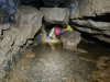 One of the early wet crawls in Southern Stream Passage. It is possible with great difficulty to keep dry, as long as the water levels are low.
Modelling by Dinny, lighting by Tarquin and Dinny
One of the early wet crawls in Southern Stream Passage. It is possible with great difficulty to keep dry, as long as the water levels are low.
Modelling by Dinny, lighting by Tarquin and Dinny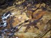 Gecko. Or plesiosaur.
 Stacked rocks making a mockery of gravity. We were aiming for Isles Inlet. During the annoying rock crawl section of the passage, Dinny realised we were part way around the Grand Circle, and asked to change our route out to be the Grand Circle instead of coming back up through Southern Stream. We conveniently passed some other cavers, and asked them to change our logbook entry to show our new route and updated ETO. We did not have enough food and drink for that route, but I wrongly assumed we would find some inlets to drink from.
Modelling by Gwenllian, lighting by Tarquin, Dinny and Gwenllian
Stacked rocks making a mockery of gravity. We were aiming for Isles Inlet. During the annoying rock crawl section of the passage, Dinny realised we were part way around the Grand Circle, and asked to change our route out to be the Grand Circle instead of coming back up through Southern Stream. We conveniently passed some other cavers, and asked them to change our logbook entry to show our new route and updated ETO. We did not have enough food and drink for that route, but I wrongly assumed we would find some inlets to drink from.
Modelling by Gwenllian, lighting by Tarquin, Dinny and Gwenllian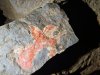 Patterned rock. Either an eagle landing (facing right) or a woman dancing (facing left).
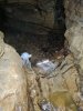 Waterfall at the end of the annoying rocky section.
Modelling by Gwenllian, lighting by Tarquin, Dinny and Gwenllian
Waterfall at the end of the annoying rocky section.
Modelling by Gwenllian, lighting by Tarquin, Dinny and Gwenllian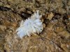 Gypsum in Gothic Passage. I was already feeling a little off at this point, having just drunk enough at Second Inlet for the shorter trip we had planned.
Lighting by Tarquin, Dinny and Gwenllian
Gypsum in Gothic Passage. I was already feeling a little off at this point, having just drunk enough at Second Inlet for the shorter trip we had planned.
Lighting by Tarquin, Dinny and Gwenllian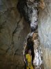 Formations in Trafalgar.
Modelling by Dinny, lighting by Tarquin and Gwenllian
Formations in Trafalgar.
Modelling by Dinny, lighting by Tarquin and Gwenllian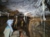 Elaborate formations in Corkscrew Chamber. By the time we left Isles Inlet, I was feeling quite dehydrated, and took the remaining electrolytes that I had, along with as much drink as I could spare. And a little of Gwenllian's. Southern Stream itself is not drinkable, and Main Stream Passage has both the Blaen Onnau Quarry water from Remembrance Series, and numerous other untrustworthy inlets. Not to worry, there are bound to be plenty of inlets in Lower Main Stream Passage, right? Right?
Modelling by Gwenllian and Dinny, lighting by Tarquin, Gwenllian and Dinny
Elaborate formations in Corkscrew Chamber. By the time we left Isles Inlet, I was feeling quite dehydrated, and took the remaining electrolytes that I had, along with as much drink as I could spare. And a little of Gwenllian's. Southern Stream itself is not drinkable, and Main Stream Passage has both the Blaen Onnau Quarry water from Remembrance Series, and numerous other untrustworthy inlets. Not to worry, there are bound to be plenty of inlets in Lower Main Stream Passage, right? Right?
Modelling by Gwenllian and Dinny, lighting by Tarquin, Gwenllian and Dinny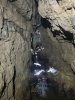 The section of Southern Stream Passage downstream of Gothic Passage.
Modelling by Gwenllian and parts of Dinny, lighting by Tarquin, Gwenllian and Dinny
The section of Southern Stream Passage downstream of Gothic Passage.
Modelling by Gwenllian and parts of Dinny, lighting by Tarquin, Gwenllian and Dinny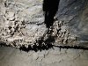 Muddy helictites. How on earth did these manage to grow in such a flood prone area?
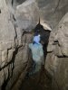 The flooding line is significantly high, and gets much higher by the end of the passage.
Modelling by Gwenllian, lighting by Tarquin, Dinny and Gwenllian
The flooding line is significantly high, and gets much higher by the end of the passage.
Modelling by Gwenllian, lighting by Tarquin, Dinny and Gwenllian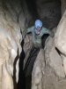 Near the end of the passage, where progress requires climbing several metres up the slippery rift, and following ledges until a descent is possible.
Modelling by Gwenllian
Near the end of the passage, where progress requires climbing several metres up the slippery rift, and following ledges until a descent is possible.
Modelling by Gwenllian Junction of Southern Stream and Lower Main Stream Passage. The flood scum on the walls is 4 metres up the wall. This river becomes an extreme chaos of water in flood, and sumps just upstream of the junction.
Modelling by Gwenllian and a mote of Dinny, lighting by Tarquin and Dinny
Junction of Southern Stream and Lower Main Stream Passage. The flood scum on the walls is 4 metres up the wall. This river becomes an extreme chaos of water in flood, and sumps just upstream of the junction.
Modelling by Gwenllian and a mote of Dinny, lighting by Tarquin and Dinny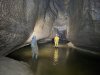 To the left, the river turns a couple of corners to reach Sump 1. Beyond that are two more sumps to reach the major river passage of Maytime (accessible to non-divers via Ressurection Passage from Gothic Passage), after which the lengthy Sump 4 marks the end of the cave.
Modelling by Gwenllian and Dinny, lighting by Tarquin, Gwenllian and Dinny
To the left, the river turns a couple of corners to reach Sump 1. Beyond that are two more sumps to reach the major river passage of Maytime (accessible to non-divers via Ressurection Passage from Gothic Passage), after which the lengthy Sump 4 marks the end of the cave.
Modelling by Gwenllian and Dinny, lighting by Tarquin, Gwenllian and Dinny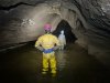 Heading upstream from the junction, along a beautifully arched section.
Modelling by Dinny and Gwenllian, lighting by Tarquin, Dinny and Gwenllian
Heading upstream from the junction, along a beautifully arched section.
Modelling by Dinny and Gwenllian, lighting by Tarquin, Dinny and Gwenllian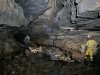 The floor then becomes more rocky, and from here onwards, the passage can be an absolute nightmare in summer, because the bacterial mats on the rocks can turn it into an ice rink. So slippery that you cannot take a step without slipping over. Progress is very slow and tiring in those conditions, and you spend the whole time staring at your feet, occasionally looking up for a moment to appreciate the passage, then back at your feet. However in winter, the frequent floods rip the bacterial mats off the rocks, and they become grippy, so you actually get to enjoy the passage. The odd little spot might still have a slick coating, but the vast majority is so much better than summer, if you can catch it between floods.
Modelling by Dinny and Gwenllian, lighting by Tarquin, Dinny and Gwenllian
The floor then becomes more rocky, and from here onwards, the passage can be an absolute nightmare in summer, because the bacterial mats on the rocks can turn it into an ice rink. So slippery that you cannot take a step without slipping over. Progress is very slow and tiring in those conditions, and you spend the whole time staring at your feet, occasionally looking up for a moment to appreciate the passage, then back at your feet. However in winter, the frequent floods rip the bacterial mats off the rocks, and they become grippy, so you actually get to enjoy the passage. The odd little spot might still have a slick coating, but the vast majority is so much better than summer, if you can catch it between floods.
Modelling by Dinny and Gwenllian, lighting by Tarquin, Dinny and Gwenllian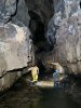 The tall passage near where it passes the rope climb to High Traverse, which can be used in an emergency to get to Gothic Passage, bypassing the section of the river that sumps, and the bottom end of Southern Stream Passage.
Modelling by Dinny and Gwenllian, lighting by Tarquin, Dinny and Gwenllian
The tall passage near where it passes the rope climb to High Traverse, which can be used in an emergency to get to Gothic Passage, bypassing the section of the river that sumps, and the bottom end of Southern Stream Passage.
Modelling by Dinny and Gwenllian, lighting by Tarquin, Dinny and Gwenllian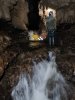 A series of exciting cascades. The pools are deep, and some amount of wedging between the walls, and careful feeling for shallower spots can be used to avoid a thorough soaking.
Modelling by Gwenllian and Dinny, lighting by Tarquin, Gwenllian and Dinny
A series of exciting cascades. The pools are deep, and some amount of wedging between the walls, and careful feeling for shallower spots can be used to avoid a thorough soaking.
Modelling by Gwenllian and Dinny, lighting by Tarquin, Gwenllian and Dinny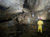 Approaching Quarry Corner.
Modelling by Dinny and Gwenllian, lighting by Tarquin, Dinny and Gwenllian
Approaching Quarry Corner.
Modelling by Dinny and Gwenllian, lighting by Tarquin, Dinny and Gwenllian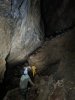 The huge passage after Quarry Corner.
Modelling by Gwenllian and Dinny, lighting by Tarquin, Gwenllian and Dinny
The huge passage after Quarry Corner.
Modelling by Gwenllian and Dinny, lighting by Tarquin, Gwenllian and Dinny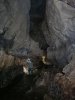 Impressively big passage.
Modelling by Gwenllian and Dinny, lighting by Tarquin, Gwenllian and Dinny
Impressively big passage.
Modelling by Gwenllian and Dinny, lighting by Tarquin, Gwenllian and Dinny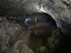 Lake with an arched celing.
Modelling by Gwenllian, Dinny and Dinny's reflection, lighting by Tarquin, Gwenllian and Dinny
Lake with an arched celing.
Modelling by Gwenllian, Dinny and Dinny's reflection, lighting by Tarquin, Gwenllian and Dinny The deepest cascade on the route. It is shallow for a while on the right, but then becomes too deep. Holding on to the right overhang makes it possible to avoid swimming, but the final climb up is always difficult, trying to get up without standing in the full force of the waterfall. However, it is quite normal to be thoroughly soaked, and we had worn clothing for the hot trip to Isles Inlet, not the cold trip in the river.
Modelling by Dinny, lighting by Tarquin, Gwenllian and Dinny
The deepest cascade on the route. It is shallow for a while on the right, but then becomes too deep. Holding on to the right overhang makes it possible to avoid swimming, but the final climb up is always difficult, trying to get up without standing in the full force of the waterfall. However, it is quite normal to be thoroughly soaked, and we had worn clothing for the hot trip to Isles Inlet, not the cold trip in the river.
Modelling by Dinny, lighting by Tarquin, Gwenllian and Dinny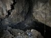 Looking down the final section of passage towards the massive Fifth Choke. Another stream seems to enter here, doubling the size of Main Stream, with cave temperature water (unlike the Main Stream), implying that it has been underground for a long time. The rope on the right accesses Lost Passage, and we once ascended it by mistake with a Petzl Tibloc and Alpine Clutch, and had to do a very dodgy traverse to regain the correct route.
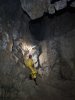 The climb up to Biza Passage, using two knotted handlines as a ladder. I was already very thirsty, as there had been no little inlets which could be trusted for drinking, and we were now heading into dry passages. The headache was already quite strong.
Modelling by Dinny and Gwenllian, lighting by Tarquin, Dinny and Gwenllian
The climb up to Biza Passage, using two knotted handlines as a ladder. I was already very thirsty, as there had been no little inlets which could be trusted for drinking, and we were now heading into dry passages. The headache was already quite strong.
Modelling by Dinny and Gwenllian, lighting by Tarquin, Dinny and Gwenllian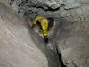 Start of Biza Passage, showing its typical style, a slight keyhole with scallops on the bottom, and a nodular top.
Modelling by Dinny, lighting by Tarquin and Dinny
Start of Biza Passage, showing its typical style, a slight keyhole with scallops on the bottom, and a nodular top.
Modelling by Dinny, lighting by Tarquin and Dinny Climb up near Sump Passage, a side passage which predictably goes to a sump.
Modelling by Dinny, lighting by Tarquin and Dinny
Climb up near Sump Passage, a side passage which predictably goes to a sump.
Modelling by Dinny, lighting by Tarquin and Dinny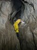 Climbing up to a higher level.
Modelling by Dinny and Gwenllian, lighting by Tarquin, Dinny and Gwenllian
Climbing up to a higher level.
Modelling by Dinny and Gwenllian, lighting by Tarquin, Dinny and Gwenllian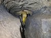 Biza Passage then becomes lower, often requiring crawling, particularly on the ledges. While this was more than Dinny's knees wanted, it should be noted that the entire passage is about 350 metres long (while the bad section of Southwen Stream Passage is 600 metres long), and takes only about 20 minutes. That includes all the walking sections, which account for about half of the passage length.
Modelling by Dinny, lighting by Tarquin and Dinny
Biza Passage then becomes lower, often requiring crawling, particularly on the ledges. While this was more than Dinny's knees wanted, it should be noted that the entire passage is about 350 metres long (while the bad section of Southwen Stream Passage is 600 metres long), and takes only about 20 minutes. That includes all the walking sections, which account for about half of the passage length.
Modelling by Dinny, lighting by Tarquin and Dinny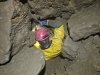 Biza Passage ends at Fourth Choke. This is really quite tight, and aims vertically downwards for 15 metres. The top 10 metres are so small, that the choke is most easily navigated by worming downwards feet first with your arms above your head. Having bags attached to your belt is a liability (speaking from experience), and they are best held in your hands. Reversing is extremely difficult, but some (crazy) people do the Grand Circle in the opposite direction, ascending through this choke.
Modelling by Dinny, lighting by Tarquin and Dinny
Biza Passage ends at Fourth Choke. This is really quite tight, and aims vertically downwards for 15 metres. The top 10 metres are so small, that the choke is most easily navigated by worming downwards feet first with your arms above your head. Having bags attached to your belt is a liability (speaking from experience), and they are best held in your hands. Reversing is extremely difficult, but some (crazy) people do the Grand Circle in the opposite direction, ascending through this choke.
Modelling by Dinny, lighting by Tarquin and Dinny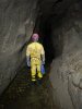 Between the chokes, back in the river, but now with a gravel floor, which is grippy even in summer.
Modelling by Dinny, lighting by Tarquin and Dinny
Between the chokes, back in the river, but now with a gravel floor, which is grippy even in summer.
Modelling by Dinny, lighting by Tarquin and Dinny Third Choke. The way through starts on the right, part way up, dropping down to the river. The route is convoluted, slowly ascending, and breaking away from the right wall, wandering through the middle of the choke, and switching to the left side. It does not feel like it should work, since it has nothing to follow.
Modelling by Dinny, lighting by Tarquin and Dinny
Third Choke. The way through starts on the right, part way up, dropping down to the river. The route is convoluted, slowly ascending, and breaking away from the right wall, wandering through the middle of the choke, and switching to the left side. It does not feel like it should work, since it has nothing to follow.
Modelling by Dinny, lighting by Tarquin and Dinny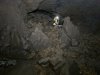 Exiting the Third Choke. The river is regained, and this marks the start of the longest uninterrupted streamway of any British cave, heading up Turkey Streamway to the Turkey Sumps.
Modelling by Dinny, lighting by Tarquin and Dinny
Exiting the Third Choke. The river is regained, and this marks the start of the longest uninterrupted streamway of any British cave, heading up Turkey Streamway to the Turkey Sumps.
Modelling by Dinny, lighting by Tarquin and Dinny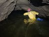 The low arched river beyond.
Modelling by Dinny, lighting by Tarquin and Dinny
The low arched river beyond.
Modelling by Dinny, lighting by Tarquin and Dinny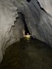 The Narrows. The water here is very deep, and progress is made by traversing along one of the walls, holding on to little nodules, and feeling for footholds under water.
Modelling by Dinny, lighting by Tarquin and Dinny
The Narrows. The water here is very deep, and progress is made by traversing along one of the walls, holding on to little nodules, and feeling for footholds under water.
Modelling by Dinny, lighting by Tarquin and Dinny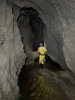 After The Narrows.
Modelling by Dinny, lighting by Tarquin and Dinny
After The Narrows.
Modelling by Dinny, lighting by Tarquin and Dinny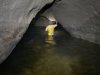 Deep Water, which is normally just a wade in the river, up to your waist.
Modelling by Dinny, lighting by Tarquin and Dinny
Deep Water, which is normally just a wade in the river, up to your waist.
Modelling by Dinny, lighting by Tarquin and Dinny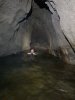 However, flooding had eroded a deep trench in the sediment floor, and we had to swim for about 3 metres. So we got soaked anyway. Oh well.
Modelling by Dinny, lighting by Tarquin and Dinny
However, flooding had eroded a deep trench in the sediment floor, and we had to swim for about 3 metres. So we got soaked anyway. Oh well.
Modelling by Dinny, lighting by Tarquin and Dinny After Deep Water.
Modelling by Dinny, lighting by Tarquin and Dinny
After Deep Water.
Modelling by Dinny, lighting by Tarquin and Dinny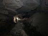 Near Chocolate Passage. The signs of flooding were impressively high.
Modelling by Gwenllian and Dinny, lighting by Tarquin, Gwenllian and Dinny
Near Chocolate Passage. The signs of flooding were impressively high.
Modelling by Gwenllian and Dinny, lighting by Tarquin, Gwenllian and Dinny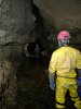 Nearing Cascade Inlet. A small inlet finally made itself known, and I was able to get the first drink for 3 hours, which was incredibly welcome. My headache soon disappeared, and normality (whatever that is) resumed.
Modelling by Dinny and Gwenllian, lighting by Tarquin, Dinny and Gwenllian
Nearing Cascade Inlet. A small inlet finally made itself known, and I was able to get the first drink for 3 hours, which was incredibly welcome. My headache soon disappeared, and normality (whatever that is) resumed.
Modelling by Dinny and Gwenllian, lighting by Tarquin, Dinny and Gwenllian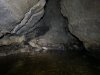 Cascade Inlet comes from the left. It is supplied by a surface sink, with no filtration. Its water cannot be trusted for drinking. The water is the source of the bacterial mats that make the Lower Main Stream so slippery. Upstream of the inlet, the floor immediately becomes more grippy. Not perfect, because the Main Stream Passage water can also be slippery on the flat floored sections upstream of Northwest Junction. At Northwest Junction, futher inlets provide a very welcome drink. Now back on more common ground, which I have already photographed extensively, my camera took a rest.
 Snow and pastel lighting at the brick works at Penwyllt, with Mynydd Marchywel.
 Orion, seen over the snow at Penwyllt.
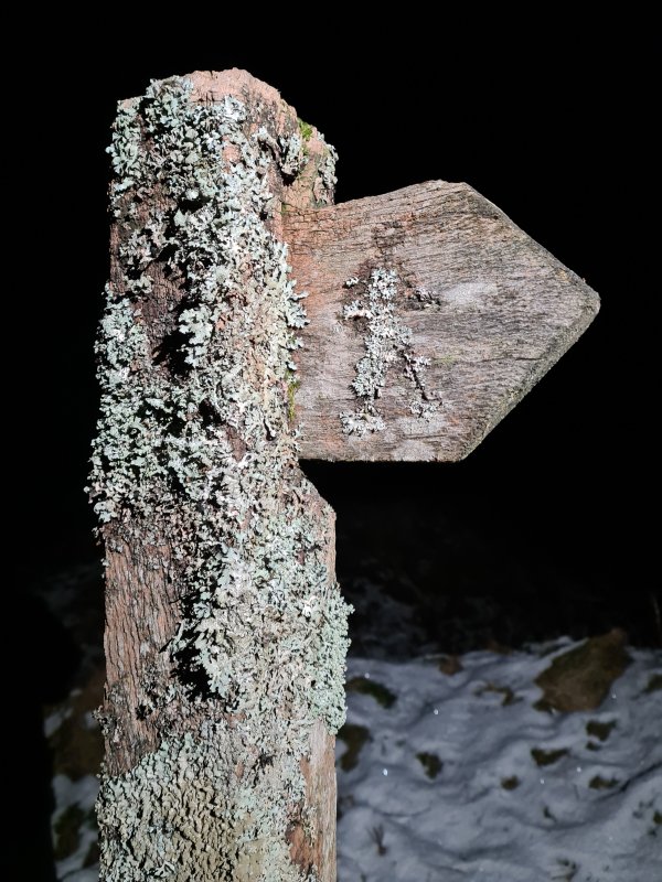 Snow and lichen.
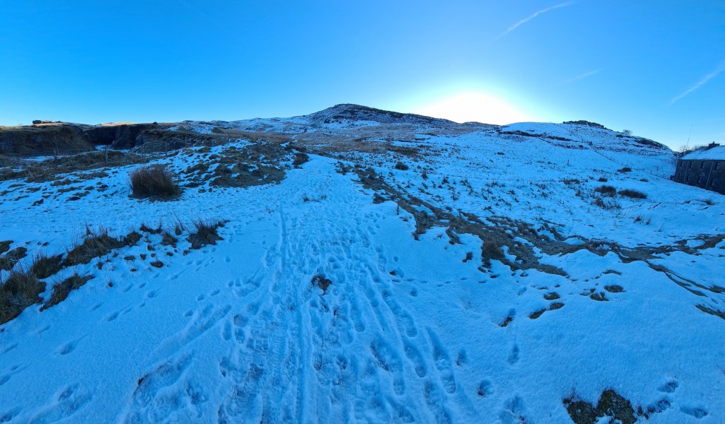 Snow on Carreg Lwyd, from Penwyllt.
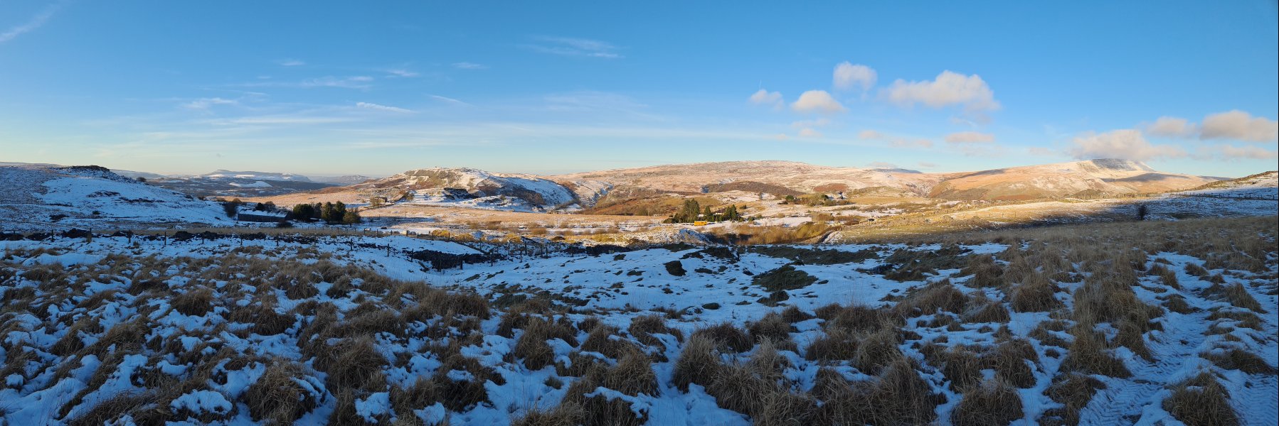 Snow over the Tawe valley. Mynydd y Drum (297 metres), Mynydd Marchywel (418 metres and 369 metres), Mynydd Allt-y-grug (338 metres), Cribarth (428 metres), Carreg Goch (558 metres) and Fan Hir (761 metres).
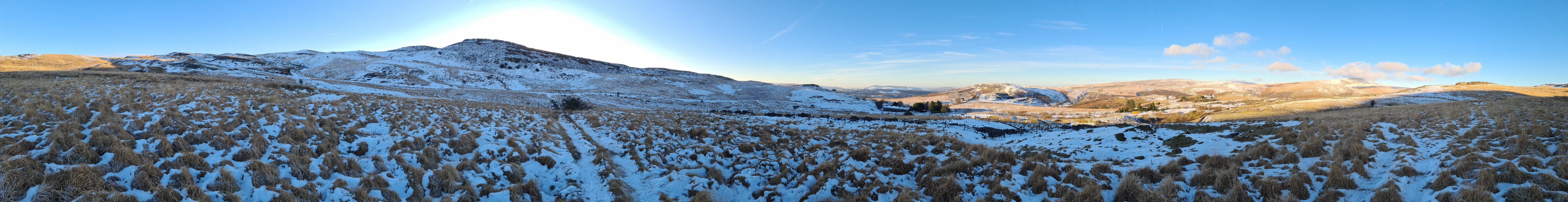 Carreg Cadno (538 metres) and its Carreg Lwyd outcrop, Mynydd y Drum, Mynydd Marchywel, Mynydd Allt-y-grug, Cribarth, Carreg Goch and Fan Hir.
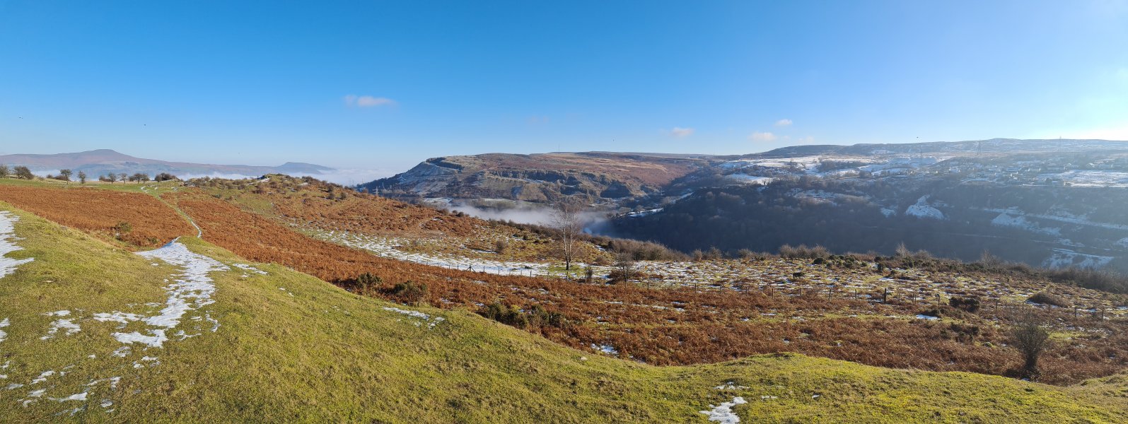 Clydach Gorge from Mynydd Llangatwg. Sugar Loaf (596 metres), Skirrid (486 metres), Gilwern Hill (441 metres) and Llanelly Hill (about 500 metres).
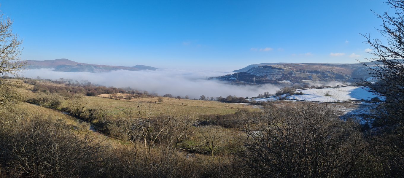 Inversion over Abergavenny. Sugar Loaf, Skirrid, Gilwern Hill, the Blorenge (561 metres) and Llanelly Hill.
 Snow Crystals.
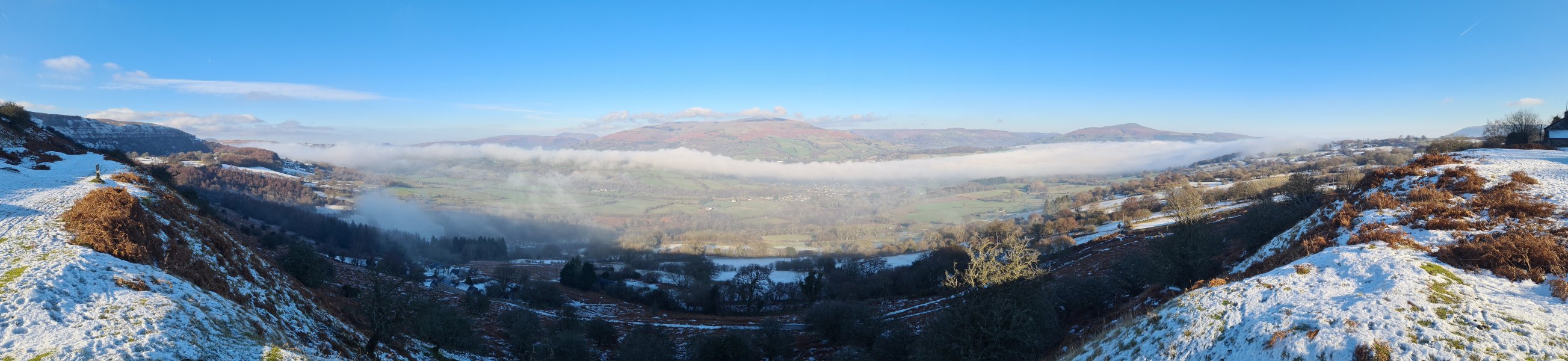 Inversion over the Usk. Mynydd Llangatwg (530 metres), Tor y Foel (551 metres), Mynydd Llangorse (515 metres), Mynydd Troed (609 metres), Pen Allt-mawr (719 metres), Pen Cerrig-calch (701 metres), Crug Mawr (550 metres), Hatterall Hill (531 metres), Gaer (427 metres) and the Sugar Loaf.
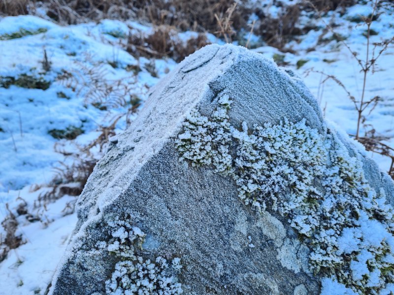 Frosty rock.
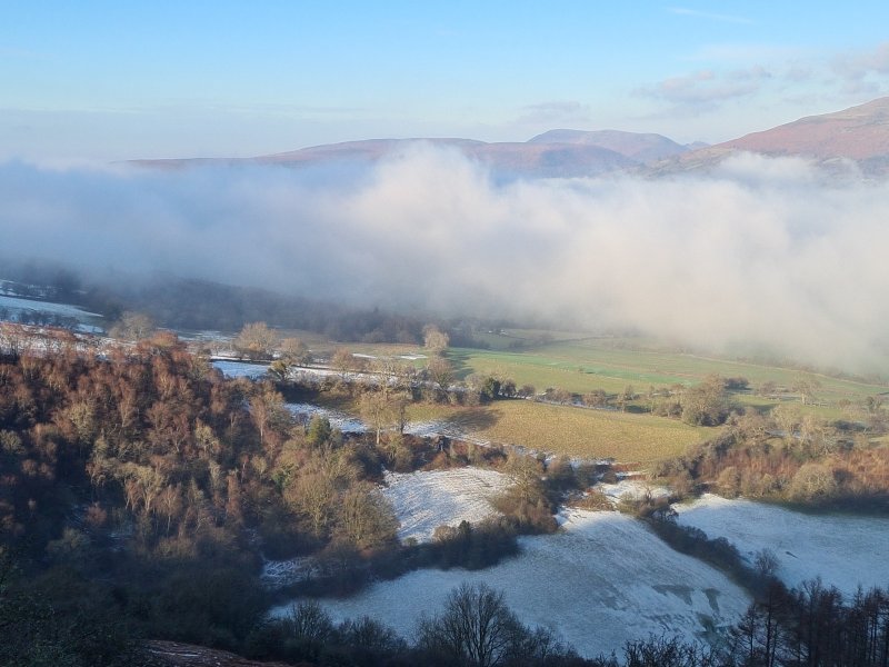 Inversion with Mynydd Llangorse and Mynydd Troed.
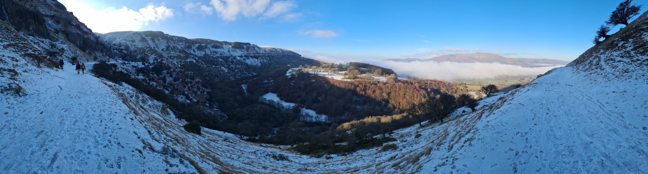 Mynydd Llangatwg in the snow. In the background are Mynydd Llangorse, Mynydd Troed, Pen Allt-mawr, Pen Cerrig-calch and Crug Mawr.
Modelling by two random walkers, Dinny and Gwenllian
Mynydd Llangatwg in the snow. In the background are Mynydd Llangorse, Mynydd Troed, Pen Allt-mawr, Pen Cerrig-calch and Crug Mawr.
Modelling by two random walkers, Dinny and Gwenllian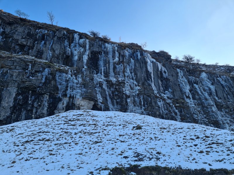 Ice on the cliff.
 Iced cave entrance.
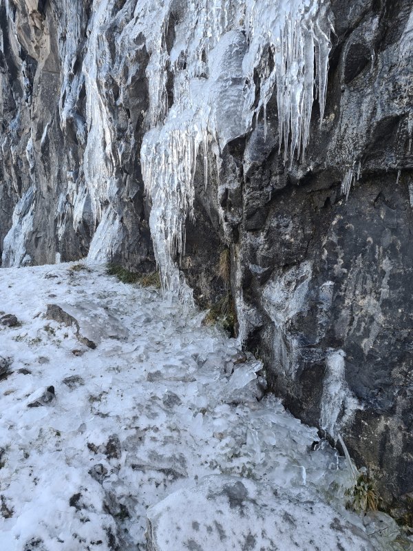 Cliff ice.
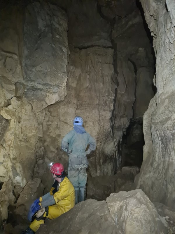 Start of Southern Stream Passage.
Modelling by Dinny and Gwenllian, lighting by Tarquin, Dinny and Gwenllian
Start of Southern Stream Passage.
Modelling by Dinny and Gwenllian, lighting by Tarquin, Dinny and Gwenllian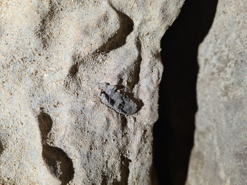 Dorsal fin spine of a Ctenacanthus proto-shark, in the wall of Southern Stream Passage, at its start.
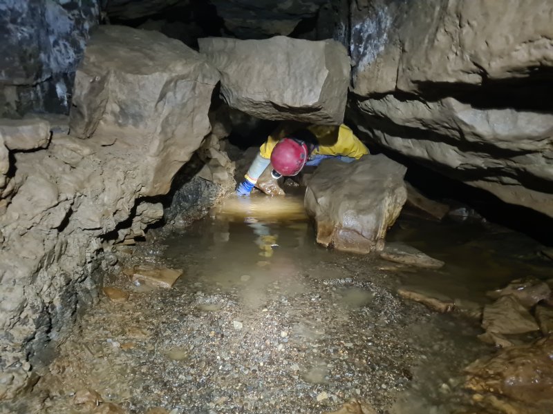 One of the early wet crawls in Southern Stream Passage. It is possible with great difficulty to keep dry, as long as the water levels are low.
Modelling by Dinny, lighting by Tarquin and Dinny
One of the early wet crawls in Southern Stream Passage. It is possible with great difficulty to keep dry, as long as the water levels are low.
Modelling by Dinny, lighting by Tarquin and Dinny Gecko. Or plesiosaur.
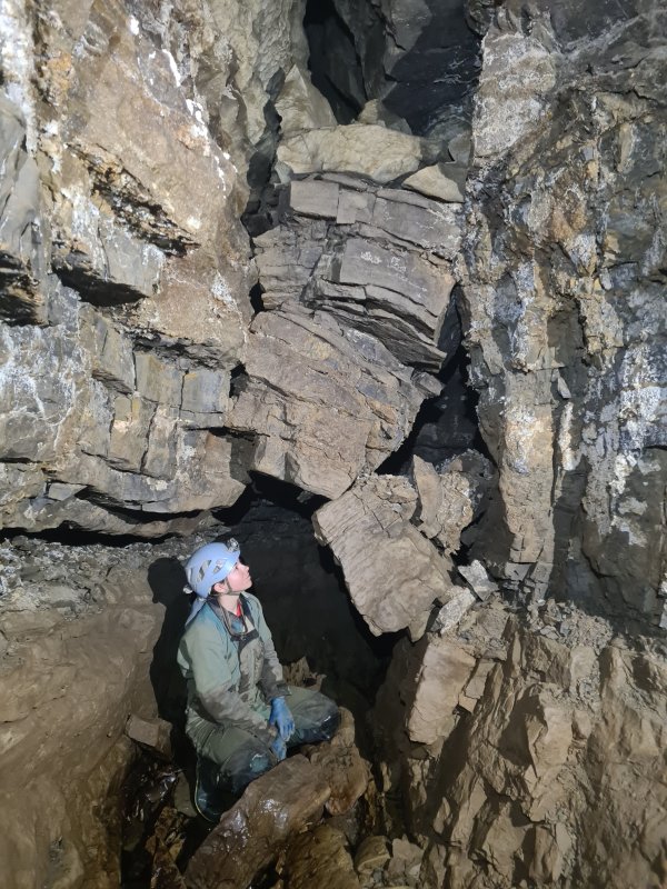 Stacked rocks making a mockery of gravity. We were aiming for Isles Inlet. During the annoying rock crawl section of the passage, Dinny realised we were part way around the Grand Circle, and asked to change our route out to be the Grand Circle instead of coming back up through Southern Stream. We conveniently passed some other cavers, and asked them to change our logbook entry to show our new route and updated ETO. We did not have enough food and drink for that route, but I wrongly assumed we would find some inlets to drink from.
Modelling by Gwenllian, lighting by Tarquin, Dinny and Gwenllian
Stacked rocks making a mockery of gravity. We were aiming for Isles Inlet. During the annoying rock crawl section of the passage, Dinny realised we were part way around the Grand Circle, and asked to change our route out to be the Grand Circle instead of coming back up through Southern Stream. We conveniently passed some other cavers, and asked them to change our logbook entry to show our new route and updated ETO. We did not have enough food and drink for that route, but I wrongly assumed we would find some inlets to drink from.
Modelling by Gwenllian, lighting by Tarquin, Dinny and Gwenllian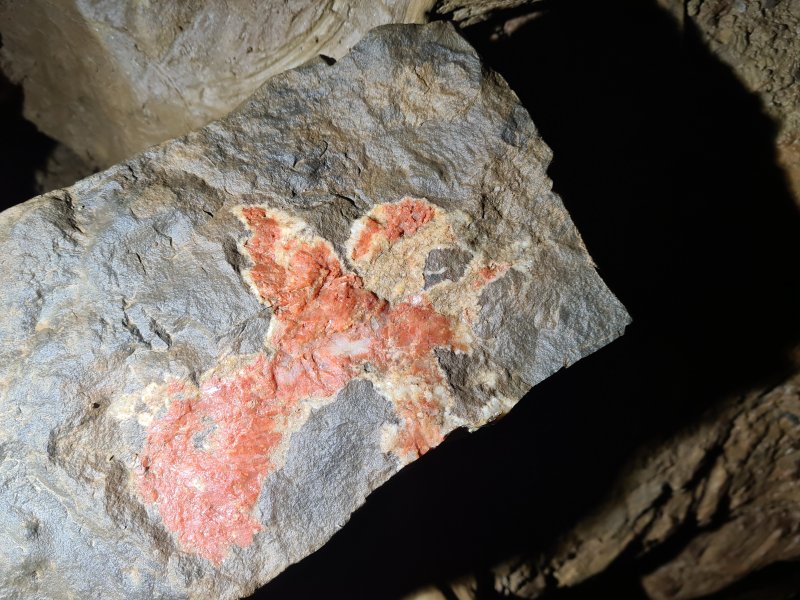 Patterned rock. Either an eagle landing (facing right) or a woman dancing (facing left).
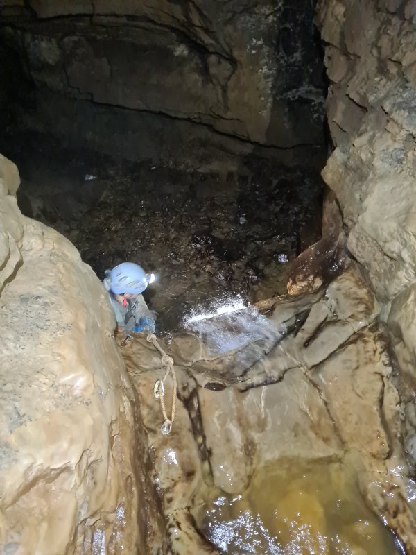 Waterfall at the end of the annoying rocky section.
Modelling by Gwenllian, lighting by Tarquin, Dinny and Gwenllian
Waterfall at the end of the annoying rocky section.
Modelling by Gwenllian, lighting by Tarquin, Dinny and Gwenllian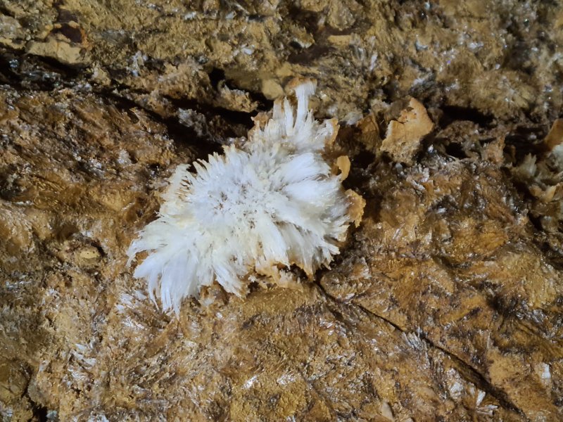 Gypsum in Gothic Passage. I was already feeling a little off at this point, having just drunk enough at Second Inlet for the shorter trip we had planned.
Lighting by Tarquin, Dinny and Gwenllian
Gypsum in Gothic Passage. I was already feeling a little off at this point, having just drunk enough at Second Inlet for the shorter trip we had planned.
Lighting by Tarquin, Dinny and Gwenllian Formations in Trafalgar.
Modelling by Dinny, lighting by Tarquin and Gwenllian
Formations in Trafalgar.
Modelling by Dinny, lighting by Tarquin and Gwenllian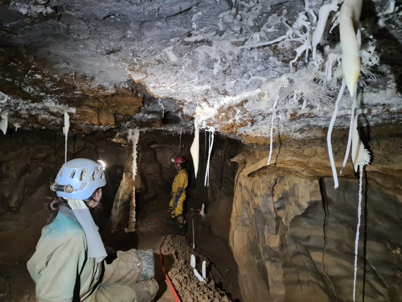 Elaborate formations in Corkscrew Chamber. By the time we left Isles Inlet, I was feeling quite dehydrated, and took the remaining electrolytes that I had, along with as much drink as I could spare. And a little of Gwenllian's. Southern Stream itself is not drinkable, and Main Stream Passage has both the Blaen Onnau Quarry water from Remembrance Series, and numerous other untrustworthy inlets. Not to worry, there are bound to be plenty of inlets in Lower Main Stream Passage, right? Right?
Modelling by Gwenllian and Dinny, lighting by Tarquin, Gwenllian and Dinny
Elaborate formations in Corkscrew Chamber. By the time we left Isles Inlet, I was feeling quite dehydrated, and took the remaining electrolytes that I had, along with as much drink as I could spare. And a little of Gwenllian's. Southern Stream itself is not drinkable, and Main Stream Passage has both the Blaen Onnau Quarry water from Remembrance Series, and numerous other untrustworthy inlets. Not to worry, there are bound to be plenty of inlets in Lower Main Stream Passage, right? Right?
Modelling by Gwenllian and Dinny, lighting by Tarquin, Gwenllian and Dinny The section of Southern Stream Passage downstream of Gothic Passage.
Modelling by Gwenllian and parts of Dinny, lighting by Tarquin, Gwenllian and Dinny
The section of Southern Stream Passage downstream of Gothic Passage.
Modelling by Gwenllian and parts of Dinny, lighting by Tarquin, Gwenllian and Dinny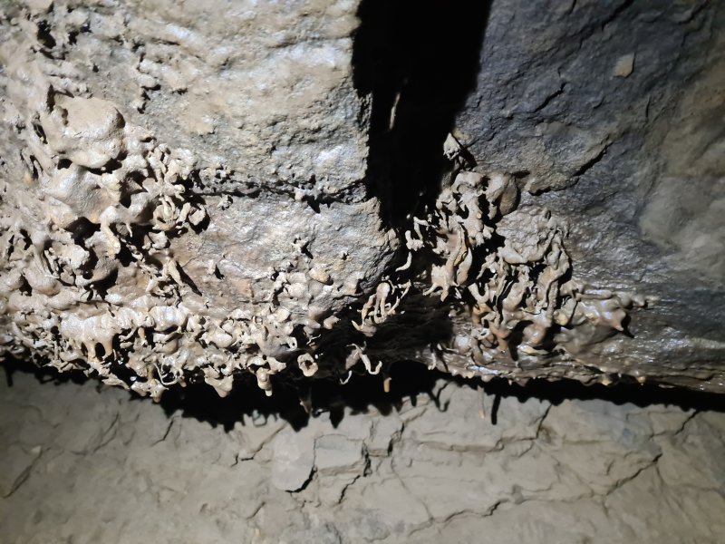 Muddy helictites. How on earth did these manage to grow in such a flood prone area?
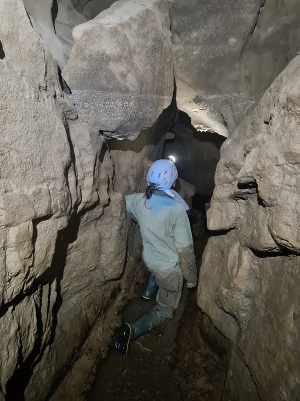 The flooding line is significantly high, and gets much higher by the end of the passage.
Modelling by Gwenllian, lighting by Tarquin, Dinny and Gwenllian
The flooding line is significantly high, and gets much higher by the end of the passage.
Modelling by Gwenllian, lighting by Tarquin, Dinny and Gwenllian Near the end of the passage, where progress requires climbing several metres up the slippery rift, and following ledges until a descent is possible.
Modelling by Gwenllian
Near the end of the passage, where progress requires climbing several metres up the slippery rift, and following ledges until a descent is possible.
Modelling by Gwenllian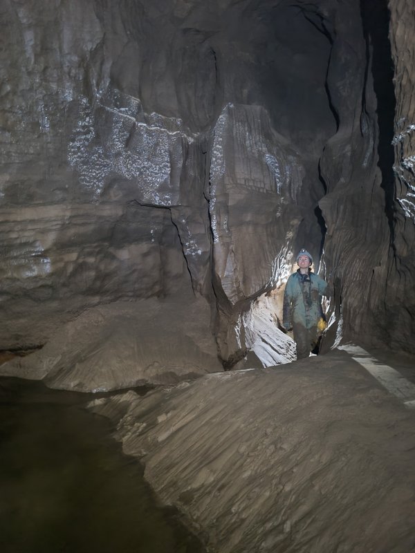 Junction of Southern Stream and Lower Main Stream Passage. The flood scum on the walls is 4 metres up the wall. This river becomes an extreme chaos of water in flood, and sumps just upstream of the junction.
Modelling by Gwenllian and a mote of Dinny, lighting by Tarquin and Dinny
Junction of Southern Stream and Lower Main Stream Passage. The flood scum on the walls is 4 metres up the wall. This river becomes an extreme chaos of water in flood, and sumps just upstream of the junction.
Modelling by Gwenllian and a mote of Dinny, lighting by Tarquin and Dinny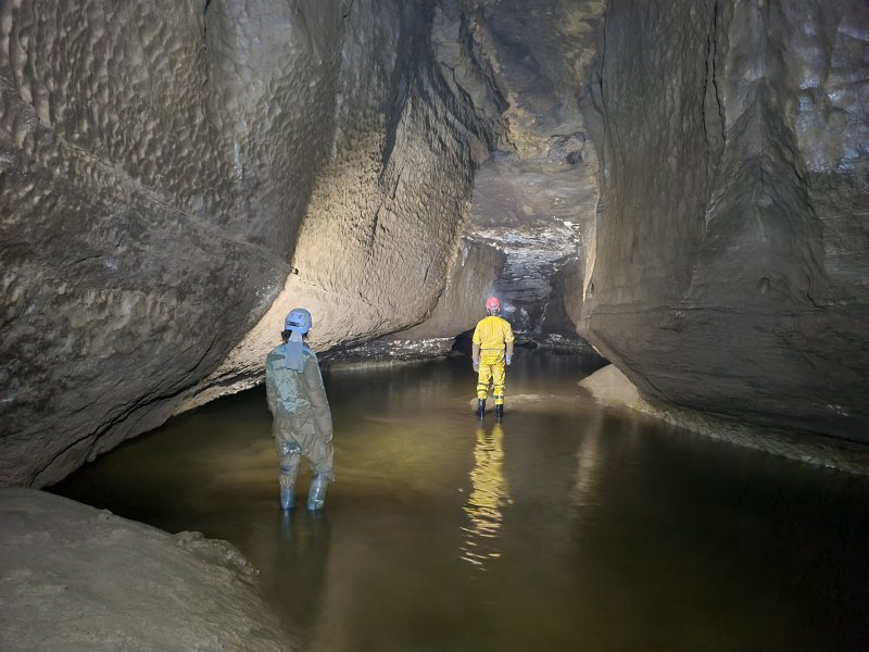 To the left, the river turns a couple of corners to reach Sump 1. Beyond that are two more sumps to reach the major river passage of Maytime (accessible to non-divers via Ressurection Passage from Gothic Passage), after which the lengthy Sump 4 marks the end of the cave.
Modelling by Gwenllian and Dinny, lighting by Tarquin, Gwenllian and Dinny
To the left, the river turns a couple of corners to reach Sump 1. Beyond that are two more sumps to reach the major river passage of Maytime (accessible to non-divers via Ressurection Passage from Gothic Passage), after which the lengthy Sump 4 marks the end of the cave.
Modelling by Gwenllian and Dinny, lighting by Tarquin, Gwenllian and Dinny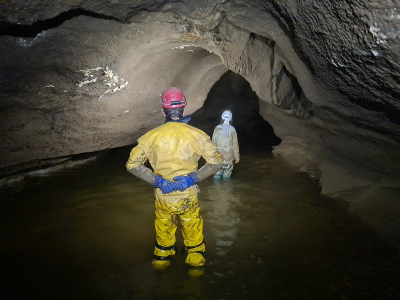 Heading upstream from the junction, along a beautifully arched section.
Modelling by Dinny and Gwenllian, lighting by Tarquin, Dinny and Gwenllian
Heading upstream from the junction, along a beautifully arched section.
Modelling by Dinny and Gwenllian, lighting by Tarquin, Dinny and Gwenllian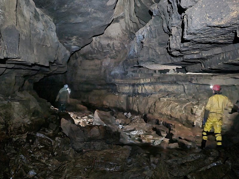 The floor then becomes more rocky, and from here onwards, the passage can be an absolute nightmare in summer, because the bacterial mats on the rocks can turn it into an ice rink. So slippery that you cannot take a step without slipping over. Progress is very slow and tiring in those conditions, and you spend the whole time staring at your feet, occasionally looking up for a moment to appreciate the passage, then back at your feet. However in winter, the frequent floods rip the bacterial mats off the rocks, and they become grippy, so you actually get to enjoy the passage. The odd little spot might still have a slick coating, but the vast majority is so much better than summer, if you can catch it between floods.
Modelling by Dinny and Gwenllian, lighting by Tarquin, Dinny and Gwenllian
The floor then becomes more rocky, and from here onwards, the passage can be an absolute nightmare in summer, because the bacterial mats on the rocks can turn it into an ice rink. So slippery that you cannot take a step without slipping over. Progress is very slow and tiring in those conditions, and you spend the whole time staring at your feet, occasionally looking up for a moment to appreciate the passage, then back at your feet. However in winter, the frequent floods rip the bacterial mats off the rocks, and they become grippy, so you actually get to enjoy the passage. The odd little spot might still have a slick coating, but the vast majority is so much better than summer, if you can catch it between floods.
Modelling by Dinny and Gwenllian, lighting by Tarquin, Dinny and Gwenllian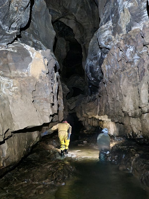 The tall passage near where it passes the rope climb to High Traverse, which can be used in an emergency to get to Gothic Passage, bypassing the section of the river that sumps, and the bottom end of Southern Stream Passage.
Modelling by Dinny and Gwenllian, lighting by Tarquin, Dinny and Gwenllian
The tall passage near where it passes the rope climb to High Traverse, which can be used in an emergency to get to Gothic Passage, bypassing the section of the river that sumps, and the bottom end of Southern Stream Passage.
Modelling by Dinny and Gwenllian, lighting by Tarquin, Dinny and Gwenllian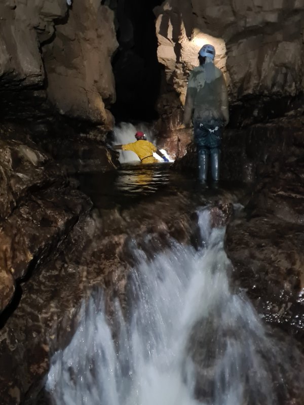 A series of exciting cascades. The pools are deep, and some amount of wedging between the walls, and careful feeling for shallower spots can be used to avoid a thorough soaking.
Modelling by Gwenllian and Dinny, lighting by Tarquin, Gwenllian and Dinny
A series of exciting cascades. The pools are deep, and some amount of wedging between the walls, and careful feeling for shallower spots can be used to avoid a thorough soaking.
Modelling by Gwenllian and Dinny, lighting by Tarquin, Gwenllian and Dinny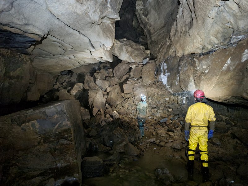 Approaching Quarry Corner.
Modelling by Dinny and Gwenllian, lighting by Tarquin, Dinny and Gwenllian
Approaching Quarry Corner.
Modelling by Dinny and Gwenllian, lighting by Tarquin, Dinny and Gwenllian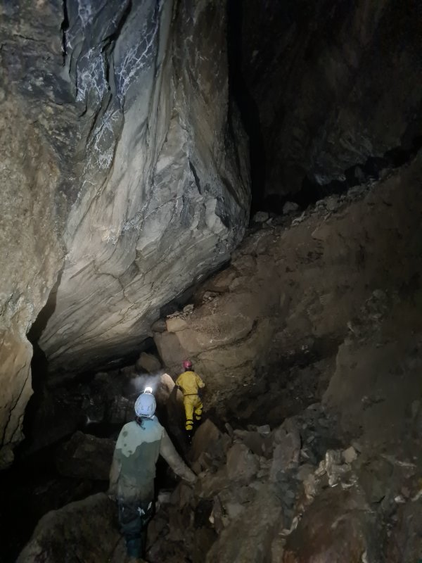 The huge passage after Quarry Corner.
Modelling by Gwenllian and Dinny, lighting by Tarquin, Gwenllian and Dinny
The huge passage after Quarry Corner.
Modelling by Gwenllian and Dinny, lighting by Tarquin, Gwenllian and Dinny Impressively big passage.
Modelling by Gwenllian and Dinny, lighting by Tarquin, Gwenllian and Dinny
Impressively big passage.
Modelling by Gwenllian and Dinny, lighting by Tarquin, Gwenllian and Dinny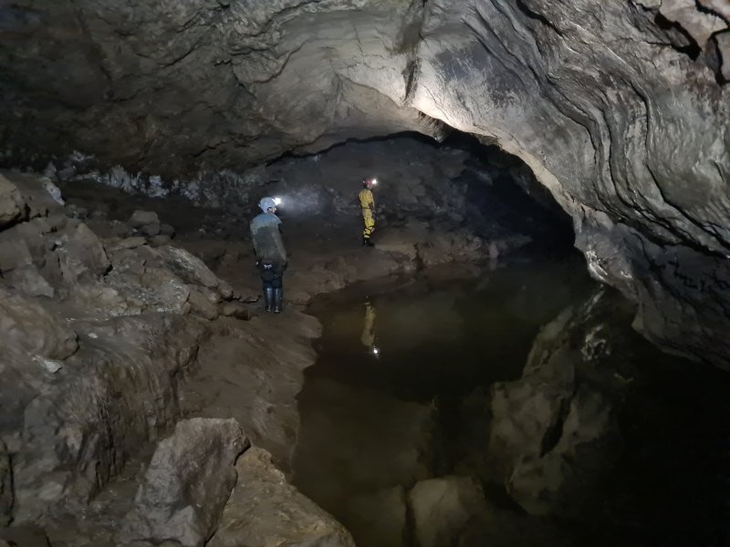 Lake with an arched celing.
Modelling by Gwenllian, Dinny and Dinny's reflection, lighting by Tarquin, Gwenllian and Dinny
Lake with an arched celing.
Modelling by Gwenllian, Dinny and Dinny's reflection, lighting by Tarquin, Gwenllian and Dinny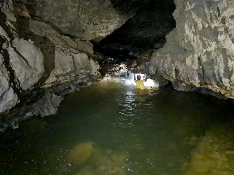 The deepest cascade on the route. It is shallow for a while on the right, but then becomes too deep. Holding on to the right overhang makes it possible to avoid swimming, but the final climb up is always difficult, trying to get up without standing in the full force of the waterfall. However, it is quite normal to be thoroughly soaked, and we had worn clothing for the hot trip to Isles Inlet, not the cold trip in the river.
Modelling by Dinny, lighting by Tarquin, Gwenllian and Dinny
The deepest cascade on the route. It is shallow for a while on the right, but then becomes too deep. Holding on to the right overhang makes it possible to avoid swimming, but the final climb up is always difficult, trying to get up without standing in the full force of the waterfall. However, it is quite normal to be thoroughly soaked, and we had worn clothing for the hot trip to Isles Inlet, not the cold trip in the river.
Modelling by Dinny, lighting by Tarquin, Gwenllian and Dinny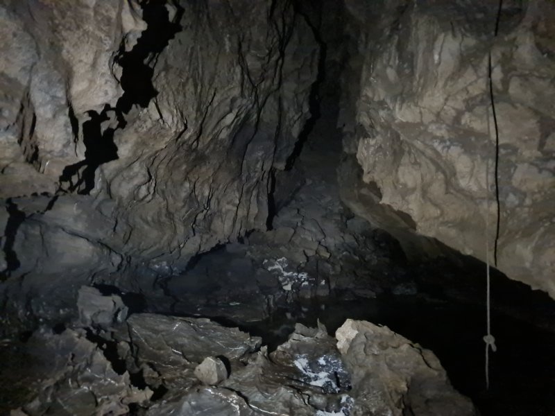 Looking down the final section of passage towards the massive Fifth Choke. Another stream seems to enter here, doubling the size of Main Stream, with cave temperature water (unlike the Main Stream), implying that it has been underground for a long time. The rope on the right accesses Lost Passage, and we once ascended it by mistake with a Petzl Tibloc and Alpine Clutch, and had to do a very dodgy traverse to regain the correct route.
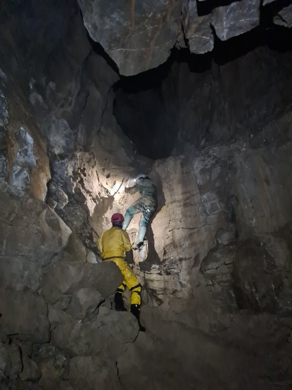 The climb up to Biza Passage, using two knotted handlines as a ladder. I was already very thirsty, as there had been no little inlets which could be trusted for drinking, and we were now heading into dry passages. The headache was already quite strong.
Modelling by Dinny and Gwenllian, lighting by Tarquin, Dinny and Gwenllian
The climb up to Biza Passage, using two knotted handlines as a ladder. I was already very thirsty, as there had been no little inlets which could be trusted for drinking, and we were now heading into dry passages. The headache was already quite strong.
Modelling by Dinny and Gwenllian, lighting by Tarquin, Dinny and Gwenllian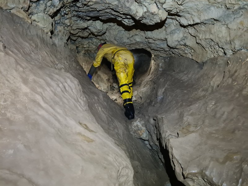 Start of Biza Passage, showing its typical style, a slight keyhole with scallops on the bottom, and a nodular top.
Modelling by Dinny, lighting by Tarquin and Dinny
Start of Biza Passage, showing its typical style, a slight keyhole with scallops on the bottom, and a nodular top.
Modelling by Dinny, lighting by Tarquin and Dinny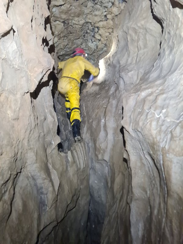 Climb up near Sump Passage, a side passage which predictably goes to a sump.
Modelling by Dinny, lighting by Tarquin and Dinny
Climb up near Sump Passage, a side passage which predictably goes to a sump.
Modelling by Dinny, lighting by Tarquin and Dinny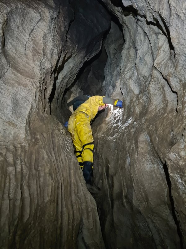 Climbing up to a higher level.
Modelling by Dinny and Gwenllian, lighting by Tarquin, Dinny and Gwenllian
Climbing up to a higher level.
Modelling by Dinny and Gwenllian, lighting by Tarquin, Dinny and Gwenllian Biza Passage then becomes lower, often requiring crawling, particularly on the ledges. While this was more than Dinny's knees wanted, it should be noted that the entire passage is about 350 metres long (while the bad section of Southwen Stream Passage is 600 metres long), and takes only about 20 minutes. That includes all the walking sections, which account for about half of the passage length.
Modelling by Dinny, lighting by Tarquin and Dinny
Biza Passage then becomes lower, often requiring crawling, particularly on the ledges. While this was more than Dinny's knees wanted, it should be noted that the entire passage is about 350 metres long (while the bad section of Southwen Stream Passage is 600 metres long), and takes only about 20 minutes. That includes all the walking sections, which account for about half of the passage length.
Modelling by Dinny, lighting by Tarquin and Dinny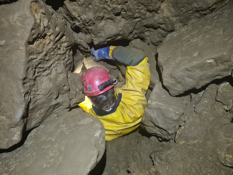 Biza Passage ends at Fourth Choke. This is really quite tight, and aims vertically downwards for 15 metres. The top 10 metres are so small, that the choke is most easily navigated by worming downwards feet first with your arms above your head. Having bags attached to your belt is a liability (speaking from experience), and they are best held in your hands. Reversing is extremely difficult, but some (crazy) people do the Grand Circle in the opposite direction, ascending through this choke.
Modelling by Dinny, lighting by Tarquin and Dinny
Biza Passage ends at Fourth Choke. This is really quite tight, and aims vertically downwards for 15 metres. The top 10 metres are so small, that the choke is most easily navigated by worming downwards feet first with your arms above your head. Having bags attached to your belt is a liability (speaking from experience), and they are best held in your hands. Reversing is extremely difficult, but some (crazy) people do the Grand Circle in the opposite direction, ascending through this choke.
Modelling by Dinny, lighting by Tarquin and Dinny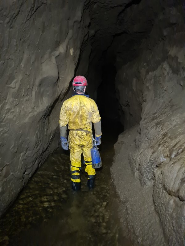 Between the chokes, back in the river, but now with a gravel floor, which is grippy even in summer.
Modelling by Dinny, lighting by Tarquin and Dinny
Between the chokes, back in the river, but now with a gravel floor, which is grippy even in summer.
Modelling by Dinny, lighting by Tarquin and Dinny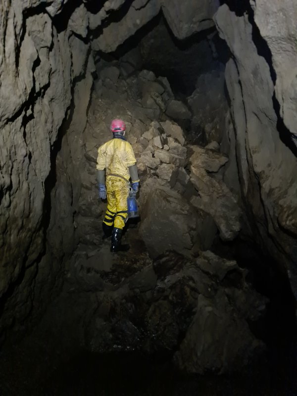 Third Choke. The way through starts on the right, part way up, dropping down to the river. The route is convoluted, slowly ascending, and breaking away from the right wall, wandering through the middle of the choke, and switching to the left side. It does not feel like it should work, since it has nothing to follow.
Modelling by Dinny, lighting by Tarquin and Dinny
Third Choke. The way through starts on the right, part way up, dropping down to the river. The route is convoluted, slowly ascending, and breaking away from the right wall, wandering through the middle of the choke, and switching to the left side. It does not feel like it should work, since it has nothing to follow.
Modelling by Dinny, lighting by Tarquin and Dinny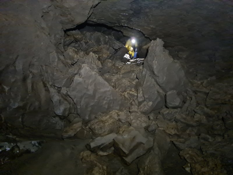 Exiting the Third Choke. The river is regained, and this marks the start of the longest uninterrupted streamway of any British cave, heading up Turkey Streamway to the Turkey Sumps.
Modelling by Dinny, lighting by Tarquin and Dinny
Exiting the Third Choke. The river is regained, and this marks the start of the longest uninterrupted streamway of any British cave, heading up Turkey Streamway to the Turkey Sumps.
Modelling by Dinny, lighting by Tarquin and Dinny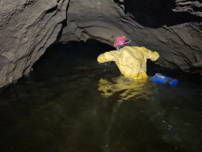 The low arched river beyond.
Modelling by Dinny, lighting by Tarquin and Dinny
The low arched river beyond.
Modelling by Dinny, lighting by Tarquin and Dinny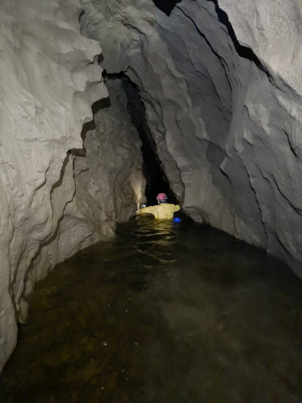 The Narrows. The water here is very deep, and progress is made by traversing along one of the walls, holding on to little nodules, and feeling for footholds under water.
Modelling by Dinny, lighting by Tarquin and Dinny
The Narrows. The water here is very deep, and progress is made by traversing along one of the walls, holding on to little nodules, and feeling for footholds under water.
Modelling by Dinny, lighting by Tarquin and Dinny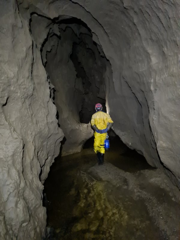 After The Narrows.
Modelling by Dinny, lighting by Tarquin and Dinny
After The Narrows.
Modelling by Dinny, lighting by Tarquin and Dinny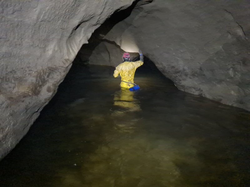 Deep Water, which is normally just a wade in the river, up to your waist.
Modelling by Dinny, lighting by Tarquin and Dinny
Deep Water, which is normally just a wade in the river, up to your waist.
Modelling by Dinny, lighting by Tarquin and Dinny However, flooding had eroded a deep trench in the sediment floor, and we had to swim for about 3 metres. So we got soaked anyway. Oh well.
Modelling by Dinny, lighting by Tarquin and Dinny
However, flooding had eroded a deep trench in the sediment floor, and we had to swim for about 3 metres. So we got soaked anyway. Oh well.
Modelling by Dinny, lighting by Tarquin and Dinny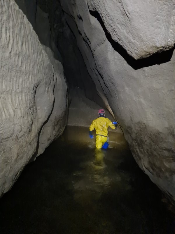 After Deep Water.
Modelling by Dinny, lighting by Tarquin and Dinny
After Deep Water.
Modelling by Dinny, lighting by Tarquin and Dinny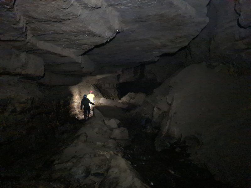 Near Chocolate Passage. The signs of flooding were impressively high.
Modelling by Gwenllian and Dinny, lighting by Tarquin, Gwenllian and Dinny
Near Chocolate Passage. The signs of flooding were impressively high.
Modelling by Gwenllian and Dinny, lighting by Tarquin, Gwenllian and Dinny Nearing Cascade Inlet. A small inlet finally made itself known, and I was able to get the first drink for 3 hours, which was incredibly welcome. My headache soon disappeared, and normality (whatever that is) resumed.
Modelling by Dinny and Gwenllian, lighting by Tarquin, Dinny and Gwenllian
Nearing Cascade Inlet. A small inlet finally made itself known, and I was able to get the first drink for 3 hours, which was incredibly welcome. My headache soon disappeared, and normality (whatever that is) resumed.
Modelling by Dinny and Gwenllian, lighting by Tarquin, Dinny and Gwenllian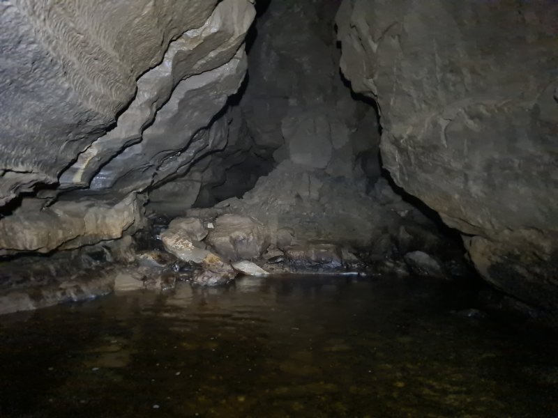 Cascade Inlet comes from the left. It is supplied by a surface sink, with no filtration. Its water cannot be trusted for drinking. The water is the source of the bacterial mats that make the Lower Main Stream so slippery. Upstream of the inlet, the floor immediately becomes more grippy. Not perfect, because the Main Stream Passage water can also be slippery on the flat floored sections upstream of Northwest Junction. At Northwest Junction, futher inlets provide a very welcome drink. Now back on more common ground, which I have already photographed extensively, my camera took a rest.
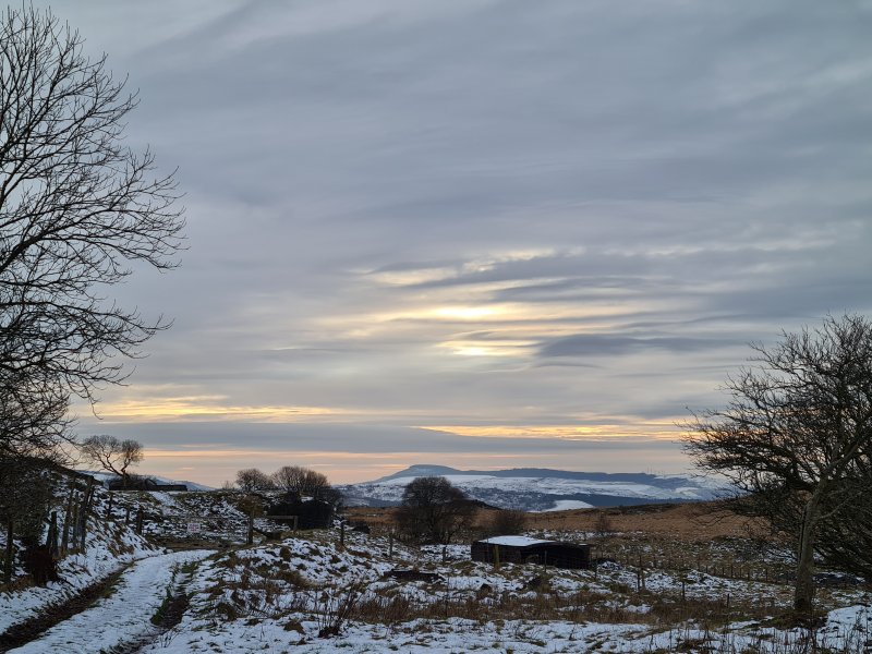 Snow and pastel lighting at the brick works at Penwyllt, with Mynydd Marchywel.