Carreg Lem trips 20/08/2023 and 30/09/2023
Unless otherwise stated, camera, setups, lighting, edits and gallery effects by Tarquin. Modelling and lighting at various points will be Jules Carter, Ali Garman, Paul Craddy and Pete Bolt.
Carreg Lem is rather lengthy, considering its position on the Black Mountain, where caves are typically very short. The cave was originally found by SWCC in 1982, with several flood prone U-bends regularly becoming blocked with gravel. It was then extended by members of Morgannwg Caving Club and SWCC in 1997. At the time of the first visit, the cave was known to be about 350 metres long, but about 100 metres of that length was inaccessible, due to gravel filling one of the passages after flooding. That 100 metres is some of the largest passage in the cave, as well as being near the lowest point in the cave, with streams offering the potential for extension. These trips were digging trips to try to regain that passage.
Like Sinc y Giedd, the cave is formed in the Oxwich Head Limestone Formation on top of the Dowlais Limestone Formation. This bed of limestone is not normally good for caves, as the limestone has an almost impermeable sandstone band below it that the water would need to pass through to get into the better Dowlais beds where all the other caves in the area, including Dan yr Ogof where the water resurges, are formed. At its lowest point, Carreg Lem has reached the Honeycomb Sandstone, the last barrier it needs to pass. Because of the dip in the area, the streams start their life higher up the slopes, but on the lower beds of rock. The cave's stream starts its existence on the moorland on top of the Dowlais beds, and crosses all of them to reach these inconvenient beds before sinking. The Afon Giedd starts on the Old Red Sandstone, below all the limestone beds (the major Clydach Valley limestones are missing at this end of the national park), and crosses all of them to do the same thing. Presumably, this is because of the glacial till overlaying the limestone, but the Dowlais Limestone is exposed for a lot of the Afon Giedd's course. Very strange.
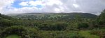 Looking back over Glyntawe, towards Fan Gyhirych (725 metres).
 Cefn Cul (562 metres) and Fan Gyhirych. The second trip was in similarly poor weather, and got much worse as the day went on, with the walk back being in rain.
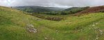 The lower part of Glyntawe, with Fan Gyhirych's Carreg Cadno ridge (538 metres) and Cribarth (428 metres).
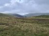 Part of a Welsh mountain pony herd, in front of Cefn Cul and Fan Gyhirych.
Modelling by The Windswept Trio
Part of a Welsh mountain pony herd, in front of Cefn Cul and Fan Gyhirych.
Modelling by The Windswept Trio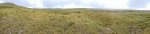 Approaching the Afon Giedd. The mountains are Disgwylfa (544 metres) and an unnamed ridge (486 metres), with the main Bannau Sir Gaer and Black Mountain peaks covered in cloud to the right.
Modelling by Ali, Jules and Paul
Approaching the Afon Giedd. The mountains are Disgwylfa (544 metres) and an unnamed ridge (486 metres), with the main Bannau Sir Gaer and Black Mountain peaks covered in cloud to the right.
Modelling by Ali, Jules and Paul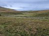 The Afon Giedd, looking downstream. This is the usual crossing point to get to Carreg Lem.
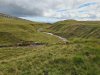 The Afon Giedd, heading towards Sync y Giedd. That cave floods to such an extreme that the cobbles regularly block access to large parts of the cave, and prospects for finding a way into the vast cave system that must exist here are very slim. The hope is that Carreg Lem, being a much smaller feeder into the same system, might bypass all of the problematic parts of Sync y Giedd.
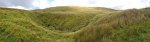 The Carreg Lem sink, just in front of the unnamed ridge.
Modelling by Jules, Paul and Ali
The Carreg Lem sink, just in front of the unnamed ridge.
Modelling by Jules, Paul and Ali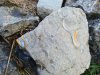 Rock with beautiful shell fossils, in the sink. These are probably brachiopods.
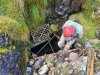 The entrance of Carreg Lem.
Modelling by Jules
The entrance of Carreg Lem.
Modelling by Jules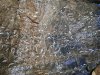 Just inside the entrance is the highly ornate shell fossil bed, probably thick shelled brachiopods.
Lighting by Tarquin and Sol
Just inside the entrance is the highly ornate shell fossil bed, probably thick shelled brachiopods.
Lighting by Tarquin and Sol The cave begins with a rather horrifying choke. This is the ceiling, being held up by scaffolding. I was told not to look too closely.
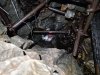 Climbing down through the scaffolded choke. This was previously not shored, and collapsed while someone was passing through it. The cave was then reopened, and the choke was scaffolded to prevent a repeat.
Modelling by Jules, lighting by Tarquin and Jules
Climbing down through the scaffolded choke. This was previously not shored, and collapsed while someone was passing through it. The cave was then reopened, and the choke was scaffolded to prevent a repeat.
Modelling by Jules, lighting by Tarquin and Jules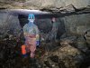 The choke lands in a relatively large chamber, the largest known part of the cave. The size is likely to be due to repeated collapse, rather than there being a hidden passage somewhere.
Modelling by Paul and Jules, lighting by Tarquin, Paul and Jules
The choke lands in a relatively large chamber, the largest known part of the cave. The size is likely to be due to repeated collapse, rather than there being a hidden passage somewhere.
Modelling by Paul and Jules, lighting by Tarquin, Paul and Jules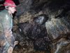 The mix of rocks in the chamber. On the left is a conglomerate that looks like chunks of limestone in a matrix, hereby referred to as "caramel rocky road". To the right of that is a black sandstone, perhaps a darkened Old Red Sandstone, Grey Grits Formation, Cwmyniscoy Mudstone Formation, or a Honeycomb Sandstone. To the right of that is Oxwich Head Limestone with a very rich layer of thick shelled brachipods. Below the sandstone block is the Oystermouth formation, a layer of limestone and mudstone. On the floor are several Old Red Sandstone cobbles.
Modelling by Jules, lighting by Tarquin and Jules
The mix of rocks in the chamber. On the left is a conglomerate that looks like chunks of limestone in a matrix, hereby referred to as "caramel rocky road". To the right of that is a black sandstone, perhaps a darkened Old Red Sandstone, Grey Grits Formation, Cwmyniscoy Mudstone Formation, or a Honeycomb Sandstone. To the right of that is Oxwich Head Limestone with a very rich layer of thick shelled brachipods. Below the sandstone block is the Oystermouth formation, a layer of limestone and mudstone. On the floor are several Old Red Sandstone cobbles.
Modelling by Jules, lighting by Tarquin and Jules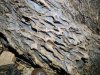 Beautifully textured limestone, which appers to be a mix of mudstone and limestone. This is likely to be the Oystermouth Formation.
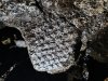 Tree fossil in the sandstone block, likely to be an arborescent lycophyte (a tree version of a club moss). Examples of these are also seen in Dan yr Ogof.
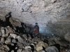 The left side of the chamber remains large, then funnels down to two small side passages, about 100 metres long in total. We did not visit the side passages.
Modelling by Paul, lighting by Tarquin and Jules
The left side of the chamber remains large, then funnels down to two small side passages, about 100 metres long in total. We did not visit the side passages.
Modelling by Paul, lighting by Tarquin and Jules The ceiling of the chamber glistens with water droplets, held in place by hydrophobic bacteria. However, they do not photograph well at all, since they only glisten when you move.
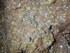 Hydrophobic bacterial mats in different colours.
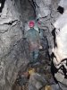 The main passage leading out of the chamber is the right branch, which starts walking sized.
Modelling by Jules, lighting by Tarquin and Jules
The main passage leading out of the chamber is the right branch, which starts walking sized.
Modelling by Jules, lighting by Tarquin and Jules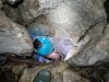 A draughting hole in the floor has previously been dug. This seems to have changed the cave's flooding pattern, and the U-bends have not flooded for over a decade, as the water can reach the lower parts of the cave without needing to go down the main passage.
Modelling by Paul and Tarquin and Ali's wellies, lighting by Tarquin and Paul
A draughting hole in the floor has previously been dug. This seems to have changed the cave's flooding pattern, and the U-bends have not flooded for over a decade, as the water can reach the lower parts of the cave without needing to go down the main passage.
Modelling by Paul and Tarquin and Ali's wellies, lighting by Tarquin and Paul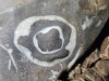 Shell fossil.
 The start of the first U-bend, where there is also a short side passage not shown on the very simplistic survey, a common occurance. The worst part of the U-bends is the gravel that gets dragged through with you, which slowly fills them to the point that they need clearing again.
Modelling by Paul, lighting by Tarquin and Paul
The start of the first U-bend, where there is also a short side passage not shown on the very simplistic survey, a common occurance. The worst part of the U-bends is the gravel that gets dragged through with you, which slowly fills them to the point that they need clearing again.
Modelling by Paul, lighting by Tarquin and Paul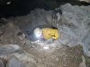 End of the first U-bend.
Modelling by Ali, lighting by Tarquin and Ali
End of the first U-bend.
Modelling by Ali, lighting by Tarquin and Ali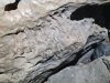 Fossil coral. This appears to be a Lithostrotion.
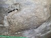 Syringopora coral fossil.
 Start of the second U-Bend.
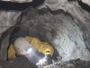 End of the second U-bend.
Modelling by Ali, lighting by Tarquin and Ali
End of the second U-bend.
Modelling by Ali, lighting by Tarquin and Ali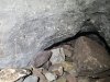 Larger Syringopora fossil, above a small side passage that is not on the survey.
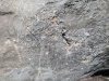 Detail of the Syringopora fossil.
 Start of the third U-bend.
Modelling by Paul, lighting by Tarquin and Paul
Start of the third U-bend.
Modelling by Paul, lighting by Tarquin and Paul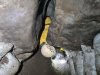 End of the third U-bend, where there is another unsurveyed side passage.
Modelling by Ali, lighting by Tarquin and Ali
End of the third U-bend, where there is another unsurveyed side passage.
Modelling by Ali, lighting by Tarquin and Ali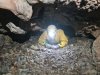 The way on stays as a crawl for a little while.
Modelling by Ali, lighting by Tarquin and Ali
The way on stays as a crawl for a little while.
Modelling by Ali, lighting by Tarquin and Ali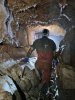 This is followed by a pretty section of larger passage.
Modelling by Paul, lighting by Tarquin, Paul and Jules
This is followed by a pretty section of larger passage.
Modelling by Paul, lighting by Tarquin, Paul and Jules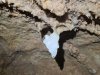 Stalactite.
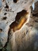 Curtain.
Lighting by Tarquin and Paul
Curtain.
Lighting by Tarquin and Paul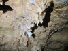 Immature stal.
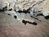 False floors held up by stal columns.
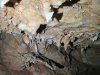 A false floor hanging from a taller column.
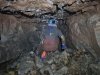 A large side passage (which is surveyed!) is short, but brings in a significant increase in the subsequent passage size.
Modelling by Paul, lighting by Tarquin and Jules
A large side passage (which is surveyed!) is short, but brings in a significant increase in the subsequent passage size.
Modelling by Paul, lighting by Tarquin and Jules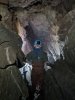 The passage then briefly follows a fault.
Modelling by Paul, lighting by Tarquin and Jules
The passage then briefly follows a fault.
Modelling by Paul, lighting by Tarquin and Jules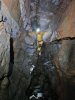 Looking back up the fault passage, which is very large compared with everything before it. At about this point, the inaccessible passage ends beneath the floor on the left side of the passage as seen here, but about 8.5 metres lower. This would explain the sudden shrinking of the passage beyond this point. Maybe it will be possible to create a round trip, or to bypass the dig.
Modelling by Ali, lighting by Tarquin, Ali and Paul
Looking back up the fault passage, which is very large compared with everything before it. At about this point, the inaccessible passage ends beneath the floor on the left side of the passage as seen here, but about 8.5 metres lower. This would explain the sudden shrinking of the passage beyond this point. Maybe it will be possible to create a round trip, or to bypass the dig.
Modelling by Ali, lighting by Tarquin, Ali and Paul The passage shrinks, then passes under a small, blind aven.
Modelling by Tarquin's legs and Ali, lighting by Tarquin and Ali
The passage shrinks, then passes under a small, blind aven.
Modelling by Tarquin's legs and Ali, lighting by Tarquin and Ali This is followed by the tightest part of the cave, but this is more awkward than tight.
Modelling by Ali, lighting by Tarquin, Ali and Paul
This is followed by the tightest part of the cave, but this is more awkward than tight.
Modelling by Ali, lighting by Tarquin, Ali and Paul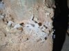 Small helictites.
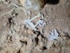 Helictites.
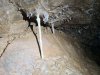 Small straws and immature helictites.
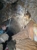 The best grotto in the cave. The passage beyond has several longer straws, and ends immediately.
Modelling by Jules, lighting by Tarquin and Jules
The best grotto in the cave. The passage beyond has several longer straws, and ends immediately.
Modelling by Jules, lighting by Tarquin and Jules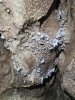 Helictites at the start of the grotto.
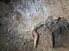 Helictites in the grotto.
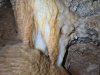 Coloured flowstone in the grotto, which forms a false floor.
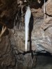 Stalactite in the grotto.
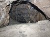 End of the grotto, which fills with sand. It would only be an oxbow, so there is no point in digging here.
 A side crawl reaches the steeply sloping continuation, which has layers of false floors.
Modelling by Paul, lighting by Tarquin and Paul
A side crawl reaches the steeply sloping continuation, which has layers of false floors.
Modelling by Paul, lighting by Tarquin and Paul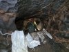 Digging spoil from our dig. We moved about a tonne of gravel during this trip.
Modelling by Paul and Ali, lighting by Tarquin, Paul and Ali
Digging spoil from our dig. We moved about a tonne of gravel during this trip.
Modelling by Paul and Ali, lighting by Tarquin, Paul and Ali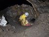 Start of the dig.
Modelling by Pete, lighting by Tarquin and Pete
Start of the dig.
Modelling by Pete, lighting by Tarquin and Pete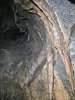 Immediately before the dig, the passage passes below an aven, which is also not on the survey. The curtains here are liberally coated with mud, and fresh plant matter. This part of the cave still floods, but we were here in summer during rain showers, and had no issues with water.
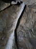 White curtain, which has avoided most of the mud.
 Worm casts. We did not see any worms, but this part of the cave must flood often enough to feed them.
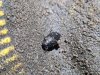 A very small water beetle, something which is very rarely seen in caves, but seems to be coping well enough down here.
Modelling by Wyatt and Tarquin's glove
A very small water beetle, something which is very rarely seen in caves, but seems to be coping well enough down here.
Modelling by Wyatt and Tarquin's glove The dig is a 20 metre long crawl. The current progress is about 4 metres from the far end of the crawl, and a large team is needed to guide drag trays around the corners. The camera is situated in the lowest part of the cave, 56.6 metres below the entrance. The streams in the cave beyond cut across the passage, and do not flow this way, except in flood.
Modelling by Ali, lighting by Tarquin and Ali
The dig is a 20 metre long crawl. The current progress is about 4 metres from the far end of the crawl, and a large team is needed to guide drag trays around the corners. The camera is situated in the lowest part of the cave, 56.6 metres below the entrance. The streams in the cave beyond cut across the passage, and do not flow this way, except in flood.
Modelling by Ali, lighting by Tarquin and Ali This part of the passage was completely excavated.
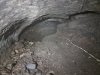 The breakthrough point.
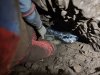 The breakthrough point, looking towards the newly regained passage.
Modelling by Tarquin, lighting by Tarquin and Jules
The breakthrough point, looking towards the newly regained passage.
Modelling by Tarquin, lighting by Tarquin and Jules Looking back out towards the breakthrough point. Streams had washed out the gravel from below. Under the wall is the bedding plane where the stream flows out towards the old cave. A small stream on the left, however, appears to emerge from the old cave direction, but this is probably coming from behind the camera, even though it can be seen flowing towards the camera.
 The largest part of the newly regained passage is at the junction, seen here with the team that made the breakthrough. We think it has been about 25 years since anyone stood at this spot. The stream flows in from under the right wall, and out under the distant left wall. The way in is a very low passage at floor level on the left. Oh the wall at about chest height, we noticed relatively fresh flood scum and grass fragments, probably from the previous winter.
Modelling by Tarquin, Ali, Jules, Paul and Pete, camera, setups and lighting by Tarquin and Jules
The largest part of the newly regained passage is at the junction, seen here with the team that made the breakthrough. We think it has been about 25 years since anyone stood at this spot. The stream flows in from under the right wall, and out under the distant left wall. The way in is a very low passage at floor level on the left. Oh the wall at about chest height, we noticed relatively fresh flood scum and grass fragments, probably from the previous winter.
Modelling by Tarquin, Ali, Jules, Paul and Pete, camera, setups and lighting by Tarquin and Jules The western passage starts very large, one of the largest in the cave. A stream emerges again from under the right wall at a corner, and flows back down the passage, then out under the left wall. Like all streams, it flows along the impervious honeycomb sandstone.
Modelling by Ali and Paul, lighting by Tarquin, Ali and Paul
The western passage starts very large, one of the largest in the cave. A stream emerges again from under the right wall at a corner, and flows back down the passage, then out under the left wall. Like all streams, it flows along the impervious honeycomb sandstone.
Modelling by Ali and Paul, lighting by Tarquin, Ali and Paul Honeycomb sandstone, with the small stream flowing down it.
Lighting by Tarquin and Ali
Honeycomb sandstone, with the small stream flowing down it.
Lighting by Tarquin and Ali False floors in a taped off oxbow.
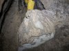 Mud formations.
Modelling by Ali
Mud formations.
Modelling by Ali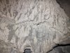 Mud formations.
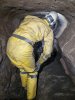 The passage gets smaller, but still fairly comfortable.
Modelling by Ali and hints of Paul, lighting by Tarquin, Ali and Paul
The passage gets smaller, but still fairly comfortable.
Modelling by Ali and hints of Paul, lighting by Tarquin, Ali and Paul Straws in a small chamber.
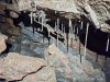 Straws with a false floor.
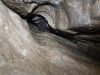 Aven in the ceiling of the chamber.
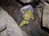 The chamber hides the end of the taped off oxbow, where a side passage chokes at a fault.
Modelling by Pete, lighting by Tarquin and Pete
The chamber hides the end of the taped off oxbow, where a side passage chokes at a fault.
Modelling by Pete, lighting by Tarquin and Pete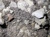 Frass in the side passage. This appears to be worm cast, and it is everywhere, even places where there is no mud for the worms to crawl through.
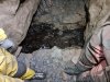 The ongoing passage passes another stream that once again crosses from right to left on the honeycomb sandstone, ignoring the passage. Digging spoil has created a Roman sewer effect.
Modelling by Ali and Paul, lighting by Tarquin, Ali and Paul
The ongoing passage passes another stream that once again crosses from right to left on the honeycomb sandstone, ignoring the passage. Digging spoil has created a Roman sewer effect.
Modelling by Ali and Paul, lighting by Tarquin, Ali and Paul A dig at the end passes below a fault aven, then punches through a wall to regain a short piece of passage, which immediately chokes.
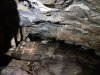 Downstream from the Roman sewer, where the water continues to flow over the honeycomb sandstone. The water has to break through it at some point since the resurgences are in the beds below, and a very involved dig was pursued with rock removal, but it could be a very long way before it breaks through. It will probably need a fault, but fortunately there are a couple nearby. So far, the dig is 10 metres long.
 The eastern passage is smaller, being a crawl for about 15 metres, ending at a squeeze.
Modelling by Jules
The eastern passage is smaller, being a crawl for about 15 metres, ending at a squeeze.
Modelling by Jules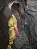 This breaks into a very large aven, which looks like it narrows, without any obvious passage at the top.
Modelling by Pete and Jules, lighting by Tarquin, Pete, Jules and Ali
This breaks into a very large aven, which looks like it narrows, without any obvious passage at the top.
Modelling by Pete and Jules, lighting by Tarquin, Pete, Jules and Ali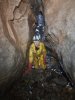 The passage continues beyond the aven, a little larger than before.
Modelling by Pete, lighting by Tarquin and Ali
The passage continues beyond the aven, a little larger than before.
Modelling by Pete, lighting by Tarquin and Ali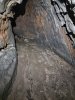 Although there was no water here, the sand showed clear signs of water, with no footprints. This passage obviously carries water in flood.
 The passage reaches a choke, which can be followed a short distance to the left. The choke is mostly vertically upwards, reaching up about 3 metres. This is directly below the floor of the large fault controlled passage after the third U-bend, with perhaps 3-4 metres separating them. A dig would be very useful.
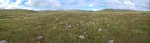 As we left the cave, the cloud had lifted, revealing the tops of Waun Lefrith (677 metres), Picws Du (749 metres), Fan Brycheiniog (803 metres) and Fan Hir (761 metres).
Modelling by Ali, Jules and Paul
As we left the cave, the cloud had lifted, revealing the tops of Waun Lefrith (677 metres), Picws Du (749 metres), Fan Brycheiniog (803 metres) and Fan Hir (761 metres).
Modelling by Ali, Jules and Paul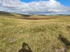 Fan Gyhirych and Fan Fraith (668 metres), seen over Waun Fignen Felen.
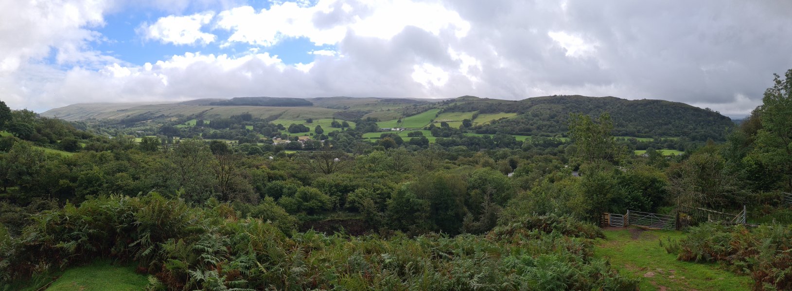
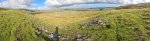 Arriving back at Glyntawe. Fan Hir, Cefn Cul, Fan Gyhirych, Fan Fraith, Carreg Cadno, Mynydd Merthyr (491 metres), Craig y Llyn (600 metres), Hirfynydd (481 metres) and Cribarth.
 Looking back over Glyntawe, towards Fan Gyhirych (725 metres).
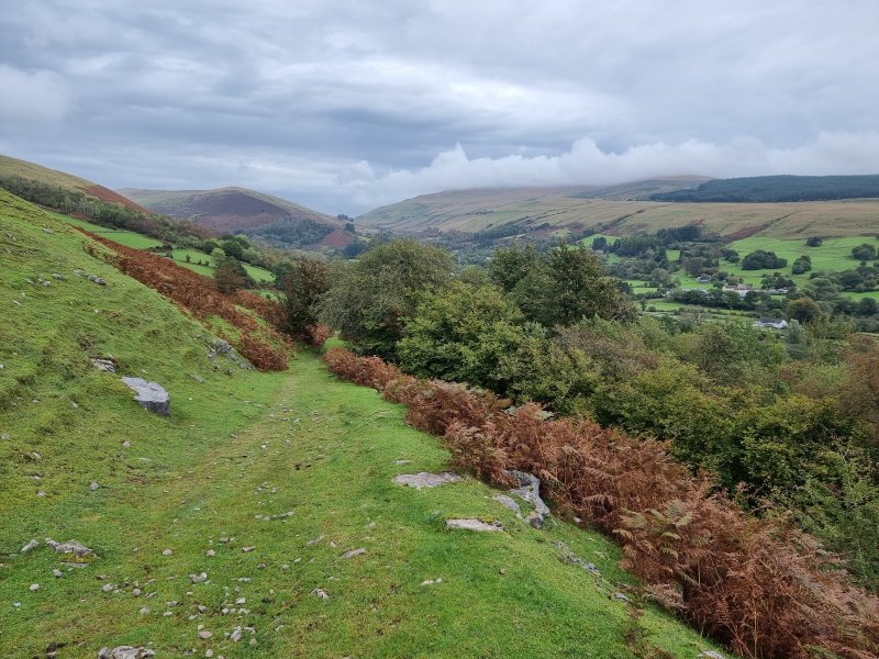 Cefn Cul (562 metres) and Fan Gyhirych. The second trip was in similarly poor weather, and got much worse as the day went on, with the walk back being in rain.
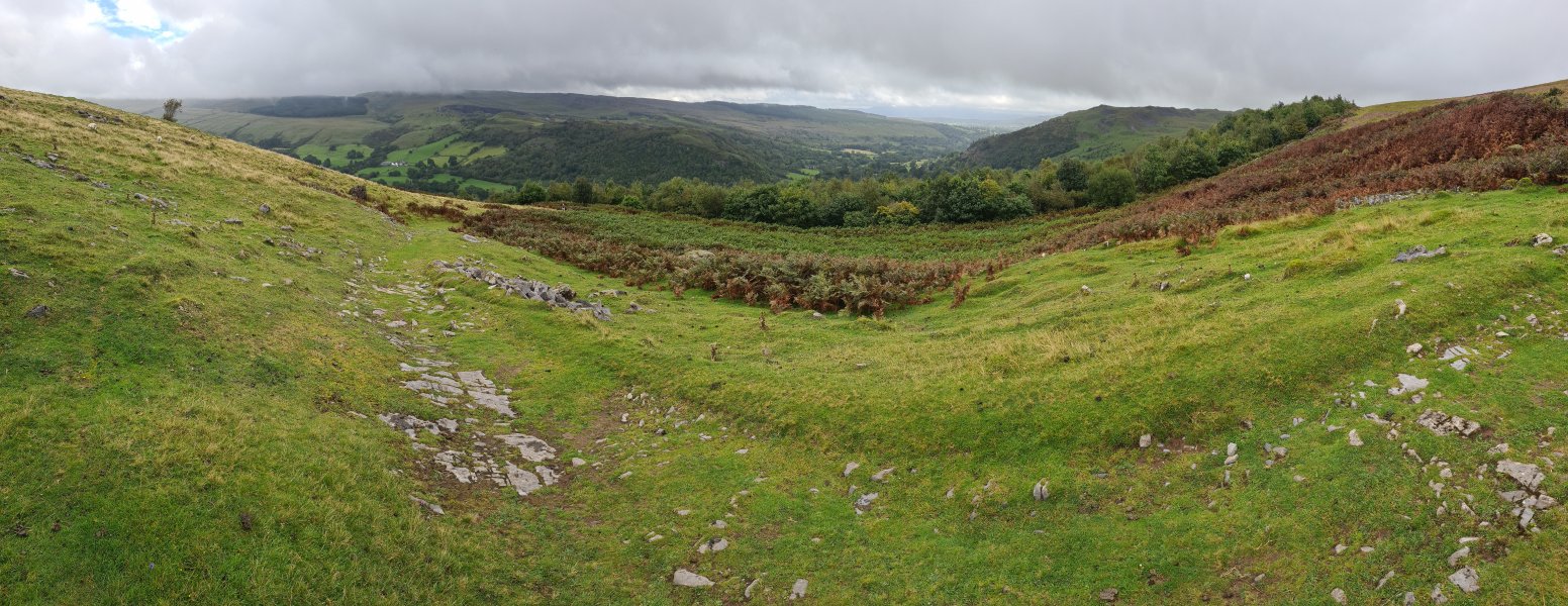 The lower part of Glyntawe, with Fan Gyhirych's Carreg Cadno ridge (538 metres) and Cribarth (428 metres).
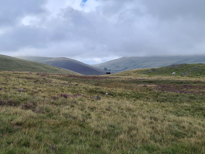 Part of a Welsh mountain pony herd, in front of Cefn Cul and Fan Gyhirych.
Modelling by The Windswept Trio
Part of a Welsh mountain pony herd, in front of Cefn Cul and Fan Gyhirych.
Modelling by The Windswept Trio Approaching the Afon Giedd. The mountains are Disgwylfa (544 metres) and an unnamed ridge (486 metres), with the main Bannau Sir Gaer and Black Mountain peaks covered in cloud to the right.
Modelling by Ali, Jules and Paul
Approaching the Afon Giedd. The mountains are Disgwylfa (544 metres) and an unnamed ridge (486 metres), with the main Bannau Sir Gaer and Black Mountain peaks covered in cloud to the right.
Modelling by Ali, Jules and Paul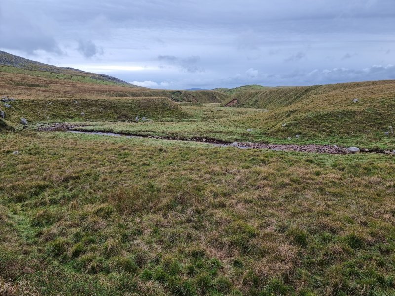 The Afon Giedd, looking downstream. This is the usual crossing point to get to Carreg Lem.
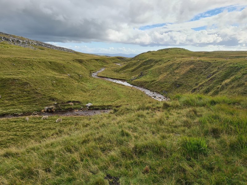 The Afon Giedd, heading towards Sync y Giedd. That cave floods to such an extreme that the cobbles regularly block access to large parts of the cave, and prospects for finding a way into the vast cave system that must exist here are very slim. The hope is that Carreg Lem, being a much smaller feeder into the same system, might bypass all of the problematic parts of Sync y Giedd.
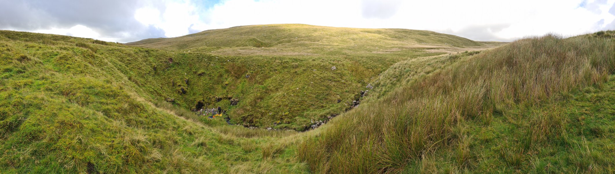 The Carreg Lem sink, just in front of the unnamed ridge.
Modelling by Jules, Paul and Ali
The Carreg Lem sink, just in front of the unnamed ridge.
Modelling by Jules, Paul and Ali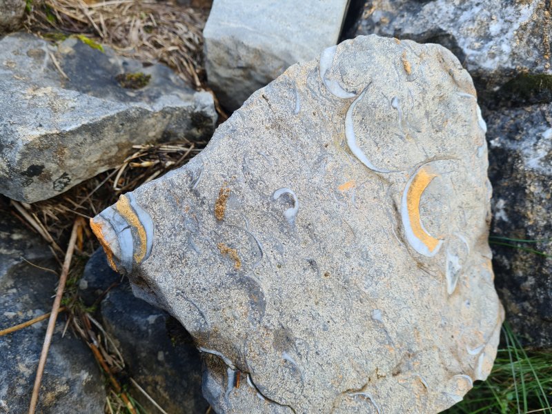 Rock with beautiful shell fossils, in the sink. These are probably brachiopods.
 The entrance of Carreg Lem.
Modelling by Jules
The entrance of Carreg Lem.
Modelling by Jules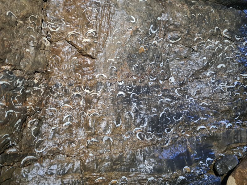 Just inside the entrance is the highly ornate shell fossil bed, probably thick shelled brachiopods.
Lighting by Tarquin and Sol
Just inside the entrance is the highly ornate shell fossil bed, probably thick shelled brachiopods.
Lighting by Tarquin and Sol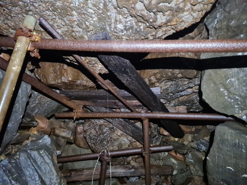 The cave begins with a rather horrifying choke. This is the ceiling, being held up by scaffolding. I was told not to look too closely.
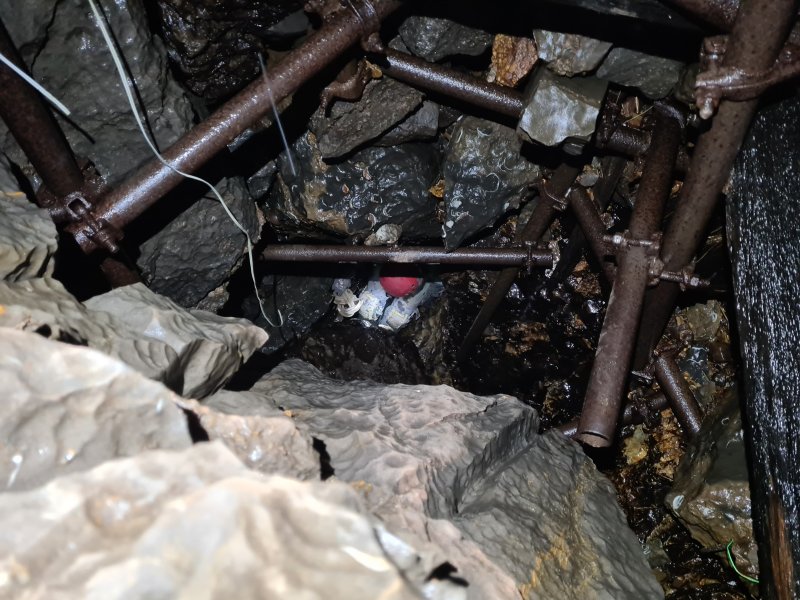 Climbing down through the scaffolded choke. This was previously not shored, and collapsed while someone was passing through it. The cave was then reopened, and the choke was scaffolded to prevent a repeat.
Modelling by Jules, lighting by Tarquin and Jules
Climbing down through the scaffolded choke. This was previously not shored, and collapsed while someone was passing through it. The cave was then reopened, and the choke was scaffolded to prevent a repeat.
Modelling by Jules, lighting by Tarquin and Jules The choke lands in a relatively large chamber, the largest known part of the cave. The size is likely to be due to repeated collapse, rather than there being a hidden passage somewhere.
Modelling by Paul and Jules, lighting by Tarquin, Paul and Jules
The choke lands in a relatively large chamber, the largest known part of the cave. The size is likely to be due to repeated collapse, rather than there being a hidden passage somewhere.
Modelling by Paul and Jules, lighting by Tarquin, Paul and Jules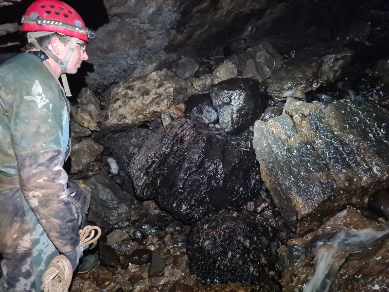 The mix of rocks in the chamber. On the left is a conglomerate that looks like chunks of limestone in a matrix, hereby referred to as "caramel rocky road". To the right of that is a black sandstone, perhaps a darkened Old Red Sandstone, Grey Grits Formation, Cwmyniscoy Mudstone Formation, or a Honeycomb Sandstone. To the right of that is Oxwich Head Limestone with a very rich layer of thick shelled brachipods. Below the sandstone block is the Oystermouth formation, a layer of limestone and mudstone. On the floor are several Old Red Sandstone cobbles.
Modelling by Jules, lighting by Tarquin and Jules
The mix of rocks in the chamber. On the left is a conglomerate that looks like chunks of limestone in a matrix, hereby referred to as "caramel rocky road". To the right of that is a black sandstone, perhaps a darkened Old Red Sandstone, Grey Grits Formation, Cwmyniscoy Mudstone Formation, or a Honeycomb Sandstone. To the right of that is Oxwich Head Limestone with a very rich layer of thick shelled brachipods. Below the sandstone block is the Oystermouth formation, a layer of limestone and mudstone. On the floor are several Old Red Sandstone cobbles.
Modelling by Jules, lighting by Tarquin and Jules Beautifully textured limestone, which appers to be a mix of mudstone and limestone. This is likely to be the Oystermouth Formation.
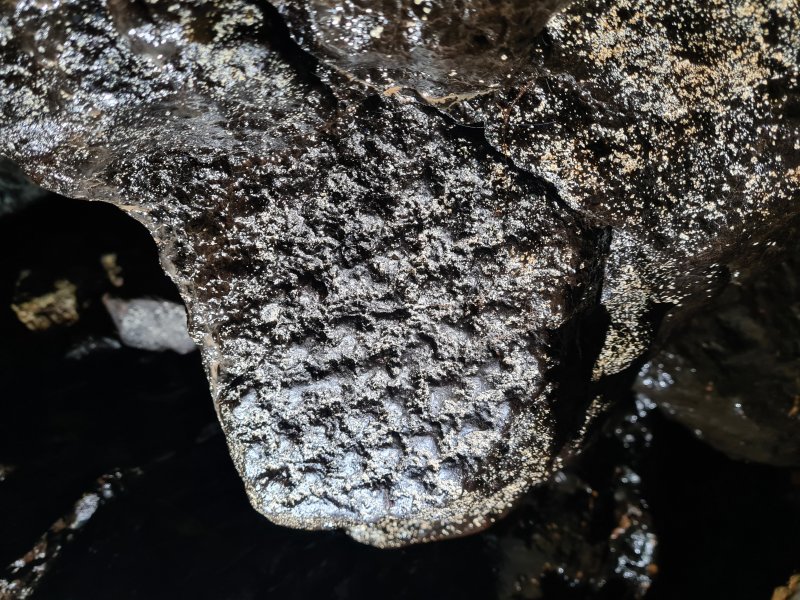 Tree fossil in the sandstone block, likely to be an arborescent lycophyte (a tree version of a club moss). Examples of these are also seen in Dan yr Ogof.
 The left side of the chamber remains large, then funnels down to two small side passages, about 100 metres long in total. We did not visit the side passages.
Modelling by Paul, lighting by Tarquin and Jules
The left side of the chamber remains large, then funnels down to two small side passages, about 100 metres long in total. We did not visit the side passages.
Modelling by Paul, lighting by Tarquin and Jules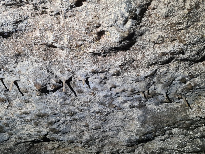 The ceiling of the chamber glistens with water droplets, held in place by hydrophobic bacteria. However, they do not photograph well at all, since they only glisten when you move.
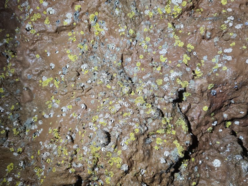 Hydrophobic bacterial mats in different colours.
 The main passage leading out of the chamber is the right branch, which starts walking sized.
Modelling by Jules, lighting by Tarquin and Jules
The main passage leading out of the chamber is the right branch, which starts walking sized.
Modelling by Jules, lighting by Tarquin and Jules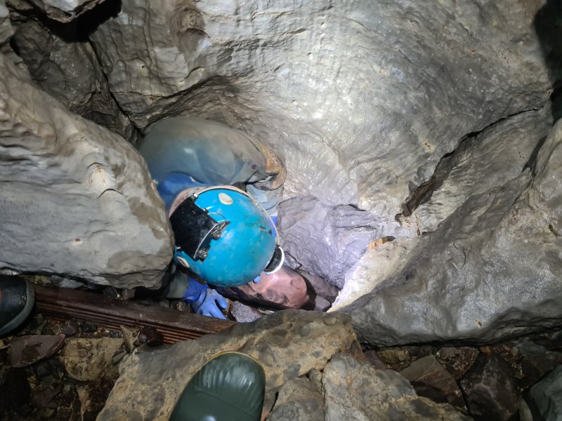 A draughting hole in the floor has previously been dug. This seems to have changed the cave's flooding pattern, and the U-bends have not flooded for over a decade, as the water can reach the lower parts of the cave without needing to go down the main passage.
Modelling by Paul and Tarquin and Ali's wellies, lighting by Tarquin and Paul
A draughting hole in the floor has previously been dug. This seems to have changed the cave's flooding pattern, and the U-bends have not flooded for over a decade, as the water can reach the lower parts of the cave without needing to go down the main passage.
Modelling by Paul and Tarquin and Ali's wellies, lighting by Tarquin and Paul Shell fossil.
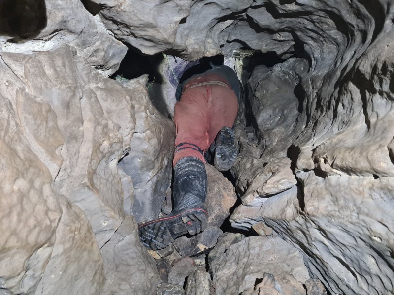 The start of the first U-bend, where there is also a short side passage not shown on the very simplistic survey, a common occurance. The worst part of the U-bends is the gravel that gets dragged through with you, which slowly fills them to the point that they need clearing again.
Modelling by Paul, lighting by Tarquin and Paul
The start of the first U-bend, where there is also a short side passage not shown on the very simplistic survey, a common occurance. The worst part of the U-bends is the gravel that gets dragged through with you, which slowly fills them to the point that they need clearing again.
Modelling by Paul, lighting by Tarquin and Paul End of the first U-bend.
Modelling by Ali, lighting by Tarquin and Ali
End of the first U-bend.
Modelling by Ali, lighting by Tarquin and Ali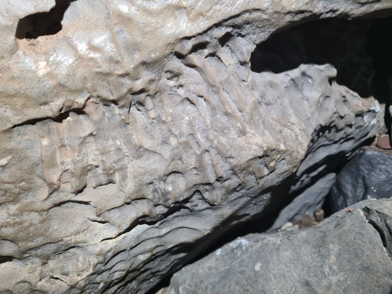 Fossil coral. This appears to be a Lithostrotion.
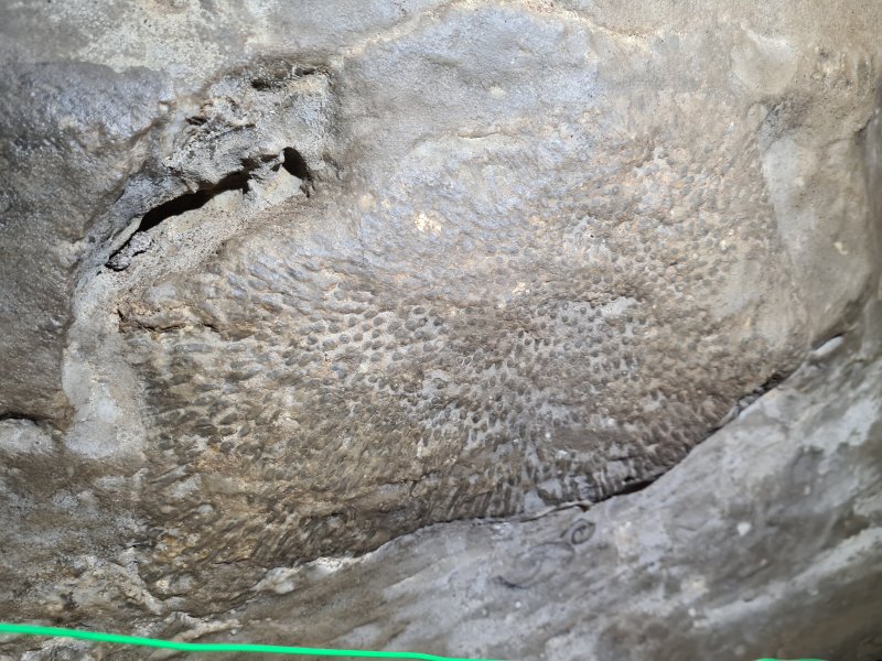 Syringopora coral fossil.
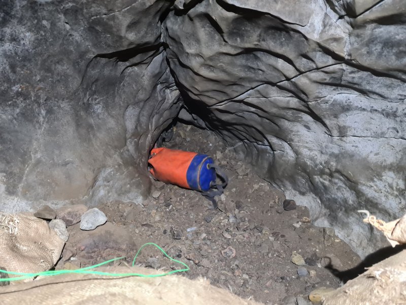 Start of the second U-Bend.
 End of the second U-bend.
Modelling by Ali, lighting by Tarquin and Ali
End of the second U-bend.
Modelling by Ali, lighting by Tarquin and Ali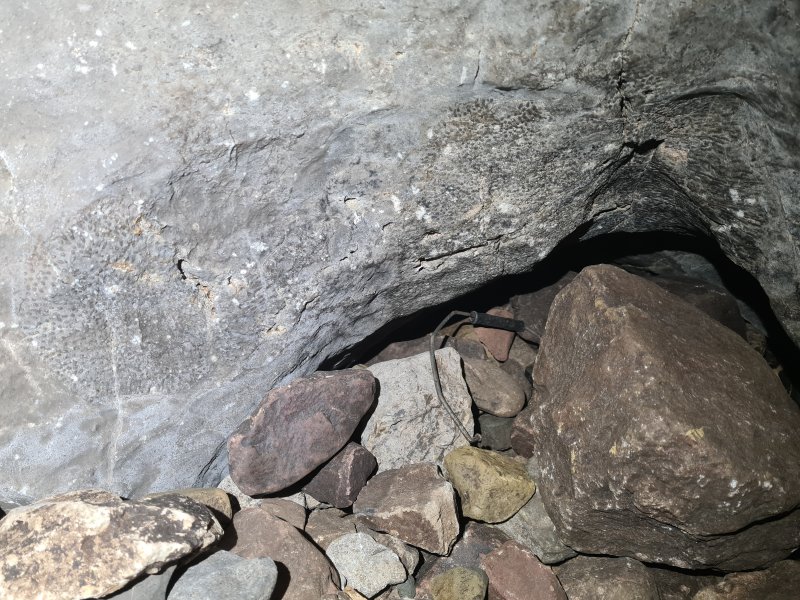 Larger Syringopora fossil, above a small side passage that is not on the survey.
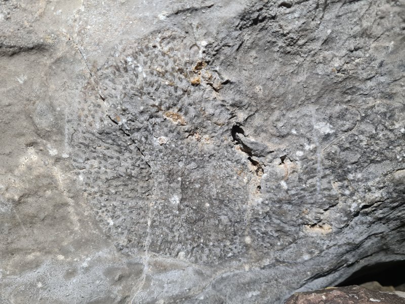 Detail of the Syringopora fossil.
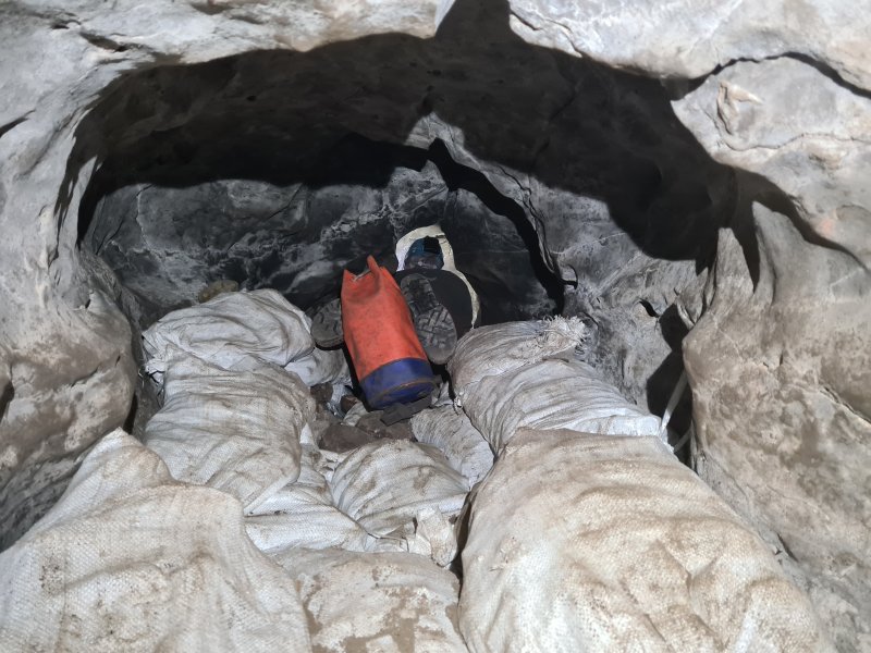 Start of the third U-bend.
Modelling by Paul, lighting by Tarquin and Paul
Start of the third U-bend.
Modelling by Paul, lighting by Tarquin and Paul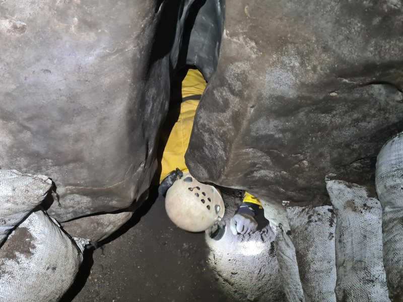 End of the third U-bend, where there is another unsurveyed side passage.
Modelling by Ali, lighting by Tarquin and Ali
End of the third U-bend, where there is another unsurveyed side passage.
Modelling by Ali, lighting by Tarquin and Ali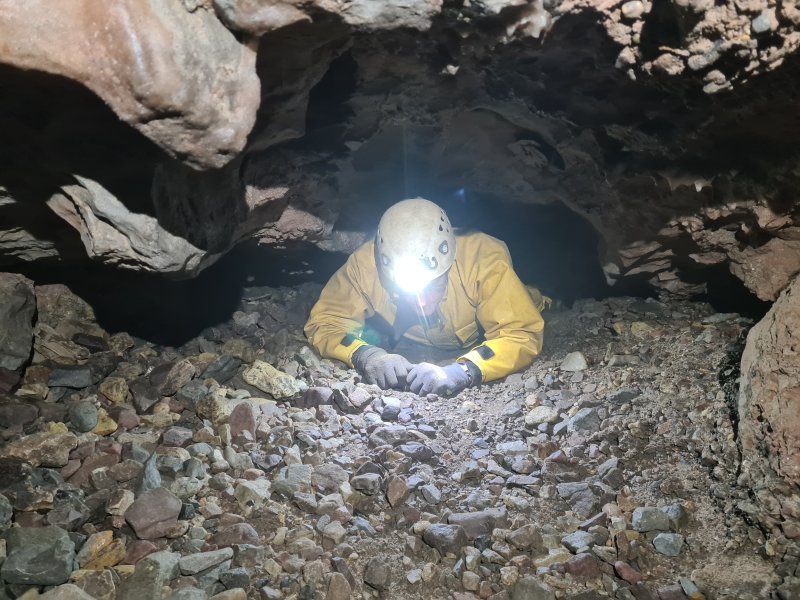 The way on stays as a crawl for a little while.
Modelling by Ali, lighting by Tarquin and Ali
The way on stays as a crawl for a little while.
Modelling by Ali, lighting by Tarquin and Ali This is followed by a pretty section of larger passage.
Modelling by Paul, lighting by Tarquin, Paul and Jules
This is followed by a pretty section of larger passage.
Modelling by Paul, lighting by Tarquin, Paul and Jules Stalactite.
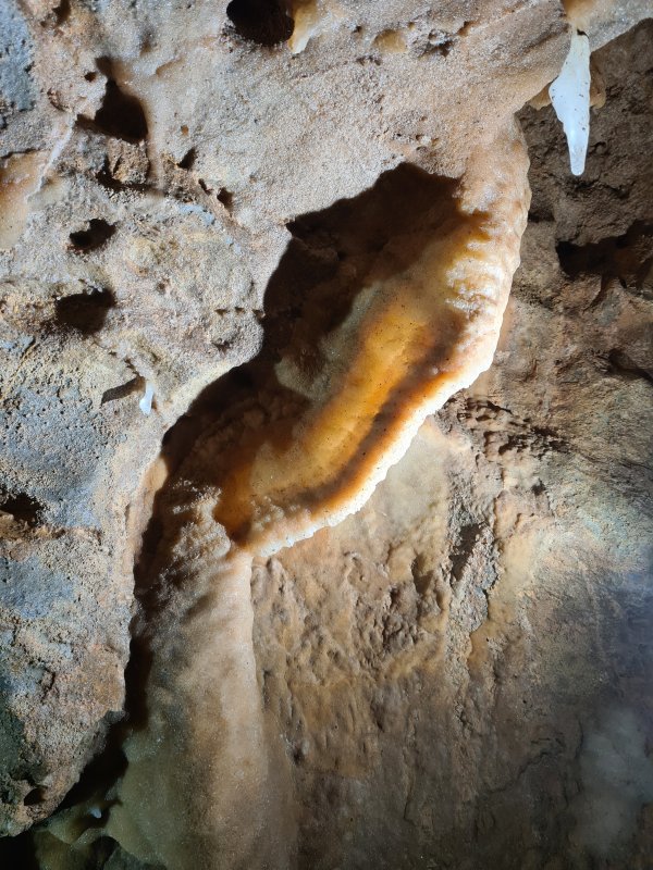 Curtain.
Lighting by Tarquin and Paul
Curtain.
Lighting by Tarquin and Paul Immature stal.
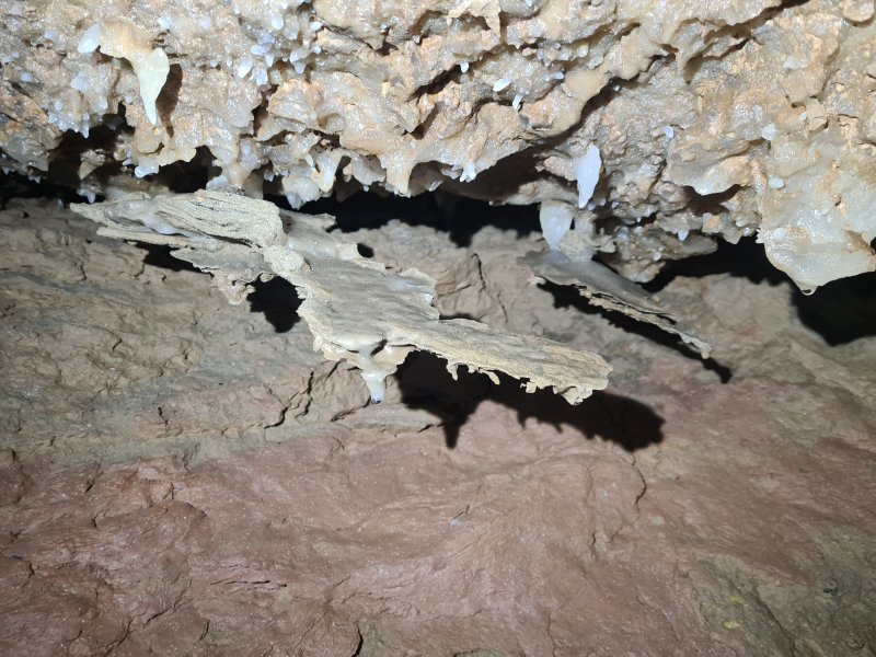 False floors held up by stal columns.
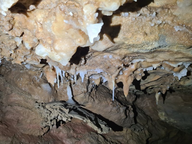 A false floor hanging from a taller column.
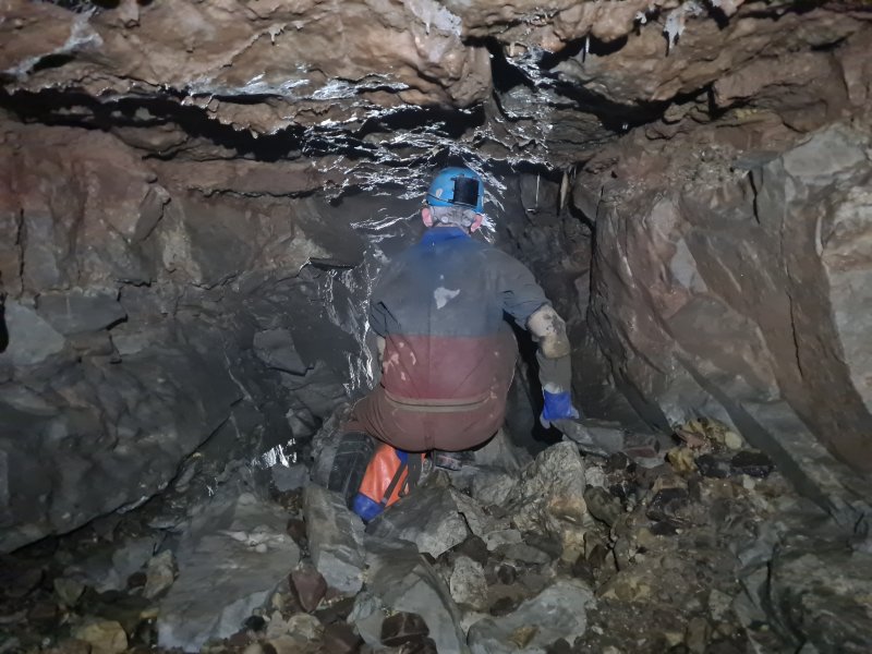 A large side passage (which is surveyed!) is short, but brings in a significant increase in the subsequent passage size.
Modelling by Paul, lighting by Tarquin and Jules
A large side passage (which is surveyed!) is short, but brings in a significant increase in the subsequent passage size.
Modelling by Paul, lighting by Tarquin and Jules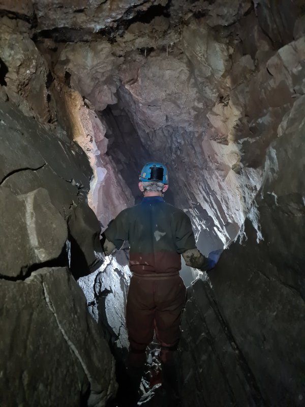 The passage then briefly follows a fault.
Modelling by Paul, lighting by Tarquin and Jules
The passage then briefly follows a fault.
Modelling by Paul, lighting by Tarquin and Jules Looking back up the fault passage, which is very large compared with everything before it. At about this point, the inaccessible passage ends beneath the floor on the left side of the passage as seen here, but about 8.5 metres lower. This would explain the sudden shrinking of the passage beyond this point. Maybe it will be possible to create a round trip, or to bypass the dig.
Modelling by Ali, lighting by Tarquin, Ali and Paul
Looking back up the fault passage, which is very large compared with everything before it. At about this point, the inaccessible passage ends beneath the floor on the left side of the passage as seen here, but about 8.5 metres lower. This would explain the sudden shrinking of the passage beyond this point. Maybe it will be possible to create a round trip, or to bypass the dig.
Modelling by Ali, lighting by Tarquin, Ali and Paul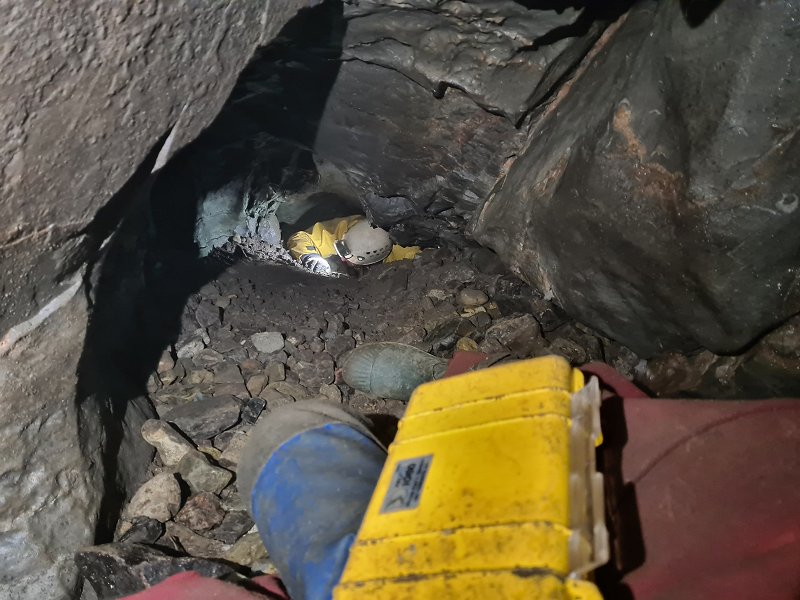 The passage shrinks, then passes under a small, blind aven.
Modelling by Tarquin's legs and Ali, lighting by Tarquin and Ali
The passage shrinks, then passes under a small, blind aven.
Modelling by Tarquin's legs and Ali, lighting by Tarquin and Ali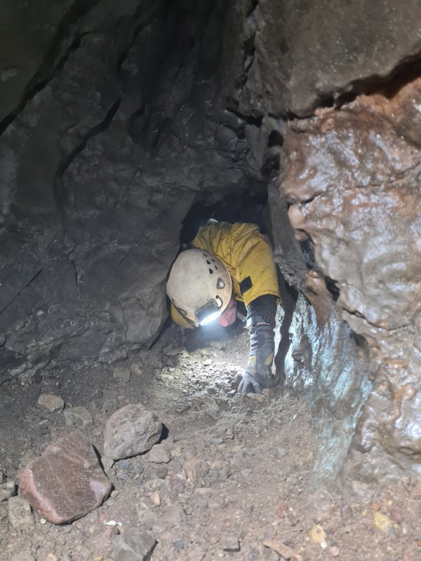 This is followed by the tightest part of the cave, but this is more awkward than tight.
Modelling by Ali, lighting by Tarquin, Ali and Paul
This is followed by the tightest part of the cave, but this is more awkward than tight.
Modelling by Ali, lighting by Tarquin, Ali and Paul Small helictites.
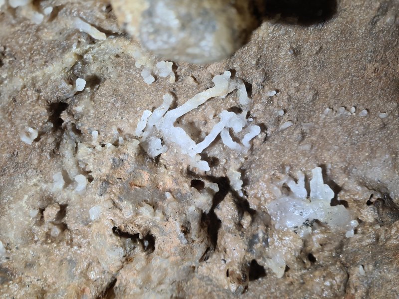 Helictites.
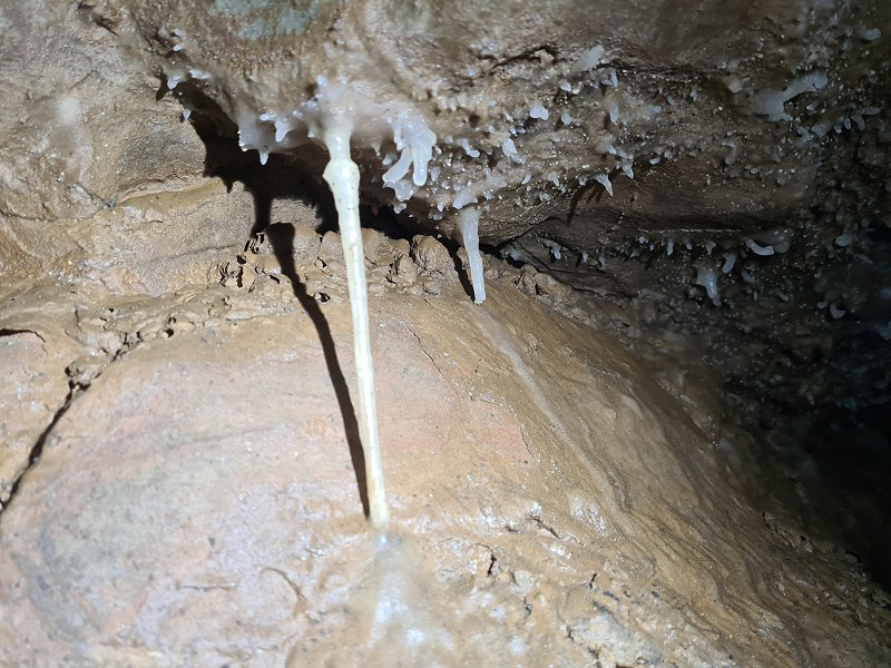 Small straws and immature helictites.
 The best grotto in the cave. The passage beyond has several longer straws, and ends immediately.
Modelling by Jules, lighting by Tarquin and Jules
The best grotto in the cave. The passage beyond has several longer straws, and ends immediately.
Modelling by Jules, lighting by Tarquin and Jules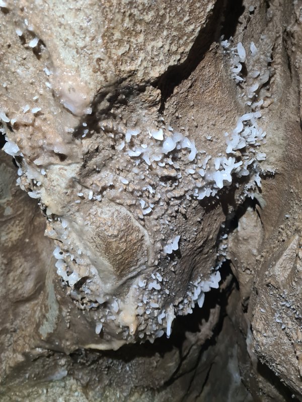 Helictites at the start of the grotto.
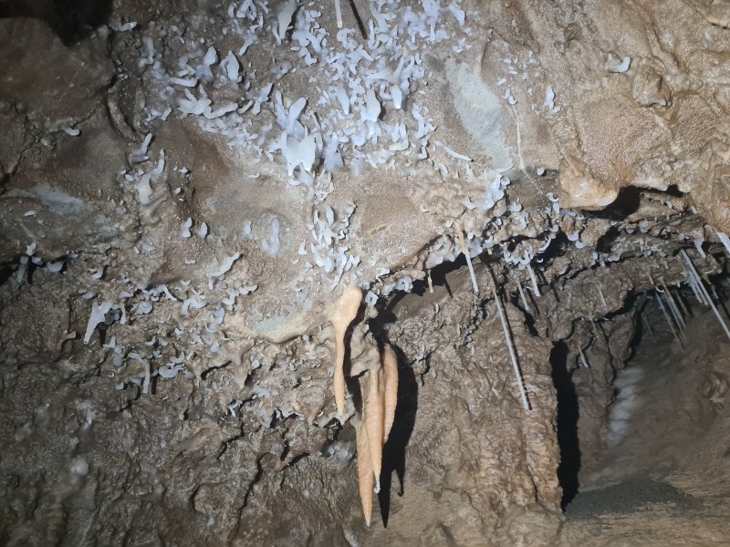 Helictites in the grotto.
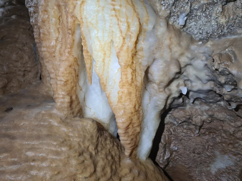 Coloured flowstone in the grotto, which forms a false floor.
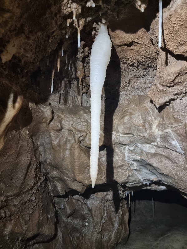 Stalactite in the grotto.
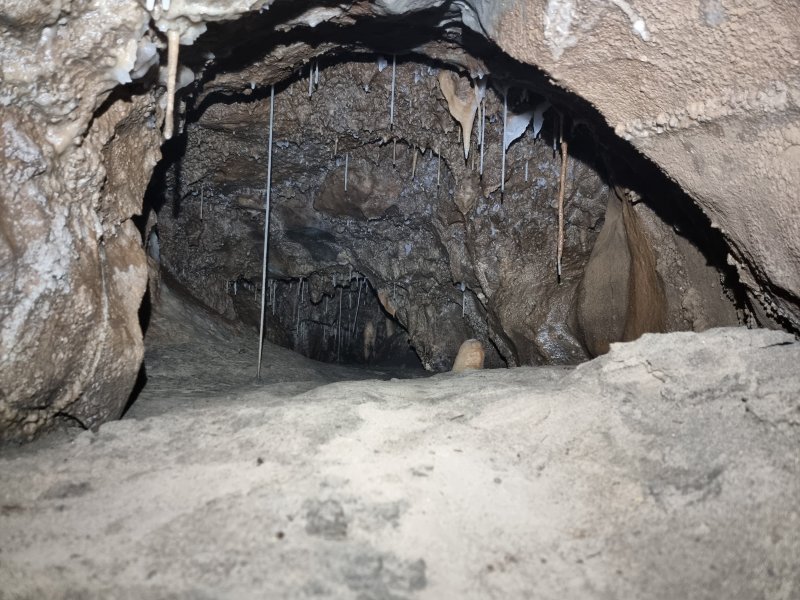 End of the grotto, which fills with sand. It would only be an oxbow, so there is no point in digging here.
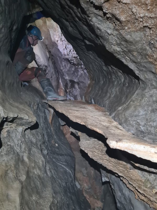 A side crawl reaches the steeply sloping continuation, which has layers of false floors.
Modelling by Paul, lighting by Tarquin and Paul
A side crawl reaches the steeply sloping continuation, which has layers of false floors.
Modelling by Paul, lighting by Tarquin and Paul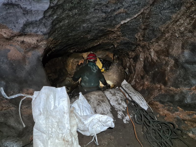 Digging spoil from our dig. We moved about a tonne of gravel during this trip.
Modelling by Paul and Ali, lighting by Tarquin, Paul and Ali
Digging spoil from our dig. We moved about a tonne of gravel during this trip.
Modelling by Paul and Ali, lighting by Tarquin, Paul and Ali Start of the dig.
Modelling by Pete, lighting by Tarquin and Pete
Start of the dig.
Modelling by Pete, lighting by Tarquin and Pete Immediately before the dig, the passage passes below an aven, which is also not on the survey. The curtains here are liberally coated with mud, and fresh plant matter. This part of the cave still floods, but we were here in summer during rain showers, and had no issues with water.
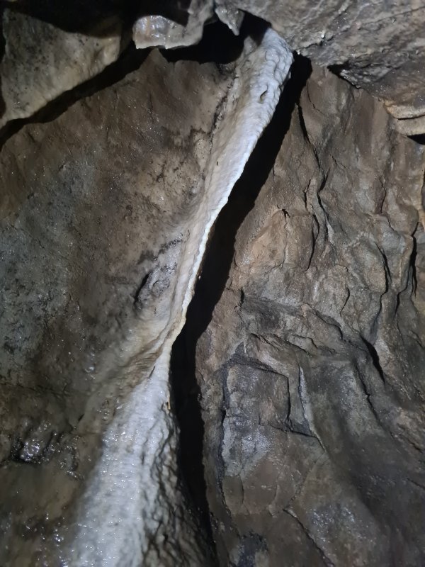 White curtain, which has avoided most of the mud.
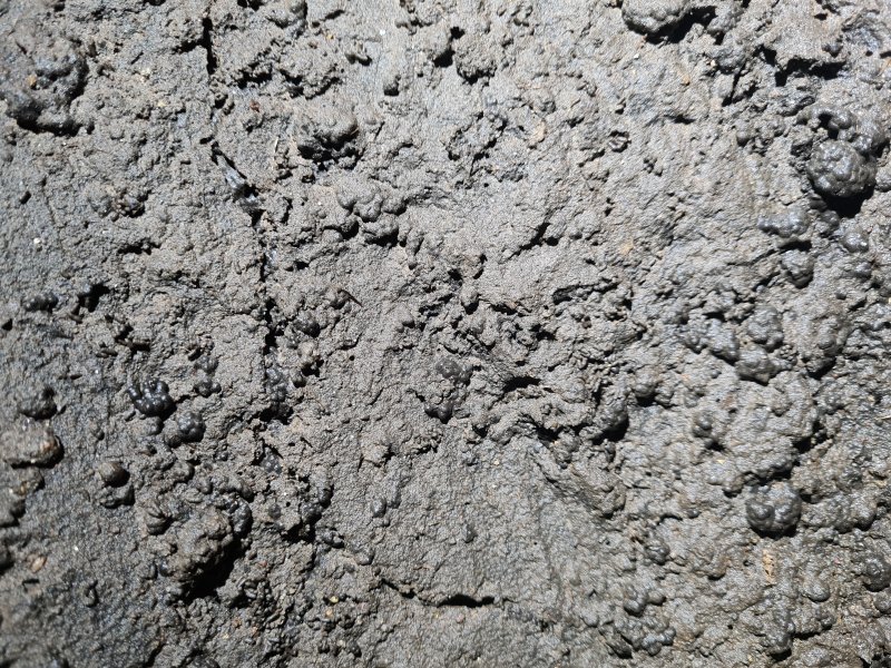 Worm casts. We did not see any worms, but this part of the cave must flood often enough to feed them.
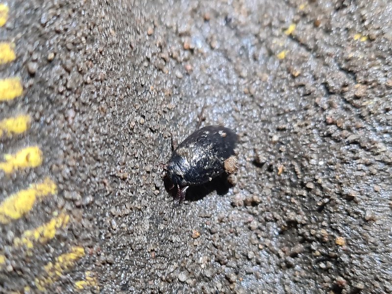 A very small water beetle, something which is very rarely seen in caves, but seems to be coping well enough down here.
Modelling by Wyatt and Tarquin's glove
A very small water beetle, something which is very rarely seen in caves, but seems to be coping well enough down here.
Modelling by Wyatt and Tarquin's glove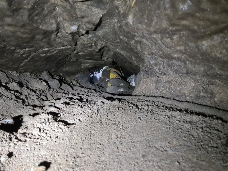 The dig is a 20 metre long crawl. The current progress is about 4 metres from the far end of the crawl, and a large team is needed to guide drag trays around the corners. The camera is situated in the lowest part of the cave, 56.6 metres below the entrance. The streams in the cave beyond cut across the passage, and do not flow this way, except in flood.
Modelling by Ali, lighting by Tarquin and Ali
The dig is a 20 metre long crawl. The current progress is about 4 metres from the far end of the crawl, and a large team is needed to guide drag trays around the corners. The camera is situated in the lowest part of the cave, 56.6 metres below the entrance. The streams in the cave beyond cut across the passage, and do not flow this way, except in flood.
Modelling by Ali, lighting by Tarquin and Ali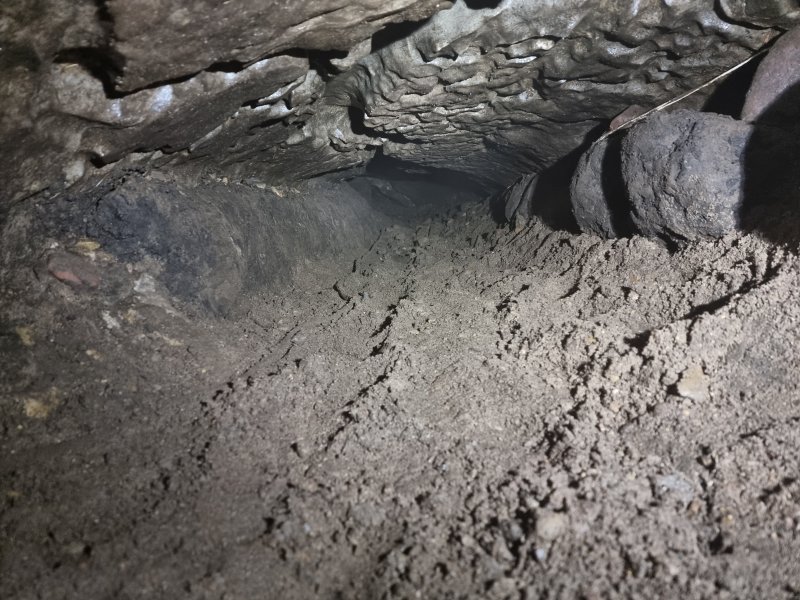 This part of the passage was completely excavated.
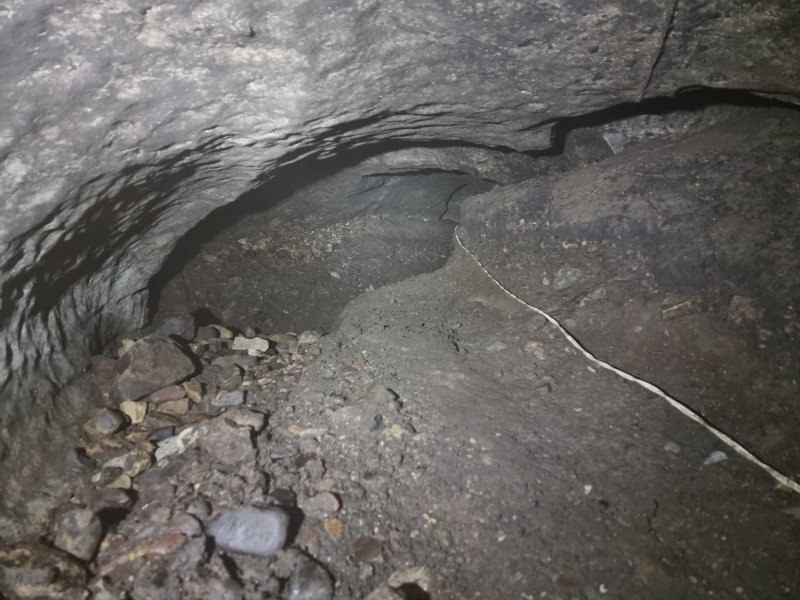 The breakthrough point.
 The breakthrough point, looking towards the newly regained passage.
Modelling by Tarquin, lighting by Tarquin and Jules
The breakthrough point, looking towards the newly regained passage.
Modelling by Tarquin, lighting by Tarquin and Jules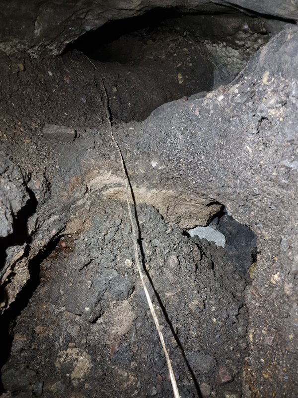 Looking back out towards the breakthrough point. Streams had washed out the gravel from below. Under the wall is the bedding plane where the stream flows out towards the old cave. A small stream on the left, however, appears to emerge from the old cave direction, but this is probably coming from behind the camera, even though it can be seen flowing towards the camera.
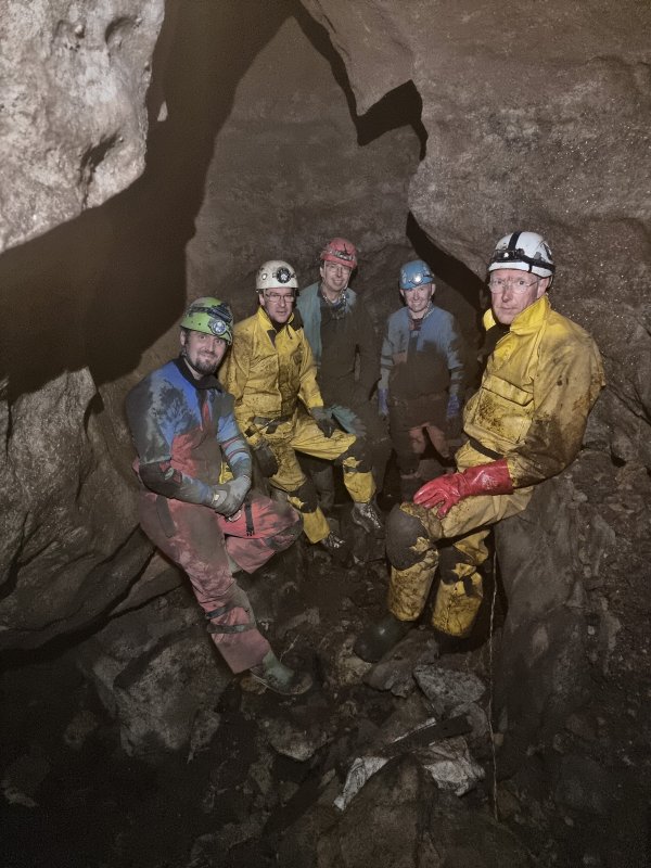 The largest part of the newly regained passage is at the junction, seen here with the team that made the breakthrough. We think it has been about 25 years since anyone stood at this spot. The stream flows in from under the right wall, and out under the distant left wall. The way in is a very low passage at floor level on the left. Oh the wall at about chest height, we noticed relatively fresh flood scum and grass fragments, probably from the previous winter.
Modelling by Tarquin, Ali, Jules, Paul and Pete, camera, setups and lighting by Tarquin and Jules
The largest part of the newly regained passage is at the junction, seen here with the team that made the breakthrough. We think it has been about 25 years since anyone stood at this spot. The stream flows in from under the right wall, and out under the distant left wall. The way in is a very low passage at floor level on the left. Oh the wall at about chest height, we noticed relatively fresh flood scum and grass fragments, probably from the previous winter.
Modelling by Tarquin, Ali, Jules, Paul and Pete, camera, setups and lighting by Tarquin and Jules The western passage starts very large, one of the largest in the cave. A stream emerges again from under the right wall at a corner, and flows back down the passage, then out under the left wall. Like all streams, it flows along the impervious honeycomb sandstone.
Modelling by Ali and Paul, lighting by Tarquin, Ali and Paul
The western passage starts very large, one of the largest in the cave. A stream emerges again from under the right wall at a corner, and flows back down the passage, then out under the left wall. Like all streams, it flows along the impervious honeycomb sandstone.
Modelling by Ali and Paul, lighting by Tarquin, Ali and Paul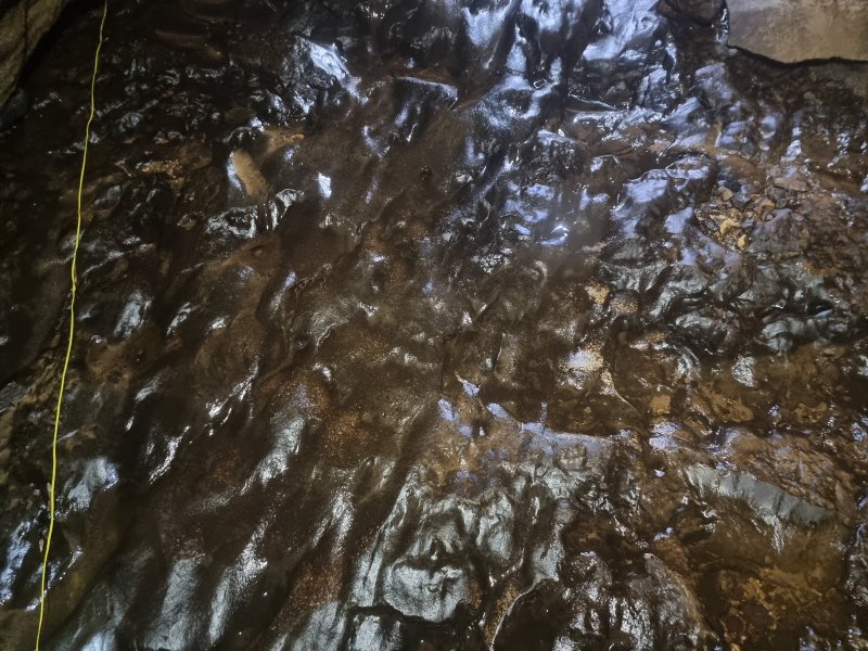 Honeycomb sandstone, with the small stream flowing down it.
Lighting by Tarquin and Ali
Honeycomb sandstone, with the small stream flowing down it.
Lighting by Tarquin and Ali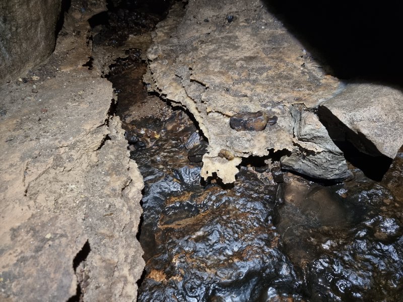 False floors in a taped off oxbow.
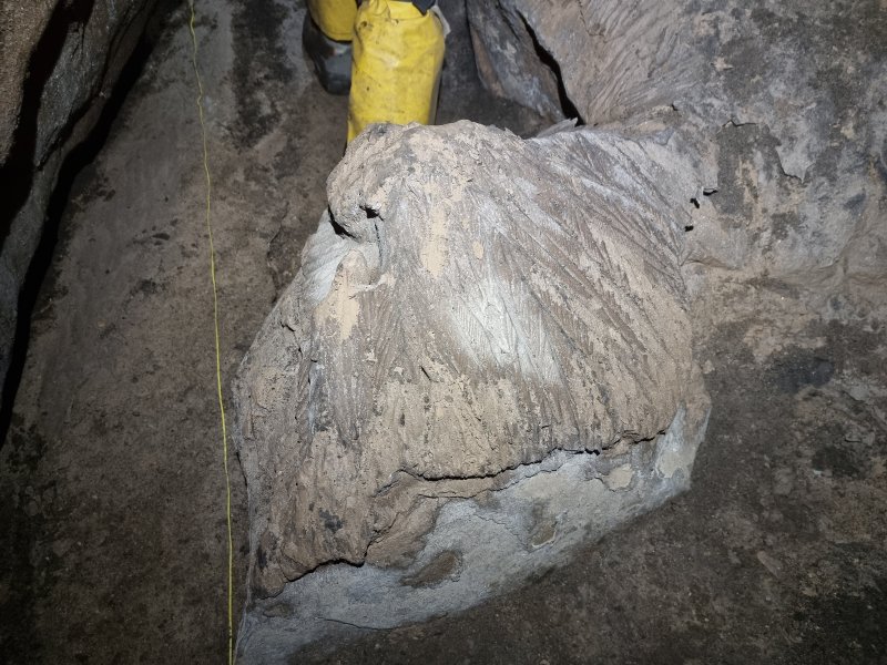 Mud formations.
Modelling by Ali
Mud formations.
Modelling by Ali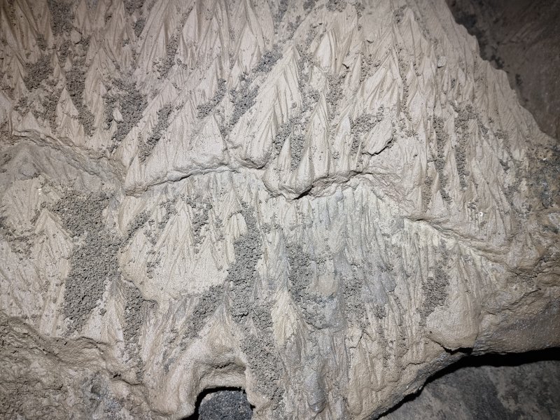 Mud formations.
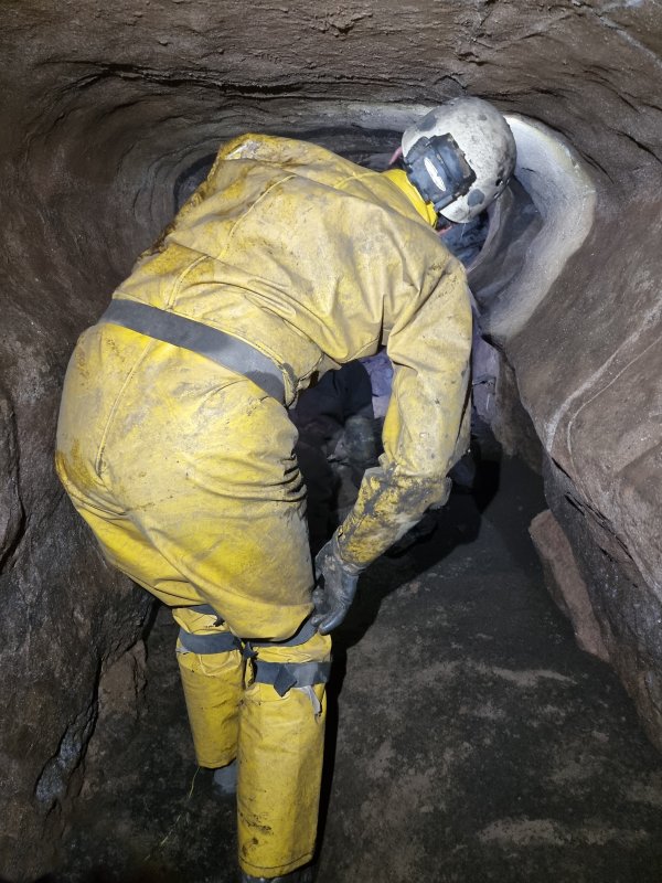 The passage gets smaller, but still fairly comfortable.
Modelling by Ali and hints of Paul, lighting by Tarquin, Ali and Paul
The passage gets smaller, but still fairly comfortable.
Modelling by Ali and hints of Paul, lighting by Tarquin, Ali and Paul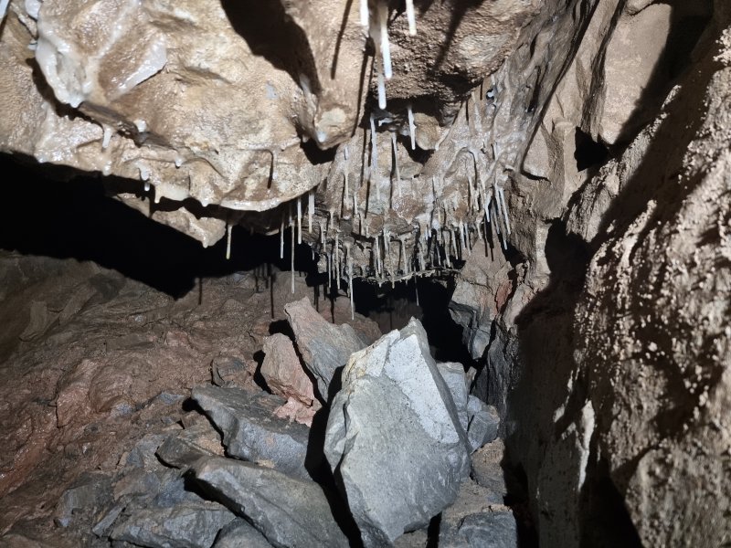 Straws in a small chamber.
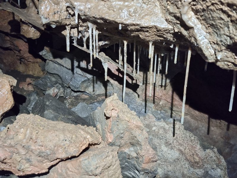 Straws with a false floor.
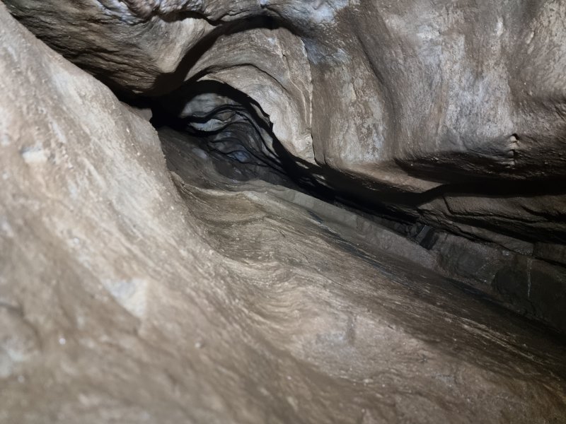 Aven in the ceiling of the chamber.
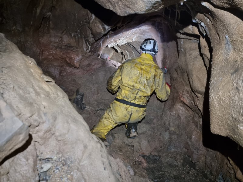 The chamber hides the end of the taped off oxbow, where a side passage chokes at a fault.
Modelling by Pete, lighting by Tarquin and Pete
The chamber hides the end of the taped off oxbow, where a side passage chokes at a fault.
Modelling by Pete, lighting by Tarquin and Pete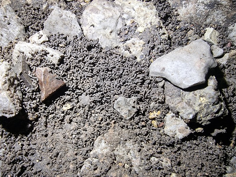 Frass in the side passage. This appears to be worm cast, and it is everywhere, even places where there is no mud for the worms to crawl through.
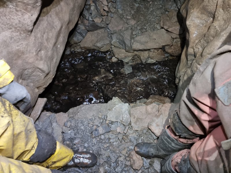 The ongoing passage passes another stream that once again crosses from right to left on the honeycomb sandstone, ignoring the passage. Digging spoil has created a Roman sewer effect.
Modelling by Ali and Paul, lighting by Tarquin, Ali and Paul
The ongoing passage passes another stream that once again crosses from right to left on the honeycomb sandstone, ignoring the passage. Digging spoil has created a Roman sewer effect.
Modelling by Ali and Paul, lighting by Tarquin, Ali and Paul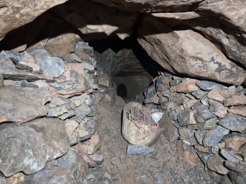 A dig at the end passes below a fault aven, then punches through a wall to regain a short piece of passage, which immediately chokes.
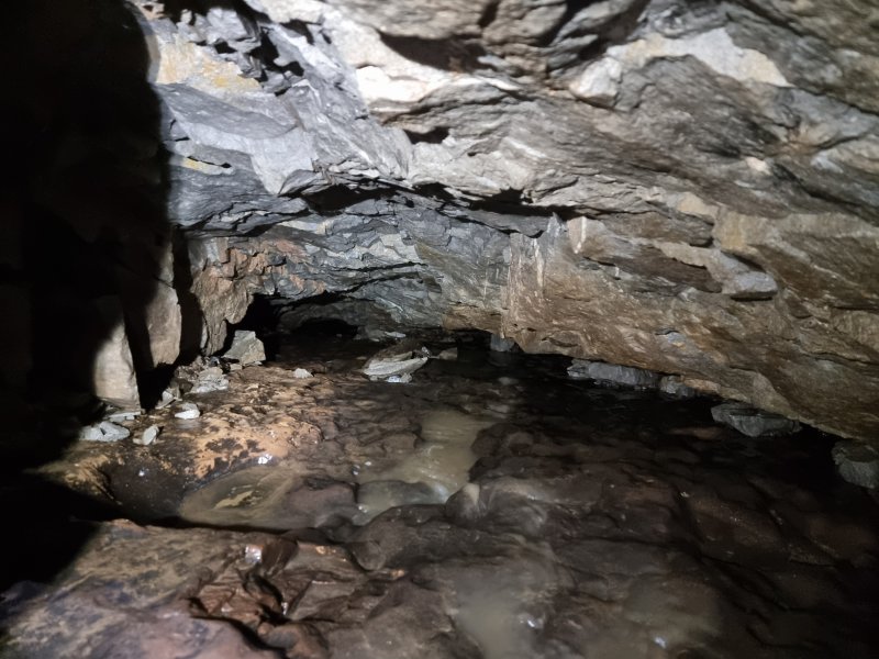 Downstream from the Roman sewer, where the water continues to flow over the honeycomb sandstone. The water has to break through it at some point since the resurgences are in the beds below, and a very involved dig was pursued with rock removal, but it could be a very long way before it breaks through. It will probably need a fault, but fortunately there are a couple nearby. So far, the dig is 10 metres long.
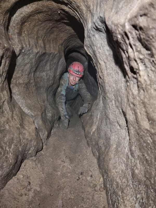 The eastern passage is smaller, being a crawl for about 15 metres, ending at a squeeze.
Modelling by Jules
The eastern passage is smaller, being a crawl for about 15 metres, ending at a squeeze.
Modelling by Jules This breaks into a very large aven, which looks like it narrows, without any obvious passage at the top.
Modelling by Pete and Jules, lighting by Tarquin, Pete, Jules and Ali
This breaks into a very large aven, which looks like it narrows, without any obvious passage at the top.
Modelling by Pete and Jules, lighting by Tarquin, Pete, Jules and Ali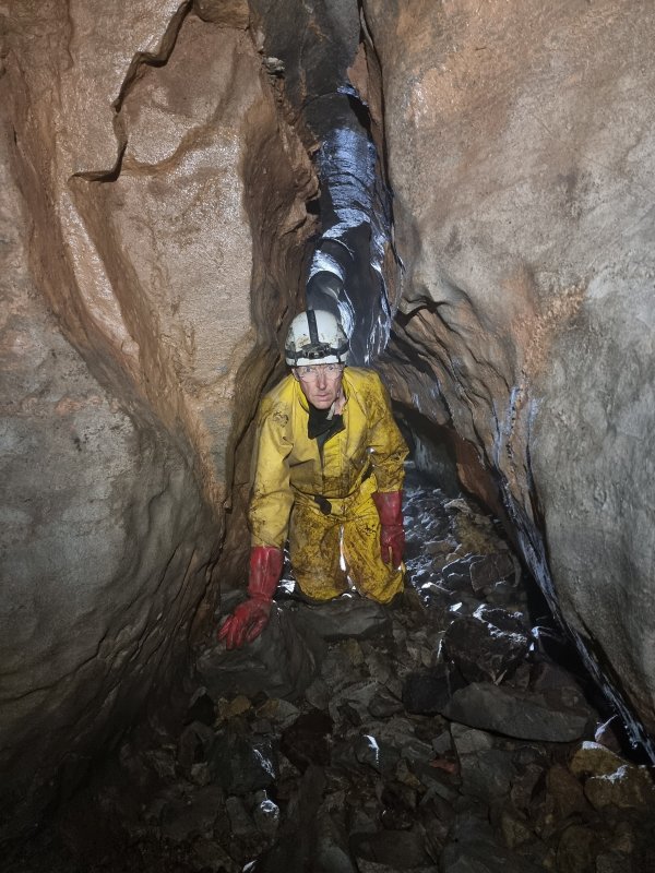 The passage continues beyond the aven, a little larger than before.
Modelling by Pete, lighting by Tarquin and Ali
The passage continues beyond the aven, a little larger than before.
Modelling by Pete, lighting by Tarquin and Ali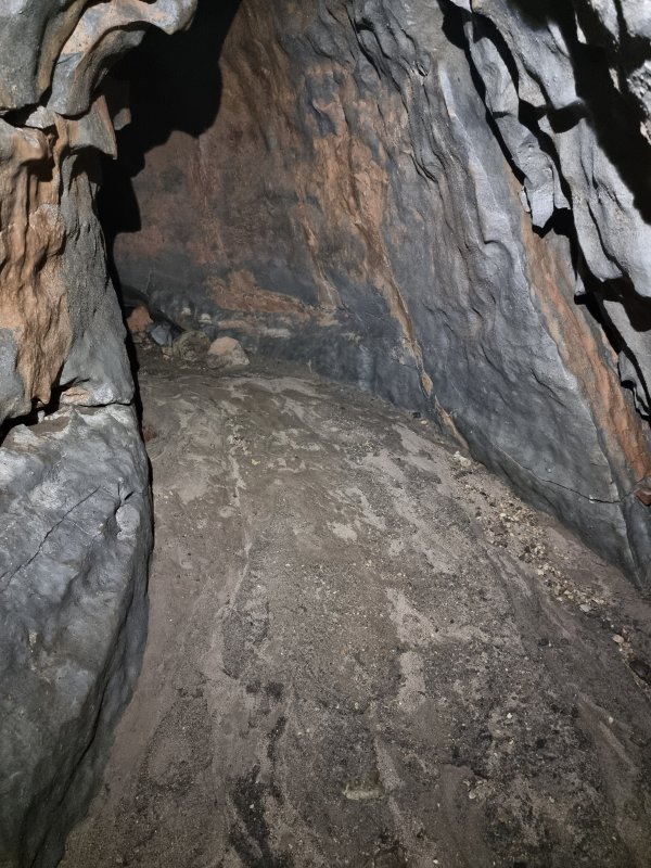 Although there was no water here, the sand showed clear signs of water, with no footprints. This passage obviously carries water in flood.
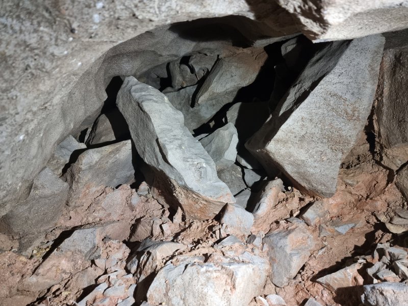 The passage reaches a choke, which can be followed a short distance to the left. The choke is mostly vertically upwards, reaching up about 3 metres. This is directly below the floor of the large fault controlled passage after the third U-bend, with perhaps 3-4 metres separating them. A dig would be very useful.
 As we left the cave, the cloud had lifted, revealing the tops of Waun Lefrith (677 metres), Picws Du (749 metres), Fan Brycheiniog (803 metres) and Fan Hir (761 metres).
Modelling by Ali, Jules and Paul
As we left the cave, the cloud had lifted, revealing the tops of Waun Lefrith (677 metres), Picws Du (749 metres), Fan Brycheiniog (803 metres) and Fan Hir (761 metres).
Modelling by Ali, Jules and Paul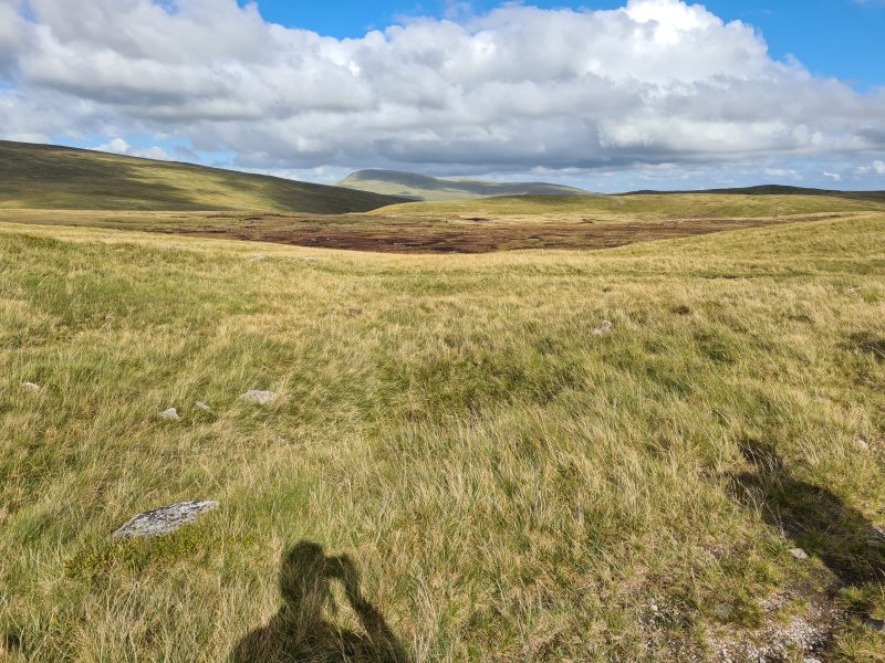 Fan Gyhirych and Fan Fraith (668 metres), seen over Waun Fignen Felen.
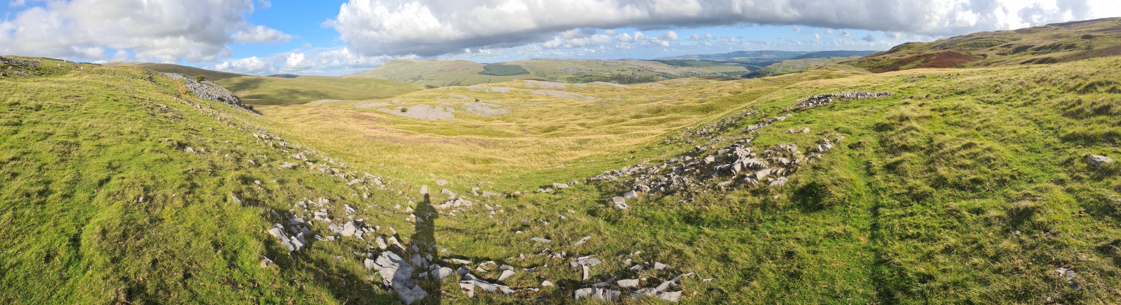 Arriving back at Glyntawe. Fan Hir, Cefn Cul, Fan Gyhirych, Fan Fraith, Carreg Cadno, Mynydd Merthyr (491 metres), Craig y Llyn (600 metres), Hirfynydd (481 metres) and Cribarth.