Chartist Cave trips 09/09/2022
This historic cave has very litte passage, 500 metres in total, formed on a grid in such a way that almost the entire cave can be seen while following a single loop. As a result, the cave does not really deserve a large gallery for each visit. The walk to it, however, can be either miserable or stunning, and we got superb conditions, with more drama in the sky than anything in the cave.
The cave has a Welsh name "Ogof Fawr", meaning "big cave", a really stupid name shared with several other minor caves, and at least one major cave in the same caving region. It used to be called "Tylles Fawr" meaning "big hole" which is just as bad, but at least it was more unique. Before that, it was called "Stabl Fawr" meaning "big stable", as it was used as a shelter by the mountain ponies.
Unless otherwise stated, camera, setups, lighting, edits and gallery effects by Tarquin. Modelling and lighting at various points will be Becci Wilton-Jones.
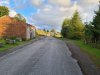 Sadly, the quarry road towards the cave is now almost always gated, so a 1.6 km walk is added in each direction, on top of the 1.6 km of moorland walk.
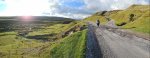 The walk can be fine, but in bad weather, the wind howls down this valley, throwing rain into your face. The moorland on the left is Trefil Ddu, and the moorland on the right is Trefil Las, both of which are parts of larger mountains.
Modelling by Becci
The walk can be fine, but in bad weather, the wind howls down this valley, throwing rain into your face. The moorland on the left is Trefil Ddu, and the moorland on the right is Trefil Las, both of which are parts of larger mountains.
Modelling by Becci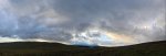 The initial signs of the drama as we head up onto the moorland, as the sun streamers begin to light up Cefn yr Ystrad (617 metres) over Trefil Ddu, Gwaun Cerrig Llwydion (754 metres), Waun Rydd (769 metres) and Allt Lwyd (654 metres). The higher peaks are hidden in the cloud.
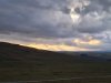 Streamers.
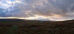 Bright edge of Cefn yr Ystrad, Gwaun Cerrig Llwydion, Waun Rydd and Allt Lwyd.
Modelling by Becci, lighting by Tarquin and Becci
Bright edge of Cefn yr Ystrad, Gwaun Cerrig Llwydion, Waun Rydd and Allt Lwyd.
Modelling by Becci, lighting by Tarquin and Becci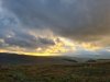 Golden sky
Mode.
Golden sky
Mode.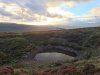 The shakehole with a lake, a very obvious landmark on the path. Before the path was so heavily worn, you would find it in one direction, and not the other.
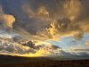 Golden clouds.
 The sun breaking through.
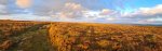 Incredible light on the Trefil Las moor. The cairn on the left is the top of Mynydd Llangynidr, with a few other mountains scraping above the horizon: Waun Fach (811 metres), Pen y Gadair Fawr (800 metres), Pen Allt-mawr (719 metres), Pen Cerrig-calch (701 metres), Sugar Loaf (596 metres), Mynydd Llangatwg (530 metres and 529 metres), the Blorenge (561 metres), Llanelly Hill (about 500 metres), Mulfran (524 metres), Cefn Coch (571 metres), Coety Mountain (578 metres), Mynydd Carn-y-cefn (550 metres), Cefn Manmoel (504 metres), Mynydd y Lan (381 metres) and Mynydd Bedwellte (486 metres).
Modelling by the shadows of our former selves
Incredible light on the Trefil Las moor. The cairn on the left is the top of Mynydd Llangynidr, with a few other mountains scraping above the horizon: Waun Fach (811 metres), Pen y Gadair Fawr (800 metres), Pen Allt-mawr (719 metres), Pen Cerrig-calch (701 metres), Sugar Loaf (596 metres), Mynydd Llangatwg (530 metres and 529 metres), the Blorenge (561 metres), Llanelly Hill (about 500 metres), Mulfran (524 metres), Cefn Coch (571 metres), Coety Mountain (578 metres), Mynydd Carn-y-cefn (550 metres), Cefn Manmoel (504 metres), Mynydd y Lan (381 metres) and Mynydd Bedwellte (486 metres).
Modelling by the shadows of our former selves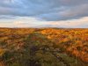 Heading into the basin that contains the caves. The caves sit below the rim of the mountain, which cuts out all light from the surrounding towns at night. In the distance are Mynydd Llangorse (515 metres), Mynydd Troed (609 metres), Waun Fach, Mynydd Llysiau (663 metres), Pen y Gadair Fawr, Pen Twyn Gas (646 metres), Pen Allt-mawr, Pen Cerrig-calch and Crug Mawr (550 metres).
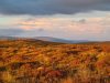 A little further on, and now there are Pen Allt-mawr, Pen Cerrig-calch Table Mountain (about 450 metres) and Crug Mawr.
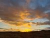 Sunset behind the top of Mynydd Llangynidr.
 Crug Mawr, the secondary top of Mynydd Llangynidr (541 metres) and the Sugar Loaf.
 The little outcrop containing the entrance to the cave. Before the path existed, this was incredibly hard to find, because in spite of its size, the entrance cannot be seen from almost all angles.
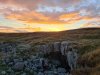 Sunset over the entrance to Chartist Cave. We were once asked by someone, who was standing on top of it, if we knew where the cave was. This inability to find it served well as a hiding place. The entrance is thought to have been originally further out, but collapsed back to its current position.
Modelling by Becci
Sunset over the entrance to Chartist Cave. We were once asked by someone, who was standing on top of it, if we knew where the cave was. This inability to find it served well as a hiding place. The entrance is thought to have been originally further out, but collapsed back to its current position.
Modelling by Becci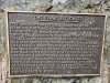 The memorial plaque, commemorating the cave's use for hiding weapons and holding meetings in preparation for the Chartist uprising in 1839, and then hiding the rebels afterwards. This uprising is responsible for giving regular men the right to vote (not just the upper classes), with several other voting reforms to make them more fair, and allow people from any class to be politicians.
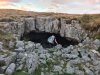 Heading into the entrance.
Modelling by Becci
Heading into the entrance.
Modelling by Becci Looking out at the fading sunset.
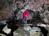 The 30 metre long right side passage. Like the entrance itself, this is formed on the contact between the limestone and the overlying Twrch Sandstone (millstone grit). It represents the common type of passage that creates shakeholes; largly meaningless, and prone to collapse. The ceiling is very weak.
Modelling by Becci, lighting by Tarquin and Becci
The 30 metre long right side passage. Like the entrance itself, this is formed on the contact between the limestone and the overlying Twrch Sandstone (millstone grit). It represents the common type of passage that creates shakeholes; largly meaningless, and prone to collapse. The ceiling is very weak.
Modelling by Becci, lighting by Tarquin and Becci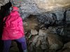 The end of the right side passage, which is a dig. There is almost no chance of finding more cave here, since it will just run up to the surface here.
Modelling by Becci, lighting by Tarquin and Becci
The end of the right side passage, which is a dig. There is almost no chance of finding more cave here, since it will just run up to the surface here.
Modelling by Becci, lighting by Tarquin and Becci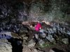 The left side passage is much more substantial. It starts off as a low arch, but gains a wide enlargement in the limestone, with a millstone grit ceiling. We had decided to go caving in normal clothing and waterproofs, which was not a good idea, as the cave is quite muddy.
Modelling by Becci, lighting by Tarquin, Sol and Becci
The left side passage is much more substantial. It starts off as a low arch, but gains a wide enlargement in the limestone, with a millstone grit ceiling. We had decided to go caving in normal clothing and waterproofs, which was not a good idea, as the cave is quite muddy.
Modelling by Becci, lighting by Tarquin, Sol and Becci Ventral (belly) view of a European cave spider in the left side passage. It has an orb web like a garden spider.
Modelling by Llenwi Bwlch
Ventral (belly) view of a European cave spider in the left side passage. It has an orb web like a garden spider.
Modelling by Llenwi Bwlch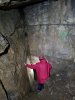 The passage then funnels down into the limestone. We met a brown long-eared bat in the ciling here, staying clear of us, but who then followed us into the cave.
Modelling by Becci, lighting by Tarquin and Becci
The passage then funnels down into the limestone. We met a brown long-eared bat in the ciling here, staying clear of us, but who then followed us into the cave.
Modelling by Becci, lighting by Tarquin and Becci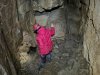 The cave used to end with a short side rift to the right, in limestone. However, a seemingly random dig in the floor by Severn Valley Caving Club, which was inspired by the scalloping in 1969, made the major breakthrough into the current cave in 1970, extending it a little in 1975.
Modelling by Becci, lighting by Tarquin and Becci
The cave used to end with a short side rift to the right, in limestone. However, a seemingly random dig in the floor by Severn Valley Caving Club, which was inspired by the scalloping in 1969, made the major breakthrough into the current cave in 1970, extending it a little in 1975.
Modelling by Becci, lighting by Tarquin and Becci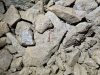 Worm among the spoil.
Modelling by Wriggles
Worm among the spoil.
Modelling by Wriggles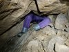 Just into the dig. 30 cm down from the top, they uncovered human bones, which were found to be about 50-100 years old. This could potentially have been in the aftermath of the Chartist uprising, or just someone who was buried there. We also found some bones, but they were animal bones, probably sheep.
Modelling by Becci
Just into the dig. 30 cm down from the top, they uncovered human bones, which were found to be about 50-100 years old. This could potentially have been in the aftermath of the Chartist uprising, or just someone who was buried there. We also found some bones, but they were animal bones, probably sheep.
Modelling by Becci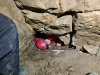 The dig descends a clamber into a very low crawl.
Modelling by Becci, lighting by Tarquin and Becci
The dig descends a clamber into a very low crawl.
Modelling by Becci, lighting by Tarquin and Becci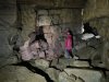 The crawl opens out to the first large junction, with everything from here onwards formed on a grid. Several small passages lead off everywhere, but the major passages are: 1. two passages to the left, which form a loop with side passages, and 2. ahead and ahead-right, both of which enter the largest chamber.
Modelling by Becci
The crawl opens out to the first large junction, with everything from here onwards formed on a grid. Several small passages lead off everywhere, but the major passages are: 1. two passages to the left, which form a loop with side passages, and 2. ahead and ahead-right, both of which enter the largest chamber.
Modelling by Becci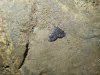 Tissue moth at the junction. The brown long-eared bat also decided to settle here, and watched us for a while.
Modelling by Hankie
Tissue moth at the junction. The brown long-eared bat also decided to settle here, and watched us for a while.
Modelling by Hankie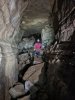 The second passage on the left, which is the largest in the cave. At the end is a junction with a choke ahead, where to the right passes through a series of squeezes to reach a bitter end, via a series of chambers. To the left reaches a junction with the end of the loop to the left, a climb to Sand Passage ahead, and several short side passages on the right.
Camera and setup by Becci, modelling by Tarquin, lighting by Becci and Tarquin
The second passage on the left, which is the largest in the cave. At the end is a junction with a choke ahead, where to the right passes through a series of squeezes to reach a bitter end, via a series of chambers. To the left reaches a junction with the end of the loop to the left, a climb to Sand Passage ahead, and several short side passages on the right.
Camera and setup by Becci, modelling by Tarquin, lighting by Becci and Tarquin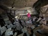 The largest chamber, which has blind side passages on all sides, and a couple of routes into the choke ahead. The other way in is to the left.
Modelling by Becci, lighting by Tarquin and Becci
The largest chamber, which has blind side passages on all sides, and a couple of routes into the choke ahead. The other way in is to the left.
Modelling by Becci, lighting by Tarquin and Becci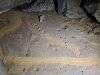 The passages to the right are the longest, but only about 30 metres each. The first has signs of a stream, and at least one stream in the cave has been dye traced to Ffynnon Siôn Sieffre, by the reservoir near Tredegar.
Modelling by Becci, lighting by Tarquin and Becci
The passages to the right are the longest, but only about 30 metres each. The first has signs of a stream, and at least one stream in the cave has been dye traced to Ffynnon Siôn Sieffre, by the reservoir near Tredegar.
Modelling by Becci, lighting by Tarquin and Becci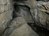 The second passage on the right chokes very close to the first.
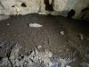 Cracked mud in the second passage on the right.
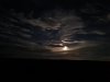 The moonlight was especially bright that night.
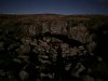 Despite being very late at night, I was able to take this picture of the entrance using only moonlight.
Modelling by Tarquin's dark side
Despite being very late at night, I was able to take this picture of the entrance using only moonlight.
Modelling by Tarquin's dark side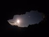 Framed moon.
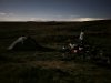 At camp.
Modelling by Becci, lighting by Luna
At camp.
Modelling by Becci, lighting by Luna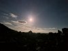 Night sky so bright it could be mistaken for a photo in the daytime, if not for the stars. It was bright enough that we went for a night walk to see Crescent Cave, without needing torches.
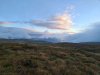 Sunrise clouds over the Black Mountains. The only one visible is Mynydd Llangorse.
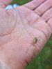 Common harvestman.
Modelling by a seven legged freak and Tarquin's hand
Common harvestman.
Modelling by a seven legged freak and Tarquin's hand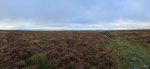 A thin gap of light over the Valleys ridges. Recognisable are Cefn Manmoel, Mynydd y Lan, Mynydd Bedwellte, Rhymney Hill (457 metres), a very distant Cefn Eglwysylian (382 metres), Pen Garnbugail (477 metres), Mynydd Fochriw (over 460 metres), Mynydd Cilfach-yr-encil (445 metres) and Mynydd Merthyr's Mynydd Gethin top (491 metres).
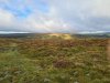 Light on Trefil Ddu.
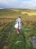 Descending towards Trefil Ddu. The rubbish bag is almost entirely stuff we collected from the cave, all discarded by other non-caving visitors.
Modelling by Becci
Descending towards Trefil Ddu. The rubbish bag is almost entirely stuff we collected from the cave, all discarded by other non-caving visitors.
Modelling by Becci
 Sadly, the quarry road towards the cave is now almost always gated, so a 1.6 km walk is added in each direction, on top of the 1.6 km of moorland walk.
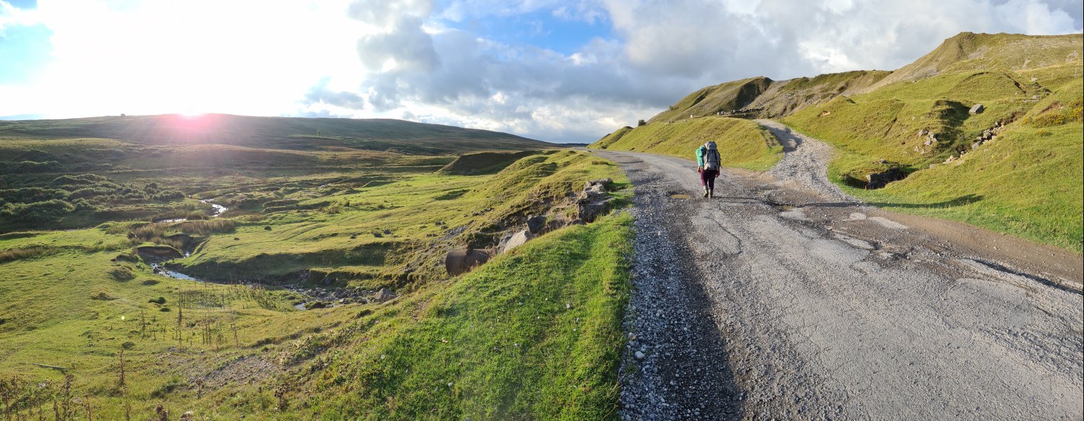 The walk can be fine, but in bad weather, the wind howls down this valley, throwing rain into your face. The moorland on the left is Trefil Ddu, and the moorland on the right is Trefil Las, both of which are parts of larger mountains.
Modelling by Becci
The walk can be fine, but in bad weather, the wind howls down this valley, throwing rain into your face. The moorland on the left is Trefil Ddu, and the moorland on the right is Trefil Las, both of which are parts of larger mountains.
Modelling by Becci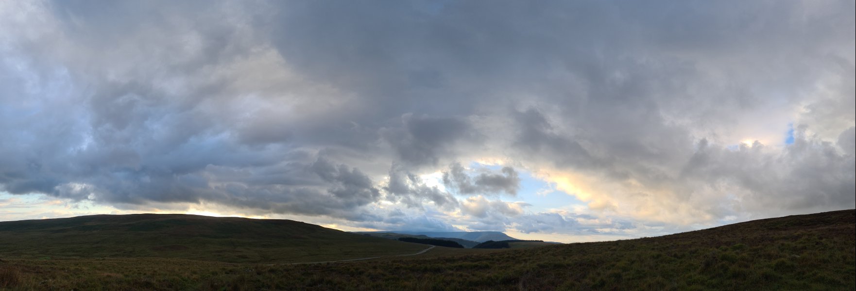 The initial signs of the drama as we head up onto the moorland, as the sun streamers begin to light up Cefn yr Ystrad (617 metres) over Trefil Ddu, Gwaun Cerrig Llwydion (754 metres), Waun Rydd (769 metres) and Allt Lwyd (654 metres). The higher peaks are hidden in the cloud.
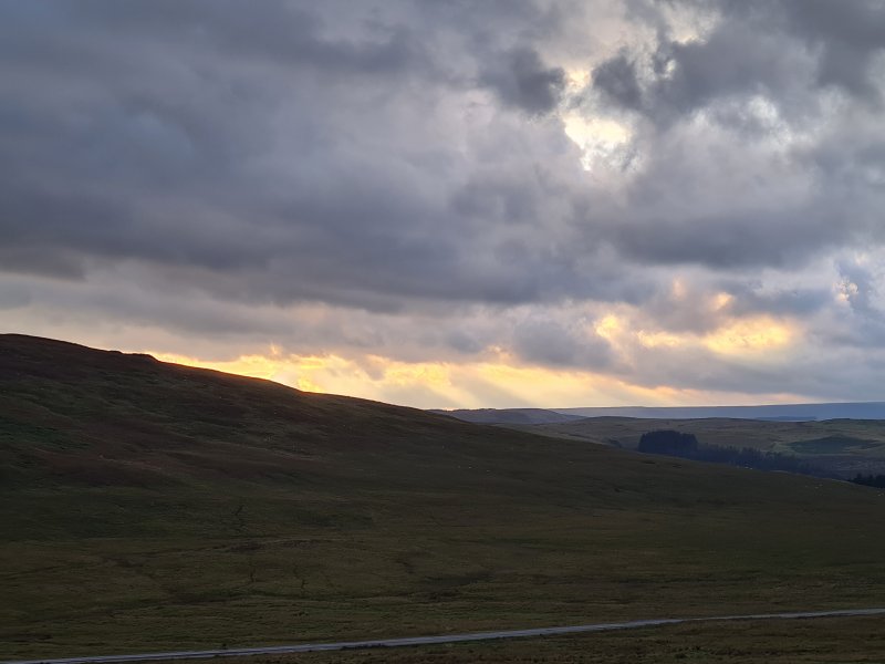 Streamers.
 Bright edge of Cefn yr Ystrad, Gwaun Cerrig Llwydion, Waun Rydd and Allt Lwyd.
Modelling by Becci, lighting by Tarquin and Becci
Bright edge of Cefn yr Ystrad, Gwaun Cerrig Llwydion, Waun Rydd and Allt Lwyd.
Modelling by Becci, lighting by Tarquin and Becci Golden sky
Mode.
Golden sky
Mode.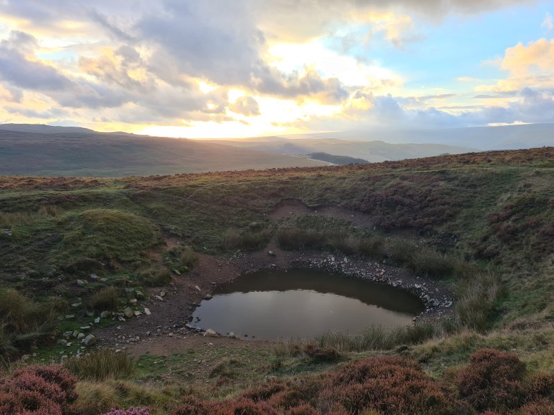 The shakehole with a lake, a very obvious landmark on the path. Before the path was so heavily worn, you would find it in one direction, and not the other.
 Golden clouds.
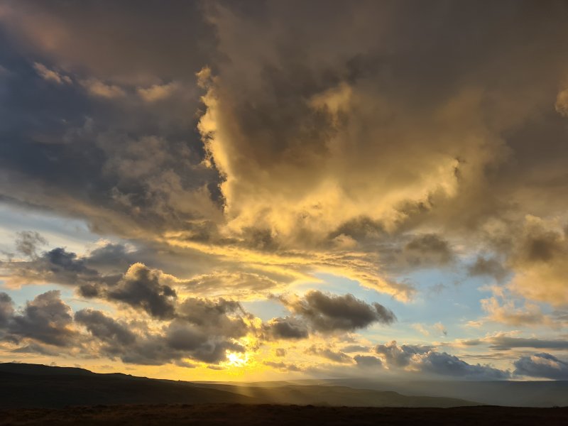 The sun breaking through.
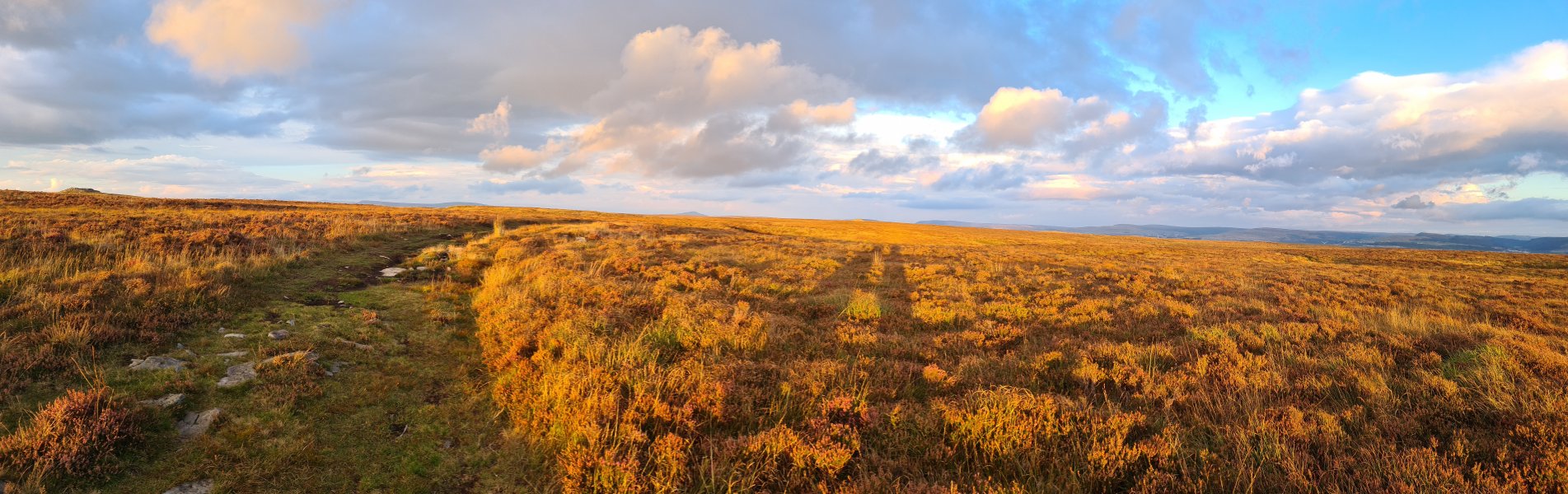 Incredible light on the Trefil Las moor. The cairn on the left is the top of Mynydd Llangynidr, with a few other mountains scraping above the horizon: Waun Fach (811 metres), Pen y Gadair Fawr (800 metres), Pen Allt-mawr (719 metres), Pen Cerrig-calch (701 metres), Sugar Loaf (596 metres), Mynydd Llangatwg (530 metres and 529 metres), the Blorenge (561 metres), Llanelly Hill (about 500 metres), Mulfran (524 metres), Cefn Coch (571 metres), Coety Mountain (578 metres), Mynydd Carn-y-cefn (550 metres), Cefn Manmoel (504 metres), Mynydd y Lan (381 metres) and Mynydd Bedwellte (486 metres).
Modelling by the shadows of our former selves
Incredible light on the Trefil Las moor. The cairn on the left is the top of Mynydd Llangynidr, with a few other mountains scraping above the horizon: Waun Fach (811 metres), Pen y Gadair Fawr (800 metres), Pen Allt-mawr (719 metres), Pen Cerrig-calch (701 metres), Sugar Loaf (596 metres), Mynydd Llangatwg (530 metres and 529 metres), the Blorenge (561 metres), Llanelly Hill (about 500 metres), Mulfran (524 metres), Cefn Coch (571 metres), Coety Mountain (578 metres), Mynydd Carn-y-cefn (550 metres), Cefn Manmoel (504 metres), Mynydd y Lan (381 metres) and Mynydd Bedwellte (486 metres).
Modelling by the shadows of our former selves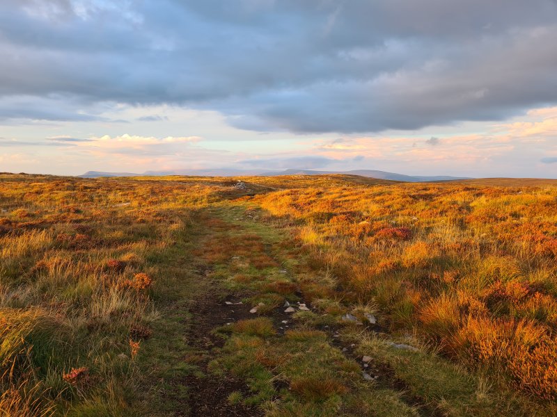 Heading into the basin that contains the caves. The caves sit below the rim of the mountain, which cuts out all light from the surrounding towns at night. In the distance are Mynydd Llangorse (515 metres), Mynydd Troed (609 metres), Waun Fach, Mynydd Llysiau (663 metres), Pen y Gadair Fawr, Pen Twyn Gas (646 metres), Pen Allt-mawr, Pen Cerrig-calch and Crug Mawr (550 metres).
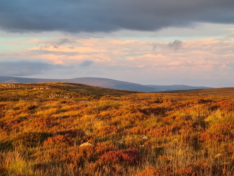 A little further on, and now there are Pen Allt-mawr, Pen Cerrig-calch Table Mountain (about 450 metres) and Crug Mawr.
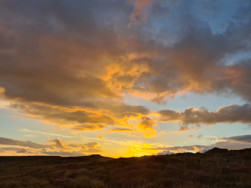 Sunset behind the top of Mynydd Llangynidr.
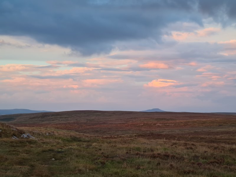 Crug Mawr, the secondary top of Mynydd Llangynidr (541 metres) and the Sugar Loaf.
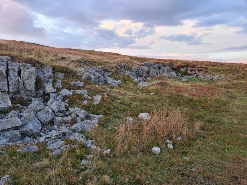 The little outcrop containing the entrance to the cave. Before the path existed, this was incredibly hard to find, because in spite of its size, the entrance cannot be seen from almost all angles.
 Sunset over the entrance to Chartist Cave. We were once asked by someone, who was standing on top of it, if we knew where the cave was. This inability to find it served well as a hiding place. The entrance is thought to have been originally further out, but collapsed back to its current position.
Modelling by Becci
Sunset over the entrance to Chartist Cave. We were once asked by someone, who was standing on top of it, if we knew where the cave was. This inability to find it served well as a hiding place. The entrance is thought to have been originally further out, but collapsed back to its current position.
Modelling by Becci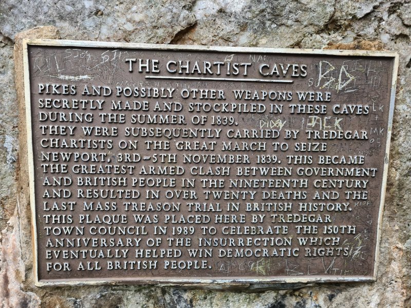 The memorial plaque, commemorating the cave's use for hiding weapons and holding meetings in preparation for the Chartist uprising in 1839, and then hiding the rebels afterwards. This uprising is responsible for giving regular men the right to vote (not just the upper classes), with several other voting reforms to make them more fair, and allow people from any class to be politicians.
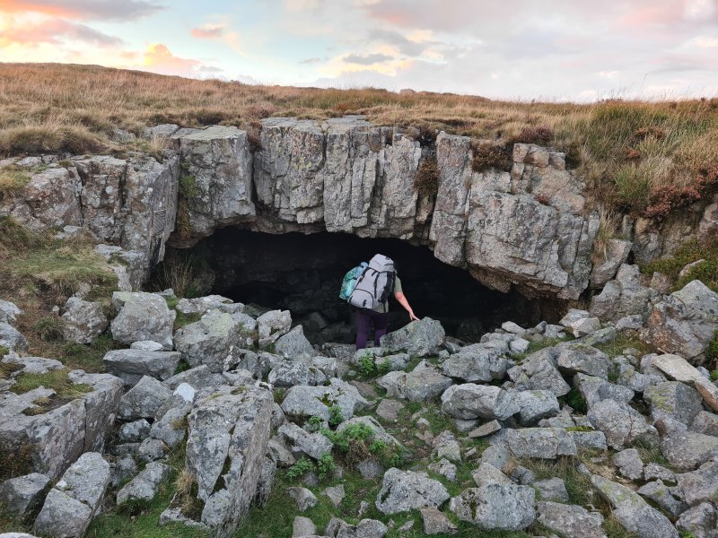 Heading into the entrance.
Modelling by Becci
Heading into the entrance.
Modelling by Becci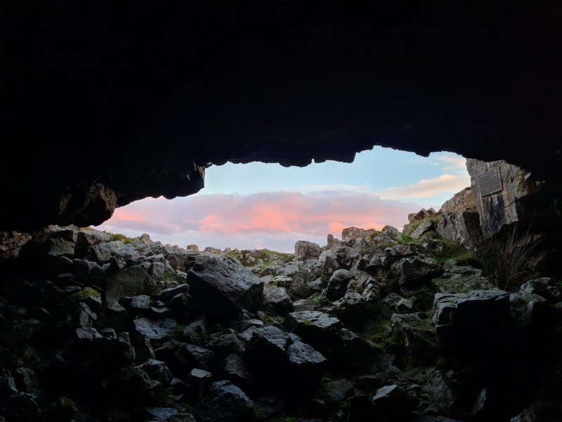 Looking out at the fading sunset.
 The 30 metre long right side passage. Like the entrance itself, this is formed on the contact between the limestone and the overlying Twrch Sandstone (millstone grit). It represents the common type of passage that creates shakeholes; largly meaningless, and prone to collapse. The ceiling is very weak.
Modelling by Becci, lighting by Tarquin and Becci
The 30 metre long right side passage. Like the entrance itself, this is formed on the contact between the limestone and the overlying Twrch Sandstone (millstone grit). It represents the common type of passage that creates shakeholes; largly meaningless, and prone to collapse. The ceiling is very weak.
Modelling by Becci, lighting by Tarquin and Becci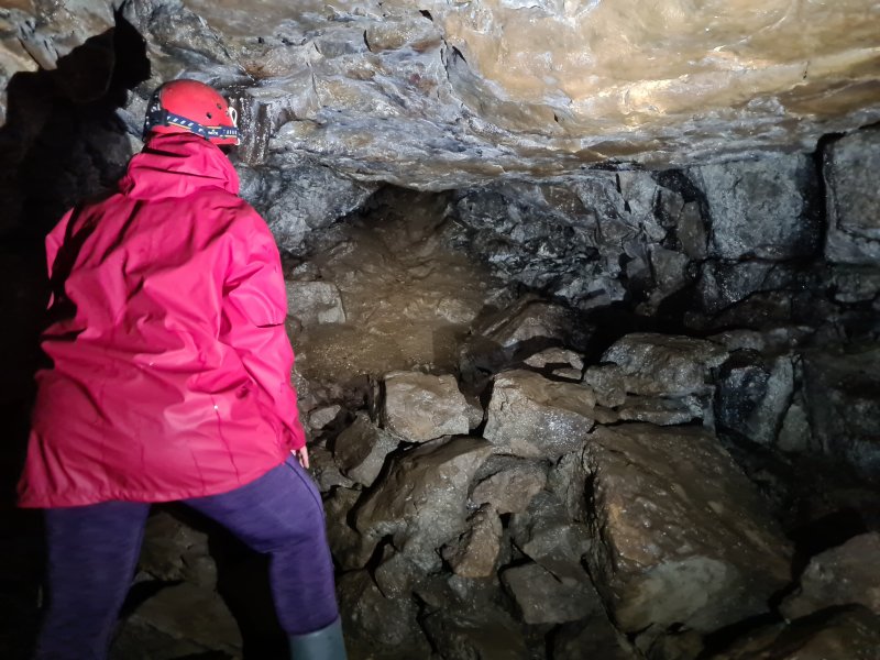 The end of the right side passage, which is a dig. There is almost no chance of finding more cave here, since it will just run up to the surface here.
Modelling by Becci, lighting by Tarquin and Becci
The end of the right side passage, which is a dig. There is almost no chance of finding more cave here, since it will just run up to the surface here.
Modelling by Becci, lighting by Tarquin and Becci The left side passage is much more substantial. It starts off as a low arch, but gains a wide enlargement in the limestone, with a millstone grit ceiling. We had decided to go caving in normal clothing and waterproofs, which was not a good idea, as the cave is quite muddy.
Modelling by Becci, lighting by Tarquin, Sol and Becci
The left side passage is much more substantial. It starts off as a low arch, but gains a wide enlargement in the limestone, with a millstone grit ceiling. We had decided to go caving in normal clothing and waterproofs, which was not a good idea, as the cave is quite muddy.
Modelling by Becci, lighting by Tarquin, Sol and Becci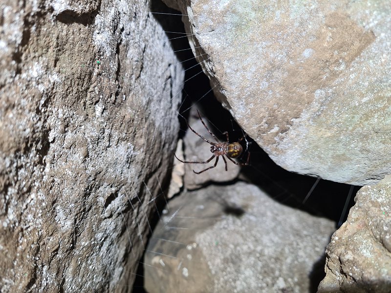 Ventral (belly) view of a European cave spider in the left side passage. It has an orb web like a garden spider.
Modelling by Llenwi Bwlch
Ventral (belly) view of a European cave spider in the left side passage. It has an orb web like a garden spider.
Modelling by Llenwi Bwlch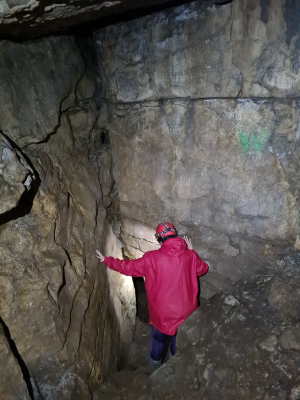 The passage then funnels down into the limestone. We met a brown long-eared bat in the ciling here, staying clear of us, but who then followed us into the cave.
Modelling by Becci, lighting by Tarquin and Becci
The passage then funnels down into the limestone. We met a brown long-eared bat in the ciling here, staying clear of us, but who then followed us into the cave.
Modelling by Becci, lighting by Tarquin and Becci The cave used to end with a short side rift to the right, in limestone. However, a seemingly random dig in the floor by Severn Valley Caving Club, which was inspired by the scalloping in 1969, made the major breakthrough into the current cave in 1970, extending it a little in 1975.
Modelling by Becci, lighting by Tarquin and Becci
The cave used to end with a short side rift to the right, in limestone. However, a seemingly random dig in the floor by Severn Valley Caving Club, which was inspired by the scalloping in 1969, made the major breakthrough into the current cave in 1970, extending it a little in 1975.
Modelling by Becci, lighting by Tarquin and Becci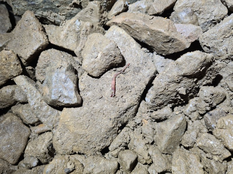 Worm among the spoil.
Modelling by Wriggles
Worm among the spoil.
Modelling by Wriggles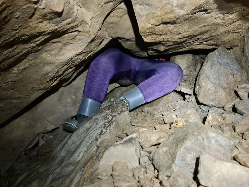 Just into the dig. 30 cm down from the top, they uncovered human bones, which were found to be about 50-100 years old. This could potentially have been in the aftermath of the Chartist uprising, or just someone who was buried there. We also found some bones, but they were animal bones, probably sheep.
Modelling by Becci
Just into the dig. 30 cm down from the top, they uncovered human bones, which were found to be about 50-100 years old. This could potentially have been in the aftermath of the Chartist uprising, or just someone who was buried there. We also found some bones, but they were animal bones, probably sheep.
Modelling by Becci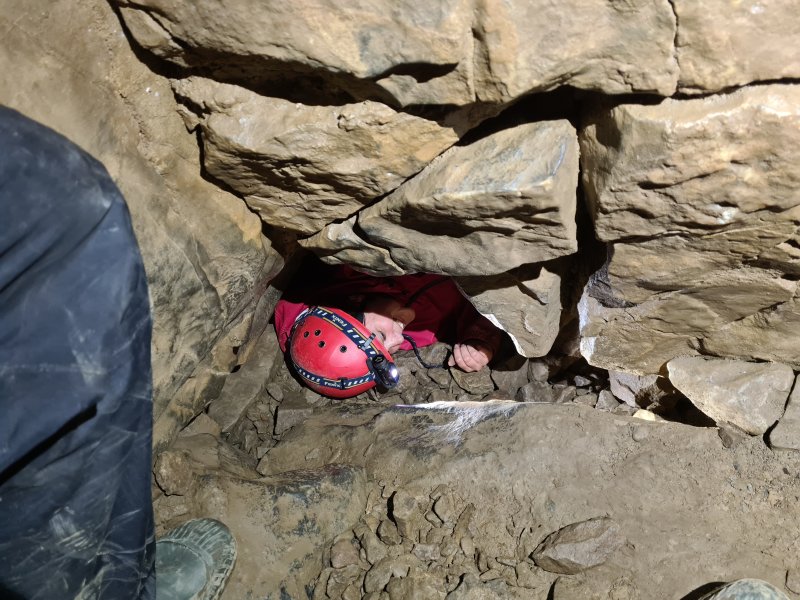 The dig descends a clamber into a very low crawl.
Modelling by Becci, lighting by Tarquin and Becci
The dig descends a clamber into a very low crawl.
Modelling by Becci, lighting by Tarquin and Becci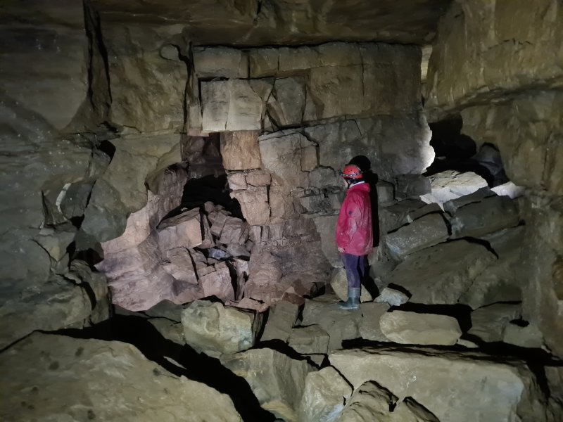 The crawl opens out to the first large junction, with everything from here onwards formed on a grid. Several small passages lead off everywhere, but the major passages are: 1. two passages to the left, which form a loop with side passages, and 2. ahead and ahead-right, both of which enter the largest chamber.
Modelling by Becci
The crawl opens out to the first large junction, with everything from here onwards formed on a grid. Several small passages lead off everywhere, but the major passages are: 1. two passages to the left, which form a loop with side passages, and 2. ahead and ahead-right, both of which enter the largest chamber.
Modelling by Becci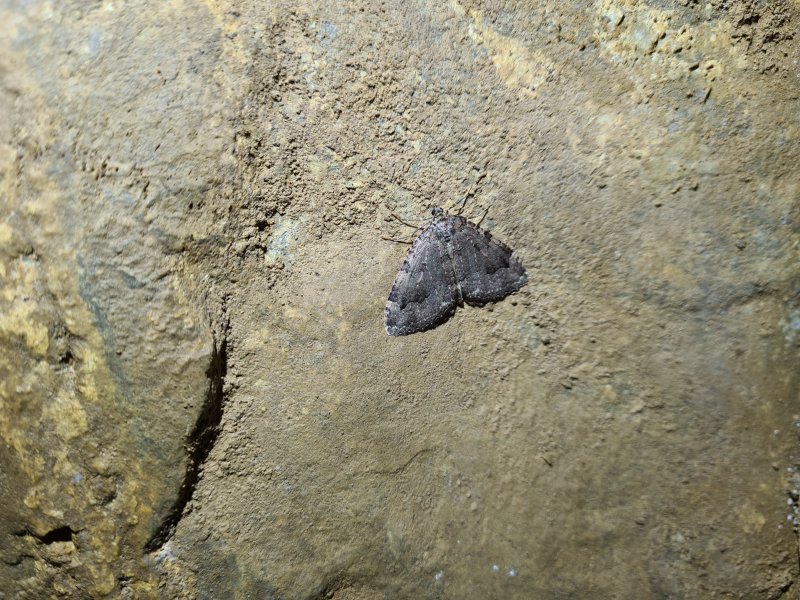 Tissue moth at the junction. The brown long-eared bat also decided to settle here, and watched us for a while.
Modelling by Hankie
Tissue moth at the junction. The brown long-eared bat also decided to settle here, and watched us for a while.
Modelling by Hankie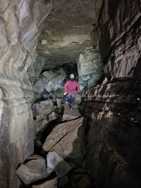 The second passage on the left, which is the largest in the cave. At the end is a junction with a choke ahead, where to the right passes through a series of squeezes to reach a bitter end, via a series of chambers. To the left reaches a junction with the end of the loop to the left, a climb to Sand Passage ahead, and several short side passages on the right.
Camera and setup by Becci, modelling by Tarquin, lighting by Becci and Tarquin
The second passage on the left, which is the largest in the cave. At the end is a junction with a choke ahead, where to the right passes through a series of squeezes to reach a bitter end, via a series of chambers. To the left reaches a junction with the end of the loop to the left, a climb to Sand Passage ahead, and several short side passages on the right.
Camera and setup by Becci, modelling by Tarquin, lighting by Becci and Tarquin The largest chamber, which has blind side passages on all sides, and a couple of routes into the choke ahead. The other way in is to the left.
Modelling by Becci, lighting by Tarquin and Becci
The largest chamber, which has blind side passages on all sides, and a couple of routes into the choke ahead. The other way in is to the left.
Modelling by Becci, lighting by Tarquin and Becci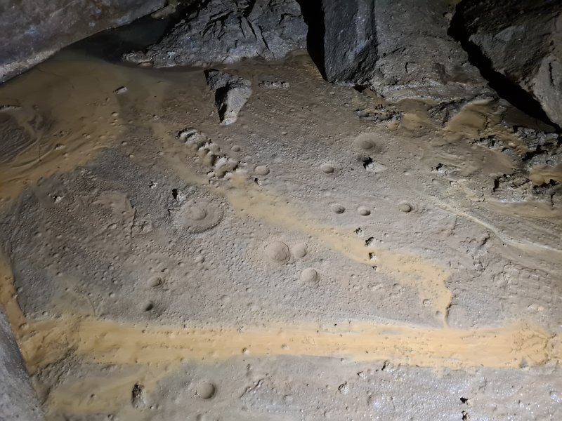 The passages to the right are the longest, but only about 30 metres each. The first has signs of a stream, and at least one stream in the cave has been dye traced to Ffynnon Siôn Sieffre, by the reservoir near Tredegar.
Modelling by Becci, lighting by Tarquin and Becci
The passages to the right are the longest, but only about 30 metres each. The first has signs of a stream, and at least one stream in the cave has been dye traced to Ffynnon Siôn Sieffre, by the reservoir near Tredegar.
Modelling by Becci, lighting by Tarquin and Becci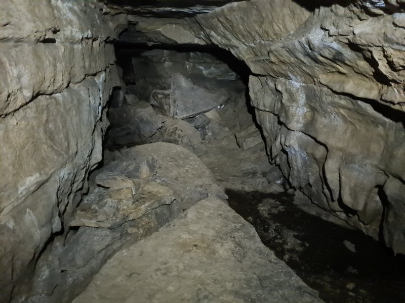 The second passage on the right chokes very close to the first.
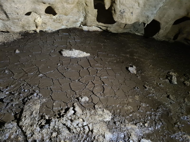 Cracked mud in the second passage on the right.
 The moonlight was especially bright that night.
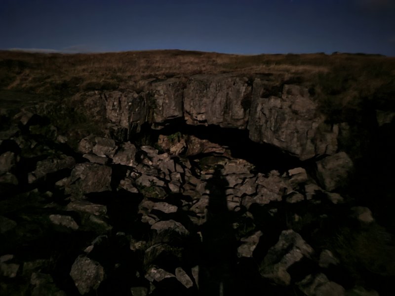 Despite being very late at night, I was able to take this picture of the entrance using only moonlight.
Modelling by Tarquin's dark side
Despite being very late at night, I was able to take this picture of the entrance using only moonlight.
Modelling by Tarquin's dark side Framed moon.
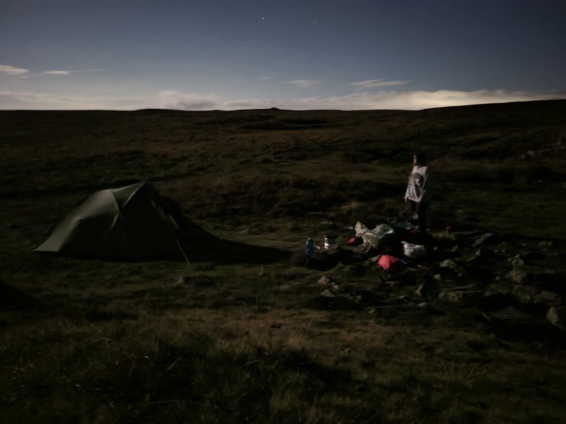 At camp.
Modelling by Becci, lighting by Luna
At camp.
Modelling by Becci, lighting by Luna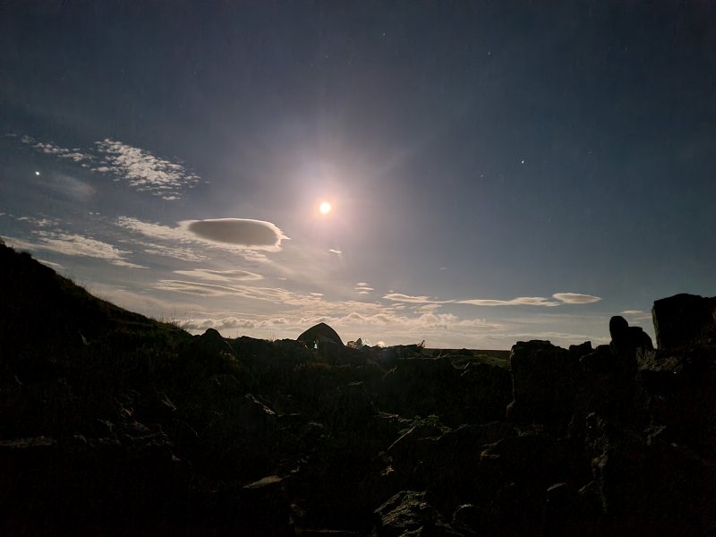 Night sky so bright it could be mistaken for a photo in the daytime, if not for the stars. It was bright enough that we went for a night walk to see Crescent Cave, without needing torches.
 Sunrise clouds over the Black Mountains. The only one visible is Mynydd Llangorse.
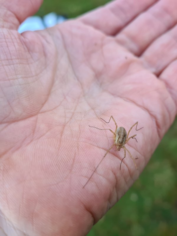 Common harvestman.
Modelling by a seven legged freak and Tarquin's hand
Common harvestman.
Modelling by a seven legged freak and Tarquin's hand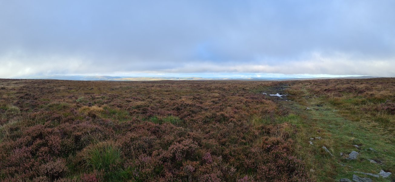 A thin gap of light over the Valleys ridges. Recognisable are Cefn Manmoel, Mynydd y Lan, Mynydd Bedwellte, Rhymney Hill (457 metres), a very distant Cefn Eglwysylian (382 metres), Pen Garnbugail (477 metres), Mynydd Fochriw (over 460 metres), Mynydd Cilfach-yr-encil (445 metres) and Mynydd Merthyr's Mynydd Gethin top (491 metres).
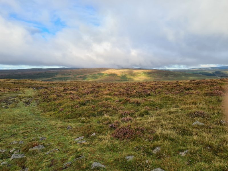 Light on Trefil Ddu.
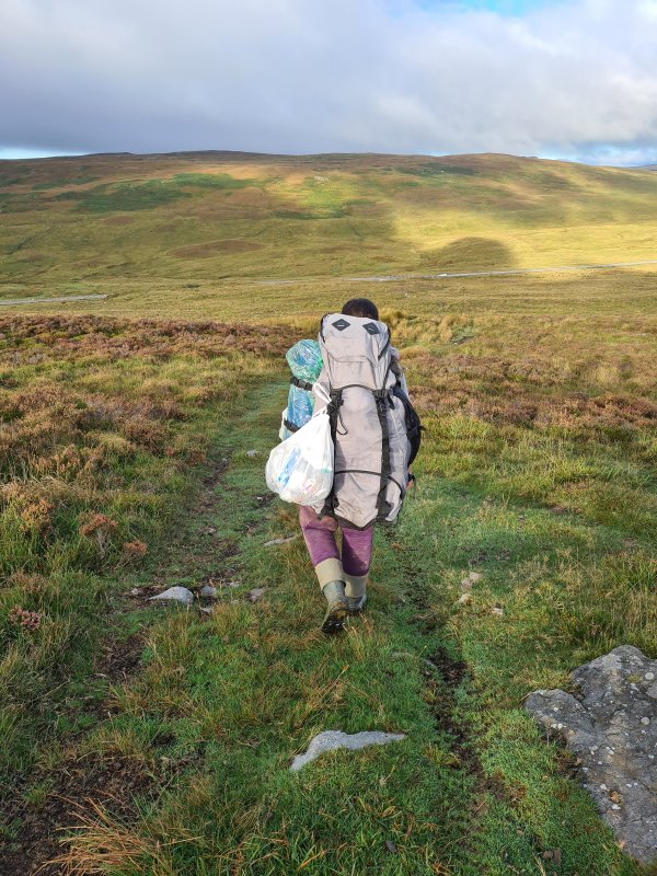 Descending towards Trefil Ddu. The rubbish bag is almost entirely stuff we collected from the cave, all discarded by other non-caving visitors.
Modelling by Becci
Descending towards Trefil Ddu. The rubbish bag is almost entirely stuff we collected from the cave, all discarded by other non-caving visitors.
Modelling by Becci