Ogof Fechan trip 18/07/2018
Unless otherwise stated, camera, setups, edits and gallery effects by Tarquin. Modelling at various points will be Gareth Davies. Lighting by Tarquin and Gareth.
This is my first visit to this sporting 1 km cave, so this will be a fairly complete gallery, showing most of the route. This visit was during a severe drought, so presumably the cave would normally have more water in it.
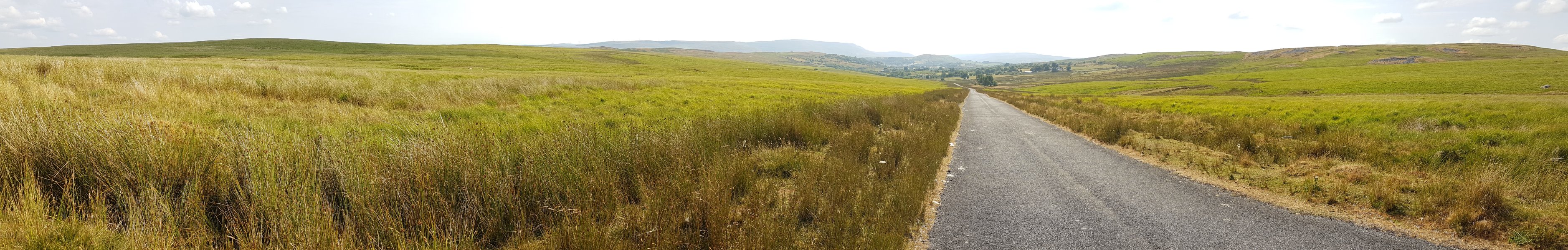
 The cave is situated in the picturesque Cwm Cadlan at the southeastern edge of Fforest Fawr in the Brecon Beacons, seen here looking towards Penderyn. The water resurges at Llygad Cynon, between Penderyn and Hirwaun (over the ridge ahead-left), along with the water from the nearby Ogof Fawr. The cave itself points in the wrong direction - towards the camera - almost directly away from its resurgence. On the left is Cefn Sychbant (419 metres), in the distance are Craig y Llyn (600 metres) and the smaller Moel Penderyn (371 metres), and on the right is Cadair Fawr (485 metres). The entrances to both caves are over the ridge to the left.
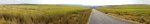
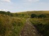 The route starts at Wernlas Farm, with this track heading over the first Nant Cadlan stream. When the track ends, the correct way on is to turn left and head up the side of the second valley. However, a mistake in the guide book caused us to waste a full 40 minutes searching in the wrong direction for the entrance. Without a good enough phone signal, we were unable to convert the grid reference into GPS coordinates, so we resorted to a manual search.
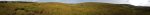 View from the Cefn Sychbant ridge. On the left is the Wernlas farm followed by Cadair Fawr, with the wooded Nant Cadlan stream in front of them. In the middle is Cefn Sychbant. The next valley contains a completely different stream which is also called Nant Cadlan (but is completely dry at the point seen here), after which is the Mynydd-y-glog ridge (389 metres). On the right is the downstream Nant Cadlan, heading towards Penderyn and Mynydd Penderyn, with Craig y Llyn in the background. In roughly the centre of the picture are two trees. The cave lies at a sink just up the valley (to the left) from those trees. Ogof Fawr lies in the same valley, another 1.5 km upstream (if only there were a stream), where the second Nant Cadlan sinks.
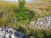 Just up the valley from the trees is another tree, with an old dig at its base, and some impressive dry stone spoil heaps. This is not the cave.
 A little further up valley is a larger sink with two trees. This is where Ogof Fechan starts. The stream would normally be flowing from a marsh into the sink, but it was almost completely dry during our visit.
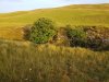 Ogof Fechan's sink is under the larger tree seen here to the left, complete with its usual influx of rotting sheep. The entrance to the cave lies beneath the tree to the right.
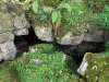 The entrance beneath the tree, the right-hand of the two holes, which is surprisingly large. The book says that this will have a corrugated sheet cover, but the sheets have rusted away.
 Clambering down the rubble slope into the entrance chamber, where there are some choked beddings.
 A Metellina merianae spider, one of the types of cave spider, with a very distinctive black carapace stripe, almost furry grey patterned abdomen, and spotty, banded legs. Less common and slightly smaller but more ornate than the usual Meta genus spiders, this was previously classified as Meta merianae. Their webs seem to be much larger, and much more regular orbs. This one had very thick pedipalps, and was probably a male.
Lighting by Tarquin
A Metellina merianae spider, one of the types of cave spider, with a very distinctive black carapace stripe, almost furry grey patterned abdomen, and spotty, banded legs. Less common and slightly smaller but more ornate than the usual Meta genus spiders, this was previously classified as Meta merianae. Their webs seem to be much larger, and much more regular orbs. This one had very thick pedipalps, and was probably a male.
Lighting by Tarquin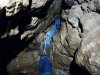 A hole through boulders then drops down what is shown on the WSG survey as a pitch, but which is actually a narrow climb. After this is a crawl through boulders, accompanied by numerous sheep bones; a passage called Twll y Mochyn (hole of the pig).
 After a couple of junctions is the Main Stream Passage.
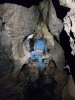 Main Stream Passage. There are several oxbows and side passages here, but all end after less than 20 metres.
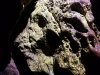 Lichen in Main Stream Passage.
Lighting by Tarquin
Lichen in Main Stream Passage.
Lighting by Tarquin A crawl then enters Sand Chamber. This used to be the end of the cave, originally called Main Chamber. The point of entry is seen here as a crawl on the left. In the distance on the left is the Inlet Stream Passage, which is one of the longest side passages in the cave, at a mere 40 metres long. The way on is in the distance on the right.
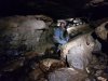 After corkscrewing down through boulders, the stream is regained.
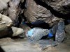 Bypassing a choked section of stream through the tightest squeeze in the cave, referred to as a crawl in a shale band.
 A slippery section of streamway, with scour holes in the floor. The floor has a black slime coating, and sometimes even has pieces of decomposing sheep in it. We were fortunate not to encounter any of those.
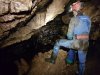 A small chamber, where there would normally be a cascade. There was only a small dribble.
 The Wet Crawl, which actually had some flowing water in it. This was quite a relief, as we were both overheating as a result of the search for the cave, and working hard to get into the cave. Gareth's wetsuit proved completely unnecessary, as I was overheating even with a fleece and oversuit.
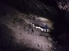 The crawl ends at the first fragment of impressive passage. These are like a gambler's win; a tiny segment of something great, just enough to tease you, and keep you hanging on for more.
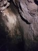 A stal covered aven in the large passage. A side passage below ends quickly in a sump.
Lighting by Tarquin
A stal covered aven in the large passage. A side passage below ends quickly in a sump.
Lighting by Tarquin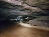 The large passage disappears abruptly, and The Canal begins. The worst part is the grit that washes up your sleeves, making crawling uncomfortable for the rest of the trip. This section of passage can sump in flood conditions, so the cave is best avoided in unsettled weather. This had caused us to (presumably needlessly) delay the trip, as two days previously there had been a local downpour.
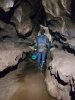 Rift beyond the canal.
 Flowstone in the rift.
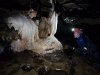 The best formations in the cave.
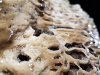 Extreme meniscus on the miniature gour pools. The water was raised as much as 4 mm above the calcite.
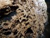 Decomposing calcite gours.
 West Rift, with thigh deep water. This may be incorrectly named, as it is labelled as Wet Rift on the WSG surveys, but West Rift in the guidebooks. The rift heads East not West, but was found by Westminster Spelæological Group. So maybe they named it after themselves.
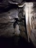 Formations and waist deep water, looking back into West Rift. Another short side passage, The Ooze, is just to the left of the picture.
Lighting by Tarquin
Formations and waist deep water, looking back into West Rift. Another short side passage, The Ooze, is just to the left of the picture.
Lighting by Tarquin Another large section of passage, which very quickly ends at a choke.
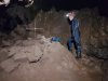 The route through the choke starts at its top, where there are a couple of small chambers. The second one has this metal cross in it for reasons unknown, made from metal bars tied together with bang wire.
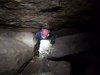 Squeeze in the 20 metre long choke.
 After the choke, the streamway is regained.
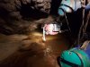 The stream then runs out through a very small rift on the side, which is the upstream end of sump 1. It is so small that it barely qualifies as a sump, not even large enough to put a leg in it.
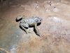 Toad sitting on a ledge above the sump. It had been washed all the way in, and really does not belong here, but at least there is food to eat, with numerous worm casts in the surrounding mudbanks. It did not want to be rescued, and had hidden by the time we returned.
Lighting by Tarquin
Toad sitting on a ledge above the sump. It had been washed all the way in, and really does not belong here, but at least there is food to eat, with numerous worm casts in the surrounding mudbanks. It did not want to be rescued, and had hidden by the time we returned.
Lighting by Tarquin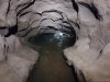 The roof then lowers into the duck, which has a rope through it, just in case. There is a roof notch in this flake, which makes it look like you can keep your head dry, and it might be possible in these conditions if you keep it on its side.
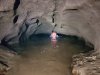 However, it is just easier to do a crocodile impression and accept a partial face plunge, since it is only a flake, not the whole 2 metres of the duck.
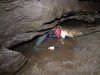 The exit from the duck is much lower, flat out, and only just enough space to keep most of your face out of water sideways. A face wetting is almost guaranteed, especially in normal weather conditions rather than these drought conditions. Presumably this would sump completely in flood.
 There are two ways on, the lower of which is a very tight crawl. Instead, the usual way on is this narrow aven above the duck. It can be free climbed without needing the rope, but it is definitely awkward.
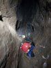 The top of the climb. The rope rubs badly, and is not officially maintained. It should not really be trusted.
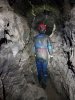 Phreatic rift at the top, where the way on is the most obvious route. There are some oxbows and a side passage here. The side passage is one of the longest in the cave, at about 40 metres. The tight crawl route enters from the floor at one point along the main route.
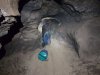 Reduced to a crawl.
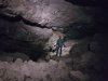 Waterfall Chamber, an unexpectedly large space.
 The waterfall would presumably normally be in this aven. Except it's dry. Just like my throat.
Lighting by Tarquin
The waterfall would presumably normally be in this aven. Except it's dry. Just like my throat.
Lighting by Tarquin The streamway is then regained at the largest passage in the cave (or at least the largest part that dry cavers can reach), which is sadly far too brief, yet again.
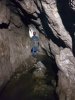 The 100 metre long upstream passage.
 The downstream end of Sump 1, which has seemingly never been dived. It will need to be at least 200 metres long to reach the upstream end.
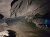 Downstream, the passage lowers to a crawl, which then ends at Sump 2. This cannot be free dived, and leads to 260 metres of wide passage, ending at Sump 3, which has never been passed.
 The cave is situated in the picturesque Cwm Cadlan at the southeastern edge of Fforest Fawr in the Brecon Beacons, seen here looking towards Penderyn. The water resurges at Llygad Cynon, between Penderyn and Hirwaun (over the ridge ahead-left), along with the water from the nearby Ogof Fawr. The cave itself points in the wrong direction - towards the camera - almost directly away from its resurgence. On the left is Cefn Sychbant (419 metres), in the distance are Craig y Llyn (600 metres) and the smaller Moel Penderyn (371 metres), and on the right is Cadair Fawr (485 metres). The entrances to both caves are over the ridge to the left.
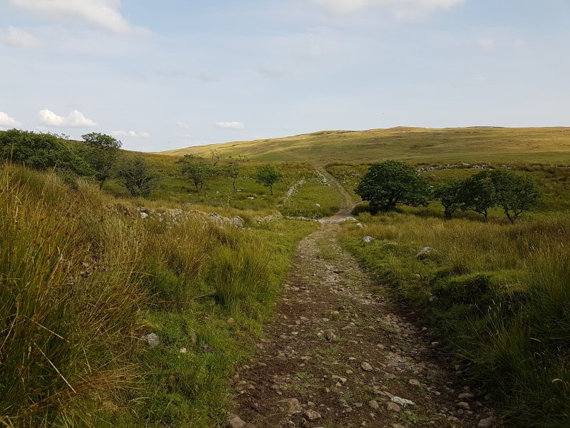 The route starts at Wernlas Farm, with this track heading over the first Nant Cadlan stream. When the track ends, the correct way on is to turn left and head up the side of the second valley. However, a mistake in the guide book caused us to waste a full 40 minutes searching in the wrong direction for the entrance. Without a good enough phone signal, we were unable to convert the grid reference into GPS coordinates, so we resorted to a manual search.
 View from the Cefn Sychbant ridge. On the left is the Wernlas farm followed by Cadair Fawr, with the wooded Nant Cadlan stream in front of them. In the middle is Cefn Sychbant. The next valley contains a completely different stream which is also called Nant Cadlan (but is completely dry at the point seen here), after which is the Mynydd-y-glog ridge (389 metres). On the right is the downstream Nant Cadlan, heading towards Penderyn and Mynydd Penderyn, with Craig y Llyn in the background. In roughly the centre of the picture are two trees. The cave lies at a sink just up the valley (to the left) from those trees. Ogof Fawr lies in the same valley, another 1.5 km upstream (if only there were a stream), where the second Nant Cadlan sinks.
 Just up the valley from the trees is another tree, with an old dig at its base, and some impressive dry stone spoil heaps. This is not the cave.
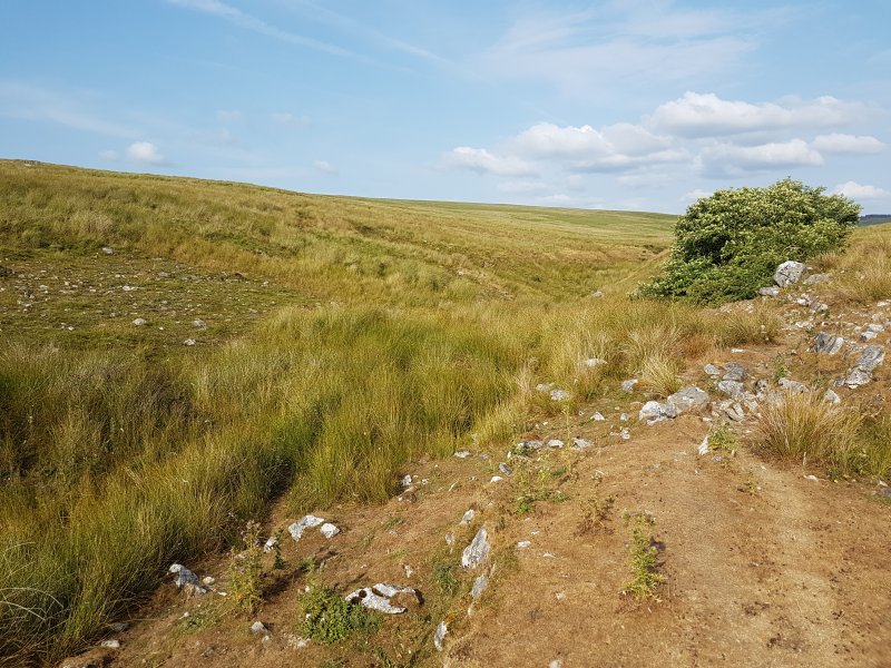 A little further up valley is a larger sink with two trees. This is where Ogof Fechan starts. The stream would normally be flowing from a marsh into the sink, but it was almost completely dry during our visit.
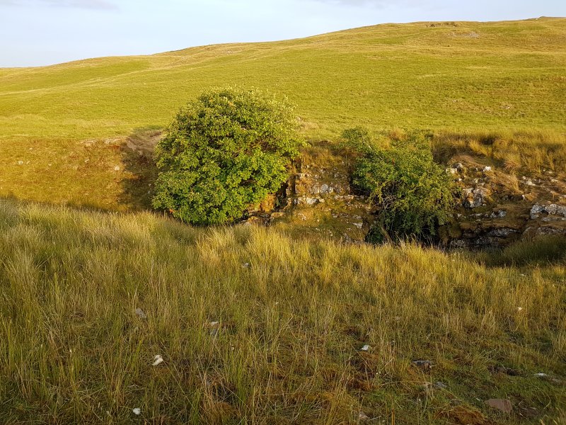 Ogof Fechan's sink is under the larger tree seen here to the left, complete with its usual influx of rotting sheep. The entrance to the cave lies beneath the tree to the right.
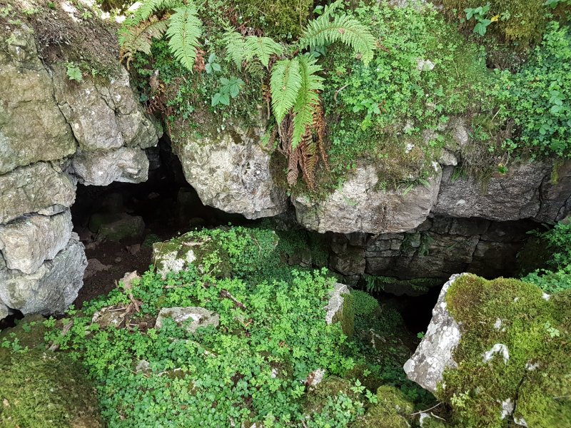 The entrance beneath the tree, the right-hand of the two holes, which is surprisingly large. The book says that this will have a corrugated sheet cover, but the sheets have rusted away.
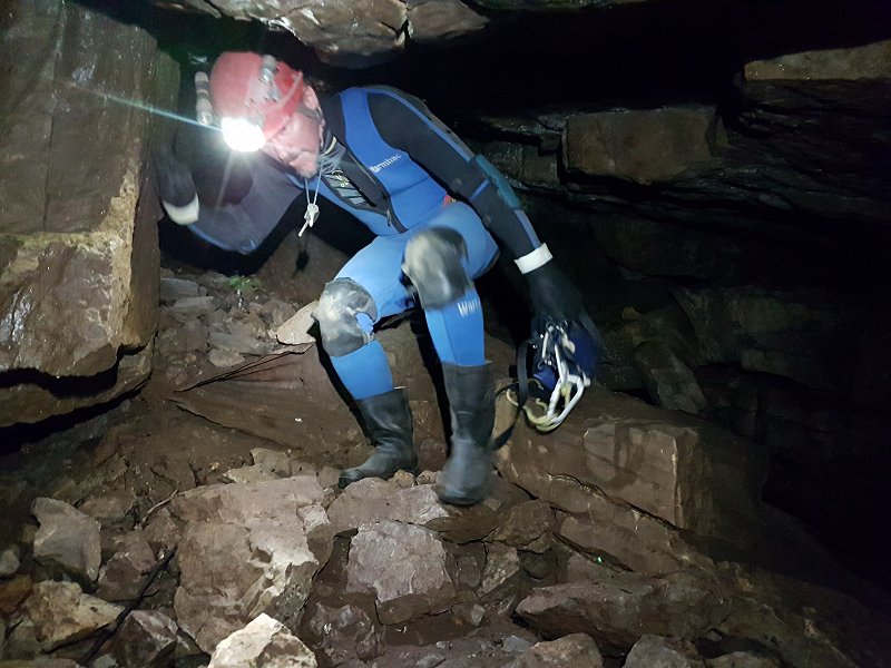 Clambering down the rubble slope into the entrance chamber, where there are some choked beddings.
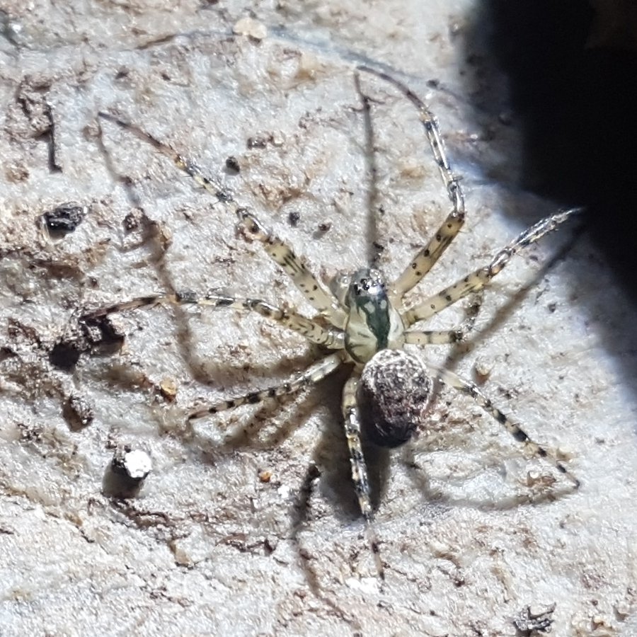 A Metellina merianae spider, one of the types of cave spider, with a very distinctive black carapace stripe, almost furry grey patterned abdomen, and spotty, banded legs. Less common and slightly smaller but more ornate than the usual Meta genus spiders, this was previously classified as Meta merianae. Their webs seem to be much larger, and much more regular orbs. This one had very thick pedipalps, and was probably a male.
Lighting by Tarquin
A Metellina merianae spider, one of the types of cave spider, with a very distinctive black carapace stripe, almost furry grey patterned abdomen, and spotty, banded legs. Less common and slightly smaller but more ornate than the usual Meta genus spiders, this was previously classified as Meta merianae. Their webs seem to be much larger, and much more regular orbs. This one had very thick pedipalps, and was probably a male.
Lighting by Tarquin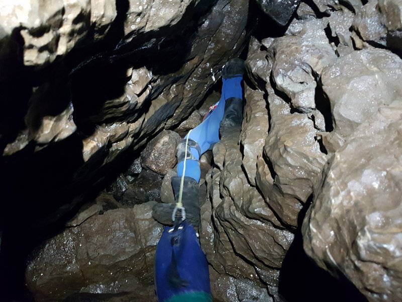 A hole through boulders then drops down what is shown on the WSG survey as a pitch, but which is actually a narrow climb. After this is a crawl through boulders, accompanied by numerous sheep bones; a passage called Twll y Mochyn (hole of the pig).
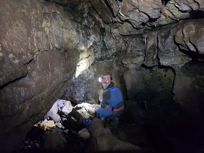 After a couple of junctions is the Main Stream Passage.
 Main Stream Passage. There are several oxbows and side passages here, but all end after less than 20 metres.
 Lichen in Main Stream Passage.
Lighting by Tarquin
Lichen in Main Stream Passage.
Lighting by Tarquin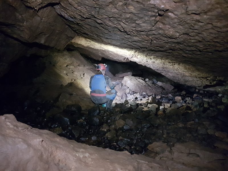 A crawl then enters Sand Chamber. This used to be the end of the cave, originally called Main Chamber. The point of entry is seen here as a crawl on the left. In the distance on the left is the Inlet Stream Passage, which is one of the longest side passages in the cave, at a mere 40 metres long. The way on is in the distance on the right.
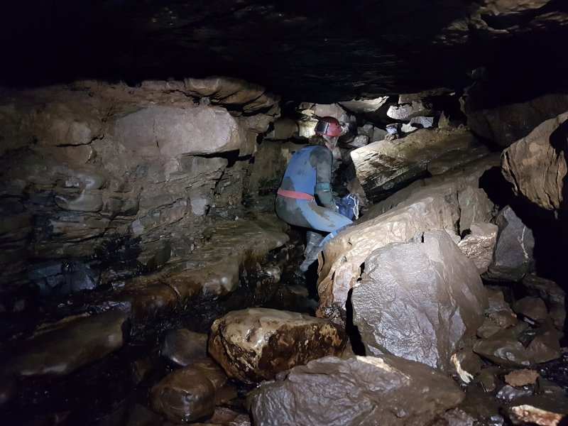 After corkscrewing down through boulders, the stream is regained.
 Bypassing a choked section of stream through the tightest squeeze in the cave, referred to as a crawl in a shale band.
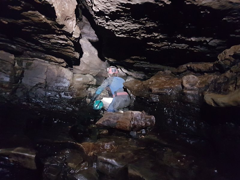 A slippery section of streamway, with scour holes in the floor. The floor has a black slime coating, and sometimes even has pieces of decomposing sheep in it. We were fortunate not to encounter any of those.
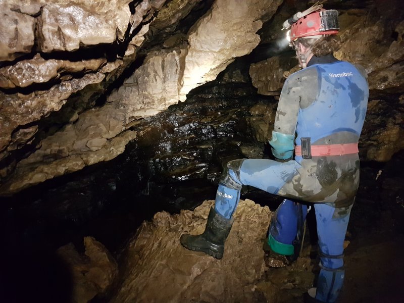 A small chamber, where there would normally be a cascade. There was only a small dribble.
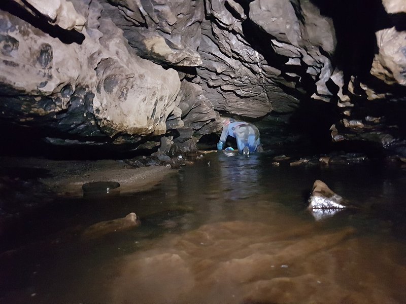 The Wet Crawl, which actually had some flowing water in it. This was quite a relief, as we were both overheating as a result of the search for the cave, and working hard to get into the cave. Gareth's wetsuit proved completely unnecessary, as I was overheating even with a fleece and oversuit.
 The crawl ends at the first fragment of impressive passage. These are like a gambler's win; a tiny segment of something great, just enough to tease you, and keep you hanging on for more.
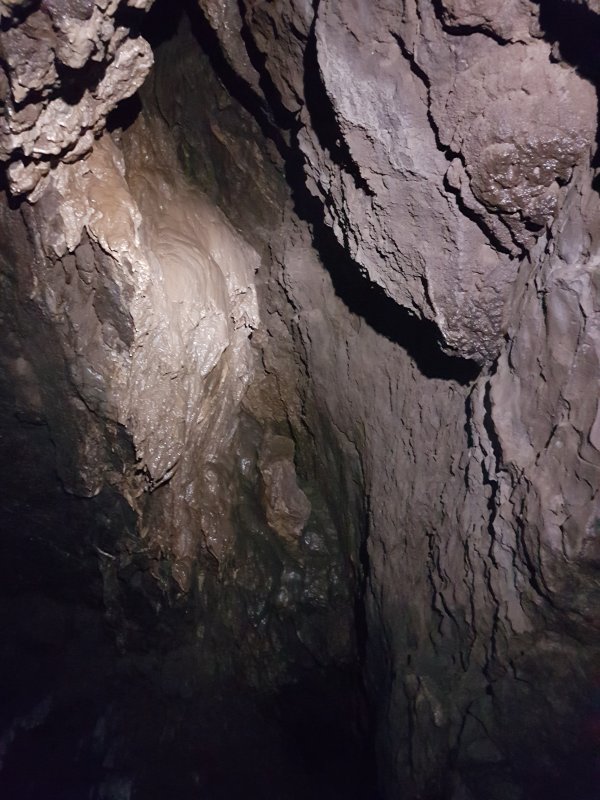 A stal covered aven in the large passage. A side passage below ends quickly in a sump.
Lighting by Tarquin
A stal covered aven in the large passage. A side passage below ends quickly in a sump.
Lighting by Tarquin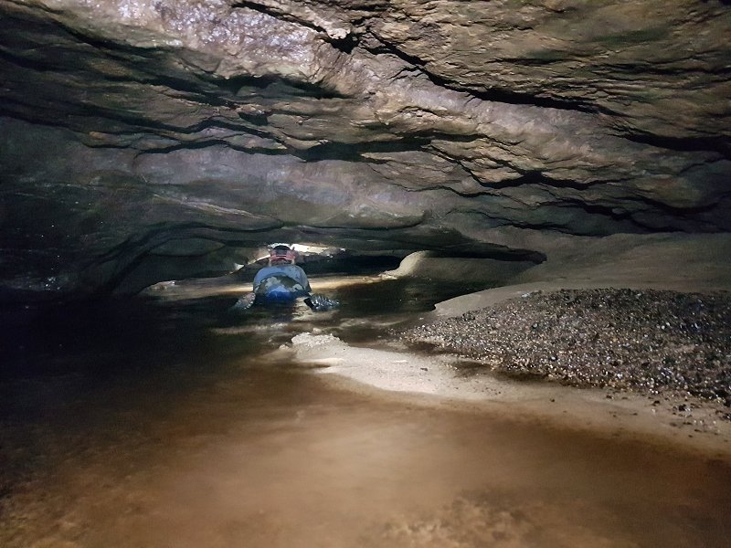 The large passage disappears abruptly, and The Canal begins. The worst part is the grit that washes up your sleeves, making crawling uncomfortable for the rest of the trip. This section of passage can sump in flood conditions, so the cave is best avoided in unsettled weather. This had caused us to (presumably needlessly) delay the trip, as two days previously there had been a local downpour.
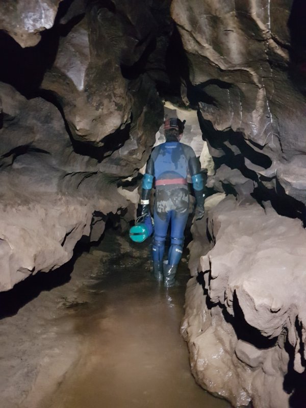 Rift beyond the canal.
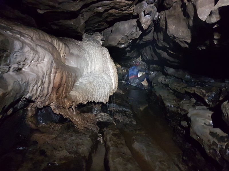 Flowstone in the rift.
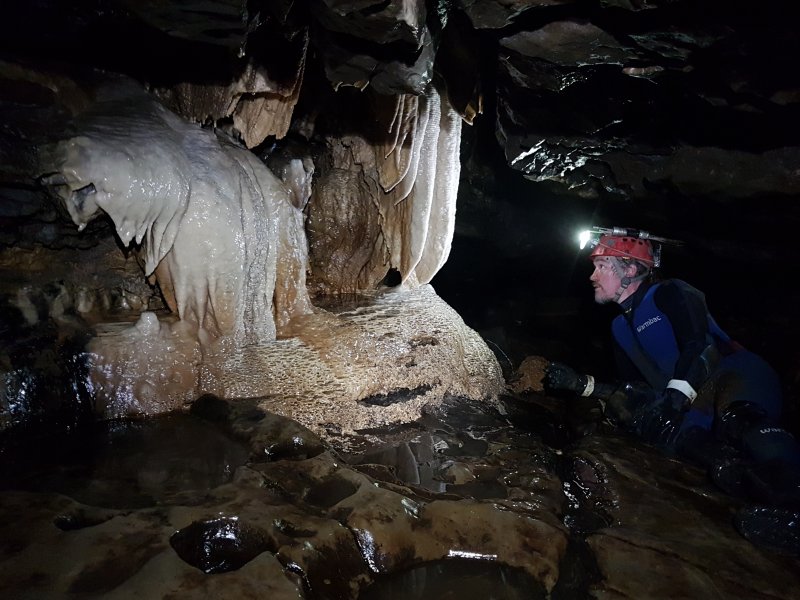 The best formations in the cave.
 Extreme meniscus on the miniature gour pools. The water was raised as much as 4 mm above the calcite.
 Decomposing calcite gours.
 West Rift, with thigh deep water. This may be incorrectly named, as it is labelled as Wet Rift on the WSG surveys, but West Rift in the guidebooks. The rift heads East not West, but was found by Westminster Spelæological Group. So maybe they named it after themselves.
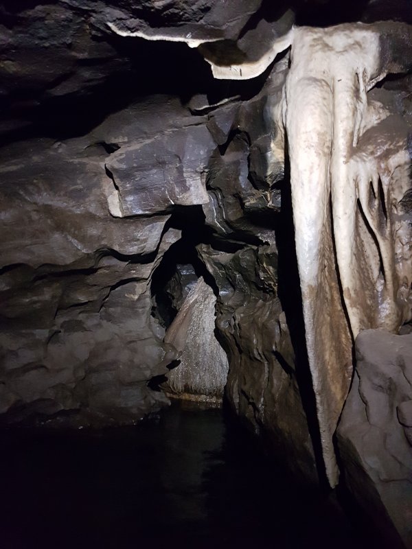 Formations and waist deep water, looking back into West Rift. Another short side passage, The Ooze, is just to the left of the picture.
Lighting by Tarquin
Formations and waist deep water, looking back into West Rift. Another short side passage, The Ooze, is just to the left of the picture.
Lighting by Tarquin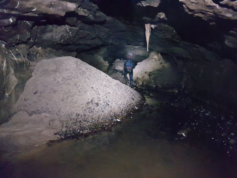 Another large section of passage, which very quickly ends at a choke.
 The route through the choke starts at its top, where there are a couple of small chambers. The second one has this metal cross in it for reasons unknown, made from metal bars tied together with bang wire.
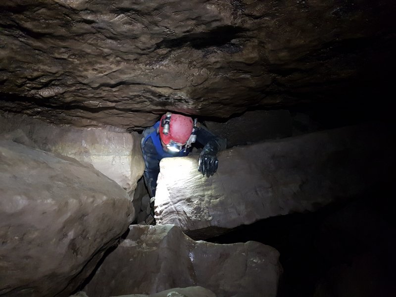 Squeeze in the 20 metre long choke.
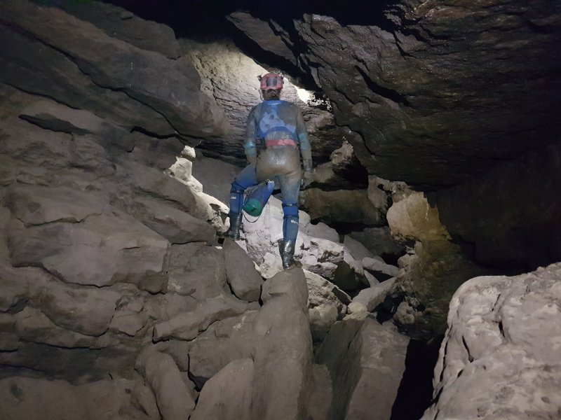 After the choke, the streamway is regained.
 The stream then runs out through a very small rift on the side, which is the upstream end of sump 1. It is so small that it barely qualifies as a sump, not even large enough to put a leg in it.
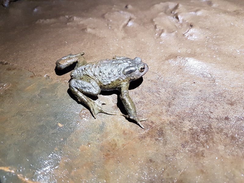 Toad sitting on a ledge above the sump. It had been washed all the way in, and really does not belong here, but at least there is food to eat, with numerous worm casts in the surrounding mudbanks. It did not want to be rescued, and had hidden by the time we returned.
Lighting by Tarquin
Toad sitting on a ledge above the sump. It had been washed all the way in, and really does not belong here, but at least there is food to eat, with numerous worm casts in the surrounding mudbanks. It did not want to be rescued, and had hidden by the time we returned.
Lighting by Tarquin The roof then lowers into the duck, which has a rope through it, just in case. There is a roof notch in this flake, which makes it look like you can keep your head dry, and it might be possible in these conditions if you keep it on its side.
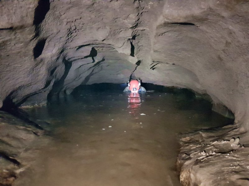 However, it is just easier to do a crocodile impression and accept a partial face plunge, since it is only a flake, not the whole 2 metres of the duck.
 The exit from the duck is much lower, flat out, and only just enough space to keep most of your face out of water sideways. A face wetting is almost guaranteed, especially in normal weather conditions rather than these drought conditions. Presumably this would sump completely in flood.
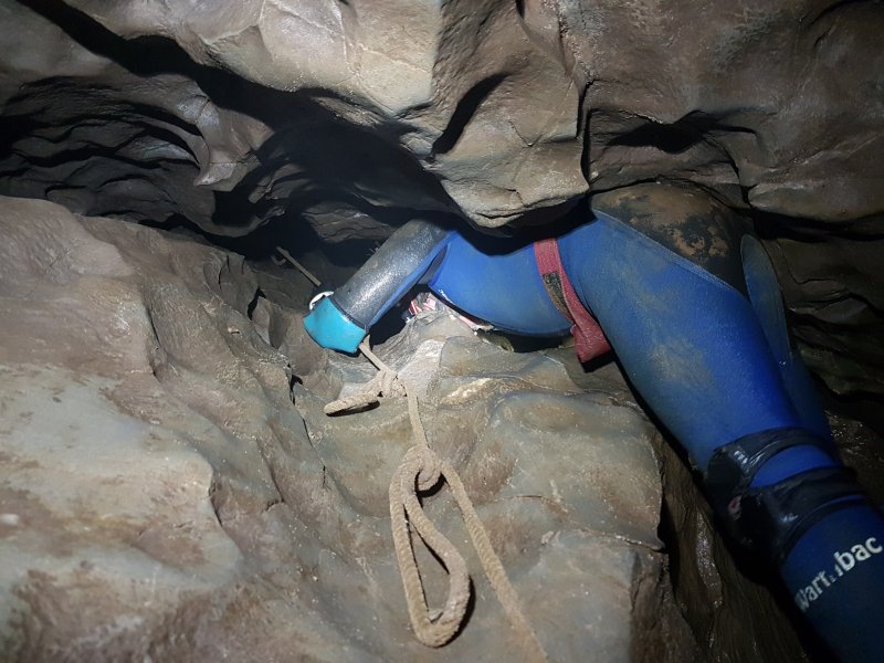 There are two ways on, the lower of which is a very tight crawl. Instead, the usual way on is this narrow aven above the duck. It can be free climbed without needing the rope, but it is definitely awkward.
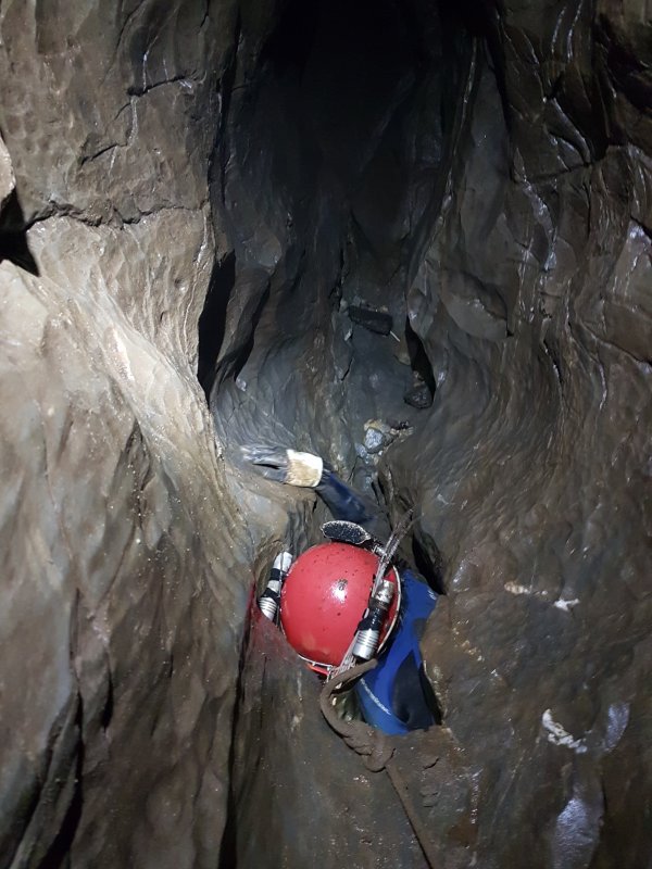 The top of the climb. The rope rubs badly, and is not officially maintained. It should not really be trusted.
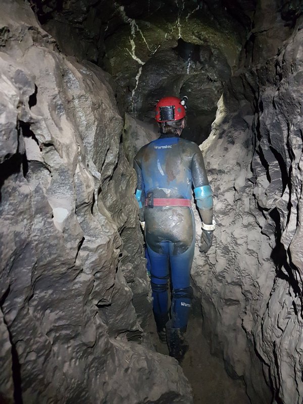 Phreatic rift at the top, where the way on is the most obvious route. There are some oxbows and a side passage here. The side passage is one of the longest in the cave, at about 40 metres. The tight crawl route enters from the floor at one point along the main route.
 Reduced to a crawl.
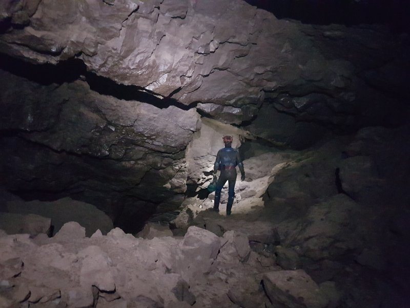 Waterfall Chamber, an unexpectedly large space.
 The waterfall would presumably normally be in this aven. Except it's dry. Just like my throat.
Lighting by Tarquin
The waterfall would presumably normally be in this aven. Except it's dry. Just like my throat.
Lighting by Tarquin The streamway is then regained at the largest passage in the cave (or at least the largest part that dry cavers can reach), which is sadly far too brief, yet again.
 The 100 metre long upstream passage.
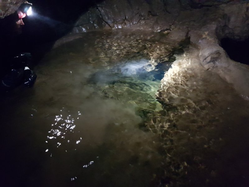 The downstream end of Sump 1, which has seemingly never been dived. It will need to be at least 200 metres long to reach the upstream end.
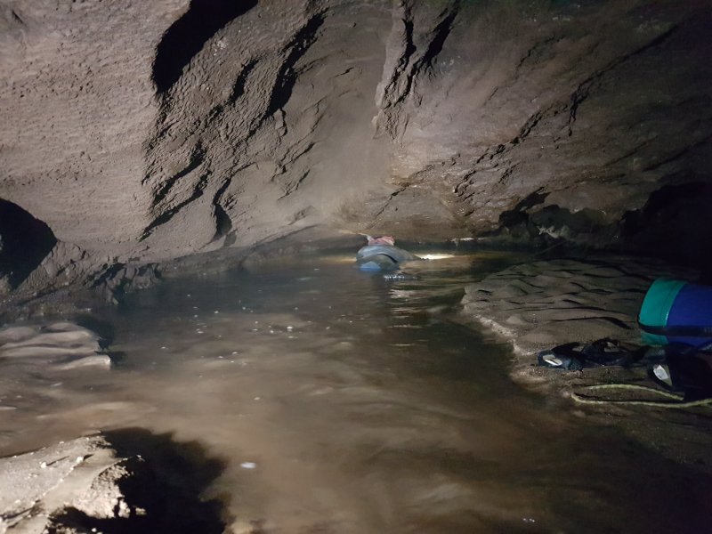 Downstream, the passage lowers to a crawl, which then ends at Sump 2. This cannot be free dived, and leads to 260 metres of wide passage, ending at Sump 3, which has never been passed.