Afon Giedd caves trip 12/07/2020
Unless otherwise stated, camera, setups, lighting, edits and gallery effects by Tarquin. Modelling and lighting at various points will be Pete Bolt, Gareth Davies and a few random cavers.
This gallery covers a trip to see the cave entrances around the Afon Giedd in the Black Mountain. Since we had only recently been released from a COVID lockdown, trips were kept short (since we were a bit out of practice). People had been allowed to form extended households, and meet up with others outdoors for the first time in nearly 4 months. By chance, a few such groups had the same idea and decided to visit the same remote piece of mountain as each other, but quickly went their own ways to avoid having too many people in one place.
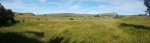 Superb view from Penwyllt in the upper Tawe valley. The main mountains are Carreg Goch (558 metres) and Fan Hir (761 metres) in the Black Mountain range. The area in front of Carreg Goch contains the Dan yr Ogof cave system, but the Afon Giedd lies beyond Carreg Goch, and is a major source of the cave's water.
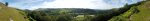 Climbing above Glyntawe. The mountains are Cefn Cul (562 metres), Fan Gyhirych (725 metres), Craig y Llyn (600 metres), Hirfynydd (481 metres) and Cribarth (428 metres).
Modelling by Gareth
Climbing above Glyntawe. The mountains are Cefn Cul (562 metres), Fan Gyhirych (725 metres), Craig y Llyn (600 metres), Hirfynydd (481 metres) and Cribarth (428 metres).
Modelling by Gareth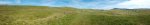 The first part of the Black Mountain plateau, with Tunnel Cave at the right edge of the picture. The hill ahead-left is a limestone outcrop called Twyn Du, a ridge of Fan Hir, Cefn Cul, another limestone outcrop called Twyn Spratt, Fan Gyhirych and the ridge of Carreg Cadno (538 metres). Carreg Cadno is the ridge containing the Ogof Ffynnon Ddu cave system.
Modelling by Gareth
The first part of the Black Mountain plateau, with Tunnel Cave at the right edge of the picture. The hill ahead-left is a limestone outcrop called Twyn Du, a ridge of Fan Hir, Cefn Cul, another limestone outcrop called Twyn Spratt, Fan Gyhirych and the ridge of Carreg Cadno (538 metres). Carreg Cadno is the ridge containing the Ogof Ffynnon Ddu cave system.
Modelling by Gareth The start of the eastern branch of the Pwll Dwfn dry valley. On the left is Carreg Goch and on the right is Twyn Du, with Fan Hir peering over its left shoulder. Pwll Dwfn lies just to the right of the tree on the left.
Modelling by Pete and Gareth
The start of the eastern branch of the Pwll Dwfn dry valley. On the left is Carreg Goch and on the right is Twyn Du, with Fan Hir peering over its left shoulder. Pwll Dwfn lies just to the right of the tree on the left.
Modelling by Pete and Gareth The eastern branch of the dry valley starts as a large depression, filled with shakeholes. There is a large water catchment here, so there must also be a lot of cave draining it. So far, only Pwll Dwfn is known.
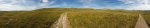 Looking towards Carreg Goch. On the left side of the path is the western branch of the dry valley, while on the right side of the path is the very large dry basin at the head of the eastern branch.
Modelling by Gareth and Pete
Looking towards Carreg Goch. On the left side of the path is the western branch of the dry valley, while on the right side of the path is the very large dry basin at the head of the eastern branch.
Modelling by Gareth and Pete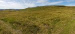 Head of the western branch of the dry valley, with a much smaller catchment. The hill in front is the Clogwyn y Geifr ridge of Carreg Goch, with Pwll Dwfn in the rocky valley to its left. Some of the water here makes its way into the Pinnacle area of Dan yr Ogof, but the rest must also join the Pwll Dwfn water. The western branch seems much more substantial in terms of the width of the old water channel, so was probably active for longer.
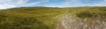 Descending into the Waun Fignen Felen depression. In front are Carreg Goch and Disgwylfa (544 metres). On the right are Waun Lefrith (677 metres), Picws Du (749 metres), Fan Brycheiniog (803 metres) and Fan Hir. From this point, the mountain tops all look so much closer, and so much smaller than they really are. The end of Dan yr Ogof's Great North Road lies under the valley to the left.
Modelling by Gareth and Pete
Descending into the Waun Fignen Felen depression. In front are Carreg Goch and Disgwylfa (544 metres). On the right are Waun Lefrith (677 metres), Picws Du (749 metres), Fan Brycheiniog (803 metres) and Fan Hir. From this point, the mountain tops all look so much closer, and so much smaller than they really are. The end of Dan yr Ogof's Great North Road lies under the valley to the left.
Modelling by Gareth and Pete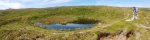 Several of the shakeholes contain small lakes. This is just before Waun Fignen Felen.
Modelling by Gareth
Several of the shakeholes contain small lakes. This is just before Waun Fignen Felen.
Modelling by Gareth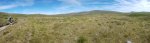 Waun Fignen Felen is a large boggy marsh, draining into a few little caves. The enormous Waun Fignen Felen sink is on the right side of the picture here, and is the main feeder of Dan yr Ogof's Great North Road.
Modelling by Gareth and Pete
Waun Fignen Felen is a large boggy marsh, draining into a few little caves. The enormous Waun Fignen Felen sink is on the right side of the picture here, and is the main feeder of Dan yr Ogof's Great North Road.
Modelling by Gareth and Pete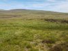 Most of the bog is fenced off to allow restoration work.
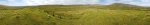
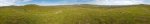 Panorama of the wilderness. Carreg Goch, Disgwylfa (the tallest one on the left), Foel Fraith (602 metres), Garreg Las (635 metres), Waun Lefrith, Picws Du, Fan Brycheiniog, Fan Hir, Fan Gyhirych, Fan Fraith (668 metres), Carreg Cadno and Craig y Llyn, followed by Carreg Goch again. On the left, the Afon Giedd can be seen in the low land beyond Disgwylfa, and the Waun Fignen Felen sink can also now be seen on the right.
Modelling by Gareth and Pete
Panorama of the wilderness. Carreg Goch, Disgwylfa (the tallest one on the left), Foel Fraith (602 metres), Garreg Las (635 metres), Waun Lefrith, Picws Du, Fan Brycheiniog, Fan Hir, Fan Gyhirych, Fan Fraith (668 metres), Carreg Cadno and Craig y Llyn, followed by Carreg Goch again. On the left, the Afon Giedd can be seen in the low land beyond Disgwylfa, and the Waun Fignen Felen sink can also now be seen on the right.
Modelling by Gareth and Pete Welsh mountain pony herd, which live wild on the mountains. The piebald is at least partly gypsy cob, and is not a pure Welsh mountain pony.
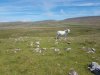 The mountain ponies were intentionally released during the industrial revolution, as a way to ensure a stock of small horses that could be used in the coal mines, and collected when they were needed. Since then, they have become an icon of the mountains. They do have a native origin here, but they have been modified by selective breeding.
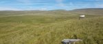 Pony herd.
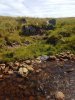 Ogof Dewi Sant Sink, in the bank of the Afon Giedd. In low water, this sink can swallow the whole flow of the river.
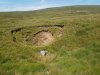 A nearby shakehole contains Ogof Dewi Sant, formed on the same rift as the sink.
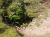 It can be clearly identified by the roar of the stream as it rushes through the rocks.
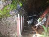 The entrance to Ogof Dewi Sant is a scaffolded shaft through the choke. At the bottom, the stream appears from the boulders, and immediately plunges over an unstable pitch head.
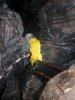 Climbing over the choss into a rift bypasses the loose pitch head.
Modelling by Pete, lighting by Tarquin and Pete
Climbing over the choss into a rift bypasses the loose pitch head.
Modelling by Pete, lighting by Tarquin and Pete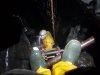 This becomes a scaffolded pitch head, where the scaffold forms a climbing frame dropping to a ladder.
Modelling by Pete, lighting by Tarquin and Pete
This becomes a scaffolded pitch head, where the scaffold forms a climbing frame dropping to a ladder.
Modelling by Pete, lighting by Tarquin and Pete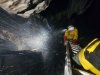 Usefully, this ladder bypasses the incredibly wet main side of the shaft, reaching a floor about 10 metres down.
Modelling by Pete, lighting by Tarquin and Pete
Usefully, this ladder bypasses the incredibly wet main side of the shaft, reaching a floor about 10 metres down.
Modelling by Pete, lighting by Tarquin and Pete Running through the waterfall into a rift.
Modelling by Pete, lighting by Tarquin and Pete
Running through the waterfall into a rift.
Modelling by Pete, lighting by Tarquin and Pete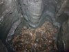 Sadly, the rift closes down, but the floor dips downwards, and seems to be the main way on.
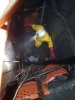 Ogof Dewi Sant has been dug extensively, downwards into the floor on the opposite side of the shaft from the rift.
Modelling by Pete, lighting by Tarquin and Pete
Ogof Dewi Sant has been dug extensively, downwards into the floor on the opposite side of the shaft from the rift.
Modelling by Pete, lighting by Tarquin and Pete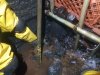 The water sinks back towards the shaft again though, and this side might not have been the best way onwards.
Modelling by Pete
The water sinks back towards the shaft again though, and this side might not have been the best way onwards.
Modelling by Pete The deeply incised Afon Giedd valley below Ogof Dewi Sant, looking towards Mynydd Marchywell (418 metres), a small hill overlooking Neath. Incidentally, this is the upper Afon Giedd, which only flows as far as the nearby rock outcrops where it sinks. Beyond there, a new river starts, which is confusingly also called the Afon Giedd, even though the two rivers flow in completely different directions, and do not share any water.
 The (upper) Afon Giedd in its little valley.
Modelling by Pete and Gareth
The (upper) Afon Giedd in its little valley.
Modelling by Pete and Gareth Another stream joins, and the Afon Giedd then almost completely sinks into the river bed on a right bend. Until just a few years ago, the river bed looked normal here, but then a shakehole appeared in the floor of the river, creating a pool.
Modelling by Pete and Gareth
Another stream joins, and the Afon Giedd then almost completely sinks into the river bed on a right bend. Until just a few years ago, the river bed looked normal here, but then a shakehole appeared in the floor of the river, creating a pool.
Modelling by Pete and Gareth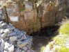 In the crag above the corner is the entrance to Ogof Giedd, one of the authorised digs in the area.
 A scaffolded dig drops down to the water's main route.
 The river water enters and is captured in a rather well made funnel.
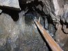 The impressive plumbing system then takes the water to the end, keeping most of the dig dry, and preventing the water from hampering progress.
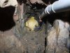 The plumbing then ends.
Modelling by Pete
The plumbing then ends.
Modelling by Pete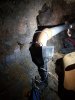 The end funnels the water into a flexible pipe.
Modelling by Gareth and Pete, lighting by Tarquin, Gareth and Pete
The end funnels the water into a flexible pipe.
Modelling by Gareth and Pete, lighting by Tarquin, Gareth and Pete The passage drops down a pipe into a pool.
Modelling by Tarquin
The passage drops down a pipe into a pool.
Modelling by Tarquin When first found, this was a very wet crawl, and a short section of passage beyond here has been visited once. However, digging work accidentally converted it into a duck, which became a sump. Work is underway to provide access again.
Modelling by Tarquin
When first found, this was a very wet crawl, and a short section of passage beyond here has been visited once. However, digging work accidentally converted it into a duck, which became a sump. Work is underway to provide access again.
Modelling by Tarquin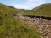 On the next bend, the river sinks into the opposite bank. The water can be heard running in a nearby hole, but the stream does not seem to flow into Ogof Giedd. Perhaps it just continues downstream below the riverbed.
Modelling by Gareth and Pete
On the next bend, the river sinks into the opposite bank. The water can be heard running in a nearby hole, but the stream does not seem to flow into Ogof Giedd. Perhaps it just continues downstream below the riverbed.
Modelling by Gareth and Pete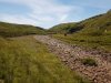 Approaching the main Sinc y Giedd. Even in extreme flood, the river never flows any further than the end of this valley.
Modelling by Pete and Gareth
Approaching the main Sinc y Giedd. Even in extreme flood, the river never flows any further than the end of this valley.
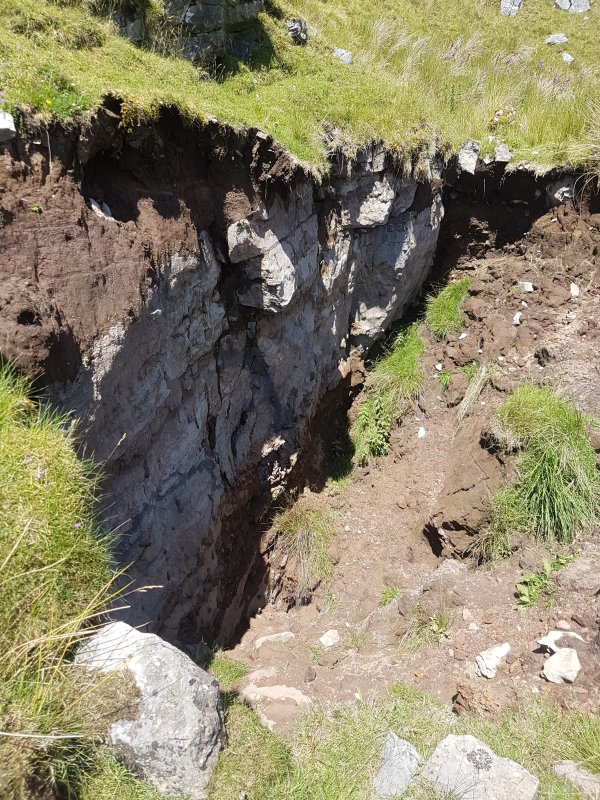
Modelling by Pete and Gareth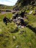 The river bank had very recently collapsed, and we met a couple of cavers who were busy investigating a small tube in the collapse.
 The collapse would almost certainly just lead into known cave within Sinc y Giedd, which lies below here, but it's worth investigating anyway, in case it provides access to other parts of it.
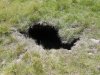 A recent little shakehole nearby.
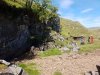 The dig lies upstream of the main sink. Another couple of cavers now randomly appeared, having also decided to try visiting the caves here. None of us had intended to meet, so this was a bit of a surprise, and after exchanging pleasantries, we all moved on with visiting the caves that others were not visiting.
Modelling by Gareth and Pete
The dig lies upstream of the main sink. Another couple of cavers now randomly appeared, having also decided to try visiting the caves here. None of us had intended to meet, so this was a bit of a surprise, and after exchanging pleasantries, we all moved on with visiting the caves that others were not visiting.
Modelling by Gareth and Pete The main sink of Sync y Giedd does not have any known passage; the river just slams into a wall and sinks in the floor. In flood, the amount of water can be phenomenal, running over a metre deep.
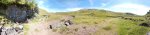 End of the valley, with the main cave of Sinc y Giedd being at the end of the flood overflow valley on the right. The mountains are Fan Brycheiniog on the left and Disgwylfa in the middle.
Modelling by Gareth and Pete
End of the valley, with the main cave of Sinc y Giedd being at the end of the flood overflow valley on the right. The mountains are Fan Brycheiniog on the left and Disgwylfa in the middle.
Modelling by Gareth and Pete The entrance to the Sinc y Giedd cave lies behind a boulder collapse. Two routes are possible, one on the left into a bedding plane, and a less obvious one between the largest boulders in the middle.
Modelling by Gareth
The entrance to the Sinc y Giedd cave lies behind a boulder collapse. Two routes are possible, one on the left into a bedding plane, and a less obvious one between the largest boulders in the middle.
Modelling by Gareth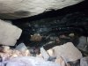 The bedding on the left looks easier, but quickly reaches a tight floor slot, which none of us felt like pushing through. It is supposed to drop into the side passages of the main cave.
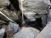 The main way into the cave is between the boulders, and down this pitch, which we had not brought sufficient kit for. The cave below is formed on several levels, but the extreme flooding randomly alters which passages are available. At most, around 180 m of cave was known here until the river blocked parts of it.
Modelling by Gareth, lighting by Tarquin and Gareth
The main way into the cave is between the boulders, and down this pitch, which we had not brought sufficient kit for. The cave below is formed on several levels, but the extreme flooding randomly alters which passages are available. At most, around 180 m of cave was known here until the river blocked parts of it.
Modelling by Gareth, lighting by Tarquin and Gareth The grassed end of the Giedd valley contains another dig, but no cave is known. From here, you get a good idea of just how much the water must back up against the cave entrances in flood, and just how extreme the flooding must be.
Modelling by Pete and Gareth
The grassed end of the Giedd valley contains another dig, but no cave is known. From here, you get a good idea of just how much the water must back up against the cave entrances in flood, and just how extreme the flooding must be.
Modelling by Pete and Gareth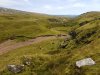 The new collapse was attracting attention, and a couple of others had turned up to take a look, without realising anyone else would be there. It was time to leave, and each of the 4 groups went their separate ways. As cavers, we are often naturally reclusive anyway (why else would we ferret around in stupid holes in the ground where regular mortals fear to tread?), but this whole social distancing situation makes us want to get even further away from others than normal. At least there is plenty of wilderness up here, and we could all find a piece for ourselves.
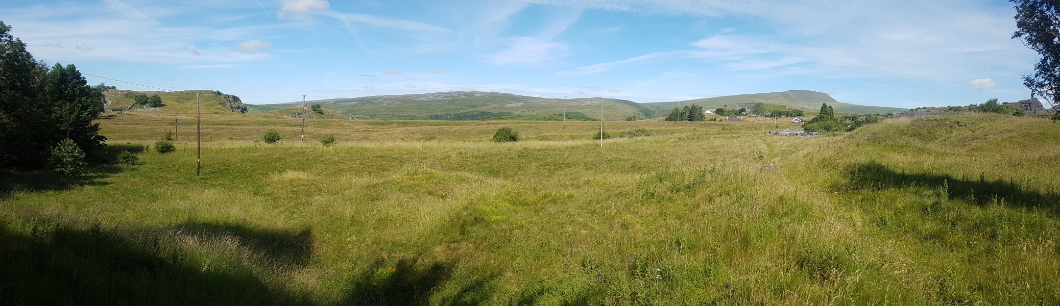
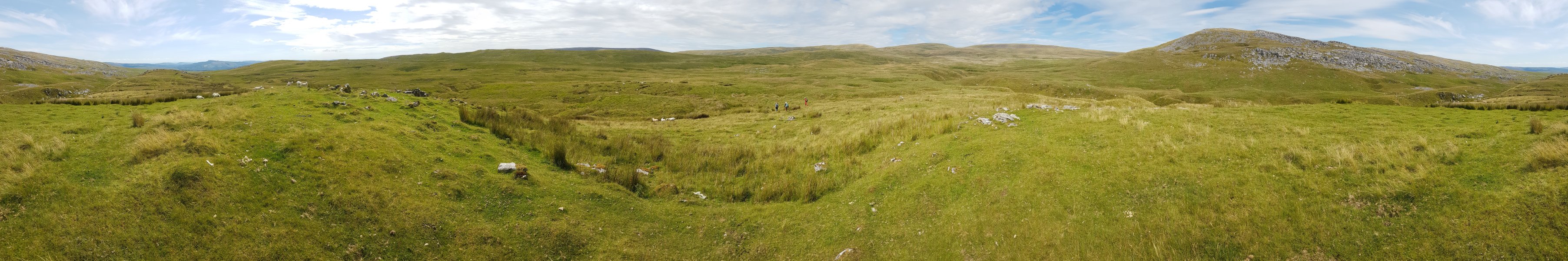
 Heading over to the next set of caves, where we randomly encountered another caver, staring into holes in the ground. The hills are Mynydd Marchywell, an unnamed lump (486 metres), Garreg Las, Waun Lefrith, Picws Du, Fan Brycheiniog, Fan Hir and Disgwylfa.
Modelling by Gareth and Pete
Heading over to the next set of caves, where we randomly encountered another caver, staring into holes in the ground. The hills are Mynydd Marchywell, an unnamed lump (486 metres), Garreg Las, Waun Lefrith, Picws Du, Fan Brycheiniog, Fan Hir and Disgwylfa.
Modelling by Gareth and Pete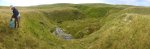 A little further west of Ogof Dewi Sant is the immense sink of Rusty Horseshoe dig. With only a tiny catchment, this sink seems oddly oversized.
Modelling by Gareth and Pete
A little further west of Ogof Dewi Sant is the immense sink of Rusty Horseshoe dig. With only a tiny catchment, this sink seems oddly oversized.
Modelling by Gareth and Pete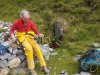 At one end of the shakehole, a grilled entrance is Rusty Horseshoe Dig, adorned with a rusty horseshoe (of course) and dry stone walled spoil.
Modelling by Pete
At one end of the shakehole, a grilled entrance is Rusty Horseshoe Dig, adorned with a rusty horseshoe (of course) and dry stone walled spoil.
Modelling by Pete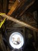 The entrance passes through a concrete tube into an area where the ceiling is like a game of ker-plunk.
Lighting by Tarquin and Sol
The entrance passes through a concrete tube into an area where the ceiling is like a game of ker-plunk.
Lighting by Tarquin and Sol The climb below that ceiling finally gains solid rock.
Modelling by Gareth, lighting by Tarquin and Gareth
The climb below that ceiling finally gains solid rock.
Modelling by Gareth, lighting by Tarquin and Gareth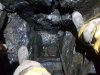 Below the climb, you feed yourself into a narrow slot, and down a series of little climbs.
Modelling by Tarquin
Below the climb, you feed yourself into a narrow slot, and down a series of little climbs.
Modelling by Tarquin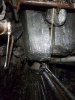 The way on passes through a crawl over a load of scaffold bars. None of them seem to be supporting the insanely poised boulder that hangs from nothing above your head.
Lighting by Tarquin and Gareth
The way on passes through a crawl over a load of scaffold bars. None of them seem to be supporting the insanely poised boulder that hangs from nothing above your head.
Lighting by Tarquin and Gareth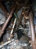 The cave ends at a collapse after a scaffolding tunnel. Gareth remembers the dig extending further in the past, with a choice of routes around a collapsing section. However, if so, that part is now lost due to collapse. The cave is only about 30 metres long, and so far seems to have failed to encounter the substantial cave promised by the sink.
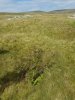 A barely visible hole in the moorland is one of the entrances to Ogof No Ogof. It may be free climbable, but certainly not something you would want to fall down.
 Another shakehole next to it has the concealed crawl entrance, avoiding the climb. This passes under a natural rock arch to reach the bottom of the climb.
Modelling by Gareth
Another shakehole next to it has the concealed crawl entrance, avoiding the climb. This passes under a natural rock arch to reach the bottom of the climb.
Modelling by Gareth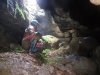 The bottom of the climb, where any unlucky sheep will land.
Modelling by Gareth, lighting by Tarquin, Gareth and Sol
The bottom of the climb, where any unlucky sheep will land.
Modelling by Gareth, lighting by Tarquin, Gareth and Sol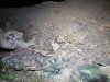 The remains of an unlucky sheep.
Modelling by Shauna
The remains of an unlucky sheep.
Modelling by Shauna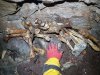 Remains of a much larger unlucky animal, probably a mountain pony.
Modelling by Tarquin and Snowfall Magic
Remains of a much larger unlucky animal, probably a mountain pony.
Modelling by Tarquin and Snowfall Magic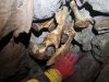 More bones in the left passage, which quickly ends.
Modelling by Tarquin and Snowfall Magic
More bones in the left passage, which quickly ends.
Modelling by Tarquin and Snowfall Magic The main way on is the right passage, which drops down a slope of spoil bags, slowly decaying, into a crawl. Eventually they will slump enough to block the way on.
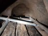 The crawl gains and loses a tiny stream, then ends at a narrow climb up some scaffolding. Being so close to the surface already, going up might not seem intuitive, but it worked.
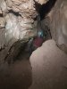 Open passage is regained, complete with a few poor formations.
Modelling by Gareth, lighting by Tarquin and Gareth
Open passage is regained, complete with a few poor formations.
Modelling by Gareth, lighting by Tarquin and Gareth Once again, it ends at a drop down, held back by scaffolding.
Modelling by Gareth
Once again, it ends at a drop down, held back by scaffolding.
Modelling by Gareth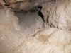 The final dig, full of gunk. Not particularly inspiring.
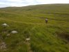 The next stream over has a more substantial catchment, and a fairly large valley.
Modelling by Pete and Gareth
The next stream over has a more substantial catchment, and a fairly large valley.
Modelling by Pete and Gareth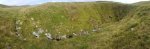 The stream ends abruptly in the giant Ogof Carreg Lem sink.
Modelling by Pete and Gareth
The stream ends abruptly in the giant Ogof Carreg Lem sink.
Modelling by Pete and Gareth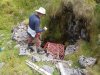 The entrance to Ogof Carreg Lem lies at the end of the sink. At 350 metres, this is the longest cave in the area. Most of it is made up from small inlet passages, but it does have a short section of large passage.
Modelling by Gareth
The entrance to Ogof Carreg Lem lies at the end of the sink. At 350 metres, this is the longest cave in the area. Most of it is made up from small inlet passages, but it does have a short section of large passage.
Modelling by Gareth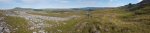 Walking back past Twyn Du and Carreg yr Ogof, with the superb view over the upper Tawe valley. Fan Gyhirych, Fan Fraith, Carreg Cadno and Craig y Llyn.
Modelling by Gareth and Pete
Walking back past Twyn Du and Carreg yr Ogof, with the superb view over the upper Tawe valley. Fan Gyhirych, Fan Fraith, Carreg Cadno and Craig y Llyn.
Modelling by Gareth and Pete
 Superb view from Penwyllt in the upper Tawe valley. The main mountains are Carreg Goch (558 metres) and Fan Hir (761 metres) in the Black Mountain range. The area in front of Carreg Goch contains the Dan yr Ogof cave system, but the Afon Giedd lies beyond Carreg Goch, and is a major source of the cave's water.
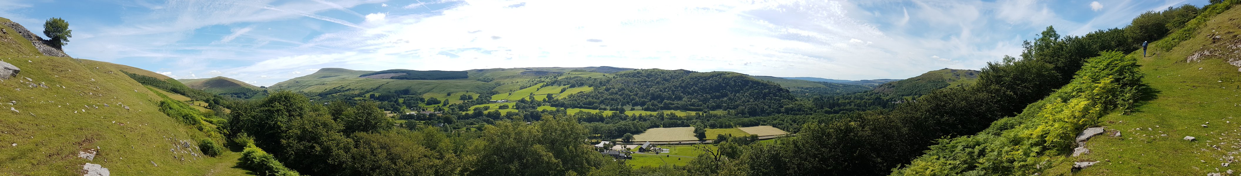 Climbing above Glyntawe. The mountains are Cefn Cul (562 metres), Fan Gyhirych (725 metres), Craig y Llyn (600 metres), Hirfynydd (481 metres) and Cribarth (428 metres).
Modelling by Gareth
Climbing above Glyntawe. The mountains are Cefn Cul (562 metres), Fan Gyhirych (725 metres), Craig y Llyn (600 metres), Hirfynydd (481 metres) and Cribarth (428 metres).
Modelling by Gareth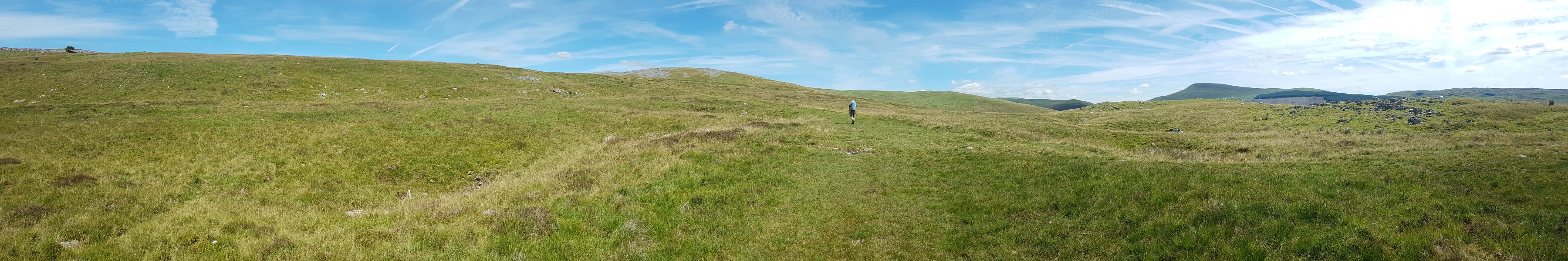 The first part of the Black Mountain plateau, with Tunnel Cave at the right edge of the picture. The hill ahead-left is a limestone outcrop called Twyn Du, a ridge of Fan Hir, Cefn Cul, another limestone outcrop called Twyn Spratt, Fan Gyhirych and the ridge of Carreg Cadno (538 metres). Carreg Cadno is the ridge containing the Ogof Ffynnon Ddu cave system.
Modelling by Gareth
The first part of the Black Mountain plateau, with Tunnel Cave at the right edge of the picture. The hill ahead-left is a limestone outcrop called Twyn Du, a ridge of Fan Hir, Cefn Cul, another limestone outcrop called Twyn Spratt, Fan Gyhirych and the ridge of Carreg Cadno (538 metres). Carreg Cadno is the ridge containing the Ogof Ffynnon Ddu cave system.
Modelling by Gareth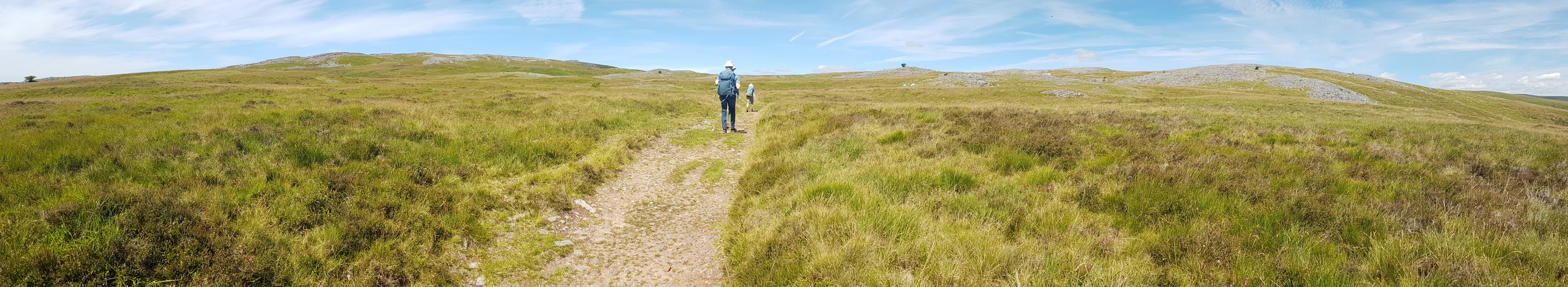 The start of the eastern branch of the Pwll Dwfn dry valley. On the left is Carreg Goch and on the right is Twyn Du, with Fan Hir peering over its left shoulder. Pwll Dwfn lies just to the right of the tree on the left.
Modelling by Pete and Gareth
The start of the eastern branch of the Pwll Dwfn dry valley. On the left is Carreg Goch and on the right is Twyn Du, with Fan Hir peering over its left shoulder. Pwll Dwfn lies just to the right of the tree on the left.
Modelling by Pete and Gareth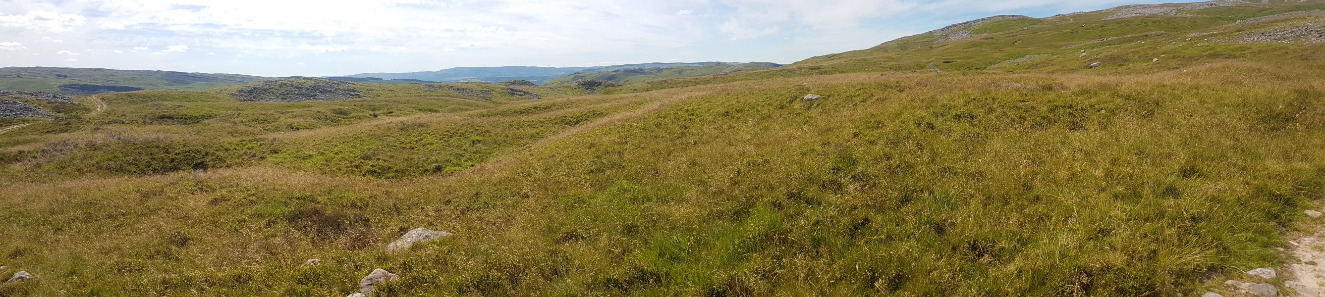 The eastern branch of the dry valley starts as a large depression, filled with shakeholes. There is a large water catchment here, so there must also be a lot of cave draining it. So far, only Pwll Dwfn is known.
 Looking towards Carreg Goch. On the left side of the path is the western branch of the dry valley, while on the right side of the path is the very large dry basin at the head of the eastern branch.
Modelling by Gareth and Pete
Looking towards Carreg Goch. On the left side of the path is the western branch of the dry valley, while on the right side of the path is the very large dry basin at the head of the eastern branch.
Modelling by Gareth and Pete Head of the western branch of the dry valley, with a much smaller catchment. The hill in front is the Clogwyn y Geifr ridge of Carreg Goch, with Pwll Dwfn in the rocky valley to its left. Some of the water here makes its way into the Pinnacle area of Dan yr Ogof, but the rest must also join the Pwll Dwfn water. The western branch seems much more substantial in terms of the width of the old water channel, so was probably active for longer.
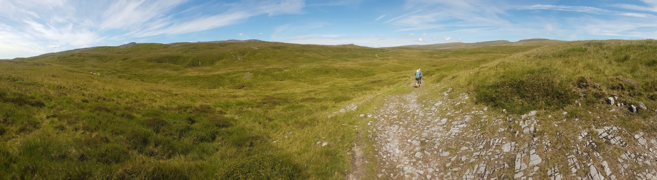 Descending into the Waun Fignen Felen depression. In front are Carreg Goch and Disgwylfa (544 metres). On the right are Waun Lefrith (677 metres), Picws Du (749 metres), Fan Brycheiniog (803 metres) and Fan Hir. From this point, the mountain tops all look so much closer, and so much smaller than they really are. The end of Dan yr Ogof's Great North Road lies under the valley to the left.
Modelling by Gareth and Pete
Descending into the Waun Fignen Felen depression. In front are Carreg Goch and Disgwylfa (544 metres). On the right are Waun Lefrith (677 metres), Picws Du (749 metres), Fan Brycheiniog (803 metres) and Fan Hir. From this point, the mountain tops all look so much closer, and so much smaller than they really are. The end of Dan yr Ogof's Great North Road lies under the valley to the left.
Modelling by Gareth and Pete Several of the shakeholes contain small lakes. This is just before Waun Fignen Felen.
Modelling by Gareth
Several of the shakeholes contain small lakes. This is just before Waun Fignen Felen.
Modelling by Gareth Waun Fignen Felen is a large boggy marsh, draining into a few little caves. The enormous Waun Fignen Felen sink is on the right side of the picture here, and is the main feeder of Dan yr Ogof's Great North Road.
Modelling by Gareth and Pete
Waun Fignen Felen is a large boggy marsh, draining into a few little caves. The enormous Waun Fignen Felen sink is on the right side of the picture here, and is the main feeder of Dan yr Ogof's Great North Road.
Modelling by Gareth and Pete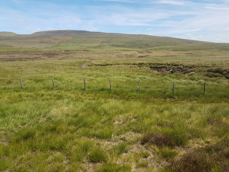 Most of the bog is fenced off to allow restoration work.
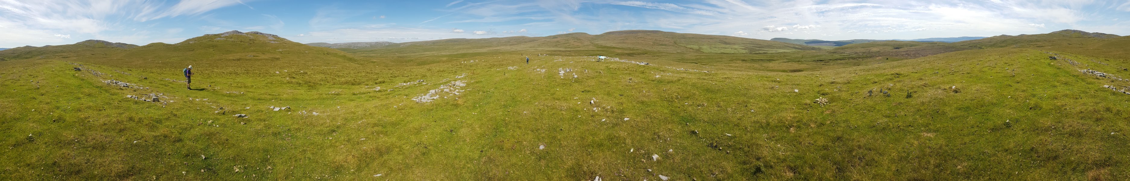 Panorama of the wilderness. Carreg Goch, Disgwylfa (the tallest one on the left), Foel Fraith (602 metres), Garreg Las (635 metres), Waun Lefrith, Picws Du, Fan Brycheiniog, Fan Hir, Fan Gyhirych, Fan Fraith (668 metres), Carreg Cadno and Craig y Llyn, followed by Carreg Goch again. On the left, the Afon Giedd can be seen in the low land beyond Disgwylfa, and the Waun Fignen Felen sink can also now be seen on the right.
Modelling by Gareth and Pete
Panorama of the wilderness. Carreg Goch, Disgwylfa (the tallest one on the left), Foel Fraith (602 metres), Garreg Las (635 metres), Waun Lefrith, Picws Du, Fan Brycheiniog, Fan Hir, Fan Gyhirych, Fan Fraith (668 metres), Carreg Cadno and Craig y Llyn, followed by Carreg Goch again. On the left, the Afon Giedd can be seen in the low land beyond Disgwylfa, and the Waun Fignen Felen sink can also now be seen on the right.
Modelling by Gareth and Pete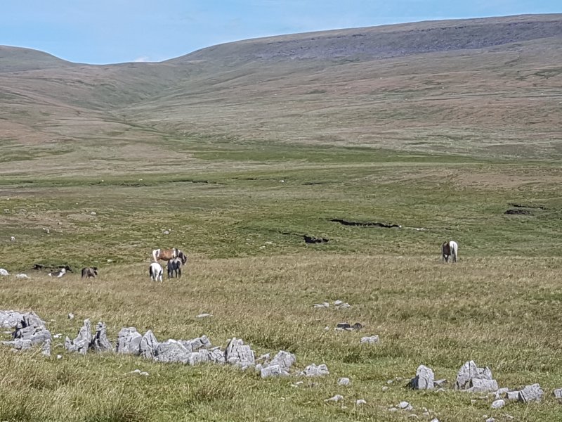 Welsh mountain pony herd, which live wild on the mountains. The piebald is at least partly gypsy cob, and is not a pure Welsh mountain pony.
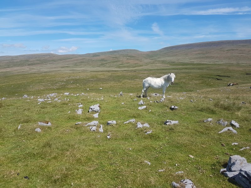 The mountain ponies were intentionally released during the industrial revolution, as a way to ensure a stock of small horses that could be used in the coal mines, and collected when they were needed. Since then, they have become an icon of the mountains. They do have a native origin here, but they have been modified by selective breeding.
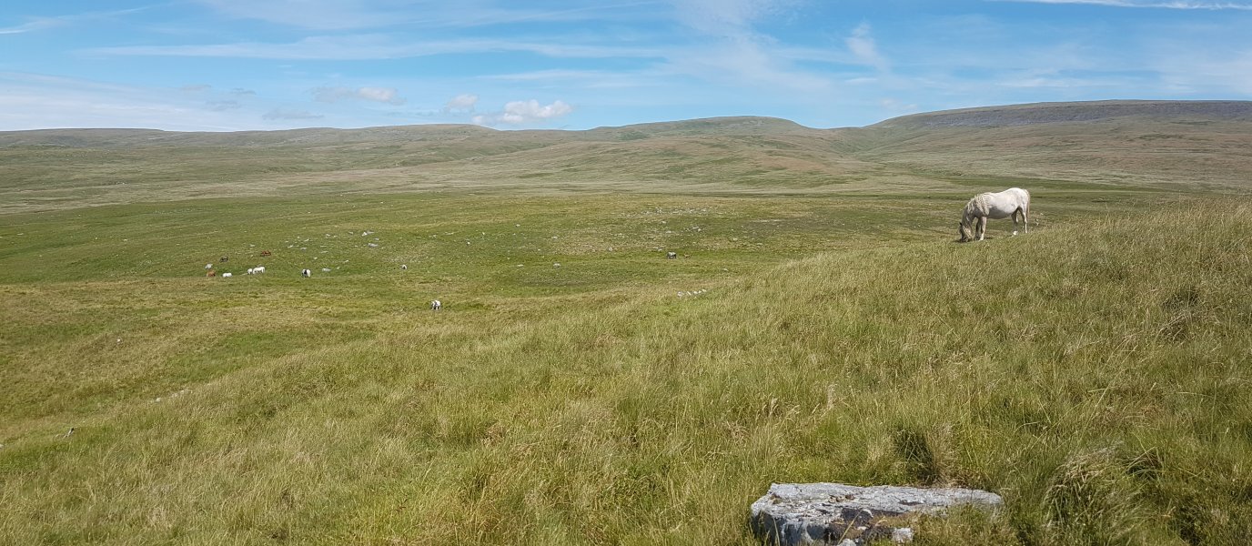 Pony herd.
 Ogof Dewi Sant Sink, in the bank of the Afon Giedd. In low water, this sink can swallow the whole flow of the river.
 A nearby shakehole contains Ogof Dewi Sant, formed on the same rift as the sink.
 It can be clearly identified by the roar of the stream as it rushes through the rocks.
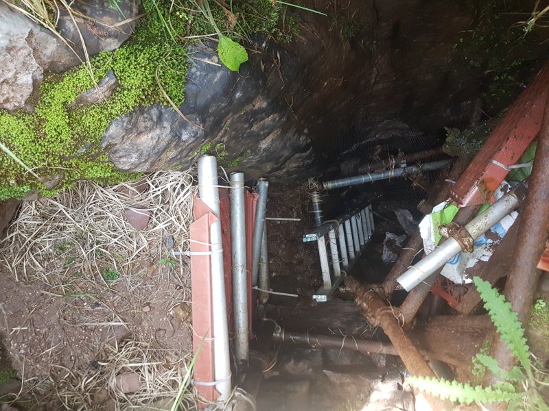 The entrance to Ogof Dewi Sant is a scaffolded shaft through the choke. At the bottom, the stream appears from the boulders, and immediately plunges over an unstable pitch head.
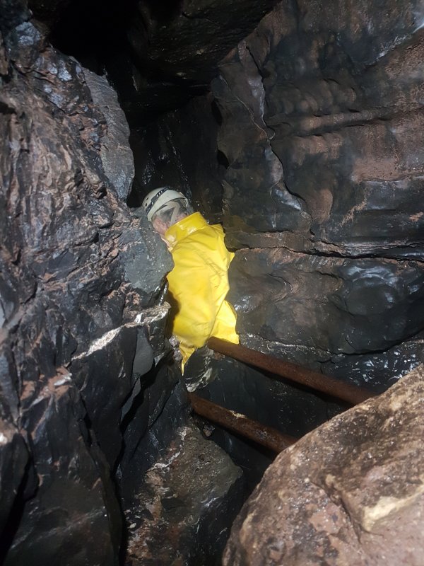 Climbing over the choss into a rift bypasses the loose pitch head.
Modelling by Pete, lighting by Tarquin and Pete
Climbing over the choss into a rift bypasses the loose pitch head.
Modelling by Pete, lighting by Tarquin and Pete This becomes a scaffolded pitch head, where the scaffold forms a climbing frame dropping to a ladder.
Modelling by Pete, lighting by Tarquin and Pete
This becomes a scaffolded pitch head, where the scaffold forms a climbing frame dropping to a ladder.
Modelling by Pete, lighting by Tarquin and Pete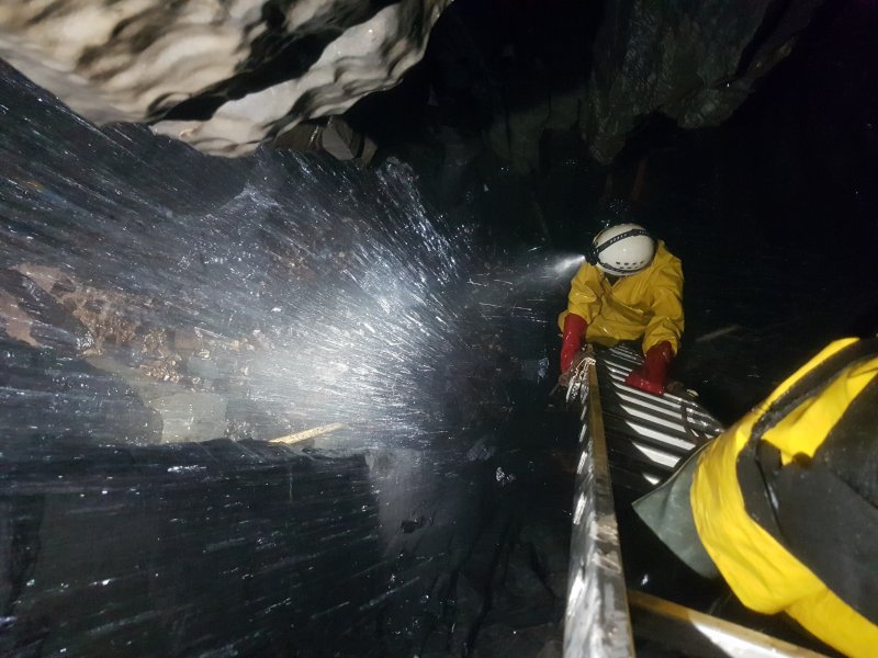 Usefully, this ladder bypasses the incredibly wet main side of the shaft, reaching a floor about 10 metres down.
Modelling by Pete, lighting by Tarquin and Pete
Usefully, this ladder bypasses the incredibly wet main side of the shaft, reaching a floor about 10 metres down.
Modelling by Pete, lighting by Tarquin and Pete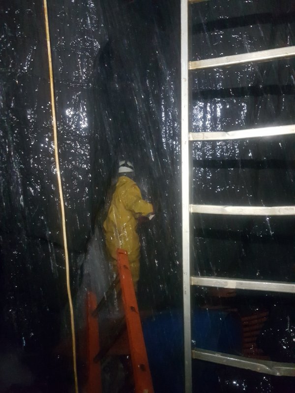 Running through the waterfall into a rift.
Modelling by Pete, lighting by Tarquin and Pete
Running through the waterfall into a rift.
Modelling by Pete, lighting by Tarquin and Pete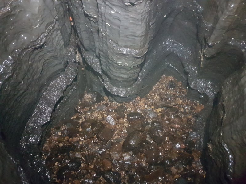 Sadly, the rift closes down, but the floor dips downwards, and seems to be the main way on.
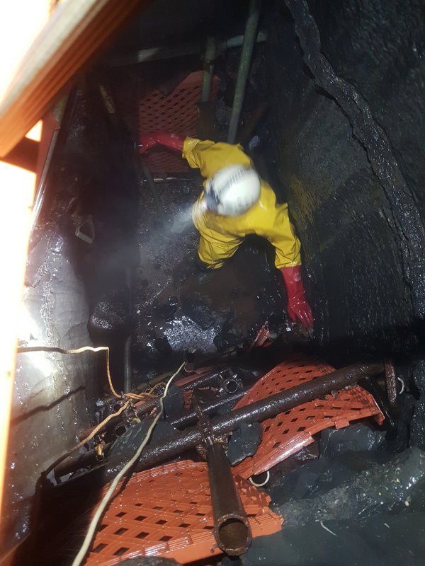 Ogof Dewi Sant has been dug extensively, downwards into the floor on the opposite side of the shaft from the rift.
Modelling by Pete, lighting by Tarquin and Pete
Ogof Dewi Sant has been dug extensively, downwards into the floor on the opposite side of the shaft from the rift.
Modelling by Pete, lighting by Tarquin and Pete The water sinks back towards the shaft again though, and this side might not have been the best way onwards.
Modelling by Pete
The water sinks back towards the shaft again though, and this side might not have been the best way onwards.
Modelling by Pete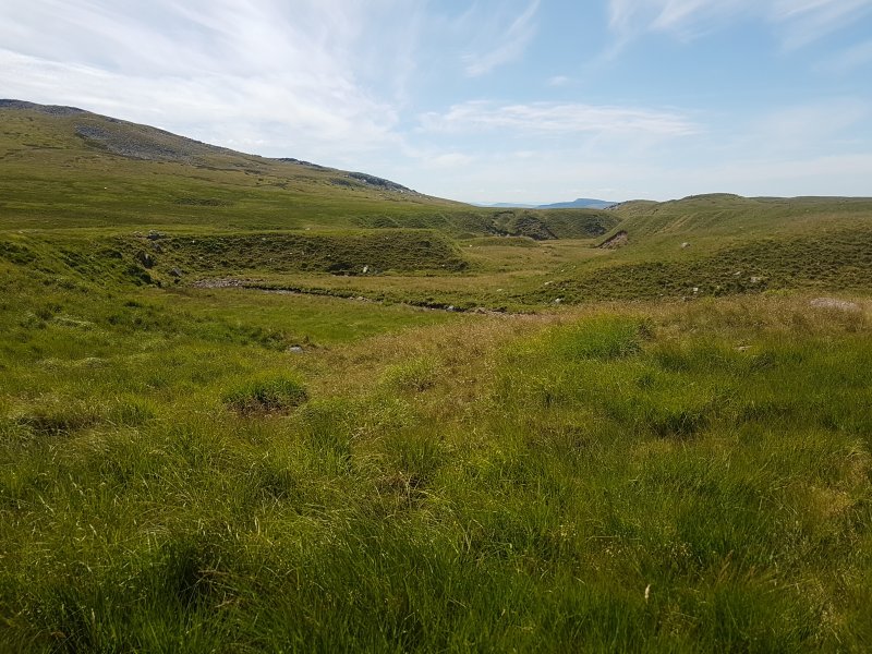 The deeply incised Afon Giedd valley below Ogof Dewi Sant, looking towards Mynydd Marchywell (418 metres), a small hill overlooking Neath. Incidentally, this is the upper Afon Giedd, which only flows as far as the nearby rock outcrops where it sinks. Beyond there, a new river starts, which is confusingly also called the Afon Giedd, even though the two rivers flow in completely different directions, and do not share any water.
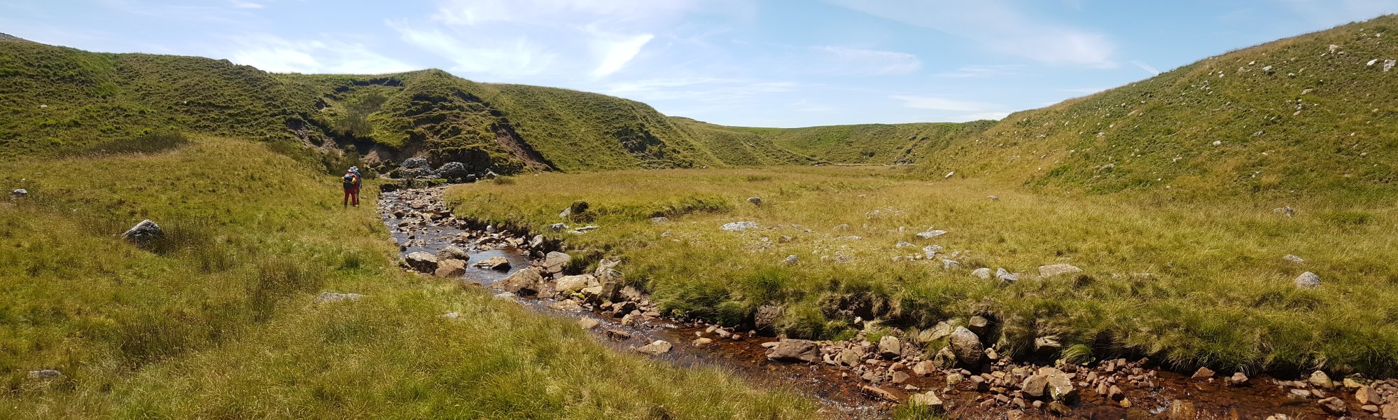 The (upper) Afon Giedd in its little valley.
Modelling by Pete and Gareth
The (upper) Afon Giedd in its little valley.
Modelling by Pete and Gareth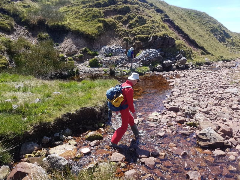 Another stream joins, and the Afon Giedd then almost completely sinks into the river bed on a right bend. Until just a few years ago, the river bed looked normal here, but then a shakehole appeared in the floor of the river, creating a pool.
Modelling by Pete and Gareth
Another stream joins, and the Afon Giedd then almost completely sinks into the river bed on a right bend. Until just a few years ago, the river bed looked normal here, but then a shakehole appeared in the floor of the river, creating a pool.
Modelling by Pete and Gareth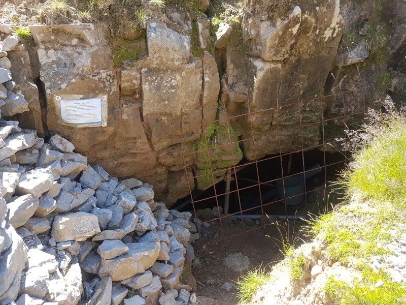 In the crag above the corner is the entrance to Ogof Giedd, one of the authorised digs in the area.
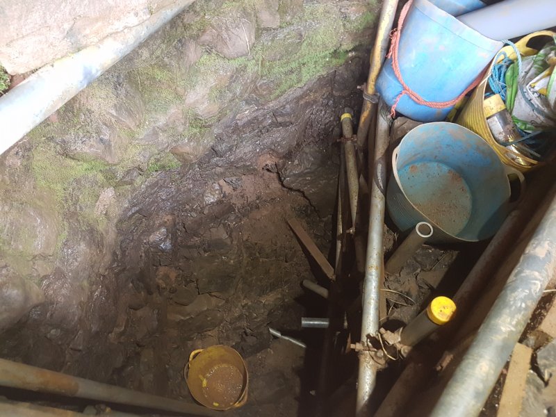 A scaffolded dig drops down to the water's main route.
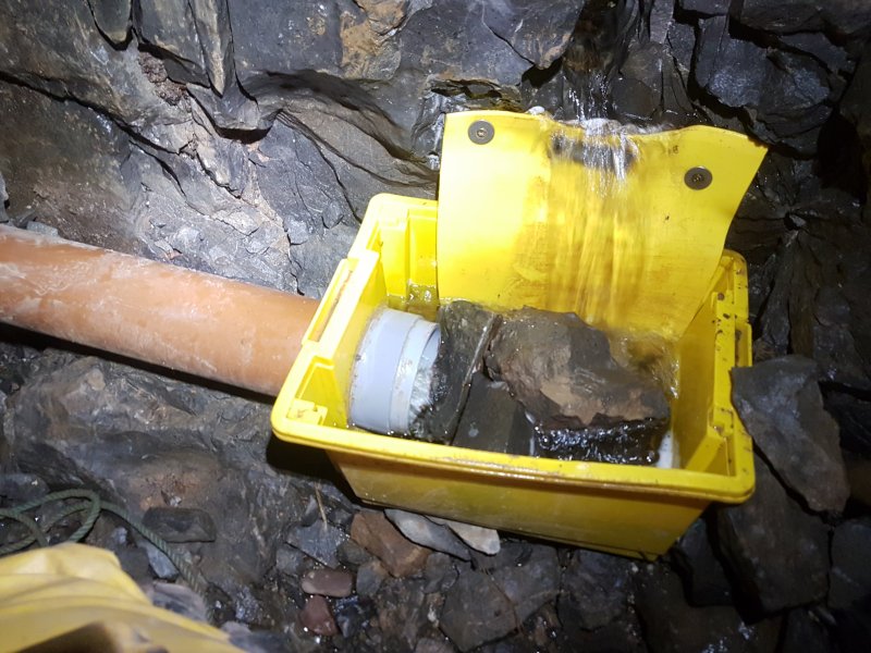 The river water enters and is captured in a rather well made funnel.
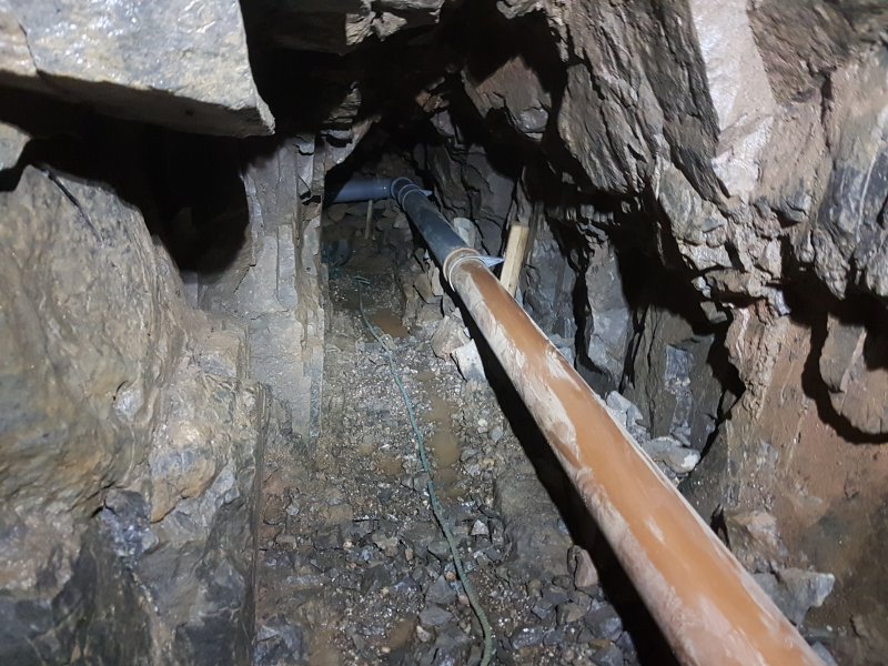 The impressive plumbing system then takes the water to the end, keeping most of the dig dry, and preventing the water from hampering progress.
 The plumbing then ends.
Modelling by Pete
The plumbing then ends.
Modelling by Pete The end funnels the water into a flexible pipe.
Modelling by Gareth and Pete, lighting by Tarquin, Gareth and Pete
The end funnels the water into a flexible pipe.
Modelling by Gareth and Pete, lighting by Tarquin, Gareth and Pete The passage drops down a pipe into a pool.
Modelling by Tarquin
The passage drops down a pipe into a pool.
Modelling by Tarquin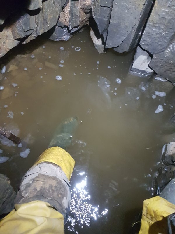 When first found, this was a very wet crawl, and a short section of passage beyond here has been visited once. However, digging work accidentally converted it into a duck, which became a sump. Work is underway to provide access again.
Modelling by Tarquin
When first found, this was a very wet crawl, and a short section of passage beyond here has been visited once. However, digging work accidentally converted it into a duck, which became a sump. Work is underway to provide access again.
Modelling by Tarquin On the next bend, the river sinks into the opposite bank. The water can be heard running in a nearby hole, but the stream does not seem to flow into Ogof Giedd. Perhaps it just continues downstream below the riverbed.
Modelling by Gareth and Pete
On the next bend, the river sinks into the opposite bank. The water can be heard running in a nearby hole, but the stream does not seem to flow into Ogof Giedd. Perhaps it just continues downstream below the riverbed.
Modelling by Gareth and Pete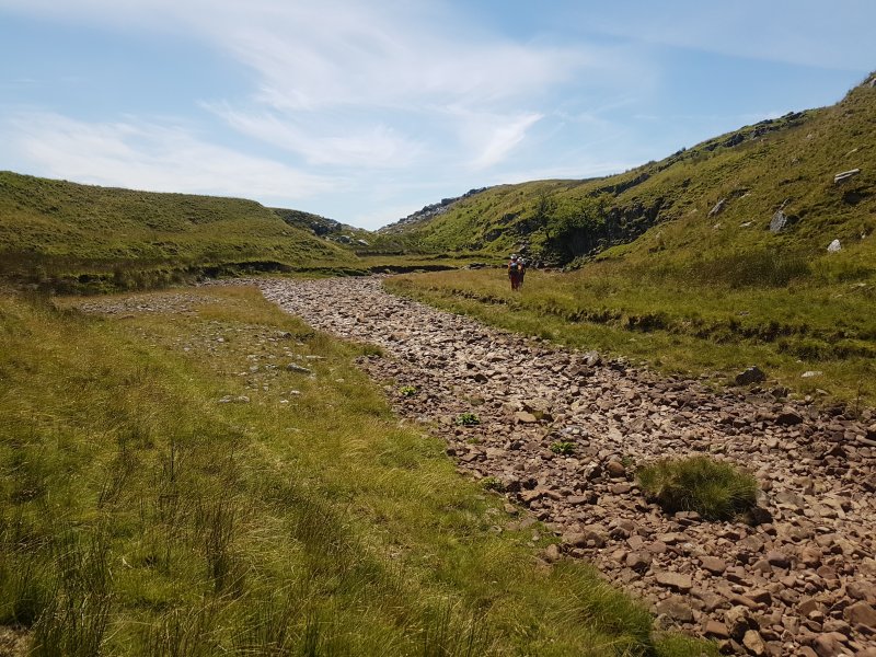 Approaching the main Sinc y Giedd. Even in extreme flood, the river never flows any further than the end of this valley.
Modelling by Pete and Gareth
Approaching the main Sinc y Giedd. Even in extreme flood, the river never flows any further than the end of this valley.
Modelling by Pete and Gareth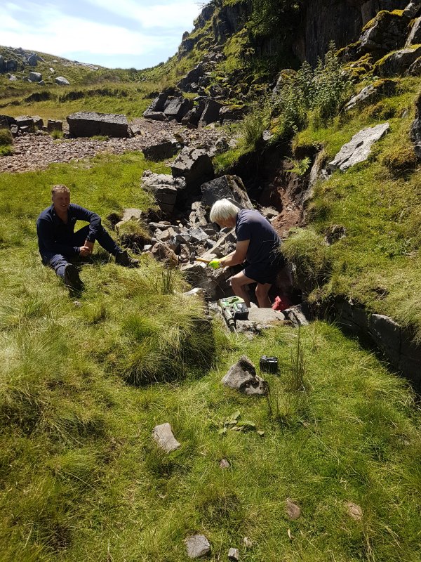 The river bank had very recently collapsed, and we met a couple of cavers who were busy investigating a small tube in the collapse.
 The collapse would almost certainly just lead into known cave within Sinc y Giedd, which lies below here, but it's worth investigating anyway, in case it provides access to other parts of it.
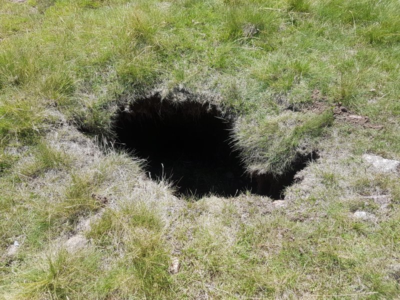 A recent little shakehole nearby.
 The dig lies upstream of the main sink. Another couple of cavers now randomly appeared, having also decided to try visiting the caves here. None of us had intended to meet, so this was a bit of a surprise, and after exchanging pleasantries, we all moved on with visiting the caves that others were not visiting.
Modelling by Gareth and Pete
The dig lies upstream of the main sink. Another couple of cavers now randomly appeared, having also decided to try visiting the caves here. None of us had intended to meet, so this was a bit of a surprise, and after exchanging pleasantries, we all moved on with visiting the caves that others were not visiting.
Modelling by Gareth and Pete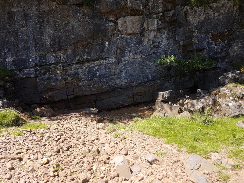 The main sink of Sync y Giedd does not have any known passage; the river just slams into a wall and sinks in the floor. In flood, the amount of water can be phenomenal, running over a metre deep.
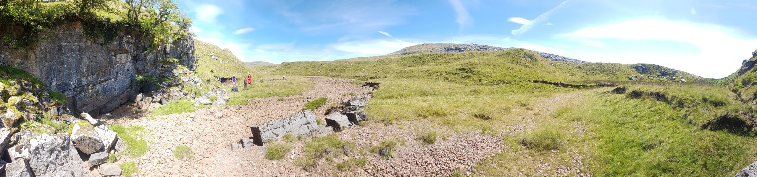 End of the valley, with the main cave of Sinc y Giedd being at the end of the flood overflow valley on the right. The mountains are Fan Brycheiniog on the left and Disgwylfa in the middle.
Modelling by Gareth and Pete
End of the valley, with the main cave of Sinc y Giedd being at the end of the flood overflow valley on the right. The mountains are Fan Brycheiniog on the left and Disgwylfa in the middle.
Modelling by Gareth and Pete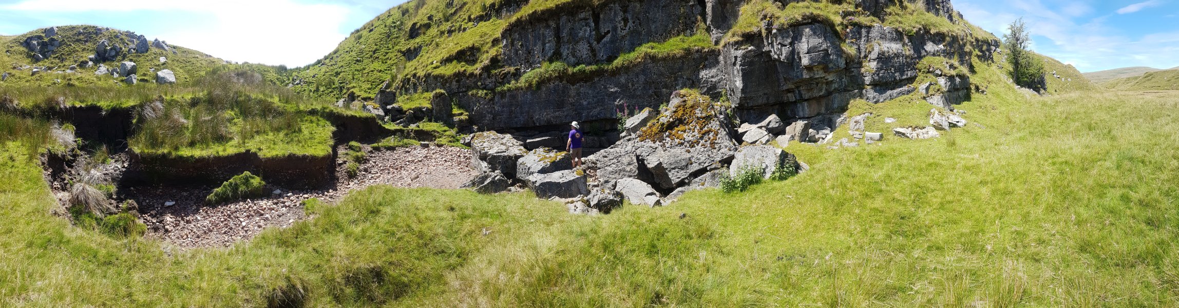 The entrance to the Sinc y Giedd cave lies behind a boulder collapse. Two routes are possible, one on the left into a bedding plane, and a less obvious one between the largest boulders in the middle.
Modelling by Gareth
The entrance to the Sinc y Giedd cave lies behind a boulder collapse. Two routes are possible, one on the left into a bedding plane, and a less obvious one between the largest boulders in the middle.
Modelling by Gareth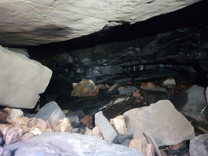 The bedding on the left looks easier, but quickly reaches a tight floor slot, which none of us felt like pushing through. It is supposed to drop into the side passages of the main cave.
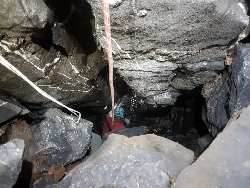 The main way into the cave is between the boulders, and down this pitch, which we had not brought sufficient kit for. The cave below is formed on several levels, but the extreme flooding randomly alters which passages are available. At most, around 180 m of cave was known here until the river blocked parts of it.
Modelling by Gareth, lighting by Tarquin and Gareth
The main way into the cave is between the boulders, and down this pitch, which we had not brought sufficient kit for. The cave below is formed on several levels, but the extreme flooding randomly alters which passages are available. At most, around 180 m of cave was known here until the river blocked parts of it.
Modelling by Gareth, lighting by Tarquin and Gareth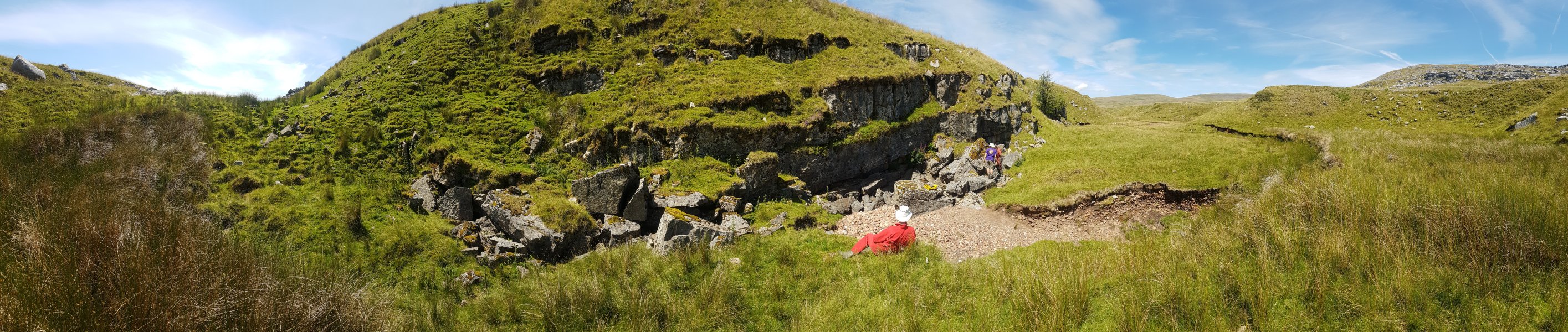 The grassed end of the Giedd valley contains another dig, but no cave is known. From here, you get a good idea of just how much the water must back up against the cave entrances in flood, and just how extreme the flooding must be.
Modelling by Pete and Gareth
The grassed end of the Giedd valley contains another dig, but no cave is known. From here, you get a good idea of just how much the water must back up against the cave entrances in flood, and just how extreme the flooding must be.
Modelling by Pete and Gareth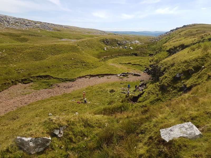 The new collapse was attracting attention, and a couple of others had turned up to take a look, without realising anyone else would be there. It was time to leave, and each of the 4 groups went their separate ways. As cavers, we are often naturally reclusive anyway (why else would we ferret around in stupid holes in the ground where regular mortals fear to tread?), but this whole social distancing situation makes us want to get even further away from others than normal. At least there is plenty of wilderness up here, and we could all find a piece for ourselves.
 Heading over to the next set of caves, where we randomly encountered another caver, staring into holes in the ground. The hills are Mynydd Marchywell, an unnamed lump (486 metres), Garreg Las, Waun Lefrith, Picws Du, Fan Brycheiniog, Fan Hir and Disgwylfa.
Modelling by Gareth and Pete
Heading over to the next set of caves, where we randomly encountered another caver, staring into holes in the ground. The hills are Mynydd Marchywell, an unnamed lump (486 metres), Garreg Las, Waun Lefrith, Picws Du, Fan Brycheiniog, Fan Hir and Disgwylfa.
Modelling by Gareth and Pete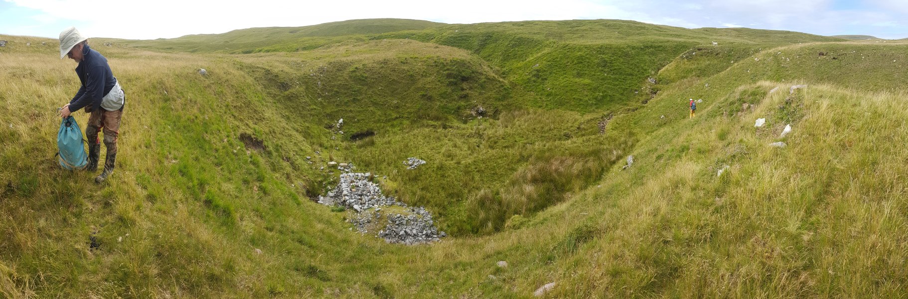 A little further west of Ogof Dewi Sant is the immense sink of Rusty Horseshoe dig. With only a tiny catchment, this sink seems oddly oversized.
Modelling by Gareth and Pete
A little further west of Ogof Dewi Sant is the immense sink of Rusty Horseshoe dig. With only a tiny catchment, this sink seems oddly oversized.
Modelling by Gareth and Pete At one end of the shakehole, a grilled entrance is Rusty Horseshoe Dig, adorned with a rusty horseshoe (of course) and dry stone walled spoil.
Modelling by Pete
At one end of the shakehole, a grilled entrance is Rusty Horseshoe Dig, adorned with a rusty horseshoe (of course) and dry stone walled spoil.
Modelling by Pete The entrance passes through a concrete tube into an area where the ceiling is like a game of ker-plunk.
Lighting by Tarquin and Sol
The entrance passes through a concrete tube into an area where the ceiling is like a game of ker-plunk.
Lighting by Tarquin and Sol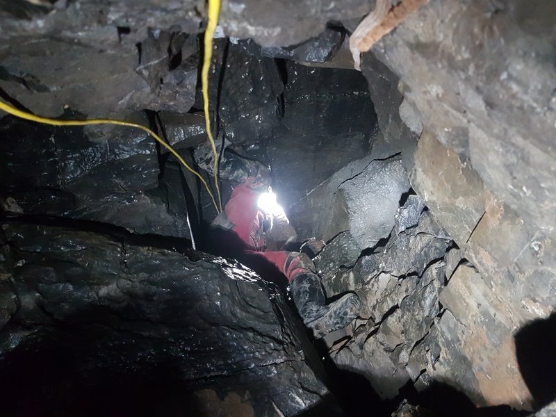 The climb below that ceiling finally gains solid rock.
Modelling by Gareth, lighting by Tarquin and Gareth
The climb below that ceiling finally gains solid rock.
Modelling by Gareth, lighting by Tarquin and Gareth Below the climb, you feed yourself into a narrow slot, and down a series of little climbs.
Modelling by Tarquin
Below the climb, you feed yourself into a narrow slot, and down a series of little climbs.
Modelling by Tarquin The way on passes through a crawl over a load of scaffold bars. None of them seem to be supporting the insanely poised boulder that hangs from nothing above your head.
Lighting by Tarquin and Gareth
The way on passes through a crawl over a load of scaffold bars. None of them seem to be supporting the insanely poised boulder that hangs from nothing above your head.
Lighting by Tarquin and Gareth The cave ends at a collapse after a scaffolding tunnel. Gareth remembers the dig extending further in the past, with a choice of routes around a collapsing section. However, if so, that part is now lost due to collapse. The cave is only about 30 metres long, and so far seems to have failed to encounter the substantial cave promised by the sink.
 A barely visible hole in the moorland is one of the entrances to Ogof No Ogof. It may be free climbable, but certainly not something you would want to fall down.
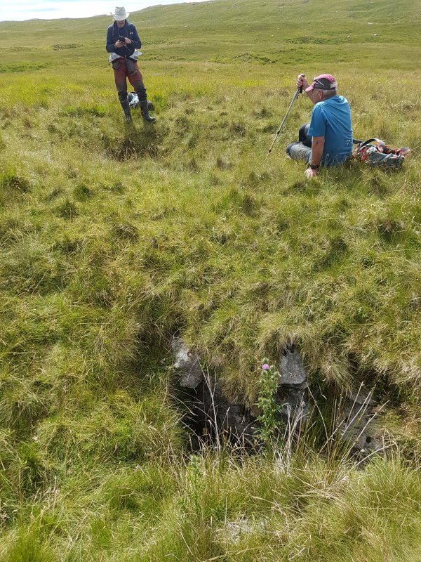 Another shakehole next to it has the concealed crawl entrance, avoiding the climb. This passes under a natural rock arch to reach the bottom of the climb.
Modelling by Gareth
Another shakehole next to it has the concealed crawl entrance, avoiding the climb. This passes under a natural rock arch to reach the bottom of the climb.
Modelling by Gareth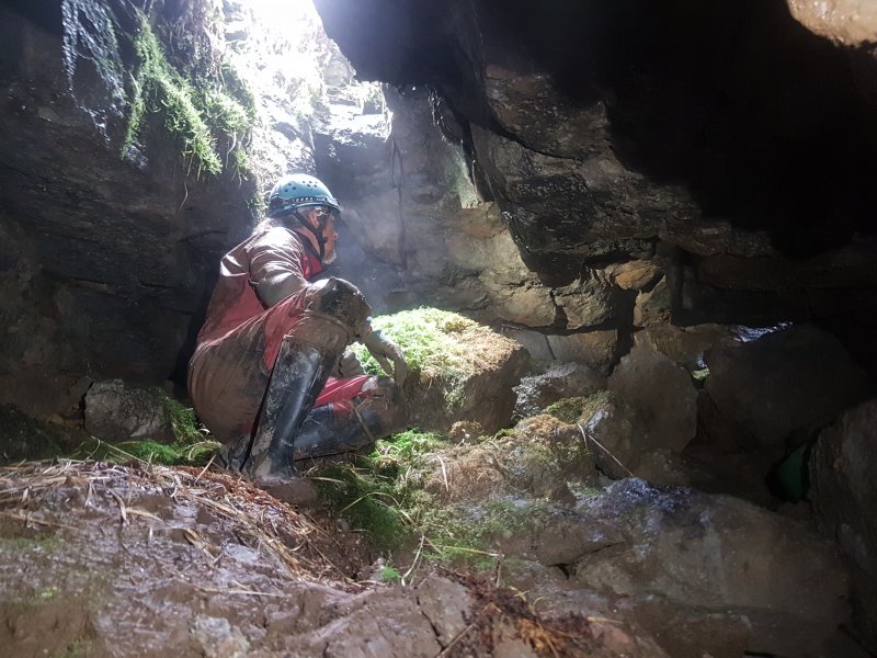 The bottom of the climb, where any unlucky sheep will land.
Modelling by Gareth, lighting by Tarquin, Gareth and Sol
The bottom of the climb, where any unlucky sheep will land.
Modelling by Gareth, lighting by Tarquin, Gareth and Sol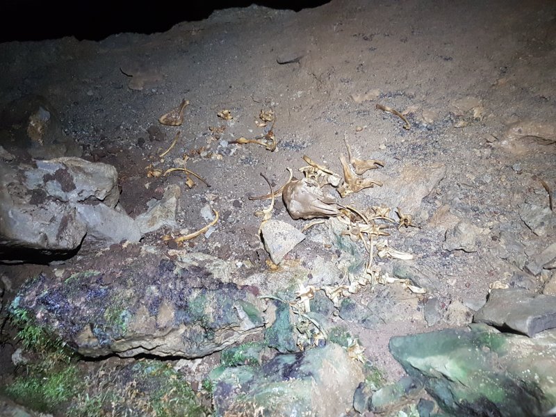 The remains of an unlucky sheep.
Modelling by Shauna
The remains of an unlucky sheep.
Modelling by Shauna Remains of a much larger unlucky animal, probably a mountain pony.
Modelling by Tarquin and Snowfall Magic
Remains of a much larger unlucky animal, probably a mountain pony.
Modelling by Tarquin and Snowfall Magic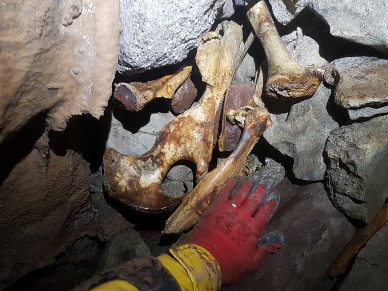 More bones in the left passage, which quickly ends.
Modelling by Tarquin and Snowfall Magic
More bones in the left passage, which quickly ends.
Modelling by Tarquin and Snowfall Magic The main way on is the right passage, which drops down a slope of spoil bags, slowly decaying, into a crawl. Eventually they will slump enough to block the way on.
 The crawl gains and loses a tiny stream, then ends at a narrow climb up some scaffolding. Being so close to the surface already, going up might not seem intuitive, but it worked.
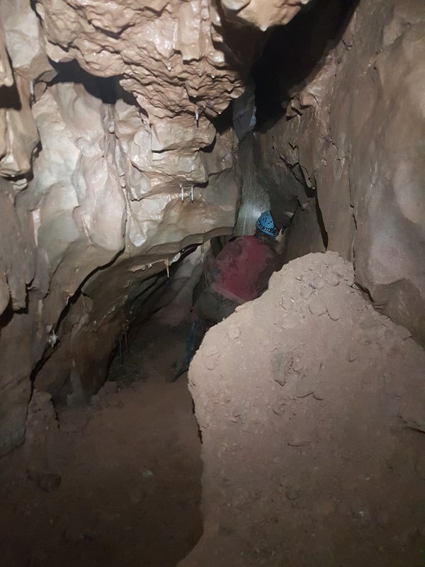 Open passage is regained, complete with a few poor formations.
Modelling by Gareth, lighting by Tarquin and Gareth
Open passage is regained, complete with a few poor formations.
Modelling by Gareth, lighting by Tarquin and Gareth Once again, it ends at a drop down, held back by scaffolding.
Modelling by Gareth
Once again, it ends at a drop down, held back by scaffolding.
Modelling by Gareth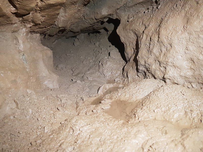 The final dig, full of gunk. Not particularly inspiring.
 The next stream over has a more substantial catchment, and a fairly large valley.
Modelling by Pete and Gareth
The next stream over has a more substantial catchment, and a fairly large valley.
Modelling by Pete and Gareth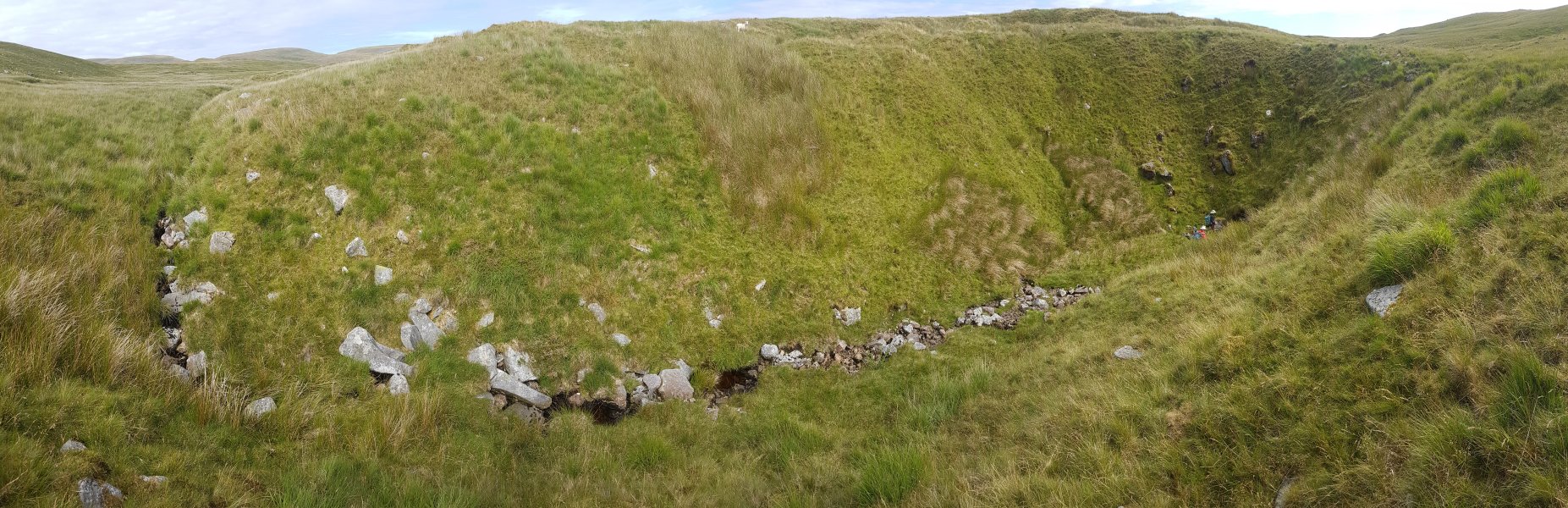 The stream ends abruptly in the giant Ogof Carreg Lem sink.
Modelling by Pete and Gareth
The stream ends abruptly in the giant Ogof Carreg Lem sink.
Modelling by Pete and Gareth The entrance to Ogof Carreg Lem lies at the end of the sink. At 350 metres, this is the longest cave in the area. Most of it is made up from small inlet passages, but it does have a short section of large passage.
Modelling by Gareth
The entrance to Ogof Carreg Lem lies at the end of the sink. At 350 metres, this is the longest cave in the area. Most of it is made up from small inlet passages, but it does have a short section of large passage.
Modelling by Gareth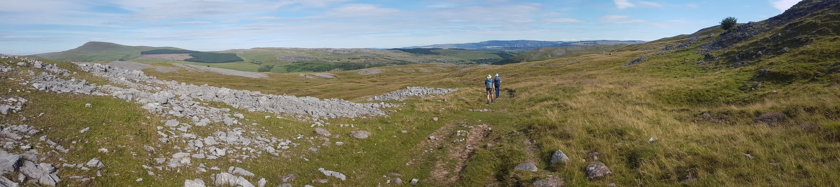 Walking back past Twyn Du and Carreg yr Ogof, with the superb view over the upper Tawe valley. Fan Gyhirych, Fan Fraith, Carreg Cadno and Craig y Llyn.
Modelling by Gareth and Pete
Walking back past Twyn Du and Carreg yr Ogof, with the superb view over the upper Tawe valley. Fan Gyhirych, Fan Fraith, Carreg Cadno and Craig y Llyn.
Modelling by Gareth and Pete