Knock Fell Caverns trip 10/06/2023
This was my first trip to this extensive cave. It is 4.5 km long, and has a maze cave structure so perfect that the survey looks more like graph paper than an actual cave, stretching just 342 metres in length and 130 metres wide, all formed on one major level, with a few passages dropping a couple of metres into a level below it. The round trip which this gallery covers is significantly less than 1 km in length, but we probably stretched it to over 1 km given our detours and additions, taking 3 hours for the whole trip.
The mind blowing thing is that the surface is absolutely peppered with shakeholes for the entire range of mountains, all following a contour ring for 8 km along the mountains, with another line of them 110 metres lower down going much further along the mountains. There are abandoned resurgences 400 metres lower down the same mountain (though separated by several non-cave bearing layers, including an igneous intrusion sill 200 metres down the mountain). The cave sits to one side of the upper line of shakeholes, with its entrance in one of them. This shows that the potential for more cave here is immense, and this is not the entire cave. It is just the fragment that has been found so far, and there are hundreds or thousands of kilometres of this cave system, just waiting to be found, on several major development levels.
In spite of sitting just below the surface, and having numerous points to take in water, the cave is completely fossil, so there must be lower levels draining it. It was formed as a phreatic maze, but there is no current catchment big enough to supply it, and it formed when there was more mountain surrounding it, a number of ice ages ago. The development was as a hypogenic cave, as part of the local groundwater, rather than an active river. This can be seen by the complete lack of scallops. The cave is in what must be some of the highest limestone in Britain, with a thick band of high quality limestone as high as 770 metres, just 75 metres to the south of the caves southernmost point. Thin limestone layers can be found interbedded with sandstones as high as 890 metres on nearby Cross Fell, but the thicker limestone beds are actually lower than 770 metres on that mountain. The cave entrance is at 762 metres altitude, with its shakehole passing through the thinly bedded layers into the solid limestone.
Beneath the high quality limestone are layers of limestones and shales, which dip down in all directions, and can be followed without interruptions to as low as 300 metres to the east, and potentially down to 150 metres a lot further away. The depth potential would be insane, but it is unlikely that good caves will have formed in those layers. That also makes it unlikely that the cave could connect to the lower line of shakeholes, and those would relate to a different cave system. The cave's limestone bed extends down to about 730 metres altitude, or 720 metres at its lowest point. The same layer reaches as low as 670 metres on the northeastern side of Cross Fell, but the cave would be unlikely to pass through extensive faulting on Great Dun Fell, so Great Dun Fell and Cross Fell would have to have their own system. The lower ring of shakeholes is formed by another layer of good limestone sitting below a sandstone layer, and there are a few other layers like it in the area.
Unless otherwise stated, camera, setups, lighting, edits and gallery effects by Tarquin. Modelling and lighting at various points will be Dinny Davies and Gwenllian Tawy.
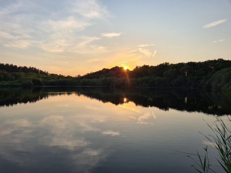
 Hatchmere, in Cheshire, at sunset.
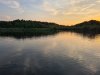 As often happens, this trip started out with a swim to the far side and back, with the sunset scorching the clouds above us.
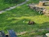 Rabbit in the grounds of Bullpot Farm.
Modelling by Bigwig
Rabbit in the grounds of Bullpot Farm.
Modelling by Bigwig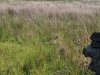 A female pheasant, trying very hard to be invisible.
Modelling by nothing at all
A female pheasant, trying very hard to be invisible.
Modelling by nothing at all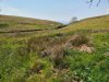 The small valley leading to the Ease Gill caves.
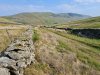 Castle Knott (538 metres) and Calf Top (610 metres), from Bullpot Farm.
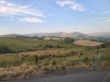 Start of Howgill Fells, a very attractive set of mountains passed on the M6 on the way towards Scotland, but seen here from the south. Master Knott (over 300 metres), Fell Head (642 metres), The Calf (676 metres), Calders (674 metres), Arant Haw (605 metres), Winder (473 metres) and Knoutberry Haw (676 metres).
 Sadly, I was in the back of a moving car, and could not demand to stop for a better version, so deal with it. As often hapens up north, every mountain gets 10 different names depending on which direction you look at it, and which ridge you walk up, but the main tops seen here are Fell Head, The Calf, Calders and Arant Haw.
 Ulldale Head (530 metres), two arms of Fell Head and The Calf.
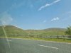 Blease Fell (474 metres) and Uldale Head (530 metres).
 Great Coum, a cirque on Grayrigg Forest (494 metres) with a 180 metre scarp.
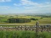 Howgill Fells from the north. Wild Boar Fell (708 metres), Swarth Fell (681 metres), Green Bell (605 metres), Hooksey (586 metres), Randygill Top (624 metres), West Fell (542 metres), Yarlside (639 metres), The Calf, Simon's Seat on Langdale Fell (587 metres), Fell Head, Uldale Head, Blease Fell and Grayrigg Forest.
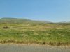 Tanks in front of Roman Fell (594 metres) and Long Fell, part of Burton Fell (745 metres), in the same range as Knock Fell. We had followed the satnav, taking us through the town of Appleby-in-Westmorland, but in spite of getting real-time updates, it completely ignored the Appleby Horse Fair, an annual gathering of 10'000 Gypsies and Travellers, and 30'000 spectators (compared with the town's own population of just 3'000 people), which blocks off half of the town, and made it impossible to get through. Thanks Google Maps. Not. So after getting stuck in the traffic for ages on roads which were not officially blocked off, much of which appeared to have been caused by a road being unofficially blocked off while horse traps and sulkies (buggies) continued past us (heading to a race?), we eventually managed to find a detour that worked, taking us through a military range. A delay of nearly an hour.
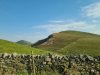 Knock Pike (398) with a quarry, and Dufton Pike (481 metres) behind it, as the private road we are on starts to climb steeply up the mountain.
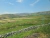 Burney Hill (426 metres), Cross Fell (893 metres), and the slopes of the fell we are ascending.
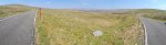 The view from our parking area, roughly where the Pennine Way briefly follows the road. Great Dun Fell (848 metres) on the left. The low and rumbling Round Hill (686 metres), Burnhope Seat (746 metres, and a hilarious name), High Field (708 metres), Three Pikes (651 metres), West Common (649 metres) and Fendrith Hill (697). On the right is Knock Fell (794 metres). The main plateau is at over 500 metres altitude.
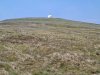 The top of Great Dun Fell is adorned with a radar station for tracking air traffic, and is clearly visible from a long distance away. The road to it is the highest paved road in Britain, running right to the top of the mountain.
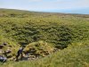 Heading south along the Pennine Way towards Knock Fell, the entrance is in a random shakehole, one out of hundreds. The grid reference we had was wrong by 80 metres, though the Black Rose Caving Club is spot on, and CNCC is only 11 metres to the southwest. A GPS is absolutely essential, because there are so many shakeholes here that you will never find it otherwise, and we did have to waste some time searching, because within that fairly minimal 80 metre error, there were 29 shakeholes!
Modelling by Dinny
Heading south along the Pennine Way towards Knock Fell, the entrance is in a random shakehole, one out of hundreds. The grid reference we had was wrong by 80 metres, though the Black Rose Caving Club is spot on, and CNCC is only 11 metres to the southwest. A GPS is absolutely essential, because there are so many shakeholes here that you will never find it otherwise, and we did have to waste some time searching, because within that fairly minimal 80 metre error, there were 29 shakeholes!
Modelling by Dinny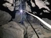 The entrance climb. There are some loose rocks, but we all climbed it without incident. The rope was rigged as a handline, but a ladder or SRT could be used if preferred.
Modelling by Gwenllian, lighting by Tarquin, Gwenllian and Sol
The entrance climb. There are some loose rocks, but we all climbed it without incident. The rope was rigged as a handline, but a ladder or SRT could be used if preferred.
Modelling by Gwenllian, lighting by Tarquin, Gwenllian and Sol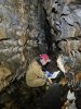 In the diagonal passage (not conforming to the grid!) leading from the Entrance Shaft to the rest of the cave. Immediately, the usual routine starts. We each had a copy of the Gritstone Club survey, and at almost every junction, we would each try to keep track of where we were on our surveys. How on earth did the original explorers manage to navigate this place without a survey?! Most passages have no names, and are identified by their cross section identifiers, or the formation area shading on the annotated version. We are at cross section M1 in this picture. We did notice a few mistakes on the survey; a connection between two chokes between M7 and M3 (I think), and a tiny side passage which was missing, just south of M7, but the survey is an absolute masterpiece, and the cave would be nearly impossible without it. For many people, a compass is advisable in case you get spun around, but we did not use one, and had no issues. The cave is relatively unvisited, and there are so many possible routes that very few routes are heavily worn, with the exception of this passage from the entrance.
Modelling by Dinny, lighting by Tarquin and Dinny
In the diagonal passage (not conforming to the grid!) leading from the Entrance Shaft to the rest of the cave. Immediately, the usual routine starts. We each had a copy of the Gritstone Club survey, and at almost every junction, we would each try to keep track of where we were on our surveys. How on earth did the original explorers manage to navigate this place without a survey?! Most passages have no names, and are identified by their cross section identifiers, or the formation area shading on the annotated version. We are at cross section M1 in this picture. We did notice a few mistakes on the survey; a connection between two chokes between M7 and M3 (I think), and a tiny side passage which was missing, just south of M7, but the survey is an absolute masterpiece, and the cave would be nearly impossible without it. For many people, a compass is advisable in case you get spun around, but we did not use one, and had no issues. The cave is relatively unvisited, and there are so many possible routes that very few routes are heavily worn, with the exception of this passage from the entrance.
Modelling by Dinny, lighting by Tarquin and Dinny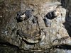 Smile :) Fossil rugose corals, which form a distinctive bed throughout a lot of the cave. The bottom one looks like a banana peel.
Modelling by the Nome King's gnome
Smile :) Fossil rugose corals, which form a distinctive bed throughout a lot of the cave. The bottom one looks like a banana peel.
Modelling by the Nome King's gnome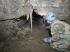 Stalactite near the W3 cross section. This section does not have formations that are good enough to deserve a detour.
Modelling by Gwenllian, lighting by Tarquin and Gwenllian
Stalactite near the W3 cross section. This section does not have formations that are good enough to deserve a detour.
Modelling by Gwenllian, lighting by Tarquin and Gwenllian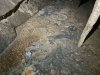 Crystal pool by the stalactite.
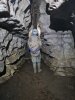 Passage at M5. We have started on the Round Trip route, anticlockwise. There are little route marker tapes throughout the cave, to help with navigation, and we were apparently going in reverse. The markers are, however, inconsistent, and not reliable for navigation.
Modelling by Gwenllian, lighting by Tarquin and Gwenllian
Passage at M5. We have started on the Round Trip route, anticlockwise. There are little route marker tapes throughout the cave, to help with navigation, and we were apparently going in reverse. The markers are, however, inconsistent, and not reliable for navigation.
Modelling by Gwenllian, lighting by Tarquin and Gwenllian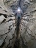 Traverse between M5 and M7 (parallel to M6). The ledges are such a characteristically unusual shape, and very cool. We headed a short distance towards the southernmost point, but there was nothing special about it, so we returned to the round trip.
Modelling by Gwenllian, lighting by Tarquin and Gwenllian
Traverse between M5 and M7 (parallel to M6). The ledges are such a characteristically unusual shape, and very cool. We headed a short distance towards the southernmost point, but there was nothing special about it, so we returned to the round trip.
Modelling by Gwenllian, lighting by Tarquin and Gwenllian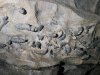 Rugose coral bed at M3.
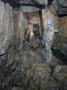 In the big passage leading towards Merlin Cave, E2.
Modelling by Gwenllian and Dinny, lighting by Tarquin, Gwenllian and Dinny
In the big passage leading towards Merlin Cave, E2.
Modelling by Gwenllian and Dinny, lighting by Tarquin, Gwenllian and Dinny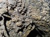 Most of the eastern side of the cave has cryostal deposits, with these at E2. This clearly shows that the cave is older than at least one ice age, and that is hardly a surprise. The ample loose breakdown had already suggested that this would be the case. The comforting thing about this is that most of the breakdown is old, even though it often looks recent.
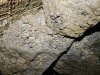 Cryostal.
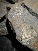 Cryostal
 The passage then chokes, with a small route through it to reach Merlin Cavern.
Modelling by Gwenllian and Dinny, lighting by Tarquin, Gwenllian and Dinny
The passage then chokes, with a small route through it to reach Merlin Cavern.
Modelling by Gwenllian and Dinny, lighting by Tarquin, Gwenllian and Dinny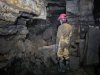 Merlin Cavern. Yes, it actually has a name. This sits almost exactly below the Pennine Way.
Modelling by Dinny, lighting by Tarquin and Dinny
Merlin Cavern. Yes, it actually has a name. This sits almost exactly below the Pennine Way.
Modelling by Dinny, lighting by Tarquin and Dinny Stal in Merlin Cavern.
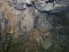 The chamber beyond Merlin Cavern, which is the easternmost part of the cave. It has a distinctive ochre deposit on one side.
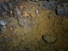 Ochre on a corner near E1, back on the round trip route.
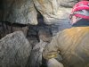 Near the eastern end of Trans-Pennine Passage, in the T4 area.
Modelling by Dinny, lighting by Tarquin, Gwenllian and Dinny
Near the eastern end of Trans-Pennine Passage, in the T4 area.
Modelling by Dinny, lighting by Tarquin, Gwenllian and Dinny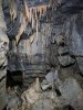 Stal in the calcited area before T1.
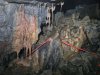 Stal in the calcited area before T1.
 Crystal pool in the calcited area before T1.
 Just after T1.
Modelling by Dinny, lighting by Tarquin and Dinny
Just after T1.
Modelling by Dinny, lighting by Tarquin and Dinny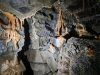 The grotto area north of T1 has very little stal. This was tucked into a the ceiling in a junction area.
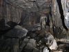 We doubled back through M7 (not marked on the annotated survey), towards the previous grotto area.
Modelling by Dinny, lighting by Tarquin and Dinny
We doubled back through M7 (not marked on the annotated survey), towards the previous grotto area.
Modelling by Dinny, lighting by Tarquin and Dinny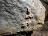 Cryostal at M7. This has been cemented in by modern calcite flow, and its usefulness for analysis is likely to be compromised.
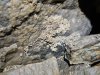 Cryostal.
 Cryostal which has not been cemented.
 Big passage between the grottos.
 Just south of M7 is the next grotto, which is the best one we saw.
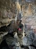 The grotto.
Modelling by Dinny, lighting by Tarquin, Gwenllian and Dinny
The grotto.
Modelling by Dinny, lighting by Tarquin, Gwenllian and Dinny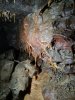 Formations in the grotto.
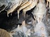 Formations in the grotto.
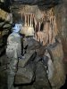 Stal grill in the grotto.
Modelling by Gwenllian, lighting by Tarquin and Gwenllian
Stal grill in the grotto.
Modelling by Gwenllian, lighting by Tarquin and Gwenllian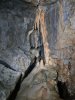 Leaving the grotto towards North-East Series.
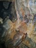 Stal in the passage leading to Myotis Chamber.
 Last section of passage before Myotis Chamber.
Modelling by Dinny, lighting by Tarquin and Dinny
Last section of passage before Myotis Chamber.
Modelling by Dinny, lighting by Tarquin and Dinny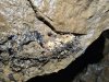 Cryostal in the last section of passage before Myotis Chamber.
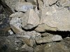 Cryostal in the last section of passage before Myotis Chamber.
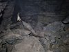 Myotis Chamber.
Modelling by Gwenllian, lighting by Tarquin and Dinny
Myotis Chamber.
Modelling by Gwenllian, lighting by Tarquin and Dinny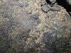 Cryostal in Myotis Chamber.
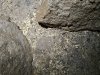 Cryostal in Myotis Chamber.
 Cryostal in Myotis Chamber.
 Cryostal in Myotis Chamber.
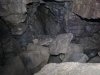 End of Myotis Chamber.
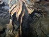 Stal in the passage just before N4, North-East Series.
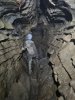 Passage at N2, North-East Series.
Modelling by Gwenllian, lighting by Tarquin and Gwenllian
Passage at N2, North-East Series.
Modelling by Gwenllian, lighting by Tarquin and Gwenllian Cryostal in the cross passage connecting North-East Series and North-West Series. The survey shows a climb down to a lower complex in this area, and maybe that level is where the streams are, but no details are shown on the survey.
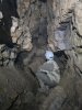 Rocks mostly blocking the passage just after F2. We went most of the way to the northern-most point, but stopped when it got small and wriggly.
Modelling by Gwenllian, lighting by Tarquin and Gwenllian
Rocks mostly blocking the passage just after F2. We went most of the way to the northern-most point, but stopped when it got small and wriggly.
Modelling by Gwenllian, lighting by Tarquin and Gwenllian Just before the narrow section shown with an aven, north of Helm Junction. We have started heading south to close the round trip.
Modelling by Gwenllian, lighting by Tarquin and Gwenllian
Just before the narrow section shown with an aven, north of Helm Junction. We have started heading south to close the round trip.
Modelling by Gwenllian, lighting by Tarquin and Gwenllian This part gets small and wriggly, with a very narrow climb.
Modelling by Gwenllian, lighting by Tarquin and Gwenllian
This part gets small and wriggly, with a very narrow climb.
Modelling by Gwenllian, lighting by Tarquin and Gwenllian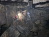 Helm Junction.
Modelling by Dinny and Gwenllian, lighting by Tarquin, Dinny and Gwenllian
Helm Junction.
Modelling by Dinny and Gwenllian, lighting by Tarquin, Dinny and Gwenllian Crossing the narrow ridge at Twin Pits. For once, there actually seems to be a lower level here, but only briefly.
Modelling by Tarquin's appendages
Crossing the narrow ridge at Twin Pits. For once, there actually seems to be a lower level here, but only briefly.
Modelling by Tarquin's appendages Calcited blocks at Twin Pits.
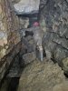 Heading through North-West Series, just after Twin Pits.
Modelling by Dinny, lighting by Tarquin, Gwenllian and Dinny
Heading through North-West Series, just after Twin Pits.
Modelling by Dinny, lighting by Tarquin, Gwenllian and Dinny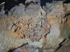 Iron stain at H2.
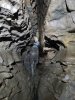 Western end of Trans-Pennine Passage. We soon closed the loop, and surprisingly, we actually recognised it without using route markers, and relocated the entrance. Considering how similar everything is to everything else in this cave, that was quite unexpected.
Modelling by Gwenllian, lighting by Tarquin and Gwenllian
Western end of Trans-Pennine Passage. We soon closed the loop, and surprisingly, we actually recognised it without using route markers, and relocated the entrance. Considering how similar everything is to everything else in this cave, that was quite unexpected.
Modelling by Gwenllian, lighting by Tarquin and Gwenllian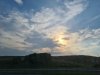 Sunset over the wind turbines at Junction 37, M6.
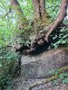 Tree at the River Lune
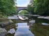 Killington New Bridge over the River Lune.
 Swimming spot on the River Lune, where we relaxed away some time before heading back to Bullpot Farm.
 Hatchmere, in Cheshire, at sunset.
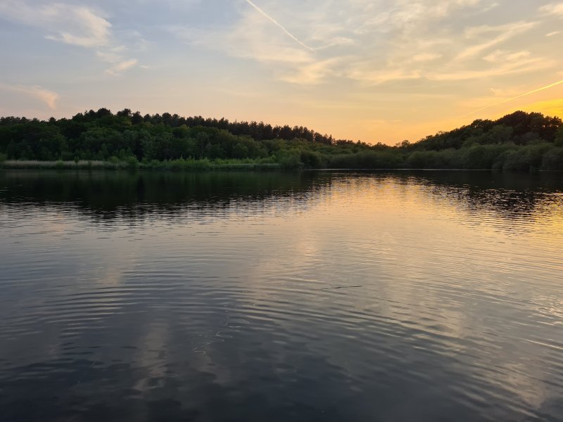 As often happens, this trip started out with a swim to the far side and back, with the sunset scorching the clouds above us.
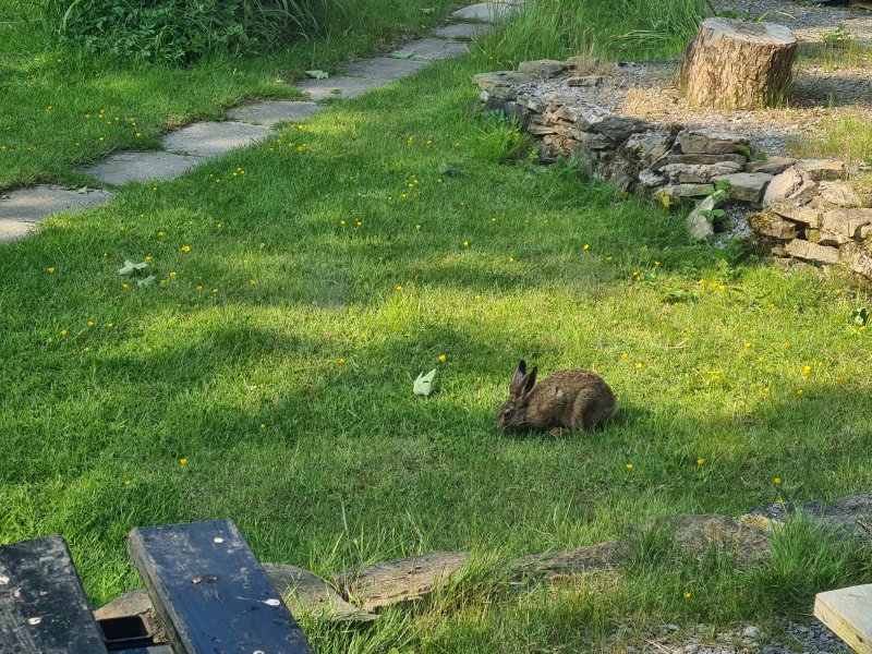 Rabbit in the grounds of Bullpot Farm.
Modelling by Bigwig
Rabbit in the grounds of Bullpot Farm.
Modelling by Bigwig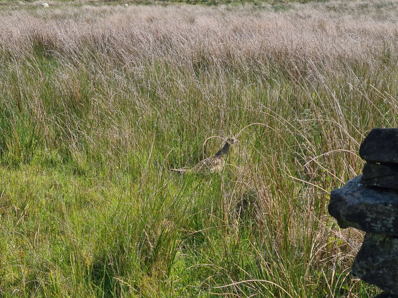 A female pheasant, trying very hard to be invisible.
Modelling by nothing at all
A female pheasant, trying very hard to be invisible.
Modelling by nothing at all The small valley leading to the Ease Gill caves.
 Castle Knott (538 metres) and Calf Top (610 metres), from Bullpot Farm.
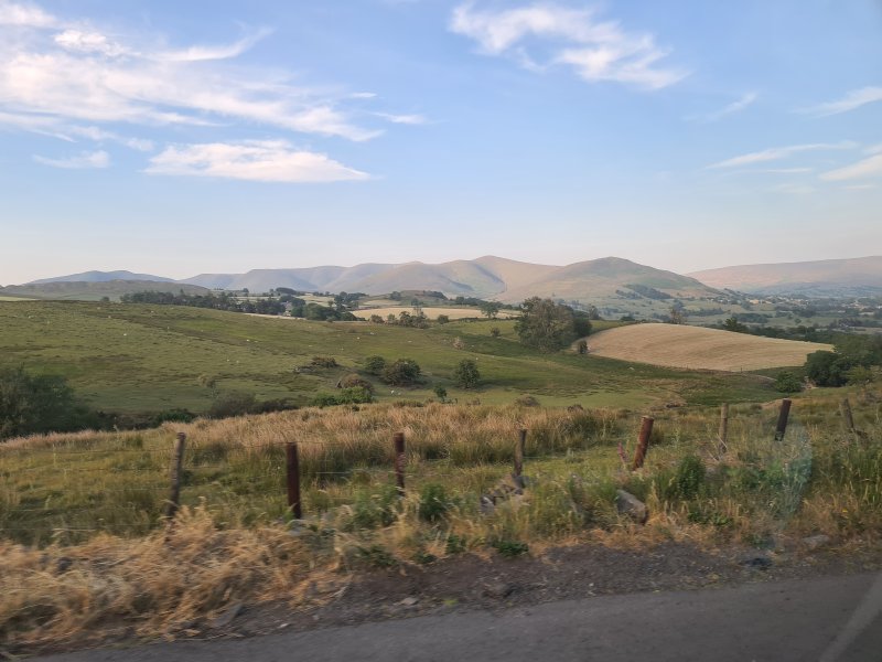 Start of Howgill Fells, a very attractive set of mountains passed on the M6 on the way towards Scotland, but seen here from the south. Master Knott (over 300 metres), Fell Head (642 metres), The Calf (676 metres), Calders (674 metres), Arant Haw (605 metres), Winder (473 metres) and Knoutberry Haw (676 metres).
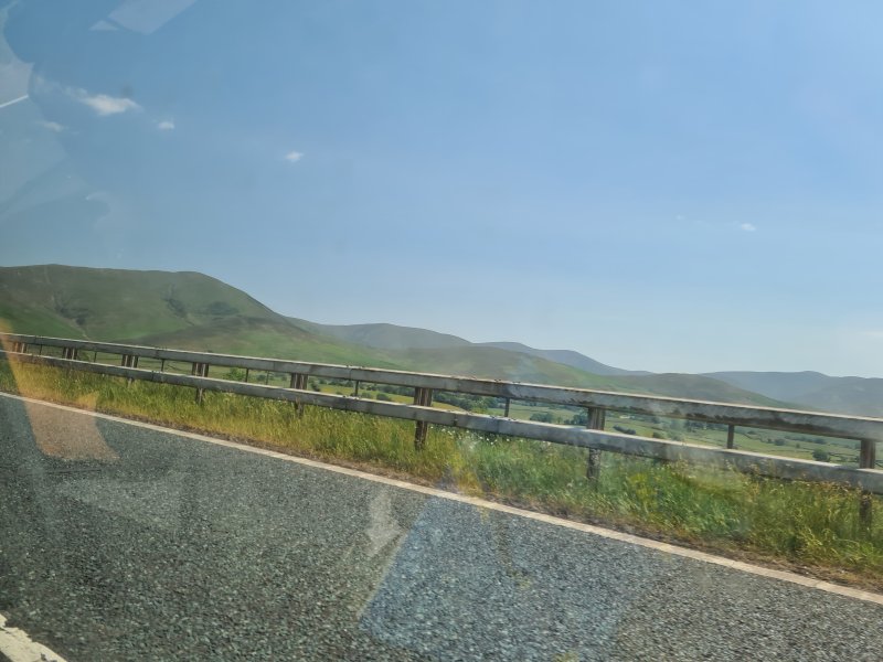 Sadly, I was in the back of a moving car, and could not demand to stop for a better version, so deal with it. As often hapens up north, every mountain gets 10 different names depending on which direction you look at it, and which ridge you walk up, but the main tops seen here are Fell Head, The Calf, Calders and Arant Haw.
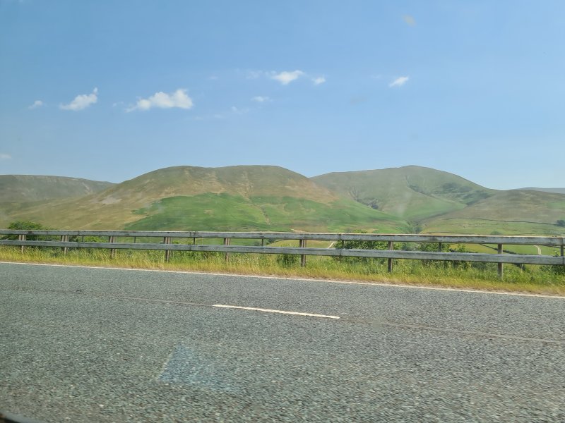 Ulldale Head (530 metres), two arms of Fell Head and The Calf.
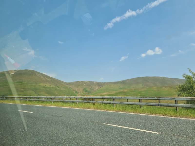 Blease Fell (474 metres) and Uldale Head (530 metres).
 Great Coum, a cirque on Grayrigg Forest (494 metres) with a 180 metre scarp.
 Howgill Fells from the north. Wild Boar Fell (708 metres), Swarth Fell (681 metres), Green Bell (605 metres), Hooksey (586 metres), Randygill Top (624 metres), West Fell (542 metres), Yarlside (639 metres), The Calf, Simon's Seat on Langdale Fell (587 metres), Fell Head, Uldale Head, Blease Fell and Grayrigg Forest.
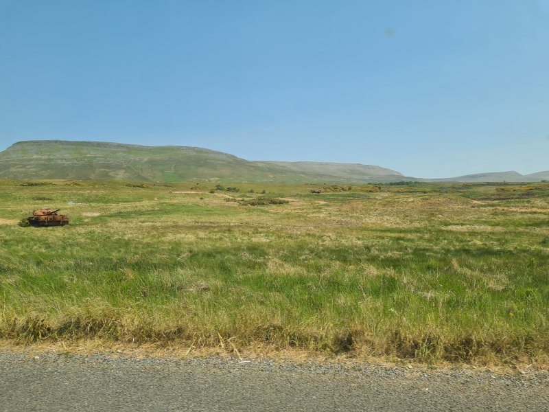 Tanks in front of Roman Fell (594 metres) and Long Fell, part of Burton Fell (745 metres), in the same range as Knock Fell. We had followed the satnav, taking us through the town of Appleby-in-Westmorland, but in spite of getting real-time updates, it completely ignored the Appleby Horse Fair, an annual gathering of 10'000 Gypsies and Travellers, and 30'000 spectators (compared with the town's own population of just 3'000 people), which blocks off half of the town, and made it impossible to get through. Thanks Google Maps. Not. So after getting stuck in the traffic for ages on roads which were not officially blocked off, much of which appeared to have been caused by a road being unofficially blocked off while horse traps and sulkies (buggies) continued past us (heading to a race?), we eventually managed to find a detour that worked, taking us through a military range. A delay of nearly an hour.
 Knock Pike (398) with a quarry, and Dufton Pike (481 metres) behind it, as the private road we are on starts to climb steeply up the mountain.
 Burney Hill (426 metres), Cross Fell (893 metres), and the slopes of the fell we are ascending.
 The view from our parking area, roughly where the Pennine Way briefly follows the road. Great Dun Fell (848 metres) on the left. The low and rumbling Round Hill (686 metres), Burnhope Seat (746 metres, and a hilarious name), High Field (708 metres), Three Pikes (651 metres), West Common (649 metres) and Fendrith Hill (697). On the right is Knock Fell (794 metres). The main plateau is at over 500 metres altitude.
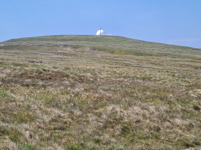 The top of Great Dun Fell is adorned with a radar station for tracking air traffic, and is clearly visible from a long distance away. The road to it is the highest paved road in Britain, running right to the top of the mountain.
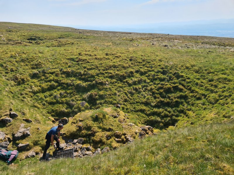 Heading south along the Pennine Way towards Knock Fell, the entrance is in a random shakehole, one out of hundreds. The grid reference we had was wrong by 80 metres, though the Black Rose Caving Club is spot on, and CNCC is only 11 metres to the southwest. A GPS is absolutely essential, because there are so many shakeholes here that you will never find it otherwise, and we did have to waste some time searching, because within that fairly minimal 80 metre error, there were 29 shakeholes!
Modelling by Dinny
Heading south along the Pennine Way towards Knock Fell, the entrance is in a random shakehole, one out of hundreds. The grid reference we had was wrong by 80 metres, though the Black Rose Caving Club is spot on, and CNCC is only 11 metres to the southwest. A GPS is absolutely essential, because there are so many shakeholes here that you will never find it otherwise, and we did have to waste some time searching, because within that fairly minimal 80 metre error, there were 29 shakeholes!
Modelling by Dinny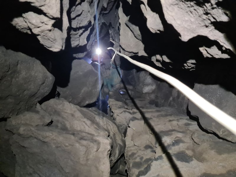 The entrance climb. There are some loose rocks, but we all climbed it without incident. The rope was rigged as a handline, but a ladder or SRT could be used if preferred.
Modelling by Gwenllian, lighting by Tarquin, Gwenllian and Sol
The entrance climb. There are some loose rocks, but we all climbed it without incident. The rope was rigged as a handline, but a ladder or SRT could be used if preferred.
Modelling by Gwenllian, lighting by Tarquin, Gwenllian and Sol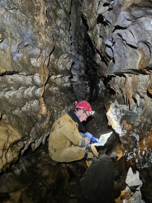 In the diagonal passage (not conforming to the grid!) leading from the Entrance Shaft to the rest of the cave. Immediately, the usual routine starts. We each had a copy of the Gritstone Club survey, and at almost every junction, we would each try to keep track of where we were on our surveys. How on earth did the original explorers manage to navigate this place without a survey?! Most passages have no names, and are identified by their cross section identifiers, or the formation area shading on the annotated version. We are at cross section M1 in this picture. We did notice a few mistakes on the survey; a connection between two chokes between M7 and M3 (I think), and a tiny side passage which was missing, just south of M7, but the survey is an absolute masterpiece, and the cave would be nearly impossible without it. For many people, a compass is advisable in case you get spun around, but we did not use one, and had no issues. The cave is relatively unvisited, and there are so many possible routes that very few routes are heavily worn, with the exception of this passage from the entrance.
Modelling by Dinny, lighting by Tarquin and Dinny
In the diagonal passage (not conforming to the grid!) leading from the Entrance Shaft to the rest of the cave. Immediately, the usual routine starts. We each had a copy of the Gritstone Club survey, and at almost every junction, we would each try to keep track of where we were on our surveys. How on earth did the original explorers manage to navigate this place without a survey?! Most passages have no names, and are identified by their cross section identifiers, or the formation area shading on the annotated version. We are at cross section M1 in this picture. We did notice a few mistakes on the survey; a connection between two chokes between M7 and M3 (I think), and a tiny side passage which was missing, just south of M7, but the survey is an absolute masterpiece, and the cave would be nearly impossible without it. For many people, a compass is advisable in case you get spun around, but we did not use one, and had no issues. The cave is relatively unvisited, and there are so many possible routes that very few routes are heavily worn, with the exception of this passage from the entrance.
Modelling by Dinny, lighting by Tarquin and Dinny Smile :) Fossil rugose corals, which form a distinctive bed throughout a lot of the cave. The bottom one looks like a banana peel.
Modelling by the Nome King's gnome
Smile :) Fossil rugose corals, which form a distinctive bed throughout a lot of the cave. The bottom one looks like a banana peel.
Modelling by the Nome King's gnome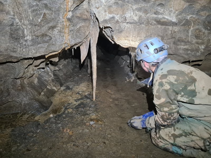 Stalactite near the W3 cross section. This section does not have formations that are good enough to deserve a detour.
Modelling by Gwenllian, lighting by Tarquin and Gwenllian
Stalactite near the W3 cross section. This section does not have formations that are good enough to deserve a detour.
Modelling by Gwenllian, lighting by Tarquin and Gwenllian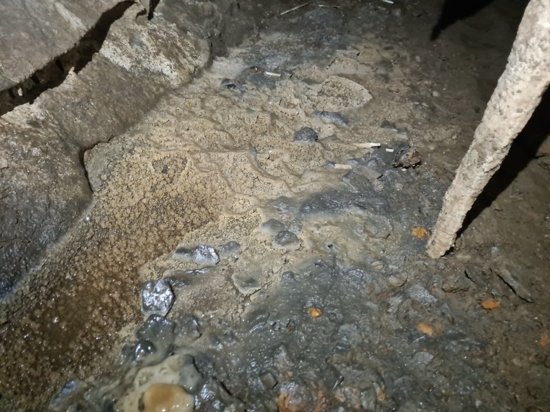 Crystal pool by the stalactite.
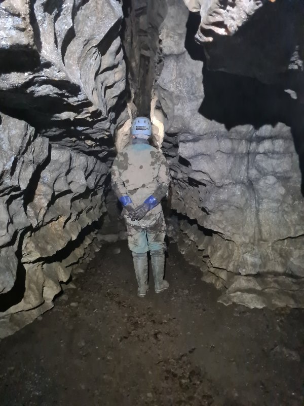 Passage at M5. We have started on the Round Trip route, anticlockwise. There are little route marker tapes throughout the cave, to help with navigation, and we were apparently going in reverse. The markers are, however, inconsistent, and not reliable for navigation.
Modelling by Gwenllian, lighting by Tarquin and Gwenllian
Passage at M5. We have started on the Round Trip route, anticlockwise. There are little route marker tapes throughout the cave, to help with navigation, and we were apparently going in reverse. The markers are, however, inconsistent, and not reliable for navigation.
Modelling by Gwenllian, lighting by Tarquin and Gwenllian Traverse between M5 and M7 (parallel to M6). The ledges are such a characteristically unusual shape, and very cool. We headed a short distance towards the southernmost point, but there was nothing special about it, so we returned to the round trip.
Modelling by Gwenllian, lighting by Tarquin and Gwenllian
Traverse between M5 and M7 (parallel to M6). The ledges are such a characteristically unusual shape, and very cool. We headed a short distance towards the southernmost point, but there was nothing special about it, so we returned to the round trip.
Modelling by Gwenllian, lighting by Tarquin and Gwenllian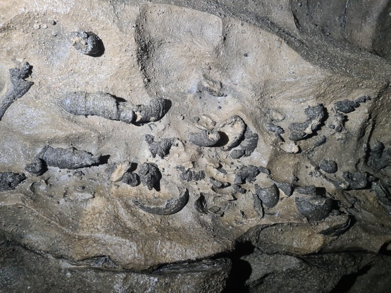 Rugose coral bed at M3.
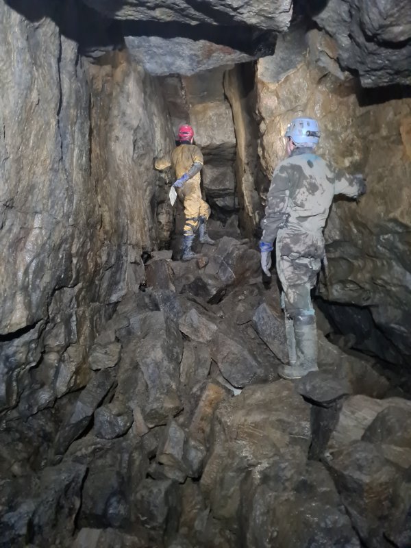 In the big passage leading towards Merlin Cave, E2.
Modelling by Gwenllian and Dinny, lighting by Tarquin, Gwenllian and Dinny
In the big passage leading towards Merlin Cave, E2.
Modelling by Gwenllian and Dinny, lighting by Tarquin, Gwenllian and Dinny Most of the eastern side of the cave has cryostal deposits, with these at E2. This clearly shows that the cave is older than at least one ice age, and that is hardly a surprise. The ample loose breakdown had already suggested that this would be the case. The comforting thing about this is that most of the breakdown is old, even though it often looks recent.
 Cryostal.
 Cryostal
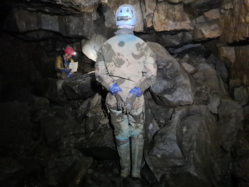 The passage then chokes, with a small route through it to reach Merlin Cavern.
Modelling by Gwenllian and Dinny, lighting by Tarquin, Gwenllian and Dinny
The passage then chokes, with a small route through it to reach Merlin Cavern.
Modelling by Gwenllian and Dinny, lighting by Tarquin, Gwenllian and Dinny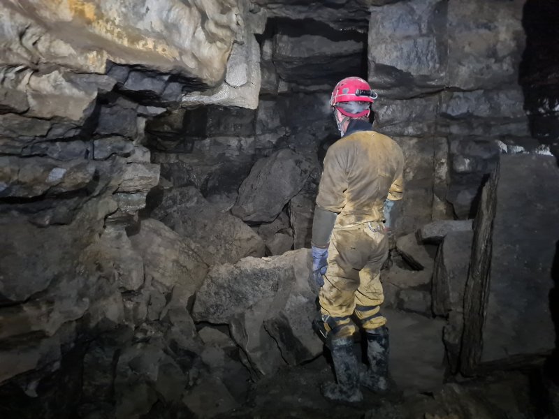 Merlin Cavern. Yes, it actually has a name. This sits almost exactly below the Pennine Way.
Modelling by Dinny, lighting by Tarquin and Dinny
Merlin Cavern. Yes, it actually has a name. This sits almost exactly below the Pennine Way.
Modelling by Dinny, lighting by Tarquin and Dinny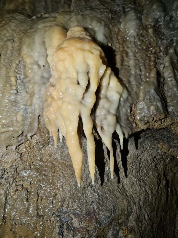 Stal in Merlin Cavern.
 The chamber beyond Merlin Cavern, which is the easternmost part of the cave. It has a distinctive ochre deposit on one side.
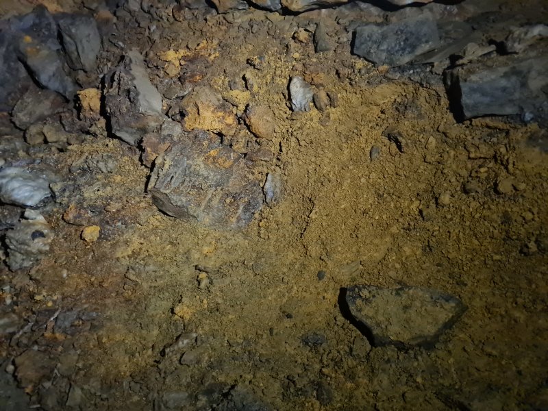 Ochre on a corner near E1, back on the round trip route.
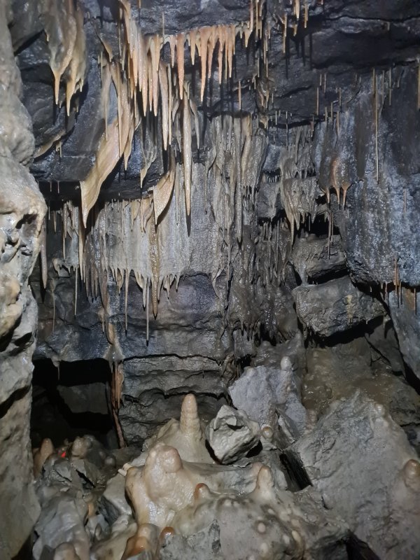 Stal in the calcited area before T1.
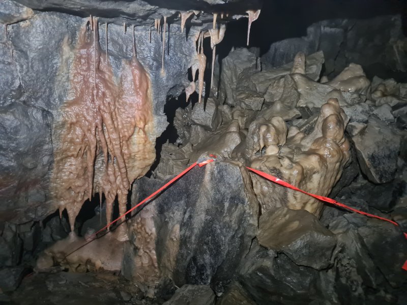 Stal in the calcited area before T1.
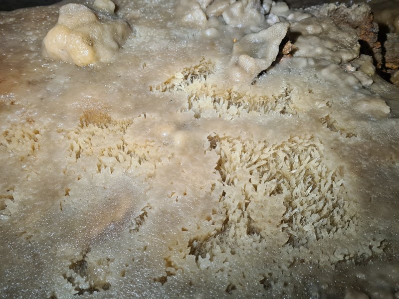 Crystal pool in the calcited area before T1.
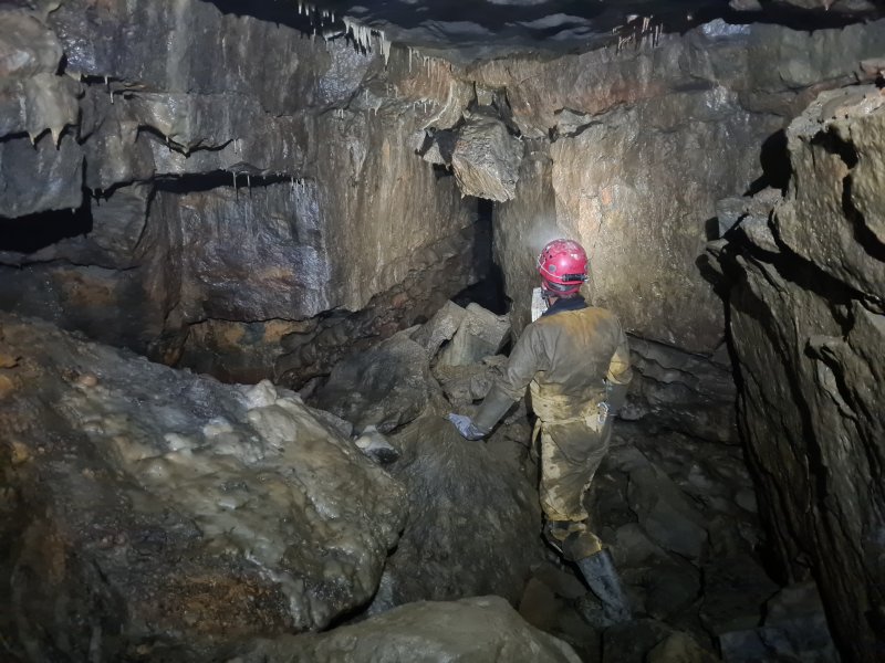 Just after T1.
Modelling by Dinny, lighting by Tarquin and Dinny
Just after T1.
Modelling by Dinny, lighting by Tarquin and Dinny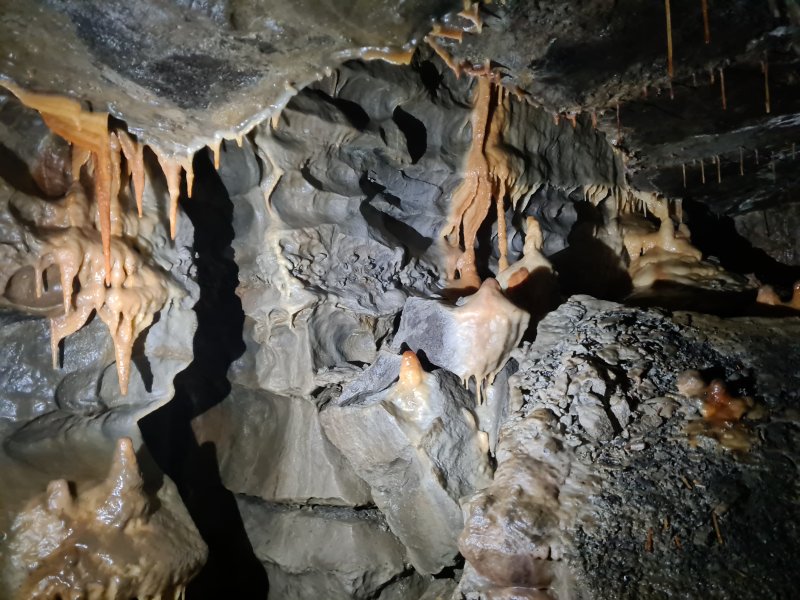 The grotto area north of T1 has very little stal. This was tucked into a the ceiling in a junction area.
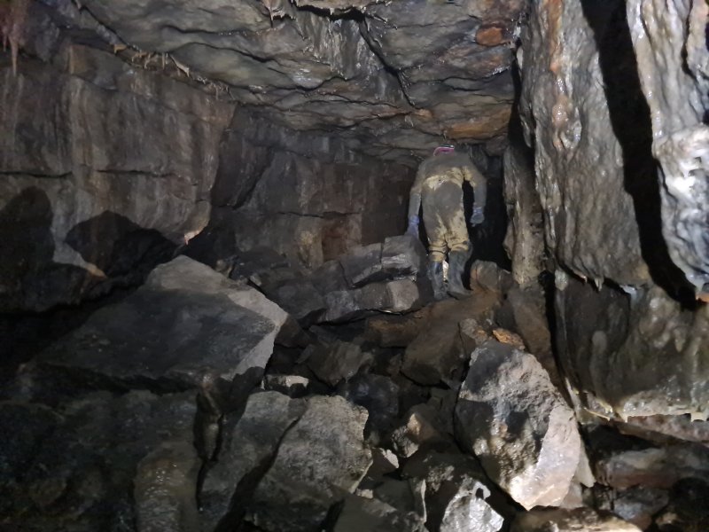 We doubled back through M7 (not marked on the annotated survey), towards the previous grotto area.
Modelling by Dinny, lighting by Tarquin and Dinny
We doubled back through M7 (not marked on the annotated survey), towards the previous grotto area.
Modelling by Dinny, lighting by Tarquin and Dinny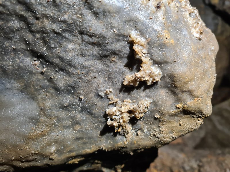 Cryostal at M7. This has been cemented in by modern calcite flow, and its usefulness for analysis is likely to be compromised.
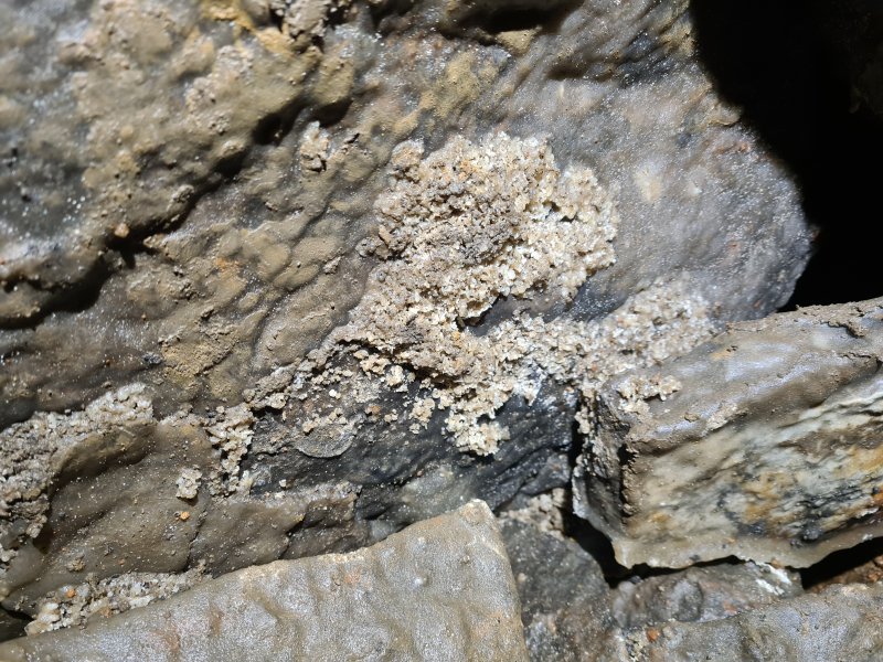 Cryostal.
 Cryostal which has not been cemented.
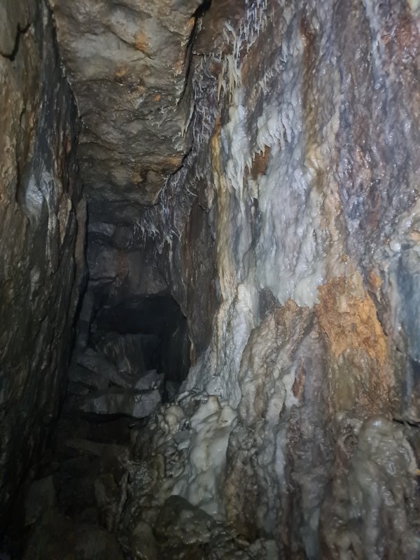 Big passage between the grottos.
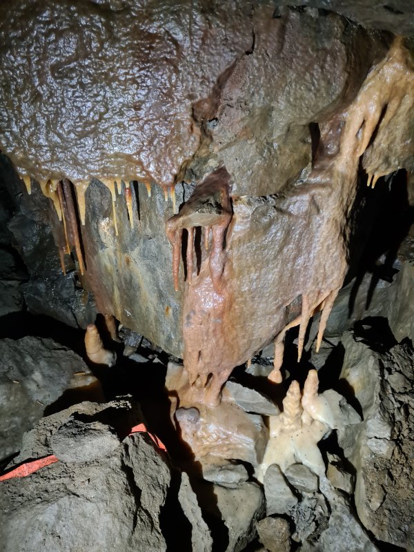 Just south of M7 is the next grotto, which is the best one we saw.
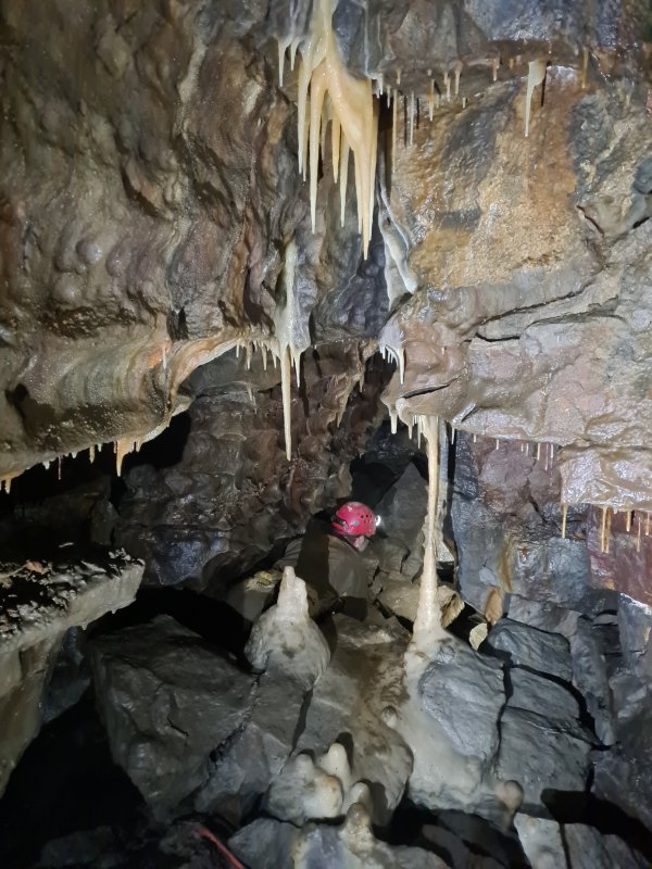 The grotto.
Modelling by Dinny, lighting by Tarquin, Gwenllian and Dinny
The grotto.
Modelling by Dinny, lighting by Tarquin, Gwenllian and Dinny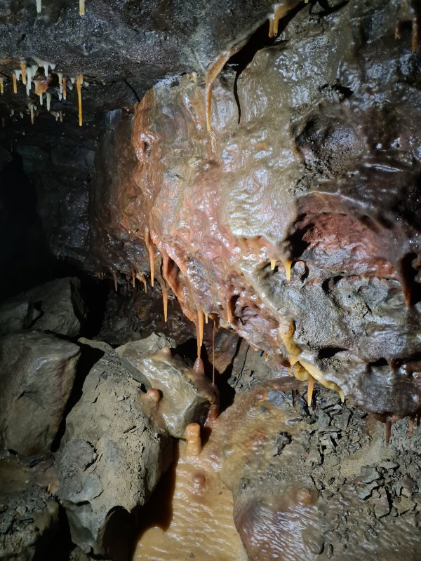 Formations in the grotto.
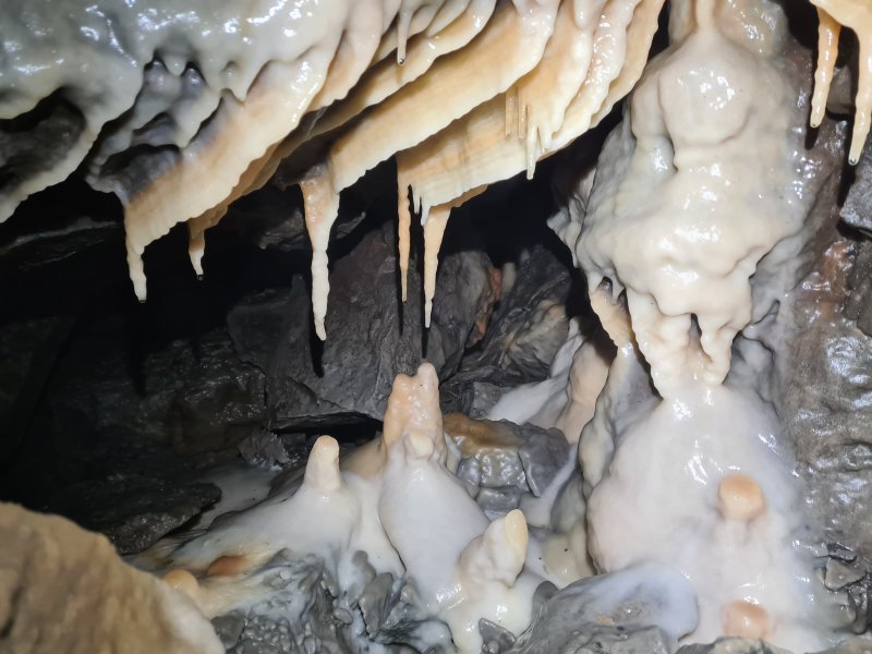 Formations in the grotto.
 Stal grill in the grotto.
Modelling by Gwenllian, lighting by Tarquin and Gwenllian
Stal grill in the grotto.
Modelling by Gwenllian, lighting by Tarquin and Gwenllian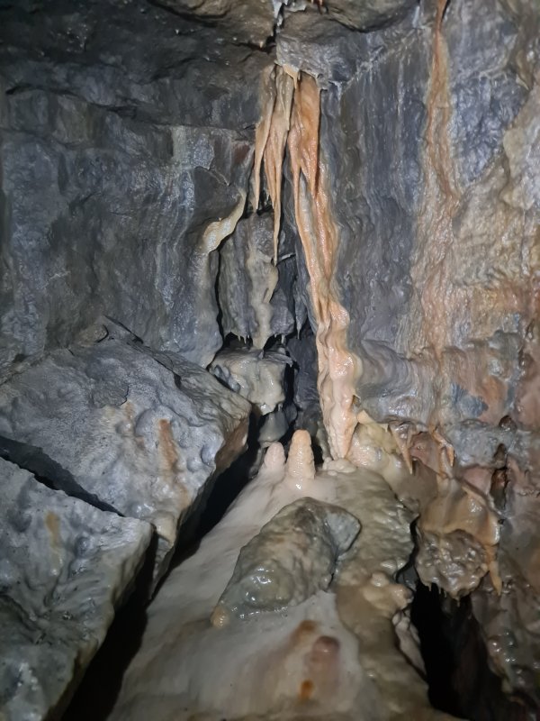 Leaving the grotto towards North-East Series.
 Stal in the passage leading to Myotis Chamber.
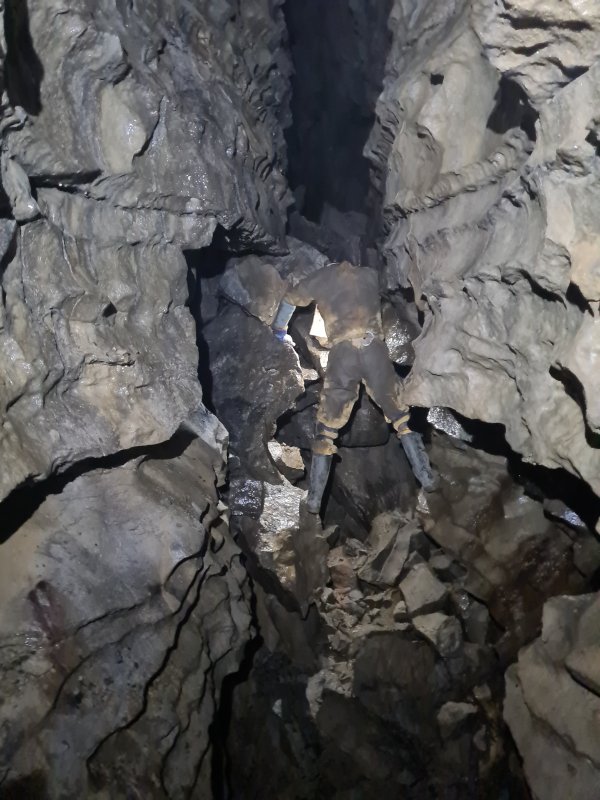 Last section of passage before Myotis Chamber.
Modelling by Dinny, lighting by Tarquin and Dinny
Last section of passage before Myotis Chamber.
Modelling by Dinny, lighting by Tarquin and Dinny Cryostal in the last section of passage before Myotis Chamber.
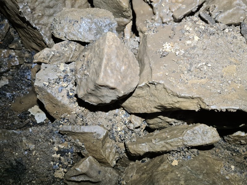 Cryostal in the last section of passage before Myotis Chamber.
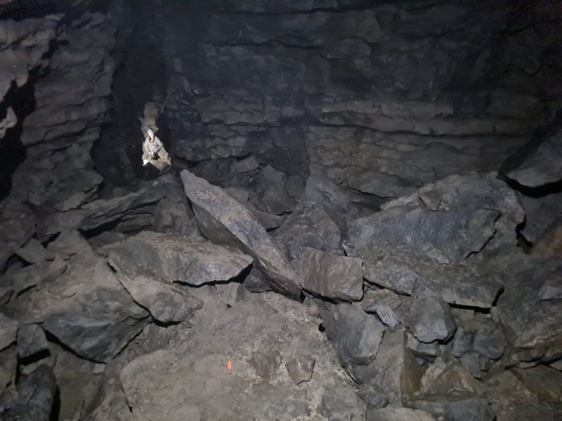 Myotis Chamber.
Modelling by Gwenllian, lighting by Tarquin and Dinny
Myotis Chamber.
Modelling by Gwenllian, lighting by Tarquin and Dinny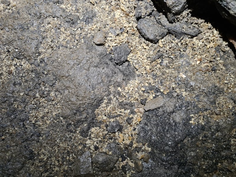 Cryostal in Myotis Chamber.
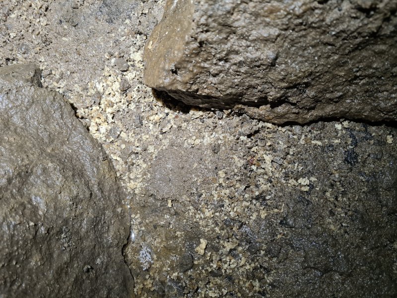 Cryostal in Myotis Chamber.
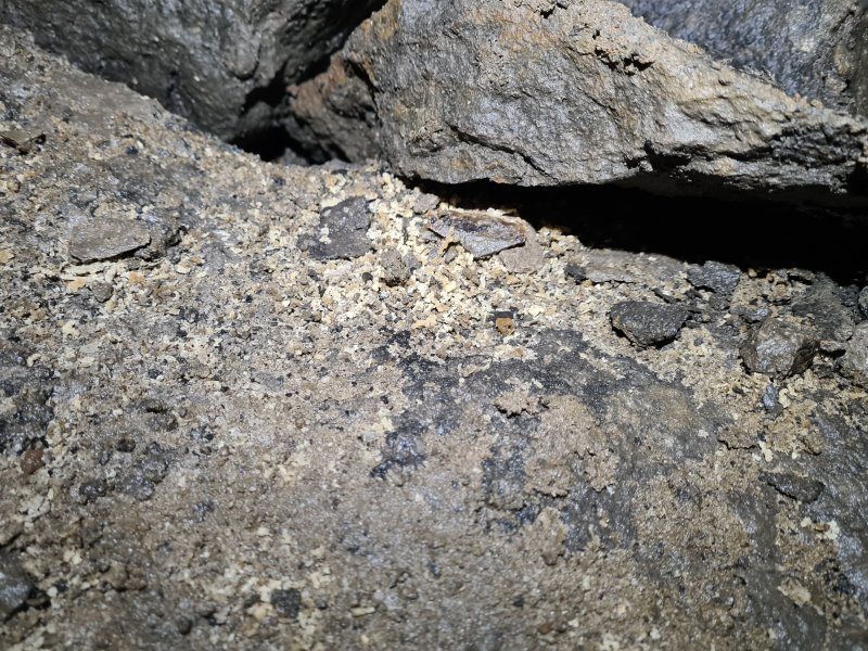 Cryostal in Myotis Chamber.
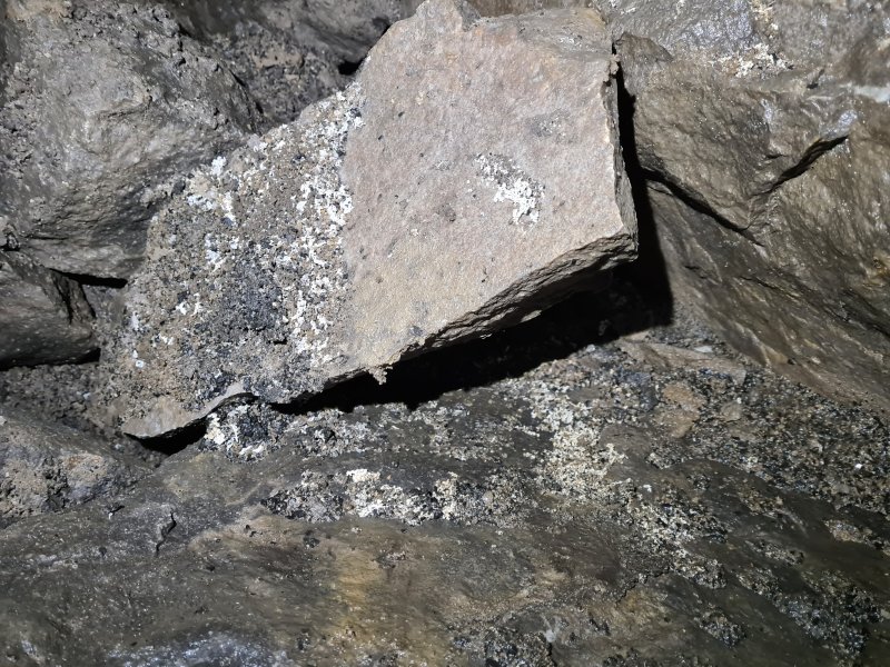 Cryostal in Myotis Chamber.
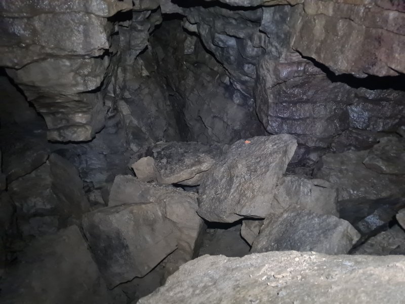 End of Myotis Chamber.
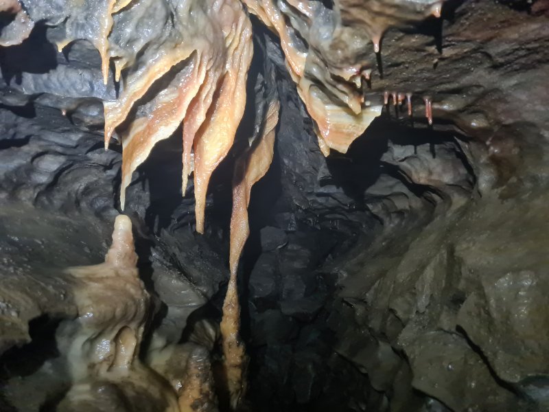 Stal in the passage just before N4, North-East Series.
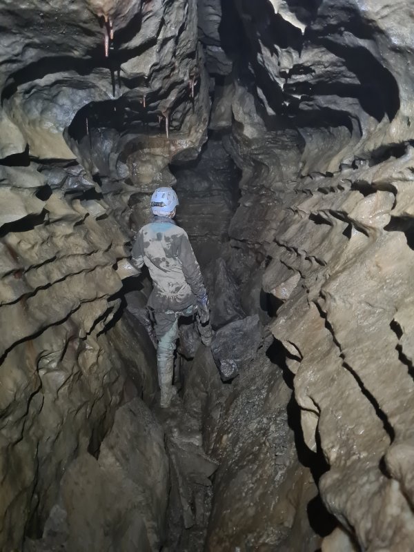 Passage at N2, North-East Series.
Modelling by Gwenllian, lighting by Tarquin and Gwenllian
Passage at N2, North-East Series.
Modelling by Gwenllian, lighting by Tarquin and Gwenllian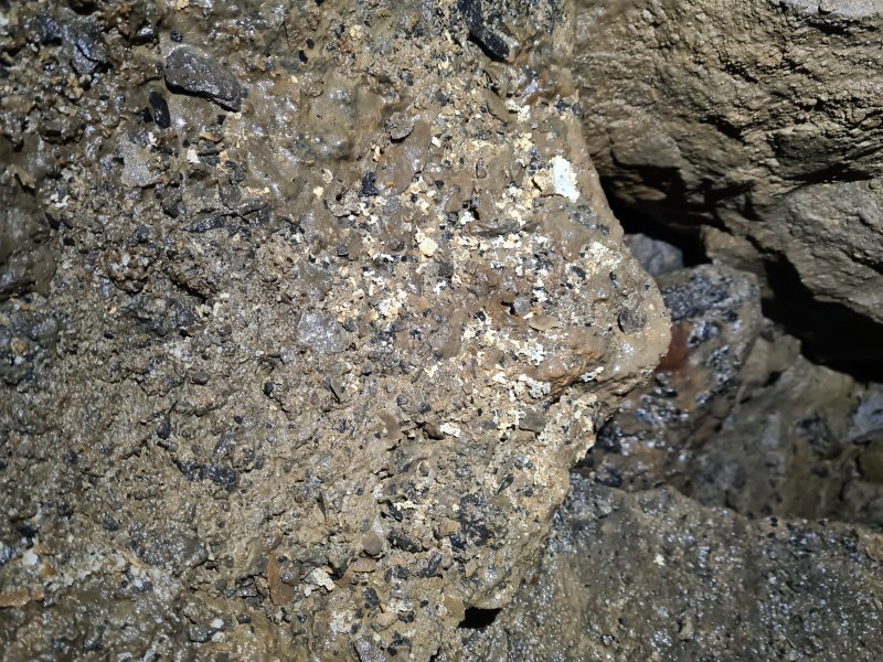 Cryostal in the cross passage connecting North-East Series and North-West Series. The survey shows a climb down to a lower complex in this area, and maybe that level is where the streams are, but no details are shown on the survey.
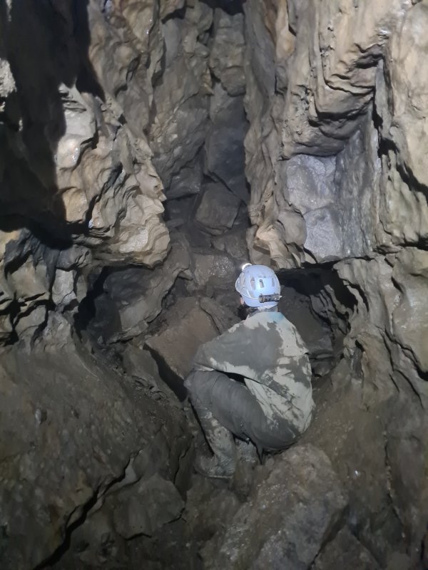 Rocks mostly blocking the passage just after F2. We went most of the way to the northern-most point, but stopped when it got small and wriggly.
Modelling by Gwenllian, lighting by Tarquin and Gwenllian
Rocks mostly blocking the passage just after F2. We went most of the way to the northern-most point, but stopped when it got small and wriggly.
Modelling by Gwenllian, lighting by Tarquin and Gwenllian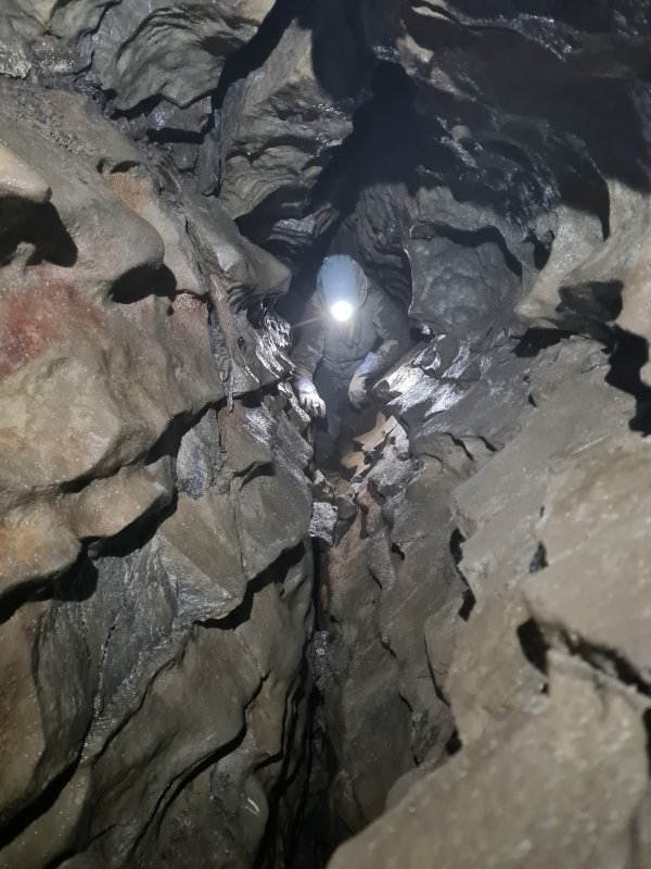 Just before the narrow section shown with an aven, north of Helm Junction. We have started heading south to close the round trip.
Modelling by Gwenllian, lighting by Tarquin and Gwenllian
Just before the narrow section shown with an aven, north of Helm Junction. We have started heading south to close the round trip.
Modelling by Gwenllian, lighting by Tarquin and Gwenllian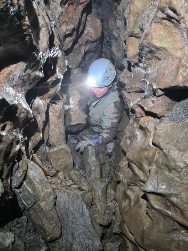 This part gets small and wriggly, with a very narrow climb.
Modelling by Gwenllian, lighting by Tarquin and Gwenllian
This part gets small and wriggly, with a very narrow climb.
Modelling by Gwenllian, lighting by Tarquin and Gwenllian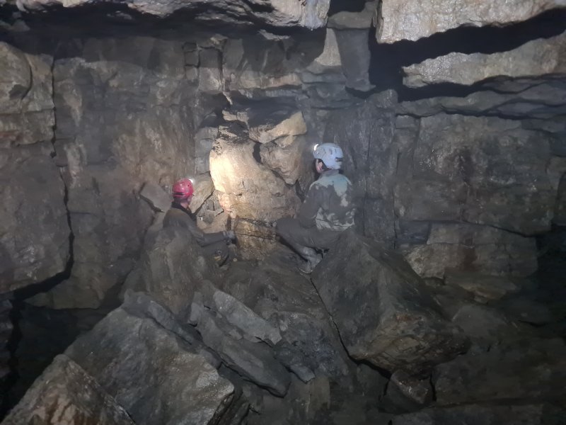 Helm Junction.
Modelling by Dinny and Gwenllian, lighting by Tarquin, Dinny and Gwenllian
Helm Junction.
Modelling by Dinny and Gwenllian, lighting by Tarquin, Dinny and Gwenllian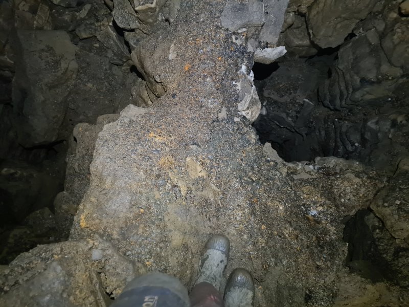 Crossing the narrow ridge at Twin Pits. For once, there actually seems to be a lower level here, but only briefly.
Modelling by Tarquin's appendages
Crossing the narrow ridge at Twin Pits. For once, there actually seems to be a lower level here, but only briefly.
Modelling by Tarquin's appendages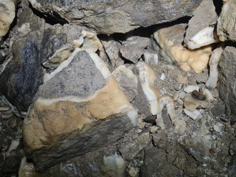 Calcited blocks at Twin Pits.
 Heading through North-West Series, just after Twin Pits.
Modelling by Dinny, lighting by Tarquin, Gwenllian and Dinny
Heading through North-West Series, just after Twin Pits.
Modelling by Dinny, lighting by Tarquin, Gwenllian and Dinny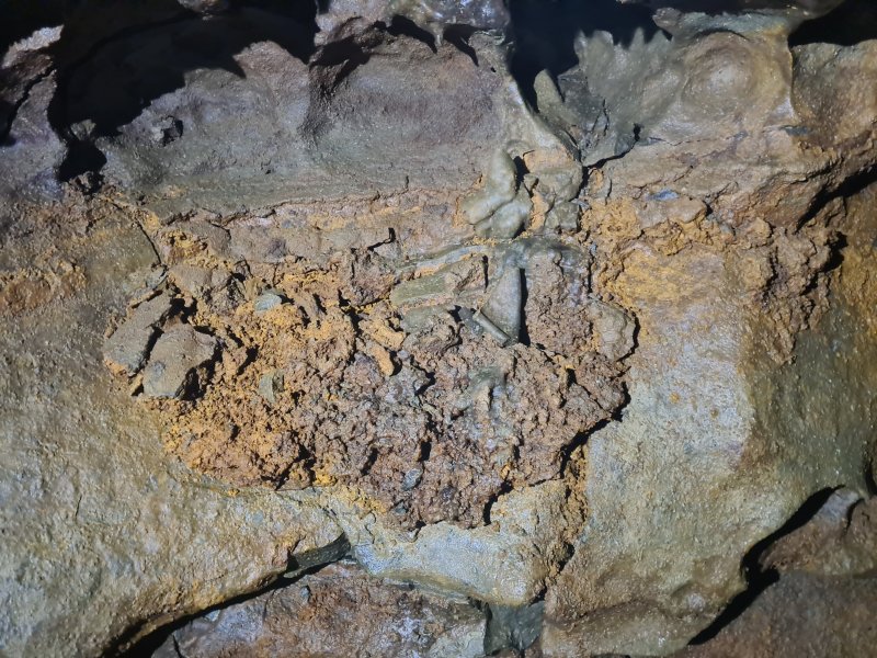 Iron stain at H2.
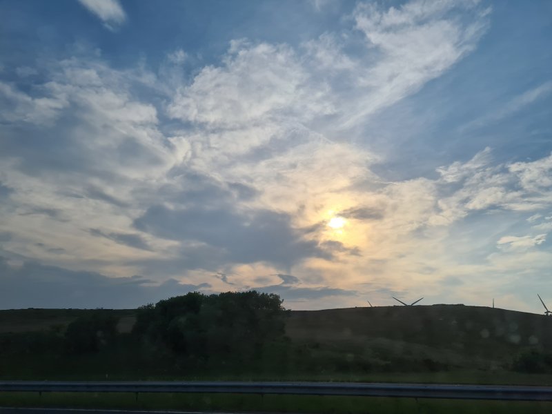 Sunset over the wind turbines at Junction 37, M6.
 Tree at the River Lune
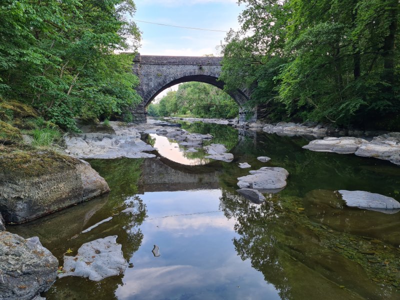 Killington New Bridge over the River Lune.
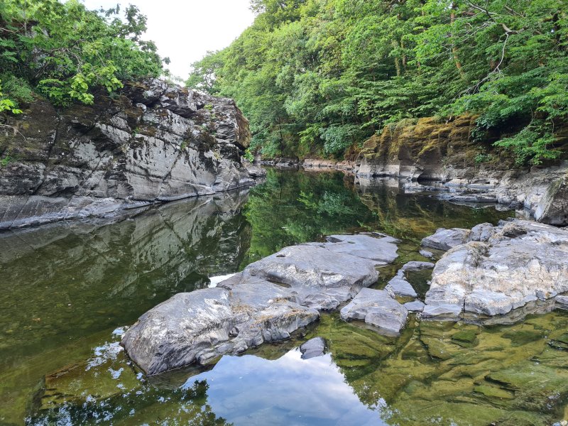 Swimming spot on the River Lune, where we relaxed away some time before heading back to Bullpot Farm.