Mynydd Llangatwg trip 02/04/2023
This was almost entirely a surface trip, prospecting for caves and locating others.
Unless otherwise stated, camera, setups, lighting, edits and gallery effects by Tarquin. Modelling and lighting at various points will be Steph Andrews.
 Main entrance of Eglwys Faen.
Modelling by Steph
Main entrance of Eglwys Faen.
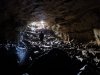
Modelling by Steph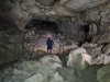 The main passage of Eglwys Faen.
Modelling by Steph, lighting by Tarquin and Steph
The main passage of Eglwys Faen.
Modelling by Steph, lighting by Tarquin and Steph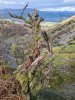 Rotten tree on the ascent above Eglwys Faen. In the background are Pen Allt-mawr (719 metres), Pen Cerrig-calch (701 metres), Table Mountain (about 450 metres), Pen Gwyllt Meirch (580 metres), Disgwylfa (540 metres) and Crug Mawr (550 metres)
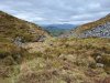 The little valley above Eglwys Faen, which clearly drops into a small depression.
 The rocky remains of a former sink in the depression.
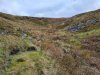 The upper reaches of the valley.
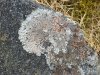 Lichen.
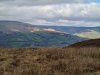 Light on Table Mountain, with Pen Cerrig-calch, Pen Gwyllt Meirch, Disgwylfa and Crug Mawr.
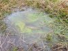 Algae in a puddle.
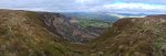 Craig y Cilau, the 200 metre high limestone escarpment, from above. On the left is the higher top of Mynyll Llangatwg (530 metres), then Allt yr Esgair (393 metres), Mynydd Llangorse (515 metres), Mynydd Troed (609 metres), Pen Allt-mawr, Pen y Gadair Fawr (800 metres), Pen Cerrig-calch, Pen Gwyllt Meirch, Disgwylfa, Crug Mawr, Hatterall Hill (531 metres), Gaer (427 metres), Sugar Loaf (596 metres), Edmund's Tump (423 metres) and The Skirrid (486 metres).
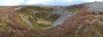 The immense shakehole of Waun Rudd, about 80 metres by 70 metres across, and over 20 metres deep. This is so deep that it punches through all the rock layers, creating the choke at the end of Meander Passage and Swiss Passage, with its water ending up in Meander Passage. It should be noted that there is a larger shakehole in terms of area, at Cascade Sink, which is 120 by 85 metres, but that is only a few metres deep. Pwll-yr-Cawr (above Dan yr Ogof) is another monstrous one which is about 100 by 90 metres, and has a far deeper total depth of about 40 metres, but it sits on a steep slope, and its maximum depth at any point is less than 20 metres. Waun Fignen Felen (near Dan yr Ogof) is about 105 by 65 metres, but is a little under 20 metres deep, and is an erroded sink rather than a shakehole.
Modelling by Steph
The immense shakehole of Waun Rudd, about 80 metres by 70 metres across, and over 20 metres deep. This is so deep that it punches through all the rock layers, creating the choke at the end of Meander Passage and Swiss Passage, with its water ending up in Meander Passage. It should be noted that there is a larger shakehole in terms of area, at Cascade Sink, which is 120 by 85 metres, but that is only a few metres deep. Pwll-yr-Cawr (above Dan yr Ogof) is another monstrous one which is about 100 by 90 metres, and has a far deeper total depth of about 40 metres, but it sits on a steep slope, and its maximum depth at any point is less than 20 metres. Waun Fignen Felen (near Dan yr Ogof) is about 105 by 65 metres, but is a little under 20 metres deep, and is an erroded sink rather than a shakehole.
Modelling by Steph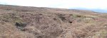 The shakehole that contains Pwll y Pasg on the right and Ogof Llungwyn on the left. The shakehole behind it sits over the Lost Passage choke in Pwll y Pasg. (Ogof Newport is behind the camera).
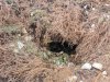 The entrance to Pwll y Pasg. The water in the cave has been dye traced to show that it is a rare example of water making it through the Llanelly Shales, into the lower limestone, emerging in Twin Avens Chamber in Agen Allwedd.
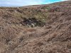 Ogof Llungwyn was found in the early 1980s, and the entrance had already collapsed by the late 1980s.
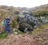 The Ogof Newport sink.
 Ogof Newport.
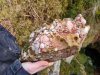 Colourful quartz conglomerate at Ogof Newport. The caves are all formed at the contact between limestone and Twrch sandstone (millstone grit).
Modelling by Steph's gripper
Colourful quartz conglomerate at Ogof Newport. The caves are all formed at the contact between limestone and Twrch sandstone (millstone grit).
Modelling by Steph's gripper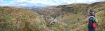 Top of the gully above Agen Allwedd. The mountains are Pen Cerrig-calch, Pen Gwyllt Meirch, Disgwylfa, Crug Mawr, Hatterall Hill, Gaer, Sugar Loaf, a hint of Edmund's Tump and The Skirrid.
Modelling by Steph
Top of the gully above Agen Allwedd. The mountains are Pen Cerrig-calch, Pen Gwyllt Meirch, Disgwylfa, Crug Mawr, Hatterall Hill, Gaer, Sugar Loaf, a hint of Edmund's Tump and The Skirrid.
Modelling by Steph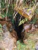 A small stream sinks in the top of the gully.
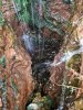 The sink chokes at about 2 metres depth. It is not known where the water goes, but there are no springs on the mountain here, and Agen Allwedd is the nearest cave, with Pwll y Gwynt being a little distance further around the cliff. It probably feeds one of the inlets to Agen Allwedd, but this is in the upper Dowlais limestone beds, so it might resurge under the scree, and re-sink into the lower limestone beds to reach the cave. Pwll y Gwynt is in the upper beds.
 The only passage of any significant size, and it is barely big enough to fit a tiny caver into. It is marked on the survey as AA Gully Cave, but is not in the cave registry. Neither is the sink.
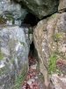 Another nearby entrance, too small for any cavers.
 Main entrance of Eglwys Faen.
Modelling by Steph
Main entrance of Eglwys Faen.
Modelling by Steph The main passage of Eglwys Faen.
Modelling by Steph, lighting by Tarquin and Steph
The main passage of Eglwys Faen.
Modelling by Steph, lighting by Tarquin and Steph Rotten tree on the ascent above Eglwys Faen. In the background are Pen Allt-mawr (719 metres), Pen Cerrig-calch (701 metres), Table Mountain (about 450 metres), Pen Gwyllt Meirch (580 metres), Disgwylfa (540 metres) and Crug Mawr (550 metres)
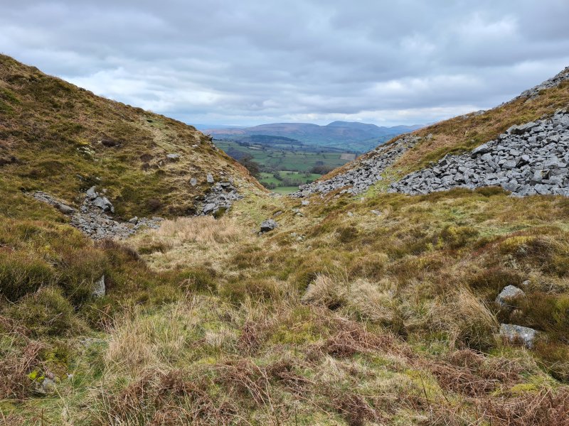 The little valley above Eglwys Faen, which clearly drops into a small depression.
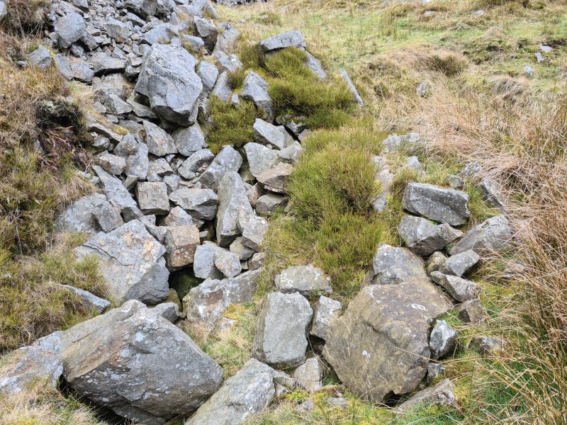 The rocky remains of a former sink in the depression.
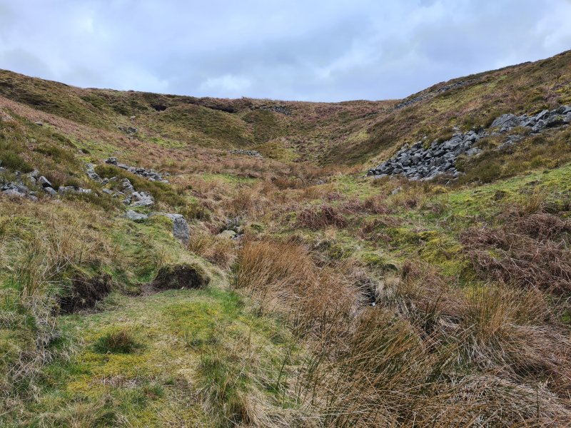 The upper reaches of the valley.
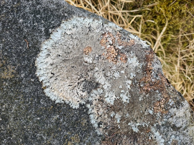 Lichen.
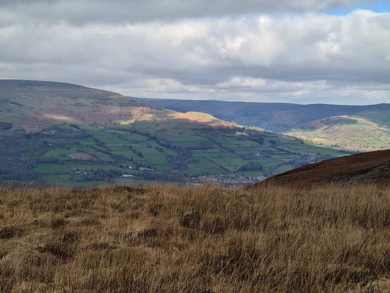 Light on Table Mountain, with Pen Cerrig-calch, Pen Gwyllt Meirch, Disgwylfa and Crug Mawr.
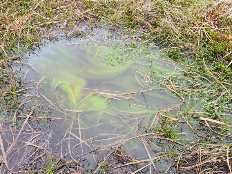 Algae in a puddle.
 Craig y Cilau, the 200 metre high limestone escarpment, from above. On the left is the higher top of Mynyll Llangatwg (530 metres), then Allt yr Esgair (393 metres), Mynydd Llangorse (515 metres), Mynydd Troed (609 metres), Pen Allt-mawr, Pen y Gadair Fawr (800 metres), Pen Cerrig-calch, Pen Gwyllt Meirch, Disgwylfa, Crug Mawr, Hatterall Hill (531 metres), Gaer (427 metres), Sugar Loaf (596 metres), Edmund's Tump (423 metres) and The Skirrid (486 metres).
 The immense shakehole of Waun Rudd, about 80 metres by 70 metres across, and over 20 metres deep. This is so deep that it punches through all the rock layers, creating the choke at the end of Meander Passage and Swiss Passage, with its water ending up in Meander Passage. It should be noted that there is a larger shakehole in terms of area, at Cascade Sink, which is 120 by 85 metres, but that is only a few metres deep. Pwll-yr-Cawr (above Dan yr Ogof) is another monstrous one which is about 100 by 90 metres, and has a far deeper total depth of about 40 metres, but it sits on a steep slope, and its maximum depth at any point is less than 20 metres. Waun Fignen Felen (near Dan yr Ogof) is about 105 by 65 metres, but is a little under 20 metres deep, and is an erroded sink rather than a shakehole.
Modelling by Steph
The immense shakehole of Waun Rudd, about 80 metres by 70 metres across, and over 20 metres deep. This is so deep that it punches through all the rock layers, creating the choke at the end of Meander Passage and Swiss Passage, with its water ending up in Meander Passage. It should be noted that there is a larger shakehole in terms of area, at Cascade Sink, which is 120 by 85 metres, but that is only a few metres deep. Pwll-yr-Cawr (above Dan yr Ogof) is another monstrous one which is about 100 by 90 metres, and has a far deeper total depth of about 40 metres, but it sits on a steep slope, and its maximum depth at any point is less than 20 metres. Waun Fignen Felen (near Dan yr Ogof) is about 105 by 65 metres, but is a little under 20 metres deep, and is an erroded sink rather than a shakehole.
Modelling by Steph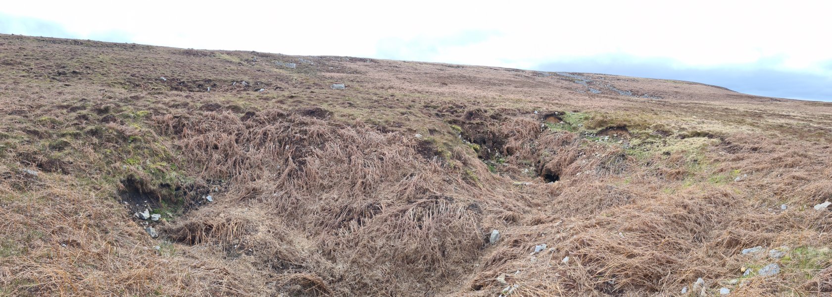 The shakehole that contains Pwll y Pasg on the right and Ogof Llungwyn on the left. The shakehole behind it sits over the Lost Passage choke in Pwll y Pasg. (Ogof Newport is behind the camera).
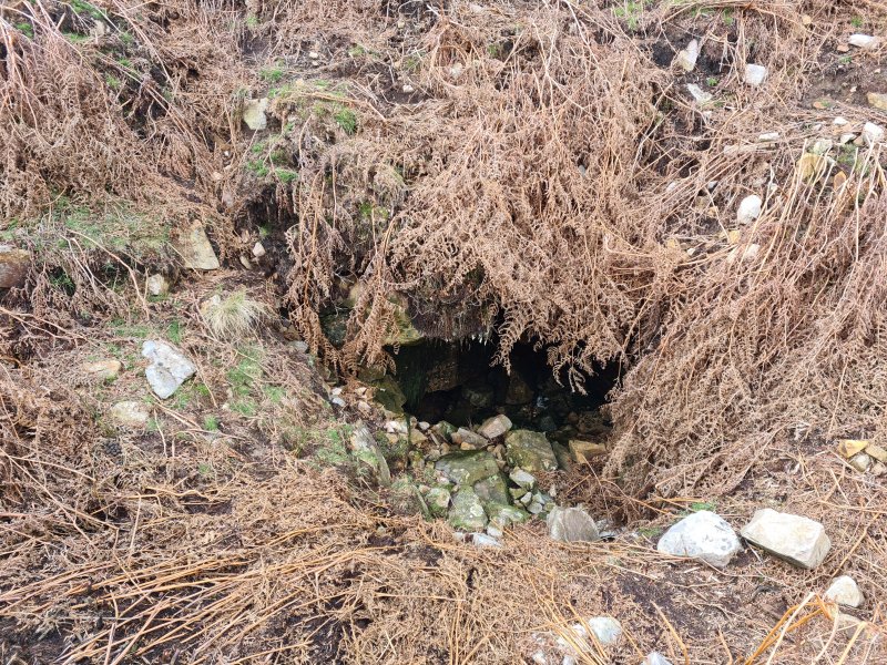 The entrance to Pwll y Pasg. The water in the cave has been dye traced to show that it is a rare example of water making it through the Llanelly Shales, into the lower limestone, emerging in Twin Avens Chamber in Agen Allwedd.
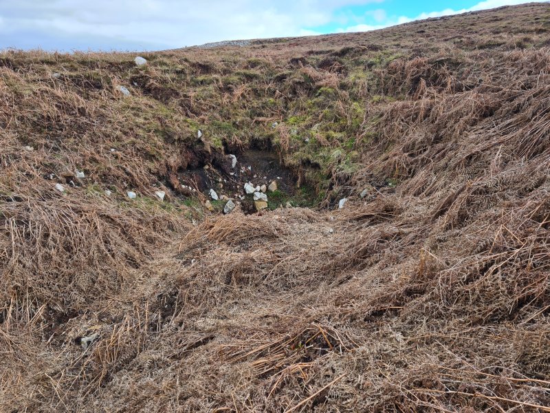 Ogof Llungwyn was found in the early 1980s, and the entrance had already collapsed by the late 1980s.
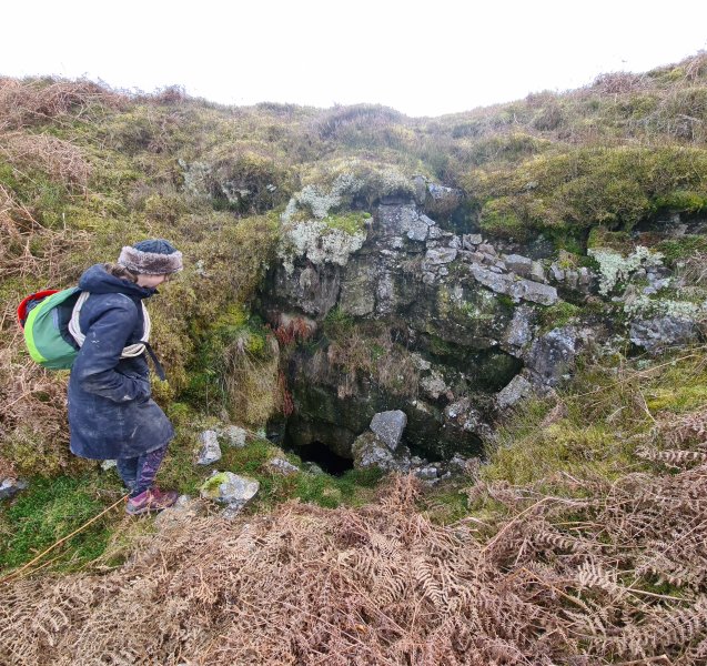 The Ogof Newport sink.
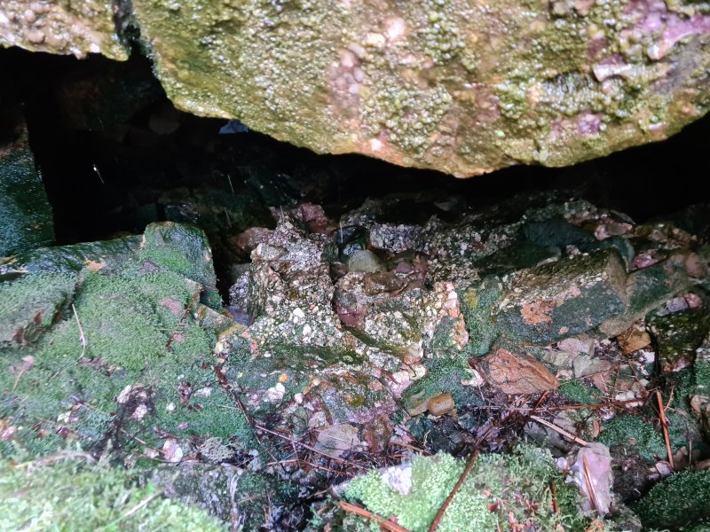 Ogof Newport.
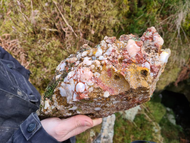 Colourful quartz conglomerate at Ogof Newport. The caves are all formed at the contact between limestone and Twrch sandstone (millstone grit).
Modelling by Steph's gripper
Colourful quartz conglomerate at Ogof Newport. The caves are all formed at the contact between limestone and Twrch sandstone (millstone grit).
Modelling by Steph's gripper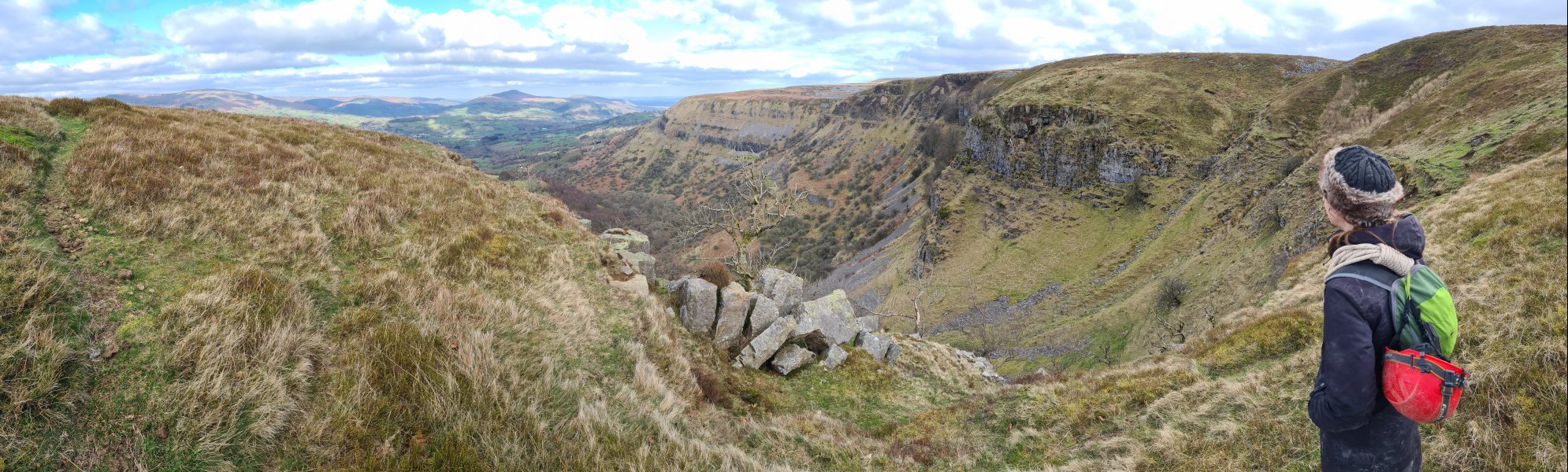 Top of the gully above Agen Allwedd. The mountains are Pen Cerrig-calch, Pen Gwyllt Meirch, Disgwylfa, Crug Mawr, Hatterall Hill, Gaer, Sugar Loaf, a hint of Edmund's Tump and The Skirrid.
Modelling by Steph
Top of the gully above Agen Allwedd. The mountains are Pen Cerrig-calch, Pen Gwyllt Meirch, Disgwylfa, Crug Mawr, Hatterall Hill, Gaer, Sugar Loaf, a hint of Edmund's Tump and The Skirrid.
Modelling by Steph A small stream sinks in the top of the gully.
 The sink chokes at about 2 metres depth. It is not known where the water goes, but there are no springs on the mountain here, and Agen Allwedd is the nearest cave, with Pwll y Gwynt being a little distance further around the cliff. It probably feeds one of the inlets to Agen Allwedd, but this is in the upper Dowlais limestone beds, so it might resurge under the scree, and re-sink into the lower limestone beds to reach the cave. Pwll y Gwynt is in the upper beds.
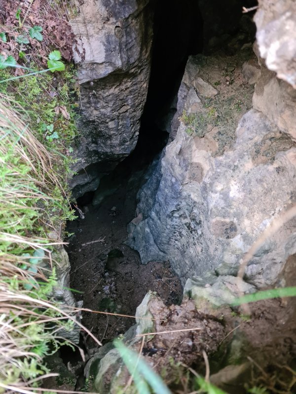 The only passage of any significant size, and it is barely big enough to fit a tiny caver into. It is marked on the survey as AA Gully Cave, but is not in the cave registry. Neither is the sink.
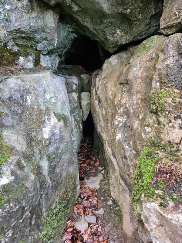 Another nearby entrance, too small for any cavers.