Pwll Dwfn surface
Unless otherwise stated, camera, setups, lighting, edits and gallery effects by Tarquin. Modelling and lighting at various points will be Gareth Davies, Toby Dryden, Becci Wilton-Jones, Peter Wilton-Jones, Dylan Wilton-Jones and Nina Wilton-Jones.
This is a series of pictures that we took during the surveying of Pwll Dwfn, to aid with drawing up the surface survey. Several, however, are just because this is a very beautiful area, and it deserves pictures. The pictures are presented in semi-logical order, rather than chronological order.
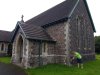 Callwen Church in Glyntawe, the location of the nearest OS benchmark (the closer one on the bridge no longer exists, as the bridge has been replaced), a second order flush bracket. Its altitude is 211.177 metres measured in 1957, and its grid reference is SN 8480 1687, a precision of 10 metres. The expected positioning error was under 10 cm, given that Fan Brycheiniog is a first order trigpoint (under RMS 10 cm error, only about 247 km from London), and Cribarth is a second order just 7.6 km from Fan Brycheiniog (max. 3 cm error), 3.3 km from the church (max. a few cm error). As a result, the error is negligible compared with the precision. As a second order benchmark, at this location, it has a possible vertical error of ±25 mm from its nearest fundamental benchmark, which itself has ±40 mm from the OS datum. Therefore it has a maximum error of ±65 mm. It is 1.55 km in a straight line from the cave or 2.11 km if following actual paths, which would give us a measured error of about 4.2 metres if we surveyed in a perfectly straight line, or 5.7 metres if we used paths (based on our measured loop closure error). That ignores the serious issues caused by overhead power lines for part of the route. In total, the error would be about 15.8 metres horizontally, and ±5.8 m vertically, if we surveyed from here, which is worse than a consumer grade GPS, but better than many published coordinates for the cave.
Modelling by Gareth
Callwen Church in Glyntawe, the location of the nearest OS benchmark (the closer one on the bridge no longer exists, as the bridge has been replaced), a second order flush bracket. Its altitude is 211.177 metres measured in 1957, and its grid reference is SN 8480 1687, a precision of 10 metres. The expected positioning error was under 10 cm, given that Fan Brycheiniog is a first order trigpoint (under RMS 10 cm error, only about 247 km from London), and Cribarth is a second order just 7.6 km from Fan Brycheiniog (max. 3 cm error), 3.3 km from the church (max. a few cm error). As a result, the error is negligible compared with the precision. As a second order benchmark, at this location, it has a possible vertical error of ±25 mm from its nearest fundamental benchmark, which itself has ±40 mm from the OS datum. Therefore it has a maximum error of ±65 mm. It is 1.55 km in a straight line from the cave or 2.11 km if following actual paths, which would give us a measured error of about 4.2 metres if we surveyed in a perfectly straight line, or 5.7 metres if we used paths (based on our measured loop closure error). That ignores the serious issues caused by overhead power lines for part of the route. In total, the error would be about 15.8 metres horizontally, and ±5.8 m vertically, if we surveyed from here, which is worse than a consumer grade GPS, but better than many published coordinates for the cave.
Modelling by Gareth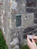 We used the benchmark to calibrate an altimeter (to the nearest metre, since that was its precision), and rushed to the cave before the local air pressure changed, testing if this might be a viable way to get the entrance altitude.
Modelling by Gareth's digits
We used the benchmark to calibrate an altimeter (to the nearest metre, since that was its precision), and rushed to the cave before the local air pressure changed, testing if this might be a viable way to get the entrance altitude.
Modelling by Gareth's digits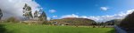 At the parking area in the Tawe Valley, at the Dan yr Ogof campsite.
Modelling by Gareth
At the parking area in the Tawe Valley, at the Dan yr Ogof campsite.
Modelling by Gareth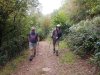 Walking up onto the mountain. This picture shows Gareth recovering after breaking his colar bone, which delayed the survey significantly, and meant he could not take advantage of the freedom between Covid lockdowns.
Modelling by Toby and Gareth
Walking up onto the mountain. This picture shows Gareth recovering after breaking his colar bone, which delayed the survey significantly, and meant he could not take advantage of the freedom between Covid lockdowns.
Modelling by Toby and Gareth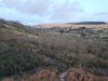 View over the Afon Haffes towards a snow-capped Fan Gyhirych (725 metres) in winter.
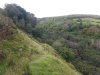 Cwm Haffes, which marks the end of the limestone outcrop.
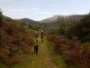 Starting the main climb. In the background are Cefn Cul (562 metres) and Fan Gyhirych.
Modelling by Toby and Gareth
Starting the main climb. In the background are Cefn Cul (562 metres) and Fan Gyhirych.
Modelling by Toby and Gareth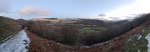 Gaining height on the former quarry road. The view is now Cefn Cul, Fan Gyhirych, Fan Gyhirych's Carreg Cadno ridge (538 metres), Craig y Llyn (600 metres), Hirfynydd (481 metres) and Cribarth (428 metres).
 Near the top of the walled-off forest. Fan Gyhirch has now been joined by Fan Fraith (668 metres) and Carreg Cadno.
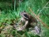 This spot on the mountain is excellent for frogs.
Modelling by Frig
This spot on the mountain is excellent for frogs.
Modelling by Frig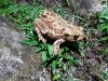 Brown phase common toad.
Modelling by Groucher
Brown phase common toad.
Modelling by Groucher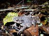 Grey phase toad.
Modelling by a rock
Grey phase toad.
Modelling by a rock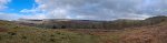 Leaving the forest. Fan Gyhirych, Fan Fraith, Carreg Cadno, Craig y Llyn, Hirfynydd and Cribarth.
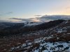 Cribarth with a winter sunset.
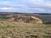 Evening light on Craig y Rhiwarth, in front of Penwyllt.
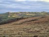 Evening light over Cribarth.
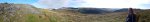 Heading to the cave on the first day of surveying, and ascending the last little outcrop, after which most of the climb is done. Cefn Cul, Fan Gyhirych, Fan Fraith, Carreg Cadno ridge, Craig y Llyn and Cribarth.
 Welsh mountain ponies in front of the outcrops that flank Pwll Dwfn's dry valley.
Modelling by the herd
Welsh mountain ponies in front of the outcrops that flank Pwll Dwfn's dry valley.
Modelling by the herd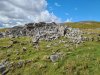 Outcrop of limestone pavement shortly before the dry valley.
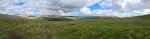 View over the Tawe Valley from the edge of Pwll Dwfn's dry valley. Fan Gyhirych, Fan Fraith, Carreg Cadno, Craig y Llyn and Cribarth.
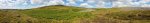 Overview of the dry valley containing the cave. The hills behind it are Castell y Geifr (531 metres), while the little grey hillocks are limestone outcrops that line the valley. Our surface survey would cover the valley from beyond the pair of grey hillocks on the right, all the way down to the large boulder in the valley near the left edge of the picture. The cave entrance lies at the left edge of the large grey patch that fills the valley, and the entire cave is crammed below less than 50 metres of the bank just to the left of it, where the bracken is in small patches.
Modelling by a very tiny Gareth, and a load of cotton wool balls
Overview of the dry valley containing the cave. The hills behind it are Castell y Geifr (531 metres), while the little grey hillocks are limestone outcrops that line the valley. Our surface survey would cover the valley from beyond the pair of grey hillocks on the right, all the way down to the large boulder in the valley near the left edge of the picture. The cave entrance lies at the left edge of the large grey patch that fills the valley, and the entire cave is crammed below less than 50 metres of the bank just to the left of it, where the bracken is in small patches.
Modelling by a very tiny Gareth, and a load of cotton wool balls The same area seen from slightly further up the valley. Our surface survey extended from behind the small grey hillock to the right, all the way down to the series of grey lumps in the valley on the left. Dry Valley Dig is situated by the tree, and Pwll Dwfn sits at the left edge of the grey patch in the valley. Dig On Black Mountain is about half way between them, in a smaller clump of bracken on the far bank.
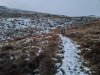 Approaching the cave in winter at the end of the project. In these conditions, it is hard to see the boulder that is used as a landmark for the entrance.
Modelling by Gareth
Approaching the cave in winter at the end of the project. In these conditions, it is hard to see the boulder that is used as a landmark for the entrance.
Modelling by Gareth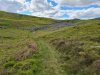 The boulder is much more obvious in summer. Gareth is standing at the entrance.
Modelling by Gareth
The boulder is much more obvious in summer. Gareth is standing at the entrance.
Modelling by Gareth The altimeter reading at our location fix. The real altitude here is 398.77 (with the error being only a couple of mm at most). Having climbed 187.59 metres in just 38 minutes on a day with very stable air pressure, the altimeter's error is 22.774 metres, an error of 12.14%. That is absolutely terrible, and not usable for surveying, so we did not use that approach. And before you say it, yes, Gareth's hand sits above the point, but that should have decreased the error not increased it, and even the altimeter's 1 metre precision has not had any significant effect. It's just not good enough.
Modelling by Gareth's wrist
The altimeter reading at our location fix. The real altitude here is 398.77 (with the error being only a couple of mm at most). Having climbed 187.59 metres in just 38 minutes on a day with very stable air pressure, the altimeter's error is 22.774 metres, an error of 12.14%. That is absolutely terrible, and not usable for surveying, so we did not use that approach. And before you say it, yes, Gareth's hand sits above the point, but that should have decreased the error not increased it, and even the altimeter's 1 metre precision has not had any significant effect. It's just not good enough.
Modelling by Gareth's wrist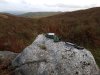 We tried a highly accurate professional grade GPS device that gives an estimated error of less than 1 metre, but without using correctional data, the Juniper Cedar CT8. Averaging 21'700 readings, over the course of 2 days (when the DOP was supposed to be very low, and ionospheric distortion was minimal), it gave us a position that was 2.03 metres wrong horizontally, and 0.67 metres wrong vertically. This is within surveying grade, and definitely better than handheld Garmin-style devices - with their multitude of faults and downright lies about accuracy - could ever achieve. However, even after averaging all those readings, it is still not within its own estimates, and we could see that with how inconsistent its readings were.
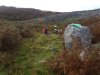 Babysitting the averaging while sleeping off a broken colar bone.
Modelling by Gareth
Babysitting the averaging while sleeping off a broken colar bone.
Modelling by Gareth We switched to using professional grade differential GPS devices, an ArduSimple DIY kit that used freely available public differential RTK sources, and a Trimble Catalyst professional device that used a paid NRTK source. The ArduSimple needs an internet connection via a phone, while the Catalyst can either use a phone for NRTK, or satellites (with a much longer setup time and slightly lower accuracy) for RTX, but needs a phone connection when starting a paid usage session. We used it in NRTK mode. Comparing the two showed that the Catalyst consistently gave readings within 6 mm, and the ArduSimple, using the nearest useful correction source (a farm quite a long way away), gave readings within a 6 cm error. Both are vastly superior to the Juniper Cedar CT8, and several orders of magnitude better than consumer grade GPS devices. They both allow surface surveying without needing to measure legs between stations, but we used Disto surveying for that instead.
 Gathering better data, with an improved app. The fixed point is a pebble on top of the big rock, which we called Trig; our trigpoint.
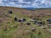 Babysitting the GPS while gathering data for accuracy analysis.
Modelling by Becci
Babysitting the GPS while gathering data for accuracy analysis.
Modelling by Becci Custom tripod used to level the GPS on top of the rock. The screws can be turned to adjust the height of each foot which controls one axis of motion, until the spirit level declares it to be level.
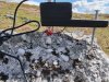 The tripod rests on a point (made from a punk stud glued to a bolt with araldite, in case you were wondering!). The bolt has an adaptor to fit the GPS thread, and the height from the point to the base of the GPS is measured with calipers.
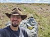 Taking the final GPS readings that were used for the survey, using a custom made Kalman filter to refine the 6 mm standard deviation to an estimated error of just 2.5 mm.
Modelling by Tarquin
Taking the final GPS readings that were used for the survey, using a custom made Kalman filter to refine the 6 mm standard deviation to an estimated error of just 2.5 mm.
Modelling by Tarquin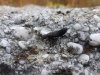 Devil's coach horse beetle on the boulder. They are generally docile, and prefer to bluff and use a stink gland. But they can bite if you hurt them, and their jaws are very large, so they can just draw blood.
Modelling by Mountain Wind
Devil's coach horse beetle on the boulder. They are generally docile, and prefer to bluff and use a stink gland. But they can bite if you hurt them, and their jaws are very large, so they can just draw blood.
Modelling by Mountain Wind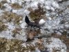 The raised tail is a threat posture, but they generally do that all the time while walking around.
Modelling by Mountain Wind
The raised tail is a threat posture, but they generally do that all the time while walking around.
Modelling by Mountain Wind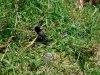 This area is covered with them.
Modelling by Black Beauty
This area is covered with them.
Modelling by Black Beauty The entrance to Pwll Dwfn is a quite unremarkable little hole at the edge of the rocky patch.
Modelling by Gareth
The entrance to Pwll Dwfn is a quite unremarkable little hole at the edge of the rocky patch.
Modelling by Gareth We waited until nightfall to start surface surveying, so that we could see the Disto laser more clearly. We used a pair of sturdy tripods to create temporary stations. The darkness means that most photographs were utility ones to remember station locations, such as a photo of a couple of rocks, which are not useful in this gallery, so the majority of the following photographs were taken on a subsequent day during the daytime, rather than while actually surveying.
 The Hills Have Eyes. But thankfully they are just sheep, with their eyes shining in the dark.
Modelling by a bunch of hillewes
The Hills Have Eyes. But thankfully they are just sheep, with their eyes shining in the dark.
Modelling by a bunch of hillewes Our surface survey progressed up from the cave to the next caves up the valley. Pwll Dwfn is at the far end of the grey patch that starts beyond the tree. Dig On Black Mountain is up on the right bank, roughly level with that grey patch, but we would loop back to that later. Dry Valley Dig is behind the camera.
 The entrance to Dry Valley Dig, situated near the largest tree, in a narrow part of the valley.
 Marking a station near Dry Valley Dig. As it happens, we would abandon all of the work from this night, as it was so cold that ice crystals formed in the Disto, and ruined its calibration.
Modelling by Gareth
Marking a station near Dry Valley Dig. As it happens, we would abandon all of the work from this night, as it was so cold that ice crystals formed in the Disto, and ruined its calibration.
Modelling by Gareth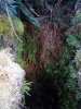 One end of Dry Valley Dig can be free climbed, but with the serious risk of falling. The gully is quite muddy, and the grip is far from perfect.
Lighting by Tarquin and Gareth
One end of Dry Valley Dig can be free climbed, but with the serious risk of falling. The gully is quite muddy, and the grip is far from perfect.
Lighting by Tarquin and Gareth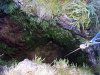 It is much better to rig a rope from the railway sleepers. The drop is just over 4 metres.
Lighting by Tarquin and Gareth
It is much better to rig a rope from the railway sleepers. The drop is just over 4 metres.
Lighting by Tarquin and Gareth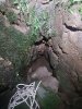 The cave ends immediately at a completely silted sump.
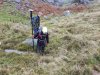 Small rock depression beyond Dry Valley Dig. The GPS was not used for our surveying, but was used to see if the methodology could work for others.
Modelling by Peter and Dylan
Small rock depression beyond Dry Valley Dig. The GPS was not used for our surveying, but was used to see if the methodology could work for others.
Modelling by Peter and Dylan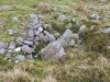 The next one looks more like digging spoil.
 The next depression shows clear signs of being dug.
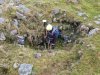 Depth of the dig.
Modelling by Peter
Depth of the dig.
Modelling by Peter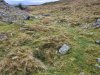 The last significant former sink covered by our survey. We surveyed the shape of the valley for a distance further, but from here, we concentrated on heading back along the upper bench seen to the right of the tree here.
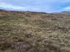 Looking north along the western bank of the valley. In the distance are an outcrop on the upper reaches of the dry valley, then Fan Brycheiniog (802 metres) and Fan Hir (761 metres).
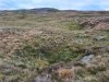 The route looping back on the upper bench passes several more shakeholes.
 The upper bench has another patch of exposed limestone rocks.
Modelling by a random group of walkers
The upper bench has another patch of exposed limestone rocks.
Modelling by a random group of walkers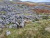 The rocks on the upper bench are flanked by a number of smaller depressions.
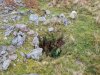 The deepest of the depressions.
 The survey used tripods for most stations, but every now and then, we would save our progress by marking a station on a rock, such as this one on the upper bench. If we messed up later, such as by knocking over a tripod, we could always come back to the last marked station and not lose everything. Our stations, as in the cave, would normally be marked using Tipp-ex (correction fluid).
Modelling by Gareth's dainty fingers
The survey used tripods for most stations, but every now and then, we would save our progress by marking a station on a rock, such as this one on the upper bench. If we messed up later, such as by knocking over a tripod, we could always come back to the last marked station and not lose everything. Our stations, as in the cave, would normally be marked using Tipp-ex (correction fluid).
Modelling by Gareth's dainty fingers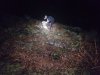 Marking a station next to Dig On Black Mountain. The cave entrance lies in the bracken under a metal grill, and would be very easy to miss.
Modelling by Gareth
Marking a station next to Dig On Black Mountain. The cave entrance lies in the bracken under a metal grill, and would be very easy to miss.
Modelling by Gareth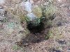 Dig On Black Mountain, with the grill removed. The bottom can be seen from here.
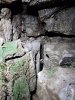 Small fracture pointing up the valley, which reaches back a fair distance. This looks like a former inlet.
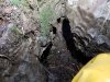 The water flowed down into this little depression in the floor.
Modelling by selected portions of Tarquin
The water flowed down into this little depression in the floor.
Modelling by selected portions of Tarquin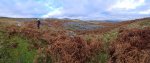 South of Dig On Black Mountain, remaining on the upper bench. The dig is just behind Peter in the bracken. Pwll Dwfn is at the right edge of the grey outcrop in the valley.
Modelling by Nina and Peter
South of Dig On Black Mountain, remaining on the upper bench. The dig is just behind Peter in the bracken. Pwll Dwfn is at the right edge of the grey outcrop in the valley.
Modelling by Nina and Peter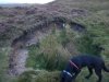 80 metres west of A Thrutch Too Far is this relatively recent shakehole. 80 metres does not sound like far, but the entire known cave fits into 65 metres.
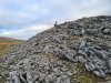 The tall grey rock pile to the northeast of the dry valley is simply an outcrop of limestone pavement.
Modelling by Nina
The tall grey rock pile to the northeast of the dry valley is simply an outcrop of limestone pavement.
Modelling by Nina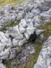 At its southern end is a gryke (fracture between pavement pieces) that seems potentially cave-like.
 The eastern end of the gryke drops into a small cavity, but the hole is barely big enough for your arm.
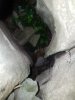 However, it just opens back to air at the other side of the clint (pavement piece), and does not appear to have any actual passage. This is not marked on our survey, since the survey only touched the outcrop with a few distant splays, without the centreline ever reaching it.
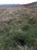 A non-natural hole nearby.
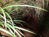 This appears to be an abandoned burrow.
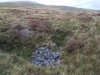 Some distance further, now quite a long way from our survey, is another dig. We did not want to start on this area, because it is an endless field of inter-related shakeholes, that do not appear to be directly related to Pwll Dwfn.
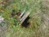 The dig has been boarded over rather poorly.
 Below the boards, the dig is only shallow, and has not intersected cave.
 The first rank of large shakeholes encountered when heading west from Pwll Dwfn. Pwll Dwfn sits in the dry valley just before all the grey outcrops, with the left edge of the distant forest behind it. The mountains are Fan Gyhirych, Fan Fraith, Carreg Cadno, Craig y Llyn, Cribarth and Hirfynydd.
 A little northwest are some much larger shakeholes. These sit 150 metres northeast of Pinnacle Series in Dan yr Ogof.
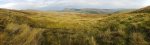 Standing nearly over Pinnacle Series, next to some of the smaller shakeholes. Pwll Dwfn sits in the dry valley just before all the grey outcrops, again with the left edge of the distant forest behind it. The mountains are Fan Brycheiniog, Fan Hir, Fan Gyhirych, Fan Fraith, Carreg Cadno, Craig y Llyn, Cribarth and Hirfynydd.
 Looking over the top of Pinnacle Series, at roughly the position of Painted Chamber and Not Far Now.
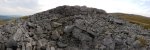 One of the millstone grit (Twrch sandstone) outcrops on Castell y Geifr.
 View from the northern edge of Castell y Geifr's high point. The mountains are Carreg Goch (558 metres), Waun Lefrith (677 metres) and Picws Du (749 metres) in the Bannau Sir Gaer ridge, Fan Brycheiniog, Fan Hir, Cefn Cul, Fan Gyhirych, Fan Fraith and Carreg Cadno.
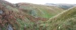 Below Pwll Dwfn, the dry valley has a number of former sinks which we surveyed, then nothing for 180 metres. Then cave features start again, with the first one being a local resurgence down by the tree. This side valley also contains a dig.
 The dig in the side valley. There are a number of small shakeholes in a line above this, and they are probably all part of a little local drainage system, as water resurges nearby too.
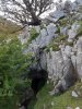 The resurgence is a short cave called Ogof Ffynnon Dewi Sant.
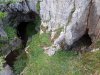 Ogof Ffynnon Dewi Sant is a pair of entrances, with the water resurging from the left one.
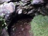 The left entrance has the audible sound of a small waterfall, but as it is only 12 metres long and mostly a flat out crawl, we did not investigate. The amount of water is not enough for this to be a major drainage system, and it is probably sourced just a short distance up the valley.
 The smaller entrance to the right.
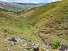 The water almost immediately sinks again, with the site of the sink slowly backtracking to earlier and earlier locations. The water resurges again almost immediately in a marshy patch of bright green grass and club rushes.
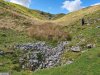 Almost immediately, the water sinks once again in a proper sink this time.
Modelling by Becci
Almost immediately, the water sinks once again in a proper sink this time.
Modelling by Becci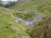 The sink almost certainly feeds one of the early inlets in Dan yr Ogof, but its destination is not (at the time of writing) known.
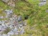 This has been dug without success.
 Callwen Church in Glyntawe, the location of the nearest OS benchmark (the closer one on the bridge no longer exists, as the bridge has been replaced), a second order flush bracket. Its altitude is 211.177 metres measured in 1957, and its grid reference is SN 8480 1687, a precision of 10 metres. The expected positioning error was under 10 cm, given that Fan Brycheiniog is a first order trigpoint (under RMS 10 cm error, only about 247 km from London), and Cribarth is a second order just 7.6 km from Fan Brycheiniog (max. 3 cm error), 3.3 km from the church (max. a few cm error). As a result, the error is negligible compared with the precision. As a second order benchmark, at this location, it has a possible vertical error of ±25 mm from its nearest fundamental benchmark, which itself has ±40 mm from the OS datum. Therefore it has a maximum error of ±65 mm. It is 1.55 km in a straight line from the cave or 2.11 km if following actual paths, which would give us a measured error of about 4.2 metres if we surveyed in a perfectly straight line, or 5.7 metres if we used paths (based on our measured loop closure error). That ignores the serious issues caused by overhead power lines for part of the route. In total, the error would be about 15.8 metres horizontally, and ±5.8 m vertically, if we surveyed from here, which is worse than a consumer grade GPS, but better than many published coordinates for the cave.
Modelling by Gareth
Callwen Church in Glyntawe, the location of the nearest OS benchmark (the closer one on the bridge no longer exists, as the bridge has been replaced), a second order flush bracket. Its altitude is 211.177 metres measured in 1957, and its grid reference is SN 8480 1687, a precision of 10 metres. The expected positioning error was under 10 cm, given that Fan Brycheiniog is a first order trigpoint (under RMS 10 cm error, only about 247 km from London), and Cribarth is a second order just 7.6 km from Fan Brycheiniog (max. 3 cm error), 3.3 km from the church (max. a few cm error). As a result, the error is negligible compared with the precision. As a second order benchmark, at this location, it has a possible vertical error of ±25 mm from its nearest fundamental benchmark, which itself has ±40 mm from the OS datum. Therefore it has a maximum error of ±65 mm. It is 1.55 km in a straight line from the cave or 2.11 km if following actual paths, which would give us a measured error of about 4.2 metres if we surveyed in a perfectly straight line, or 5.7 metres if we used paths (based on our measured loop closure error). That ignores the serious issues caused by overhead power lines for part of the route. In total, the error would be about 15.8 metres horizontally, and ±5.8 m vertically, if we surveyed from here, which is worse than a consumer grade GPS, but better than many published coordinates for the cave.
Modelling by Gareth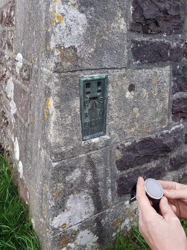 We used the benchmark to calibrate an altimeter (to the nearest metre, since that was its precision), and rushed to the cave before the local air pressure changed, testing if this might be a viable way to get the entrance altitude.
Modelling by Gareth's digits
We used the benchmark to calibrate an altimeter (to the nearest metre, since that was its precision), and rushed to the cave before the local air pressure changed, testing if this might be a viable way to get the entrance altitude.
Modelling by Gareth's digits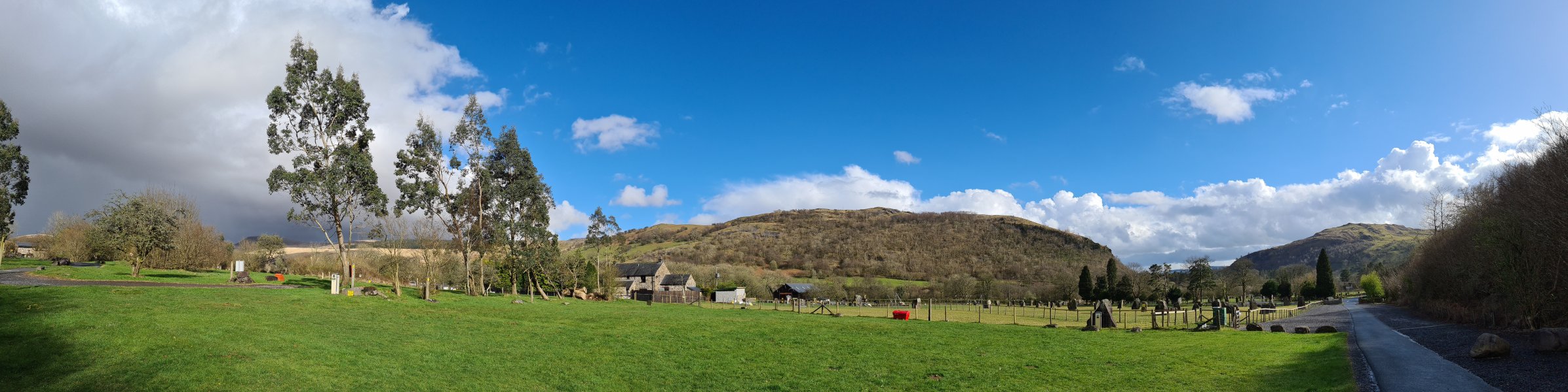 At the parking area in the Tawe Valley, at the Dan yr Ogof campsite.
Modelling by Gareth
At the parking area in the Tawe Valley, at the Dan yr Ogof campsite.
Modelling by Gareth Walking up onto the mountain. This picture shows Gareth recovering after breaking his colar bone, which delayed the survey significantly, and meant he could not take advantage of the freedom between Covid lockdowns.
Modelling by Toby and Gareth
Walking up onto the mountain. This picture shows Gareth recovering after breaking his colar bone, which delayed the survey significantly, and meant he could not take advantage of the freedom between Covid lockdowns.
Modelling by Toby and Gareth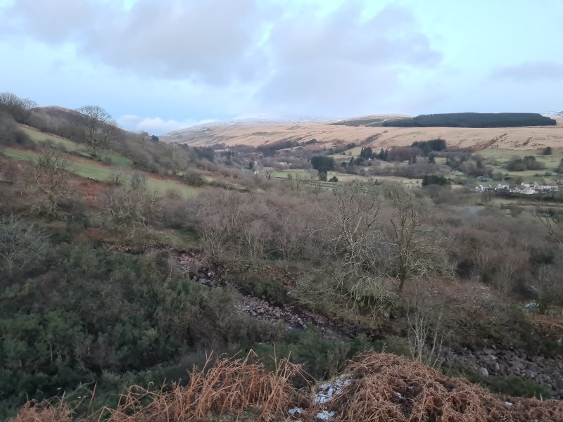 View over the Afon Haffes towards a snow-capped Fan Gyhirych (725 metres) in winter.
 Cwm Haffes, which marks the end of the limestone outcrop.
 Starting the main climb. In the background are Cefn Cul (562 metres) and Fan Gyhirych.
Modelling by Toby and Gareth
Starting the main climb. In the background are Cefn Cul (562 metres) and Fan Gyhirych.
Modelling by Toby and Gareth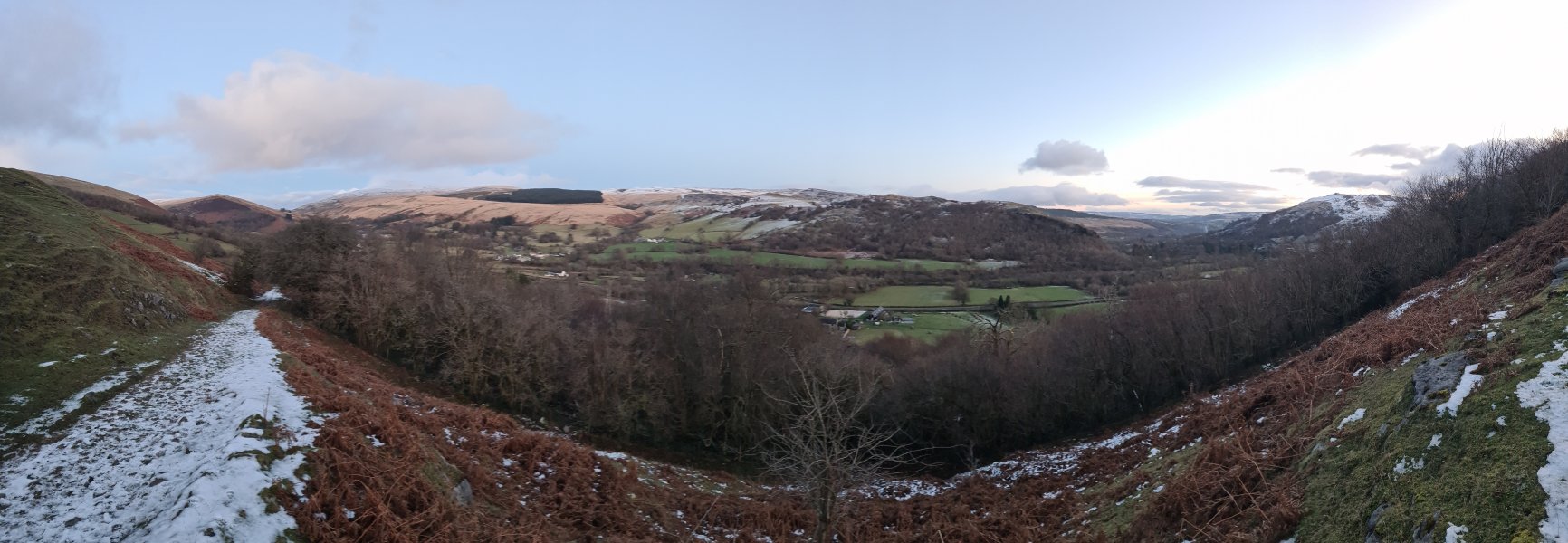 Gaining height on the former quarry road. The view is now Cefn Cul, Fan Gyhirych, Fan Gyhirych's Carreg Cadno ridge (538 metres), Craig y Llyn (600 metres), Hirfynydd (481 metres) and Cribarth (428 metres).
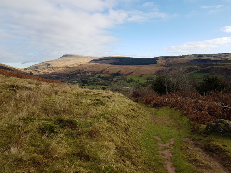 Near the top of the walled-off forest. Fan Gyhirch has now been joined by Fan Fraith (668 metres) and Carreg Cadno.
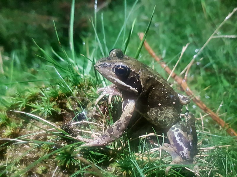 This spot on the mountain is excellent for frogs.
Modelling by Frig
This spot on the mountain is excellent for frogs.
Modelling by Frig Brown phase common toad.
Modelling by Groucher
Brown phase common toad.
Modelling by Groucher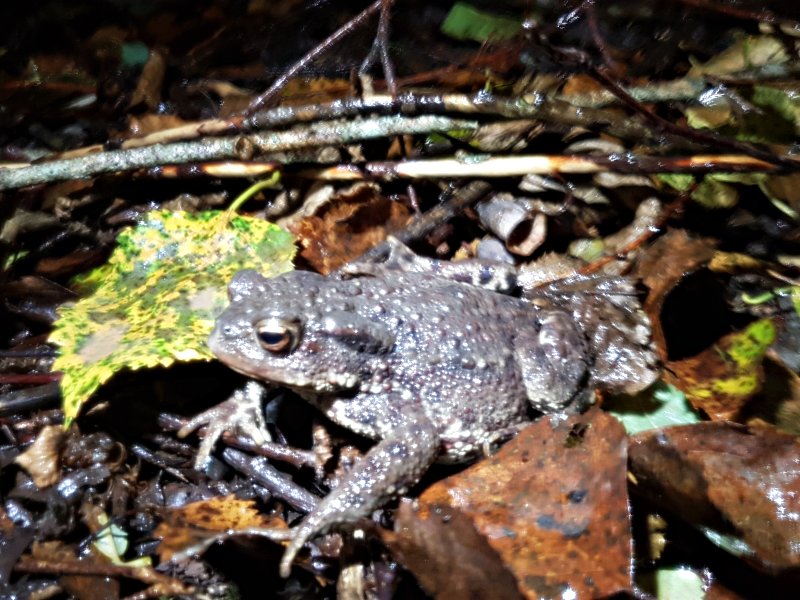 Grey phase toad.
Modelling by a rock
Grey phase toad.
Modelling by a rock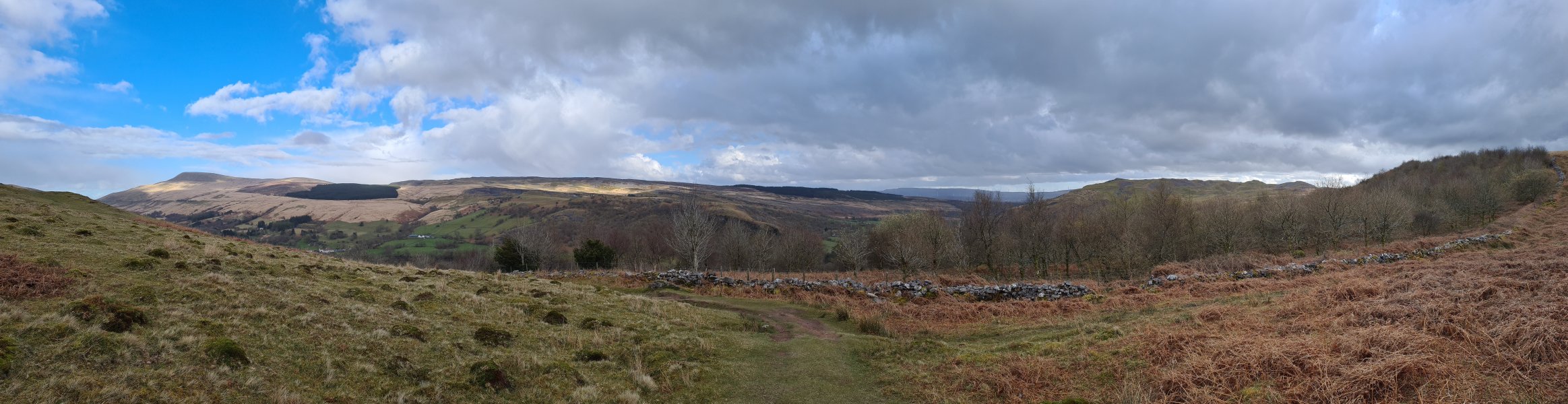 Leaving the forest. Fan Gyhirych, Fan Fraith, Carreg Cadno, Craig y Llyn, Hirfynydd and Cribarth.
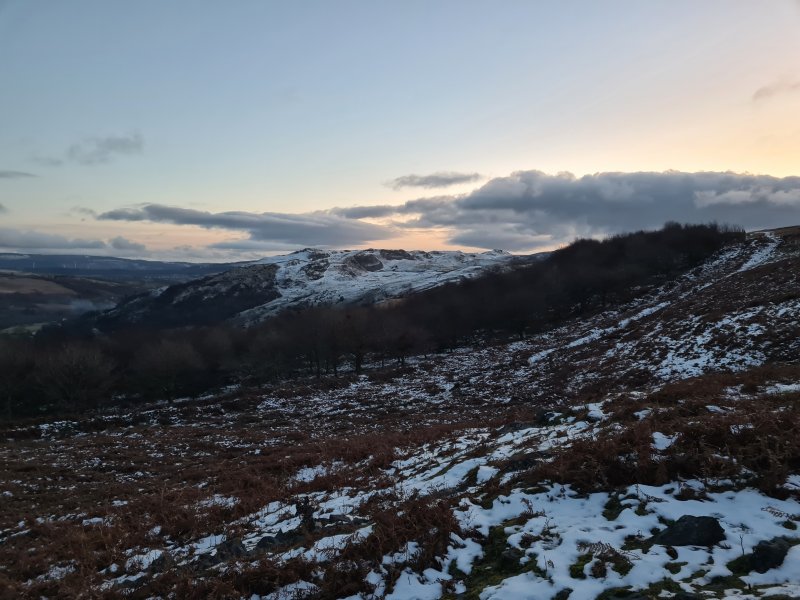 Cribarth with a winter sunset.
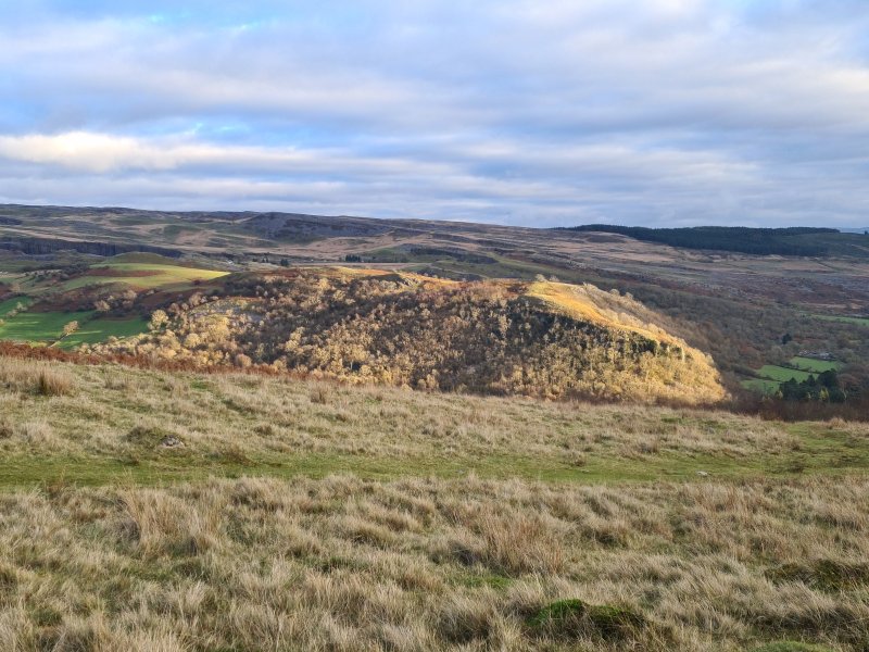 Evening light on Craig y Rhiwarth, in front of Penwyllt.
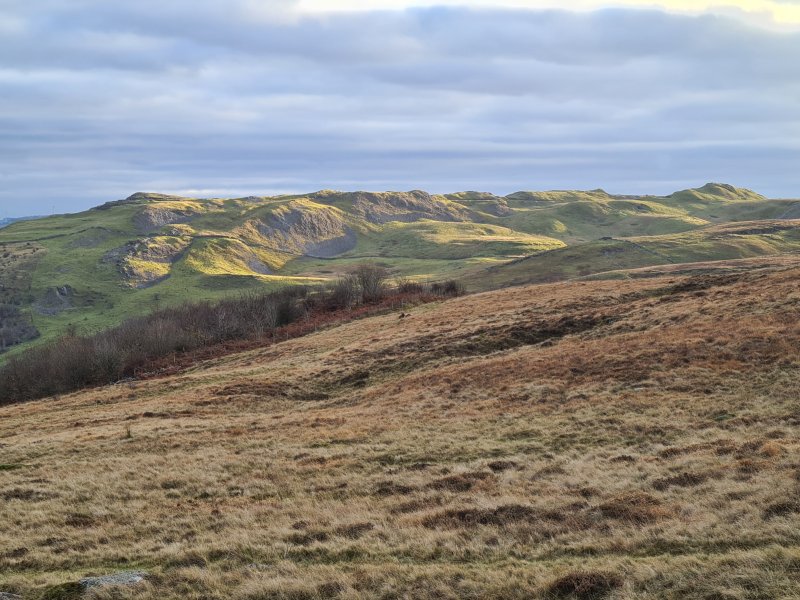 Evening light over Cribarth.
 Heading to the cave on the first day of surveying, and ascending the last little outcrop, after which most of the climb is done. Cefn Cul, Fan Gyhirych, Fan Fraith, Carreg Cadno ridge, Craig y Llyn and Cribarth.
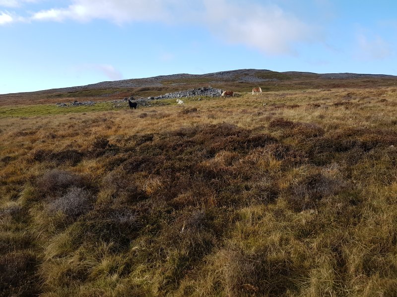 Welsh mountain ponies in front of the outcrops that flank Pwll Dwfn's dry valley.
Modelling by the herd
Welsh mountain ponies in front of the outcrops that flank Pwll Dwfn's dry valley.
Modelling by the herd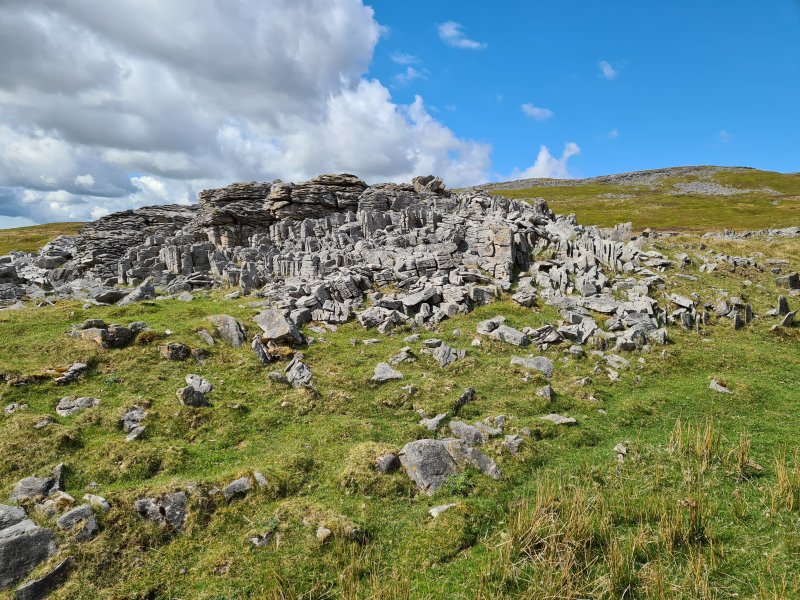 Outcrop of limestone pavement shortly before the dry valley.
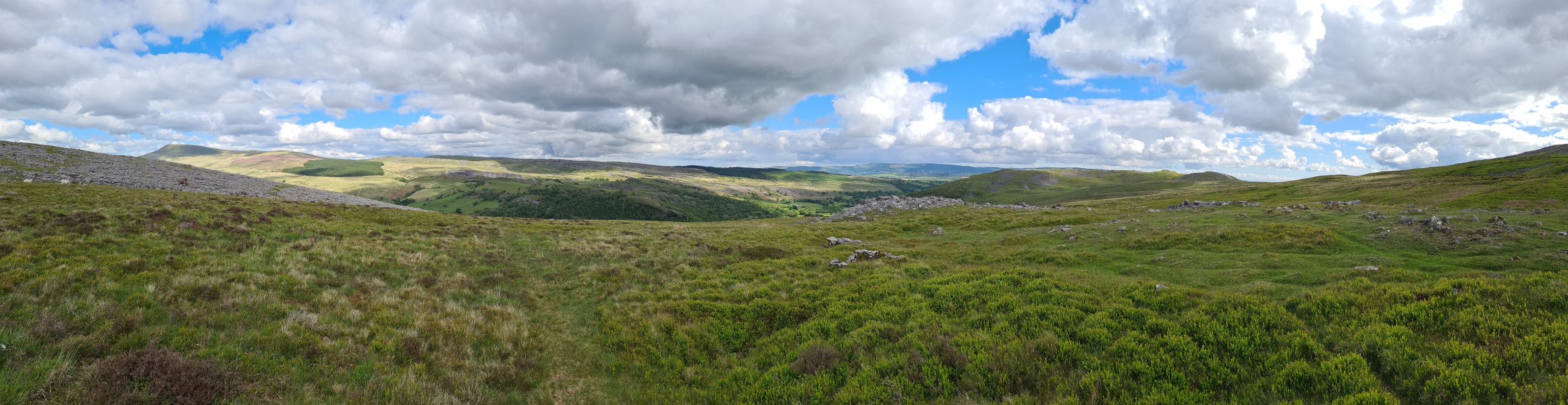 View over the Tawe Valley from the edge of Pwll Dwfn's dry valley. Fan Gyhirych, Fan Fraith, Carreg Cadno, Craig y Llyn and Cribarth.
 Overview of the dry valley containing the cave. The hills behind it are Castell y Geifr (531 metres), while the little grey hillocks are limestone outcrops that line the valley. Our surface survey would cover the valley from beyond the pair of grey hillocks on the right, all the way down to the large boulder in the valley near the left edge of the picture. The cave entrance lies at the left edge of the large grey patch that fills the valley, and the entire cave is crammed below less than 50 metres of the bank just to the left of it, where the bracken is in small patches.
Modelling by a very tiny Gareth, and a load of cotton wool balls
Overview of the dry valley containing the cave. The hills behind it are Castell y Geifr (531 metres), while the little grey hillocks are limestone outcrops that line the valley. Our surface survey would cover the valley from beyond the pair of grey hillocks on the right, all the way down to the large boulder in the valley near the left edge of the picture. The cave entrance lies at the left edge of the large grey patch that fills the valley, and the entire cave is crammed below less than 50 metres of the bank just to the left of it, where the bracken is in small patches.
Modelling by a very tiny Gareth, and a load of cotton wool balls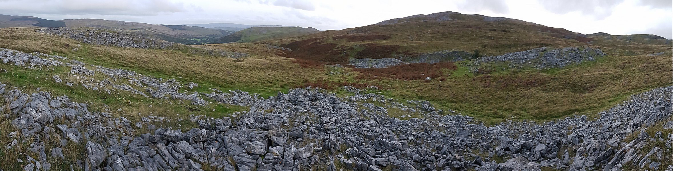 The same area seen from slightly further up the valley. Our surface survey extended from behind the small grey hillock to the right, all the way down to the series of grey lumps in the valley on the left. Dry Valley Dig is situated by the tree, and Pwll Dwfn sits at the left edge of the grey patch in the valley. Dig On Black Mountain is about half way between them, in a smaller clump of bracken on the far bank.
 Approaching the cave in winter at the end of the project. In these conditions, it is hard to see the boulder that is used as a landmark for the entrance.
Modelling by Gareth
Approaching the cave in winter at the end of the project. In these conditions, it is hard to see the boulder that is used as a landmark for the entrance.
Modelling by Gareth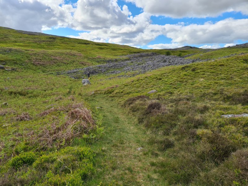 The boulder is much more obvious in summer. Gareth is standing at the entrance.
Modelling by Gareth
The boulder is much more obvious in summer. Gareth is standing at the entrance.
Modelling by Gareth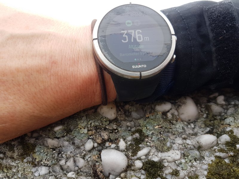 The altimeter reading at our location fix. The real altitude here is 398.77 (with the error being only a couple of mm at most). Having climbed 187.59 metres in just 38 minutes on a day with very stable air pressure, the altimeter's error is 22.774 metres, an error of 12.14%. That is absolutely terrible, and not usable for surveying, so we did not use that approach. And before you say it, yes, Gareth's hand sits above the point, but that should have decreased the error not increased it, and even the altimeter's 1 metre precision has not had any significant effect. It's just not good enough.
Modelling by Gareth's wrist
The altimeter reading at our location fix. The real altitude here is 398.77 (with the error being only a couple of mm at most). Having climbed 187.59 metres in just 38 minutes on a day with very stable air pressure, the altimeter's error is 22.774 metres, an error of 12.14%. That is absolutely terrible, and not usable for surveying, so we did not use that approach. And before you say it, yes, Gareth's hand sits above the point, but that should have decreased the error not increased it, and even the altimeter's 1 metre precision has not had any significant effect. It's just not good enough.
Modelling by Gareth's wrist We tried a highly accurate professional grade GPS device that gives an estimated error of less than 1 metre, but without using correctional data, the Juniper Cedar CT8. Averaging 21'700 readings, over the course of 2 days (when the DOP was supposed to be very low, and ionospheric distortion was minimal), it gave us a position that was 2.03 metres wrong horizontally, and 0.67 metres wrong vertically. This is within surveying grade, and definitely better than handheld Garmin-style devices - with their multitude of faults and downright lies about accuracy - could ever achieve. However, even after averaging all those readings, it is still not within its own estimates, and we could see that with how inconsistent its readings were.
 Babysitting the averaging while sleeping off a broken colar bone.
Modelling by Gareth
Babysitting the averaging while sleeping off a broken colar bone.
Modelling by Gareth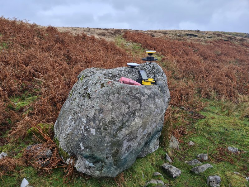 We switched to using professional grade differential GPS devices, an ArduSimple DIY kit that used freely available public differential RTK sources, and a Trimble Catalyst professional device that used a paid NRTK source. The ArduSimple needs an internet connection via a phone, while the Catalyst can either use a phone for NRTK, or satellites (with a much longer setup time and slightly lower accuracy) for RTX, but needs a phone connection when starting a paid usage session. We used it in NRTK mode. Comparing the two showed that the Catalyst consistently gave readings within 6 mm, and the ArduSimple, using the nearest useful correction source (a farm quite a long way away), gave readings within a 6 cm error. Both are vastly superior to the Juniper Cedar CT8, and several orders of magnitude better than consumer grade GPS devices. They both allow surface surveying without needing to measure legs between stations, but we used Disto surveying for that instead.
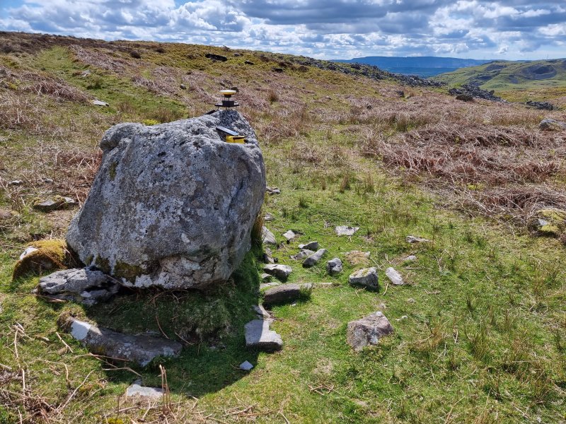 Gathering better data, with an improved app. The fixed point is a pebble on top of the big rock, which we called Trig; our trigpoint.
 Babysitting the GPS while gathering data for accuracy analysis.
Modelling by Becci
Babysitting the GPS while gathering data for accuracy analysis.
Modelling by Becci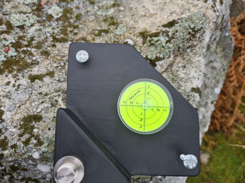 Custom tripod used to level the GPS on top of the rock. The screws can be turned to adjust the height of each foot which controls one axis of motion, until the spirit level declares it to be level.
 The tripod rests on a point (made from a punk stud glued to a bolt with araldite, in case you were wondering!). The bolt has an adaptor to fit the GPS thread, and the height from the point to the base of the GPS is measured with calipers.
 Taking the final GPS readings that were used for the survey, using a custom made Kalman filter to refine the 6 mm standard deviation to an estimated error of just 2.5 mm.
Modelling by Tarquin
Taking the final GPS readings that were used for the survey, using a custom made Kalman filter to refine the 6 mm standard deviation to an estimated error of just 2.5 mm.
Modelling by Tarquin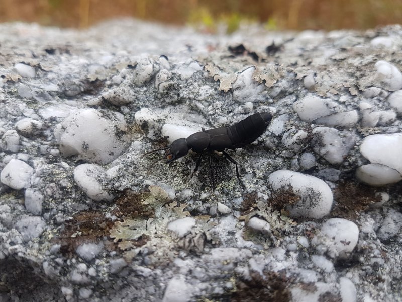 Devil's coach horse beetle on the boulder. They are generally docile, and prefer to bluff and use a stink gland. But they can bite if you hurt them, and their jaws are very large, so they can just draw blood.
Modelling by Mountain Wind
Devil's coach horse beetle on the boulder. They are generally docile, and prefer to bluff and use a stink gland. But they can bite if you hurt them, and their jaws are very large, so they can just draw blood.
Modelling by Mountain Wind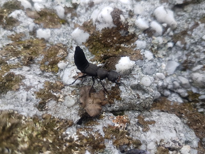 The raised tail is a threat posture, but they generally do that all the time while walking around.
Modelling by Mountain Wind
The raised tail is a threat posture, but they generally do that all the time while walking around.
Modelling by Mountain Wind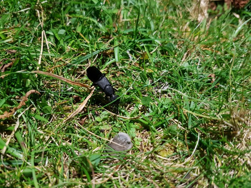 This area is covered with them.
Modelling by Black Beauty
This area is covered with them.
Modelling by Black Beauty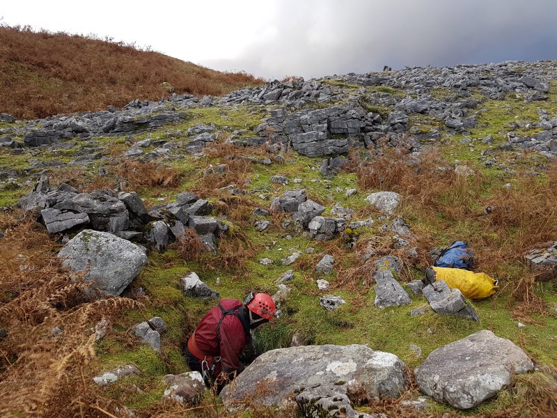 The entrance to Pwll Dwfn is a quite unremarkable little hole at the edge of the rocky patch.
Modelling by Gareth
The entrance to Pwll Dwfn is a quite unremarkable little hole at the edge of the rocky patch.
Modelling by Gareth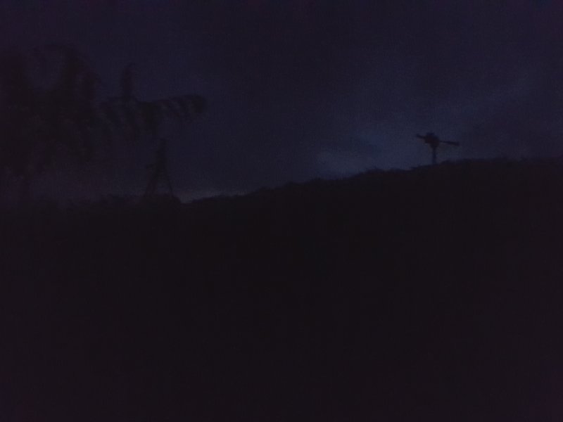 We waited until nightfall to start surface surveying, so that we could see the Disto laser more clearly. We used a pair of sturdy tripods to create temporary stations. The darkness means that most photographs were utility ones to remember station locations, such as a photo of a couple of rocks, which are not useful in this gallery, so the majority of the following photographs were taken on a subsequent day during the daytime, rather than while actually surveying.
 The Hills Have Eyes. But thankfully they are just sheep, with their eyes shining in the dark.
Modelling by a bunch of hillewes
The Hills Have Eyes. But thankfully they are just sheep, with their eyes shining in the dark.
Modelling by a bunch of hillewes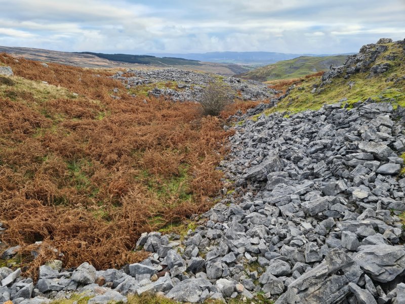 Our surface survey progressed up from the cave to the next caves up the valley. Pwll Dwfn is at the far end of the grey patch that starts beyond the tree. Dig On Black Mountain is up on the right bank, roughly level with that grey patch, but we would loop back to that later. Dry Valley Dig is behind the camera.
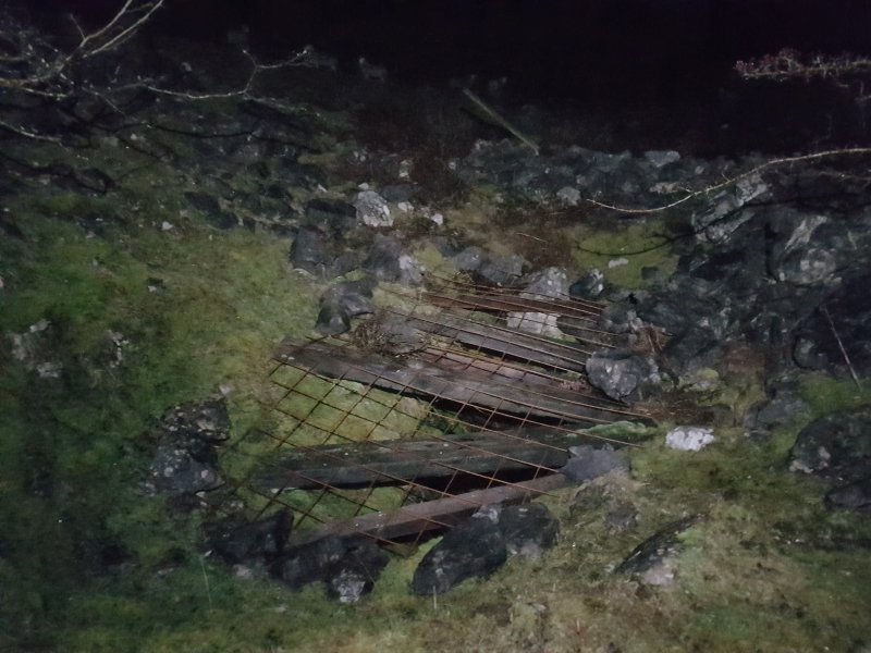 The entrance to Dry Valley Dig, situated near the largest tree, in a narrow part of the valley.
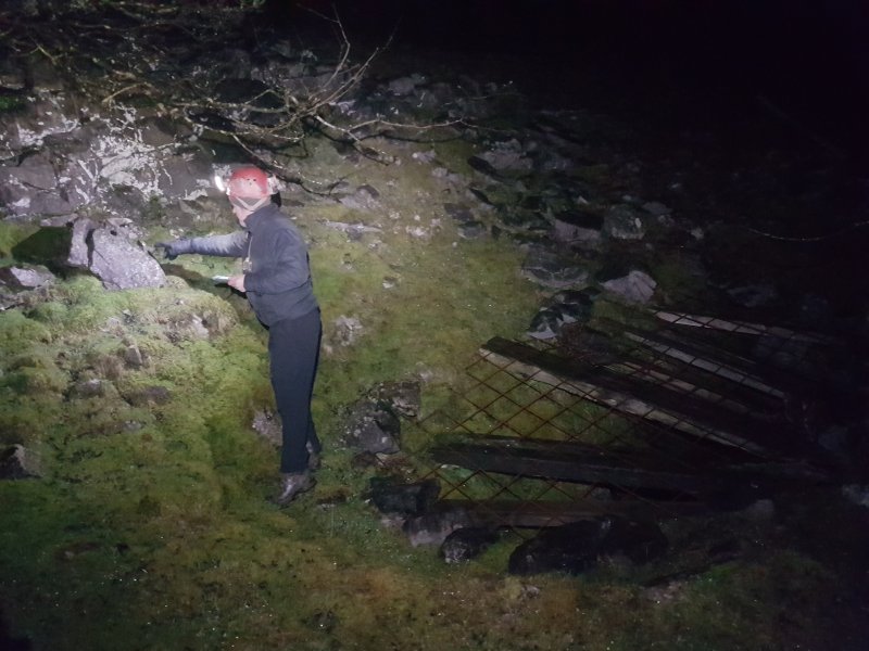 Marking a station near Dry Valley Dig. As it happens, we would abandon all of the work from this night, as it was so cold that ice crystals formed in the Disto, and ruined its calibration.
Modelling by Gareth
Marking a station near Dry Valley Dig. As it happens, we would abandon all of the work from this night, as it was so cold that ice crystals formed in the Disto, and ruined its calibration.
Modelling by Gareth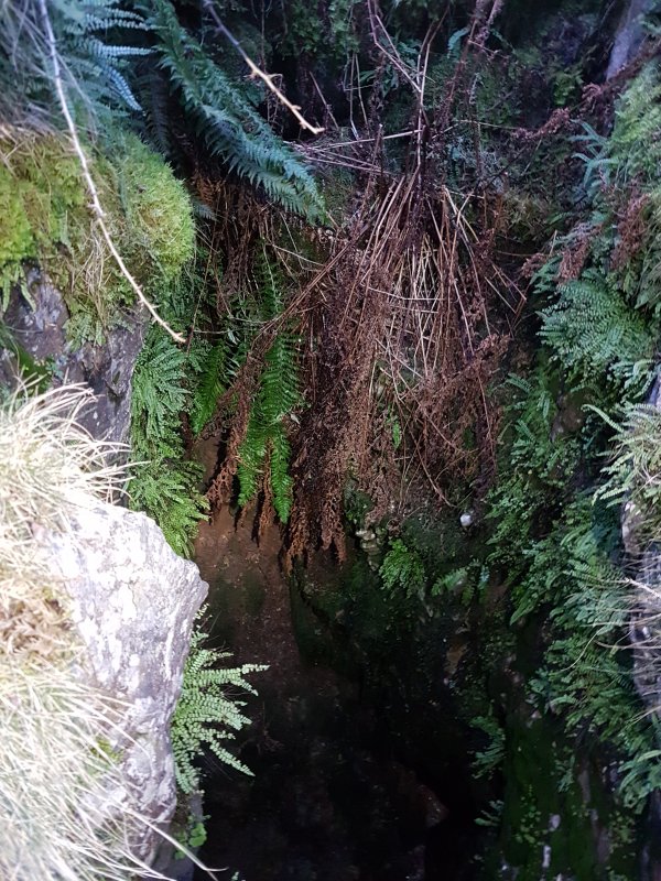 One end of Dry Valley Dig can be free climbed, but with the serious risk of falling. The gully is quite muddy, and the grip is far from perfect.
Lighting by Tarquin and Gareth
One end of Dry Valley Dig can be free climbed, but with the serious risk of falling. The gully is quite muddy, and the grip is far from perfect.
Lighting by Tarquin and Gareth It is much better to rig a rope from the railway sleepers. The drop is just over 4 metres.
Lighting by Tarquin and Gareth
It is much better to rig a rope from the railway sleepers. The drop is just over 4 metres.
Lighting by Tarquin and Gareth The cave ends immediately at a completely silted sump.
 Small rock depression beyond Dry Valley Dig. The GPS was not used for our surveying, but was used to see if the methodology could work for others.
Modelling by Peter and Dylan
Small rock depression beyond Dry Valley Dig. The GPS was not used for our surveying, but was used to see if the methodology could work for others.
Modelling by Peter and Dylan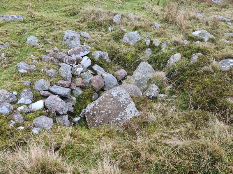 The next one looks more like digging spoil.
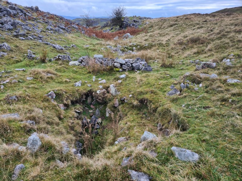 The next depression shows clear signs of being dug.
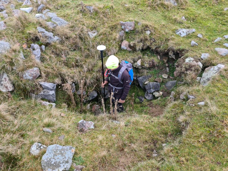 Depth of the dig.
Modelling by Peter
Depth of the dig.
Modelling by Peter The last significant former sink covered by our survey. We surveyed the shape of the valley for a distance further, but from here, we concentrated on heading back along the upper bench seen to the right of the tree here.
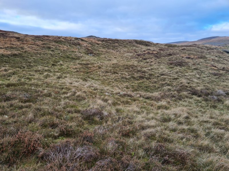 Looking north along the western bank of the valley. In the distance are an outcrop on the upper reaches of the dry valley, then Fan Brycheiniog (802 metres) and Fan Hir (761 metres).
 The route looping back on the upper bench passes several more shakeholes.
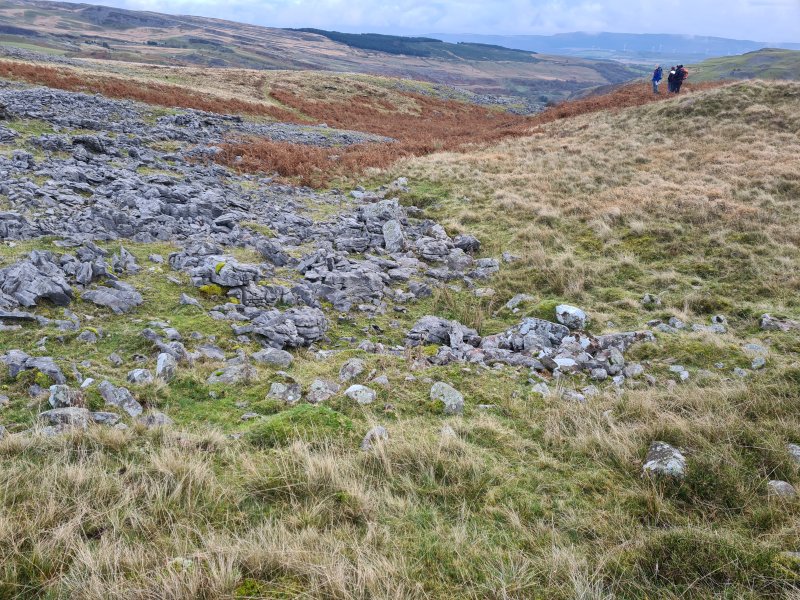 The upper bench has another patch of exposed limestone rocks.
Modelling by a random group of walkers
The upper bench has another patch of exposed limestone rocks.
Modelling by a random group of walkers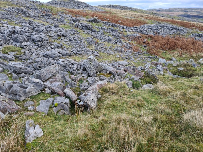 The rocks on the upper bench are flanked by a number of smaller depressions.
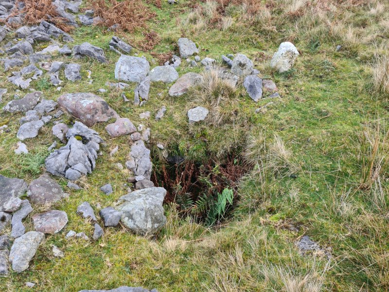 The deepest of the depressions.
 The survey used tripods for most stations, but every now and then, we would save our progress by marking a station on a rock, such as this one on the upper bench. If we messed up later, such as by knocking over a tripod, we could always come back to the last marked station and not lose everything. Our stations, as in the cave, would normally be marked using Tipp-ex (correction fluid).
Modelling by Gareth's dainty fingers
The survey used tripods for most stations, but every now and then, we would save our progress by marking a station on a rock, such as this one on the upper bench. If we messed up later, such as by knocking over a tripod, we could always come back to the last marked station and not lose everything. Our stations, as in the cave, would normally be marked using Tipp-ex (correction fluid).
Modelling by Gareth's dainty fingers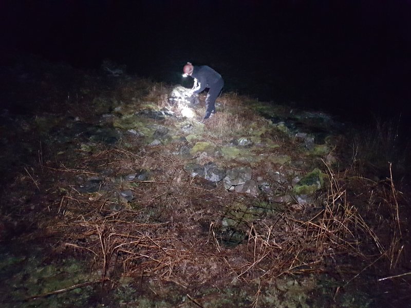 Marking a station next to Dig On Black Mountain. The cave entrance lies in the bracken under a metal grill, and would be very easy to miss.
Modelling by Gareth
Marking a station next to Dig On Black Mountain. The cave entrance lies in the bracken under a metal grill, and would be very easy to miss.
Modelling by Gareth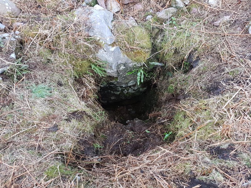 Dig On Black Mountain, with the grill removed. The bottom can be seen from here.
 Small fracture pointing up the valley, which reaches back a fair distance. This looks like a former inlet.
 The water flowed down into this little depression in the floor.
Modelling by selected portions of Tarquin
The water flowed down into this little depression in the floor.
Modelling by selected portions of Tarquin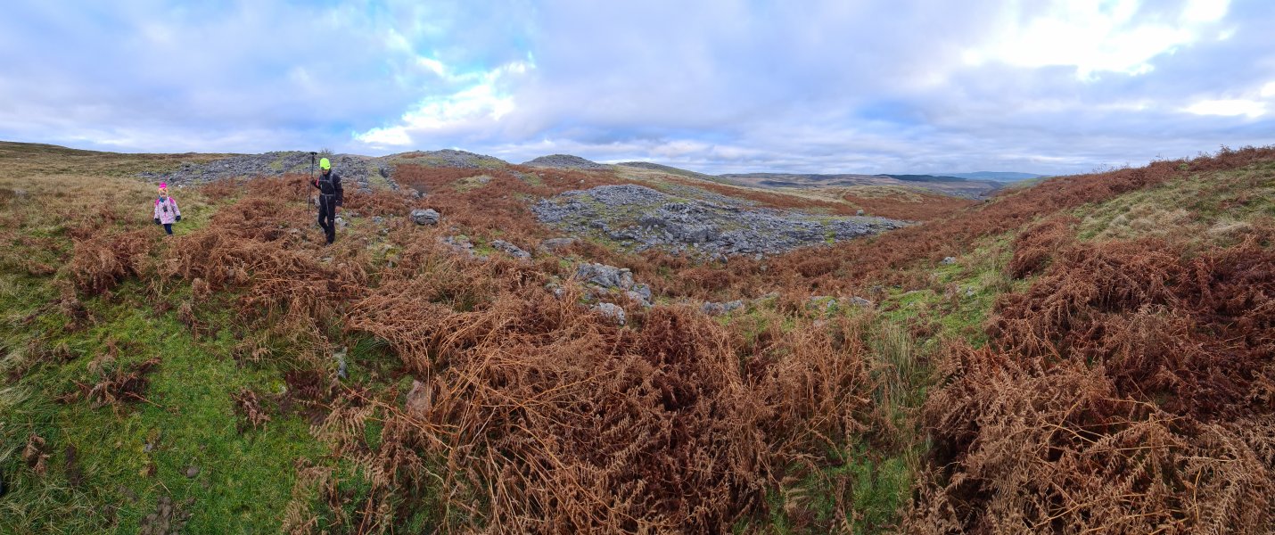 South of Dig On Black Mountain, remaining on the upper bench. The dig is just behind Peter in the bracken. Pwll Dwfn is at the right edge of the grey outcrop in the valley.
Modelling by Nina and Peter
South of Dig On Black Mountain, remaining on the upper bench. The dig is just behind Peter in the bracken. Pwll Dwfn is at the right edge of the grey outcrop in the valley.
Modelling by Nina and Peter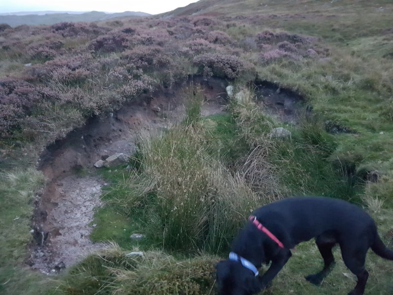 80 metres west of A Thrutch Too Far is this relatively recent shakehole. 80 metres does not sound like far, but the entire known cave fits into 65 metres.
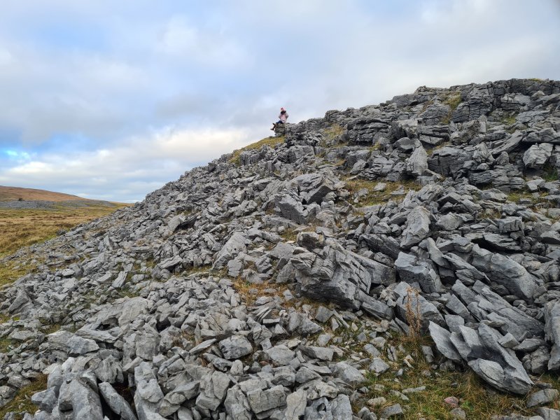 The tall grey rock pile to the northeast of the dry valley is simply an outcrop of limestone pavement.
Modelling by Nina
The tall grey rock pile to the northeast of the dry valley is simply an outcrop of limestone pavement.
Modelling by Nina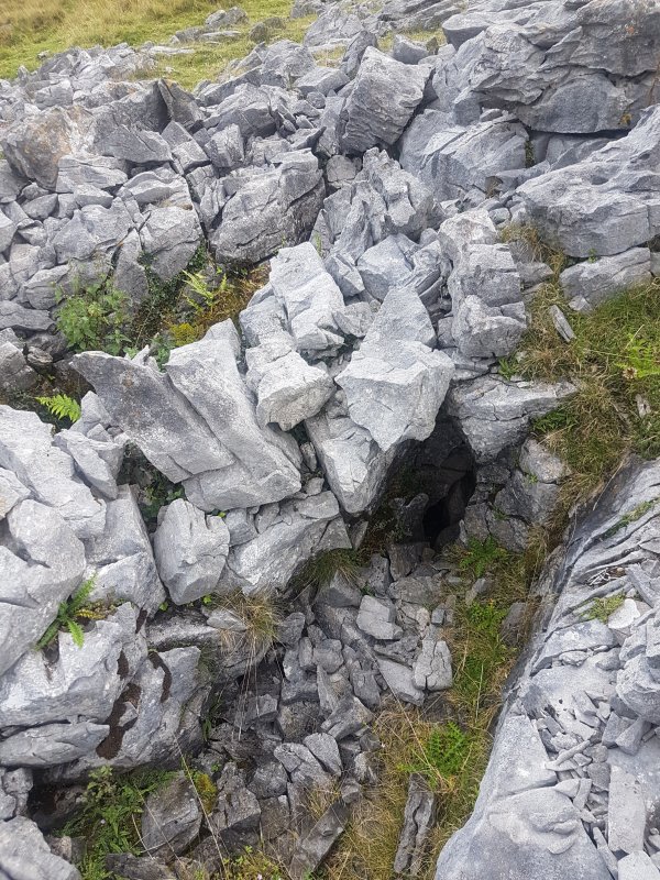 At its southern end is a gryke (fracture between pavement pieces) that seems potentially cave-like.
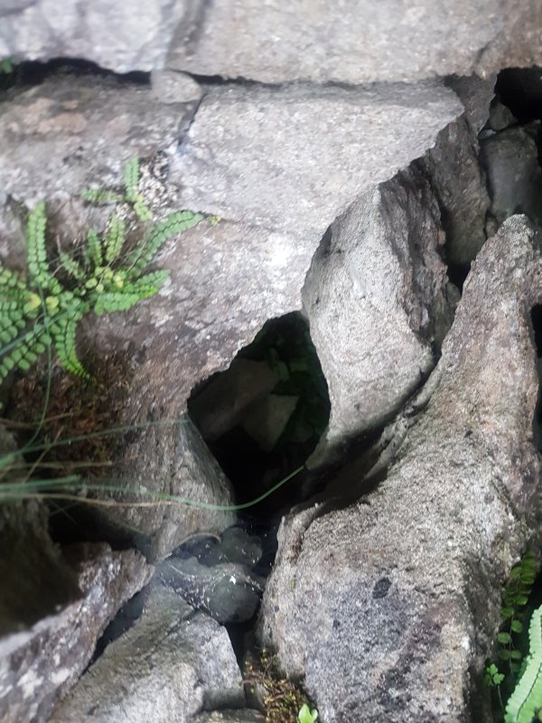 The eastern end of the gryke drops into a small cavity, but the hole is barely big enough for your arm.
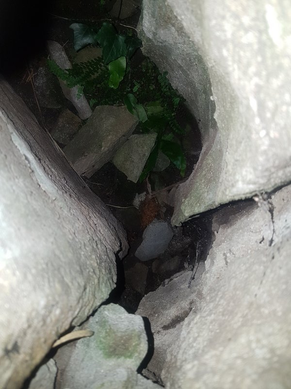 However, it just opens back to air at the other side of the clint (pavement piece), and does not appear to have any actual passage. This is not marked on our survey, since the survey only touched the outcrop with a few distant splays, without the centreline ever reaching it.
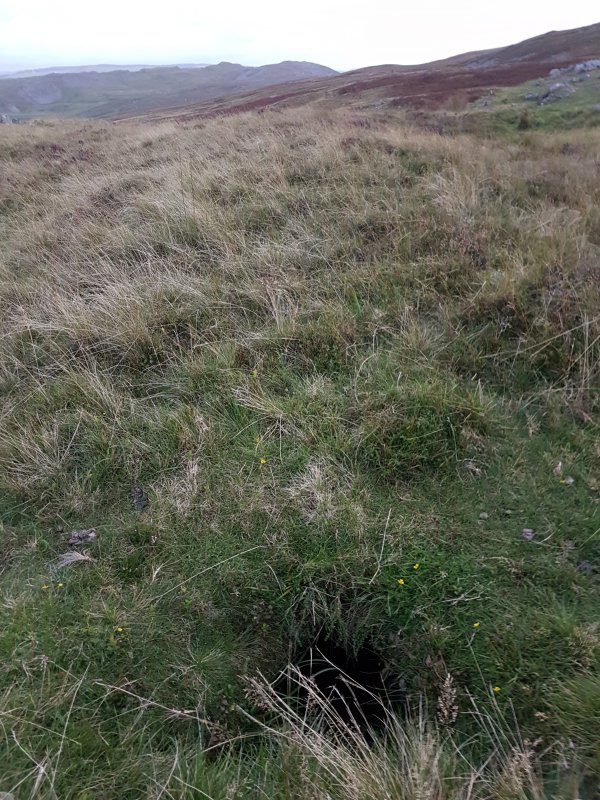 A non-natural hole nearby.
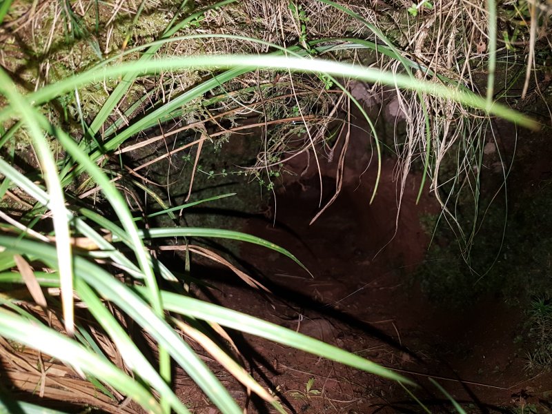 This appears to be an abandoned burrow.
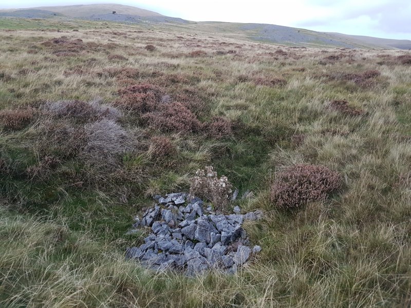 Some distance further, now quite a long way from our survey, is another dig. We did not want to start on this area, because it is an endless field of inter-related shakeholes, that do not appear to be directly related to Pwll Dwfn.
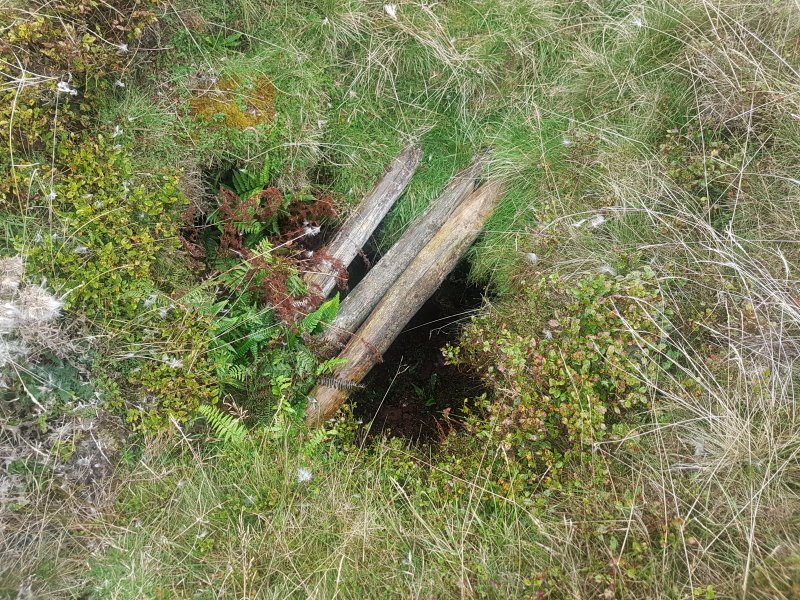 The dig has been boarded over rather poorly.
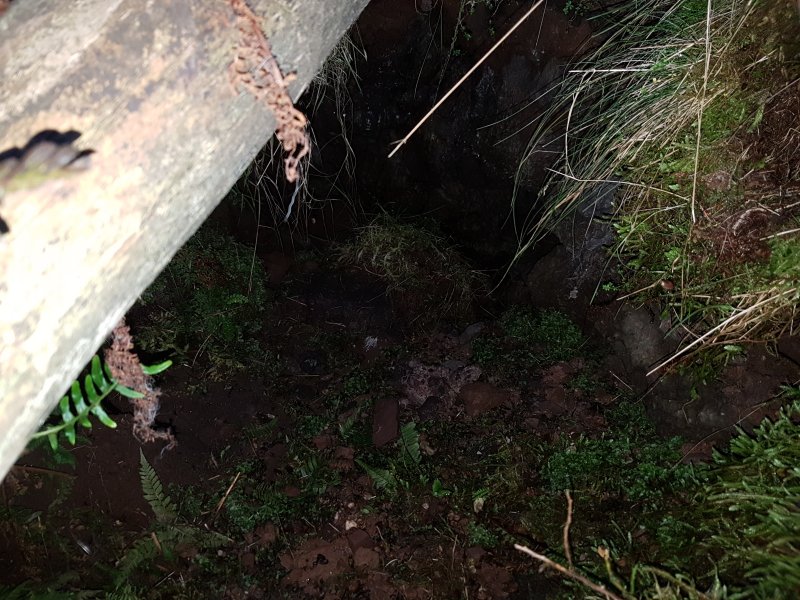 Below the boards, the dig is only shallow, and has not intersected cave.
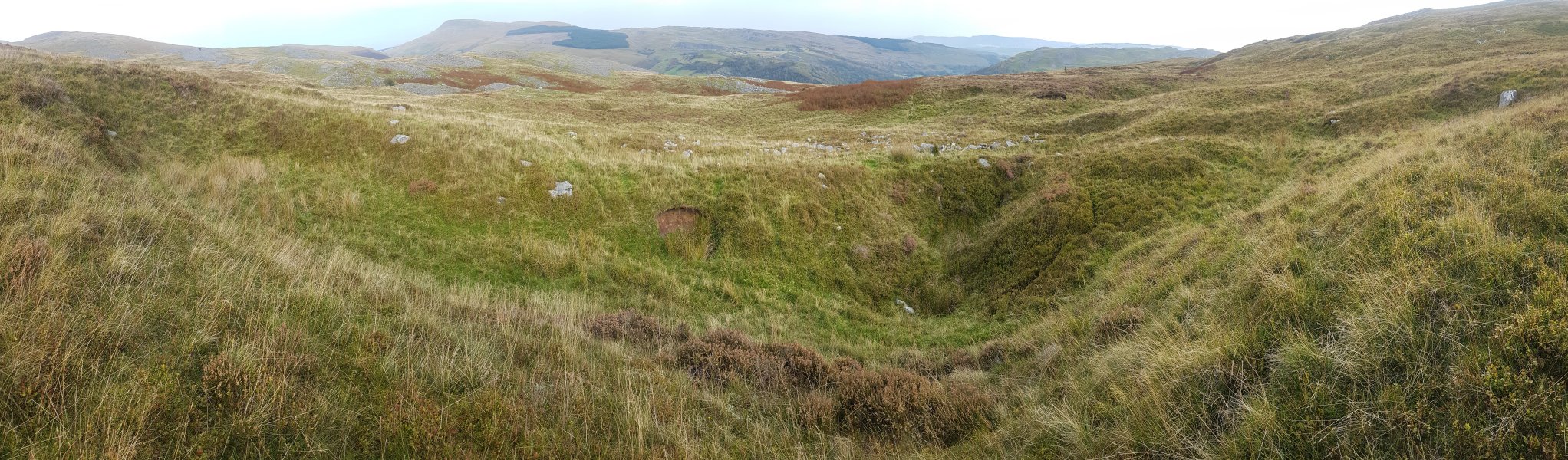 The first rank of large shakeholes encountered when heading west from Pwll Dwfn. Pwll Dwfn sits in the dry valley just before all the grey outcrops, with the left edge of the distant forest behind it. The mountains are Fan Gyhirych, Fan Fraith, Carreg Cadno, Craig y Llyn, Cribarth and Hirfynydd.
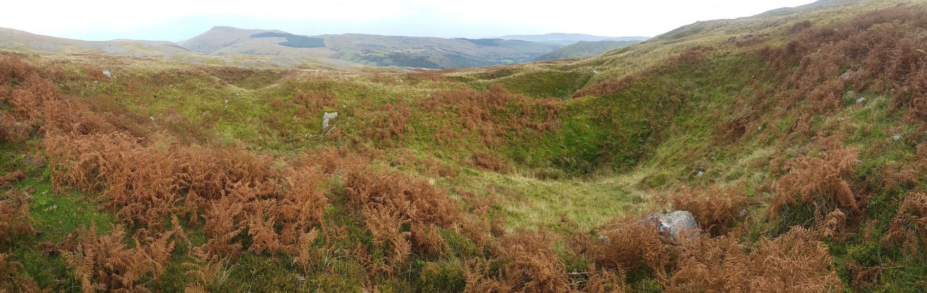 A little northwest are some much larger shakeholes. These sit 150 metres northeast of Pinnacle Series in Dan yr Ogof.
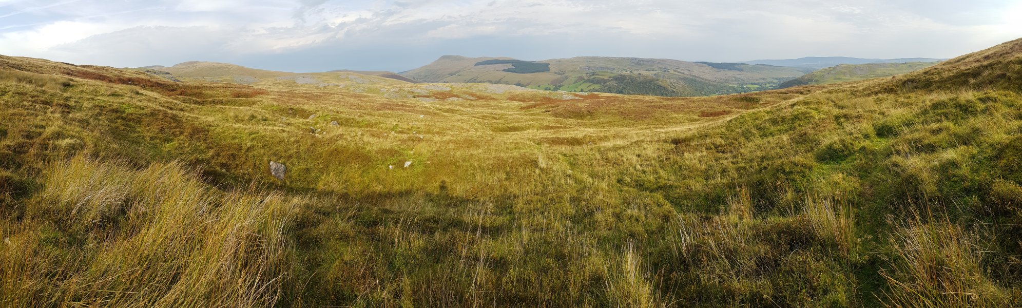 Standing nearly over Pinnacle Series, next to some of the smaller shakeholes. Pwll Dwfn sits in the dry valley just before all the grey outcrops, again with the left edge of the distant forest behind it. The mountains are Fan Brycheiniog, Fan Hir, Fan Gyhirych, Fan Fraith, Carreg Cadno, Craig y Llyn, Cribarth and Hirfynydd.
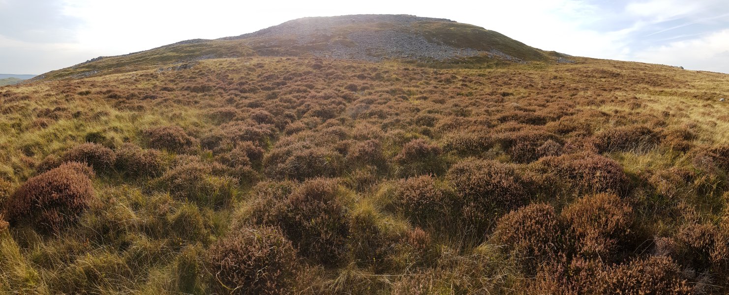 Looking over the top of Pinnacle Series, at roughly the position of Painted Chamber and Not Far Now.
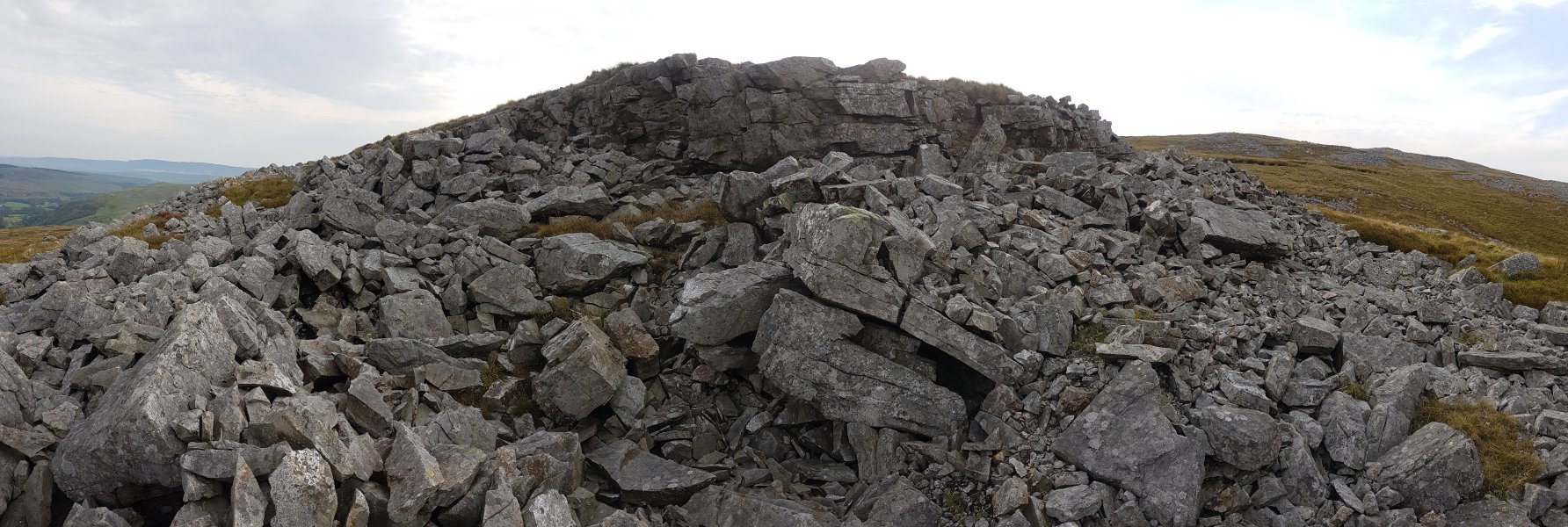 One of the millstone grit (Twrch sandstone) outcrops on Castell y Geifr.
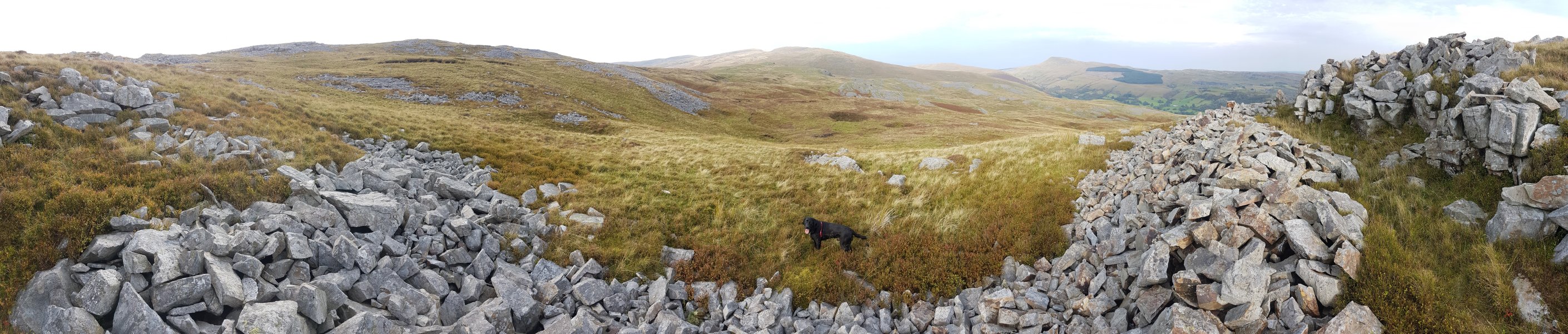 View from the northern edge of Castell y Geifr's high point. The mountains are Carreg Goch (558 metres), Waun Lefrith (677 metres) and Picws Du (749 metres) in the Bannau Sir Gaer ridge, Fan Brycheiniog, Fan Hir, Cefn Cul, Fan Gyhirych, Fan Fraith and Carreg Cadno.
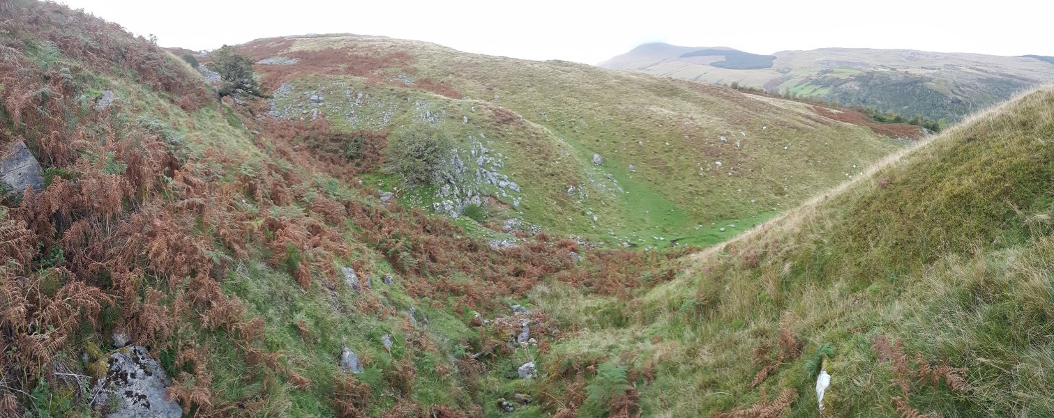 Below Pwll Dwfn, the dry valley has a number of former sinks which we surveyed, then nothing for 180 metres. Then cave features start again, with the first one being a local resurgence down by the tree. This side valley also contains a dig.
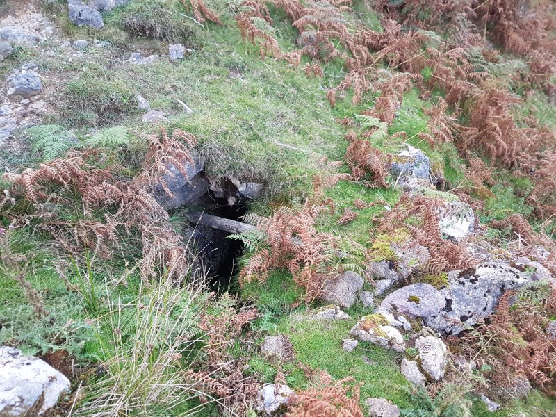 The dig in the side valley. There are a number of small shakeholes in a line above this, and they are probably all part of a little local drainage system, as water resurges nearby too.
 The resurgence is a short cave called Ogof Ffynnon Dewi Sant.
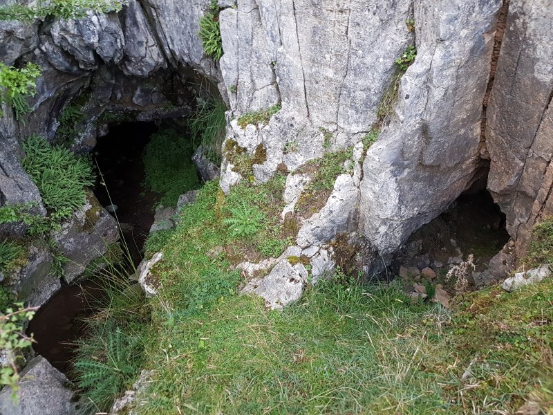 Ogof Ffynnon Dewi Sant is a pair of entrances, with the water resurging from the left one.
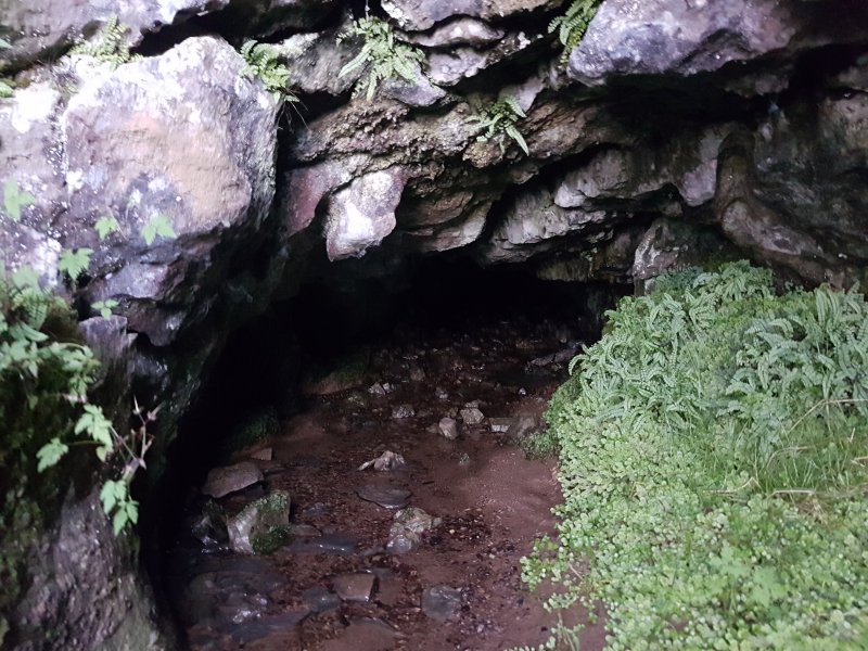 The left entrance has the audible sound of a small waterfall, but as it is only 12 metres long and mostly a flat out crawl, we did not investigate. The amount of water is not enough for this to be a major drainage system, and it is probably sourced just a short distance up the valley.
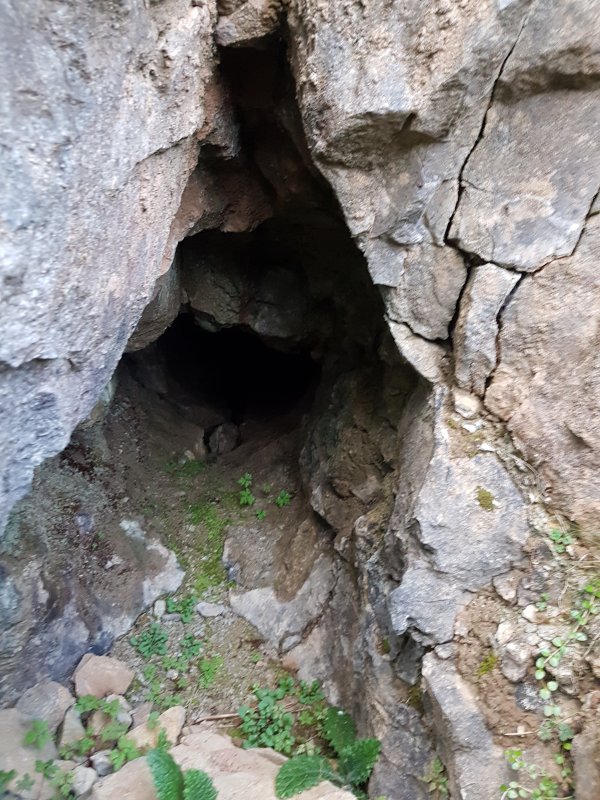 The smaller entrance to the right.
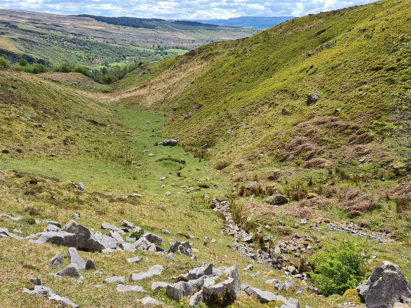 The water almost immediately sinks again, with the site of the sink slowly backtracking to earlier and earlier locations. The water resurges again almost immediately in a marshy patch of bright green grass and club rushes.
 Almost immediately, the water sinks once again in a proper sink this time.
Modelling by Becci
Almost immediately, the water sinks once again in a proper sink this time.
Modelling by Becci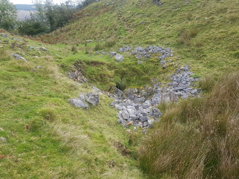 The sink almost certainly feeds one of the early inlets in Dan yr Ogof, but its destination is not (at the time of writing) known.
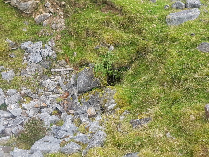 This has been dug without success.