Trefil trip 11/05/2019
Unless otherwise stated, camera, setups, lighting, edits and gallery effects by Tarquin, modelling by SMWCRT members.
This was a cave rescue team practice, intended to ensure a well rounded knowledge of the cave entrances in a relatively remote area. There are a few substantial caves in the area, such as Ogof Ap Robert and Ogof Tarddiad Rhymney, as well as several significant caves like Chartists Cave and Crescent Cave. There are even more little cave sites, like Ogof Claisfer, and Ogof Pyrgad. With these and many others scattered over a wide moorland, it also gave a chance to test searching tactics when the rescue site is not known in advance. Therefore, you will see cavers mostly in surface clothing, with only a small few of us wearing caving gear. This is therefore not a regular rescue situation, and this is not representative of common cave rescue operations (that's why we practice, after all).
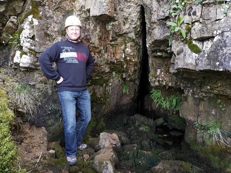
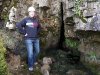 The main entrance to Ogof Pyrgad, the first cave on our search list. The main entrance is a rarity; an actual cave entrance behind a waterfall, with both the cave and the waterfall being completely natural. If you can call this pathetic dribble a waterfall. (Note that it should be pronounced as the English pronunciation of "Purgad", but it should never be spelled that way. Sometimes the name is written that way by mistake, however.)
Modelling by Henry Dawson
The main entrance to Ogof Pyrgad, the first cave on our search list. The main entrance is a rarity; an actual cave entrance behind a waterfall, with both the cave and the waterfall being completely natural. If you can call this pathetic dribble a waterfall. (Note that it should be pronounced as the English pronunciation of "Purgad", but it should never be spelled that way. Sometimes the name is written that way by mistake, however.)
Modelling by Henry Dawson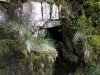 The side entrance, where most of the water resurges. This is too tight after a metre.
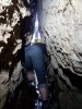 We did not expect our overdue caver to be here, but just in case, we decided to check out the cave. It's not what you would hope for from a cave behind a waterfall.
Modelling by Henry and Dan Thorne, lighting by Tarquin, Henry and Sol
We did not expect our overdue caver to be here, but just in case, we decided to check out the cave. It's not what you would hope for from a cave behind a waterfall.
Modelling by Henry and Dan Thorne, lighting by Tarquin, Henry and Sol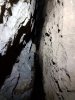 Ogof Pyrgad starts with a small, dry side passage on the left which twists around a few corners before becoming too tight. The main route continues through a torturously tight rift with snatchy walls. I should not have worn a PVC suit.
 My search companion had the sense not to follow, since I was the only one with complete caving gear. This is not a good cave. The squeeze between him and me would prevent many cavers from getting through.
Modelling by Henry, lighting by Tarquin and Henry
My search companion had the sense not to follow, since I was the only one with complete caving gear. This is not a good cave. The squeeze between him and me would prevent many cavers from getting through.
Modelling by Henry, lighting by Tarquin and Henry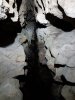 The passage splits shortly after the squeeze, but all the descriptions I could find are wrong. The right branch immediately becomes too tight, but is the source of the water. The left branch continues lower than before, and closes down in a small enlargement, where it is possible to turn around. What a horrible little cave. The amount of water seems very promising, but it seems to be either immature local drainage, or an immature passage draining a more significant system (the latter is the hope, of course).
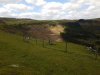 Our search list then took us over towards Dyffryn Crawnon. At the left edge of the felled trees is the Pistyll Crawnon waterfall, with Ogof Blaen Crawnon at its base, but we had some smaller sites on the way.
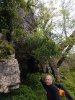 Ogof Llwynog sits below the cliff under some limekilns, and needs a detour to reach. The name is a mistake, as it is the North Welsh word for fox, rather than the South Welsh word "cadno". This is not North Wales. (The name Ogof Cadno is already in use a few mountains away.)
Modelling by Henry
Ogof Llwynog sits below the cliff under some limekilns, and needs a detour to reach. The name is a mistake, as it is the North Welsh word for fox, rather than the South Welsh word "cadno". This is not North Wales. (The name Ogof Cadno is already in use a few mountains away.)
Modelling by Henry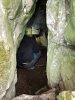 Ogof Llwynog is just a short cave, and this is the largest part of it, just inside the entrance.
Modelling by Henry
Ogof Llwynog is just a short cave, and this is the largest part of it, just inside the entrance.
Modelling by Henry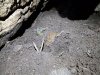 Fox scat (yes, that's the proper term). We didn't need to upset a fox for the purpose of a practice. And besides which, the multiple cobwebs and undisturbed detritus showed that this was not the cave with a lost caver in it, so we left the fox to its snooze, and headed elsewhere.
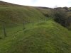 Abandoned limekilns on the path to Pistyll Crawnon.
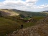 Ruined limekilns at the edge of the quarry.
Modelling by Henry
Ruined limekilns at the edge of the quarry.
Modelling by Henry Very visible normal dip slip fault in Cwar Blaen-dyffryn quarry. The right side has dropped about 4 metres from its natural position. The Llanelly Shales can be seen as a layer of powdery rubble just over half way up. Most caves in this area are in the upper limestone beds (Dowlais) like Carno Adit Cave, Ogof Ffynnon Ddu and Dan yr Ogof. I think that Ogof Tarddiad Rhymney is the exception, being in the lower beds (Abercriban Oolite) like the major caves to the east; Agen Allwedd, Daren Cilau, Craig a Ffynnon and Ogof Draenen.
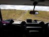 Taking the cave rescue ambulance (a modified Land Rover) up the tracks towards the more remote caves.
Modelling by Toby Dryden
Taking the cave rescue ambulance (a modified Land Rover) up the tracks towards the more remote caves.
Modelling by Toby Dryden The land rover is capable of being used off-road if needed, and this area has numerous green tracks that we could use, but since this is a national park, this is reserved for times when it is needed, rather than for a practice.
Modelling by Toby Dryden
The land rover is capable of being used off-road if needed, and this area has numerous green tracks that we could use, but since this is a national park, this is reserved for times when it is needed, rather than for a practice.
Modelling by Toby Dryden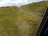 This area is still within the quarry zone. The odd boulders would have defeated even this vehicle.
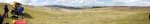 View over Cwar yr Hendre, which contains Ogof Tarddiad Rhymney, and Dyffryn Crawnon. The Brecon Beacons; Corn Ddu (873 metres), Pen y Fan (886 metres), Gwaun Cerrig Llwydion (754 metres), Waun Rydd (769 metres) and Allt Lwyd (654 metres). Southeastern Beacons; Bryniau Gleision (538 metres) and Tor y Foel (551 metres). Black Mountains; Mynydd Troed (609 metres), Pen Rhos Dirion (713 metres), Waun Fach (810 metres), Pwn y Gadair Fawr (800 metres), Mynydd Llysiau (663 metres), Pwn Twyn Glas (646 metres), Pen Allt-mawr (719 metres), Pen Cerrig-Calch (701 metres) and Crug Mawr (550 metres). Then Southeastern Beacons again; Trefil Ddu (557 metres).
Modelling by Dan, Henry, Gary Evans and Toby
View over Cwar yr Hendre, which contains Ogof Tarddiad Rhymney, and Dyffryn Crawnon. The Brecon Beacons; Corn Ddu (873 metres), Pen y Fan (886 metres), Gwaun Cerrig Llwydion (754 metres), Waun Rydd (769 metres) and Allt Lwyd (654 metres). Southeastern Beacons; Bryniau Gleision (538 metres) and Tor y Foel (551 metres). Black Mountains; Mynydd Troed (609 metres), Pen Rhos Dirion (713 metres), Waun Fach (810 metres), Pwn y Gadair Fawr (800 metres), Mynydd Llysiau (663 metres), Pwn Twyn Glas (646 metres), Pen Allt-mawr (719 metres), Pen Cerrig-Calch (701 metres) and Crug Mawr (550 metres). Then Southeastern Beacons again; Trefil Ddu (557 metres).
Modelling by Dan, Henry, Gary Evans and Toby The back of Trefil Ddu. Tor y Foel, Mynydd Troed, Pen Rhos Dirion, Waun Fach, Pwn y Gadair Fawr, Mynydd Llysiau, Pwn Twyn Glas, Pen Allt-mawr, Pen Cerrig-Calch, Trefil Ddu, The Blorenge (561 metres), Coity Mountain (578 metres), Cefn Coch (571 metres) and the ridges of The Valleys, and Cefn yr Ystrad (617 metres). In spite of a million shakeholes, the only cave visible in this picture is Pwll Pirs, on the ridge just to the left of the cavers, where another group are standing.
Modelling by Henry, Gary, Dan, and another distant group
The back of Trefil Ddu. Tor y Foel, Mynydd Troed, Pen Rhos Dirion, Waun Fach, Pwn y Gadair Fawr, Mynydd Llysiau, Pwn Twyn Glas, Pen Allt-mawr, Pen Cerrig-Calch, Trefil Ddu, The Blorenge (561 metres), Coity Mountain (578 metres), Cefn Coch (571 metres) and the ridges of The Valleys, and Cefn yr Ystrad (617 metres). In spite of a million shakeholes, the only cave visible in this picture is Pwll Pirs, on the ridge just to the left of the cavers, where another group are standing.
Modelling by Henry, Gary, Dan, and another distant group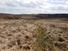 The depression containing the other caves. The large shakehole on the left is Derek's Dig. The distant large shakehole below the small hill summit, to the right of the centre of the photograph, contains Ogof Ap Robert. The huge shakehole in the distance between them contains nothing, but it really looks like it should.
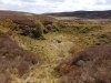 Derek's Dig is a massive shakehole, but it contains no significant cave.
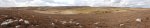 Cefn yr Ystrad, seen over the depression. On the left is the distant shakehole with no cave. At the left side of the central light patch is Ogof Ap Robert. Just to the left of the summit is another deep depression with no known cave. The Rifts lie immediately below the summmit, and Ogof Garn y Bica lies on the right edge of the summit, with all of these being very short.
 Pwll Pirs, an absolutely huge opening, containing only 30 metres of passage.
Modelling by Henry, Gary, Rich Hill and Joel Corrigan
Pwll Pirs, an absolutely huge opening, containing only 30 metres of passage.
Modelling by Henry, Gary, Rich Hill and Joel Corrigan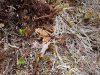 Common frog at the entrance.
 Common frog living in the undercuts of Pwll Pirs.
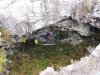 Preparing for a stretcher haul out of Pwll Pirs. Almost the entire cave can be seen in this picture. There is an undercut starting on the left, connecting to the holes in the middle and right. The furthest one to the right allows a descent between boulders, but never breaks into stable passage. This is clearly not a real solutional cave, and is just a collapse cavity at the boundary between the limestone and the caprock. The real cave is somewhere below, now full of breakdown.
Modelling by Rich, Henry, Gary and Dan
Preparing for a stretcher haul out of Pwll Pirs. Almost the entire cave can be seen in this picture. There is an undercut starting on the left, connecting to the holes in the middle and right. The furthest one to the right allows a descent between boulders, but never breaks into stable passage. This is clearly not a real solutional cave, and is just a collapse cavity at the boundary between the limestone and the caprock. The real cave is somewhere below, now full of breakdown.
Modelling by Rich, Henry, Gary and Dan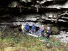 Time to attach the ropes and start the haul.
Modelling by Henry, Rich, Gary, Dan, Ali Garman and Jules Carter
Time to attach the ropes and start the haul.
Modelling by Henry, Rich, Gary, Dan, Ali Garman and Jules Carter
 The main entrance to Ogof Pyrgad, the first cave on our search list. The main entrance is a rarity; an actual cave entrance behind a waterfall, with both the cave and the waterfall being completely natural. If you can call this pathetic dribble a waterfall. (Note that it should be pronounced as the English pronunciation of "Purgad", but it should never be spelled that way. Sometimes the name is written that way by mistake, however.)
Modelling by Henry Dawson
The main entrance to Ogof Pyrgad, the first cave on our search list. The main entrance is a rarity; an actual cave entrance behind a waterfall, with both the cave and the waterfall being completely natural. If you can call this pathetic dribble a waterfall. (Note that it should be pronounced as the English pronunciation of "Purgad", but it should never be spelled that way. Sometimes the name is written that way by mistake, however.)
Modelling by Henry Dawson The side entrance, where most of the water resurges. This is too tight after a metre.
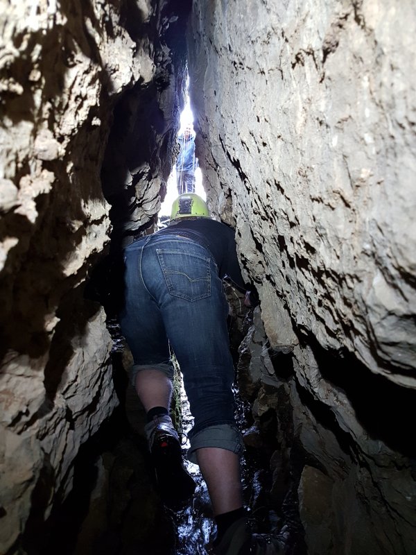 We did not expect our overdue caver to be here, but just in case, we decided to check out the cave. It's not what you would hope for from a cave behind a waterfall.
Modelling by Henry and Dan Thorne, lighting by Tarquin, Henry and Sol
We did not expect our overdue caver to be here, but just in case, we decided to check out the cave. It's not what you would hope for from a cave behind a waterfall.
Modelling by Henry and Dan Thorne, lighting by Tarquin, Henry and Sol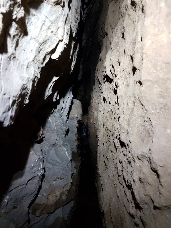 Ogof Pyrgad starts with a small, dry side passage on the left which twists around a few corners before becoming too tight. The main route continues through a torturously tight rift with snatchy walls. I should not have worn a PVC suit.
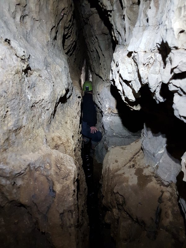 My search companion had the sense not to follow, since I was the only one with complete caving gear. This is not a good cave. The squeeze between him and me would prevent many cavers from getting through.
Modelling by Henry, lighting by Tarquin and Henry
My search companion had the sense not to follow, since I was the only one with complete caving gear. This is not a good cave. The squeeze between him and me would prevent many cavers from getting through.
Modelling by Henry, lighting by Tarquin and Henry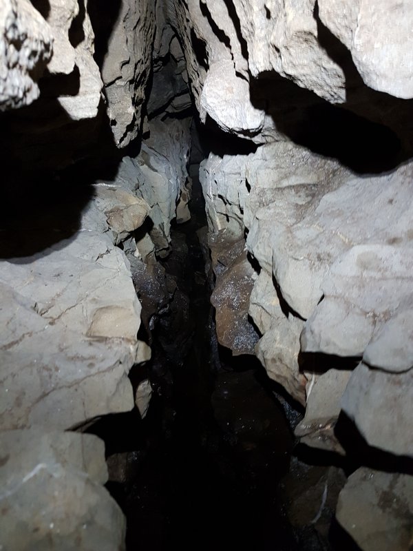 The passage splits shortly after the squeeze, but all the descriptions I could find are wrong. The right branch immediately becomes too tight, but is the source of the water. The left branch continues lower than before, and closes down in a small enlargement, where it is possible to turn around. What a horrible little cave. The amount of water seems very promising, but it seems to be either immature local drainage, or an immature passage draining a more significant system (the latter is the hope, of course).
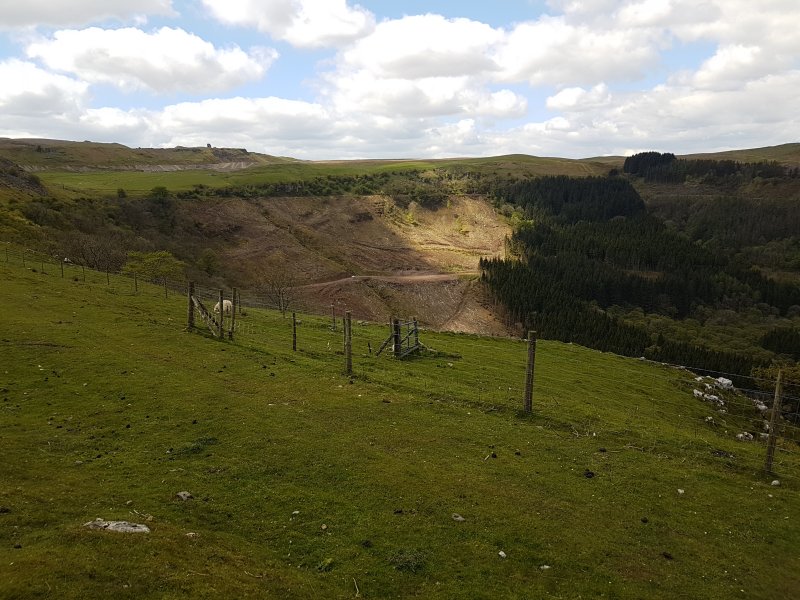 Our search list then took us over towards Dyffryn Crawnon. At the left edge of the felled trees is the Pistyll Crawnon waterfall, with Ogof Blaen Crawnon at its base, but we had some smaller sites on the way.
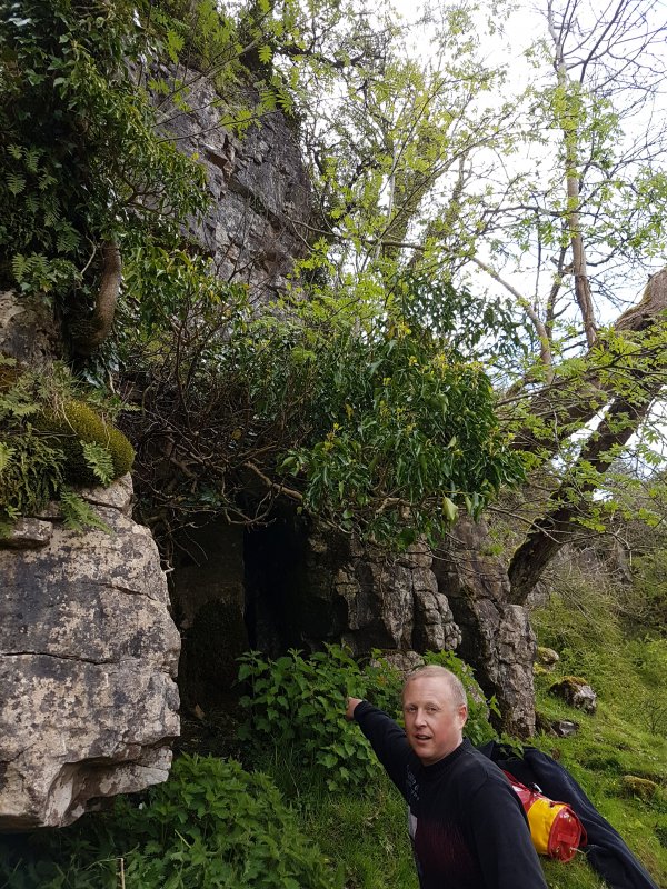 Ogof Llwynog sits below the cliff under some limekilns, and needs a detour to reach. The name is a mistake, as it is the North Welsh word for fox, rather than the South Welsh word "cadno". This is not North Wales. (The name Ogof Cadno is already in use a few mountains away.)
Modelling by Henry
Ogof Llwynog sits below the cliff under some limekilns, and needs a detour to reach. The name is a mistake, as it is the North Welsh word for fox, rather than the South Welsh word "cadno". This is not North Wales. (The name Ogof Cadno is already in use a few mountains away.)
Modelling by Henry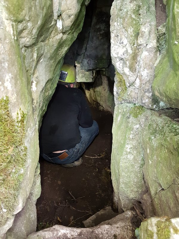 Ogof Llwynog is just a short cave, and this is the largest part of it, just inside the entrance.
Modelling by Henry
Ogof Llwynog is just a short cave, and this is the largest part of it, just inside the entrance.
Modelling by Henry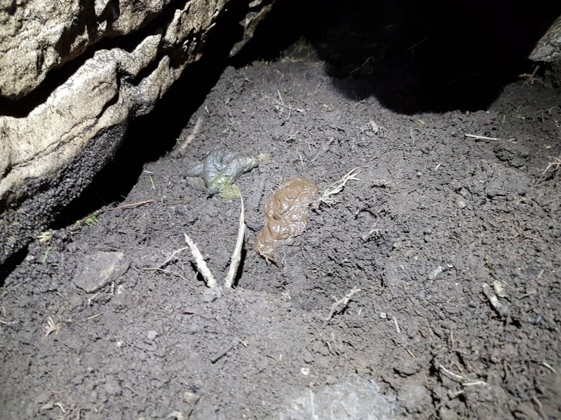 Fox scat (yes, that's the proper term). We didn't need to upset a fox for the purpose of a practice. And besides which, the multiple cobwebs and undisturbed detritus showed that this was not the cave with a lost caver in it, so we left the fox to its snooze, and headed elsewhere.
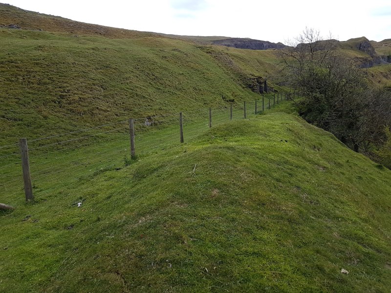 Abandoned limekilns on the path to Pistyll Crawnon.
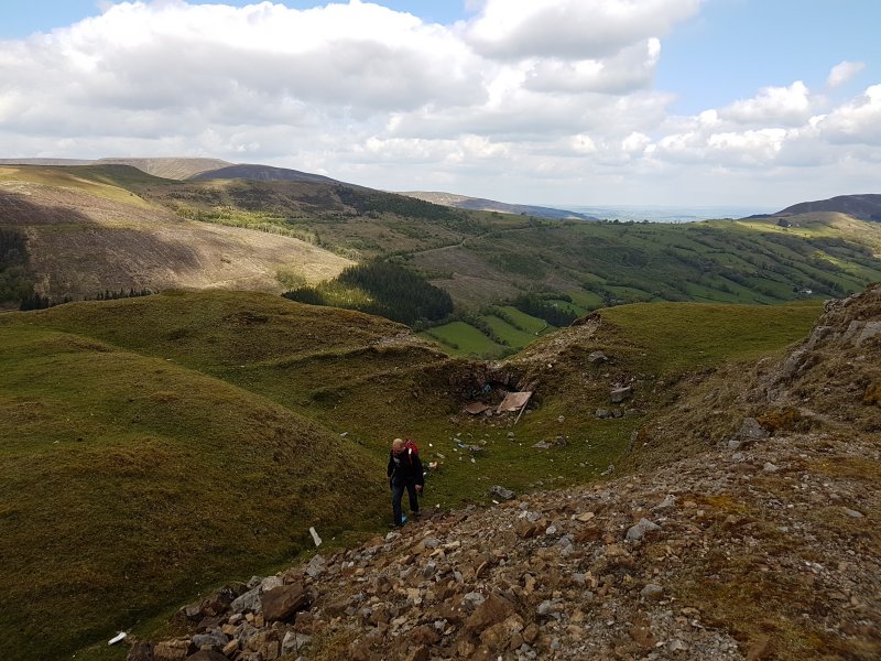 Ruined limekilns at the edge of the quarry.
Modelling by Henry
Ruined limekilns at the edge of the quarry.
Modelling by Henry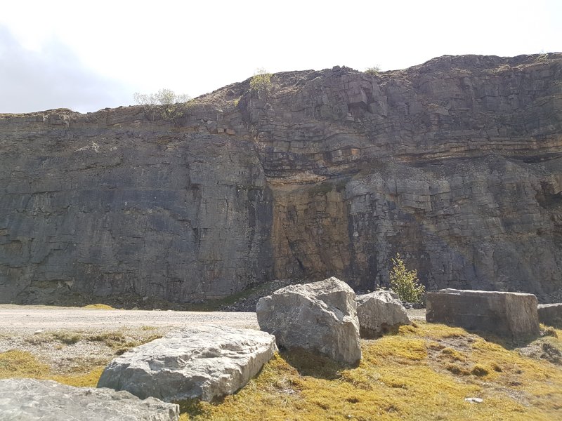 Very visible normal dip slip fault in Cwar Blaen-dyffryn quarry. The right side has dropped about 4 metres from its natural position. The Llanelly Shales can be seen as a layer of powdery rubble just over half way up. Most caves in this area are in the upper limestone beds (Dowlais) like Carno Adit Cave, Ogof Ffynnon Ddu and Dan yr Ogof. I think that Ogof Tarddiad Rhymney is the exception, being in the lower beds (Abercriban Oolite) like the major caves to the east; Agen Allwedd, Daren Cilau, Craig a Ffynnon and Ogof Draenen.
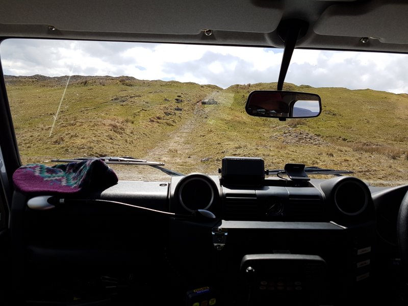 Taking the cave rescue ambulance (a modified Land Rover) up the tracks towards the more remote caves.
Modelling by Toby Dryden
Taking the cave rescue ambulance (a modified Land Rover) up the tracks towards the more remote caves.
Modelling by Toby Dryden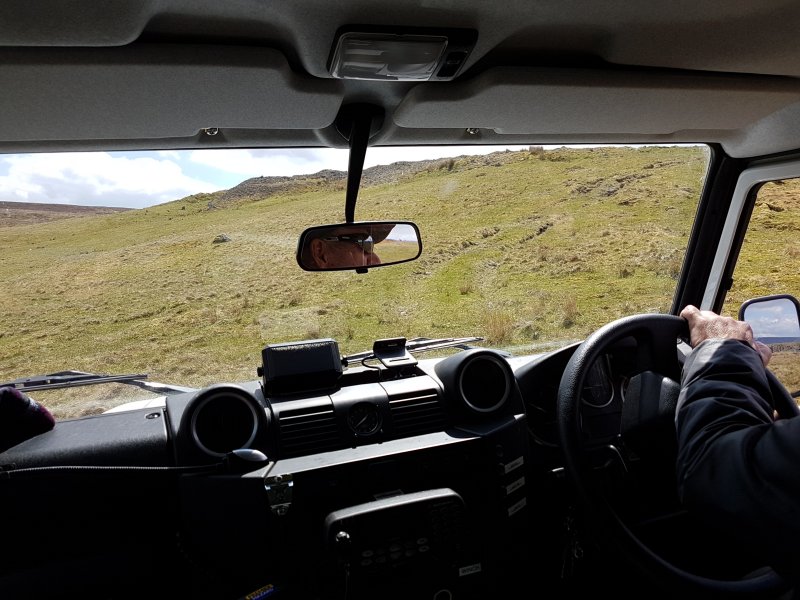 The land rover is capable of being used off-road if needed, and this area has numerous green tracks that we could use, but since this is a national park, this is reserved for times when it is needed, rather than for a practice.
Modelling by Toby Dryden
The land rover is capable of being used off-road if needed, and this area has numerous green tracks that we could use, but since this is a national park, this is reserved for times when it is needed, rather than for a practice.
Modelling by Toby Dryden This area is still within the quarry zone. The odd boulders would have defeated even this vehicle.
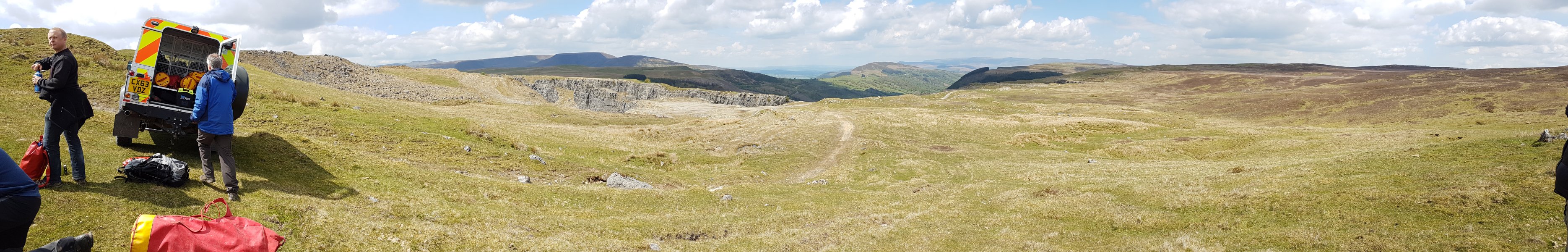 View over Cwar yr Hendre, which contains Ogof Tarddiad Rhymney, and Dyffryn Crawnon. The Brecon Beacons; Corn Ddu (873 metres), Pen y Fan (886 metres), Gwaun Cerrig Llwydion (754 metres), Waun Rydd (769 metres) and Allt Lwyd (654 metres). Southeastern Beacons; Bryniau Gleision (538 metres) and Tor y Foel (551 metres). Black Mountains; Mynydd Troed (609 metres), Pen Rhos Dirion (713 metres), Waun Fach (810 metres), Pwn y Gadair Fawr (800 metres), Mynydd Llysiau (663 metres), Pwn Twyn Glas (646 metres), Pen Allt-mawr (719 metres), Pen Cerrig-Calch (701 metres) and Crug Mawr (550 metres). Then Southeastern Beacons again; Trefil Ddu (557 metres).
Modelling by Dan, Henry, Gary Evans and Toby
View over Cwar yr Hendre, which contains Ogof Tarddiad Rhymney, and Dyffryn Crawnon. The Brecon Beacons; Corn Ddu (873 metres), Pen y Fan (886 metres), Gwaun Cerrig Llwydion (754 metres), Waun Rydd (769 metres) and Allt Lwyd (654 metres). Southeastern Beacons; Bryniau Gleision (538 metres) and Tor y Foel (551 metres). Black Mountains; Mynydd Troed (609 metres), Pen Rhos Dirion (713 metres), Waun Fach (810 metres), Pwn y Gadair Fawr (800 metres), Mynydd Llysiau (663 metres), Pwn Twyn Glas (646 metres), Pen Allt-mawr (719 metres), Pen Cerrig-Calch (701 metres) and Crug Mawr (550 metres). Then Southeastern Beacons again; Trefil Ddu (557 metres).
Modelling by Dan, Henry, Gary Evans and Toby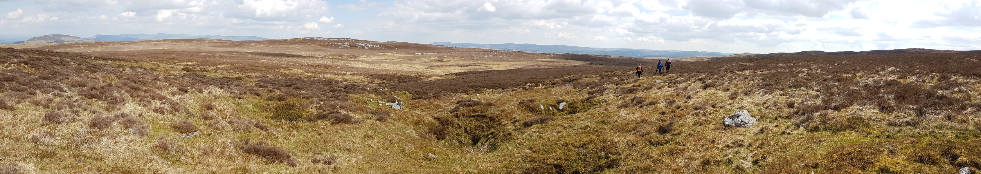 The back of Trefil Ddu. Tor y Foel, Mynydd Troed, Pen Rhos Dirion, Waun Fach, Pwn y Gadair Fawr, Mynydd Llysiau, Pwn Twyn Glas, Pen Allt-mawr, Pen Cerrig-Calch, Trefil Ddu, The Blorenge (561 metres), Coity Mountain (578 metres), Cefn Coch (571 metres) and the ridges of The Valleys, and Cefn yr Ystrad (617 metres). In spite of a million shakeholes, the only cave visible in this picture is Pwll Pirs, on the ridge just to the left of the cavers, where another group are standing.
Modelling by Henry, Gary, Dan, and another distant group
The back of Trefil Ddu. Tor y Foel, Mynydd Troed, Pen Rhos Dirion, Waun Fach, Pwn y Gadair Fawr, Mynydd Llysiau, Pwn Twyn Glas, Pen Allt-mawr, Pen Cerrig-Calch, Trefil Ddu, The Blorenge (561 metres), Coity Mountain (578 metres), Cefn Coch (571 metres) and the ridges of The Valleys, and Cefn yr Ystrad (617 metres). In spite of a million shakeholes, the only cave visible in this picture is Pwll Pirs, on the ridge just to the left of the cavers, where another group are standing.
Modelling by Henry, Gary, Dan, and another distant group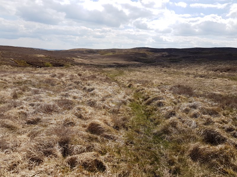 The depression containing the other caves. The large shakehole on the left is Derek's Dig. The distant large shakehole below the small hill summit, to the right of the centre of the photograph, contains Ogof Ap Robert. The huge shakehole in the distance between them contains nothing, but it really looks like it should.
 Derek's Dig is a massive shakehole, but it contains no significant cave.
 Cefn yr Ystrad, seen over the depression. On the left is the distant shakehole with no cave. At the left side of the central light patch is Ogof Ap Robert. Just to the left of the summit is another deep depression with no known cave. The Rifts lie immediately below the summmit, and Ogof Garn y Bica lies on the right edge of the summit, with all of these being very short.
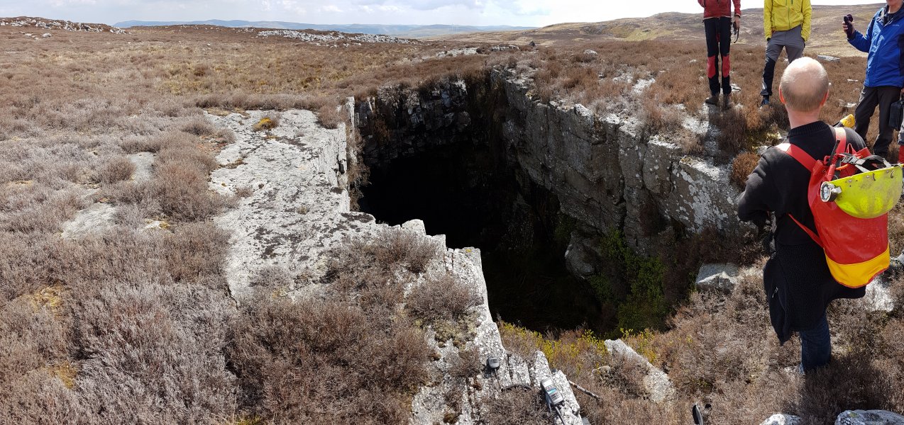 Pwll Pirs, an absolutely huge opening, containing only 30 metres of passage.
Modelling by Henry, Gary, Rich Hill and Joel Corrigan
Pwll Pirs, an absolutely huge opening, containing only 30 metres of passage.
Modelling by Henry, Gary, Rich Hill and Joel Corrigan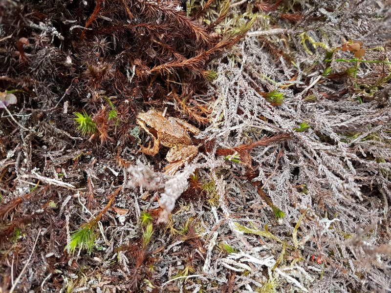 Common frog at the entrance.
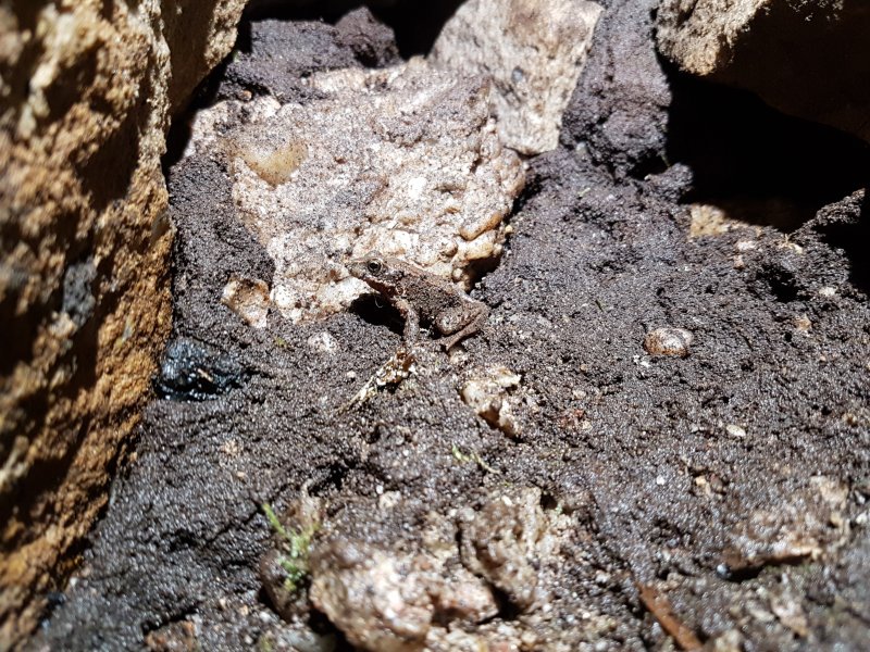 Common frog living in the undercuts of Pwll Pirs.
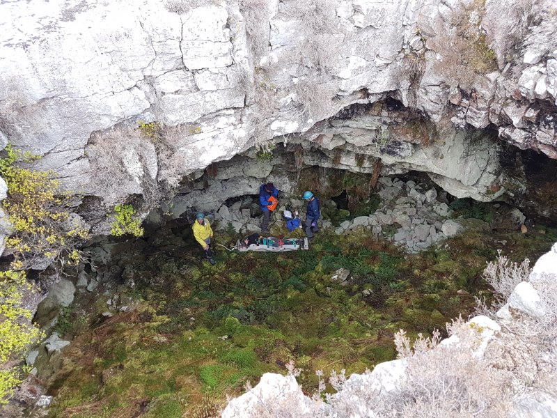 Preparing for a stretcher haul out of Pwll Pirs. Almost the entire cave can be seen in this picture. There is an undercut starting on the left, connecting to the holes in the middle and right. The furthest one to the right allows a descent between boulders, but never breaks into stable passage. This is clearly not a real solutional cave, and is just a collapse cavity at the boundary between the limestone and the caprock. The real cave is somewhere below, now full of breakdown.
Modelling by Rich, Henry, Gary and Dan
Preparing for a stretcher haul out of Pwll Pirs. Almost the entire cave can be seen in this picture. There is an undercut starting on the left, connecting to the holes in the middle and right. The furthest one to the right allows a descent between boulders, but never breaks into stable passage. This is clearly not a real solutional cave, and is just a collapse cavity at the boundary between the limestone and the caprock. The real cave is somewhere below, now full of breakdown.
Modelling by Rich, Henry, Gary and Dan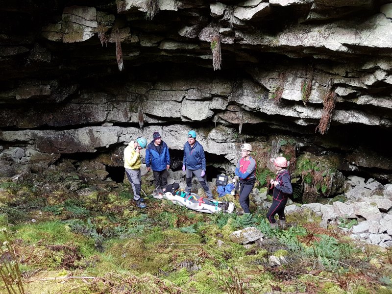 Time to attach the ropes and start the haul.
Modelling by Henry, Rich, Gary, Dan, Ali Garman and Jules Carter
Time to attach the ropes and start the haul.
Modelling by Henry, Rich, Gary, Dan, Ali Garman and Jules Carter