Yorkshire Dales trip 18/03/2022 to 20/03/2022
Unless otherwise stated, camera, setups, lighting, edits and gallery effects by Tarquin. Modelling and lighting at various points will be Gwenllian Tawy and Jack Overhill.
This was a trip to see the other side of the Yorkshire Dales caves. Rather than the potholes that southern cavers head to Yorkshire for, this gallery covers some caves instead, including some of the best decorated caves in the Yorkshire Dales. Proof that there are some great formations up here too. But yes, there will be some SRT; it is The North, after all. It starts with a short trip through the Peak District. The caves were Shuttleworth Pot, Notts II and Illusion Pot.
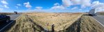 View over to the Thurlstone Moors reservoirs at the northeastern edge of Peak District; Upper and Lower Windleden Reservoirs and Winscar Reservoir. On the left is Dead Edge End (499 metres), and on the right is South Nab (461 metres).
Modelling by a shadowy apparition
View over to the Thurlstone Moors reservoirs at the northeastern edge of Peak District; Upper and Lower Windleden Reservoirs and Winscar Reservoir. On the left is Dead Edge End (499 metres), and on the right is South Nab (461 metres).
Modelling by a shadowy apparition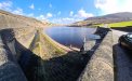 Woodhead Reservoir in Longdendale. From left to right are Ancote Hill (only a ridge), Dead Edge End, Pikenaze Hill (382 metres) and the Lawrence Edge of Bleaklow (633 metres).
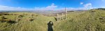 View from Slack Edge, over Glossop, towards Black Hill (582 metres), Bleaklow, Shelf Moor (621 metres) and Kinder Scout (636 metres). Just above the vitally important stile, is the equally comically named Cock Hill ridge, a local point of growing interest.
Modelling by the dark side of Tarquin
View from Slack Edge, over Glossop, towards Black Hill (582 metres), Bleaklow, Shelf Moor (621 metres) and Kinder Scout (636 metres). Just above the vitally important stile, is the equally comically named Cock Hill ridge, a local point of growing interest.
Modelling by the dark side of Tarquin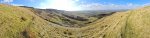 Coombes Edge, a relatively small glacial cirque, filled with morraines.
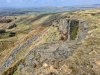 An early part of the crag.
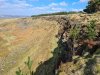 A later part of the crag.
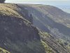 Coombes Tor, a rock pinnacle.
 Coombes Edge, with its very small tarn, nestled above the morraines.
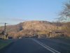 Stainsforth Scar, a prominent cliff between Lancliffe and Stainforth in Ribblesdale, in the Yorkshire Dales.
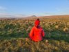 In the sunset light in front of Pen-y-ghent (694 metres), with Plover Hill (over 680 metres) and the more distant High Green Field Knott (602 metres) behind it.
Modelling by Beandan, Gwenllian and Noahoop
In the sunset light in front of Pen-y-ghent (694 metres), with Plover Hill (over 680 metres) and the more distant High Green Field Knott (602 metres) behind it.
Modelling by Beandan, Gwenllian and Noahoop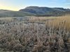 Swarth Moor marsh, in front of Moughton (427 metres).
 Dry Rigg Quarry, a deep and impressive quarry on the side of Moughton (with Pen-y-ghent in the background). This is a gritstone quarry, and its rock is used as the stones in tarmac/asphalt.
Modelling by vague hints of Gwenllian's left leg
Dry Rigg Quarry, a deep and impressive quarry on the side of Moughton (with Pen-y-ghent in the background). This is a gritstone quarry, and its rock is used as the stones in tarmac/asphalt.
Modelling by vague hints of Gwenllian's left leg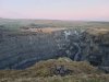 The quarry is supposed to run until 2035, and is then destined to become a 125 metre deep lake by 2065. Or perhaps deeper, if they make it any deeper before 2035
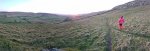 Walking towards the sunset on Moughton Scar. On the left is In Moor (363 metres), in the distance is Burn Moor (486 metres), and the Thwaite ridge can be seen on the right.
Modelling by Gwenllian
Walking towards the sunset on Moughton Scar. On the left is In Moor (363 metres), in the distance is Burn Moor (486 metres), and the Thwaite ridge can be seen on the right.
Modelling by Gwenllian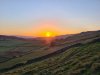 Sunset over Thwaite.
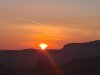 A rich and glorious sunset.
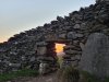 Sunset through the wall.
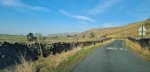 Driving past Moughton and Thwaite.
 Approaching Bullpot Farm, the Red Rose Cave & Pothole Club's hut. This was a CHECC (Council of Higher Education Caving Clubs) weekend, and the place was covered with tents. Surprisingly, the students were already out and about by the time we arrived, and were just starting to head off to the caves. The mountains are Barbon Low Fell (437 metres), Castle Knott (538 metres), Calf Top (610 metres), Great Coum (687 metres) and Gragareth (627 metres). The slope of Great Coum is called Casterton Fell, is in Cumbria (not Yorkshire), and is home to the Three Counties caves of Ease Gill (or Easegill). The slope of Gragareth is called Leck Fell, is in Lancashire (not Yorkshire), and is home to many more of the Three Counties System caves. Why is this called the Yorkshire Dales again?
Modelling by auto-portrait
Approaching Bullpot Farm, the Red Rose Cave & Pothole Club's hut. This was a CHECC (Council of Higher Education Caving Clubs) weekend, and the place was covered with tents. Surprisingly, the students were already out and about by the time we arrived, and were just starting to head off to the caves. The mountains are Barbon Low Fell (437 metres), Castle Knott (538 metres), Calf Top (610 metres), Great Coum (687 metres) and Gragareth (627 metres). The slope of Great Coum is called Casterton Fell, is in Cumbria (not Yorkshire), and is home to the Three Counties caves of Ease Gill (or Easegill). The slope of Gragareth is called Leck Fell, is in Lancashire (not Yorkshire), and is home to many more of the Three Counties System caves. Why is this called the Yorkshire Dales again?
Modelling by auto-portrait Just beyond where the path branches to Lancaster Hole, our route continues towards Easegill. Left and right are Green Hill (628 metres), Gragareth and Barbon Low Fell.
Modelling by Gwenllian, Jack, and a lurker
Just beyond where the path branches to Lancaster Hole, our route continues towards Easegill. Left and right are Green Hill (628 metres), Gragareth and Barbon Low Fell.
Modelling by Gwenllian, Jack, and a lurker Dropping down into Ease Gill beside Hellot Scales Barn, just above the gorge called Ease Gill Kirk, where Leck Beck Head - the resurgence for all of the Ease Gill caves, is located.
Modelling by Gwenllian and Jack
Dropping down into Ease Gill beside Hellot Scales Barn, just above the gorge called Ease Gill Kirk, where Leck Beck Head - the resurgence for all of the Ease Gill caves, is located.
Modelling by Gwenllian and Jack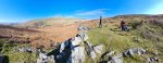 The entrance to Shuttleworth Pot, with Barbon Low Fell, Castle Knott, Calf Top, and the Crag Hill (682 metres) bump on Great Coum.
Modelling by Gwenllian, Jack and a dementor
The entrance to Shuttleworth Pot, with Barbon Low Fell, Castle Knott, Calf Top, and the Crag Hill (682 metres) bump on Great Coum.
Modelling by Gwenllian, Jack and a dementor Entering Shuttleworth Pot. The entrance tube drops a few metres to the head of the first pitch.
Camera by Jack, modelling by Beandan, Noahoop, Tarquin, and Jackhouette
Entering Shuttleworth Pot. The entrance tube drops a few metres to the head of the first pitch.
Camera by Jack, modelling by Beandan, Noahoop, Tarquin, and Jackhouette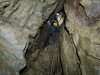 This cave was originally part of an upstream section of Witches Cave, and was explored to surface from below.
Modelling by Gwenllian, lighting by Tarquin, Gwenllian and Sol
This cave was originally part of an upstream section of Witches Cave, and was explored to surface from below.
Modelling by Gwenllian, lighting by Tarquin, Gwenllian and Sol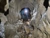 A descent through a dig then reaches this crawl, which has a short side passage.
Modelling by Gwenllian, lighting by Tarquin and Gwenllian
A descent through a dig then reaches this crawl, which has a short side passage.
Modelling by Gwenllian, lighting by Tarquin and Gwenllian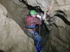 The next pitch is the start of a series of little drops leading to the head of the main pitch.
Modelling by Jack, lighting by Tarquin and Jack
The next pitch is the start of a series of little drops leading to the head of the main pitch.
Modelling by Jack, lighting by Tarquin and Jack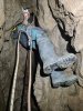 The first of the little drops is tight at the top.
Modelling by Gwenllian, lighting by Tarquin and Gwenllian
The first of the little drops is tight at the top.
Modelling by Gwenllian, lighting by Tarquin and Gwenllian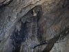 The main pitch - known as the Diver's Pitch - slopes gently, with a couple of rebelays. The top has a lot of loose rocks, so each person needs to complete the descent before the next person passes the rocky ledges.
Modelling by Gwenllian, lighting by Tarquin and Gwenllian
The main pitch - known as the Diver's Pitch - slopes gently, with a couple of rebelays. The top has a lot of loose rocks, so each person needs to complete the descent before the next person passes the rocky ledges.
Modelling by Gwenllian, lighting by Tarquin and Gwenllian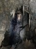 Diver's Pitch of Shuttleworth Pot, which is only about 25 metres. The slope of the pitch is quite apparent here, as it makes the photograph look tilted - it really slopes this much.
Modelling by Gwenllian, lighting by Tarquin and Gwenllian
Diver's Pitch of Shuttleworth Pot, which is only about 25 metres. The slope of the pitch is quite apparent here, as it makes the photograph look tilted - it really slopes this much.
Modelling by Gwenllian, lighting by Tarquin and Gwenllian The main river of Shuttleworth Pot, looking into House Of The Rising Sump. This is, strictly speaking, the Witches Cave river, between Upstream Sumps 1 and 2. The downstream sump (connecting to Witches Cave) is behind the camera (connected to the pool in the floor), and is 430 metres long and a maximum of 33.5 metres deep. Up to the left here is the other side of the cave, a ramp up into The Exercise Yard, which leads through Zig Zag Passage into Lake Chamber. This was left for another day.
Modelling by Gwenllian and Jack, lighting by Tarquin, Gwenllian and Jack
The main river of Shuttleworth Pot, looking into House Of The Rising Sump. This is, strictly speaking, the Witches Cave river, between Upstream Sumps 1 and 2. The downstream sump (connecting to Witches Cave) is behind the camera (connected to the pool in the floor), and is 430 metres long and a maximum of 33.5 metres deep. Up to the left here is the other side of the cave, a ramp up into The Exercise Yard, which leads through Zig Zag Passage into Lake Chamber. This was left for another day.
Modelling by Gwenllian and Jack, lighting by Tarquin, Gwenllian and Jack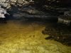 The upstream sump is 500 metres long and a maximum of 31 metres deep, connecting to Pippikin Pot, or an additional 765 metres long connecting to Lost John's Cave, or 900 metres to Gavel Pot. This river basically drains the entire Leck Fell.
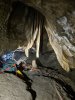 The parted curtains formation. The stalagmite once sat below the stalactite in the middle, but has at some point shifted away, presumably caused by an old water flow or subsidence.
Modelling by Gwenllian and hints of Jack, lighting by Tarquin, Gwenllian and Jack
The parted curtains formation. The stalagmite once sat below the stalactite in the middle, but has at some point shifted away, presumably caused by an old water flow or subsidence.
Modelling by Gwenllian and hints of Jack, lighting by Tarquin, Gwenllian and Jack White carrot. This early part of the cave is a flat out crawl over sediment.
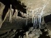 Straws in an undercut.
 Early hints of helictites.
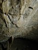 At this point, the helictites are not particularly special, but the characteristic way they form on the fracture lines is quite distinctive.
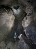 The passage grows to a very grand canyon, which shows just how much passage must be hiding below the earlier sediment.
Modelling by Gwenllian and Jack, lighting by Tarquin, Gwenllian and Jack
The passage grows to a very grand canyon, which shows just how much passage must be hiding below the earlier sediment.
Modelling by Gwenllian and Jack, lighting by Tarquin, Gwenllian and Jack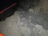 Protected mud formations. The footprints are from the first explorers; divers who had reached this point from Witches Cave.
Lighting by Tarquin and Gwenllian
Protected mud formations. The footprints are from the first explorers; divers who had reached this point from Witches Cave.
Lighting by Tarquin and Gwenllian Admiring the straws and translucent curtains.
Modelling by Gwenllian, lighting by Tarquin and Jack
Admiring the straws and translucent curtains.
Modelling by Gwenllian, lighting by Tarquin and Jack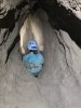 A small side tube leads down a very slippery chute.
Modelling by Gwenllian, lighting by Tarquin and Gwenllian
A small side tube leads down a very slippery chute.
Modelling by Gwenllian, lighting by Tarquin and Gwenllian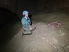 This leads into My Newt Passage, a short, muddy passage lying far below the floor of the main passage, but without any of the water from the main passage.
Modelling by Gwenllian
This leads into My Newt Passage, a short, muddy passage lying far below the floor of the main passage, but without any of the water from the main passage.
Modelling by Gwenllian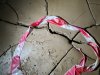 On the floor is one of the highlights of the trip to here, The Little Dragon; a tiny skeleton of a newt. Conservation tape for scale
Modelling by The Little Dragon
On the floor is one of the highlights of the trip to here, The Little Dragon; a tiny skeleton of a newt. Conservation tape for scale
Modelling by The Little Dragon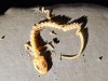 The conservation document says this is probably a palmate newt, but it has been identified in scientific literature as a species in the Triturus genus, which would make this a great crested newt. I have not been able to find enough details of either species' skeletons in order to conclusively identify it either way. The conservation document also mentions that there is a second one, but we only saw this one. Perhaps it is a little further along the passage, but it is taped off in order to protect the mud formations.
Modelling by The Little Dragon
The conservation document says this is probably a palmate newt, but it has been identified in scientific literature as a species in the Triturus genus, which would make this a great crested newt. I have not been able to find enough details of either species' skeletons in order to conclusively identify it either way. The conservation document also mentions that there is a second one, but we only saw this one. Perhaps it is a little further along the passage, but it is taped off in order to protect the mud formations.
Modelling by The Little Dragon Climbing out of My Newt Passage
Modelling by Gwenllian, lighting by Tarquin and Gwenllian
Climbing out of My Newt Passage
Modelling by Gwenllian, lighting by Tarquin and Gwenllian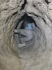 The chute is far harder on the way out, with very few holds, and an extremely slippery surface. Most visitors require some kind of assistance.
Modelling by Gwenllian, lighting by Tarquin and Gwenllian
The chute is far harder on the way out, with very few holds, and an extremely slippery surface. Most visitors require some kind of assistance.
Modelling by Gwenllian, lighting by Tarquin and Gwenllian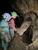 Gravity defying straw, and a false floor straw column.
Modelling by Gwenllian and Jack, lighting by Tarquin, Gwenllian and Jack
Gravity defying straw, and a false floor straw column.
Modelling by Gwenllian and Jack, lighting by Tarquin, Gwenllian and Jack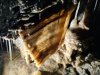 Curtain.
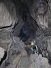 Continuing along the canyon.
Modelling by Gwenllian and Jack, lighting by Tarquin, Gwenllian and Jack
Continuing along the canyon.
Modelling by Gwenllian and Jack, lighting by Tarquin, Gwenllian and Jack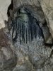 A green and black tinted formation in the ceiling, looking like a witch flying overhead. The dramatic colouring is most likely caused by manganese.
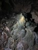 Manganese stained stalagmite below it, with distinctive yellow, green, grey and brown colouring.
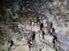 Calcite crusted mud.
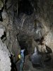 Richly black stalagmite, with white curtains.
Modelling by Gwenllian, lighting by Tarquin and Gwenllian
Richly black stalagmite, with white curtains.
Modelling by Gwenllian, lighting by Tarquin and Gwenllian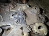 Calcite crusted mud formations, with drip pockets. These look almost surreal, like a miniature volcanic landscape.
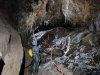 Under a decorated arch. From here onwards, the passage earns the name Painter's Alley.
Modelling by Gwenllian, lighting by Tarquin, Gwenllian and Jack
Under a decorated arch. From here onwards, the passage earns the name Painter's Alley.
Modelling by Gwenllian, lighting by Tarquin, Gwenllian and Jack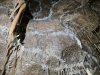 Beyond the arch, Painter's Alley is richly decorated with vast numbers of helictites.
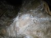 These are not as elaborate as the cray aragonite helictites seen in South Wales, and are the basic calcite helictites. But they make up for the lack of insanity with sheer volume of numbers.
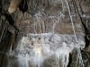 Helictites and straws.
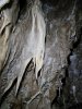 Flowstone and helictites.
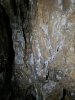 Helictites.
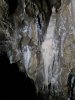 Creamy flowstone and helictite pie.
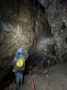 Painter's Alley.
Modelling by Gwenllian and Jack, lighting by Tarquin, Gwenllian and Jack
Painter's Alley.
Modelling by Gwenllian and Jack, lighting by Tarquin, Gwenllian and Jack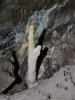 Rabbit.
 The Painter's Palette, a multi-coloured flowstone mound.
Lighting by Tarquin, Gwenllian and Jack
The Painter's Palette, a multi-coloured flowstone mound.
Lighting by Tarquin, Gwenllian and Jack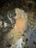 Flowstone at the Painter's Palette.
Lighting by Tarquin, Gwenllian and Jack
Flowstone at the Painter's Palette.
Lighting by Tarquin, Gwenllian and Jack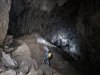 Dogger Bank, an unexpectedly enormous chamber, with a large sediment bank, and long straws above. The size of the chamber makes it feel like a major junction has been reached, perhaps with a pothole entering from above. However, there is only one way out of the chamber; the straw-filled archway.
Modelling by Gwenllian and Jack, lighting by Tarquin, Gwenllian and Jack
Dogger Bank, an unexpectedly enormous chamber, with a large sediment bank, and long straws above. The size of the chamber makes it feel like a major junction has been reached, perhaps with a pothole entering from above. However, there is only one way out of the chamber; the straw-filled archway.
Modelling by Gwenllian and Jack, lighting by Tarquin, Gwenllian and Jack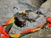 Exposed drip pockets in Dogger Bank.
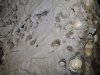 Drip pockets still in the surrounding mud.
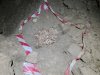 The dog skeleton that gave the passage its name. The bones were originally quite distinctive and identifiable, but apparently were handled by too many visitors, and turned to dust. The dog had evidently been alive when it reached this point, but it is not known how it got in here.
Lighting by Tarquin and Gwenllian
The dog skeleton that gave the passage its name. The bones were originally quite distinctive and identifiable, but apparently were handled by too many visitors, and turned to dust. The dog had evidently been alive when it reached this point, but it is not known how it got in here.
Lighting by Tarquin and Gwenllian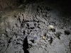 Drip pockets and mushroom-shaped stalagmites at the top of the sediment bank.
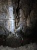 Flowstone covered wall in Dogger Bank.
Modelling by Jack, lighting by Tarquin, Gwenllian and Jack
Flowstone covered wall in Dogger Bank.
Modelling by Jack, lighting by Tarquin, Gwenllian and Jack Calcited gours below it.
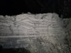 Sediment layers (laminates) in Dogger Bank, below the arch. These appear to be periglacial rhythmites from an ice age; a layer of fine silt in winter when the glaciers are frozen, and a layer of coarser grained sand in the summer when the ice melts, and the meltwater can carry larger grains.
Lighting by Tarquin and Gwenllian
Sediment layers (laminates) in Dogger Bank, below the arch. These appear to be periglacial rhythmites from an ice age; a layer of fine silt in winter when the glaciers are frozen, and a layer of coarser grained sand in the summer when the ice melts, and the meltwater can carry larger grains.
Lighting by Tarquin and Gwenllian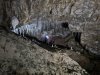 Straw covered arch in Dogger Bank.
Modelling by Jack, lighting by Tarquin, Gwenllian and Jack
Straw covered arch in Dogger Bank.
Modelling by Jack, lighting by Tarquin, Gwenllian and Jack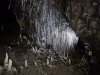 Intense profusion of straws in the arch.
Modelling by Gwenllian and shadowy hints of Jack, lighting by Tarquin, Gwenllian and Jack
Intense profusion of straws in the arch.
Modelling by Gwenllian and shadowy hints of Jack, lighting by Tarquin, Gwenllian and Jack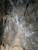 Helictites in the continuing passage.
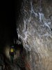 Helictites as the passage approaches Oxbow Aven.
Modelling by Gwenllian and Jack, lighting by Tarquin, Gwenllian and Jack
Helictites as the passage approaches Oxbow Aven.
Modelling by Gwenllian and Jack, lighting by Tarquin, Gwenllian and Jack The passage then rapidly shrinks, and quickly ends at a disappointing, muddy choke.
Modelling by Gwenllian, lighting by Tarquin and Gwenllian
The passage then rapidly shrinks, and quickly ends at a disappointing, muddy choke.
Modelling by Gwenllian, lighting by Tarquin and Gwenllian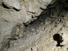 The muddy choke.
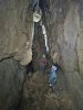 A slither up a muddy slope reaches the last rift. After dropping down a tricky mud climb (comical on the way out), the passage ends in this tall rift, which has several avens, and a hanging boulder. The muddy passage chokes below the floor. This is a rather disappointing end to what had been a very grand passage.
Modelling by Gwenllian and Jack, lighting by Tarquin, Gwenllian and Jack
A slither up a muddy slope reaches the last rift. After dropping down a tricky mud climb (comical on the way out), the passage ends in this tall rift, which has several avens, and a hanging boulder. The muddy passage chokes below the floor. This is a rather disappointing end to what had been a very grand passage.
Modelling by Gwenllian and Jack, lighting by Tarquin, Gwenllian and Jack View from the road over Leck Fell, with the Hutton Roof Crags (274 metres) on the left, then Barbon Low Fell and Gragareth on either side of the valley. The Committee Pot entrance to Notts II sits in the pile of rocks just over the wall to the right.
Modelling by the dark knight and a detatched cast of white flaxen from the River Tawe
View from the road over Leck Fell, with the Hutton Roof Crags (274 metres) on the left, then Barbon Low Fell and Gragareth on either side of the valley. The Committee Pot entrance to Notts II sits in the pile of rocks just over the wall to the right.
Modelling by the dark knight and a detatched cast of white flaxen from the River Tawe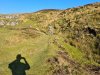 Heading into the Committee Pot shakehole. This is right by the road, and as a result, was one of the few places accessible during the Foot And Mouth countryside restrictions in the 1990s. That led to the epic dig which gained access to the streamway beyond the Notts Pot downstream sump.
Modelling by Gwenllian, Jack and a dissociative impression
Heading into the Committee Pot shakehole. This is right by the road, and as a result, was one of the few places accessible during the Foot And Mouth countryside restrictions in the 1990s. That led to the epic dig which gained access to the streamway beyond the Notts Pot downstream sump.
Modelling by Gwenllian, Jack and a dissociative impression Entrance to Committee Pot. This is the usual entrance to Notts II, and is usually called Notts II, but its official name is Committee Pot.
Modelling by Jack, Gwenllian and a projected lack of light
Entrance to Committee Pot. This is the usual entrance to Notts II, and is usually called Notts II, but its official name is Committee Pot.
Modelling by Jack, Gwenllian and a projected lack of light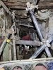 The dig starts off as a scaffolded shaft, with ladders or brickwork for climbing.
Modelling by Jack and Tarquin's knee pads, lighting by Tarquin, Sol and Jack
The dig starts off as a scaffolded shaft, with ladders or brickwork for climbing.
Modelling by Jack and Tarquin's knee pads, lighting by Tarquin, Sol and Jack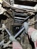 And it carries on as a scaffolded shaft.
Modelling by Jack and Tarquin's lower legs, lighting by Tarquin and Jack
And it carries on as a scaffolded shaft.
Modelling by Jack and Tarquin's lower legs, lighting by Tarquin and Jack And on. In total, it drops around 50 metres through a shored choke, which is an incredible piece of engineering, an attraction in its own right.
Modelling by Jack and Tarquin's welly, lighting by Tarquin and Jack
And on. In total, it drops around 50 metres through a shored choke, which is an incredible piece of engineering, an attraction in its own right.
Modelling by Jack and Tarquin's welly, lighting by Tarquin and Jack At the breakthrough point, it switches to natural passage, followed quickly by a laddered climb.
Modelling by Jack, lighting by Tarquin and Jack
At the breakthrough point, it switches to natural passage, followed quickly by a laddered climb.
Modelling by Jack, lighting by Tarquin and Jack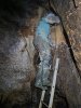 Then a short pitch with another ladder.
Modelling by Gwenllian, lighting by Tarquin and Gwenllian
Then a short pitch with another ladder.
Modelling by Gwenllian, lighting by Tarquin and Gwenllian But then, just in case there wasn't enough already, another scaffolded dig through a choke.
Modelling by Gwenllian, lighting by Tarquin and Gwenllian
But then, just in case there wasn't enough already, another scaffolded dig through a choke.
Modelling by Gwenllian, lighting by Tarquin and Gwenllian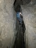 Rope climb. The rope, incidentally, makes it harder, not easier. Without the rope, you would climb at the other end of the gully, where it is very easy. But with the rope, you feel obliged to use the rope. It is nearly impossible to climb back up with the rope.
Modelling by Gwenllian, lighting by Tarquin and Gwenllian
Rope climb. The rope, incidentally, makes it harder, not easier. Without the rope, you would climb at the other end of the gully, where it is very easy. But with the rope, you feel obliged to use the rope. It is nearly impossible to climb back up with the rope.
Modelling by Gwenllian, lighting by Tarquin and Gwenllian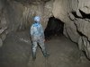 Finally some big passage, before Mincemeat Aven.
Modelling by Gwenllian, lighting by Tarquin and Gwenllian
Finally some big passage, before Mincemeat Aven.
Modelling by Gwenllian, lighting by Tarquin and Gwenllian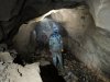 Phreatic passage after Mincemeat Aven.
Modelling by Gwenllian and Jack, lighting by Tarquin, Gwenllian and Jack
Phreatic passage after Mincemeat Aven.
Modelling by Gwenllian and Jack, lighting by Tarquin, Gwenllian and Jack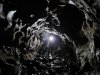 Scalloped walls of the phreas.
Modelling by Gwenllian, lighting by Gwenllian and Jack
Scalloped walls of the phreas.
Modelling by Gwenllian, lighting by Gwenllian and Jack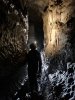 The Notts II streamway, downstream of the junction with the Committee Pot entrance.
Modelling by Gwenllian, lighting by Tarquin and Gwenllian
The Notts II streamway, downstream of the junction with the Committee Pot entrance.
Modelling by Gwenllian, lighting by Tarquin and Gwenllian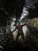 The fine downstream passage.
Modelling by Jack, lighting by Tarquin, Jack and Gwenllian
The fine downstream passage.
Modelling by Jack, lighting by Tarquin, Jack and Gwenllian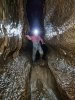 Surfing down the water slides.
Modelling by Jack, lighting by Tarquin and Jack
Surfing down the water slides.
Modelling by Jack, lighting by Tarquin and Jack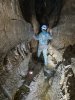 A later part of the downstream passage.
Modelling by Noahoop, Beandan and Gwenllian, lighting by Tarquin and Gwenllian
A later part of the downstream passage.
Modelling by Noahoop, Beandan and Gwenllian, lighting by Tarquin and Gwenllian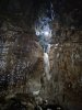 The final cascade, landing in a large chamber. The dry way on from here is a pitch up, leading to pitches into a short passage between the main downstream sump, upstream sump and an inlet sump.
Modelling by Gwenllian, lighting by Tarquin, Gwenllian and Jack
The final cascade, landing in a large chamber. The dry way on from here is a pitch up, leading to pitches into a short passage between the main downstream sump, upstream sump and an inlet sump.
Modelling by Gwenllian, lighting by Tarquin, Gwenllian and Jack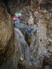 Trying to keep a dry bum. He failed.
Modelling by Jack, lighting by Tarquin, Gwenllian and Jack
Trying to keep a dry bum. He failed.
Modelling by Jack, lighting by Tarquin, Gwenllian and Jack The stream then flows into a low bedding, which sumps. This connects to the streamway that can be accessed via the pitch.
 Formations in the upstream passage.
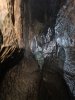 Drinking from the Showerbath Inlet.
Modelling by Gwenllian, lighting by Tarquin, Gwenllian and Jack
Drinking from the Showerbath Inlet.
Modelling by Gwenllian, lighting by Tarquin, Gwenllian and Jack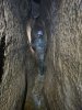 The upstream passage, beyond the connection to The Cupcake and Lost John's Cave
Modelling by Gwenllian, lighting by Tarquin and Gwenllian
The upstream passage, beyond the connection to The Cupcake and Lost John's Cave
Modelling by Gwenllian, lighting by Tarquin and Gwenllian Magnificent column hidden in the top of the keyhole above the river, just before Nick Point. This is very easy to miss, as it sits above the trench where most cavers travel, and requires a clamber up jammed boulders (or a traverse on ledges).
Modelling by Gwenllian, lighting by Tarquin and Gwenllian
Magnificent column hidden in the top of the keyhole above the river, just before Nick Point. This is very easy to miss, as it sits above the trench where most cavers travel, and requires a clamber up jammed boulders (or a traverse on ledges).
Modelling by Gwenllian, lighting by Tarquin and Gwenllian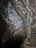 Elaborate, white-washed ceiling. There are a great many straws up there too, but too far away to be clearly seen.
Lighting by Tarquin and Gwenllian
Elaborate, white-washed ceiling. There are a great many straws up there too, but too far away to be clearly seen.
Lighting by Tarquin and Gwenllian Upstream of Nick Point, the passage grows to very grand proportions.
Modelling by Gwenllian and Jack, lighting by Tarquin, Gwenllian and Jack
Upstream of Nick Point, the passage grows to very grand proportions.
Modelling by Gwenllian and Jack, lighting by Tarquin, Gwenllian and Jack Grand passage near Inlet 8 (this is how almost all side passages are named in this cave).
Modelling by Gwenllian and Jack, lighting by Tarquin, Gwenllian and Jack
Grand passage near Inlet 8 (this is how almost all side passages are named in this cave).
Modelling by Gwenllian and Jack, lighting by Tarquin, Gwenllian and Jack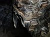 Black stained curtains at Inlet 7.
Lighting by Tarquin, Gwenllian and Jack
Black stained curtains at Inlet 7.
Lighting by Tarquin, Gwenllian and Jack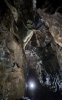 Curtains high in the ceiling.
Modelling by Gwenllian, lighting by Tarquin and Gwenllian
Curtains high in the ceiling.
Modelling by Gwenllian, lighting by Tarquin and Gwenllian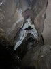 Curtains from a roof tube.
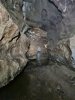 The start of the deeper pools. It is possible to keep wellies dry in the first one, but after that, it is impossible.
Modelling by Gwenllian, lighting by Tarquin and Gwenllian
The start of the deeper pools. It is possible to keep wellies dry in the first one, but after that, it is impossible.
Modelling by Gwenllian, lighting by Tarquin and Gwenllian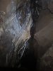 Flowstone and curtains.
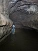 Deeper pool, where dry feet is no longer an option. Depending on leg length, this can turn a baritone into an alto.
Modelling by Gwenllian, lighting by Tarquin and Gwenllian
Deeper pool, where dry feet is no longer an option. Depending on leg length, this can turn a baritone into an alto.
Modelling by Gwenllian, lighting by Tarquin and Gwenllian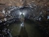 Beautifully shaped passage.
Modelling by Gwenllian, lighting by Tarquin, Gwenllian and Jack
Beautifully shaped passage.
Modelling by Gwenllian, lighting by Tarquin, Gwenllian and Jack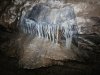 Manganese stained flowstone
Lighting by Tarquin, Jack and Gwenllian
Manganese stained flowstone
Lighting by Tarquin, Jack and Gwenllian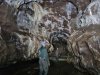 Curtain adorned passage.
Modelling by Gwenllian and Jack, lighting by Tarquin, Gwenllian and Jack
Curtain adorned passage.
Modelling by Gwenllian and Jack, lighting by Tarquin, Gwenllian and Jack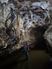 Cream and manganese curtains and column.
Modelling by Jack, lighting by Tarquin and Gwenllian
Cream and manganese curtains and column.
Modelling by Jack, lighting by Tarquin and Gwenllian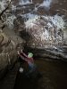 Straws over a pool. Apparently horrifying.
Modelling by Jack, lighting by Tarquin and Gwenllian
Straws over a pool. Apparently horrifying.
Modelling by Jack, lighting by Tarquin and Gwenllian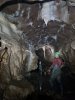 Flowstone and stalactites. And a completely normal pose.
Modelling by Jack and Gwenllian, lighting by Tarquin, Jack and Gwenllian
Flowstone and stalactites. And a completely normal pose.
Modelling by Jack and Gwenllian, lighting by Tarquin, Jack and Gwenllian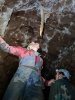 Taste it. Just the tip. No formations were harmed (or stimulated) in the making of this image.
The award for best actor in an adult image goes to Jack, the award for best supporting actress goes to Gwenllian, lighting by Tarquin, Jack and Gwenllian
Taste it. Just the tip. No formations were harmed (or stimulated) in the making of this image.
The award for best actor in an adult image goes to Jack, the award for best supporting actress goes to Gwenllian, lighting by Tarquin, Jack and Gwenllian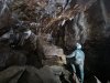 Junction with Curry Inlet. Incidentally, this should be Inlet 6, but there is also Inlet Sixpointfiveandthreequarters just downstream, which confuses everything, so this just gets called Curry Inlet.
Modelling by Gwenllian, lighting by Tarquin, Jack and Gwenllian
Junction with Curry Inlet. Incidentally, this should be Inlet 6, but there is also Inlet Sixpointfiveandthreequarters just downstream, which confuses everything, so this just gets called Curry Inlet.
Modelling by Gwenllian, lighting by Tarquin, Jack and Gwenllian Continuing up the Notts II streamway beyond Curry Inlet, the water gets deeper.
Modelling by Gwenllian, lighting by Tarquin, Jack and Gwenllian
Continuing up the Notts II streamway beyond Curry Inlet, the water gets deeper.
Modelling by Gwenllian, lighting by Tarquin, Jack and Gwenllian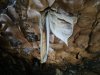 Bat ears in curtain form.
Lighting by Tarquin, Gwenllian and Jack
Bat ears in curtain form.
Lighting by Tarquin, Gwenllian and Jack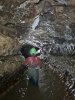 Wading upstream.
Modelling by Jack, lighting by Tarquin, Jack and Gwenllian
Wading upstream.
Modelling by Jack, lighting by Tarquin, Jack and Gwenllian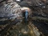 It is not all deep. This section has a washed out pebble floor.
Modelling by Gwenllian, lighting by Tarquin and Gwenllian
It is not all deep. This section has a washed out pebble floor.
Modelling by Gwenllian, lighting by Tarquin and Gwenllian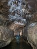 Wading below the straws.
Modelling by Gwenllian, lighting by Tarquin and Gwenllian
Wading below the straws.
Modelling by Gwenllian, lighting by Tarquin and Gwenllian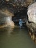 The deepest pool so far, which turned out to be waist deep at its deepest point.
Modelling by Gwenllian, lighting by Tarquin and Gwenllian
The deepest pool so far, which turned out to be waist deep at its deepest point.
Modelling by Gwenllian, lighting by Tarquin and Gwenllian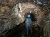 Formations beyond the pool.
Modelling by Gwenllian, lighting by Tarquin and Gwenllian
Formations beyond the pool.
Modelling by Gwenllian, lighting by Tarquin and Gwenllian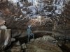 Straws on a rocky patch. This is near Inlet 5, which is a long loop, back to Inlet Sixpointfiveandthreequarters.
Modelling by Gwenllian, lighting by Tarquin, Jack and Gwenllian
Straws on a rocky patch. This is near Inlet 5, which is a long loop, back to Inlet Sixpointfiveandthreequarters.
Modelling by Gwenllian, lighting by Tarquin, Jack and Gwenllian Last curtains before the deep part.
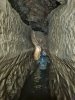 The water then gets much deeper, soon forcing a swim for about 30 metres. After that is the upstream sump, so it is not really worth the soaking.
Modelling by Gwenllian (bravo!), lighting by Tarquin and Gwenllian
The water then gets much deeper, soon forcing a swim for about 30 metres. After that is the upstream sump, so it is not really worth the soaking.
Modelling by Gwenllian (bravo!), lighting by Tarquin and Gwenllian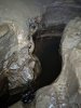 Traversing on the ledges bypasses the first part of the swim, but it looked too hard to traverse the rest of the way. The water is very deep, and falling in from here would not be good.
 Accessed via the ledges, however, is a muddy oxbow, reaching a part called Passchendaele (spelled Paaschendaele on the survey), which loops ahead to 14-18 Series, a passage collecting back to the streamway, upstream of the swim. However, with a name like Passchendaele, it is unlikely to be a good alternative.
 Formations at the start of Curry Inlet.
Lighting by Tarquin, Gwenllian and Jack
Formations at the start of Curry Inlet.
Lighting by Tarquin, Gwenllian and Jack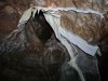 Curtains.
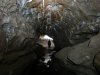 An early part of Curry Inlet. Cold was definitely becoming a problem, so the photography of this passage was a little rushed, but hopefully good enough.
Modelling by Gwenllian, lighting by Tarquin and Gwenllian
An early part of Curry Inlet. Cold was definitely becoming a problem, so the photography of this passage was a little rushed, but hopefully good enough.
Modelling by Gwenllian, lighting by Tarquin and Gwenllian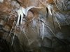 Straws, stalactites, and immature helictites.
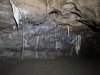 Straws and curtains.
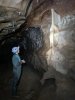 Flowstone in Curry Inlet.
Modelling by Gwenllian, lighting by Tarquin and Gwenllian
Flowstone in Curry Inlet.
Modelling by Gwenllian, lighting by Tarquin and Gwenllian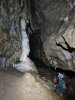 Curtain and flowstone formation.
Modelling by Gwenllian, lighting by Tarquin and Gwenllian
Curtain and flowstone formation.
Modelling by Gwenllian, lighting by Tarquin and Gwenllian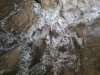 Helictites.
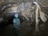 Column and curtain.
Modelling by Gwenllian, lighting by Tarquin and Gwenllian
Column and curtain.
Modelling by Gwenllian, lighting by Tarquin and Gwenllian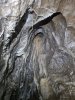 Helictites and flowstone.
 Curtain cluster.
Modelling by Gwenllian, lighting by Tarquin and Gwenllian
Curtain cluster.
Modelling by Gwenllian, lighting by Tarquin and Gwenllian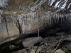 Straws
Lighting by Tarquin and Gwenllian
Straws
Lighting by Tarquin and Gwenllian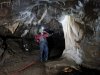 One of the finest formations in Curry Inlet; it looks like the white robes of an elder.
Modelling by Gentleman Jack, lighting by Tarquin and Jack
One of the finest formations in Curry Inlet; it looks like the white robes of an elder.
Modelling by Gentleman Jack, lighting by Tarquin and Jack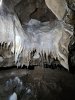 Decorated alcove.
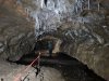 Later part of Curry Inlet.
Modelling by Gwenllian, lighting by Tarquin and Gwenllian
Later part of Curry Inlet.
Modelling by Gwenllian, lighting by Tarquin and Gwenllian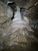 Decorated alcove.
 Decorated alcove.
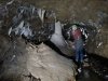 The final, impressive stal column in Curry Inlet. Jack, incidentally, is completely normal. So normal that The Who wrote a song all about him. La la l-l-la la la l-l-la.
Modelling by Jack, lighting by Tarquin and Jack
The final, impressive stal column in Curry Inlet. Jack, incidentally, is completely normal. So normal that The Who wrote a song all about him. La la l-l-la la la l-l-la.
Modelling by Jack, lighting by Tarquin and Jack Curry Inlet continues upstream towards its upstream sump. The other side of the sump can be reached via Inlet 7, and is apparently incredibly miserable.
Modelling by Jack and Gwenllian, lighting by Tarquin and Gwenllian
Curry Inlet continues upstream towards its upstream sump. The other side of the sump can be reached via Inlet 7, and is apparently incredibly miserable.
Modelling by Jack and Gwenllian, lighting by Tarquin and Gwenllian The only other way on from Curry Inlet is this incredibly muddy crawl to a dead end chamber, called the Garden Of Ganesh.
 So instead, we headed out into the sunset, seen here at Ireby Fell (which is basically Leck Fell's continuation, with no obvious boundary between them).
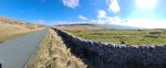 Mouth of Kingsdale. The mountains are Gragareth, High Pike (537 metres), Whernside (736 metres) and the ever impressive Ingleborough (723 metres).
Modelling by vague hints of Darth Vader
Mouth of Kingsdale. The mountains are Gragareth, High Pike (537 metres), Whernside (736 metres) and the ever impressive Ingleborough (723 metres).
Modelling by vague hints of Darth Vader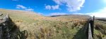 Floodplains of Kingsdale, between Gragareth and Whernside.
Modelling by the rest of Darth Vader
Floodplains of Kingsdale, between Gragareth and Whernside.
Modelling by the rest of Darth Vader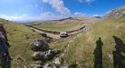 View from Twisleton Scar End, the end of Whernside's southern ridge. The distant mountains are the Forest Of Bowland, topping out at Ward's Stone (561 metres). On the right, the small bup on Gragareth's ridge is Tow Scar (383 metres). The ice cream van catches all the tourists who walk up from the Ingleton waterfall walk.
Modelling by Gwenllian, Jack, Tarquin Pan's detatched Shadow, and the last known impressions of Tootles the lost boy and the Wendy lady
View from Twisleton Scar End, the end of Whernside's southern ridge. The distant mountains are the Forest Of Bowland, topping out at Ward's Stone (561 metres). On the right, the small bup on Gragareth's ridge is Tow Scar (383 metres). The ice cream van catches all the tourists who walk up from the Ingleton waterfall walk.
Modelling by Gwenllian, Jack, Tarquin Pan's detatched Shadow, and the last known impressions of Tootles the lost boy and the Wendy lady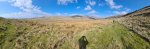 Walking over Wackenburgh Hill towards Illusion Pot, which sits in the dry valley ahead. Gragareth is in front of the camera, and the near side of it is where all of the famous Kingsdale caves are, such as Swinsto Hole, Simpson's Pot, Rowten Pot, Valley Entrance and Yordas cave. To the right of Gragareth is Green Hill, but they look like the same mountain from here.
Modelling by Gwenllian, Jack and an ominous darkened patch of grass
Walking over Wackenburgh Hill towards Illusion Pot, which sits in the dry valley ahead. Gragareth is in front of the camera, and the near side of it is where all of the famous Kingsdale caves are, such as Swinsto Hole, Simpson's Pot, Rowten Pot, Valley Entrance and Yordas cave. To the right of Gragareth is Green Hill, but they look like the same mountain from here.
Modelling by Gwenllian, Jack and an ominous darkened patch of grass Entrance to Illusion Pot, with Gragareth and Green Hill in the background.
Modelling by Jack, Gwenllian and some thrown shade
Entrance to Illusion Pot, with Gragareth and Green Hill in the background.
Modelling by Jack, Gwenllian and some thrown shade The entrance to Illusion Pot is another deep excavation with several ladders. This rusticle is part way down.
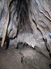 Decorated alcove at the bottom of the ladder.
 A small stream emerges from a little sump. The other side of this sump can be reached via a flat out crawl, but apart from a small chamber (which is supposed to be decorated) to the side of the crawl, there is nothing worth seeing upstream.
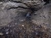 Downstream is a damp hands and knees crawl, and is the way on.
Modelling by Jack, lighting by Tarquin and Jack
Downstream is a damp hands and knees crawl, and is the way on.
Modelling by Jack, lighting by Tarquin and Jack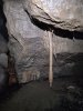 A stalactite that is disturbingly similar to a sad earthworm, slumping out of the ceiling. Seriously, cheer up, mate, it's not all that bad.
 Formations in a side passage near the sad earthworm.
Modelling by Gwenllian, lighting by Tarquin and Gwenllian
Formations in a side passage near the sad earthworm.
Modelling by Gwenllian, lighting by Tarquin and Gwenllian "Should I go underneath or would you prefer me on top?" - how is a man supposed to choose? Why not both?
Modelling by Gwenllian and Gwenllian, lighting by Tarquin, Gwenllian, Gwenllian and Jack
"Should I go underneath or would you prefer me on top?" - how is a man supposed to choose? Why not both?
Modelling by Gwenllian and Gwenllian, lighting by Tarquin, Gwenllian, Gwenllian and Jack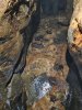 Floor of the side passage.
Modelling by Gwenllian's knees, lighting by Tarquin and Gwenllian
Floor of the side passage.
Modelling by Gwenllian's knees, lighting by Tarquin and Gwenllian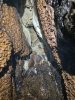 Dripping grotto at the end of the side passage.
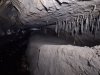 Stalactites that had very clearly been forming in muddy water, and have suffered repeated flooding.
Lighting by Tarquin and Gwenllian
Stalactites that had very clearly been forming in muddy water, and have suffered repeated flooding.
Lighting by Tarquin and Gwenllian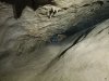 A lower section of the passage.
Modelling by Gwenllian, lighting by Tarquin and Gwenllian
A lower section of the passage.
Modelling by Gwenllian, lighting by Tarquin and Gwenllian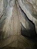 Formations in a cross rift.
 Formations in the other direction along the cross rift. The crystal pool would probably look lovely without the mud, but the evident flooding here would only put the mud back.
 Surge mark mud formations, created by repeated flooding and draining.
Lighting by Tarquin and Gwenllian
Surge mark mud formations, created by repeated flooding and draining.
Lighting by Tarquin and Gwenllian Worm in the mud.
Modelling by Wally
Worm in the mud.
Modelling by Wally Mud hoodoos.
 Detail of the hoodoos, looking like Helm's Deep in Lord Of The Rings.
 Start of the duck. This can be bailed from this side only, but the water needs to be taken all the way back to before this crawl.
Modelling by Jack, lighting by Tarquin and Jack
Start of the duck. This can be bailed from this side only, but the water needs to be taken all the way back to before this crawl.
Modelling by Jack, lighting by Tarquin and Jack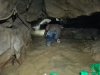 The duck starts as a wet crawl, but then gets lower and lower, until the ceiling is about 15 cm above the water, at the lowest point. The lowest point is an obvious flake which needs a face wetting to pass. This passage can easily sump in wet weather, and remain sumped for a long time.
Modelling by Jack, lighting by Tarquin and Jack
The duck starts as a wet crawl, but then gets lower and lower, until the ceiling is about 15 cm above the water, at the lowest point. The lowest point is an obvious flake which needs a face wetting to pass. This passage can easily sump in wet weather, and remain sumped for a long time.
Modelling by Jack, lighting by Tarquin and Jack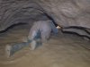 The far side of the duck. The lowest point is about 2 metres in from this, where the passage is at its narrowest.
Modelling by Gwenllian, lighting by Tarquin and Gwenllian
The far side of the duck. The lowest point is about 2 metres in from this, where the passage is at its narrowest.
Modelling by Gwenllian, lighting by Tarquin and Gwenllian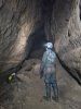 The duck emerges in Sump Passage, part of Dale Barn Cave III. It was originally found from the Dale Barn side, and since access is no longer possible through Dale Barn Cave, this is now the only way into the system.
Modelling by Gwenllian, lighting by Tarquin and Gwenllian
The duck emerges in Sump Passage, part of Dale Barn Cave III. It was originally found from the Dale Barn side, and since access is no longer possible through Dale Barn Cave, this is now the only way into the system.
Modelling by Gwenllian, lighting by Tarquin and Gwenllian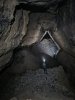 Sump Passage emerges into Expressway at the enormous Missile Silo chamber - seen here looking northwest. The aven in the ceiling is the source of the name, a 52 metre aven which ends in a blank ceiling.
Modelling by Gwenllian and Jack, lighting by Tarquin, Gwenllian and Jack
Sump Passage emerges into Expressway at the enormous Missile Silo chamber - seen here looking northwest. The aven in the ceiling is the source of the name, a 52 metre aven which ends in a blank ceiling.
Modelling by Gwenllian and Jack, lighting by Tarquin, Gwenllian and Jack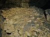 Flowstone formation on the floor of the Northwest trending end of Expressway. This heads away from Dale Barn Cave.
Lighting by Tarquin and Jack
Flowstone formation on the floor of the Northwest trending end of Expressway. This heads away from Dale Barn Cave.
Lighting by Tarquin and Jack Further flowstone formations on the floor of Expressway's northwestern end.
Modelling by Gwenllian, lighting by Tarquin and Gwenllian
Further flowstone formations on the floor of Expressway's northwestern end.
Modelling by Gwenllian, lighting by Tarquin and Gwenllian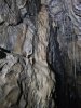 The passage ends at a grotto with no name shown on the survey.
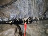 Tiny formations in a bedding.
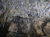 Straws in the grotto.
Lighting by Tarquin and Gwenllian
Straws in the grotto.
Lighting by Tarquin and Gwenllian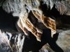 Heavily banded curtains.
 Straws and curtains.
Lighting by Tarquin and Gwenllian
Straws and curtains.
Lighting by Tarquin and Gwenllian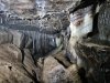 Window into the far end of the grotto. Getting there involves an exposed climb down boulders, then another climb up calcited boulders.
Modelling by Gwenllian, lighting by Tarquin and Jack
Window into the far end of the grotto. Getting there involves an exposed climb down boulders, then another climb up calcited boulders.
Modelling by Gwenllian, lighting by Tarquin and Jack The formations in the second part of the grotto are arguably the best looking in the cave.
Modelling by Gwenllian, lighting by Tarquin, Gwenllian and Jack
The formations in the second part of the grotto are arguably the best looking in the cave.
Modelling by Gwenllian, lighting by Tarquin, Gwenllian and Jack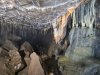 The end of the grotto, with richly banded dark chocolate orange curtains. The black is likely to be manganese, and the orange is likely to be iron oxide.
 Big section of Expressway, in the southeastern direction.
Modelling by Noahoop, Beandan, Jack and Gwenllian, lighting by Tarquin, Jack and Gwenllian
Big section of Expressway, in the southeastern direction.
Modelling by Noahoop, Beandan, Jack and Gwenllian, lighting by Tarquin, Jack and Gwenllian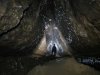 Characteristically triangular passage in Expressway.
Modelling by Gwenllian, lighting by Tarquin, Gwenllian and Jack
Characteristically triangular passage in Expressway.
Modelling by Gwenllian, lighting by Tarquin, Gwenllian and Jack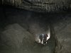 Enormous undercut below the passage wall in Expressway, looking back along the passage. Behind the camera is one end of Vandal Passage, the original way into this passage from Rushton Chamber. Somewhere here, possibly in the crater in the floor, is the way into a lengthy sump leading up along the side of Kingsdale to Braida Garth Wood.
Modelling by Jack and Gwenllian, lighting by Tarquin, Jack and Gwenllian
Enormous undercut below the passage wall in Expressway, looking back along the passage. Behind the camera is one end of Vandal Passage, the original way into this passage from Rushton Chamber. Somewhere here, possibly in the crater in the floor, is the way into a lengthy sump leading up along the side of Kingsdale to Braida Garth Wood.
Modelling by Jack and Gwenllian, lighting by Tarquin, Jack and Gwenllian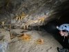 Caramel coloured formations in Expressway.
Modelling by Gwenllian, lighting by Tarquin and Gwenllian
Caramel coloured formations in Expressway.
Modelling by Gwenllian, lighting by Tarquin and Gwenllian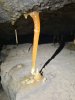 Stal column snapped by subsidence, with the two parts desperately clinging on.
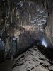 Grotto in Expressway.
Modelling by Gwenllian, lighting by Tarquin, Gwenllian and Jack
Grotto in Expressway.
Modelling by Gwenllian, lighting by Tarquin, Gwenllian and Jack Crystal pool in Expressway.
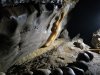 Curtain near the end of Expressway.
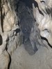 The bitter end of Expressway. Although this looks like a good place to dig, the actual continuation of the passage is probably regained via Perfidia.
Modelling by Gwenllian, lighting by Tarquin and Gwenllian
The bitter end of Expressway. Although this looks like a good place to dig, the actual continuation of the passage is probably regained via Perfidia.
Modelling by Gwenllian, lighting by Tarquin and Gwenllian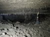 A descent under the wall of Expressway enters Rushton Chamber. This is one of the largest in the cave in terms of area, but clearly smaller than the Missile Silo in terms of volume. The way into the chamber is up behind the camera, with the sediment bank spilling in from Expressway. To the left beyond the straws is the other end of Vandal Passage, a very low crawl. To the right of the camera is Perfidia. Ahead-right is a 25 metre crawl over cobbles which ends at a dig. Ahead is Brunel Rift.
Modelling by Jack, lighting by Tarquin and Gwenllian
A descent under the wall of Expressway enters Rushton Chamber. This is one of the largest in the cave in terms of area, but clearly smaller than the Missile Silo in terms of volume. The way into the chamber is up behind the camera, with the sediment bank spilling in from Expressway. To the left beyond the straws is the other end of Vandal Passage, a very low crawl. To the right of the camera is Perfidia. Ahead-right is a 25 metre crawl over cobbles which ends at a dig. Ahead is Brunel Rift.
Modelling by Jack, lighting by Tarquin and Gwenllian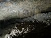 Straws in Rushton Chamber.
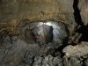 Brunel Rift, a traverse over a 15 metre deep rift that leads to Dale Barn Cave's Sump 3. This is the way downstream, where it joins the downstream water from Dale Barn Cave.
Modelling by Jack, lighting by Tarquin, Gwenllian and Jack
Brunel Rift, a traverse over a 15 metre deep rift that leads to Dale Barn Cave's Sump 3. This is the way downstream, where it joins the downstream water from Dale Barn Cave.
Modelling by Jack, lighting by Tarquin, Gwenllian and Jack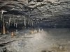 Start of Perfidia, a crawling sized bedding.
Modelling by Gwenllian, lighting by Tarquin and Gwenllian
Start of Perfidia, a crawling sized bedding.
Modelling by Gwenllian, lighting by Tarquin and Gwenllian Formations in Perfidia.
Lighting by Tarquin and Jack
Formations in Perfidia.
Lighting by Tarquin and Jack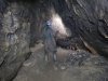 Standing room, for a moment, in Perfidia.
Modelling by Gwenllian, lighting by Tarquin and Gwenllian
Standing room, for a moment, in Perfidia.
Modelling by Gwenllian, lighting by Tarquin and Gwenllian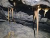 Formations in Perfidia.
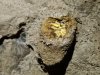 Drip formation in Perfidia.
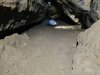 Perfidia continues as a 600 metre flat out crawl, and is almost certainly the top of the fossil main drain heading to Dale Barn Cave, with the rest of the passage filled with sediment. The first significant chamber has a red formation that we did not go far enough to see, unfortunately. Parts of Perfidia clearly sump in flood, even though this is very much a fossil level of the cave. The flooding in this system is pretty insane. Given the crazy length of the crawl (and the fact that we weren't sure if it was a side passage worth visiting), we decided to head back out.
Modelling by Gwenllian, lighting by Tarquin and Gwenllian
Perfidia continues as a 600 metre flat out crawl, and is almost certainly the top of the fossil main drain heading to Dale Barn Cave, with the rest of the passage filled with sediment. The first significant chamber has a red formation that we did not go far enough to see, unfortunately. Parts of Perfidia clearly sump in flood, even though this is very much a fossil level of the cave. The flooding in this system is pretty insane. Given the crazy length of the crawl (and the fact that we weren't sure if it was a side passage worth visiting), we decided to head back out.
Modelling by Gwenllian, lighting by Tarquin and Gwenllian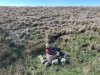 Exiting Illusion Pot.
Modelling by Jack, lighting by Sol and Jack's feeble light
Exiting Illusion Pot.
Modelling by Jack, lighting by Sol and Jack's feeble light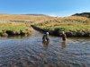 Washing off in the River Twiss.
Modelling by Gwenllian and Jack
Washing off in the River Twiss.
Modelling by Gwenllian and Jack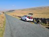 Why would you bring a yoga mat to a caving trip? How else do you unwind after a weekend's caving?
Modelling by Gwenllian
Why would you bring a yoga mat to a caving trip? How else do you unwind after a weekend's caving?
Modelling by Gwenllian
 View over to the Thurlstone Moors reservoirs at the northeastern edge of Peak District; Upper and Lower Windleden Reservoirs and Winscar Reservoir. On the left is Dead Edge End (499 metres), and on the right is South Nab (461 metres).
Modelling by a shadowy apparition
View over to the Thurlstone Moors reservoirs at the northeastern edge of Peak District; Upper and Lower Windleden Reservoirs and Winscar Reservoir. On the left is Dead Edge End (499 metres), and on the right is South Nab (461 metres).
Modelling by a shadowy apparition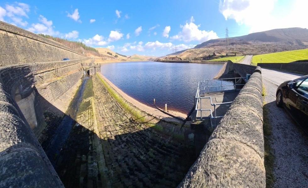 Woodhead Reservoir in Longdendale. From left to right are Ancote Hill (only a ridge), Dead Edge End, Pikenaze Hill (382 metres) and the Lawrence Edge of Bleaklow (633 metres).
 View from Slack Edge, over Glossop, towards Black Hill (582 metres), Bleaklow, Shelf Moor (621 metres) and Kinder Scout (636 metres). Just above the vitally important stile, is the equally comically named Cock Hill ridge, a local point of growing interest.
Modelling by the dark side of Tarquin
View from Slack Edge, over Glossop, towards Black Hill (582 metres), Bleaklow, Shelf Moor (621 metres) and Kinder Scout (636 metres). Just above the vitally important stile, is the equally comically named Cock Hill ridge, a local point of growing interest.
Modelling by the dark side of Tarquin Coombes Edge, a relatively small glacial cirque, filled with morraines.
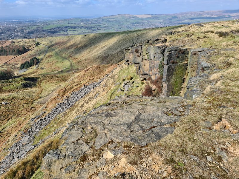 An early part of the crag.
 A later part of the crag.
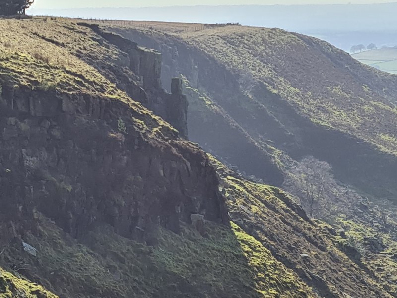 Coombes Tor, a rock pinnacle.
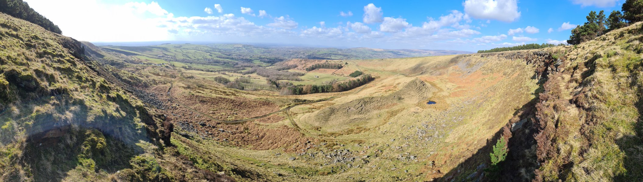 Coombes Edge, with its very small tarn, nestled above the morraines.
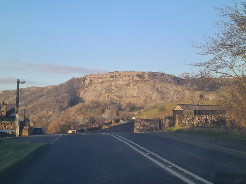 Stainsforth Scar, a prominent cliff between Lancliffe and Stainforth in Ribblesdale, in the Yorkshire Dales.
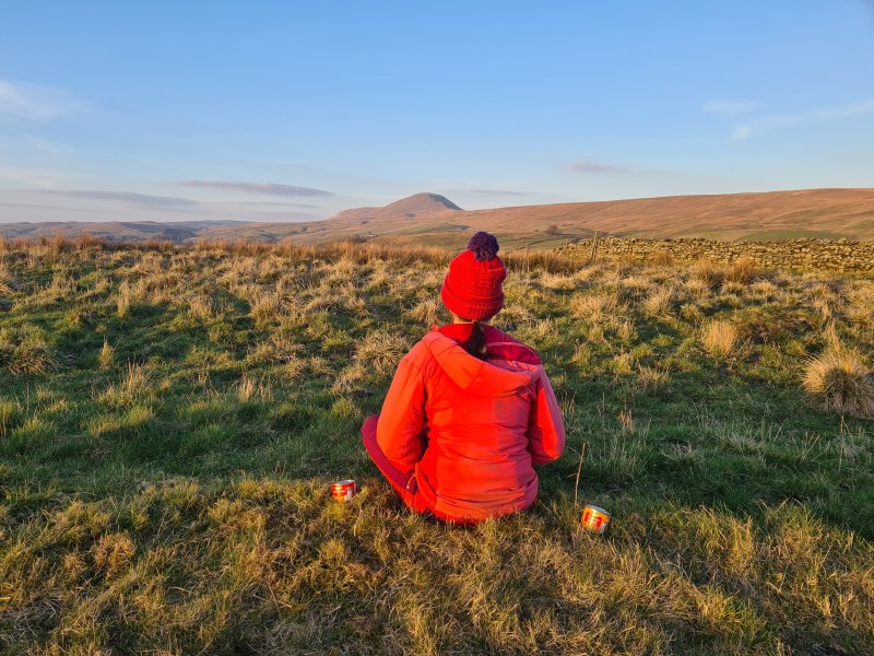 In the sunset light in front of Pen-y-ghent (694 metres), with Plover Hill (over 680 metres) and the more distant High Green Field Knott (602 metres) behind it.
Modelling by Beandan, Gwenllian and Noahoop
In the sunset light in front of Pen-y-ghent (694 metres), with Plover Hill (over 680 metres) and the more distant High Green Field Knott (602 metres) behind it.
Modelling by Beandan, Gwenllian and Noahoop Swarth Moor marsh, in front of Moughton (427 metres).
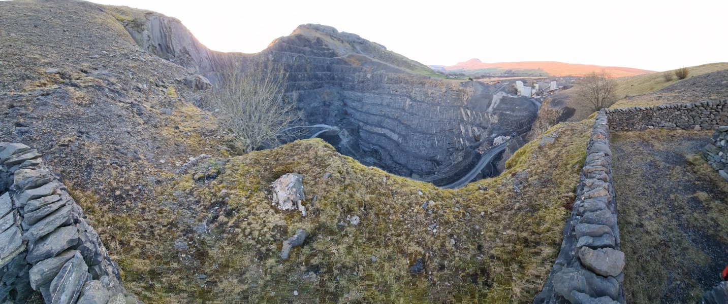 Dry Rigg Quarry, a deep and impressive quarry on the side of Moughton (with Pen-y-ghent in the background). This is a gritstone quarry, and its rock is used as the stones in tarmac/asphalt.
Modelling by vague hints of Gwenllian's left leg
Dry Rigg Quarry, a deep and impressive quarry on the side of Moughton (with Pen-y-ghent in the background). This is a gritstone quarry, and its rock is used as the stones in tarmac/asphalt.
Modelling by vague hints of Gwenllian's left leg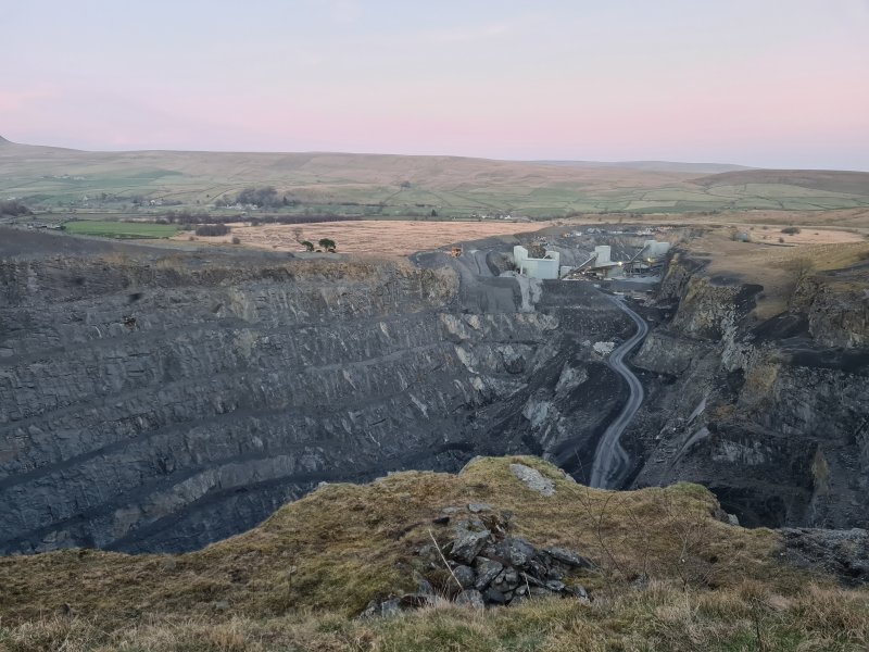 The quarry is supposed to run until 2035, and is then destined to become a 125 metre deep lake by 2065. Or perhaps deeper, if they make it any deeper before 2035
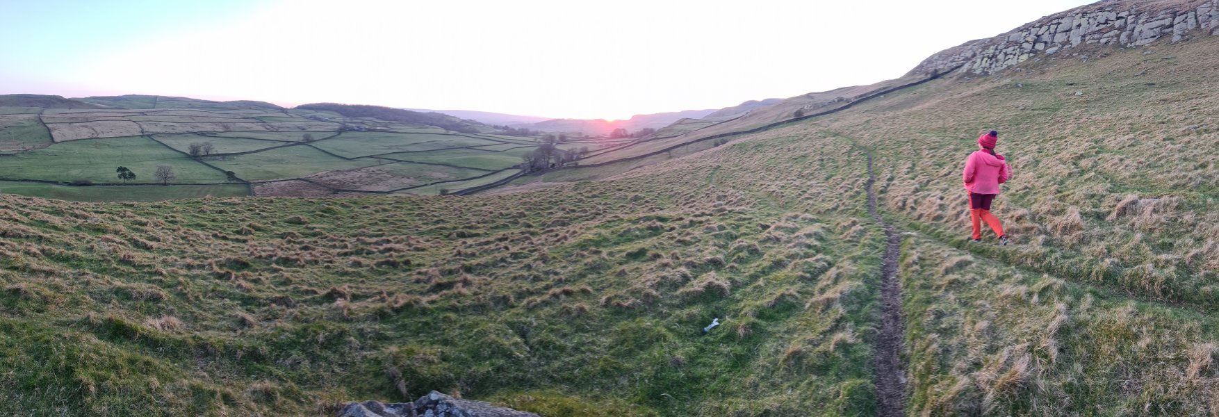 Walking towards the sunset on Moughton Scar. On the left is In Moor (363 metres), in the distance is Burn Moor (486 metres), and the Thwaite ridge can be seen on the right.
Modelling by Gwenllian
Walking towards the sunset on Moughton Scar. On the left is In Moor (363 metres), in the distance is Burn Moor (486 metres), and the Thwaite ridge can be seen on the right.
Modelling by Gwenllian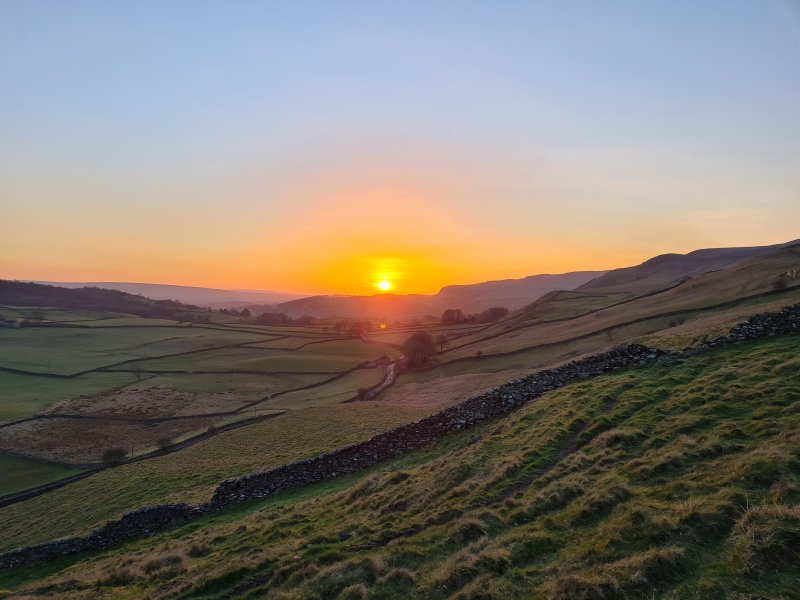 Sunset over Thwaite.
 A rich and glorious sunset.
 Sunset through the wall.
 Driving past Moughton and Thwaite.
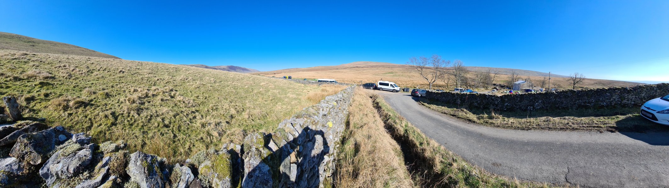 Approaching Bullpot Farm, the Red Rose Cave & Pothole Club's hut. This was a CHECC (Council of Higher Education Caving Clubs) weekend, and the place was covered with tents. Surprisingly, the students were already out and about by the time we arrived, and were just starting to head off to the caves. The mountains are Barbon Low Fell (437 metres), Castle Knott (538 metres), Calf Top (610 metres), Great Coum (687 metres) and Gragareth (627 metres). The slope of Great Coum is called Casterton Fell, is in Cumbria (not Yorkshire), and is home to the Three Counties caves of Ease Gill (or Easegill). The slope of Gragareth is called Leck Fell, is in Lancashire (not Yorkshire), and is home to many more of the Three Counties System caves. Why is this called the Yorkshire Dales again?
Modelling by auto-portrait
Approaching Bullpot Farm, the Red Rose Cave & Pothole Club's hut. This was a CHECC (Council of Higher Education Caving Clubs) weekend, and the place was covered with tents. Surprisingly, the students were already out and about by the time we arrived, and were just starting to head off to the caves. The mountains are Barbon Low Fell (437 metres), Castle Knott (538 metres), Calf Top (610 metres), Great Coum (687 metres) and Gragareth (627 metres). The slope of Great Coum is called Casterton Fell, is in Cumbria (not Yorkshire), and is home to the Three Counties caves of Ease Gill (or Easegill). The slope of Gragareth is called Leck Fell, is in Lancashire (not Yorkshire), and is home to many more of the Three Counties System caves. Why is this called the Yorkshire Dales again?
Modelling by auto-portrait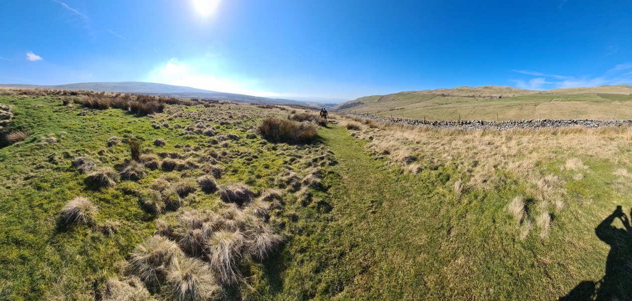 Just beyond where the path branches to Lancaster Hole, our route continues towards Easegill. Left and right are Green Hill (628 metres), Gragareth and Barbon Low Fell.
Modelling by Gwenllian, Jack, and a lurker
Just beyond where the path branches to Lancaster Hole, our route continues towards Easegill. Left and right are Green Hill (628 metres), Gragareth and Barbon Low Fell.
Modelling by Gwenllian, Jack, and a lurker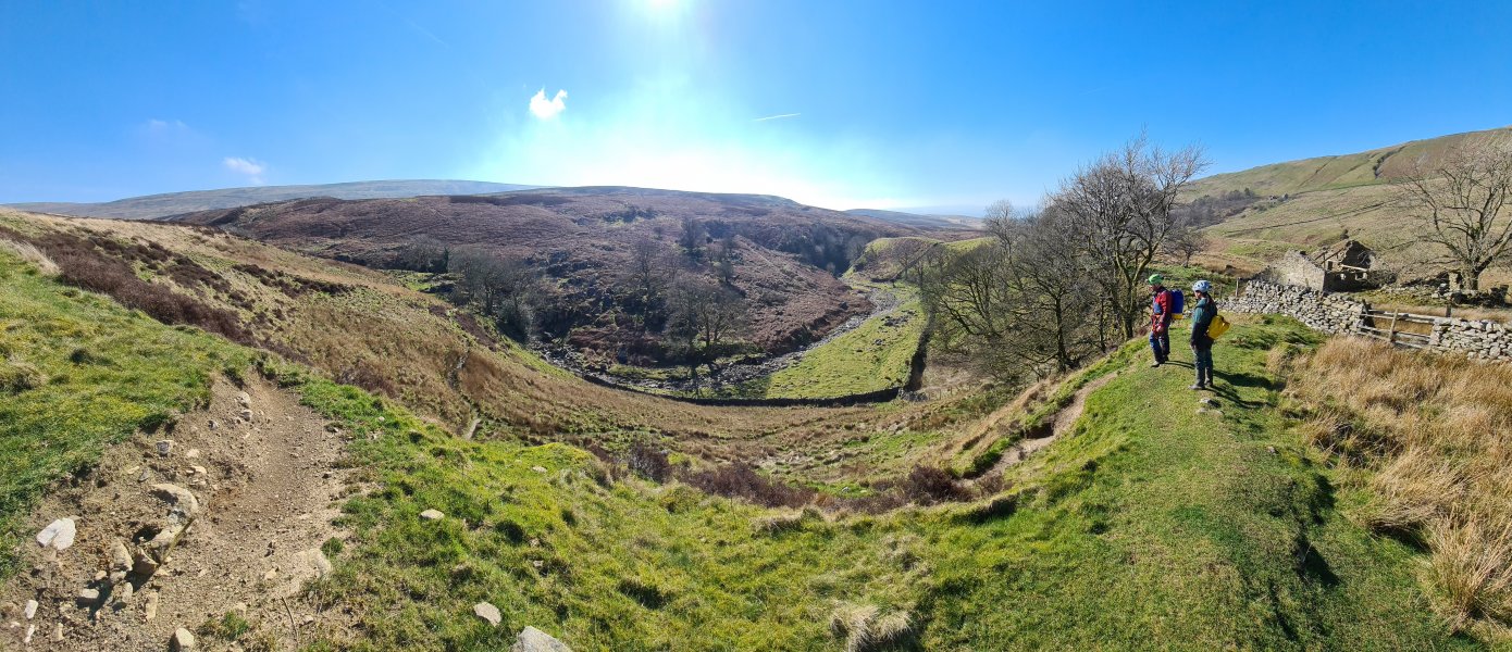 Dropping down into Ease Gill beside Hellot Scales Barn, just above the gorge called Ease Gill Kirk, where Leck Beck Head - the resurgence for all of the Ease Gill caves, is located.
Modelling by Gwenllian and Jack
Dropping down into Ease Gill beside Hellot Scales Barn, just above the gorge called Ease Gill Kirk, where Leck Beck Head - the resurgence for all of the Ease Gill caves, is located.
Modelling by Gwenllian and Jack The entrance to Shuttleworth Pot, with Barbon Low Fell, Castle Knott, Calf Top, and the Crag Hill (682 metres) bump on Great Coum.
Modelling by Gwenllian, Jack and a dementor
The entrance to Shuttleworth Pot, with Barbon Low Fell, Castle Knott, Calf Top, and the Crag Hill (682 metres) bump on Great Coum.
Modelling by Gwenllian, Jack and a dementor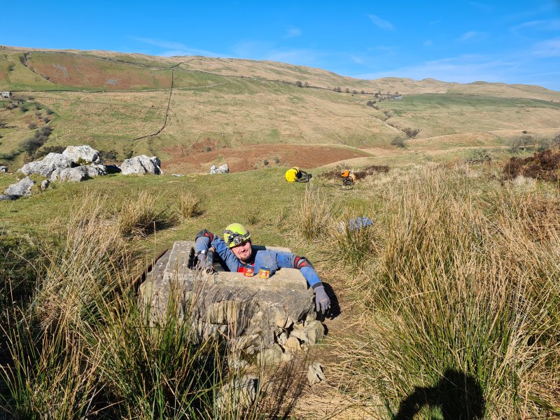 Entering Shuttleworth Pot. The entrance tube drops a few metres to the head of the first pitch.
Camera by Jack, modelling by Beandan, Noahoop, Tarquin, and Jackhouette
Entering Shuttleworth Pot. The entrance tube drops a few metres to the head of the first pitch.
Camera by Jack, modelling by Beandan, Noahoop, Tarquin, and Jackhouette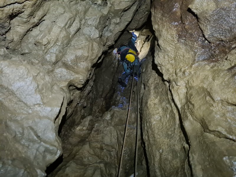 This cave was originally part of an upstream section of Witches Cave, and was explored to surface from below.
Modelling by Gwenllian, lighting by Tarquin, Gwenllian and Sol
This cave was originally part of an upstream section of Witches Cave, and was explored to surface from below.
Modelling by Gwenllian, lighting by Tarquin, Gwenllian and Sol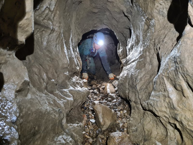 A descent through a dig then reaches this crawl, which has a short side passage.
Modelling by Gwenllian, lighting by Tarquin and Gwenllian
A descent through a dig then reaches this crawl, which has a short side passage.
Modelling by Gwenllian, lighting by Tarquin and Gwenllian The next pitch is the start of a series of little drops leading to the head of the main pitch.
Modelling by Jack, lighting by Tarquin and Jack
The next pitch is the start of a series of little drops leading to the head of the main pitch.
Modelling by Jack, lighting by Tarquin and Jack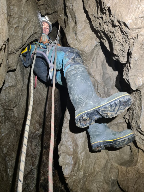 The first of the little drops is tight at the top.
Modelling by Gwenllian, lighting by Tarquin and Gwenllian
The first of the little drops is tight at the top.
Modelling by Gwenllian, lighting by Tarquin and Gwenllian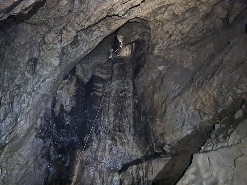 The main pitch - known as the Diver's Pitch - slopes gently, with a couple of rebelays. The top has a lot of loose rocks, so each person needs to complete the descent before the next person passes the rocky ledges.
Modelling by Gwenllian, lighting by Tarquin and Gwenllian
The main pitch - known as the Diver's Pitch - slopes gently, with a couple of rebelays. The top has a lot of loose rocks, so each person needs to complete the descent before the next person passes the rocky ledges.
Modelling by Gwenllian, lighting by Tarquin and Gwenllian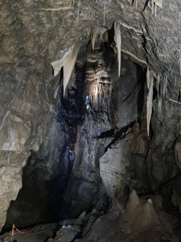 Diver's Pitch of Shuttleworth Pot, which is only about 25 metres. The slope of the pitch is quite apparent here, as it makes the photograph look tilted - it really slopes this much.
Modelling by Gwenllian, lighting by Tarquin and Gwenllian
Diver's Pitch of Shuttleworth Pot, which is only about 25 metres. The slope of the pitch is quite apparent here, as it makes the photograph look tilted - it really slopes this much.
Modelling by Gwenllian, lighting by Tarquin and Gwenllian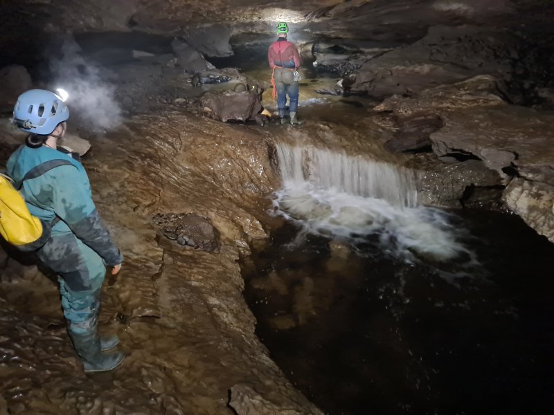 The main river of Shuttleworth Pot, looking into House Of The Rising Sump. This is, strictly speaking, the Witches Cave river, between Upstream Sumps 1 and 2. The downstream sump (connecting to Witches Cave) is behind the camera (connected to the pool in the floor), and is 430 metres long and a maximum of 33.5 metres deep. Up to the left here is the other side of the cave, a ramp up into The Exercise Yard, which leads through Zig Zag Passage into Lake Chamber. This was left for another day.
Modelling by Gwenllian and Jack, lighting by Tarquin, Gwenllian and Jack
The main river of Shuttleworth Pot, looking into House Of The Rising Sump. This is, strictly speaking, the Witches Cave river, between Upstream Sumps 1 and 2. The downstream sump (connecting to Witches Cave) is behind the camera (connected to the pool in the floor), and is 430 metres long and a maximum of 33.5 metres deep. Up to the left here is the other side of the cave, a ramp up into The Exercise Yard, which leads through Zig Zag Passage into Lake Chamber. This was left for another day.
Modelling by Gwenllian and Jack, lighting by Tarquin, Gwenllian and Jack The upstream sump is 500 metres long and a maximum of 31 metres deep, connecting to Pippikin Pot, or an additional 765 metres long connecting to Lost John's Cave, or 900 metres to Gavel Pot. This river basically drains the entire Leck Fell.
 The parted curtains formation. The stalagmite once sat below the stalactite in the middle, but has at some point shifted away, presumably caused by an old water flow or subsidence.
Modelling by Gwenllian and hints of Jack, lighting by Tarquin, Gwenllian and Jack
The parted curtains formation. The stalagmite once sat below the stalactite in the middle, but has at some point shifted away, presumably caused by an old water flow or subsidence.
Modelling by Gwenllian and hints of Jack, lighting by Tarquin, Gwenllian and Jack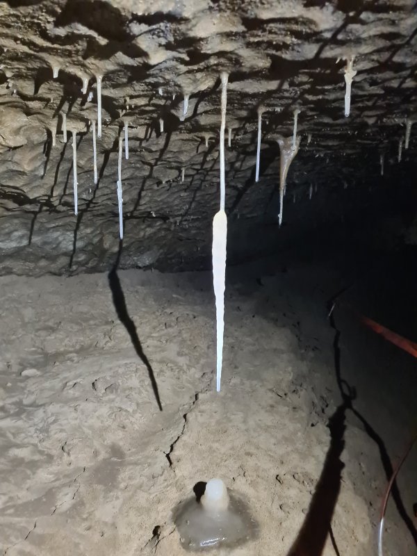 White carrot. This early part of the cave is a flat out crawl over sediment.
 Straws in an undercut.
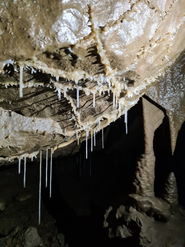 Early hints of helictites.
 At this point, the helictites are not particularly special, but the characteristic way they form on the fracture lines is quite distinctive.
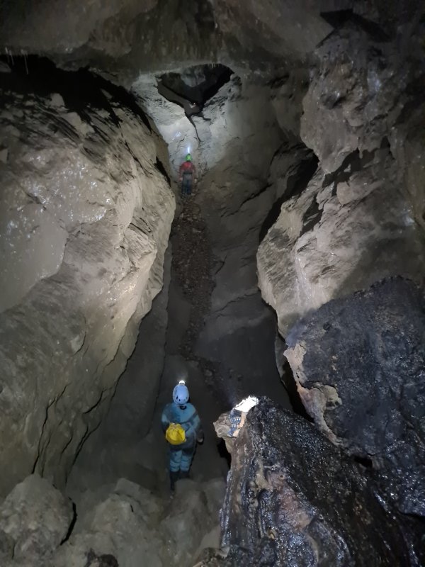 The passage grows to a very grand canyon, which shows just how much passage must be hiding below the earlier sediment.
Modelling by Gwenllian and Jack, lighting by Tarquin, Gwenllian and Jack
The passage grows to a very grand canyon, which shows just how much passage must be hiding below the earlier sediment.
Modelling by Gwenllian and Jack, lighting by Tarquin, Gwenllian and Jack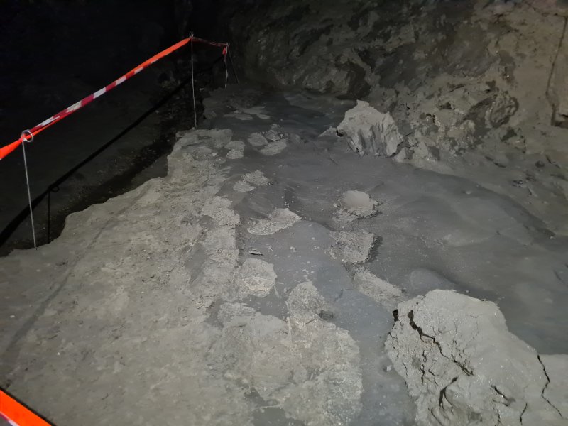 Protected mud formations. The footprints are from the first explorers; divers who had reached this point from Witches Cave.
Lighting by Tarquin and Gwenllian
Protected mud formations. The footprints are from the first explorers; divers who had reached this point from Witches Cave.
Lighting by Tarquin and Gwenllian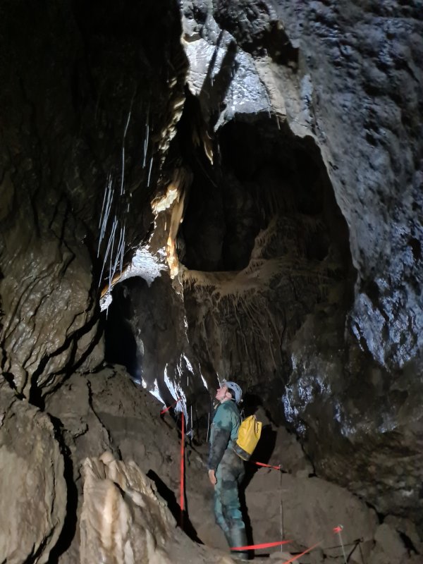 Admiring the straws and translucent curtains.
Modelling by Gwenllian, lighting by Tarquin and Jack
Admiring the straws and translucent curtains.
Modelling by Gwenllian, lighting by Tarquin and Jack A small side tube leads down a very slippery chute.
Modelling by Gwenllian, lighting by Tarquin and Gwenllian
A small side tube leads down a very slippery chute.
Modelling by Gwenllian, lighting by Tarquin and Gwenllian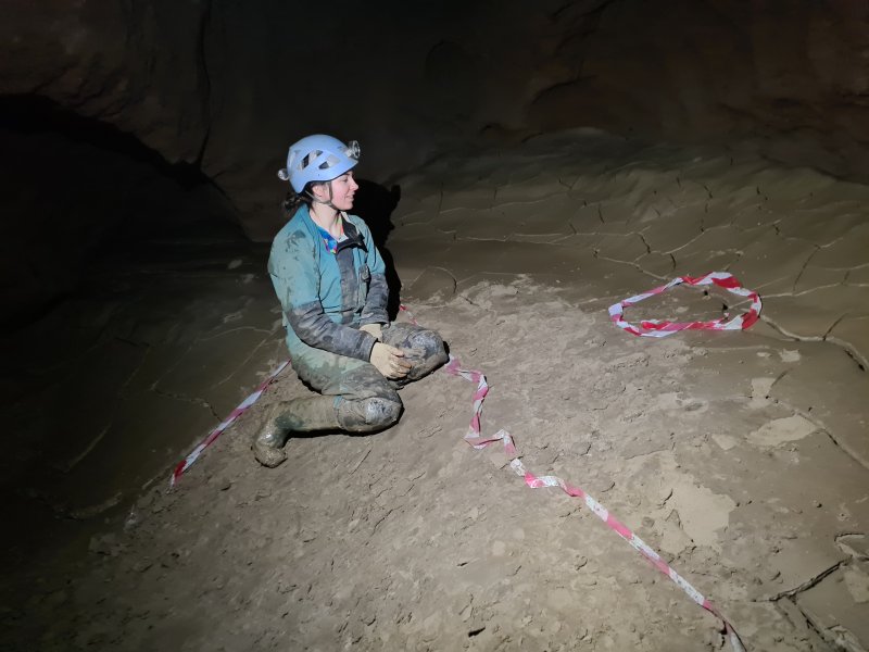 This leads into My Newt Passage, a short, muddy passage lying far below the floor of the main passage, but without any of the water from the main passage.
Modelling by Gwenllian
This leads into My Newt Passage, a short, muddy passage lying far below the floor of the main passage, but without any of the water from the main passage.
Modelling by Gwenllian On the floor is one of the highlights of the trip to here, The Little Dragon; a tiny skeleton of a newt. Conservation tape for scale
Modelling by The Little Dragon
On the floor is one of the highlights of the trip to here, The Little Dragon; a tiny skeleton of a newt. Conservation tape for scale
Modelling by The Little Dragon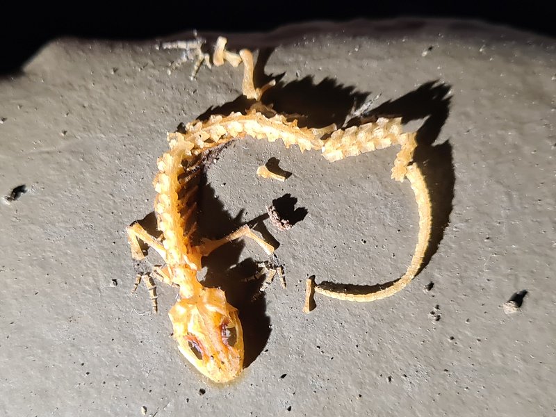 The conservation document says this is probably a palmate newt, but it has been identified in scientific literature as a species in the Triturus genus, which would make this a great crested newt. I have not been able to find enough details of either species' skeletons in order to conclusively identify it either way. The conservation document also mentions that there is a second one, but we only saw this one. Perhaps it is a little further along the passage, but it is taped off in order to protect the mud formations.
Modelling by The Little Dragon
The conservation document says this is probably a palmate newt, but it has been identified in scientific literature as a species in the Triturus genus, which would make this a great crested newt. I have not been able to find enough details of either species' skeletons in order to conclusively identify it either way. The conservation document also mentions that there is a second one, but we only saw this one. Perhaps it is a little further along the passage, but it is taped off in order to protect the mud formations.
Modelling by The Little Dragon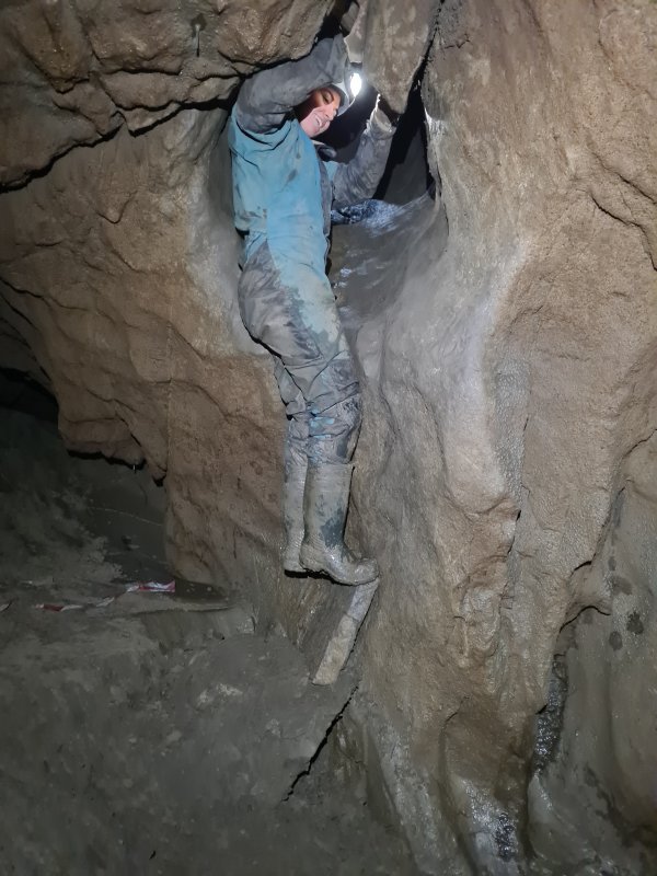 Climbing out of My Newt Passage
Modelling by Gwenllian, lighting by Tarquin and Gwenllian
Climbing out of My Newt Passage
Modelling by Gwenllian, lighting by Tarquin and Gwenllian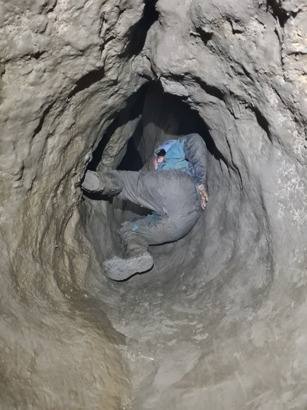 The chute is far harder on the way out, with very few holds, and an extremely slippery surface. Most visitors require some kind of assistance.
Modelling by Gwenllian, lighting by Tarquin and Gwenllian
The chute is far harder on the way out, with very few holds, and an extremely slippery surface. Most visitors require some kind of assistance.
Modelling by Gwenllian, lighting by Tarquin and Gwenllian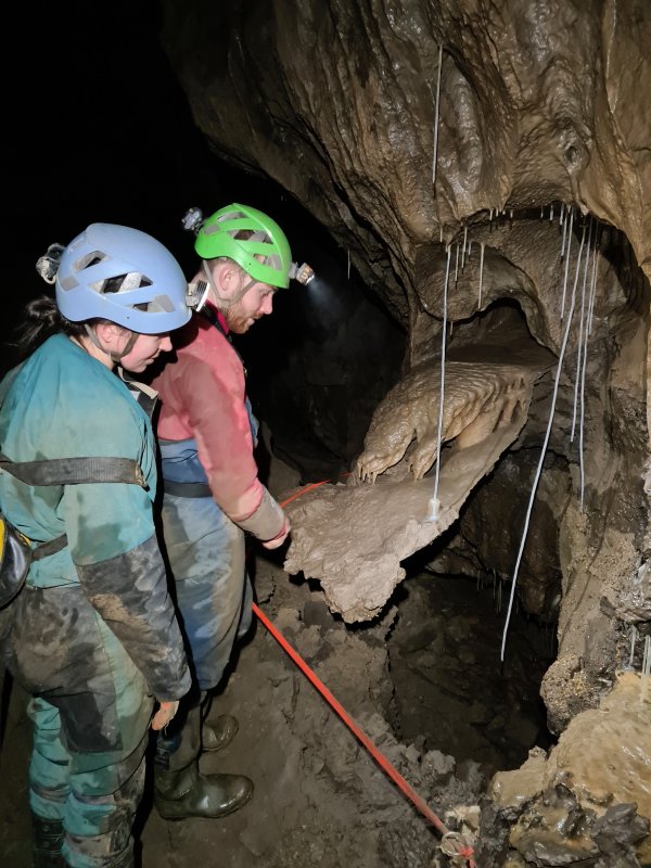 Gravity defying straw, and a false floor straw column.
Modelling by Gwenllian and Jack, lighting by Tarquin, Gwenllian and Jack
Gravity defying straw, and a false floor straw column.
Modelling by Gwenllian and Jack, lighting by Tarquin, Gwenllian and Jack Curtain.
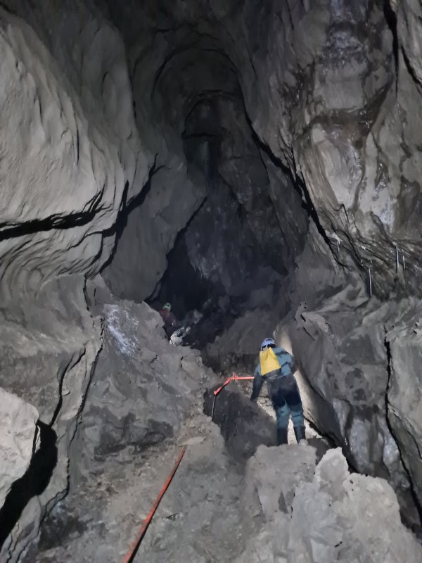 Continuing along the canyon.
Modelling by Gwenllian and Jack, lighting by Tarquin, Gwenllian and Jack
Continuing along the canyon.
Modelling by Gwenllian and Jack, lighting by Tarquin, Gwenllian and Jack A green and black tinted formation in the ceiling, looking like a witch flying overhead. The dramatic colouring is most likely caused by manganese.
 Manganese stained stalagmite below it, with distinctive yellow, green, grey and brown colouring.
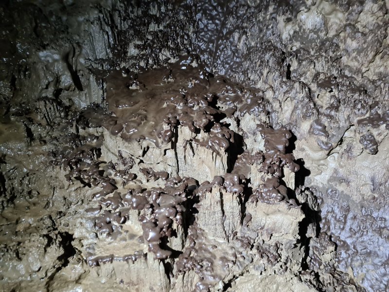 Calcite crusted mud.
 Richly black stalagmite, with white curtains.
Modelling by Gwenllian, lighting by Tarquin and Gwenllian
Richly black stalagmite, with white curtains.
Modelling by Gwenllian, lighting by Tarquin and Gwenllian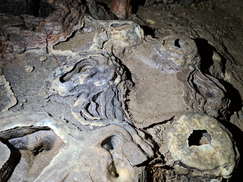 Calcite crusted mud formations, with drip pockets. These look almost surreal, like a miniature volcanic landscape.
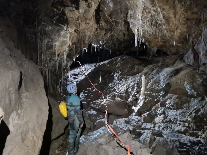 Under a decorated arch. From here onwards, the passage earns the name Painter's Alley.
Modelling by Gwenllian, lighting by Tarquin, Gwenllian and Jack
Under a decorated arch. From here onwards, the passage earns the name Painter's Alley.
Modelling by Gwenllian, lighting by Tarquin, Gwenllian and Jack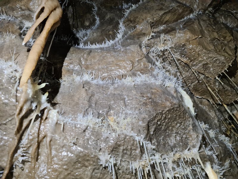 Beyond the arch, Painter's Alley is richly decorated with vast numbers of helictites.
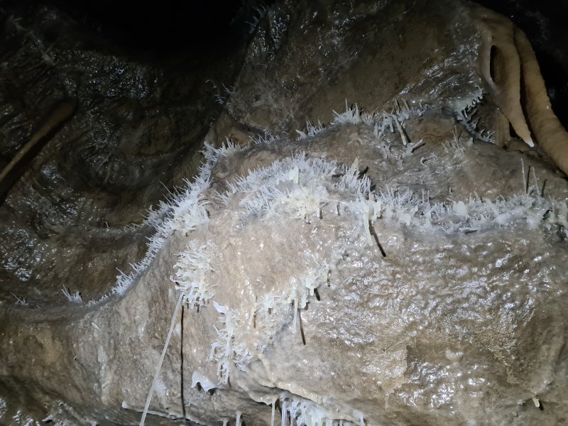 These are not as elaborate as the cray aragonite helictites seen in South Wales, and are the basic calcite helictites. But they make up for the lack of insanity with sheer volume of numbers.
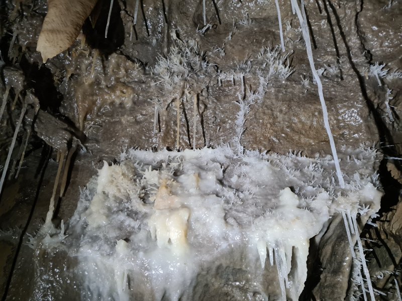 Helictites and straws.
 Flowstone and helictites.
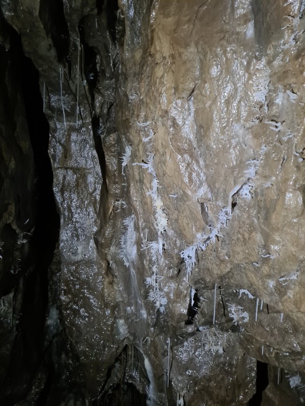 Helictites.
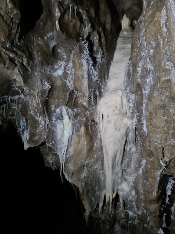 Creamy flowstone and helictite pie.
 Painter's Alley.
Modelling by Gwenllian and Jack, lighting by Tarquin, Gwenllian and Jack
Painter's Alley.
Modelling by Gwenllian and Jack, lighting by Tarquin, Gwenllian and Jack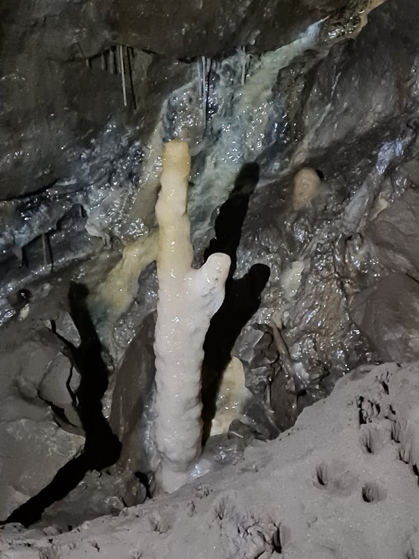 Rabbit.
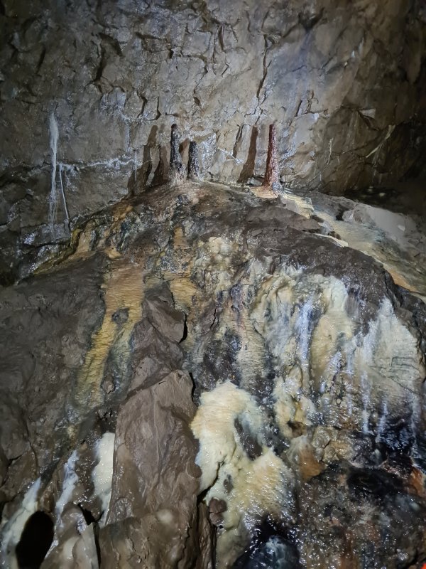 The Painter's Palette, a multi-coloured flowstone mound.
Lighting by Tarquin, Gwenllian and Jack
The Painter's Palette, a multi-coloured flowstone mound.
Lighting by Tarquin, Gwenllian and Jack Flowstone at the Painter's Palette.
Lighting by Tarquin, Gwenllian and Jack
Flowstone at the Painter's Palette.
Lighting by Tarquin, Gwenllian and Jack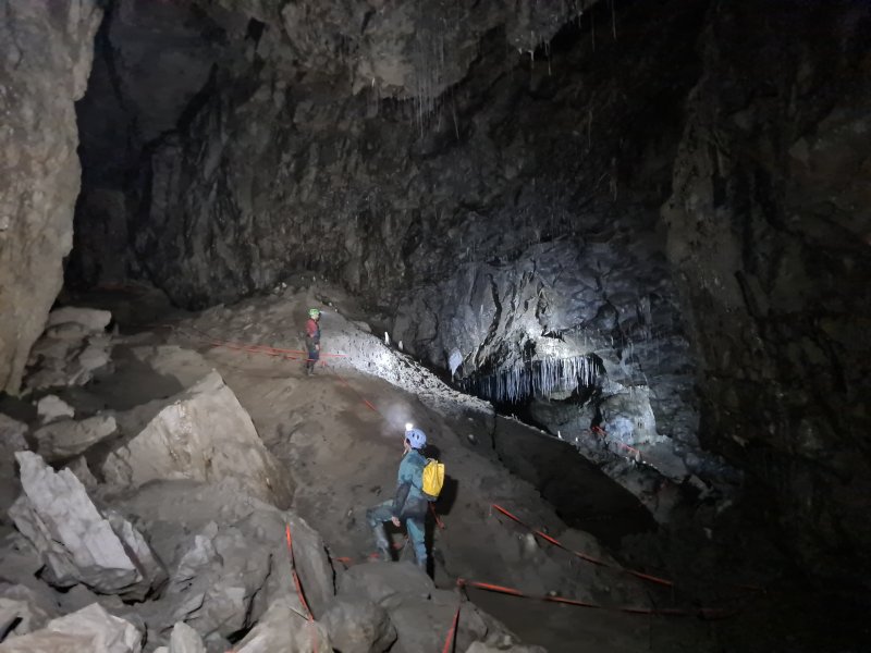 Dogger Bank, an unexpectedly enormous chamber, with a large sediment bank, and long straws above. The size of the chamber makes it feel like a major junction has been reached, perhaps with a pothole entering from above. However, there is only one way out of the chamber; the straw-filled archway.
Modelling by Gwenllian and Jack, lighting by Tarquin, Gwenllian and Jack
Dogger Bank, an unexpectedly enormous chamber, with a large sediment bank, and long straws above. The size of the chamber makes it feel like a major junction has been reached, perhaps with a pothole entering from above. However, there is only one way out of the chamber; the straw-filled archway.
Modelling by Gwenllian and Jack, lighting by Tarquin, Gwenllian and Jack Exposed drip pockets in Dogger Bank.
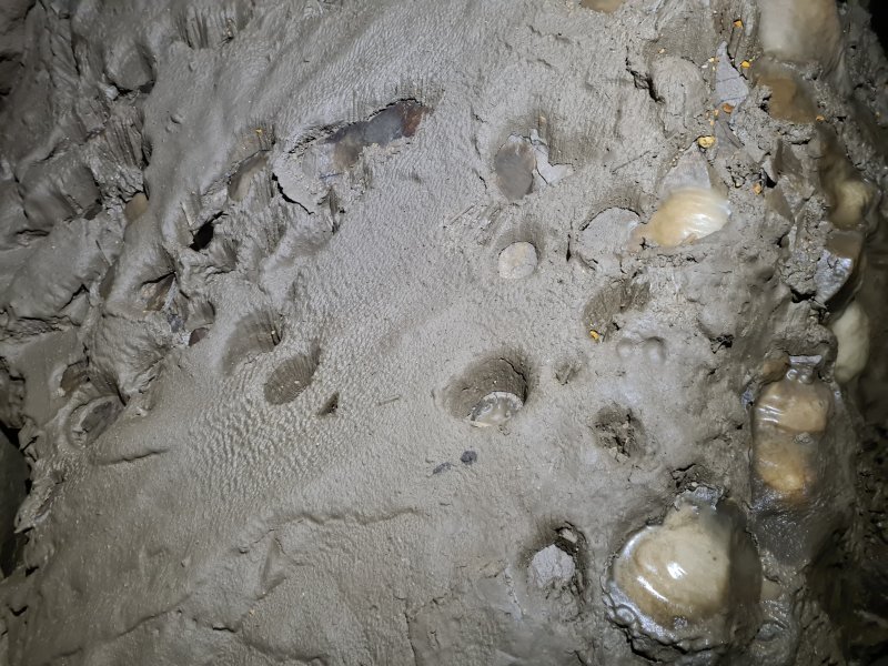 Drip pockets still in the surrounding mud.
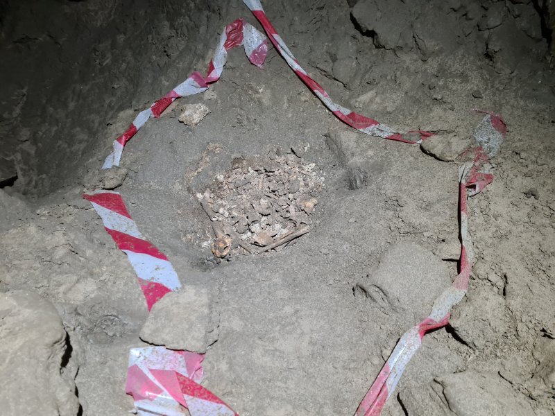 The dog skeleton that gave the passage its name. The bones were originally quite distinctive and identifiable, but apparently were handled by too many visitors, and turned to dust. The dog had evidently been alive when it reached this point, but it is not known how it got in here.
Lighting by Tarquin and Gwenllian
The dog skeleton that gave the passage its name. The bones were originally quite distinctive and identifiable, but apparently were handled by too many visitors, and turned to dust. The dog had evidently been alive when it reached this point, but it is not known how it got in here.
Lighting by Tarquin and Gwenllian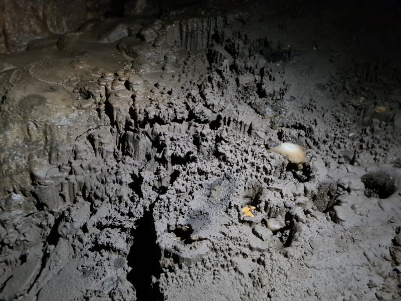 Drip pockets and mushroom-shaped stalagmites at the top of the sediment bank.
 Flowstone covered wall in Dogger Bank.
Modelling by Jack, lighting by Tarquin, Gwenllian and Jack
Flowstone covered wall in Dogger Bank.
Modelling by Jack, lighting by Tarquin, Gwenllian and Jack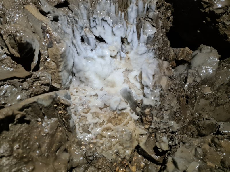 Calcited gours below it.
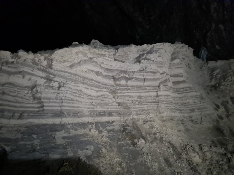 Sediment layers (laminates) in Dogger Bank, below the arch. These appear to be periglacial rhythmites from an ice age; a layer of fine silt in winter when the glaciers are frozen, and a layer of coarser grained sand in the summer when the ice melts, and the meltwater can carry larger grains.
Lighting by Tarquin and Gwenllian
Sediment layers (laminates) in Dogger Bank, below the arch. These appear to be periglacial rhythmites from an ice age; a layer of fine silt in winter when the glaciers are frozen, and a layer of coarser grained sand in the summer when the ice melts, and the meltwater can carry larger grains.
Lighting by Tarquin and Gwenllian Straw covered arch in Dogger Bank.
Modelling by Jack, lighting by Tarquin, Gwenllian and Jack
Straw covered arch in Dogger Bank.
Modelling by Jack, lighting by Tarquin, Gwenllian and Jack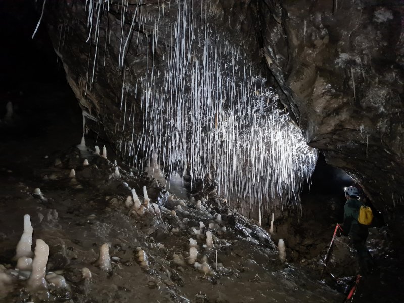 Intense profusion of straws in the arch.
Modelling by Gwenllian and shadowy hints of Jack, lighting by Tarquin, Gwenllian and Jack
Intense profusion of straws in the arch.
Modelling by Gwenllian and shadowy hints of Jack, lighting by Tarquin, Gwenllian and Jack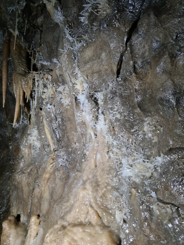 Helictites in the continuing passage.
 Helictites as the passage approaches Oxbow Aven.
Modelling by Gwenllian and Jack, lighting by Tarquin, Gwenllian and Jack
Helictites as the passage approaches Oxbow Aven.
Modelling by Gwenllian and Jack, lighting by Tarquin, Gwenllian and Jack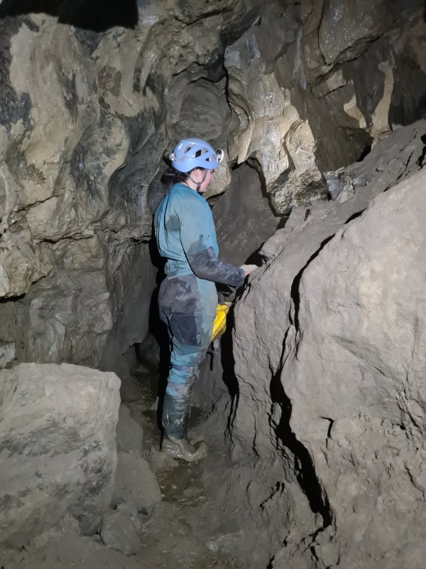 The passage then rapidly shrinks, and quickly ends at a disappointing, muddy choke.
Modelling by Gwenllian, lighting by Tarquin and Gwenllian
The passage then rapidly shrinks, and quickly ends at a disappointing, muddy choke.
Modelling by Gwenllian, lighting by Tarquin and Gwenllian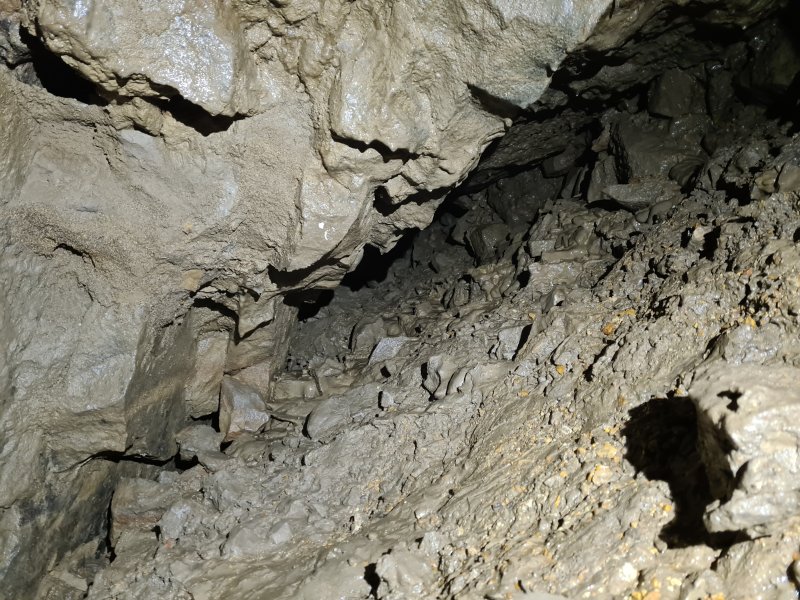 The muddy choke.
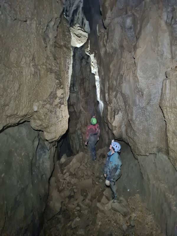 A slither up a muddy slope reaches the last rift. After dropping down a tricky mud climb (comical on the way out), the passage ends in this tall rift, which has several avens, and a hanging boulder. The muddy passage chokes below the floor. This is a rather disappointing end to what had been a very grand passage.
Modelling by Gwenllian and Jack, lighting by Tarquin, Gwenllian and Jack
A slither up a muddy slope reaches the last rift. After dropping down a tricky mud climb (comical on the way out), the passage ends in this tall rift, which has several avens, and a hanging boulder. The muddy passage chokes below the floor. This is a rather disappointing end to what had been a very grand passage.
Modelling by Gwenllian and Jack, lighting by Tarquin, Gwenllian and Jack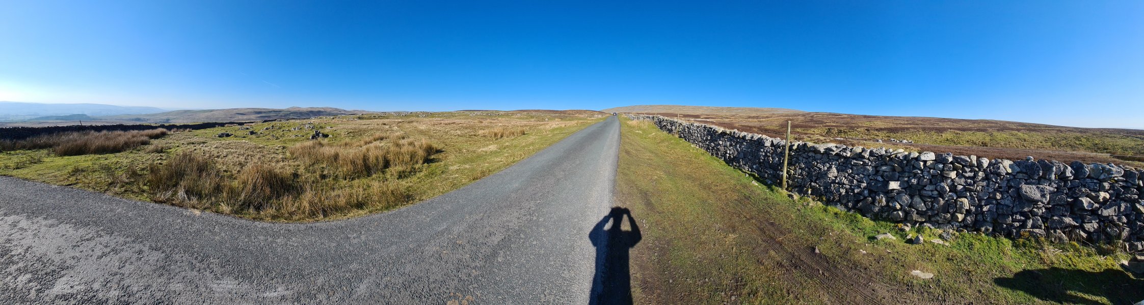 View from the road over Leck Fell, with the Hutton Roof Crags (274 metres) on the left, then Barbon Low Fell and Gragareth on either side of the valley. The Committee Pot entrance to Notts II sits in the pile of rocks just over the wall to the right.
Modelling by the dark knight and a detatched cast of white flaxen from the River Tawe
View from the road over Leck Fell, with the Hutton Roof Crags (274 metres) on the left, then Barbon Low Fell and Gragareth on either side of the valley. The Committee Pot entrance to Notts II sits in the pile of rocks just over the wall to the right.
Modelling by the dark knight and a detatched cast of white flaxen from the River Tawe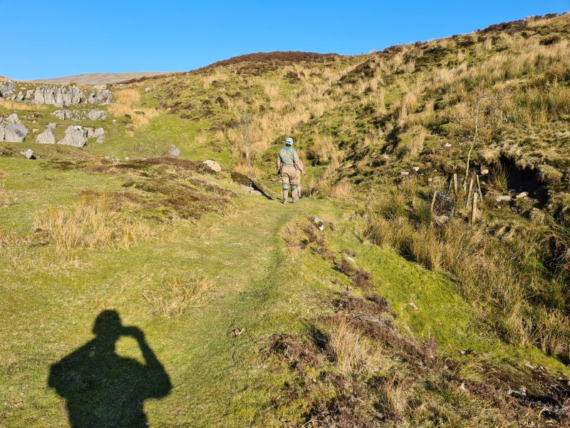 Heading into the Committee Pot shakehole. This is right by the road, and as a result, was one of the few places accessible during the Foot And Mouth countryside restrictions in the 1990s. That led to the epic dig which gained access to the streamway beyond the Notts Pot downstream sump.
Modelling by Gwenllian, Jack and a dissociative impression
Heading into the Committee Pot shakehole. This is right by the road, and as a result, was one of the few places accessible during the Foot And Mouth countryside restrictions in the 1990s. That led to the epic dig which gained access to the streamway beyond the Notts Pot downstream sump.
Modelling by Gwenllian, Jack and a dissociative impression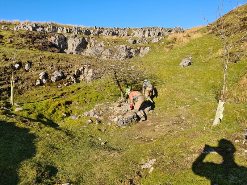 Entrance to Committee Pot. This is the usual entrance to Notts II, and is usually called Notts II, but its official name is Committee Pot.
Modelling by Jack, Gwenllian and a projected lack of light
Entrance to Committee Pot. This is the usual entrance to Notts II, and is usually called Notts II, but its official name is Committee Pot.
Modelling by Jack, Gwenllian and a projected lack of light The dig starts off as a scaffolded shaft, with ladders or brickwork for climbing.
Modelling by Jack and Tarquin's knee pads, lighting by Tarquin, Sol and Jack
The dig starts off as a scaffolded shaft, with ladders or brickwork for climbing.
Modelling by Jack and Tarquin's knee pads, lighting by Tarquin, Sol and Jack And it carries on as a scaffolded shaft.
Modelling by Jack and Tarquin's lower legs, lighting by Tarquin and Jack
And it carries on as a scaffolded shaft.
Modelling by Jack and Tarquin's lower legs, lighting by Tarquin and Jack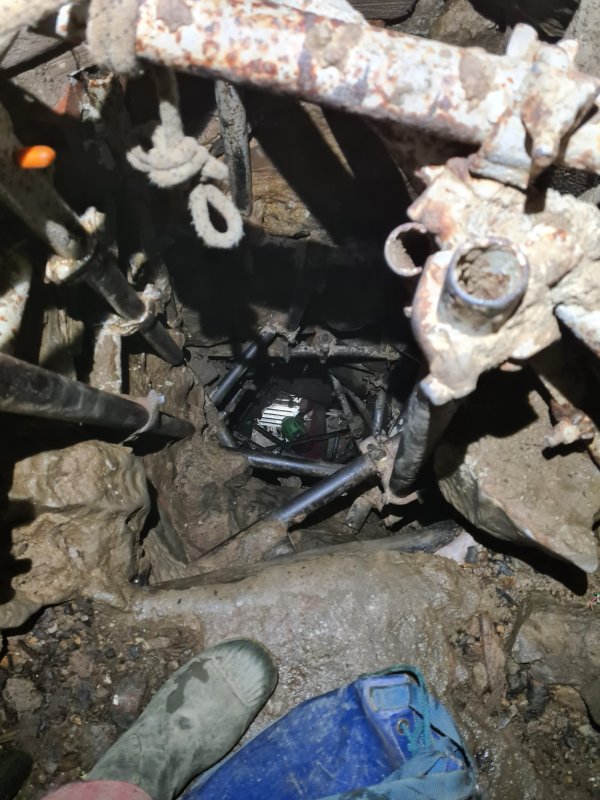 And on. In total, it drops around 50 metres through a shored choke, which is an incredible piece of engineering, an attraction in its own right.
Modelling by Jack and Tarquin's welly, lighting by Tarquin and Jack
And on. In total, it drops around 50 metres through a shored choke, which is an incredible piece of engineering, an attraction in its own right.
Modelling by Jack and Tarquin's welly, lighting by Tarquin and Jack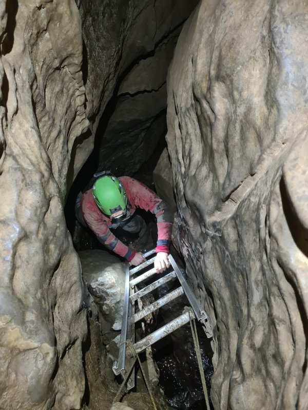 At the breakthrough point, it switches to natural passage, followed quickly by a laddered climb.
Modelling by Jack, lighting by Tarquin and Jack
At the breakthrough point, it switches to natural passage, followed quickly by a laddered climb.
Modelling by Jack, lighting by Tarquin and Jack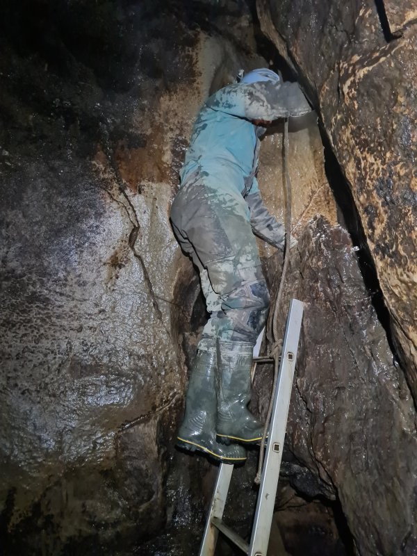 Then a short pitch with another ladder.
Modelling by Gwenllian, lighting by Tarquin and Gwenllian
Then a short pitch with another ladder.
Modelling by Gwenllian, lighting by Tarquin and Gwenllian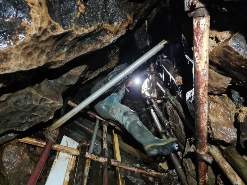 But then, just in case there wasn't enough already, another scaffolded dig through a choke.
Modelling by Gwenllian, lighting by Tarquin and Gwenllian
But then, just in case there wasn't enough already, another scaffolded dig through a choke.
Modelling by Gwenllian, lighting by Tarquin and Gwenllian Rope climb. The rope, incidentally, makes it harder, not easier. Without the rope, you would climb at the other end of the gully, where it is very easy. But with the rope, you feel obliged to use the rope. It is nearly impossible to climb back up with the rope.
Modelling by Gwenllian, lighting by Tarquin and Gwenllian
Rope climb. The rope, incidentally, makes it harder, not easier. Without the rope, you would climb at the other end of the gully, where it is very easy. But with the rope, you feel obliged to use the rope. It is nearly impossible to climb back up with the rope.
Modelling by Gwenllian, lighting by Tarquin and Gwenllian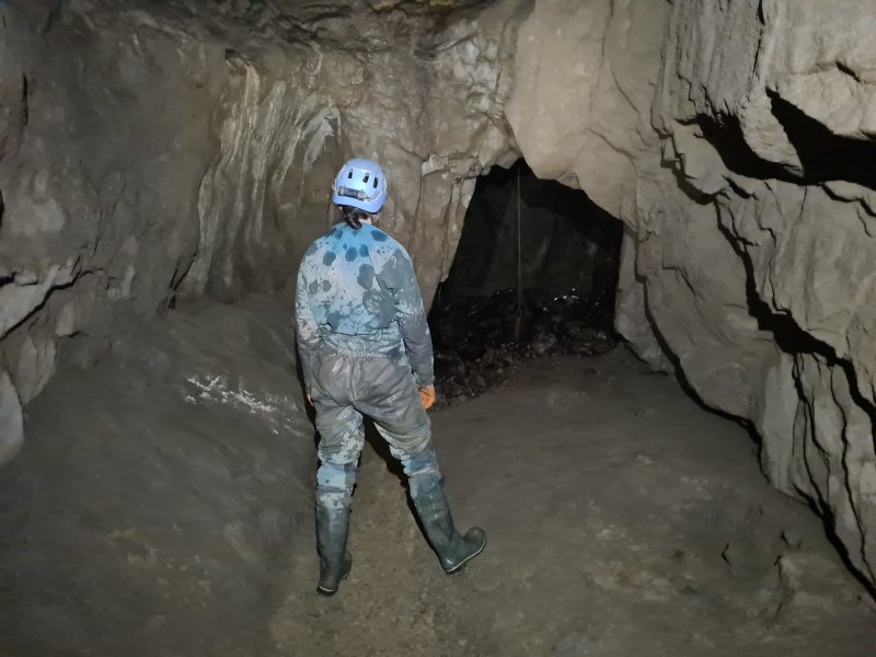 Finally some big passage, before Mincemeat Aven.
Modelling by Gwenllian, lighting by Tarquin and Gwenllian
Finally some big passage, before Mincemeat Aven.
Modelling by Gwenllian, lighting by Tarquin and Gwenllian Phreatic passage after Mincemeat Aven.
Modelling by Gwenllian and Jack, lighting by Tarquin, Gwenllian and Jack
Phreatic passage after Mincemeat Aven.
Modelling by Gwenllian and Jack, lighting by Tarquin, Gwenllian and Jack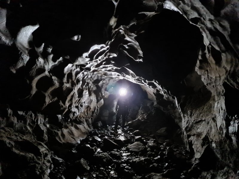 Scalloped walls of the phreas.
Modelling by Gwenllian, lighting by Gwenllian and Jack
Scalloped walls of the phreas.
Modelling by Gwenllian, lighting by Gwenllian and Jack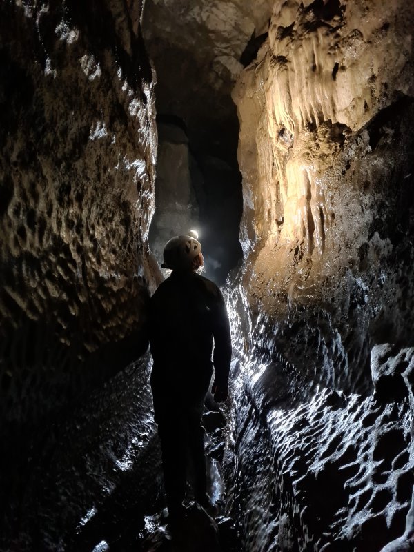 The Notts II streamway, downstream of the junction with the Committee Pot entrance.
Modelling by Gwenllian, lighting by Tarquin and Gwenllian
The Notts II streamway, downstream of the junction with the Committee Pot entrance.
Modelling by Gwenllian, lighting by Tarquin and Gwenllian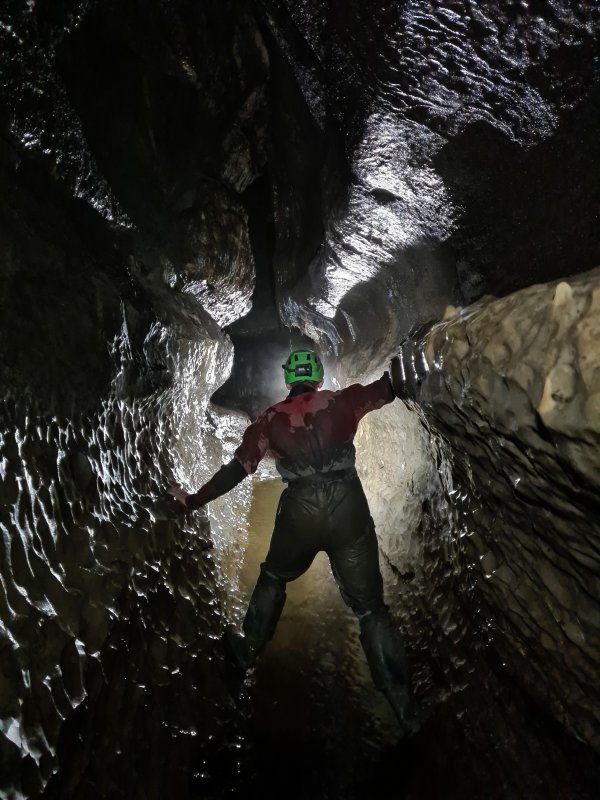 The fine downstream passage.
Modelling by Jack, lighting by Tarquin, Jack and Gwenllian
The fine downstream passage.
Modelling by Jack, lighting by Tarquin, Jack and Gwenllian Surfing down the water slides.
Modelling by Jack, lighting by Tarquin and Jack
Surfing down the water slides.
Modelling by Jack, lighting by Tarquin and Jack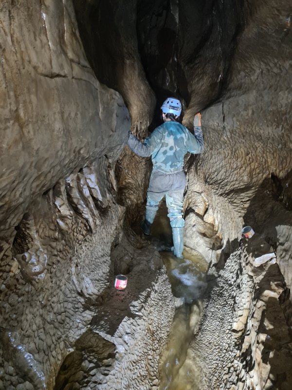 A later part of the downstream passage.
Modelling by Noahoop, Beandan and Gwenllian, lighting by Tarquin and Gwenllian
A later part of the downstream passage.
Modelling by Noahoop, Beandan and Gwenllian, lighting by Tarquin and Gwenllian The final cascade, landing in a large chamber. The dry way on from here is a pitch up, leading to pitches into a short passage between the main downstream sump, upstream sump and an inlet sump.
Modelling by Gwenllian, lighting by Tarquin, Gwenllian and Jack
The final cascade, landing in a large chamber. The dry way on from here is a pitch up, leading to pitches into a short passage between the main downstream sump, upstream sump and an inlet sump.
Modelling by Gwenllian, lighting by Tarquin, Gwenllian and Jack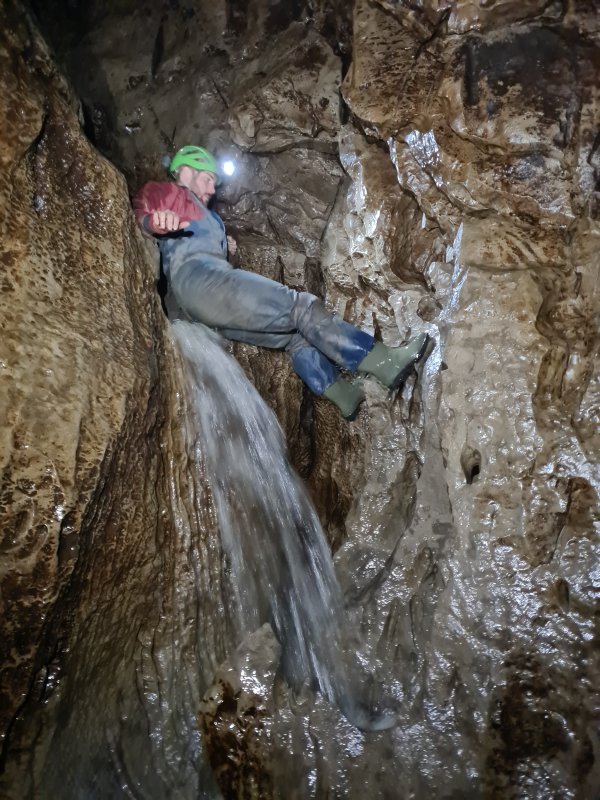 Trying to keep a dry bum. He failed.
Modelling by Jack, lighting by Tarquin, Gwenllian and Jack
Trying to keep a dry bum. He failed.
Modelling by Jack, lighting by Tarquin, Gwenllian and Jack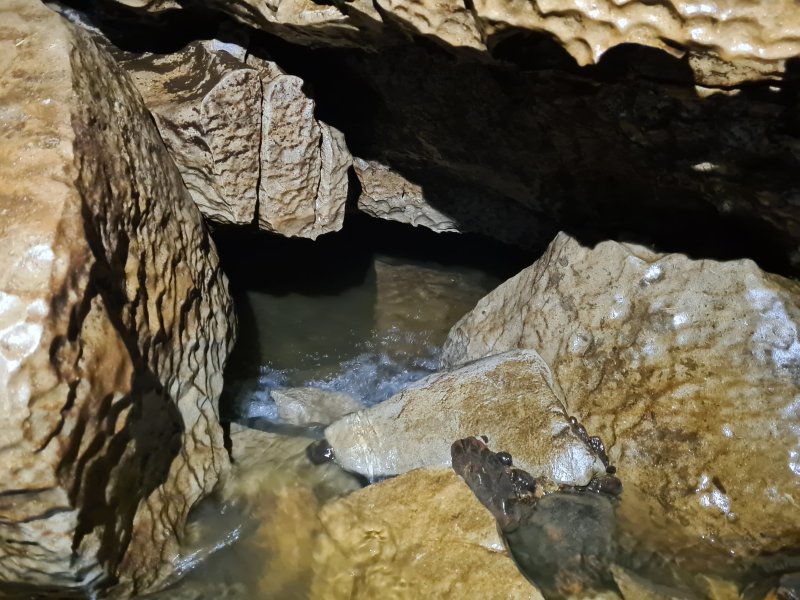 The stream then flows into a low bedding, which sumps. This connects to the streamway that can be accessed via the pitch.
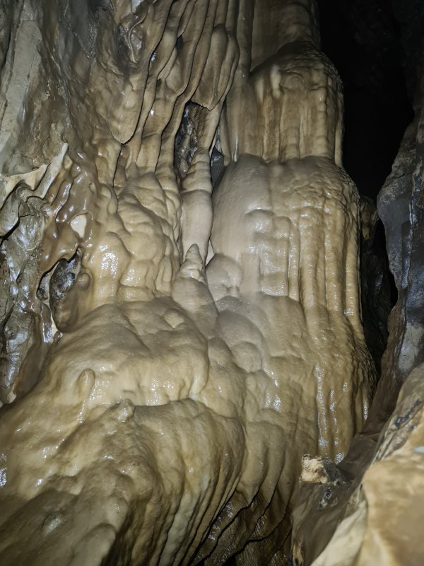 Formations in the upstream passage.
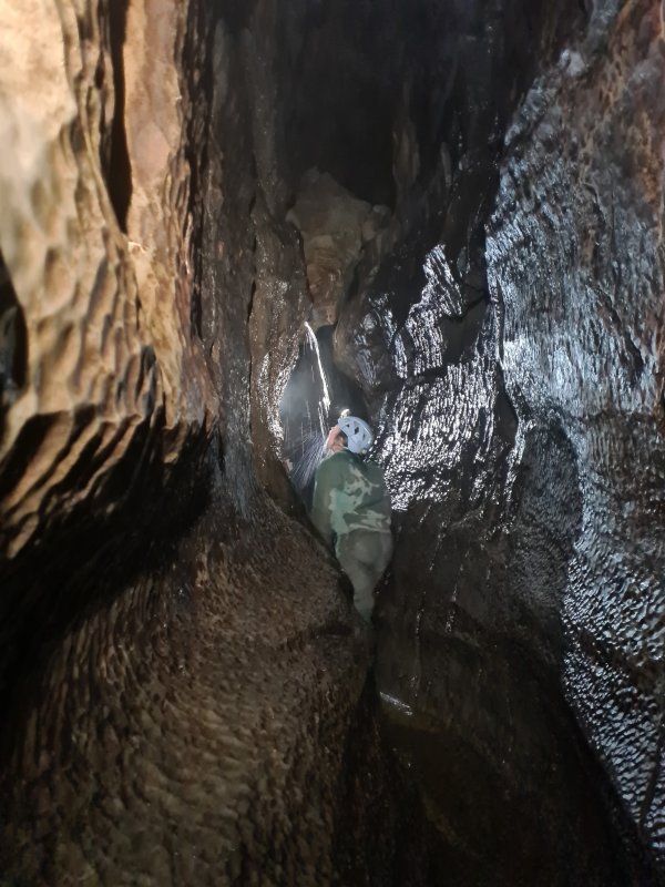 Drinking from the Showerbath Inlet.
Modelling by Gwenllian, lighting by Tarquin, Gwenllian and Jack
Drinking from the Showerbath Inlet.
Modelling by Gwenllian, lighting by Tarquin, Gwenllian and Jack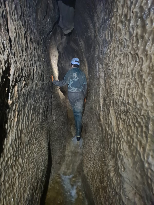 The upstream passage, beyond the connection to The Cupcake and Lost John's Cave
Modelling by Gwenllian, lighting by Tarquin and Gwenllian
The upstream passage, beyond the connection to The Cupcake and Lost John's Cave
Modelling by Gwenllian, lighting by Tarquin and Gwenllian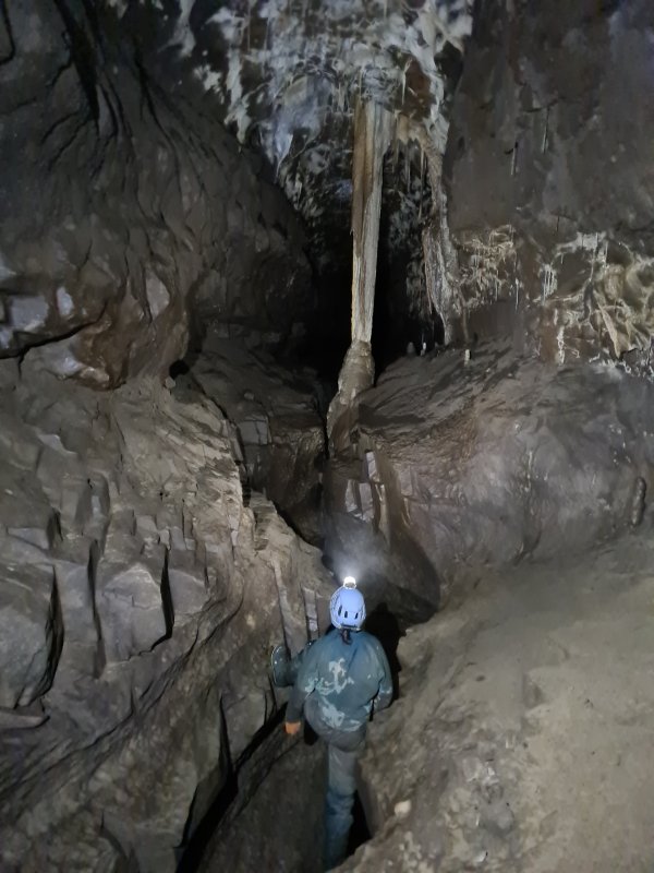 Magnificent column hidden in the top of the keyhole above the river, just before Nick Point. This is very easy to miss, as it sits above the trench where most cavers travel, and requires a clamber up jammed boulders (or a traverse on ledges).
Modelling by Gwenllian, lighting by Tarquin and Gwenllian
Magnificent column hidden in the top of the keyhole above the river, just before Nick Point. This is very easy to miss, as it sits above the trench where most cavers travel, and requires a clamber up jammed boulders (or a traverse on ledges).
Modelling by Gwenllian, lighting by Tarquin and Gwenllian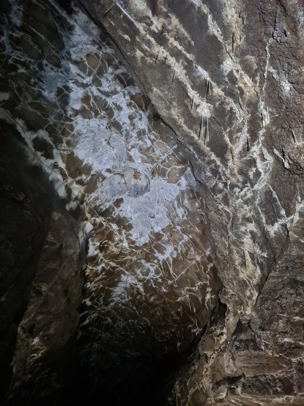 Elaborate, white-washed ceiling. There are a great many straws up there too, but too far away to be clearly seen.
Lighting by Tarquin and Gwenllian
Elaborate, white-washed ceiling. There are a great many straws up there too, but too far away to be clearly seen.
Lighting by Tarquin and Gwenllian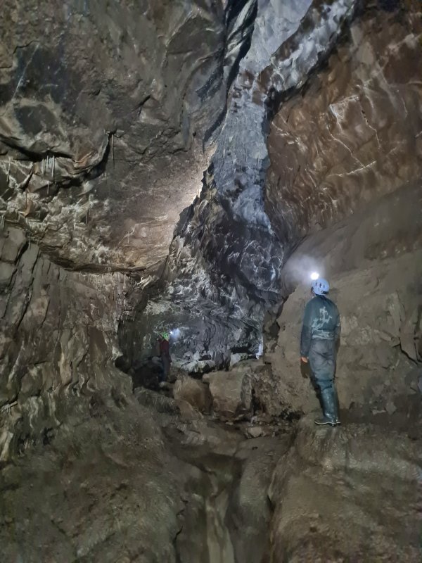 Upstream of Nick Point, the passage grows to very grand proportions.
Modelling by Gwenllian and Jack, lighting by Tarquin, Gwenllian and Jack
Upstream of Nick Point, the passage grows to very grand proportions.
Modelling by Gwenllian and Jack, lighting by Tarquin, Gwenllian and Jack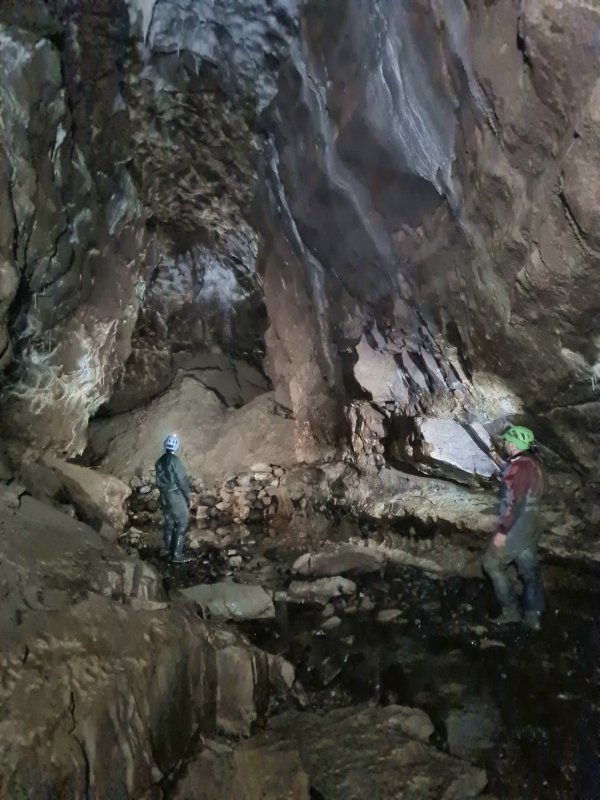 Grand passage near Inlet 8 (this is how almost all side passages are named in this cave).
Modelling by Gwenllian and Jack, lighting by Tarquin, Gwenllian and Jack
Grand passage near Inlet 8 (this is how almost all side passages are named in this cave).
Modelling by Gwenllian and Jack, lighting by Tarquin, Gwenllian and Jack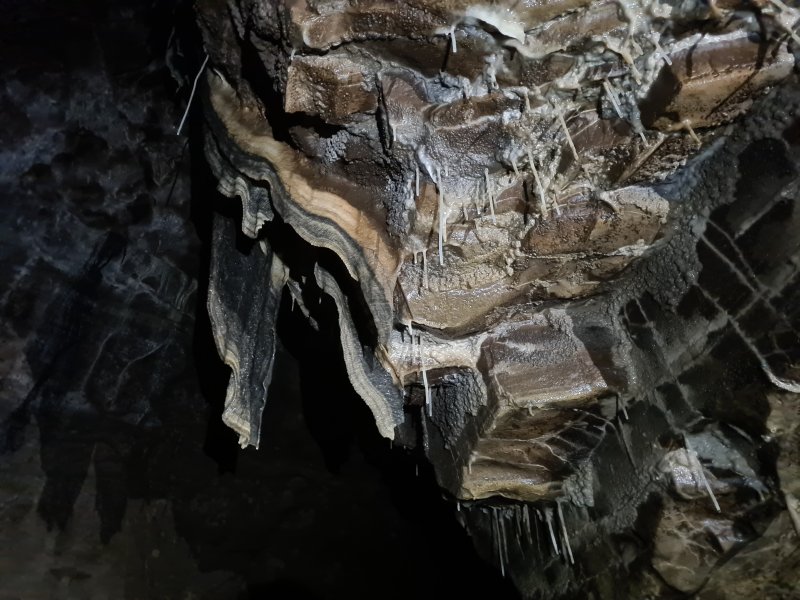 Black stained curtains at Inlet 7.
Lighting by Tarquin, Gwenllian and Jack
Black stained curtains at Inlet 7.
Lighting by Tarquin, Gwenllian and Jack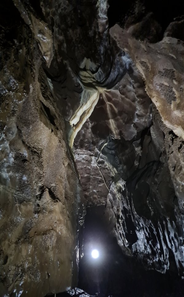 Curtains high in the ceiling.
Modelling by Gwenllian, lighting by Tarquin and Gwenllian
Curtains high in the ceiling.
Modelling by Gwenllian, lighting by Tarquin and Gwenllian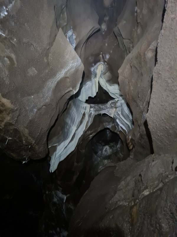 Curtains from a roof tube.
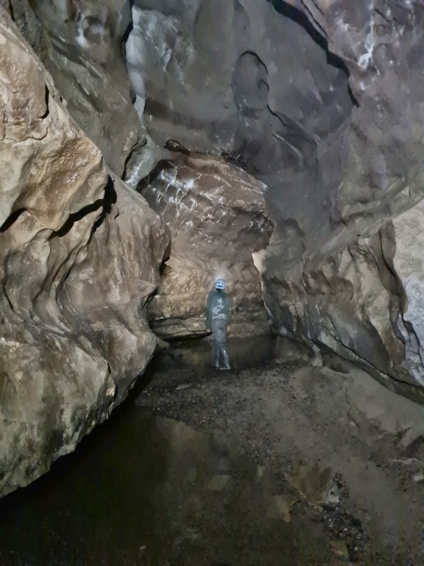 The start of the deeper pools. It is possible to keep wellies dry in the first one, but after that, it is impossible.
Modelling by Gwenllian, lighting by Tarquin and Gwenllian
The start of the deeper pools. It is possible to keep wellies dry in the first one, but after that, it is impossible.
Modelling by Gwenllian, lighting by Tarquin and Gwenllian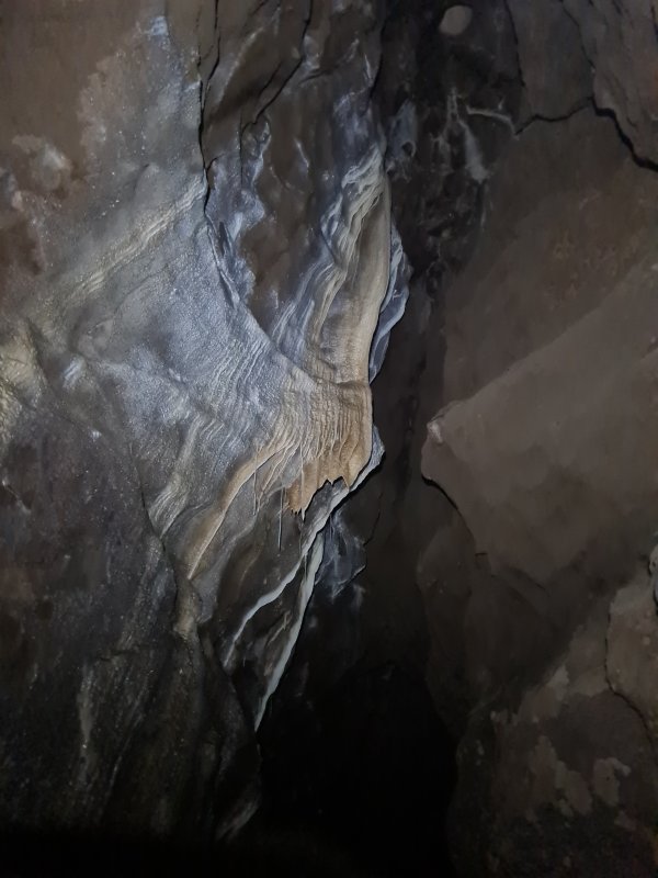 Flowstone and curtains.
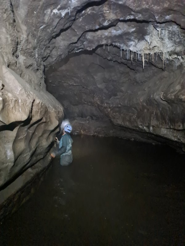 Deeper pool, where dry feet is no longer an option. Depending on leg length, this can turn a baritone into an alto.
Modelling by Gwenllian, lighting by Tarquin and Gwenllian
Deeper pool, where dry feet is no longer an option. Depending on leg length, this can turn a baritone into an alto.
Modelling by Gwenllian, lighting by Tarquin and Gwenllian Beautifully shaped passage.
Modelling by Gwenllian, lighting by Tarquin, Gwenllian and Jack
Beautifully shaped passage.
Modelling by Gwenllian, lighting by Tarquin, Gwenllian and Jack Manganese stained flowstone
Lighting by Tarquin, Jack and Gwenllian
Manganese stained flowstone
Lighting by Tarquin, Jack and Gwenllian Curtain adorned passage.
Modelling by Gwenllian and Jack, lighting by Tarquin, Gwenllian and Jack
Curtain adorned passage.
Modelling by Gwenllian and Jack, lighting by Tarquin, Gwenllian and Jack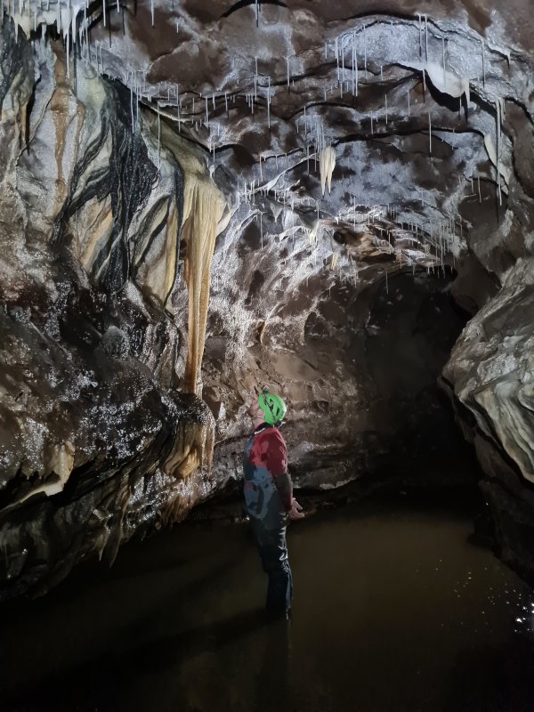 Cream and manganese curtains and column.
Modelling by Jack, lighting by Tarquin and Gwenllian
Cream and manganese curtains and column.
Modelling by Jack, lighting by Tarquin and Gwenllian Straws over a pool. Apparently horrifying.
Modelling by Jack, lighting by Tarquin and Gwenllian
Straws over a pool. Apparently horrifying.
Modelling by Jack, lighting by Tarquin and Gwenllian Flowstone and stalactites. And a completely normal pose.
Modelling by Jack and Gwenllian, lighting by Tarquin, Jack and Gwenllian
Flowstone and stalactites. And a completely normal pose.
Modelling by Jack and Gwenllian, lighting by Tarquin, Jack and Gwenllian Taste it. Just the tip. No formations were harmed (or stimulated) in the making of this image.
The award for best actor in an adult image goes to Jack, the award for best supporting actress goes to Gwenllian, lighting by Tarquin, Jack and Gwenllian
Taste it. Just the tip. No formations were harmed (or stimulated) in the making of this image.
The award for best actor in an adult image goes to Jack, the award for best supporting actress goes to Gwenllian, lighting by Tarquin, Jack and Gwenllian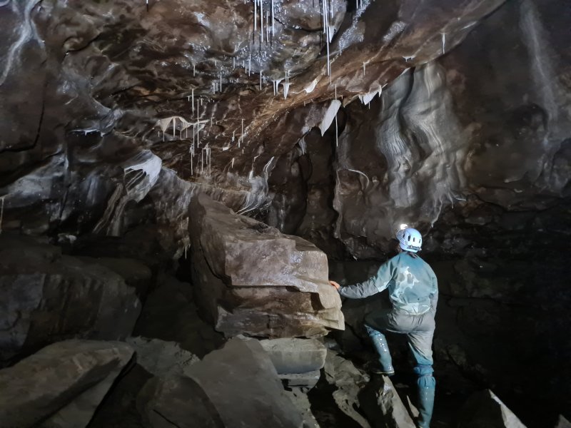 Junction with Curry Inlet. Incidentally, this should be Inlet 6, but there is also Inlet Sixpointfiveandthreequarters just downstream, which confuses everything, so this just gets called Curry Inlet.
Modelling by Gwenllian, lighting by Tarquin, Jack and Gwenllian
Junction with Curry Inlet. Incidentally, this should be Inlet 6, but there is also Inlet Sixpointfiveandthreequarters just downstream, which confuses everything, so this just gets called Curry Inlet.
Modelling by Gwenllian, lighting by Tarquin, Jack and Gwenllian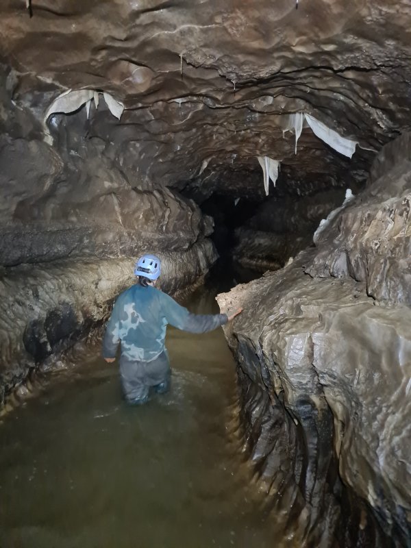 Continuing up the Notts II streamway beyond Curry Inlet, the water gets deeper.
Modelling by Gwenllian, lighting by Tarquin, Jack and Gwenllian
Continuing up the Notts II streamway beyond Curry Inlet, the water gets deeper.
Modelling by Gwenllian, lighting by Tarquin, Jack and Gwenllian Bat ears in curtain form.
Lighting by Tarquin, Gwenllian and Jack
Bat ears in curtain form.
Lighting by Tarquin, Gwenllian and Jack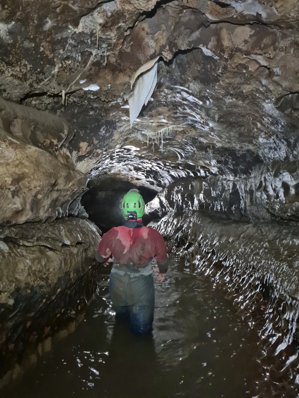 Wading upstream.
Modelling by Jack, lighting by Tarquin, Jack and Gwenllian
Wading upstream.
Modelling by Jack, lighting by Tarquin, Jack and Gwenllian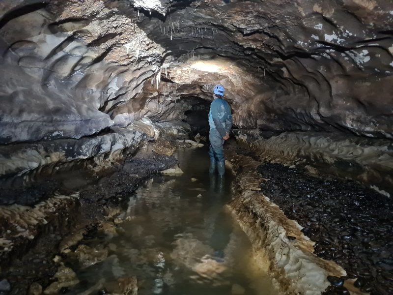 It is not all deep. This section has a washed out pebble floor.
Modelling by Gwenllian, lighting by Tarquin and Gwenllian
It is not all deep. This section has a washed out pebble floor.
Modelling by Gwenllian, lighting by Tarquin and Gwenllian Wading below the straws.
Modelling by Gwenllian, lighting by Tarquin and Gwenllian
Wading below the straws.
Modelling by Gwenllian, lighting by Tarquin and Gwenllian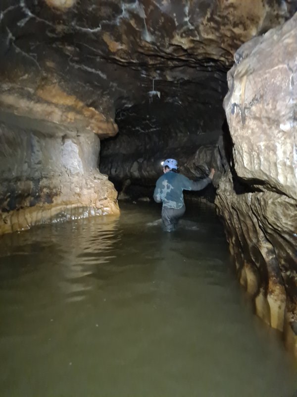 The deepest pool so far, which turned out to be waist deep at its deepest point.
Modelling by Gwenllian, lighting by Tarquin and Gwenllian
The deepest pool so far, which turned out to be waist deep at its deepest point.
Modelling by Gwenllian, lighting by Tarquin and Gwenllian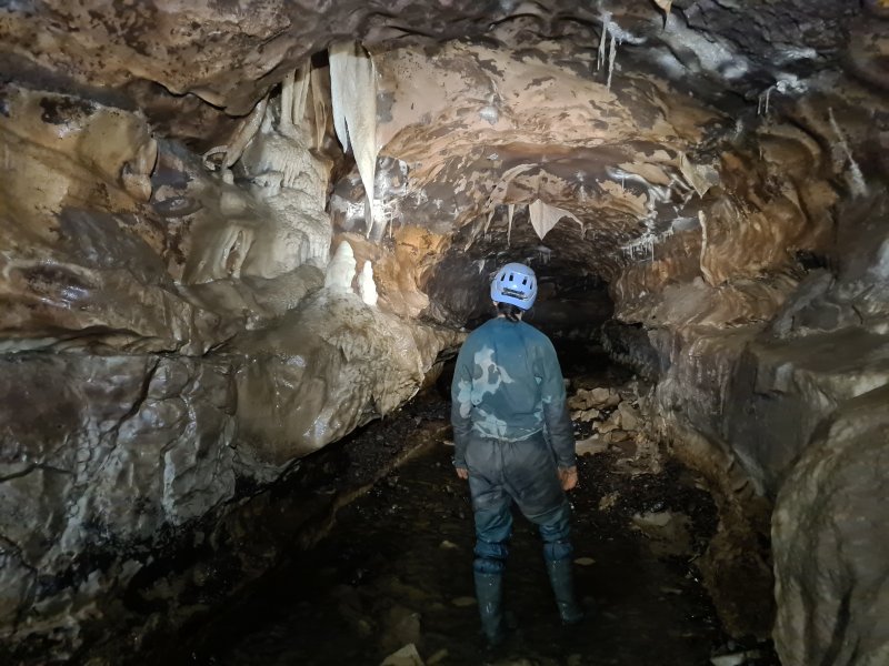 Formations beyond the pool.
Modelling by Gwenllian, lighting by Tarquin and Gwenllian
Formations beyond the pool.
Modelling by Gwenllian, lighting by Tarquin and Gwenllian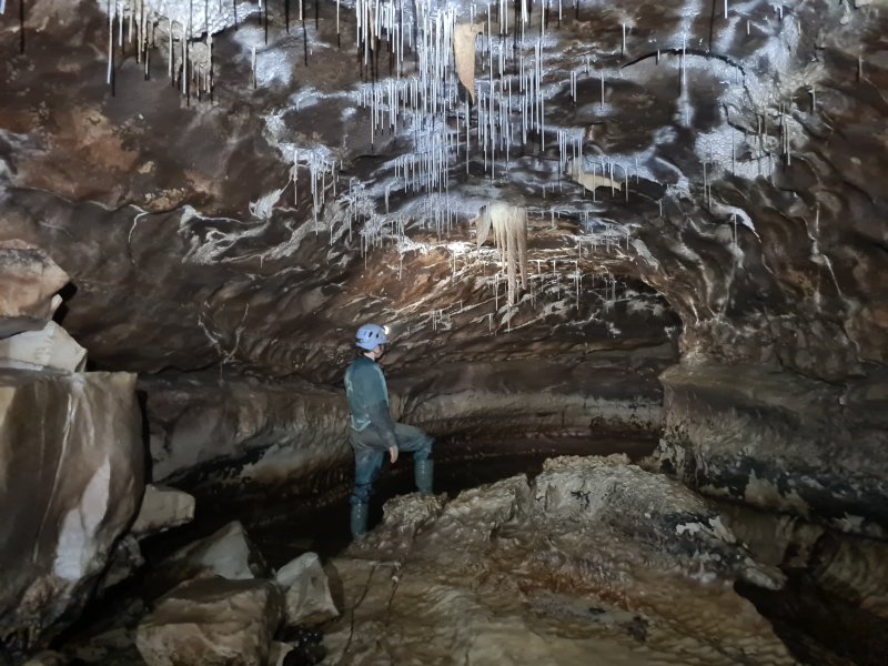 Straws on a rocky patch. This is near Inlet 5, which is a long loop, back to Inlet Sixpointfiveandthreequarters.
Modelling by Gwenllian, lighting by Tarquin, Jack and Gwenllian
Straws on a rocky patch. This is near Inlet 5, which is a long loop, back to Inlet Sixpointfiveandthreequarters.
Modelling by Gwenllian, lighting by Tarquin, Jack and Gwenllian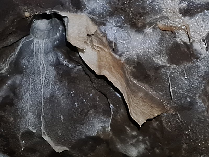 Last curtains before the deep part.
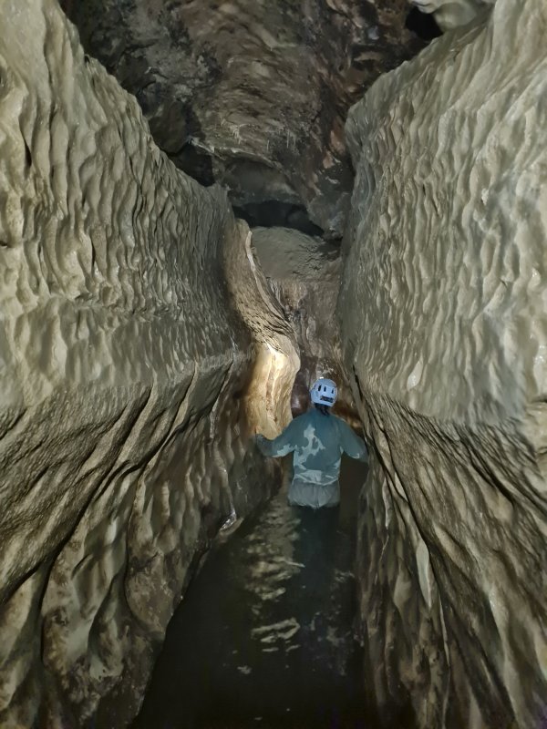 The water then gets much deeper, soon forcing a swim for about 30 metres. After that is the upstream sump, so it is not really worth the soaking.
Modelling by Gwenllian (bravo!), lighting by Tarquin and Gwenllian
The water then gets much deeper, soon forcing a swim for about 30 metres. After that is the upstream sump, so it is not really worth the soaking.
Modelling by Gwenllian (bravo!), lighting by Tarquin and Gwenllian Traversing on the ledges bypasses the first part of the swim, but it looked too hard to traverse the rest of the way. The water is very deep, and falling in from here would not be good.
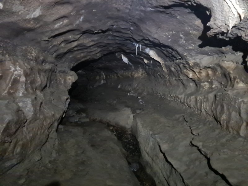 Accessed via the ledges, however, is a muddy oxbow, reaching a part called Passchendaele (spelled Paaschendaele on the survey), which loops ahead to 14-18 Series, a passage collecting back to the streamway, upstream of the swim. However, with a name like Passchendaele, it is unlikely to be a good alternative.
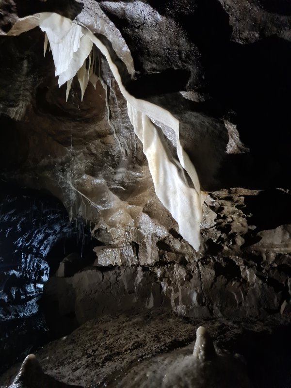 Formations at the start of Curry Inlet.
Lighting by Tarquin, Gwenllian and Jack
Formations at the start of Curry Inlet.
Lighting by Tarquin, Gwenllian and Jack Curtains.
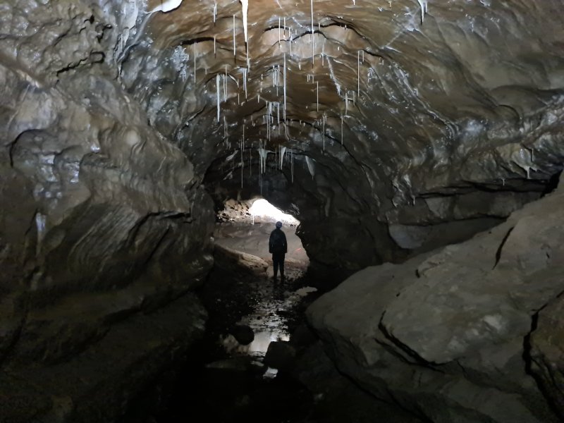 An early part of Curry Inlet. Cold was definitely becoming a problem, so the photography of this passage was a little rushed, but hopefully good enough.
Modelling by Gwenllian, lighting by Tarquin and Gwenllian
An early part of Curry Inlet. Cold was definitely becoming a problem, so the photography of this passage was a little rushed, but hopefully good enough.
Modelling by Gwenllian, lighting by Tarquin and Gwenllian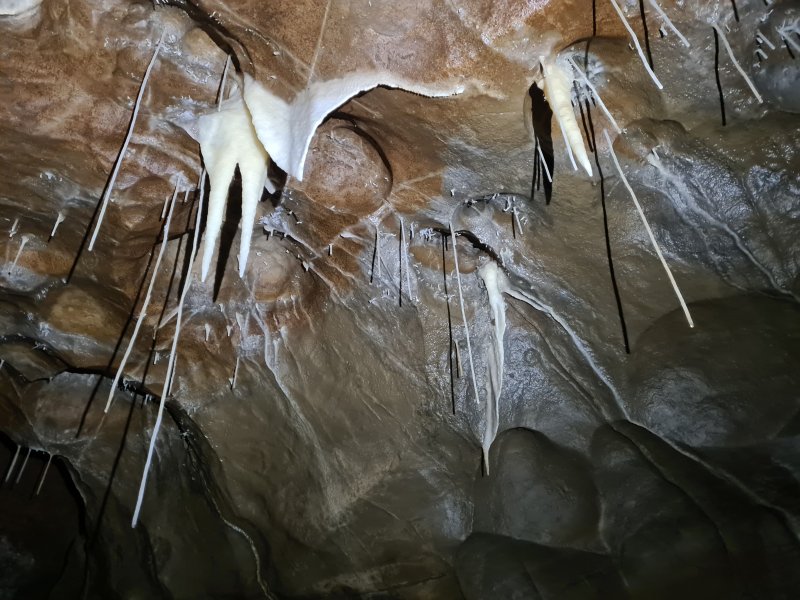 Straws, stalactites, and immature helictites.
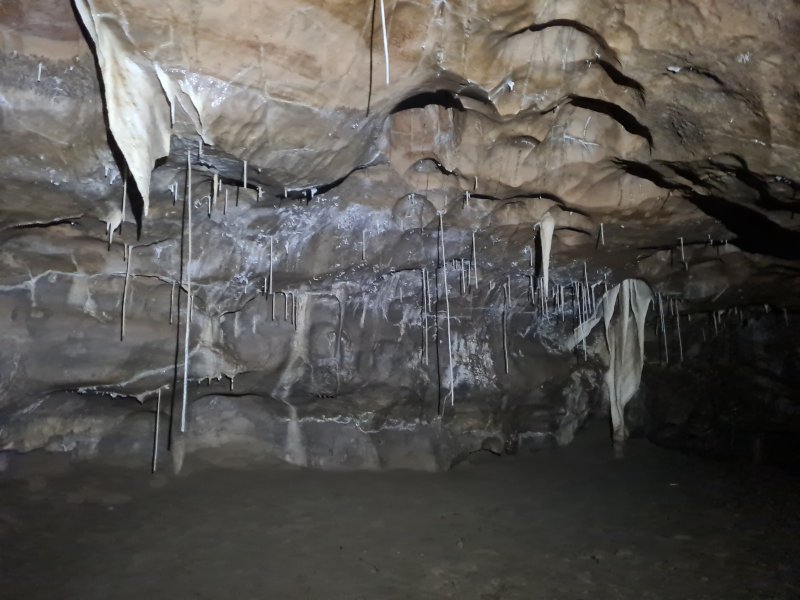 Straws and curtains.
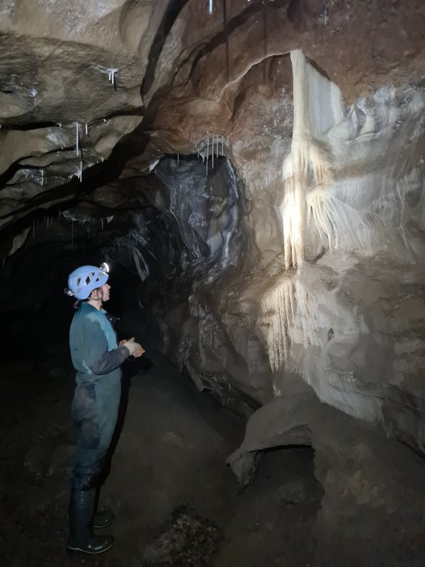 Flowstone in Curry Inlet.
Modelling by Gwenllian, lighting by Tarquin and Gwenllian
Flowstone in Curry Inlet.
Modelling by Gwenllian, lighting by Tarquin and Gwenllian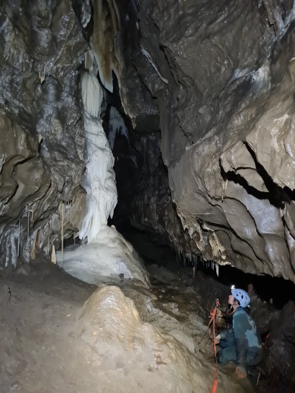 Curtain and flowstone formation.
Modelling by Gwenllian, lighting by Tarquin and Gwenllian
Curtain and flowstone formation.
Modelling by Gwenllian, lighting by Tarquin and Gwenllian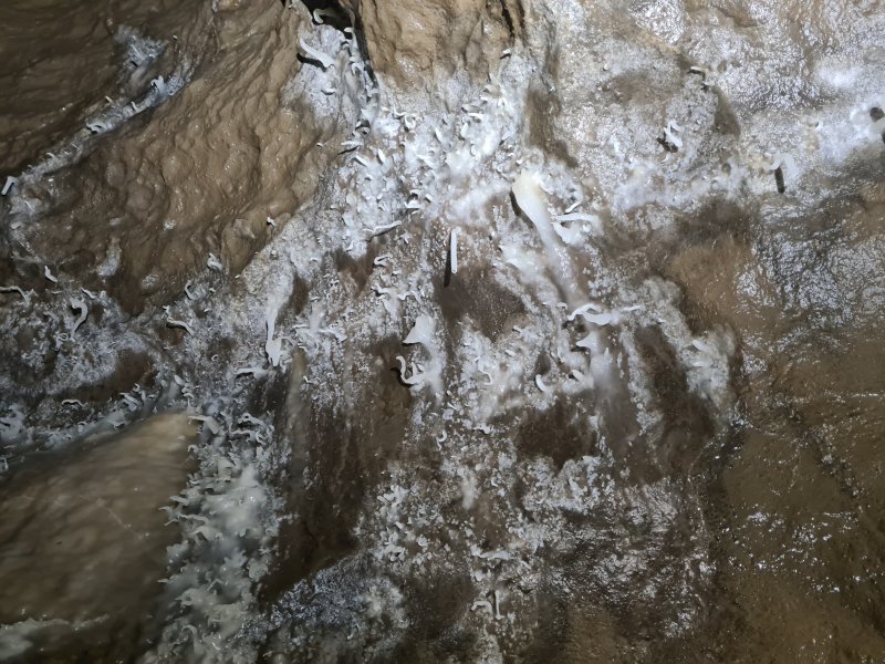 Helictites.
 Column and curtain.
Modelling by Gwenllian, lighting by Tarquin and Gwenllian
Column and curtain.
Modelling by Gwenllian, lighting by Tarquin and Gwenllian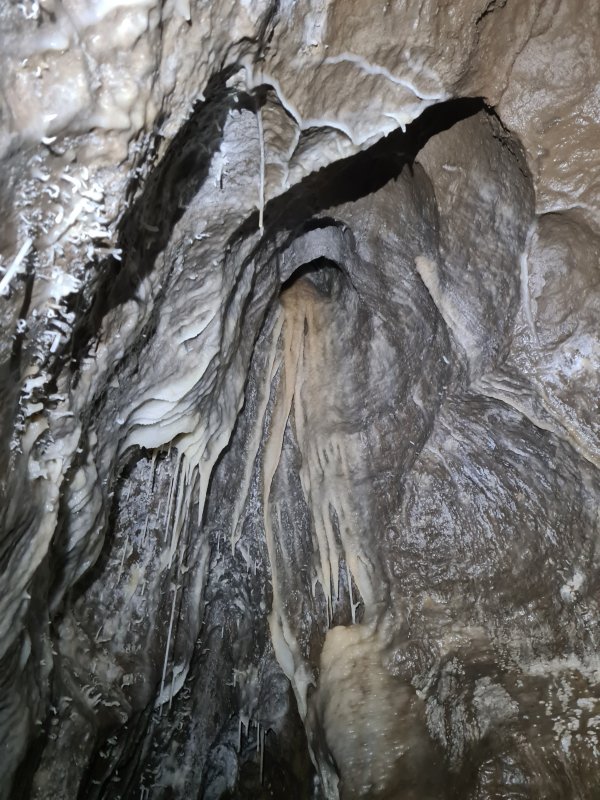 Helictites and flowstone.
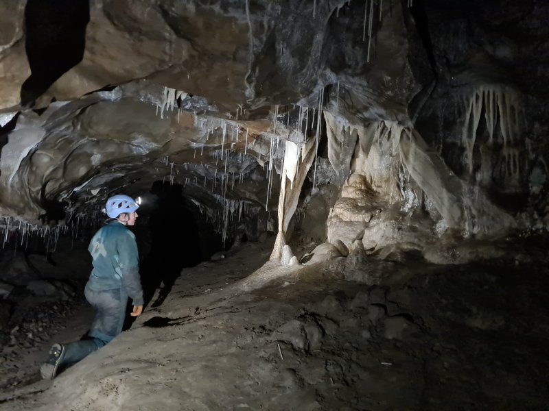 Curtain cluster.
Modelling by Gwenllian, lighting by Tarquin and Gwenllian
Curtain cluster.
Modelling by Gwenllian, lighting by Tarquin and Gwenllian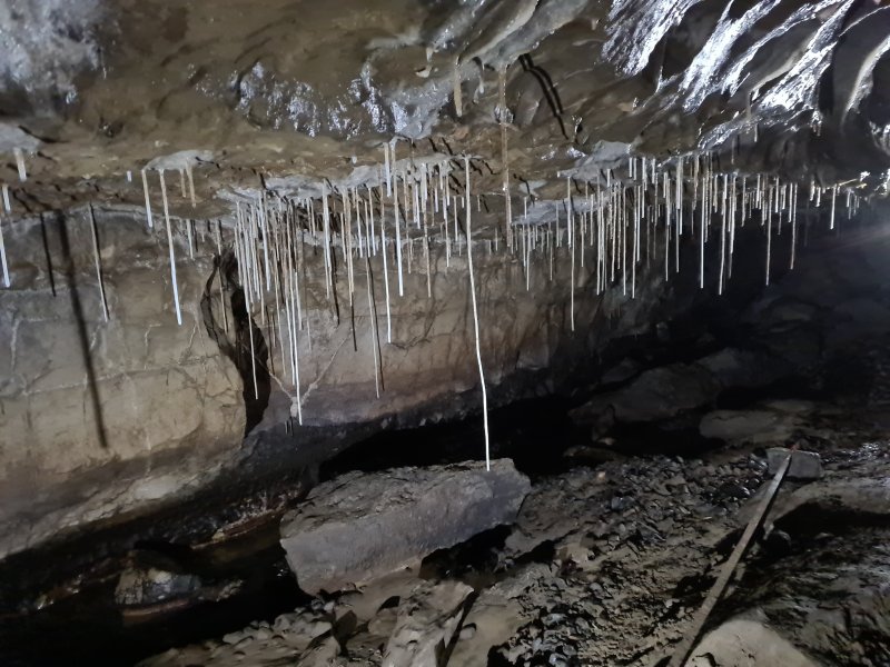 Straws
Lighting by Tarquin and Gwenllian
Straws
Lighting by Tarquin and Gwenllian One of the finest formations in Curry Inlet; it looks like the white robes of an elder.
Modelling by Gentleman Jack, lighting by Tarquin and Jack
One of the finest formations in Curry Inlet; it looks like the white robes of an elder.
Modelling by Gentleman Jack, lighting by Tarquin and Jack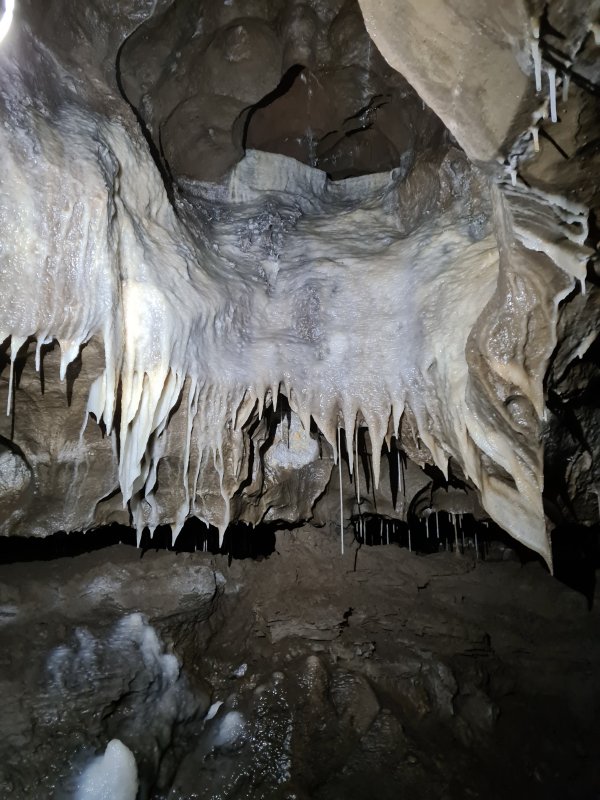 Decorated alcove.
 Later part of Curry Inlet.
Modelling by Gwenllian, lighting by Tarquin and Gwenllian
Later part of Curry Inlet.
Modelling by Gwenllian, lighting by Tarquin and Gwenllian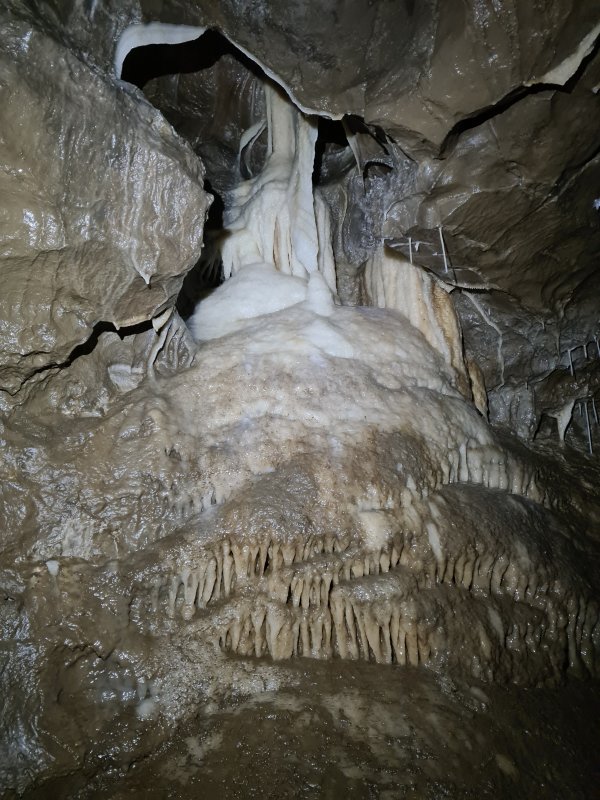 Decorated alcove.
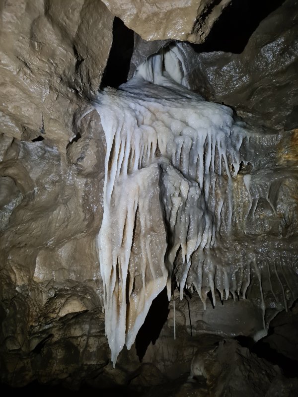 Decorated alcove.
 The final, impressive stal column in Curry Inlet. Jack, incidentally, is completely normal. So normal that The Who wrote a song all about him. La la l-l-la la la l-l-la.
Modelling by Jack, lighting by Tarquin and Jack
The final, impressive stal column in Curry Inlet. Jack, incidentally, is completely normal. So normal that The Who wrote a song all about him. La la l-l-la la la l-l-la.
Modelling by Jack, lighting by Tarquin and Jack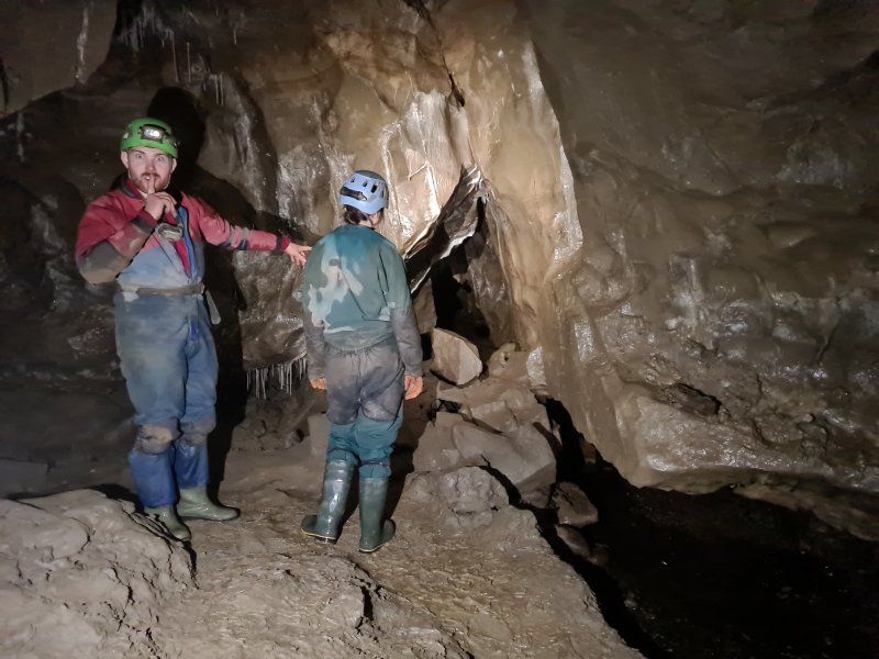 Curry Inlet continues upstream towards its upstream sump. The other side of the sump can be reached via Inlet 7, and is apparently incredibly miserable.
Modelling by Jack and Gwenllian, lighting by Tarquin and Gwenllian
Curry Inlet continues upstream towards its upstream sump. The other side of the sump can be reached via Inlet 7, and is apparently incredibly miserable.
Modelling by Jack and Gwenllian, lighting by Tarquin and Gwenllian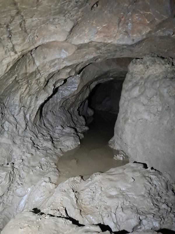 The only other way on from Curry Inlet is this incredibly muddy crawl to a dead end chamber, called the Garden Of Ganesh.
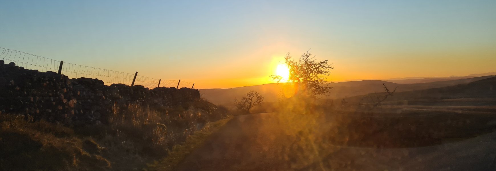 So instead, we headed out into the sunset, seen here at Ireby Fell (which is basically Leck Fell's continuation, with no obvious boundary between them).
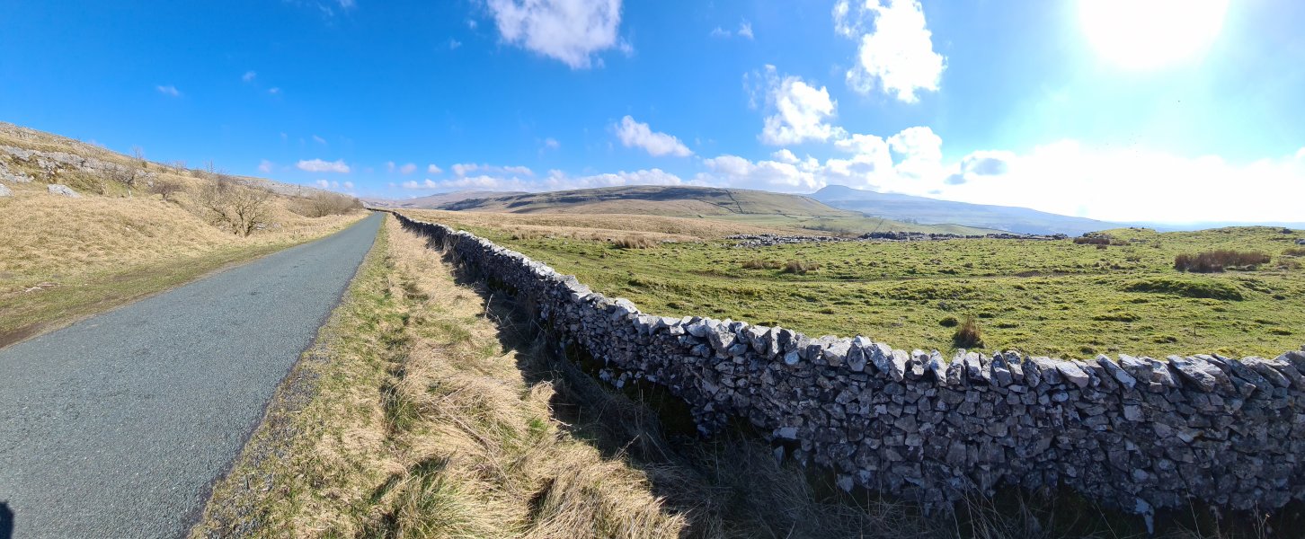 Mouth of Kingsdale. The mountains are Gragareth, High Pike (537 metres), Whernside (736 metres) and the ever impressive Ingleborough (723 metres).
Modelling by vague hints of Darth Vader
Mouth of Kingsdale. The mountains are Gragareth, High Pike (537 metres), Whernside (736 metres) and the ever impressive Ingleborough (723 metres).
Modelling by vague hints of Darth Vader Floodplains of Kingsdale, between Gragareth and Whernside.
Modelling by the rest of Darth Vader
Floodplains of Kingsdale, between Gragareth and Whernside.
Modelling by the rest of Darth Vader View from Twisleton Scar End, the end of Whernside's southern ridge. The distant mountains are the Forest Of Bowland, topping out at Ward's Stone (561 metres). On the right, the small bup on Gragareth's ridge is Tow Scar (383 metres). The ice cream van catches all the tourists who walk up from the Ingleton waterfall walk.
Modelling by Gwenllian, Jack, Tarquin Pan's detatched Shadow, and the last known impressions of Tootles the lost boy and the Wendy lady
View from Twisleton Scar End, the end of Whernside's southern ridge. The distant mountains are the Forest Of Bowland, topping out at Ward's Stone (561 metres). On the right, the small bup on Gragareth's ridge is Tow Scar (383 metres). The ice cream van catches all the tourists who walk up from the Ingleton waterfall walk.
Modelling by Gwenllian, Jack, Tarquin Pan's detatched Shadow, and the last known impressions of Tootles the lost boy and the Wendy lady Walking over Wackenburgh Hill towards Illusion Pot, which sits in the dry valley ahead. Gragareth is in front of the camera, and the near side of it is where all of the famous Kingsdale caves are, such as Swinsto Hole, Simpson's Pot, Rowten Pot, Valley Entrance and Yordas cave. To the right of Gragareth is Green Hill, but they look like the same mountain from here.
Modelling by Gwenllian, Jack and an ominous darkened patch of grass
Walking over Wackenburgh Hill towards Illusion Pot, which sits in the dry valley ahead. Gragareth is in front of the camera, and the near side of it is where all of the famous Kingsdale caves are, such as Swinsto Hole, Simpson's Pot, Rowten Pot, Valley Entrance and Yordas cave. To the right of Gragareth is Green Hill, but they look like the same mountain from here.
Modelling by Gwenllian, Jack and an ominous darkened patch of grass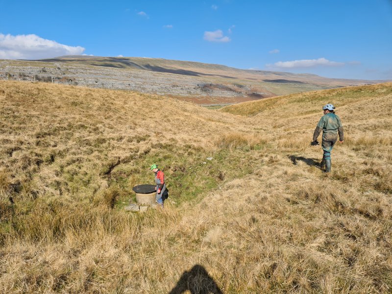 Entrance to Illusion Pot, with Gragareth and Green Hill in the background.
Modelling by Jack, Gwenllian and some thrown shade
Entrance to Illusion Pot, with Gragareth and Green Hill in the background.
Modelling by Jack, Gwenllian and some thrown shade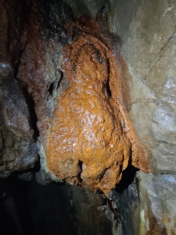 The entrance to Illusion Pot is another deep excavation with several ladders. This rusticle is part way down.
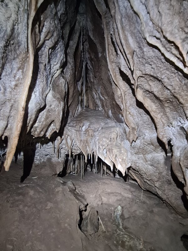 Decorated alcove at the bottom of the ladder.
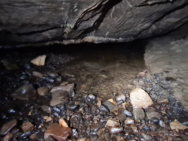 A small stream emerges from a little sump. The other side of this sump can be reached via a flat out crawl, but apart from a small chamber (which is supposed to be decorated) to the side of the crawl, there is nothing worth seeing upstream.
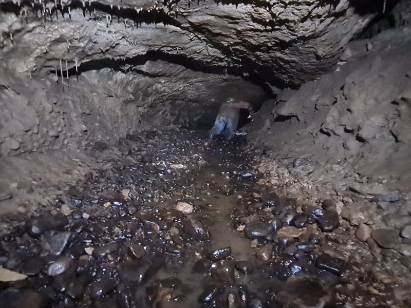 Downstream is a damp hands and knees crawl, and is the way on.
Modelling by Jack, lighting by Tarquin and Jack
Downstream is a damp hands and knees crawl, and is the way on.
Modelling by Jack, lighting by Tarquin and Jack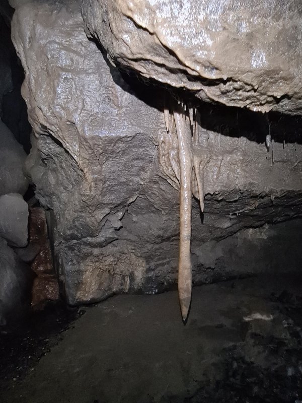 A stalactite that is disturbingly similar to a sad earthworm, slumping out of the ceiling. Seriously, cheer up, mate, it's not all that bad.
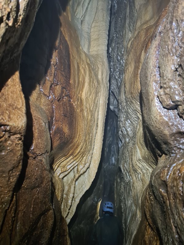 Formations in a side passage near the sad earthworm.
Modelling by Gwenllian, lighting by Tarquin and Gwenllian
Formations in a side passage near the sad earthworm.
Modelling by Gwenllian, lighting by Tarquin and Gwenllian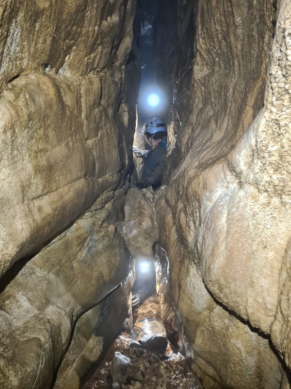 "Should I go underneath or would you prefer me on top?" - how is a man supposed to choose? Why not both?
Modelling by Gwenllian and Gwenllian, lighting by Tarquin, Gwenllian, Gwenllian and Jack
"Should I go underneath or would you prefer me on top?" - how is a man supposed to choose? Why not both?
Modelling by Gwenllian and Gwenllian, lighting by Tarquin, Gwenllian, Gwenllian and Jack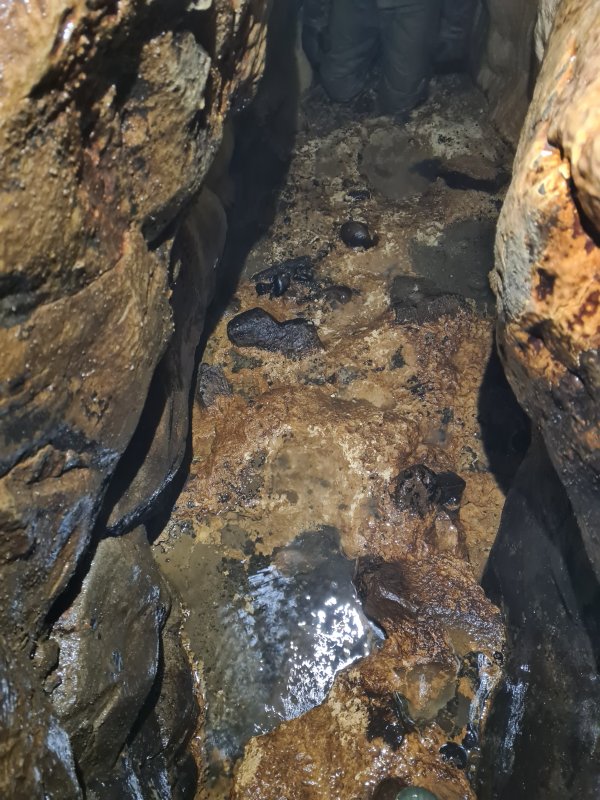 Floor of the side passage.
Modelling by Gwenllian's knees, lighting by Tarquin and Gwenllian
Floor of the side passage.
Modelling by Gwenllian's knees, lighting by Tarquin and Gwenllian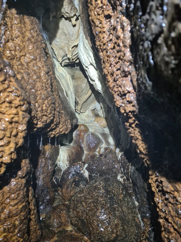 Dripping grotto at the end of the side passage.
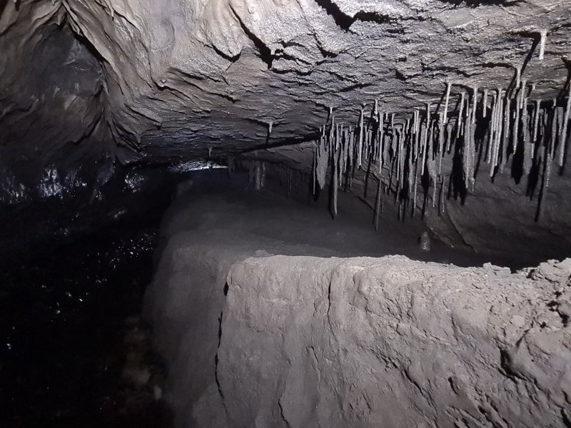 Stalactites that had very clearly been forming in muddy water, and have suffered repeated flooding.
Lighting by Tarquin and Gwenllian
Stalactites that had very clearly been forming in muddy water, and have suffered repeated flooding.
Lighting by Tarquin and Gwenllian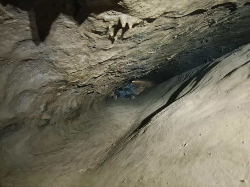 A lower section of the passage.
Modelling by Gwenllian, lighting by Tarquin and Gwenllian
A lower section of the passage.
Modelling by Gwenllian, lighting by Tarquin and Gwenllian Formations in a cross rift.
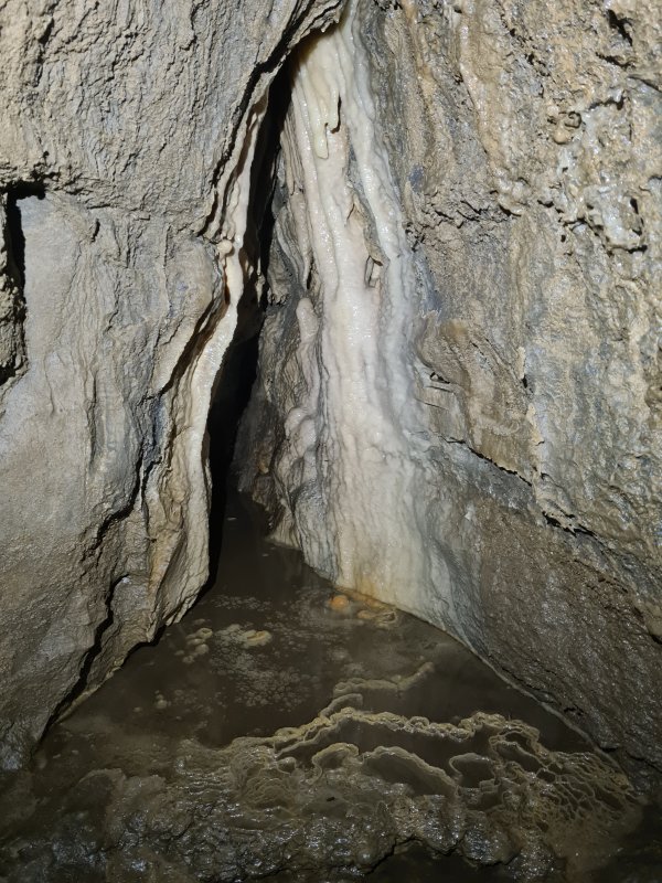 Formations in the other direction along the cross rift. The crystal pool would probably look lovely without the mud, but the evident flooding here would only put the mud back.
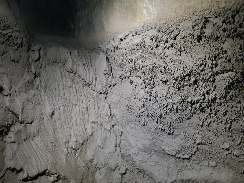 Surge mark mud formations, created by repeated flooding and draining.
Lighting by Tarquin and Gwenllian
Surge mark mud formations, created by repeated flooding and draining.
Lighting by Tarquin and Gwenllian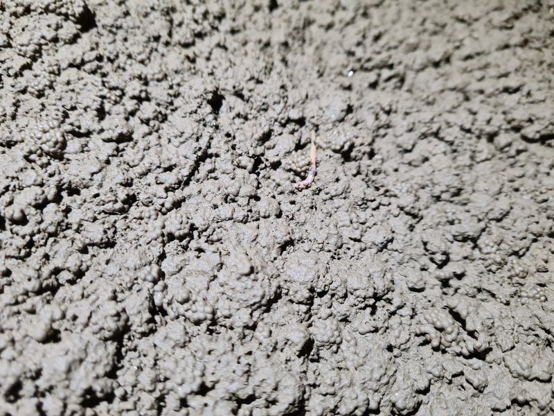 Worm in the mud.
Modelling by Wally
Worm in the mud.
Modelling by Wally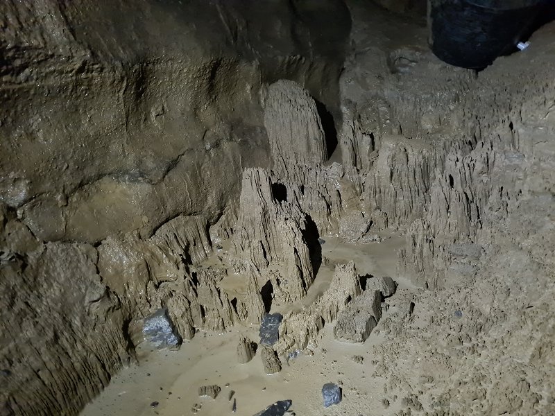 Mud hoodoos.
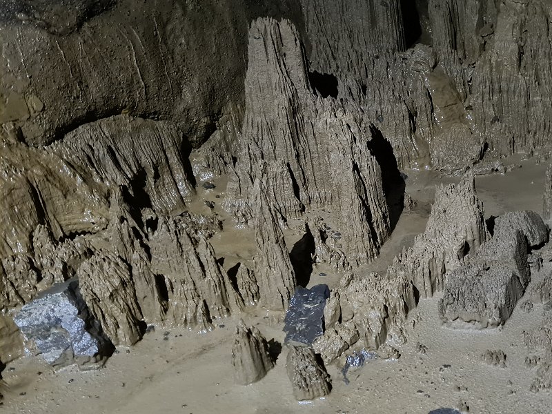 Detail of the hoodoos, looking like Helm's Deep in Lord Of The Rings.
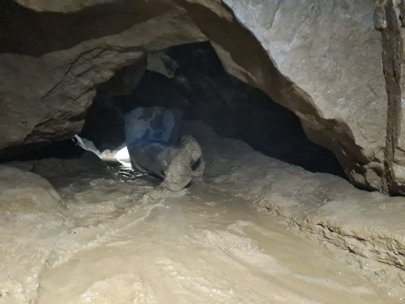 Start of the duck. This can be bailed from this side only, but the water needs to be taken all the way back to before this crawl.
Modelling by Jack, lighting by Tarquin and Jack
Start of the duck. This can be bailed from this side only, but the water needs to be taken all the way back to before this crawl.
Modelling by Jack, lighting by Tarquin and Jack The duck starts as a wet crawl, but then gets lower and lower, until the ceiling is about 15 cm above the water, at the lowest point. The lowest point is an obvious flake which needs a face wetting to pass. This passage can easily sump in wet weather, and remain sumped for a long time.
Modelling by Jack, lighting by Tarquin and Jack
The duck starts as a wet crawl, but then gets lower and lower, until the ceiling is about 15 cm above the water, at the lowest point. The lowest point is an obvious flake which needs a face wetting to pass. This passage can easily sump in wet weather, and remain sumped for a long time.
Modelling by Jack, lighting by Tarquin and Jack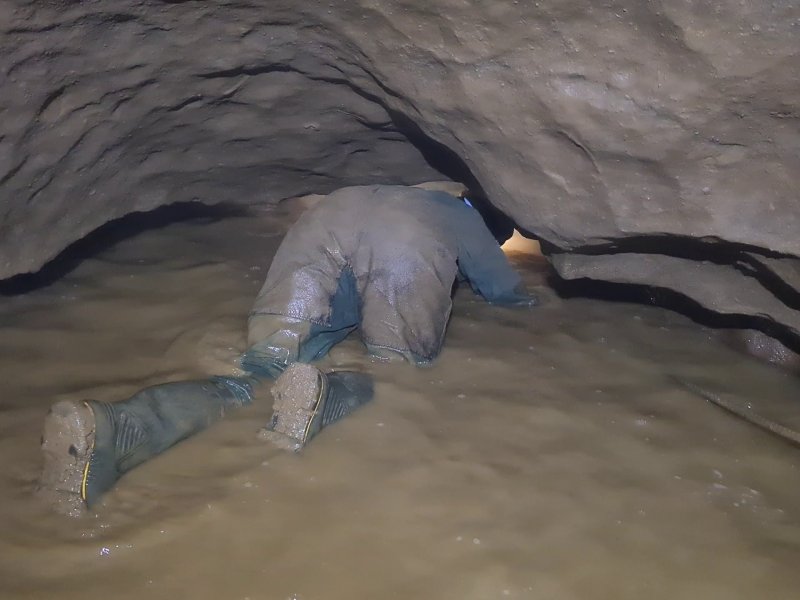 The far side of the duck. The lowest point is about 2 metres in from this, where the passage is at its narrowest.
Modelling by Gwenllian, lighting by Tarquin and Gwenllian
The far side of the duck. The lowest point is about 2 metres in from this, where the passage is at its narrowest.
Modelling by Gwenllian, lighting by Tarquin and Gwenllian The duck emerges in Sump Passage, part of Dale Barn Cave III. It was originally found from the Dale Barn side, and since access is no longer possible through Dale Barn Cave, this is now the only way into the system.
Modelling by Gwenllian, lighting by Tarquin and Gwenllian
The duck emerges in Sump Passage, part of Dale Barn Cave III. It was originally found from the Dale Barn side, and since access is no longer possible through Dale Barn Cave, this is now the only way into the system.
Modelling by Gwenllian, lighting by Tarquin and Gwenllian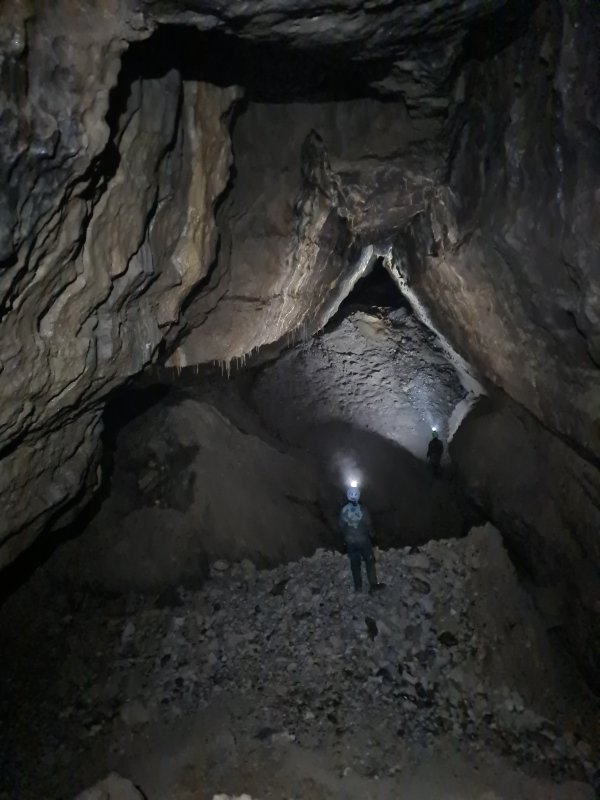 Sump Passage emerges into Expressway at the enormous Missile Silo chamber - seen here looking northwest. The aven in the ceiling is the source of the name, a 52 metre aven which ends in a blank ceiling.
Modelling by Gwenllian and Jack, lighting by Tarquin, Gwenllian and Jack
Sump Passage emerges into Expressway at the enormous Missile Silo chamber - seen here looking northwest. The aven in the ceiling is the source of the name, a 52 metre aven which ends in a blank ceiling.
Modelling by Gwenllian and Jack, lighting by Tarquin, Gwenllian and Jack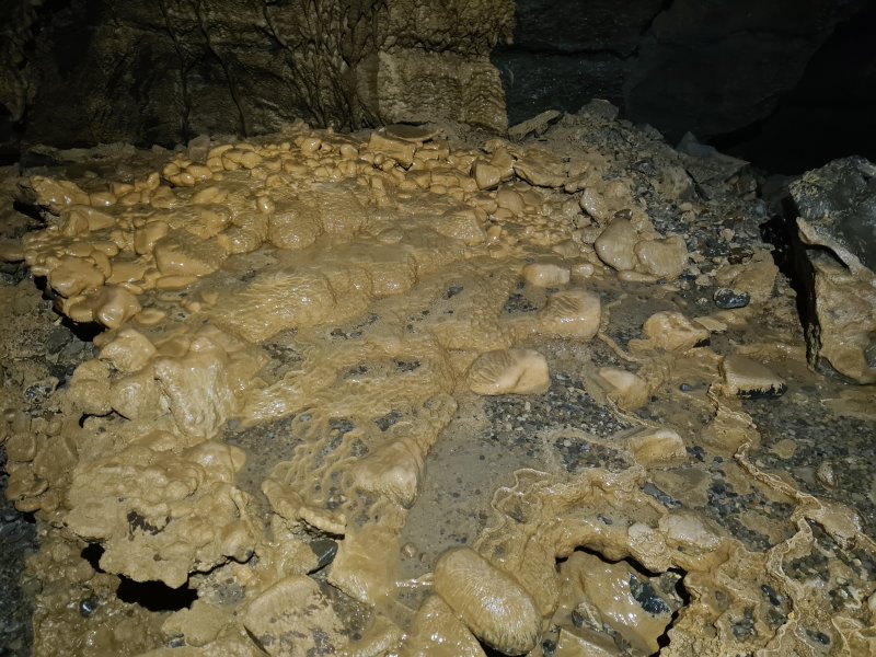 Flowstone formation on the floor of the Northwest trending end of Expressway. This heads away from Dale Barn Cave.
Lighting by Tarquin and Jack
Flowstone formation on the floor of the Northwest trending end of Expressway. This heads away from Dale Barn Cave.
Lighting by Tarquin and Jack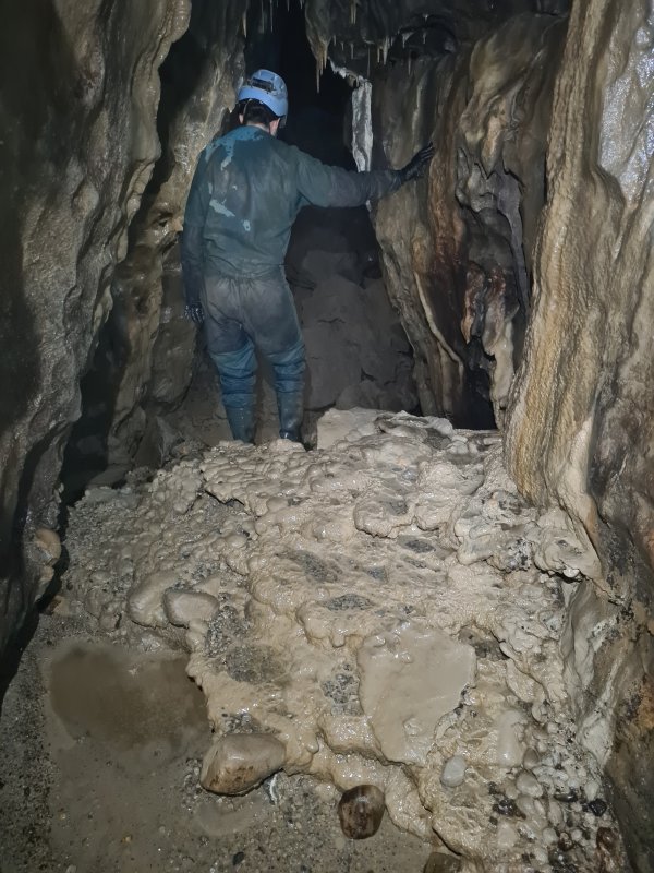 Further flowstone formations on the floor of Expressway's northwestern end.
Modelling by Gwenllian, lighting by Tarquin and Gwenllian
Further flowstone formations on the floor of Expressway's northwestern end.
Modelling by Gwenllian, lighting by Tarquin and Gwenllian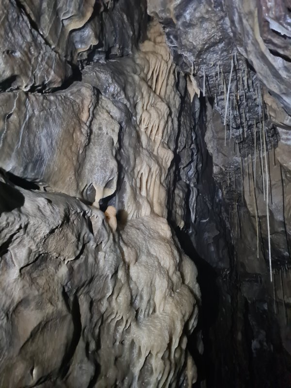 The passage ends at a grotto with no name shown on the survey.
 Tiny formations in a bedding.
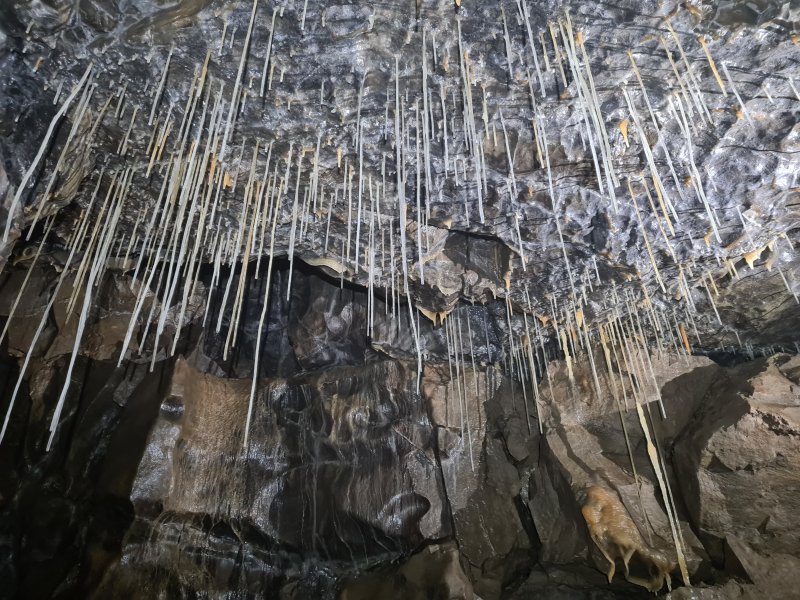 Straws in the grotto.
Lighting by Tarquin and Gwenllian
Straws in the grotto.
Lighting by Tarquin and Gwenllian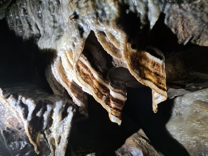 Heavily banded curtains.
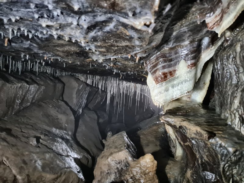 Straws and curtains.
Lighting by Tarquin and Gwenllian
Straws and curtains.
Lighting by Tarquin and Gwenllian Window into the far end of the grotto. Getting there involves an exposed climb down boulders, then another climb up calcited boulders.
Modelling by Gwenllian, lighting by Tarquin and Jack
Window into the far end of the grotto. Getting there involves an exposed climb down boulders, then another climb up calcited boulders.
Modelling by Gwenllian, lighting by Tarquin and Jack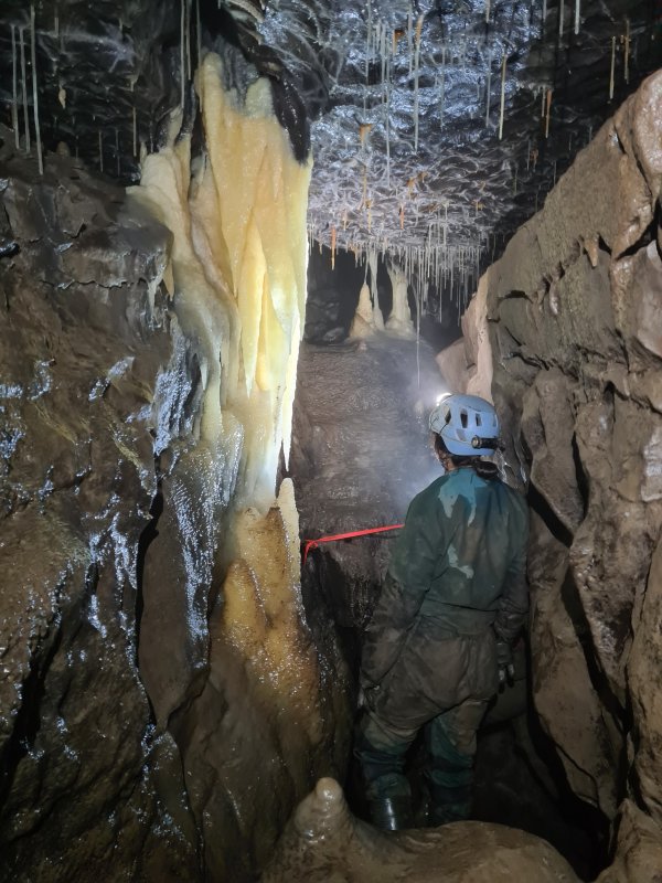 The formations in the second part of the grotto are arguably the best looking in the cave.
Modelling by Gwenllian, lighting by Tarquin, Gwenllian and Jack
The formations in the second part of the grotto are arguably the best looking in the cave.
Modelling by Gwenllian, lighting by Tarquin, Gwenllian and Jack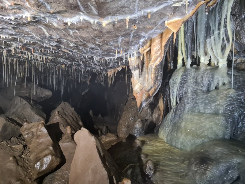 The end of the grotto, with richly banded dark chocolate orange curtains. The black is likely to be manganese, and the orange is likely to be iron oxide.
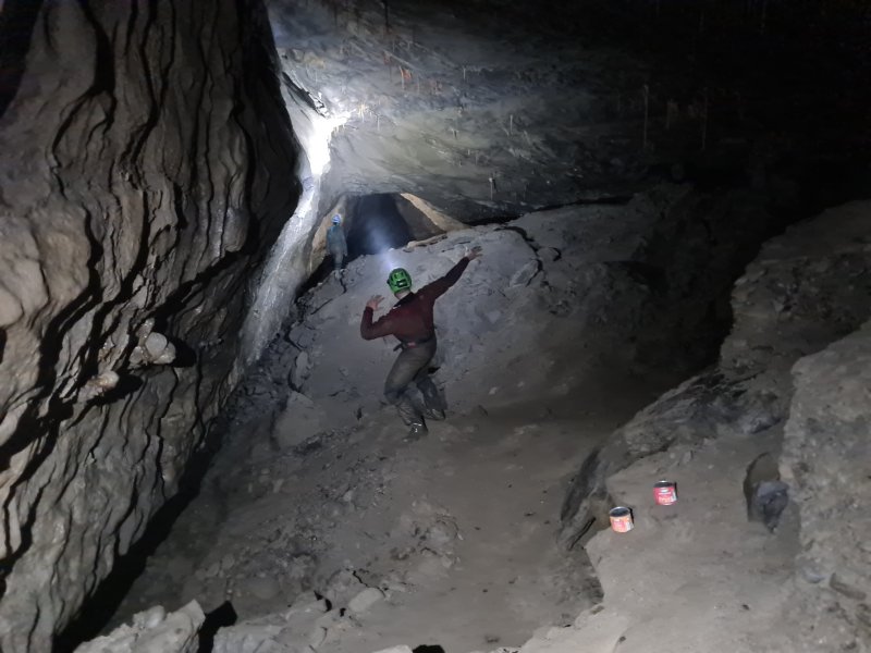 Big section of Expressway, in the southeastern direction.
Modelling by Noahoop, Beandan, Jack and Gwenllian, lighting by Tarquin, Jack and Gwenllian
Big section of Expressway, in the southeastern direction.
Modelling by Noahoop, Beandan, Jack and Gwenllian, lighting by Tarquin, Jack and Gwenllian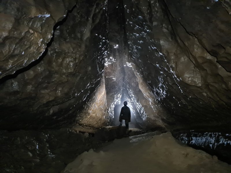 Characteristically triangular passage in Expressway.
Modelling by Gwenllian, lighting by Tarquin, Gwenllian and Jack
Characteristically triangular passage in Expressway.
Modelling by Gwenllian, lighting by Tarquin, Gwenllian and Jack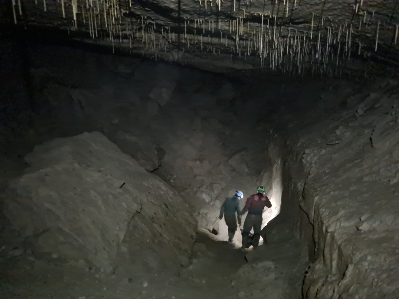 Enormous undercut below the passage wall in Expressway, looking back along the passage. Behind the camera is one end of Vandal Passage, the original way into this passage from Rushton Chamber. Somewhere here, possibly in the crater in the floor, is the way into a lengthy sump leading up along the side of Kingsdale to Braida Garth Wood.
Modelling by Jack and Gwenllian, lighting by Tarquin, Jack and Gwenllian
Enormous undercut below the passage wall in Expressway, looking back along the passage. Behind the camera is one end of Vandal Passage, the original way into this passage from Rushton Chamber. Somewhere here, possibly in the crater in the floor, is the way into a lengthy sump leading up along the side of Kingsdale to Braida Garth Wood.
Modelling by Jack and Gwenllian, lighting by Tarquin, Jack and Gwenllian Caramel coloured formations in Expressway.
Modelling by Gwenllian, lighting by Tarquin and Gwenllian
Caramel coloured formations in Expressway.
Modelling by Gwenllian, lighting by Tarquin and Gwenllian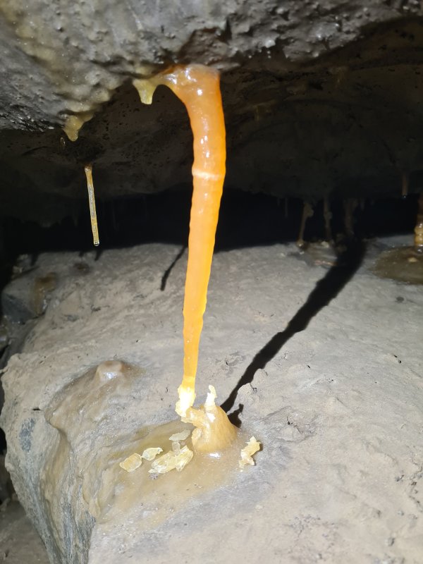 Stal column snapped by subsidence, with the two parts desperately clinging on.
 Grotto in Expressway.
Modelling by Gwenllian, lighting by Tarquin, Gwenllian and Jack
Grotto in Expressway.
Modelling by Gwenllian, lighting by Tarquin, Gwenllian and Jack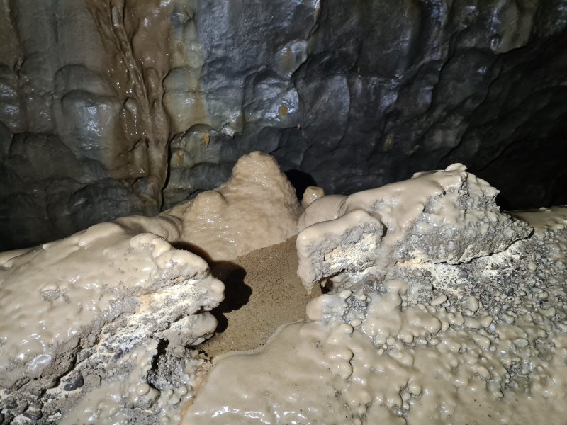 Crystal pool in Expressway.
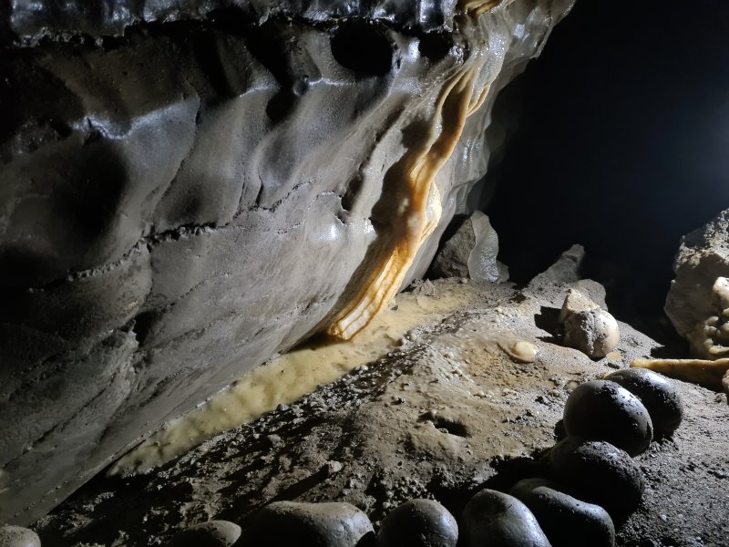 Curtain near the end of Expressway.
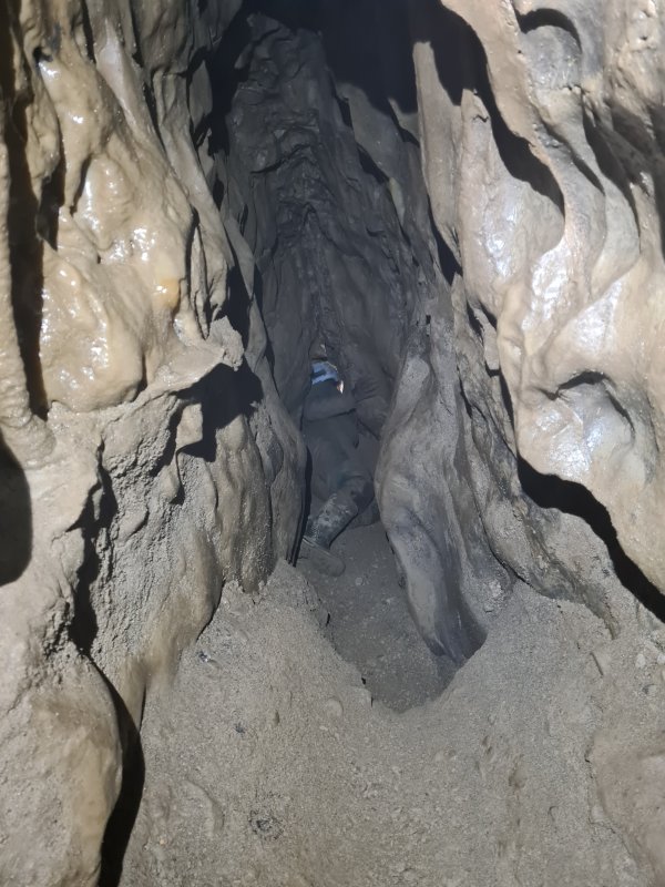 The bitter end of Expressway. Although this looks like a good place to dig, the actual continuation of the passage is probably regained via Perfidia.
Modelling by Gwenllian, lighting by Tarquin and Gwenllian
The bitter end of Expressway. Although this looks like a good place to dig, the actual continuation of the passage is probably regained via Perfidia.
Modelling by Gwenllian, lighting by Tarquin and Gwenllian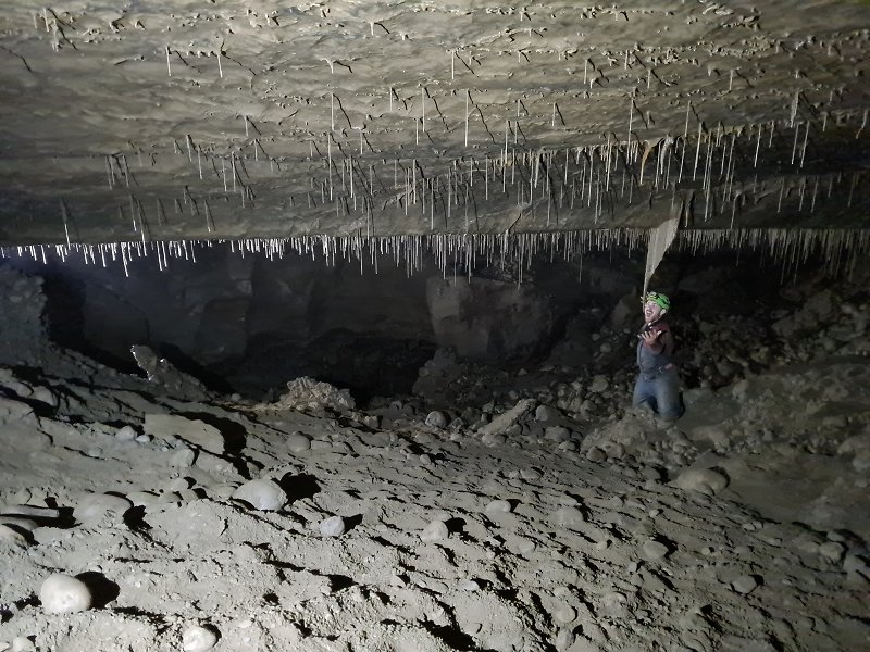 A descent under the wall of Expressway enters Rushton Chamber. This is one of the largest in the cave in terms of area, but clearly smaller than the Missile Silo in terms of volume. The way into the chamber is up behind the camera, with the sediment bank spilling in from Expressway. To the left beyond the straws is the other end of Vandal Passage, a very low crawl. To the right of the camera is Perfidia. Ahead-right is a 25 metre crawl over cobbles which ends at a dig. Ahead is Brunel Rift.
Modelling by Jack, lighting by Tarquin and Gwenllian
A descent under the wall of Expressway enters Rushton Chamber. This is one of the largest in the cave in terms of area, but clearly smaller than the Missile Silo in terms of volume. The way into the chamber is up behind the camera, with the sediment bank spilling in from Expressway. To the left beyond the straws is the other end of Vandal Passage, a very low crawl. To the right of the camera is Perfidia. Ahead-right is a 25 metre crawl over cobbles which ends at a dig. Ahead is Brunel Rift.
Modelling by Jack, lighting by Tarquin and Gwenllian Straws in Rushton Chamber.
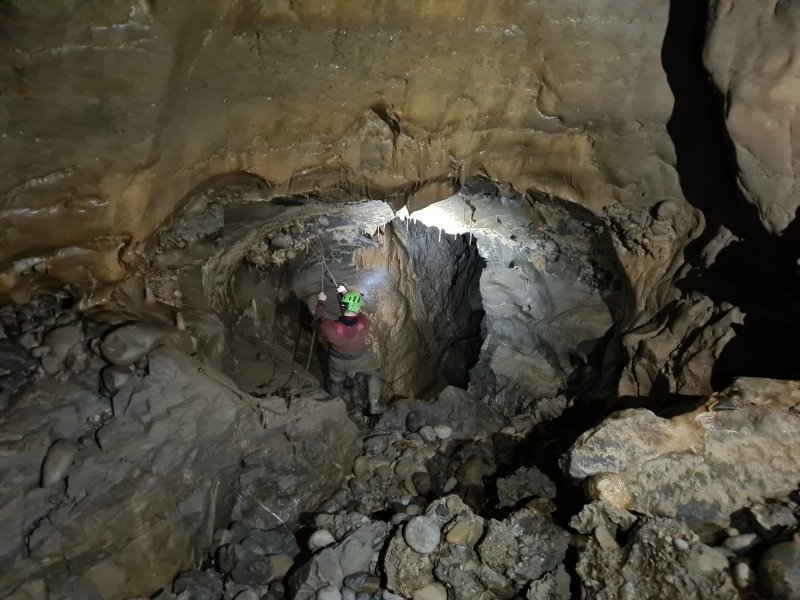 Brunel Rift, a traverse over a 15 metre deep rift that leads to Dale Barn Cave's Sump 3. This is the way downstream, where it joins the downstream water from Dale Barn Cave.
Modelling by Jack, lighting by Tarquin, Gwenllian and Jack
Brunel Rift, a traverse over a 15 metre deep rift that leads to Dale Barn Cave's Sump 3. This is the way downstream, where it joins the downstream water from Dale Barn Cave.
Modelling by Jack, lighting by Tarquin, Gwenllian and Jack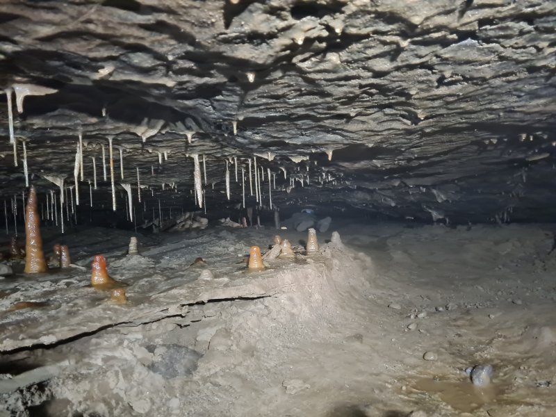 Start of Perfidia, a crawling sized bedding.
Modelling by Gwenllian, lighting by Tarquin and Gwenllian
Start of Perfidia, a crawling sized bedding.
Modelling by Gwenllian, lighting by Tarquin and Gwenllian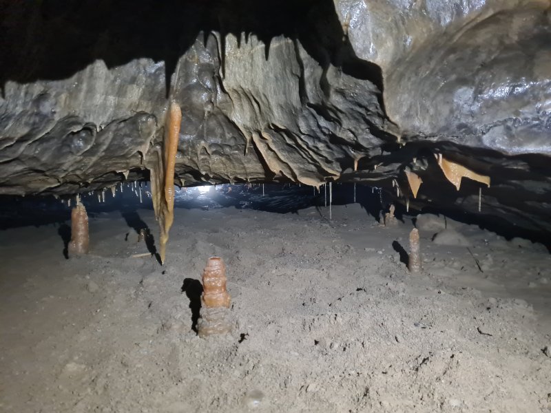 Formations in Perfidia.
Lighting by Tarquin and Jack
Formations in Perfidia.
Lighting by Tarquin and Jack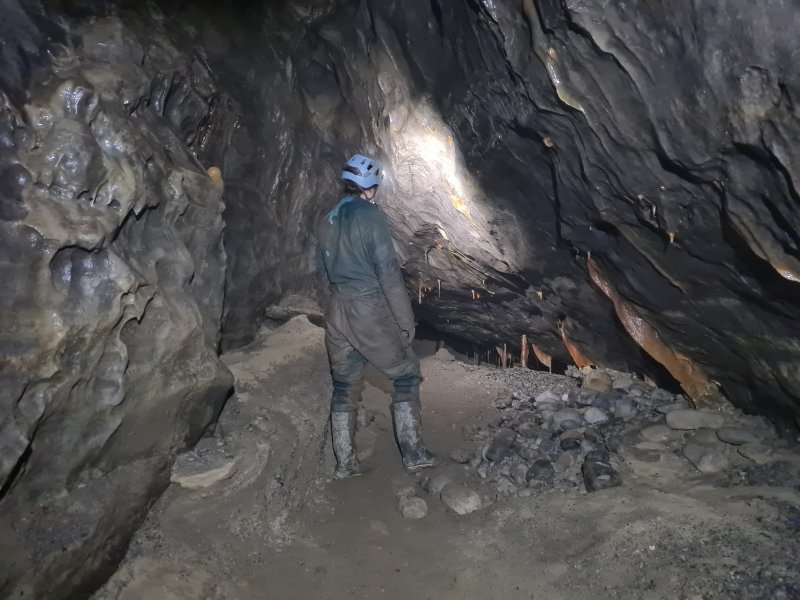 Standing room, for a moment, in Perfidia.
Modelling by Gwenllian, lighting by Tarquin and Gwenllian
Standing room, for a moment, in Perfidia.
Modelling by Gwenllian, lighting by Tarquin and Gwenllian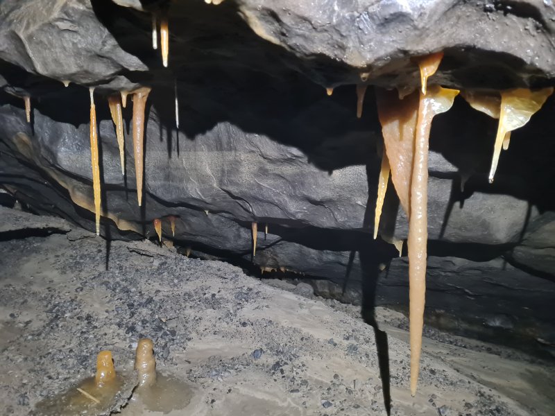 Formations in Perfidia.
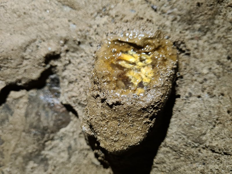 Drip formation in Perfidia.
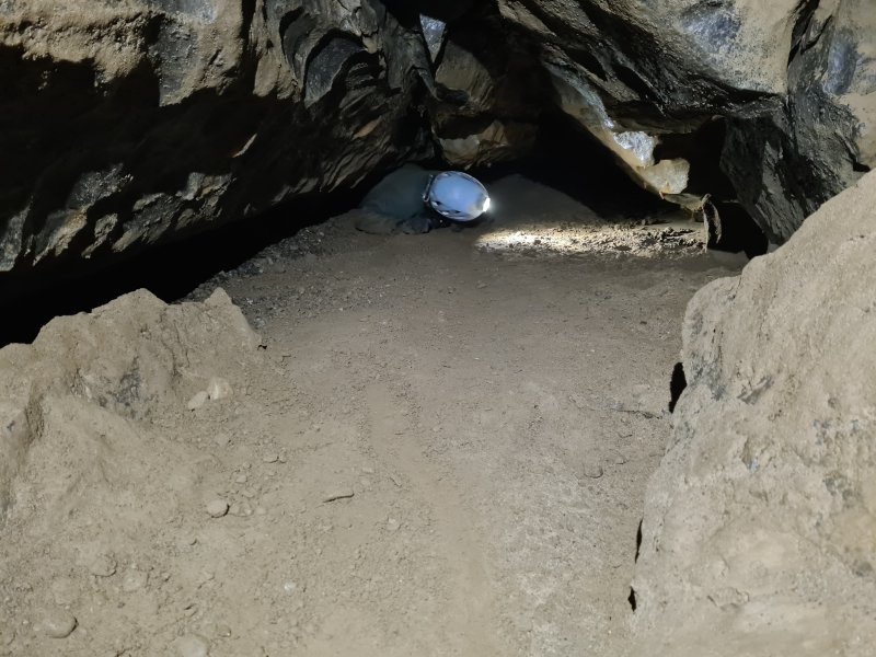 Perfidia continues as a 600 metre flat out crawl, and is almost certainly the top of the fossil main drain heading to Dale Barn Cave, with the rest of the passage filled with sediment. The first significant chamber has a red formation that we did not go far enough to see, unfortunately. Parts of Perfidia clearly sump in flood, even though this is very much a fossil level of the cave. The flooding in this system is pretty insane. Given the crazy length of the crawl (and the fact that we weren't sure if it was a side passage worth visiting), we decided to head back out.
Modelling by Gwenllian, lighting by Tarquin and Gwenllian
Perfidia continues as a 600 metre flat out crawl, and is almost certainly the top of the fossil main drain heading to Dale Barn Cave, with the rest of the passage filled with sediment. The first significant chamber has a red formation that we did not go far enough to see, unfortunately. Parts of Perfidia clearly sump in flood, even though this is very much a fossil level of the cave. The flooding in this system is pretty insane. Given the crazy length of the crawl (and the fact that we weren't sure if it was a side passage worth visiting), we decided to head back out.
Modelling by Gwenllian, lighting by Tarquin and Gwenllian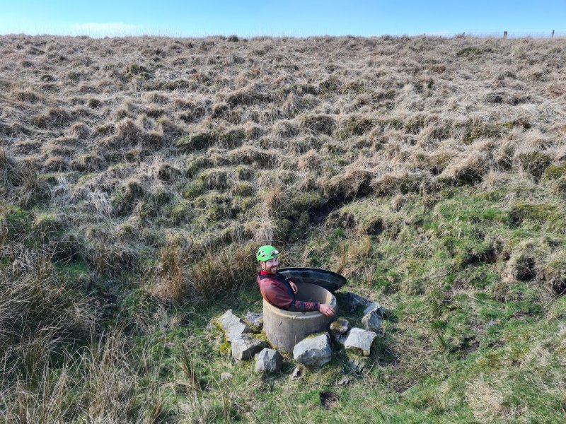 Exiting Illusion Pot.
Modelling by Jack, lighting by Sol and Jack's feeble light
Exiting Illusion Pot.
Modelling by Jack, lighting by Sol and Jack's feeble light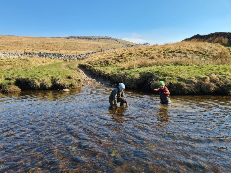 Washing off in the River Twiss.
Modelling by Gwenllian and Jack
Washing off in the River Twiss.
Modelling by Gwenllian and Jack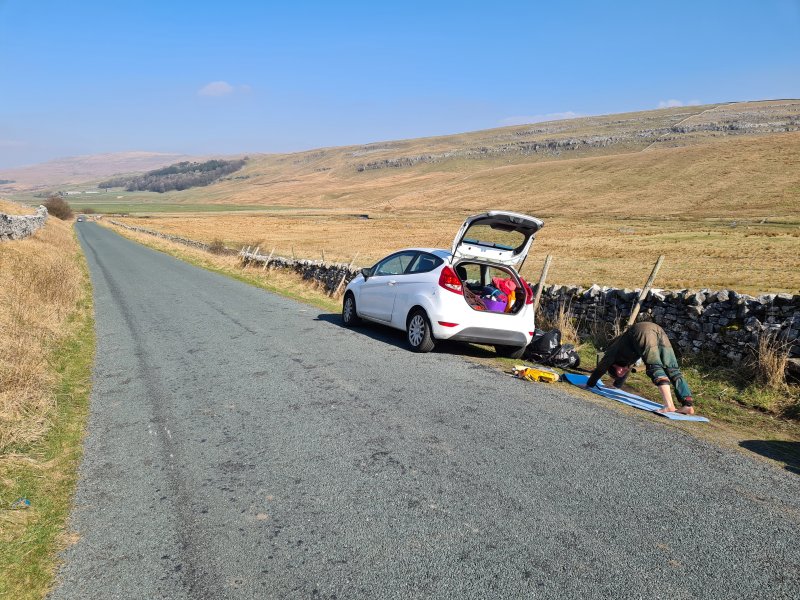 Why would you bring a yoga mat to a caving trip? How else do you unwind after a weekend's caving?
Modelling by Gwenllian
Why would you bring a yoga mat to a caving trip? How else do you unwind after a weekend's caving?
Modelling by Gwenllian