Aberdulais Falls 2009
Hydroelectrics, industrial heritage, and waterfalls.
Aberdulais Falls seems to be mentioned quite a lot on various tourist sites, especially coupled with the names of artists who painted them (like I care). Plenty of people had published pictures of them, but the pictures all seemed to be of different waterfalls. I struggled (and failed) to find a map of the area in high enough detail to see how many waterfalls there are, and how to reach them.
The site of the falls was used for copper making around 420 years ago, and 200 years ago, the buildings that are now ruins were built as a tin works. A weir was made in the river above the falls, and tapped to provide a water source for the water wheel, ejecting the remaining water below the falls. Despite all the pictures, there is only one waterfall, just downstream of the weir. It can only be viewed from one side, as the other side is a cliff. The waterfall lies diagonally across the river, and its appearence is highly dependent on the flow of water, and how much is being tapped to drive the water wheel turbine, and a modern turbine hidden in the works. At low flow, the waterfall appears much taller than it is, making two waterfalls at either side of the river. In high flow, these combine as a single, wide waterfall. We went after rain, and there was a lot of water in the river.
The tin works and hydroelectric power station are maintained by the National Trust, and an entry fee is required, even if you only want to see the waterfall. It is not possible to see the waterfall properly without paying this entry fee, unless you happen to live in one of the clifftop houses. That sucks. The entry point is on the side of the A4109, just 100 metres from the A465 roundabout, where it crosses the river Dulais (sounds like dill-ice) - the river on which the waterfall is located.
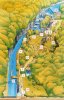 Since I couldn't find anything this useful anywhere else, this is the map of Aberdulais Falls from the free leaflet. It shows the entire little heritage site, the weir, and the waterfall below it. It also shows the large buttress of rock which annoyingly blocks the view of the waterfall.
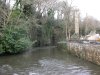 The Dulais river at the lower end of the site, flowing out of its small gorge.
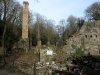 The 18 metre chimney from the old tin works.
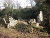 The old works.
 The water wheel. Apparently it is the second tallest water wheel in the UK, and the tallest water wheel in Europe used for electricity generation, at about 8.5 metres diameter (28 feet). It generates only 20 kW though, which is enough for just two houses. In the building to the left (the doorway gives a nice idea of scale), there is a turbine that generates 200 kW, which is sold back to the National Grid as renewable energy. There's also a pipe allowing salmon to swim upstream. Meh to that last part.
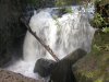 Just by the doorway in the last picture is a viewpoint into the gorge, showing the waterfall. The buttress and tree on the right are really badly positioned, blocking the view. The rock slab on the left slopes too much (and is on the wrong side of a fence) to get pictures from there. Most people do not even get this view, because they are not tall enough - this shot was taken from the top of the wall.
 A quick scramble down to the river, on the other side of a fence (doo dee doo) gives this alternative view, but although the tree is now gone, there are rocks in the way of the base instead. Anyway ... in low water, the left side of this still seems to flow, but almost everything to the right does not.
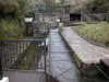 The leat above, carrying the water to the water wheel. The obvious balcony is the best viewpoint for the top of the waterfall, which is a pity, since waterfalls rarely look as good from the top as they do from the bottom.
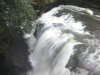 The view from the top. In low water, the water flows down as a narrow (misleadingly tall-looking) waterfall at the bottom of the picture, and a larger waterfall at the top. Seen in high water here, the water crashes into the cleft, bouncing off a ledge on the other side part way down, which makes it look a little shorter than it is.
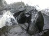 A pothole part of the waterfall, just to the bottom-right of the last picture.
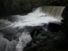 The weir just above the waterfall.
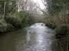 The Dulais just above the weir.
 Since I couldn't find anything this useful anywhere else, this is the map of Aberdulais Falls from the free leaflet. It shows the entire little heritage site, the weir, and the waterfall below it. It also shows the large buttress of rock which annoyingly blocks the view of the waterfall.
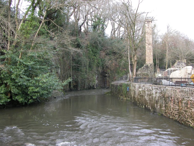 The Dulais river at the lower end of the site, flowing out of its small gorge.
 The 18 metre chimney from the old tin works.
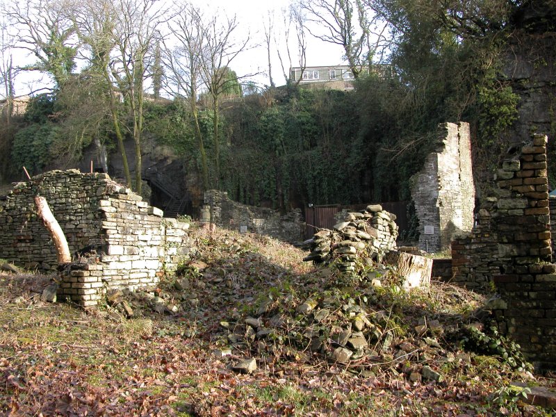 The old works.
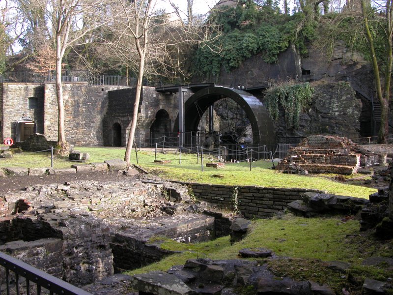 The water wheel. Apparently it is the second tallest water wheel in the UK, and the tallest water wheel in Europe used for electricity generation, at about 8.5 metres diameter (28 feet). It generates only 20 kW though, which is enough for just two houses. In the building to the left (the doorway gives a nice idea of scale), there is a turbine that generates 200 kW, which is sold back to the National Grid as renewable energy. There's also a pipe allowing salmon to swim upstream. Meh to that last part.
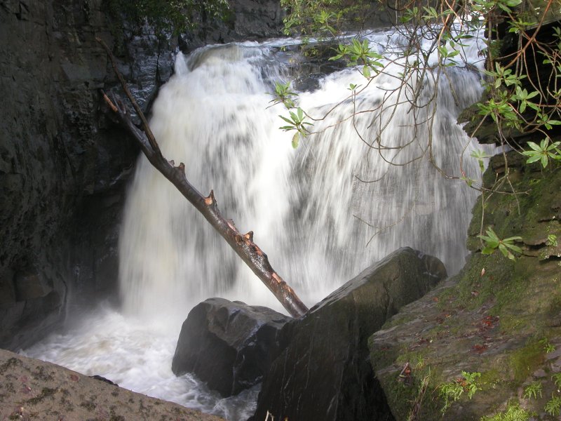 Just by the doorway in the last picture is a viewpoint into the gorge, showing the waterfall. The buttress and tree on the right are really badly positioned, blocking the view. The rock slab on the left slopes too much (and is on the wrong side of a fence) to get pictures from there. Most people do not even get this view, because they are not tall enough - this shot was taken from the top of the wall.
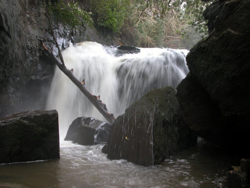 A quick scramble down to the river, on the other side of a fence (doo dee doo) gives this alternative view, but although the tree is now gone, there are rocks in the way of the base instead. Anyway ... in low water, the left side of this still seems to flow, but almost everything to the right does not.
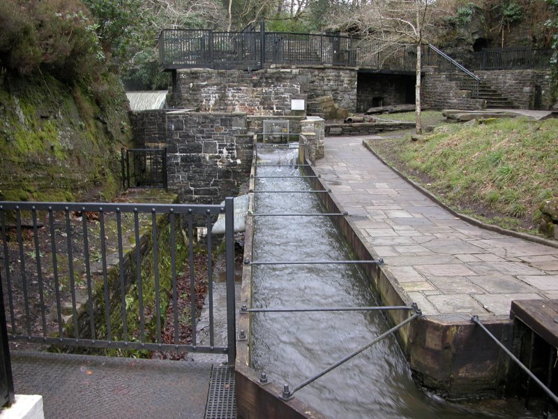 The leat above, carrying the water to the water wheel. The obvious balcony is the best viewpoint for the top of the waterfall, which is a pity, since waterfalls rarely look as good from the top as they do from the bottom.
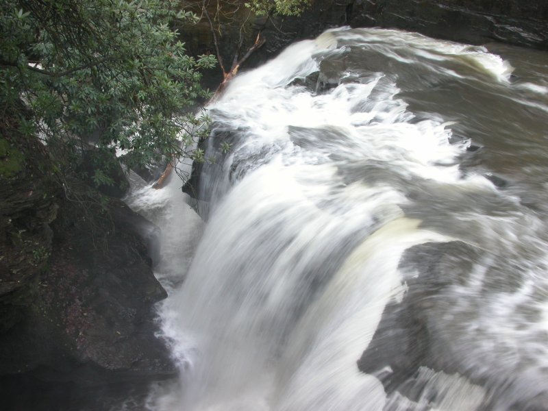 The view from the top. In low water, the water flows down as a narrow (misleadingly tall-looking) waterfall at the bottom of the picture, and a larger waterfall at the top. Seen in high water here, the water crashes into the cleft, bouncing off a ledge on the other side part way down, which makes it look a little shorter than it is.
 A pothole part of the waterfall, just to the bottom-right of the last picture.
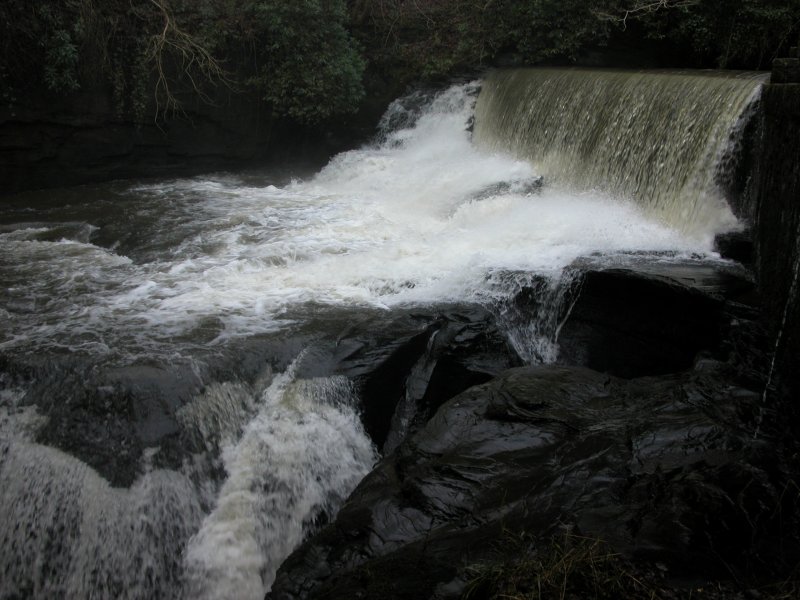 The weir just above the waterfall.
 The Dulais just above the weir.