Bach Howey and Glyn Tarell 2009
A brief visit to the dramatic and challenging Bach Howey Gorge, and the upper Glyn Tarell, in search of hidden gems.
Bach Howey Gorge
It is very easy to overlook the dramatic Bach Howey Gorge (also known as the Bachawy Gorge), and it would appear that most people do. It is tucked on the side of the Wye Valley, just downstream of Builth Wells, and spills a surprising amount of water into the Wye. (Admitedly, I visited during winter water levels, but it must be stressed that the river was not in flood.) The few paths that used to exist along the top of the gorge have been reclaimed by nature, and can no longer be identified - most of them do not go anywhere useful anyway.
Despite being only 2.5 km long in each direction, this is easily one of the hardest waterfall walks I have done, requiring over 4 hours for that small distance. There are no paths through any of the important parts, and the gorge is far deeper and more difficult than the maps make it look. If you plan on following my route, you will need to have:
- Balls of solid rock
- A death wish
- The skills of a third generation mountain goat
- Skin that is impervious to vast quantities of brambles and gorse
- Flawless map reading skills
- A copy of the 1:25'000 scale map of the area, and if possible, a 1:10'000 scale map as well
- The ability to walk on water
- Tall, waterproof boots
- A spell of good weather, with water levels according to your own tastes
The Mid Wales gorges are typically wide and V-shaped, with their sides only just steep enough to be considered a gorge. A few manage to get vertical sides, but rarely very deep. Bach Howey Gorge is therefore very unusual for Mid Wales, as it is a properly vertical-sided, deep gorge. Its thundering waterfalls are also quite spectacular, and for the first time in Mid Wales, I felt like I was back in the splendour of South Wales' Waterfall Country.
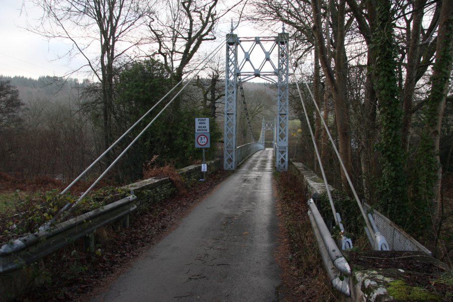
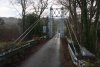 Single-vehicle suspension bridge leading from the A470 to Llanstephan. Cross the bridge, then turn left on the lane heading up the valley. The walk starts where the road crosses a bridge over a river.
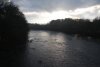 Winter light on the River Wye.
 From there, choose which side of the river to follow. The left side provides the only safe access to the waterfalls, but the right side provides better views. I started on the right, dropping down to a track that then climbed up to a field above the river.
 Following the edge of the field (which looks suspiciously like the grounds of a country manor house), a gate on the left then gives access to a dirt track leading into the valley.
 Angled winter light and low clouds in the Darren Wood. If you chose to start on the right, you should find somewhere appropriate to ford the river, and continue on the left bank instead. The track continues on the right side, then swings right to a junction, where to the left continues up the valley.
 The path on the left bank climbs over a set of high crags, then continues half way up the side of the valley, passing a solitary cottage. Beyond there, the map no longer reflects reality, as a new forestry track exists somewhere in the forest, and is the easiest way up the valley. I do not know how to reach it, however.
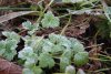 Frosted leaves on the track.
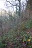 I tried to bypass a corner in the track. Bad idea. Still, this should give you a good idea of what to expect from most of the area, whenever you step off a track.
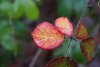 Blackberry leaves in autumn colours.
 When the track forked, my route took an overgrown track to the left.
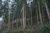 Slowly climbing through the tall trees.
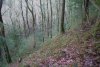 Where the track fizzled out, the map shows a footpath continuing ahead. Here. No sign of it. Instead, I chose this point to descend to the river, as the map showed it would be a couple of hundred metres before the gorge started.
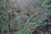 The map was definitely wrong. The gorge starts a lot further downstream than the map showed, and there was no convenient way down to it. The water was also clearly too deep for my wellies, and there is no way I could make my way upstream along the bottom of the gorge. So I decided to try the top instead, and climbed up over the cliffs along the right side, far above the river, and through the undergrowth and fallen branches.
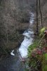 Finally, I got to a platform overlooking the Salmon Pool waterfall - the only one shown on the 1:25'000 map. Stuck well over 20 metres up on an overhanging cliff, with nothing but moss and brambles keeping me there. If you follow the right bank, you should not allow yourself to get into this position - it's far too dangerous.
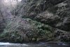 Just upstream of it, a slope provided a very slippery way down to the river. With nothing but leaf litter for footholds, I slid and stumbled down to reach the edge of the plunge pool. The final climb - seen on the right here as an overhanging ledge covered in hart's tongue - had only a slimy ledge and the root of a very small tree as handholds, and no footholds at all. After abandoning some of my kit to succesfully get down off the overhang, I then stupidly fell backwards, taking some saplings with me, and landed upside down with my head inches from the water. Then I had to climb part way back up to collect the kit. I was lucky that there was a better way out of the gorge, because that move would be very difficult to reverse. Don't copy me, please.
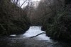 The Salmon Pool waterfall, between 4 and 5 metres tall, with the deep gorge blocking out most of the light, leaving a naturally gloomy feel. The downstream side of the pool was one of the few places where it was shallow enough for me to ford the river, though even there it was splashing into the tops of my wellies. To get back out, the slope on the left bank was far easier (though even that would be too tough for many walkers), and provided access to the new forestry track far above.
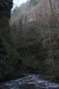 The downstream side of the pool, showing the depth of the gorge. The cliffs on the right are over 30 metres, while the cliffs over 20 metres high on the left are the ones I had previously been standing on.
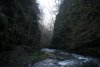 Depths of the Bach Howey Gorge.
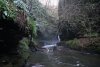 The map shows a small segment of the left bank (looking upstream) without cliffs, starting at the Salmon Pool. At the upstream side of that segment, a steep slope gave access to the river again. This then enters a very deep section of the gorge, where the water quickly becomes too deep, but the edge of a waterfall can be seen ahead. The cliffs immediately above the camera on the left are Craig Pwll-du, as much as 40 metres tall, the tallest in the gorge.
 Not good enough! So part way down the slope I had used to reach the river, a bramble covered, friable scramble gave a really dodgy way onto a large, slippery ledge running along the side of the gorge, towards the waterfall. Even at this distance from the waterfall, the spray was enough that I needed to protect the camera.
 The thundering splendour of the Craig Pwll-du waterfall. At 9 metres tall, it is easily the largest in the area, and very reminiscent of Waterfall Country. The ledges cannot be followed beyond this point but I will not complain - I absolutely love the view with the canyon winding towards it, much like Sgwd Einion Gam. Note that although there are some small overhanging streamlets on the left and a large ledge space visible behind the waterfall, it would be impossible to safely reach it, as there is nowhere to walk.
 Now forced to return up to the overhanging clifftops, I stayed near the lip of Craig Pwll-du, with the waterfall seeming dwarfed 40 metres below me. Without using my ledge route, this is the best view you will get.
 Just around the corner upstream is another small cascade. Unlike the main waterfall, this is marked on the 1:10'000 map.
 On the far bank, the map marks an earthwork, above the main waterfall and the cascade. I can't see anything, perhaps you can.
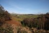 A further ascent of the slope brought me onto the new forestry track, where I continued upstream. The going quickly deteriorated, as the track became heavily overgrown with deep gorse. Eventually, it reached a field, where the edge of the gorge can be used to continue, though it is interrupted now by a few fences.
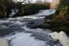 At the path between Penisarplwyf (you might want to read that a couple of times) and Pwllperran, there is a footbridge over the river, and the gorge starts immediately downstream of it, with this pair of 2 metre waterfalls.
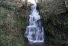 And this 5-6 metre waterfall on the stream from Pwllperran.
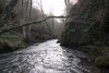 Upper end of the gorge.
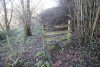 Above the Pwllperran stream, an old footpath leads back into the valley's woodland. The rotting state of this stile should give a nice idea of how often this area is visited. From here, there is supposedly a footpath leading back to the footpath from the start - it doesn't actually exist any more, and the only option is to plough through thigh-deep brambles, along the top edge of the gorge (the map does not show any gorge here, but believe me, it's there).
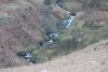
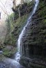 After crossing some streams, I carefully descended to the river at a brief point where the cliffs disappeared, just to check if the inlets made good waterfalls. I vote; meh.
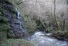 The river was too deep for me to continue downstream, so I had to get back above the cliffs, and wade through the horror above - that mess you can see in the top-right of the picture. I was still a couple of corners upstream of the main waterfalls, and had a long way to go.
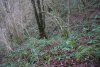 Very. Very. Slowly. Might not look too bad, but then you have to remember that each bramble loops over at shin-to-thigh height. For every one that you step on or whack, another one you didn't notice just embedded 200 thorns in your legs, and ripped them off, leaving them stuck through your clothing and into your skin. And another 2 just fell down your boot.
 Finally above the undergrowth, I reached the track running along the valley, with a view towards the southern edge of the hills that slowly rise up to the mountains of the Radnor Forest range. Twyn y Garth (325 metres), Pen-y-Graig (382 metres), Llandeilo Hill (479 metres), Llanbedr Hill (467 metres and 446 metres) - with the green ridge of The Garth (367 metres) in front of it, The Roundabout (415 metres) and the edge of Trewern Hill (357 metres).
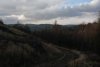 Slowly descending back to the track junction from the start of the walk. Ahead are Cefn Llwydallt (about 375 metres) and Waun Gynllwch (415 metres), on the edge of Mynydd Epynt.
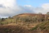 Twyn y Garth.
(Note; Kayakers told me the stretch of river is grade IV, but I can only assume this refers to the section of river below the gorge and waterfalls. The main waterfall is easily a grade VI, and would almost certainly prove fatal, as its wide spread thunders into a tiny slot less than a metre wide - you're more likely to land on the ledges than the water. Although this would therefore be considered a portage, the banks are too ridiculous to attempt dragging any kind of water craft up the sides, and there would be nowhere to stand for lowering. But then, they're even more nuts than me...)
Llanedw
The Llanedw Falls are not mentioned on any maps, but were described in a canoeing guide. The trouble is that canoeists and kayakers have different perceptions than walkers. The slightest wave in the river is a stopper, a shallow section becomes rapids, a slight drop in river level becomes a fall, and a good waterfall becomes a portage. Whenever there is a feature of any kind, it gets a name, typically from whatever village is nearby, or the canoeist that got stuck there 17.3 years ago. I could spend several lifetimes visiting all of these pointless (from a walker's perspective) features - I really need to learn to ignore canoeing guides. Llanedw Falls is one such example, by the Llanedw farm (the one near Upper Rhose) on the river Edw, near Builth Wells. It is not worth a dedicated visit.
Upper Glyn Tarell
Since it's on the way back, I stopped in the upper end of Glyn Tarell, the massive glacial valley separating the Fforest Fawr and Brecon Beacons mountain ranges. The valley is covered in small streams whose character changes completely depending on rainfall. From the road, several looked like they might hang cleanly, so given the winter water levels, it was time to investigate.
 Down below the road are a few cascades in the river. None are very impressive.
 To get to the main upper Tarell waterfalls, park at the Storey Arms, then walk down the right side of the valley, along the Taff Trail. When it crosses a stream, follow it up to the right to reach the waterfalls. From the road, these look like they might have space behind them; they don't.
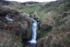 Upper spout.
 Meh.
Meh.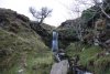 Finally, one worth looking at - around 4 metres tall.
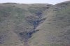 On the far side of the valley, a small stream also looks like it leaps cleanly, but it's such a small space behind it that you'd have to lie down. Defeats the purpose of walking behind a waterfall. Not worthy.
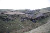 The lower cascades of Nant y Gerdinen can be seen from the road. Above them, the stream splits into the two separate channels seen here.
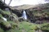 Above the split.
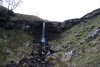 Next is the top waterfall. It's the tallest on the stream, at about 6 metres.
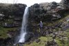 In high flow, two overflow channels appear, making extra waterfalls that can be walked behind.
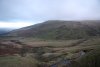 Not often you get this sort of view from behind a waterfall; Y Gyrn (619 metres).
 Cascades on the nearby Taf Fawr.
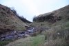 Taf Fawr Gorge, heading up behind Y Gyrn.
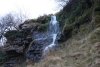 Inlet dropping a few metres down the side of the gorge.
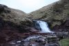 The gorge ends at a 3 metre waterfall. Above it is Blaen Taf Fawr, which has a few more waterfalls, but daylight was fading fast.
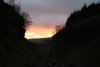 Sunset over Taf Fawr Gorge.
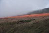 Colouring the slopes of Tyle Brith.
 And the final light of sunset over Fan Fawr (734 metres).
 Single-vehicle suspension bridge leading from the A470 to Llanstephan. Cross the bridge, then turn left on the lane heading up the valley. The walk starts where the road crosses a bridge over a river.
 Winter light on the River Wye.
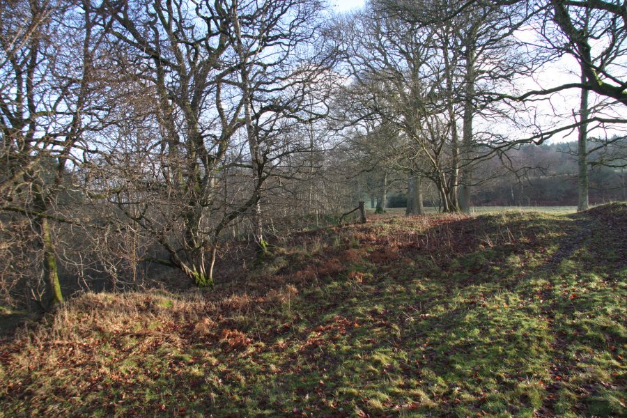 From there, choose which side of the river to follow. The left side provides the only safe access to the waterfalls, but the right side provides better views. I started on the right, dropping down to a track that then climbed up to a field above the river.
 Following the edge of the field (which looks suspiciously like the grounds of a country manor house), a gate on the left then gives access to a dirt track leading into the valley.
 Angled winter light and low clouds in the Darren Wood. If you chose to start on the right, you should find somewhere appropriate to ford the river, and continue on the left bank instead. The track continues on the right side, then swings right to a junction, where to the left continues up the valley.
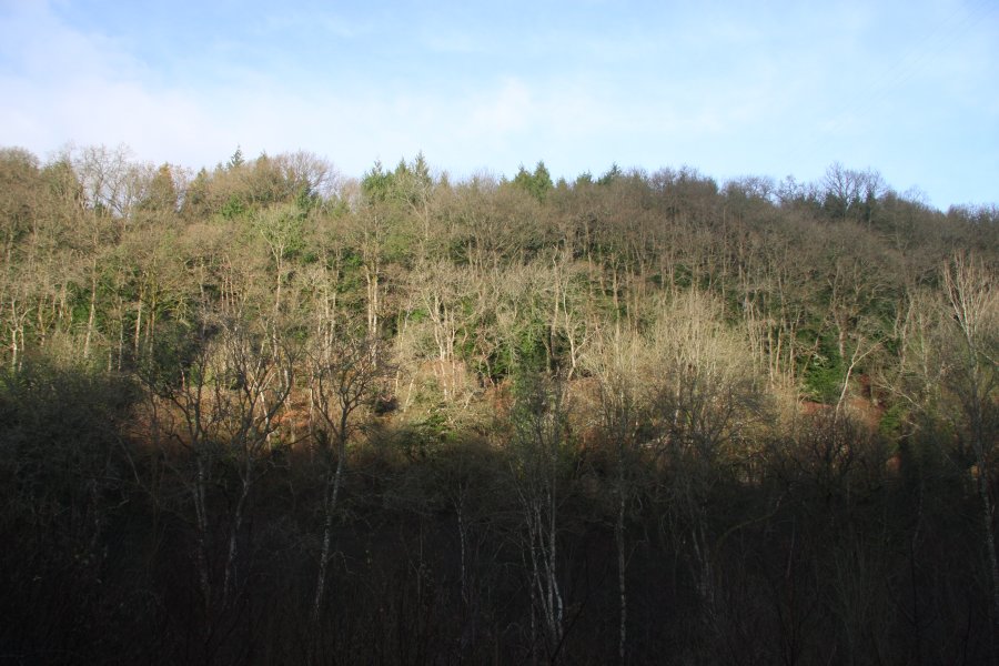 The path on the left bank climbs over a set of high crags, then continues half way up the side of the valley, passing a solitary cottage. Beyond there, the map no longer reflects reality, as a new forestry track exists somewhere in the forest, and is the easiest way up the valley. I do not know how to reach it, however.
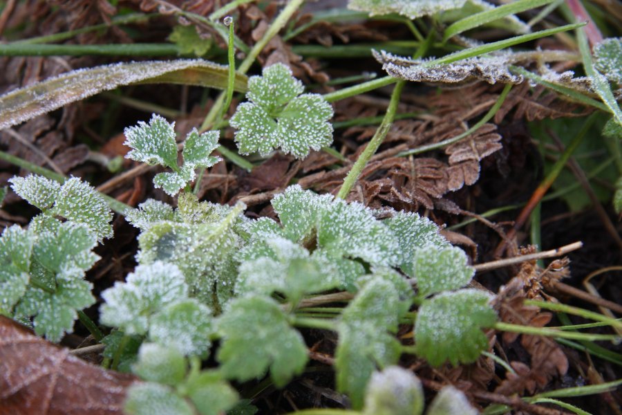 Frosted leaves on the track.
 I tried to bypass a corner in the track. Bad idea. Still, this should give you a good idea of what to expect from most of the area, whenever you step off a track.
 Blackberry leaves in autumn colours.
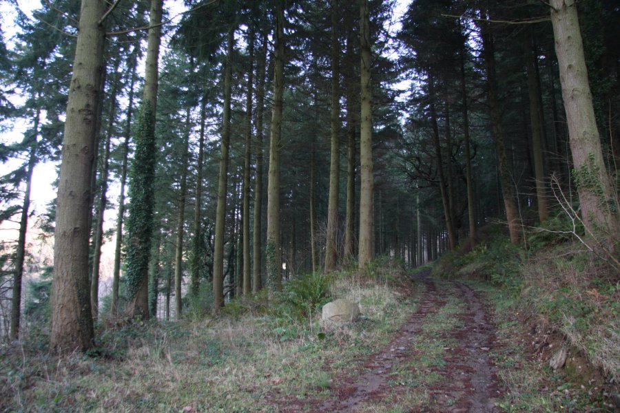 When the track forked, my route took an overgrown track to the left.
 Slowly climbing through the tall trees.
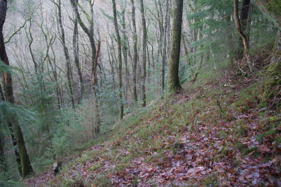 Where the track fizzled out, the map shows a footpath continuing ahead. Here. No sign of it. Instead, I chose this point to descend to the river, as the map showed it would be a couple of hundred metres before the gorge started.
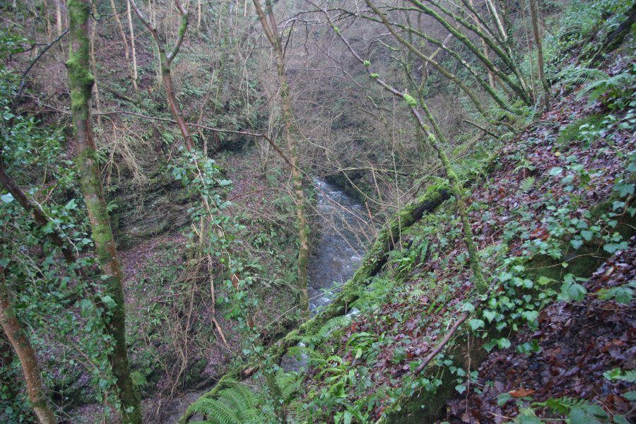 The map was definitely wrong. The gorge starts a lot further downstream than the map showed, and there was no convenient way down to it. The water was also clearly too deep for my wellies, and there is no way I could make my way upstream along the bottom of the gorge. So I decided to try the top instead, and climbed up over the cliffs along the right side, far above the river, and through the undergrowth and fallen branches.
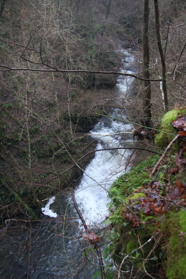 Finally, I got to a platform overlooking the Salmon Pool waterfall - the only one shown on the 1:25'000 map. Stuck well over 20 metres up on an overhanging cliff, with nothing but moss and brambles keeping me there. If you follow the right bank, you should not allow yourself to get into this position - it's far too dangerous.
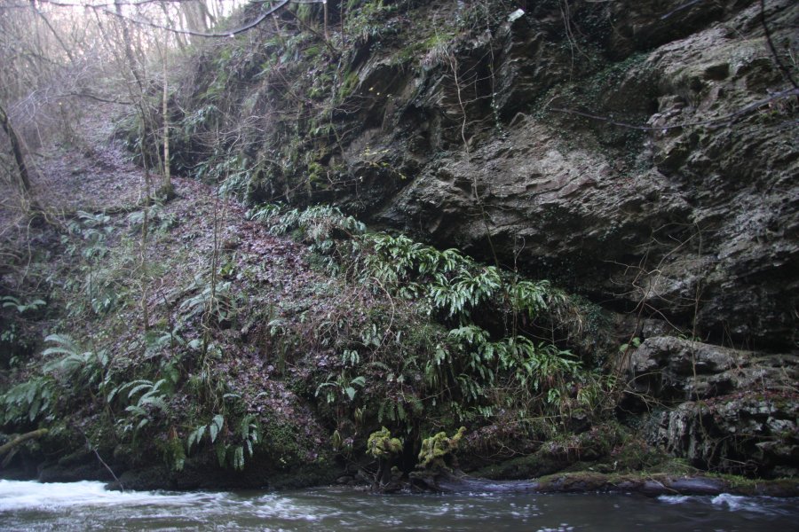 Just upstream of it, a slope provided a very slippery way down to the river. With nothing but leaf litter for footholds, I slid and stumbled down to reach the edge of the plunge pool. The final climb - seen on the right here as an overhanging ledge covered in hart's tongue - had only a slimy ledge and the root of a very small tree as handholds, and no footholds at all. After abandoning some of my kit to succesfully get down off the overhang, I then stupidly fell backwards, taking some saplings with me, and landed upside down with my head inches from the water. Then I had to climb part way back up to collect the kit. I was lucky that there was a better way out of the gorge, because that move would be very difficult to reverse. Don't copy me, please.
 The Salmon Pool waterfall, between 4 and 5 metres tall, with the deep gorge blocking out most of the light, leaving a naturally gloomy feel. The downstream side of the pool was one of the few places where it was shallow enough for me to ford the river, though even there it was splashing into the tops of my wellies. To get back out, the slope on the left bank was far easier (though even that would be too tough for many walkers), and provided access to the new forestry track far above.
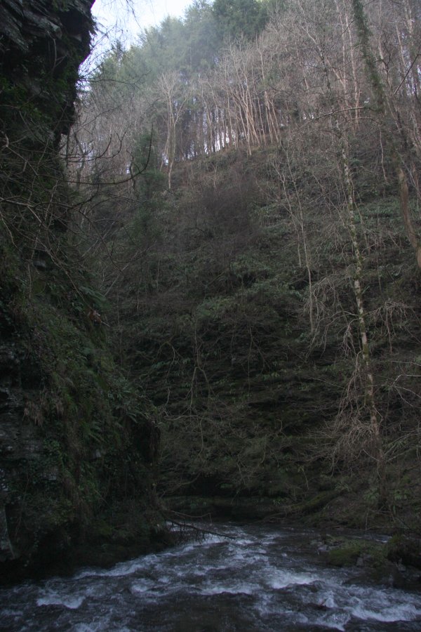 The downstream side of the pool, showing the depth of the gorge. The cliffs on the right are over 30 metres, while the cliffs over 20 metres high on the left are the ones I had previously been standing on.
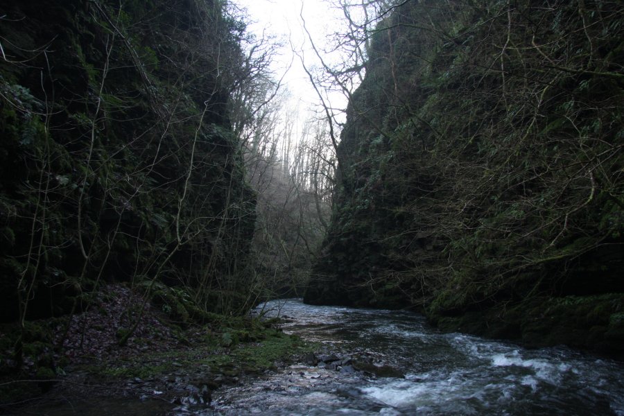 Depths of the Bach Howey Gorge.
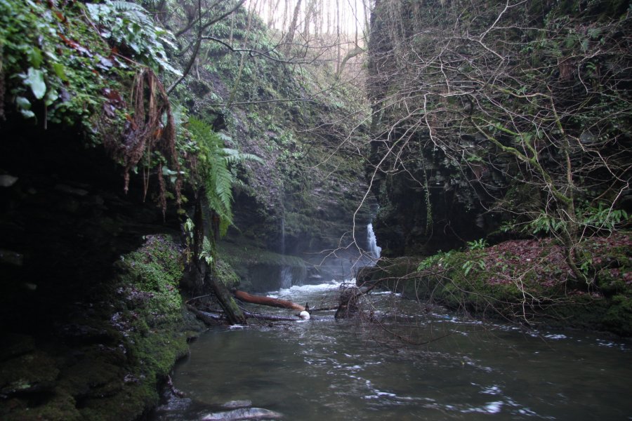 The map shows a small segment of the left bank (looking upstream) without cliffs, starting at the Salmon Pool. At the upstream side of that segment, a steep slope gave access to the river again. This then enters a very deep section of the gorge, where the water quickly becomes too deep, but the edge of a waterfall can be seen ahead. The cliffs immediately above the camera on the left are Craig Pwll-du, as much as 40 metres tall, the tallest in the gorge.
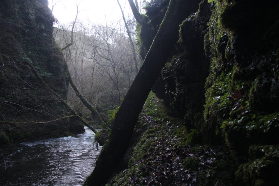 Not good enough! So part way down the slope I had used to reach the river, a bramble covered, friable scramble gave a really dodgy way onto a large, slippery ledge running along the side of the gorge, towards the waterfall. Even at this distance from the waterfall, the spray was enough that I needed to protect the camera.
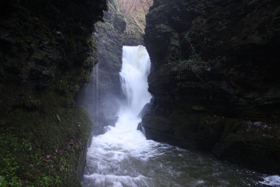 The thundering splendour of the Craig Pwll-du waterfall. At 9 metres tall, it is easily the largest in the area, and very reminiscent of Waterfall Country. The ledges cannot be followed beyond this point but I will not complain - I absolutely love the view with the canyon winding towards it, much like Sgwd Einion Gam. Note that although there are some small overhanging streamlets on the left and a large ledge space visible behind the waterfall, it would be impossible to safely reach it, as there is nowhere to walk.
 Now forced to return up to the overhanging clifftops, I stayed near the lip of Craig Pwll-du, with the waterfall seeming dwarfed 40 metres below me. Without using my ledge route, this is the best view you will get.
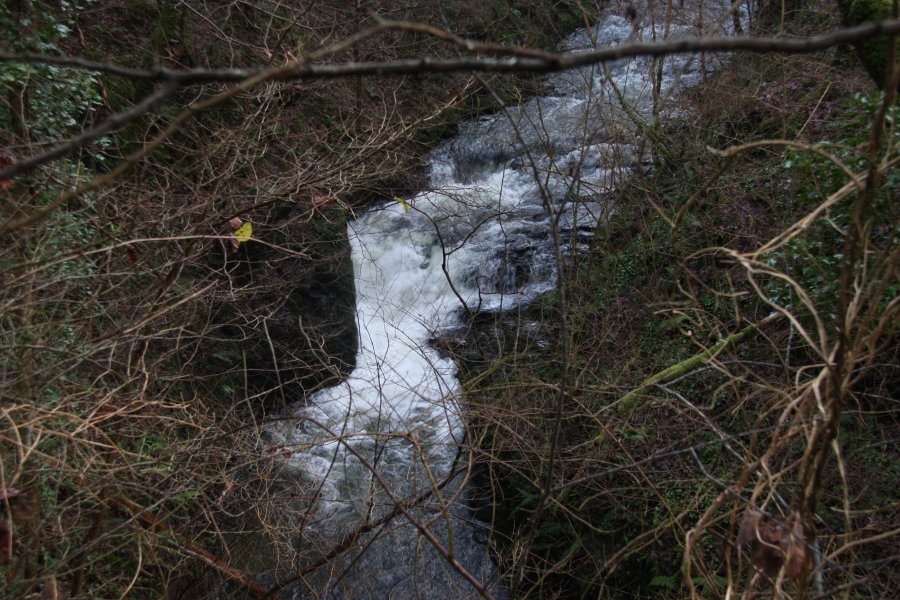 Just around the corner upstream is another small cascade. Unlike the main waterfall, this is marked on the 1:10'000 map.
 On the far bank, the map marks an earthwork, above the main waterfall and the cascade. I can't see anything, perhaps you can.
 A further ascent of the slope brought me onto the new forestry track, where I continued upstream. The going quickly deteriorated, as the track became heavily overgrown with deep gorse. Eventually, it reached a field, where the edge of the gorge can be used to continue, though it is interrupted now by a few fences.
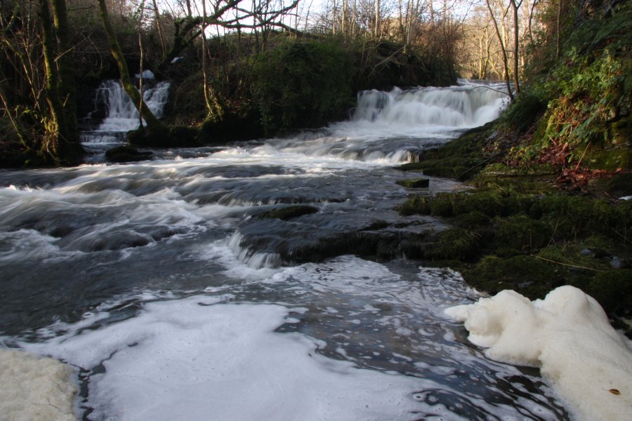 At the path between Penisarplwyf (you might want to read that a couple of times) and Pwllperran, there is a footbridge over the river, and the gorge starts immediately downstream of it, with this pair of 2 metre waterfalls.
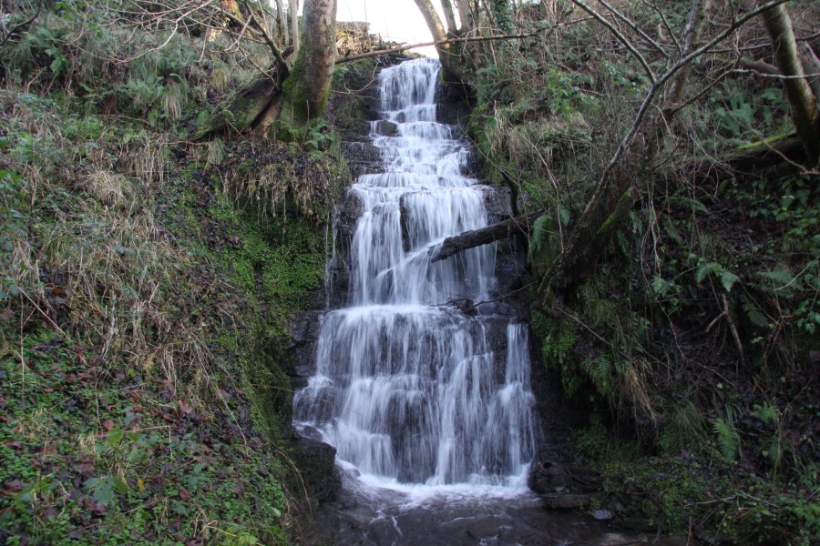 And this 5-6 metre waterfall on the stream from Pwllperran.
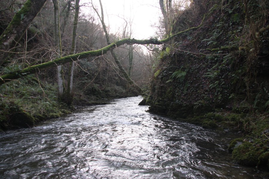 Upper end of the gorge.
 Above the Pwllperran stream, an old footpath leads back into the valley's woodland. The rotting state of this stile should give a nice idea of how often this area is visited. From here, there is supposedly a footpath leading back to the footpath from the start - it doesn't actually exist any more, and the only option is to plough through thigh-deep brambles, along the top edge of the gorge (the map does not show any gorge here, but believe me, it's there).
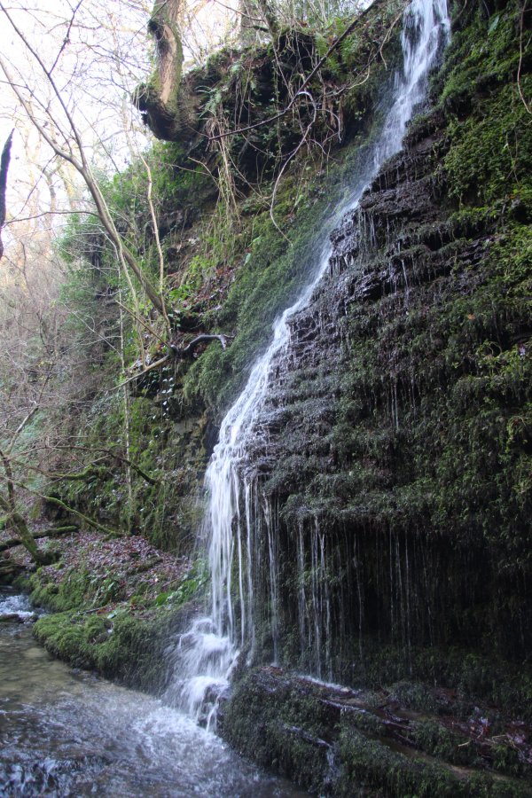 After crossing some streams, I carefully descended to the river at a brief point where the cliffs disappeared, just to check if the inlets made good waterfalls. I vote; meh.
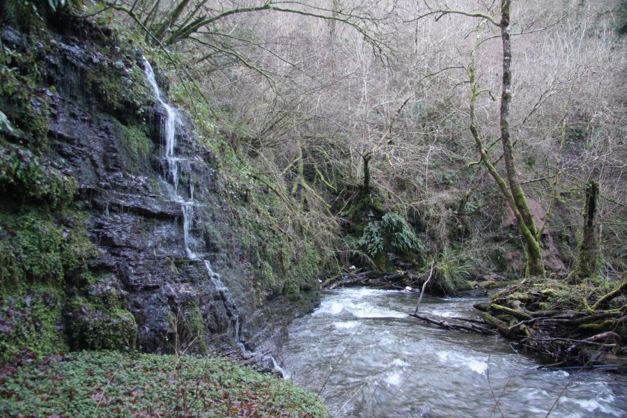 The river was too deep for me to continue downstream, so I had to get back above the cliffs, and wade through the horror above - that mess you can see in the top-right of the picture. I was still a couple of corners upstream of the main waterfalls, and had a long way to go.
 Very. Very. Slowly. Might not look too bad, but then you have to remember that each bramble loops over at shin-to-thigh height. For every one that you step on or whack, another one you didn't notice just embedded 200 thorns in your legs, and ripped them off, leaving them stuck through your clothing and into your skin. And another 2 just fell down your boot.
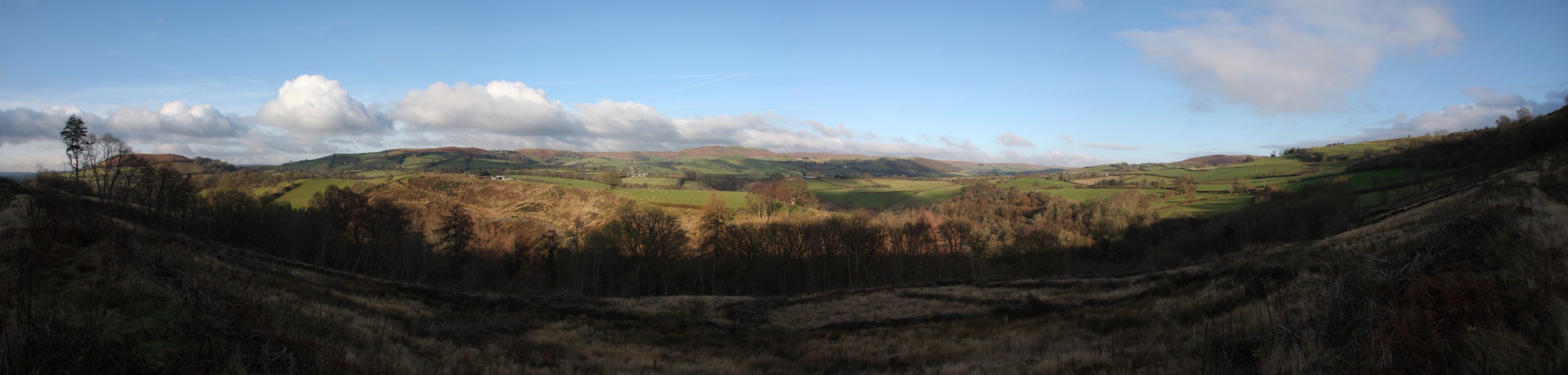 Finally above the undergrowth, I reached the track running along the valley, with a view towards the southern edge of the hills that slowly rise up to the mountains of the Radnor Forest range. Twyn y Garth (325 metres), Pen-y-Graig (382 metres), Llandeilo Hill (479 metres), Llanbedr Hill (467 metres and 446 metres) - with the green ridge of The Garth (367 metres) in front of it, The Roundabout (415 metres) and the edge of Trewern Hill (357 metres).
 Slowly descending back to the track junction from the start of the walk. Ahead are Cefn Llwydallt (about 375 metres) and Waun Gynllwch (415 metres), on the edge of Mynydd Epynt.
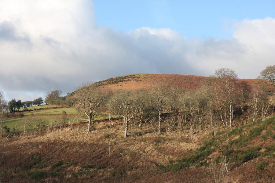 Twyn y Garth.
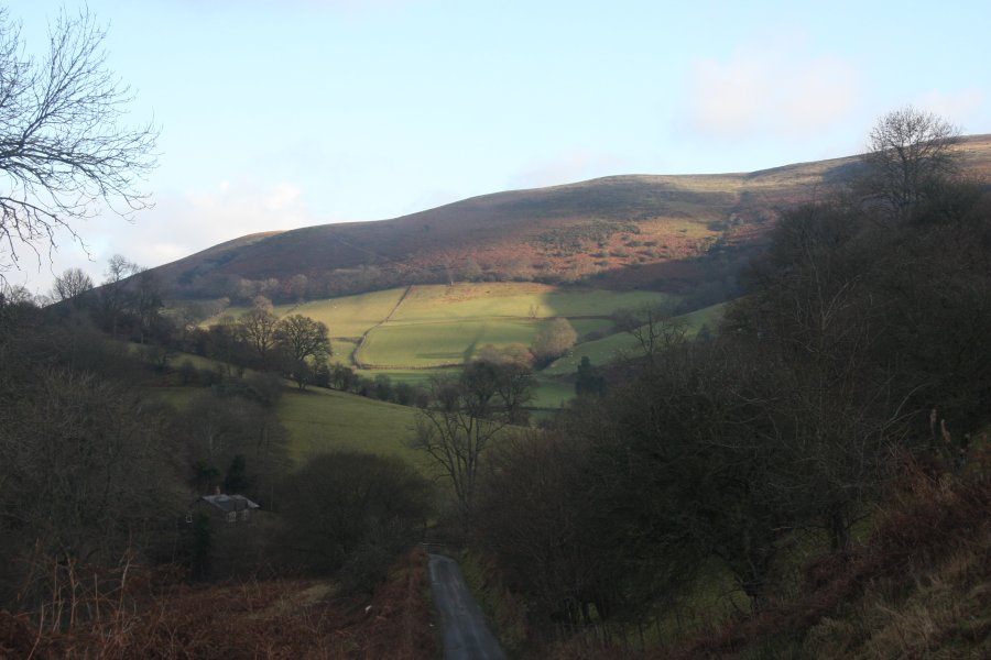 Gareg Lwyd ridge of Llandeilo Hill.
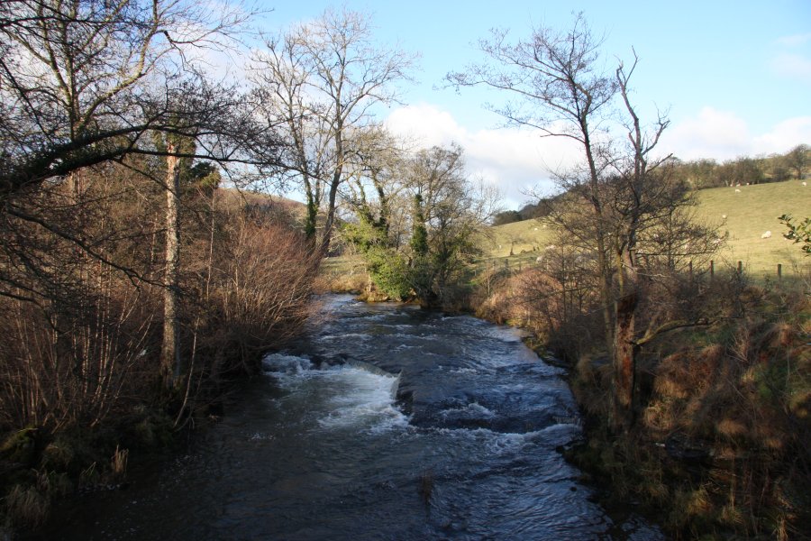 Park on the roadside near Llanedw. Follow the track down to the farm, turning right in front of the farm to cross a stream, then cross the main River Edw via a footbridge.
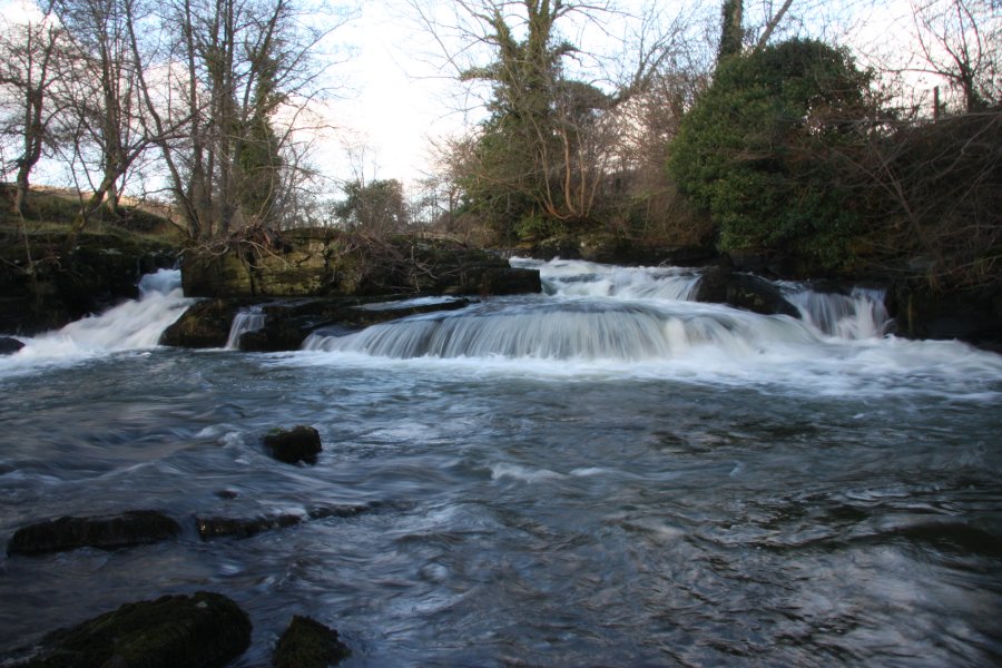 Turn left, and just downstream is Llanedw Falls. More rapids than cascade, dropping a little less than 2 metres in total, but with a tiny island separating the two channels.
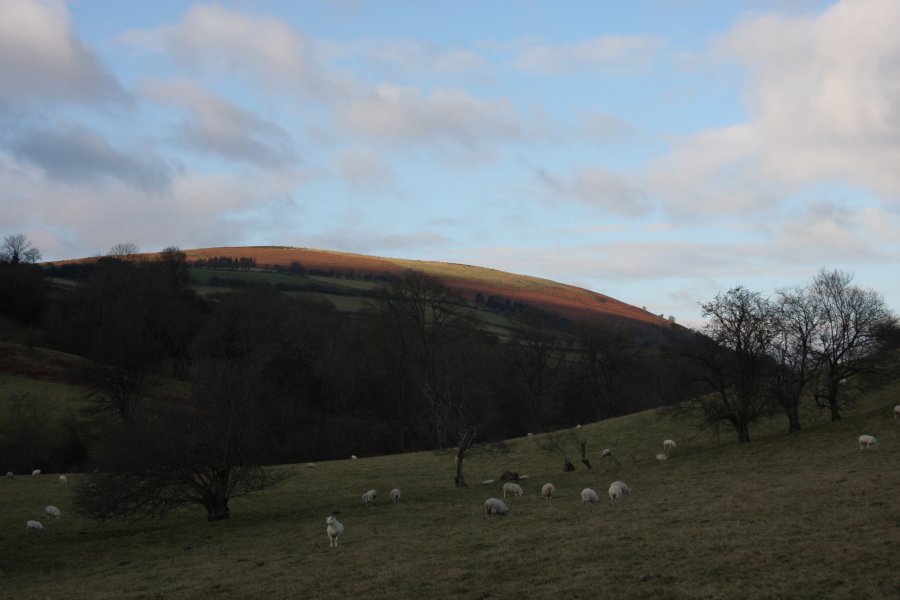 Impending sunset lighting up the bold colours of Wylfre (410 metres).
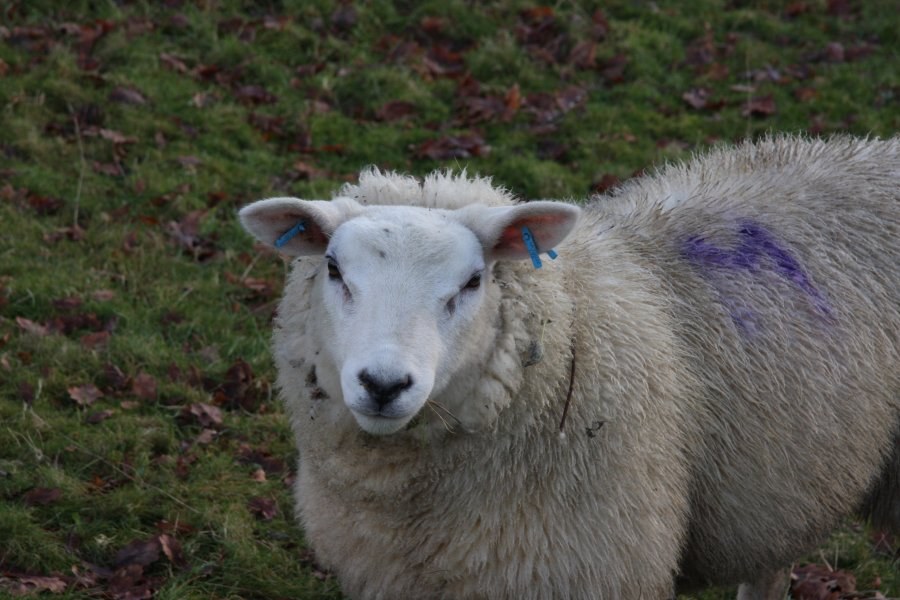 Bizzarely friendly sheep. They followed me around the field like a dog following its master. Perhaps I am just too used to mountain sheep, which are afraid of humans.
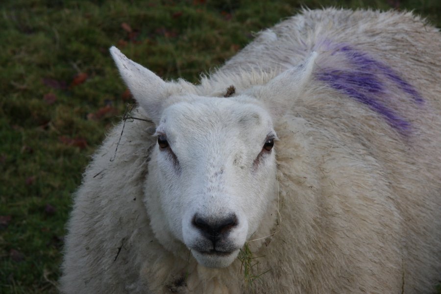 They even allowed themselves to be stroked, though they put their ears back at the camera, and backed off to a whopping 0.5 metres! But then of course, this is Wales - maybe they're just looking for some 'attention'...
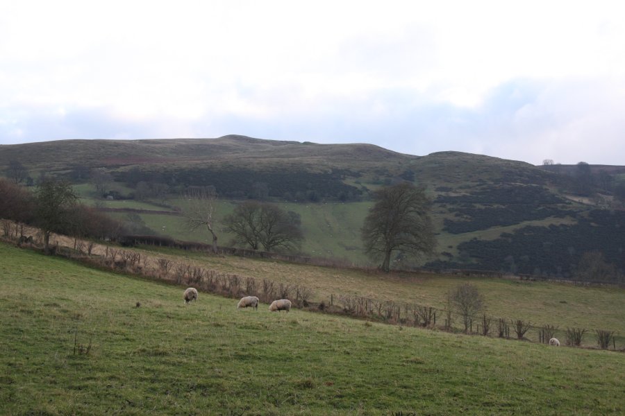 Rhulen Hill (464 metres).
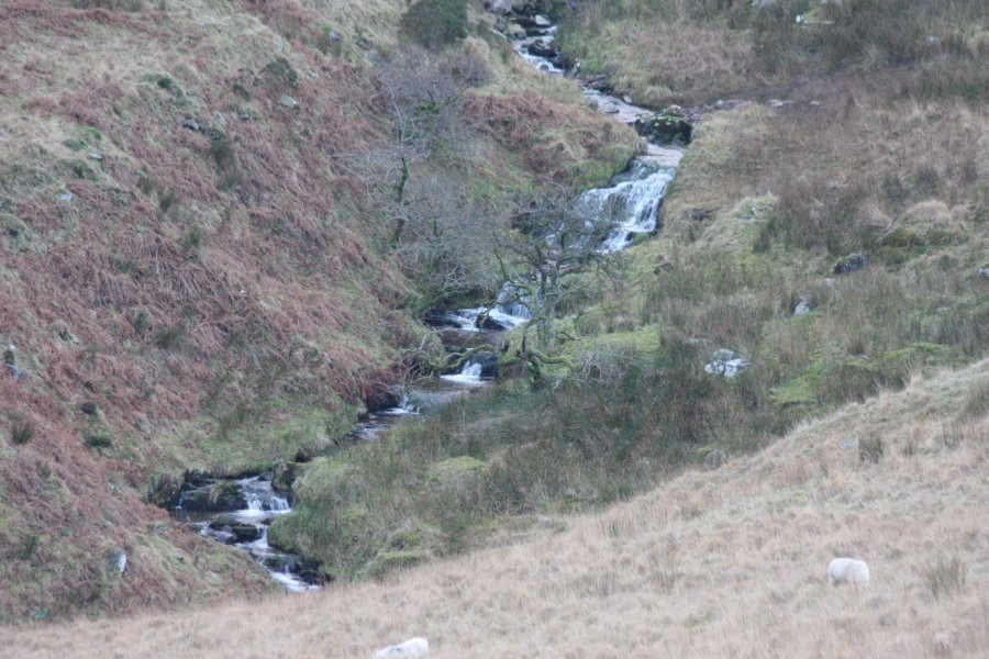 Down below the road are a few cascades in the river. None are very impressive.
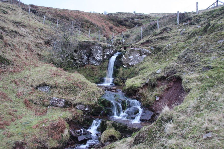 To get to the main upper Tarell waterfalls, park at the Storey Arms, then walk down the right side of the valley, along the Taff Trail. When it crosses a stream, follow it up to the right to reach the waterfalls. From the road, these look like they might have space behind them; they don't.
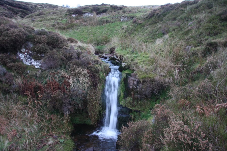 Upper spout.
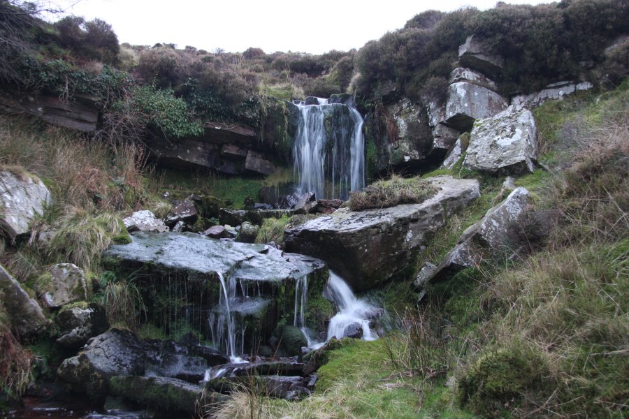 Meh.
Meh.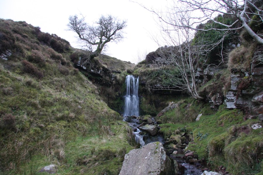 Finally, one worth looking at - around 4 metres tall.
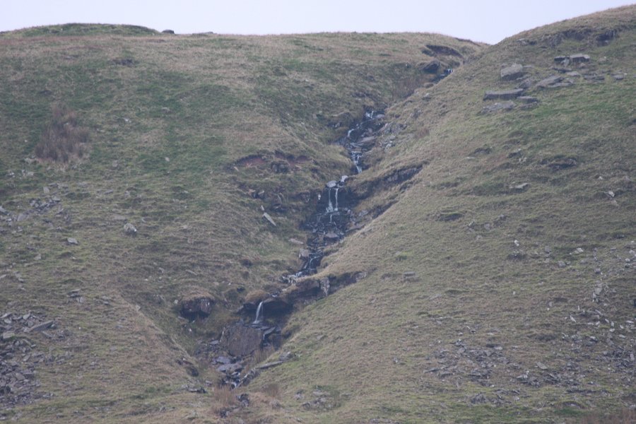 On the far side of the valley, a small stream also looks like it leaps cleanly, but it's such a small space behind it that you'd have to lie down. Defeats the purpose of walking behind a waterfall. Not worthy.
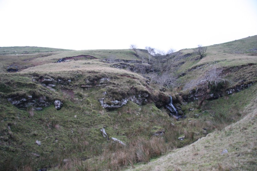 The lower cascades of Nant y Gerdinen can be seen from the road. Above them, the stream splits into the two separate channels seen here.
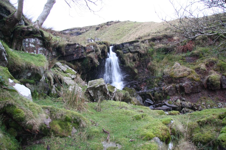 Above the split.
 Next is the top waterfall. It's the tallest on the stream, at about 6 metres.
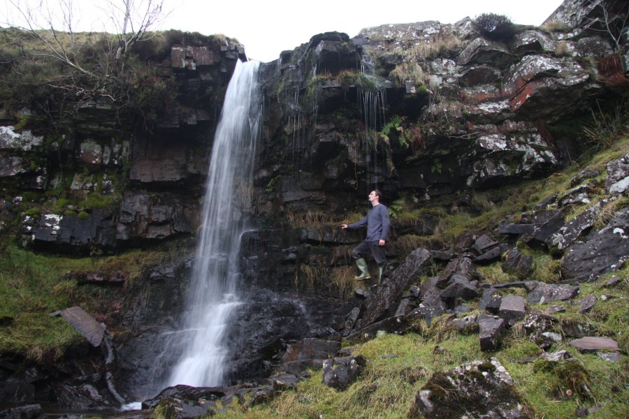 In high flow, two overflow channels appear, making extra waterfalls that can be walked behind.
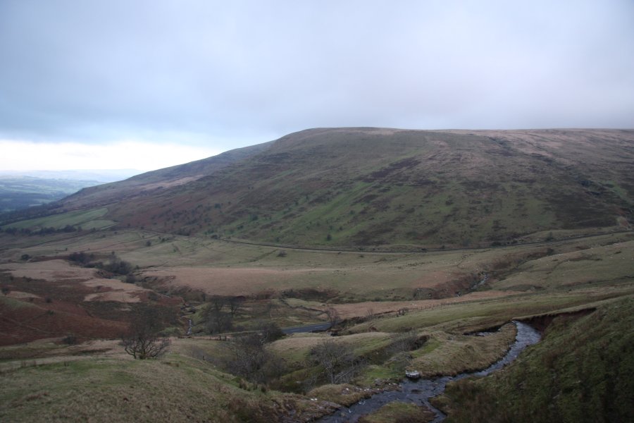 Not often you get this sort of view from behind a waterfall; Y Gyrn (619 metres).
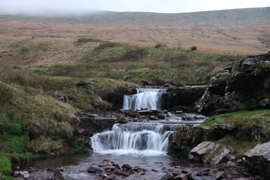 Cascades on the nearby Taf Fawr.
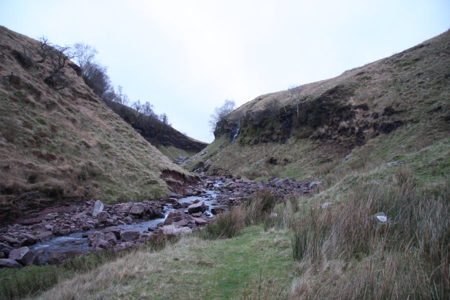 Taf Fawr Gorge, heading up behind Y Gyrn.
 Inlet dropping a few metres down the side of the gorge.
 The gorge ends at a 3 metre waterfall. Above it is Blaen Taf Fawr, which has a few more waterfalls, but daylight was fading fast.
 Sunset over Taf Fawr Gorge.
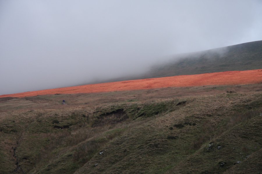 Colouring the slopes of Tyle Brith.
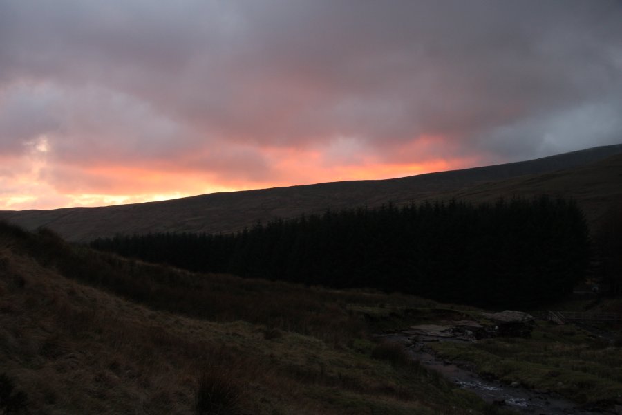 And the final light of sunset over Fan Fawr (734 metres).