Glyncorrwg 2009
A deceptively tough walk at the infrequented top end of the Afan Forest Park, sandwiched between the Vale of Neath and upper Rhondda Valley.
It is very easy to underestimate this walk, as most of the distances are covered on forestry tracks that also serve as relatively easy cycling routes (and if you're just out walking the dog or trying some easy mountain biking, then maybe the forestry tracks will be enough). However, given that managed forests are generally quite monotonous, there has to be something to liven it up, and in this case, it's my old friends; waterfalls. The visit was made after weeks of heavy daily downpours, so all streams and rivers were running very high, but not in spate conditions. River crossings remained possible with wellies, but required a lot of care.
In this forest, there are no easy paths to the waterfalls, and the forest is actively logged, so the terrain that must be covered to reach the waterfalls is especially hard. Despite being mostly on open access land, there are very few convenient points to cross fences, which intersect the routes at various points. If you plan on following this route, you will need to be capable of crossing this terrain, using an OS map, and hopping barbed wire fences if needed. The entire walk took 6 hours to cover a little over 13 km. None of the waterfalls are officially named on the maps, so names are taken either from the river/stream name, or the main feature where the waterfall is located.
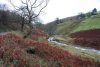 The route starts at Heol-y-Deryn in Glyncorrwg (near the back of the cemetery), and picks up the public right of way track running along the western bank of Afon Corrwg Fechan, up Cwm Corrwg Fechan.
 Just before a gate that blocks the track, a track doubles back on the left towards a house at Llwyn-y-ffynnon. Part way along this, a stream draining Twyn y Crug crosses the track, and upstream is this 7 metre waterfall (marked only on the 1:10'000 map as being a spout). It can also be seen from the far side of the village.
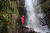 Even in this high water, there was enough space to get behind it, though the water splashing off the nearby ledge meant that waterproofs were desirable. Getting up to it was a little difficult, as there was no path up the stream, though compared with some of the others on this walk, it was relatively easy.
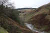 Afon Corrwg Fechan, with artificial water channel and weir.
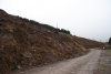 Obliteration by logging.
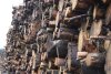 Timber stacks. Do not climb. The sign says so.
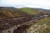 Mynydd Corrwg Fechan, only a small hill at about 412 metres high, but one of the most obvious landmarks in the area. It also gives a nice impression of what the area would have looked like before the forestry commission obliterated it.
 Below, in the Corrwg Fechan river, the 1:25'000 map shows waterfalls - the first is barely 1.5 metres tall, and guarded by ranks of fallen trees, a fence and a small gorge.
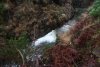 A short distance upstream in the Corrwg Fechan, the gorge has another waterfall, even less impressive than the first. These are certainly not worth the effort needed to reach them.
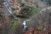 The gorge ends just afterwards. I was now stuck on the wrong side of the river, and did not want to go through the effort to get back to it. However, remaining on the track provides an easy way to skirt the head of the river, and end up on the other side near the main waterfalls.
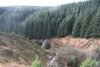 Cascading inlet from Bryn Lydan.
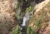 Smaller cascade in the river.
 Of fire and water; the burned remains of the forest and recent hailstorms.
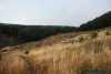 So this was my path, crossing the horrendous surface of Lluest y Derlwyn to reach the track. It may not seem too bad, until you realise that the deep grass is underlain by slimy fallen branches, decomposing tree stumps and occasional holes filled with water. It takes ages to cross this, stumbling, falling, slipping, cursing.
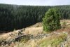 Beautiful light on Lluest y Derlwyn.
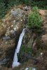 Just below where the track crosses the Afon Corrwg Fechan, the river charges down a 7 metre water chute, one of only two of the waterfalls to be marked on the 1:50'000 maps. It can only be properly seen by leaving the path and standing on the rim of the waterfall. Take care.
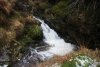 At its base, the water then charges out of the tiny enclosure, and thunders into a lower plunge pool.
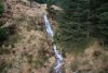 Just downstream, an inlet stream splits into multiple strands, each creating its own waterfalls on the other side of the main river, such as this 6 metre horsetail. It is best to view it from the far side of the main river, and not try to see the others beside it, as they are more risky to reach.
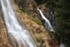 Inlet waterfalls. The main one is around 7 metres tall, and although it leaps nicely away from the base, it cannot be walked behind.
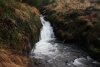 A series of small cascades with deep plunge pools guard the river here, making it risky to try to cross the river to see the inlet waterfalls.
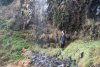 One of the inlet strands falls over a nearby cliff, producing a very thin veil, with plenty of space to walk behind it. Note, however, that this is fairly high flow. In lower flow, it may disappear completely, though the exposed rocks suggest it usually appears. It's not good enough to deserve the attention or risk to reach it.
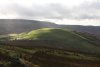 Mynydd Corrwg Fechan. Note the drainage channels that encircle the mountain. Also note the caravan (!) on the ridge, that must have been dragged there along the grassy tracks over this ridiculous terrain.
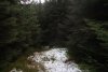 I followed the track as it swung into Cwm Corrwg. Several small streams cross it, some of which are significant enough for the track to dip sideways temporarily to cross them. The second time this happened (Nant Gau is the third), I followed the unnamed stream down a hail-and-moss covered stream bed to reach the river below. Careful; just upstream, the next inlet falls over a cliff.
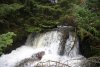 Neat little waterfall on the Afon Corrwg.
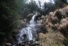 Small inlet waterfall.
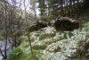 Remains of a house at Old Blaencorrwg, with snow-like hail decorations.
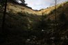 Felled trees in Cwm Corrwg.
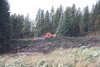 Reeling machine.
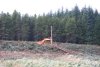 And another large machine, pulling a cable over the river to another similar machine 500 metres away on the far bank. Presumably, these are used to haul felled trees over the long distances to the nearest tracks.
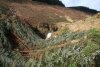 The felled trees completely covered the river, making it very hard to walk upstream to the main waterfall, which is the last one on the river marked on the 1:25'000 map. One false move, and you'd fall down gaps between the trees into the river. Note the cable over the top of the waterfall.
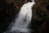 The 5 metre thundering waterfall is the most impressive on the rivers, and it was a real shame to have it obscured by the trees. I can only hope that the ongoing logging work will remove them soon enough, and not leave them behind due to their inconvenient location.
 Upstream are a few cascades, but nothing worth your time. The forestry track slowly makes its way up to the head of the river, then loops around to the other side.
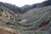 Felled trees, toppled uniformly, completely covering the landscape. It's like the aftermath of the Mount St. Helens eruption. My way on would be to head back to the stream gully a little way downstream on the left.
 Volcanic aftermath?
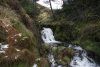 The start of the Nant Pigws-y-waun gully.
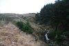 More of the horrendous terrain on the way up the gully - everywhere there are brambles and felled trees hiding under the grass, and every step runs the risk of sliding or tripping over the hidden slimy pine branches. It took far too long to get over this terrain, but there's no better option.
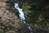 Nant Pigws-y-waun has several cascades, including this section that totals about 10 metres in height. None are marked on the maps.
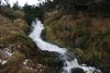 Cascades near the top. The stream now swings left, and I continued ahead to pick up the forestry track.
 Beautiful light in a mossy clearing, dusted with snow and hail.
 Looking back at the clouds in the head of Cwm Corrwg. On the left is Mynydd Pen-y-cae (573 metres) and on the right is the top of Craig y Llyn (600 metres), the highest point in Wales that is south of the Brecon Beacons National Park. Once at the track, I turned right, and followed it as it slowly rounded the next buttress.
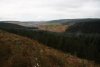 View towards the lower Cwm Corrwg, as it passes Mynydd Corrwg Fechan.
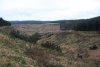 Looking down Nant Melyn, where the track crosses the stream, then begins its route around the next buttress. The easiest route here is to continue around the buttress to reach a cross roads on the far side, where the way on is to the right. I took a short-cut; when the stone wall crosses Nant Melyn, a steep stream gully on the left can be used to climb up to an upper track in the forest.
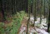 Remains of habitation in the forest. The track is just after this, where I turned right.
 Hmm ... guess it's been raining around here then. When the track reached a crossroads at Nant Meliorath, I continued ahead along a better track, which zig-zagged towards Cwm Cas.
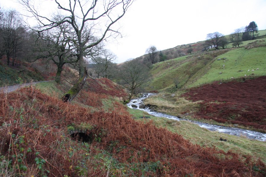
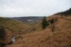 Nant Cwm-cas appears at a very sharp zig-zag, and not too far downstream, it intersects a biking single track, as the valley opens up with a view towards Glyncorrwg, and the trees disappear. At last. The cyclist on the right was the first human I had seen all day.
 Cascades at the top of the valley.
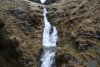 Just below the fence is the main Nant Cwm-cas waterfall, which drops around 10 metres in a series of cascades.
 The stream continues with a few small cascades. The 1:10'000 map shows another waterfall downstream, but there is actually nothing there.
 Panorama of the Glyncorrwg area.
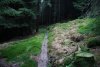 Returning to the single track, I followed it back to the last stream; Nant Meliorath.
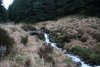 Once at the stream, I headed left, and followed it down some small cascades.
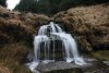 A 4 metre waterfall, marked only on the 1:10'000 map, proved to be the biggest on the stream.
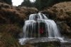 And yes, it turned out to be possible to crouch behind it. I needed the waterproofs to get there, but it would probably be a lot drier (and a lot more boring) in low flow.
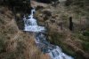 A further fence and some cascades.
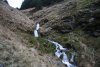 And some more cascades.
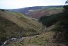 Lower Nant Meliorath. Remember that green bump on the left.
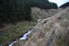 A final few cascades. One of these actually makes it onto the 1:10'000 map, though I really fail to see why.
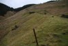 That green bump is part of an old tram road. Some rails, foundations, storage buildings, and a few other artifacts are still visible.
 Drainage channel running down the old tramroad. I was unlucky enough here to witness a terrier attacking and most likely killing a sheep, attempting to eat it while it was still in the process of dying - urgh. (Initially, I mistook the curly-haired dog for a lamb trying to revive its mother, then realised of course that there are no lambs here in winter.) A further two sheep were dying nearby from their wounds. Though I was almost certainly too late to save the sheep, I photographed the attack as I chased the dog away, and luckily managed to find the farmer in the village and show him the evidence. However, it would be too morbid for me to post them online. Sorry weirdos. Still, at least the farmer will know exactly which dog to blame, instead of assuming they are all guilty.
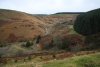 Craig Tyle-cam, on the side of Cwm Corrwg.
 The base of Cwm Cas. There are some footpaths and a track here, separated by fences. I'm not sure of the best route back, but since there were two dying sheep at my feet as I took this picture, I was not in the mood to go exploring, and simply hopped a fence to get to the track, in order to find the farmer as quickly as possible. Staying on the left bank of the Afon Corrwg, the track leads directly into the village.
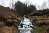 At the edge of the village, the track crosses the Nant yr Allor, which is adorned with a series of waterfalls. They are only a little over 10 metres in total height, but are impressively powerful. Shortly afterwards, I located the farmer (the only person driving a proper old Landrover, of course), and was able to ease off the pace.
 On the far side of the church, a small bridge crosses Nant Du, which has this small cascade upstream. Some further cascades can be seen high up the hillside upstream on the Nant Blaen-y-ty, but it had been a long day already, and they were deemed unworthy.
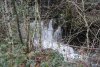 Just downstream of the bridge is a small waterfall, which can be seen from the nearby churchyard. It appears to have an undercut to the side, but this does not extend properly behind the waterfall, so it doesn't look possible to walk behind it. To be honest, I was so tired at this stage that I couldn't face hopping the wall to check it out. Maybe you can. I wanna go home!
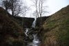 Very visible from the road near Duffryn in Cwm Afan, this 4 metre spout on the Nant Tryfal is actually a weir - admitedly a fairly natural-looking weir, but still just a weir. Pity.
 The route starts at Heol-y-Deryn in Glyncorrwg (near the back of the cemetery), and picks up the public right of way track running along the western bank of Afon Corrwg Fechan, up Cwm Corrwg Fechan.
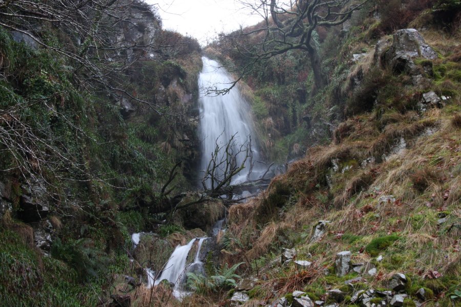 Just before a gate that blocks the track, a track doubles back on the left towards a house at Llwyn-y-ffynnon. Part way along this, a stream draining Twyn y Crug crosses the track, and upstream is this 7 metre waterfall (marked only on the 1:10'000 map as being a spout). It can also be seen from the far side of the village.
 Even in this high water, there was enough space to get behind it, though the water splashing off the nearby ledge meant that waterproofs were desirable. Getting up to it was a little difficult, as there was no path up the stream, though compared with some of the others on this walk, it was relatively easy.
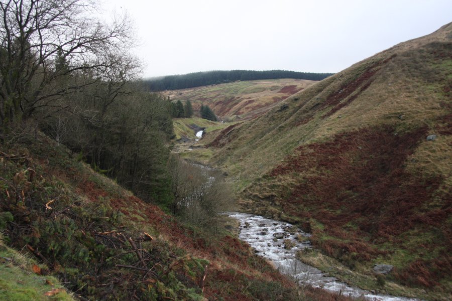 Afon Corrwg Fechan, with artificial water channel and weir.
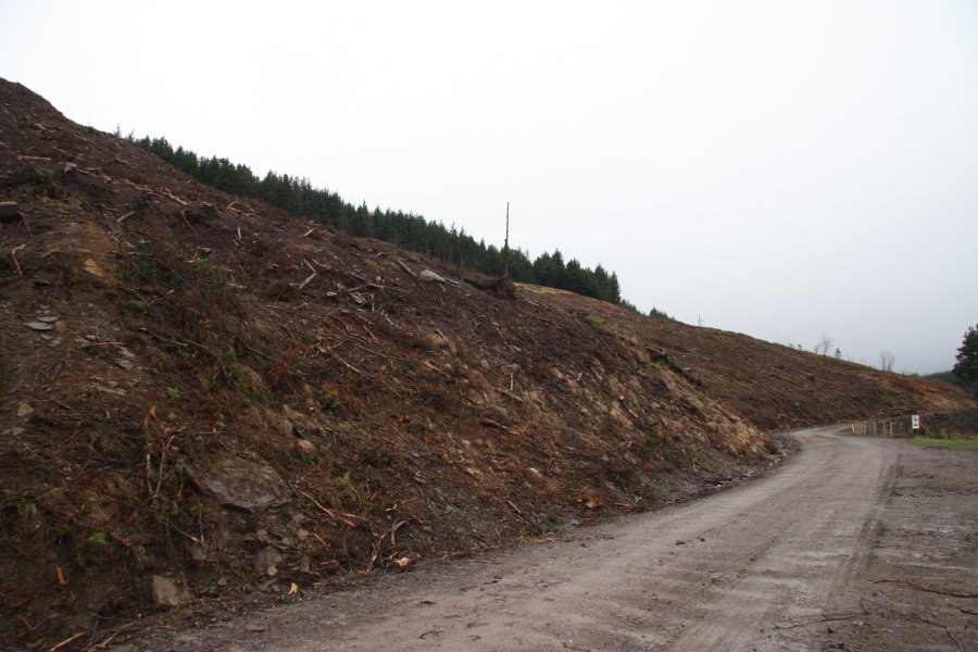 Obliteration by logging.
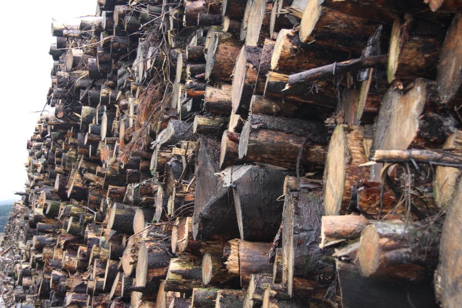 Timber stacks. Do not climb. The sign says so.
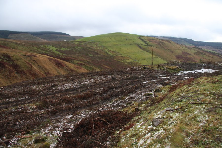 Mynydd Corrwg Fechan, only a small hill at about 412 metres high, but one of the most obvious landmarks in the area. It also gives a nice impression of what the area would have looked like before the forestry commission obliterated it.
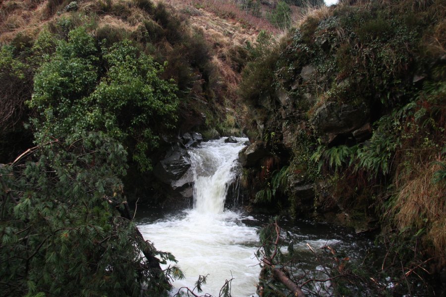 Below, in the Corrwg Fechan river, the 1:25'000 map shows waterfalls - the first is barely 1.5 metres tall, and guarded by ranks of fallen trees, a fence and a small gorge.
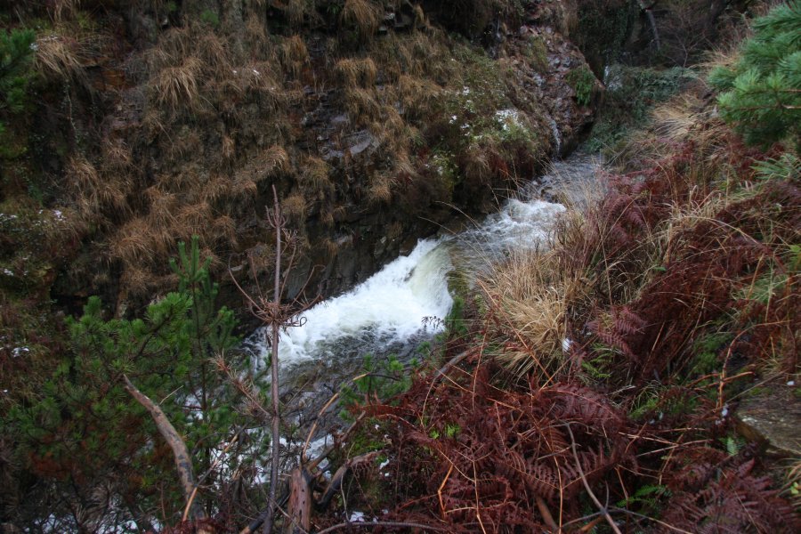 A short distance upstream in the Corrwg Fechan, the gorge has another waterfall, even less impressive than the first. These are certainly not worth the effort needed to reach them.
 The gorge ends just afterwards. I was now stuck on the wrong side of the river, and did not want to go through the effort to get back to it. However, remaining on the track provides an easy way to skirt the head of the river, and end up on the other side near the main waterfalls.
 Cascading inlet from Bryn Lydan.
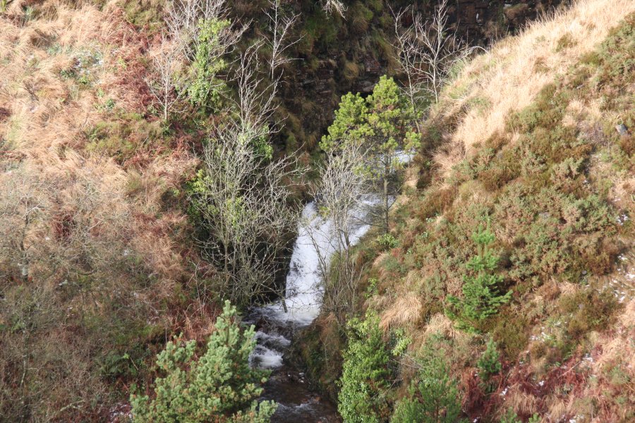 Smaller cascade in the river.
 Of fire and water; the burned remains of the forest and recent hailstorms.
 So this was my path, crossing the horrendous surface of Lluest y Derlwyn to reach the track. It may not seem too bad, until you realise that the deep grass is underlain by slimy fallen branches, decomposing tree stumps and occasional holes filled with water. It takes ages to cross this, stumbling, falling, slipping, cursing.
 Beautiful light on Lluest y Derlwyn.
 Just below where the track crosses the Afon Corrwg Fechan, the river charges down a 7 metre water chute, one of only two of the waterfalls to be marked on the 1:50'000 maps. It can only be properly seen by leaving the path and standing on the rim of the waterfall. Take care.
 At its base, the water then charges out of the tiny enclosure, and thunders into a lower plunge pool.
 Just downstream, an inlet stream splits into multiple strands, each creating its own waterfalls on the other side of the main river, such as this 6 metre horsetail. It is best to view it from the far side of the main river, and not try to see the others beside it, as they are more risky to reach.
 Inlet waterfalls. The main one is around 7 metres tall, and although it leaps nicely away from the base, it cannot be walked behind.
 A series of small cascades with deep plunge pools guard the river here, making it risky to try to cross the river to see the inlet waterfalls.
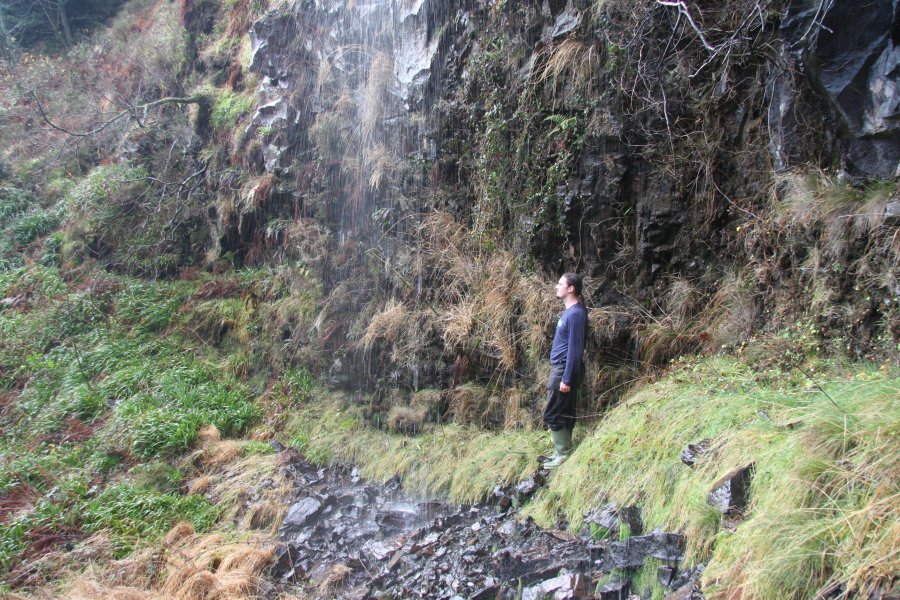 One of the inlet strands falls over a nearby cliff, producing a very thin veil, with plenty of space to walk behind it. Note, however, that this is fairly high flow. In lower flow, it may disappear completely, though the exposed rocks suggest it usually appears. It's not good enough to deserve the attention or risk to reach it.
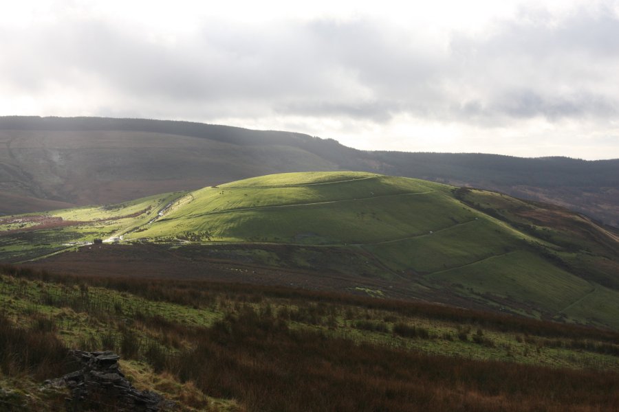 Mynydd Corrwg Fechan. Note the drainage channels that encircle the mountain. Also note the caravan (!) on the ridge, that must have been dragged there along the grassy tracks over this ridiculous terrain.
 I followed the track as it swung into Cwm Corrwg. Several small streams cross it, some of which are significant enough for the track to dip sideways temporarily to cross them. The second time this happened (Nant Gau is the third), I followed the unnamed stream down a hail-and-moss covered stream bed to reach the river below. Careful; just upstream, the next inlet falls over a cliff.
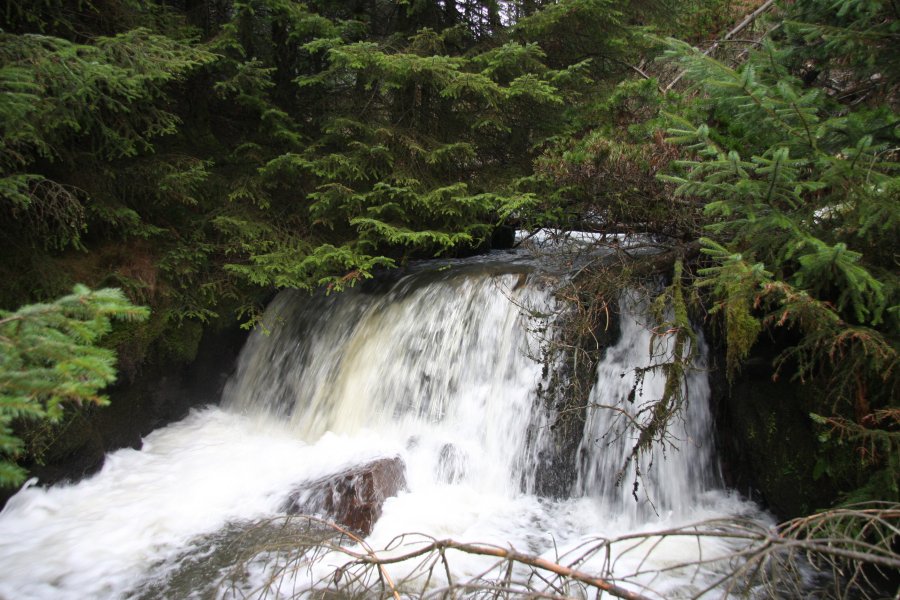 Neat little waterfall on the Afon Corrwg.
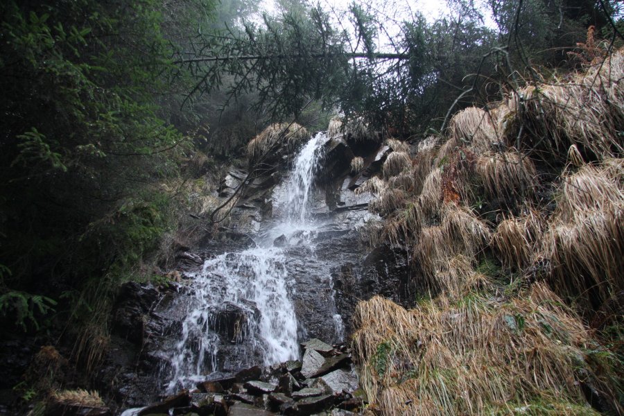 Small inlet waterfall.
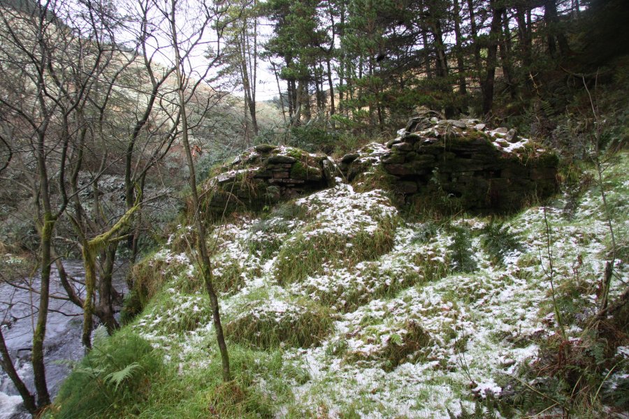 Remains of a house at Old Blaencorrwg, with snow-like hail decorations.
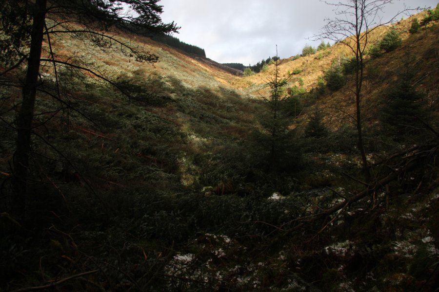 Felled trees in Cwm Corrwg.
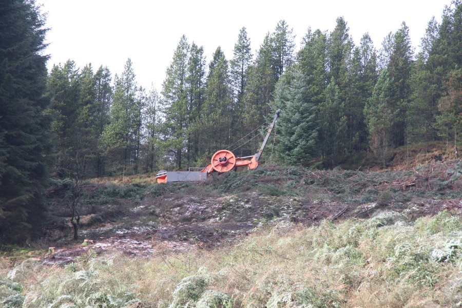 Reeling machine.
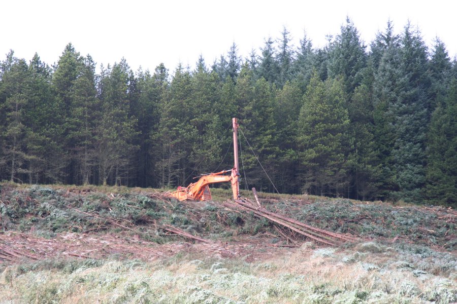 And another large machine, pulling a cable over the river to another similar machine 500 metres away on the far bank. Presumably, these are used to haul felled trees over the long distances to the nearest tracks.
 The felled trees completely covered the river, making it very hard to walk upstream to the main waterfall, which is the last one on the river marked on the 1:25'000 map. One false move, and you'd fall down gaps between the trees into the river. Note the cable over the top of the waterfall.
 The 5 metre thundering waterfall is the most impressive on the rivers, and it was a real shame to have it obscured by the trees. I can only hope that the ongoing logging work will remove them soon enough, and not leave them behind due to their inconvenient location.
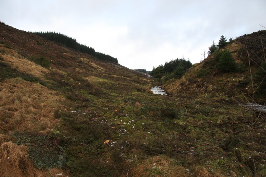 Upstream are a few cascades, but nothing worth your time. The forestry track slowly makes its way up to the head of the river, then loops around to the other side.
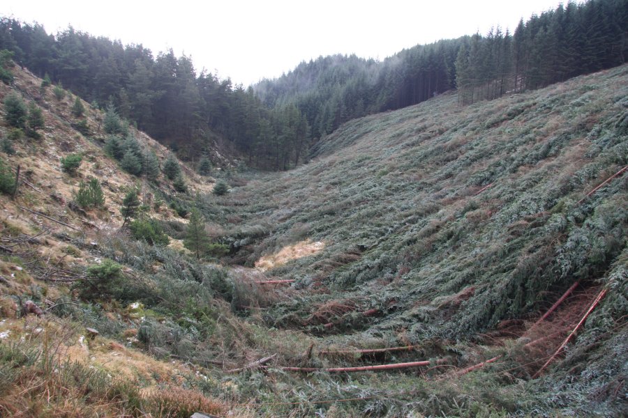 Felled trees, toppled uniformly, completely covering the landscape. It's like the aftermath of the Mount St. Helens eruption. My way on would be to head back to the stream gully a little way downstream on the left.
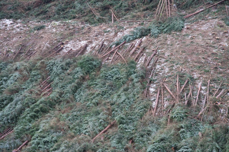 Volcanic aftermath?
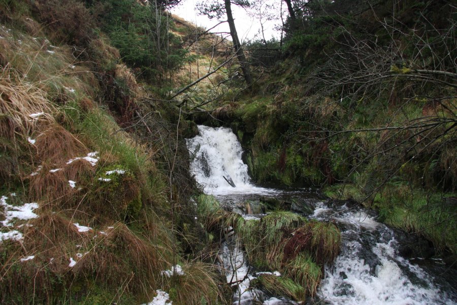 The start of the Nant Pigws-y-waun gully.
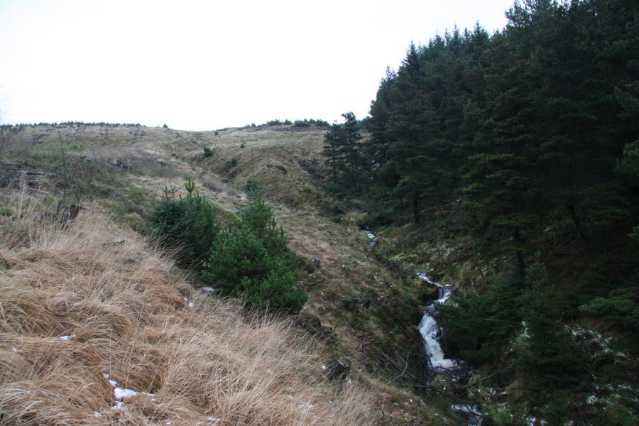 More of the horrendous terrain on the way up the gully - everywhere there are brambles and felled trees hiding under the grass, and every step runs the risk of sliding or tripping over the hidden slimy pine branches. It took far too long to get over this terrain, but there's no better option.
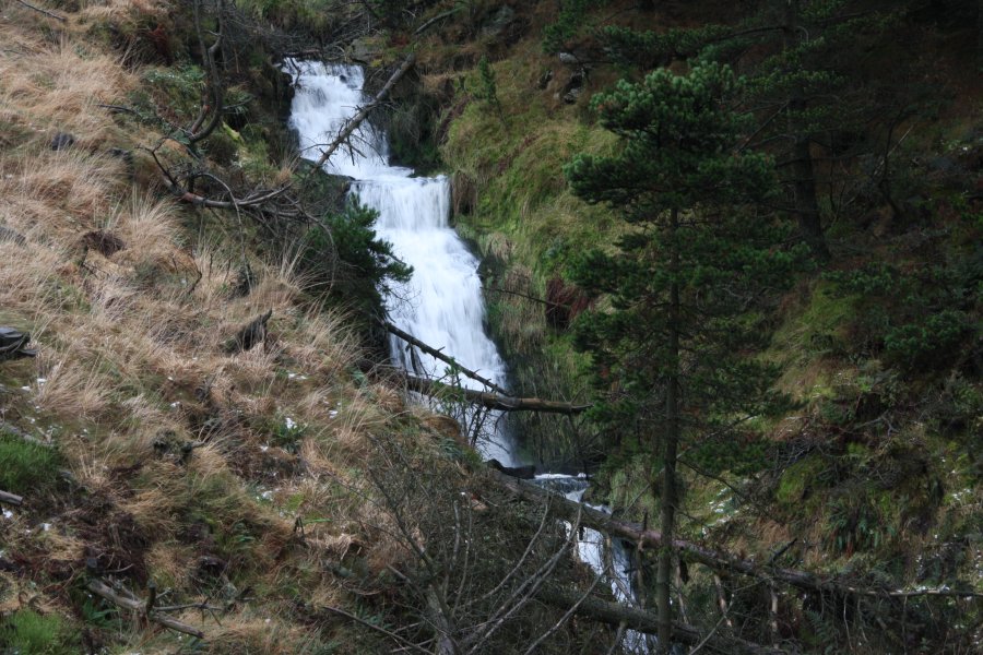 Nant Pigws-y-waun has several cascades, including this section that totals about 10 metres in height. None are marked on the maps.
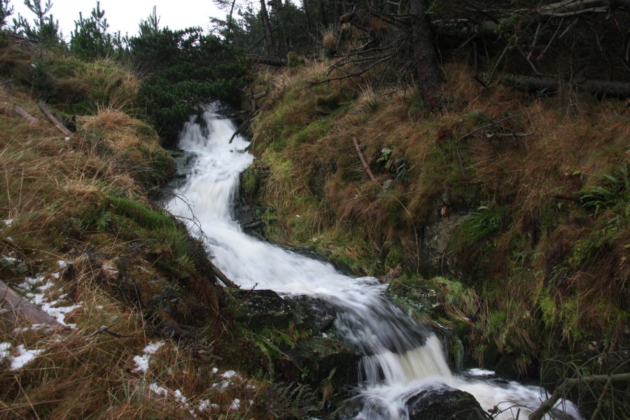 Cascades near the top. The stream now swings left, and I continued ahead to pick up the forestry track.
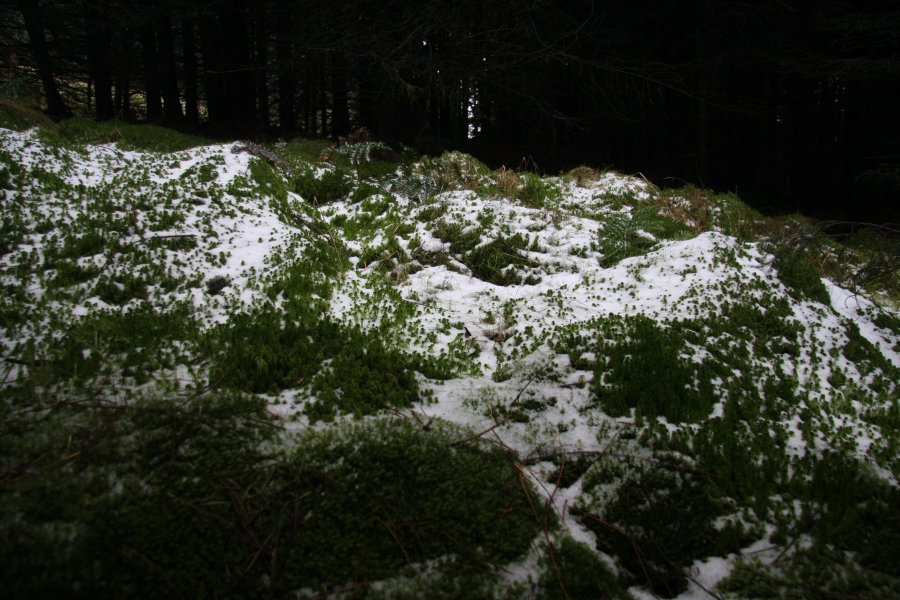 Beautiful light in a mossy clearing, dusted with snow and hail.
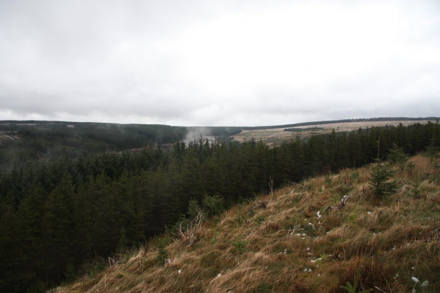 Looking back at the clouds in the head of Cwm Corrwg. On the left is Mynydd Pen-y-cae (573 metres) and on the right is the top of Craig y Llyn (600 metres), the highest point in Wales that is south of the Brecon Beacons National Park. Once at the track, I turned right, and followed it as it slowly rounded the next buttress.
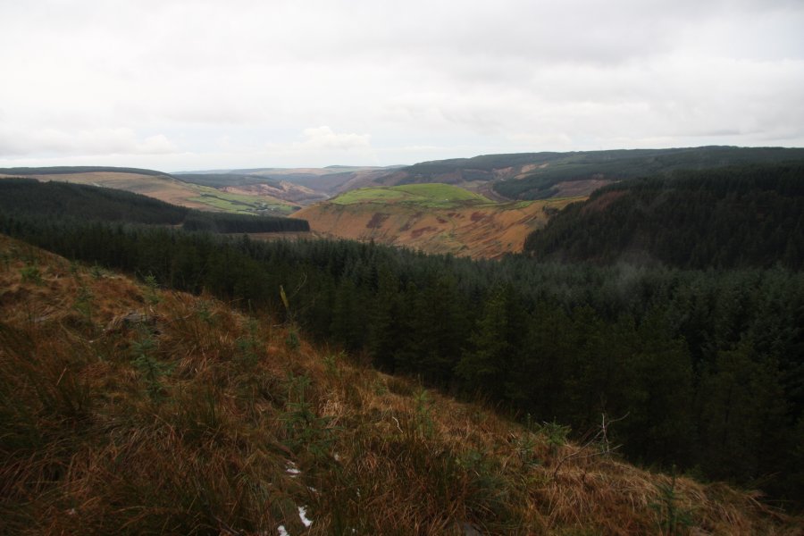 View towards the lower Cwm Corrwg, as it passes Mynydd Corrwg Fechan.
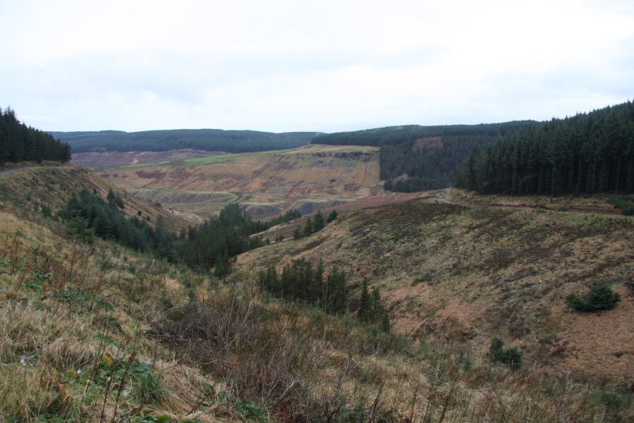 Looking down Nant Melyn, where the track crosses the stream, then begins its route around the next buttress. The easiest route here is to continue around the buttress to reach a cross roads on the far side, where the way on is to the right. I took a short-cut; when the stone wall crosses Nant Melyn, a steep stream gully on the left can be used to climb up to an upper track in the forest.
 Remains of habitation in the forest. The track is just after this, where I turned right.
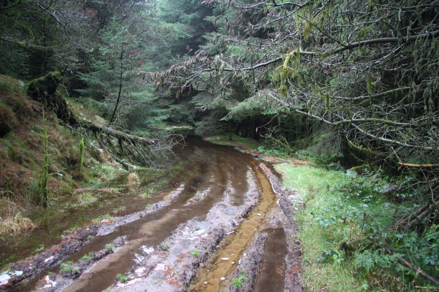 Hmm ... guess it's been raining around here then. When the track reached a crossroads at Nant Meliorath, I continued ahead along a better track, which zig-zagged towards Cwm Cas.
 Nant Cwm-cas appears at a very sharp zig-zag, and not too far downstream, it intersects a biking single track, as the valley opens up with a view towards Glyncorrwg, and the trees disappear. At last. The cyclist on the right was the first human I had seen all day.
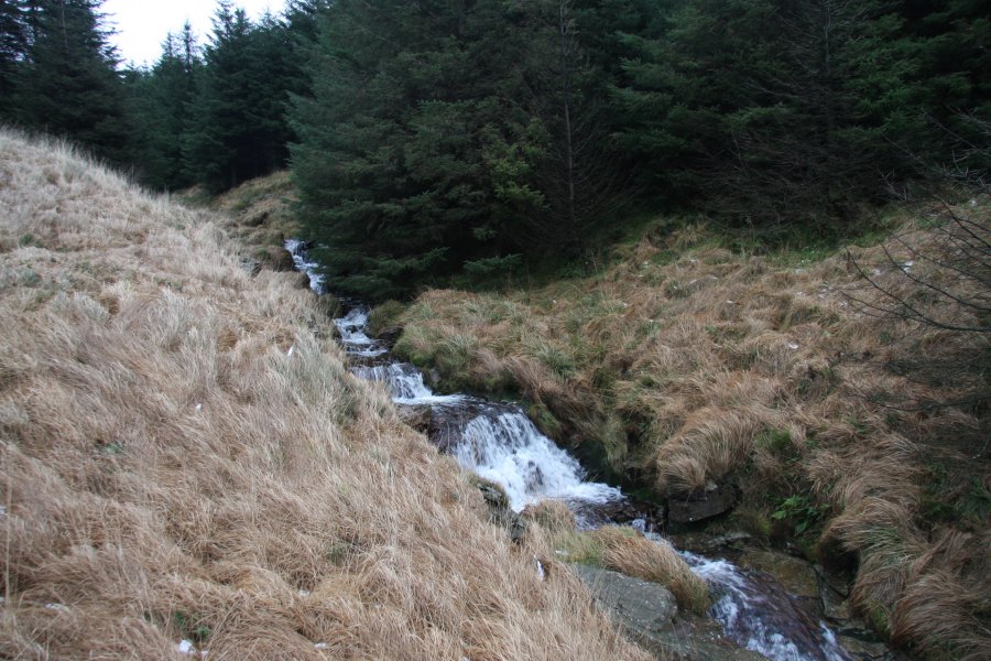 Cascades at the top of the valley.
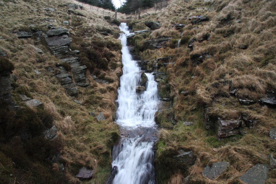 Just below the fence is the main Nant Cwm-cas waterfall, which drops around 10 metres in a series of cascades.
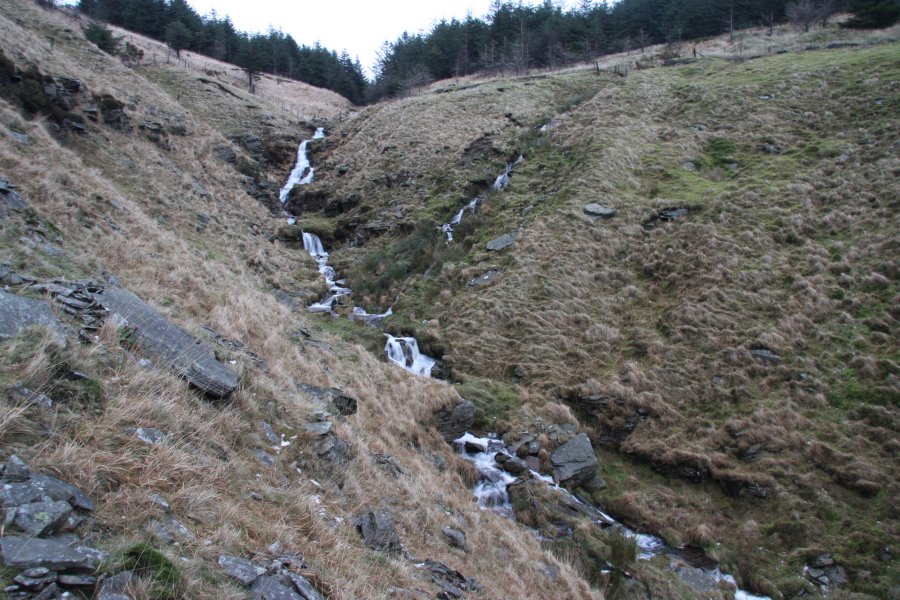 The stream continues with a few small cascades. The 1:10'000 map shows another waterfall downstream, but there is actually nothing there.
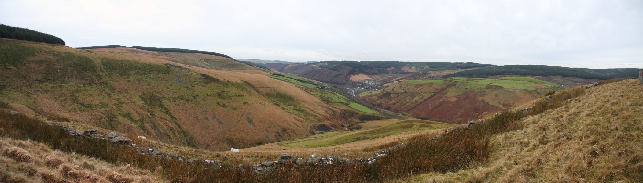 Panorama of the Glyncorrwg area.
 Returning to the single track, I followed it back to the last stream; Nant Meliorath.
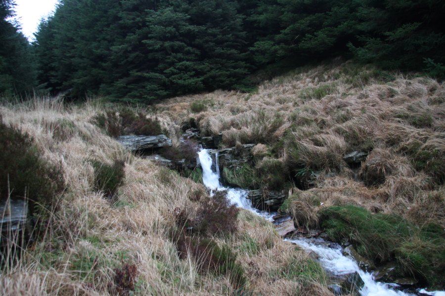 Once at the stream, I headed left, and followed it down some small cascades.
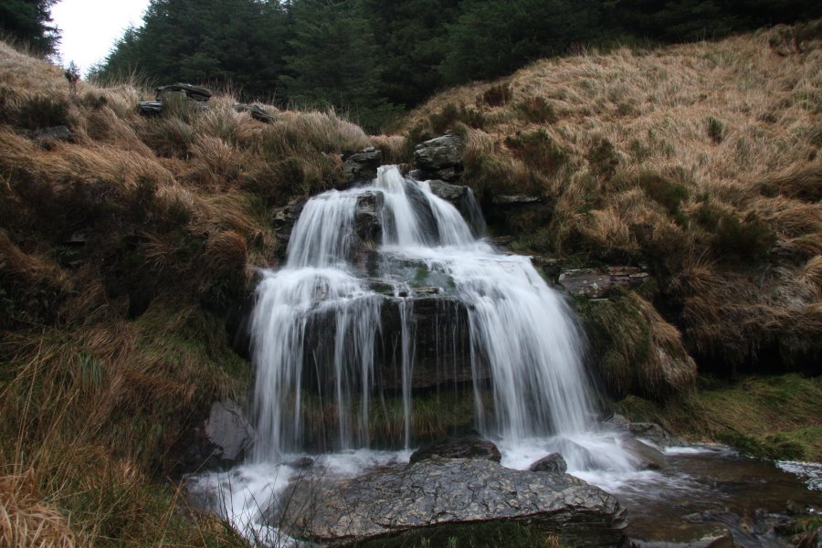 A 4 metre waterfall, marked only on the 1:10'000 map, proved to be the biggest on the stream.
 And yes, it turned out to be possible to crouch behind it. I needed the waterproofs to get there, but it would probably be a lot drier (and a lot more boring) in low flow.
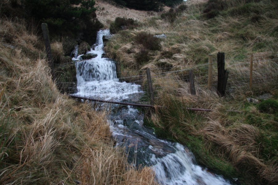 A further fence and some cascades.
 And some more cascades.
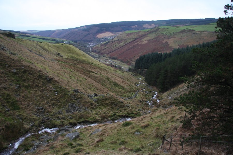 Lower Nant Meliorath. Remember that green bump on the left.
 A final few cascades. One of these actually makes it onto the 1:10'000 map, though I really fail to see why.
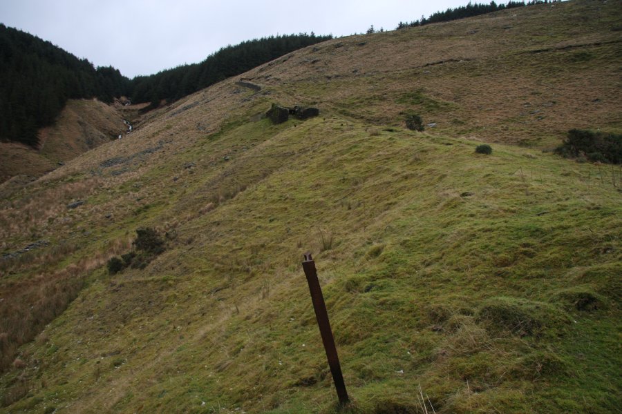 That green bump is part of an old tram road. Some rails, foundations, storage buildings, and a few other artifacts are still visible.
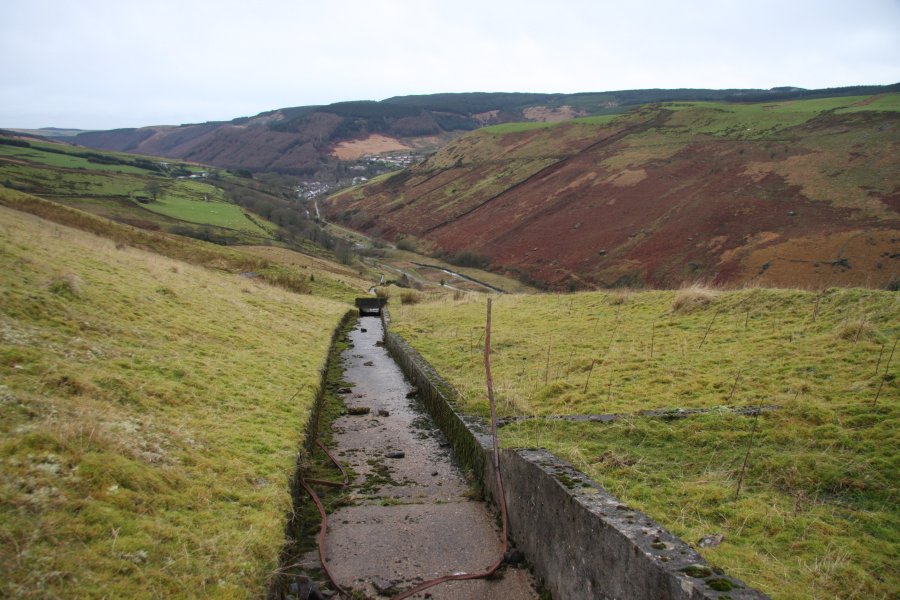 Drainage channel running down the old tramroad. I was unlucky enough here to witness a terrier attacking and most likely killing a sheep, attempting to eat it while it was still in the process of dying - urgh. (Initially, I mistook the curly-haired dog for a lamb trying to revive its mother, then realised of course that there are no lambs here in winter.) A further two sheep were dying nearby from their wounds. Though I was almost certainly too late to save the sheep, I photographed the attack as I chased the dog away, and luckily managed to find the farmer in the village and show him the evidence. However, it would be too morbid for me to post them online. Sorry weirdos. Still, at least the farmer will know exactly which dog to blame, instead of assuming they are all guilty.
 Craig Tyle-cam, on the side of Cwm Corrwg.
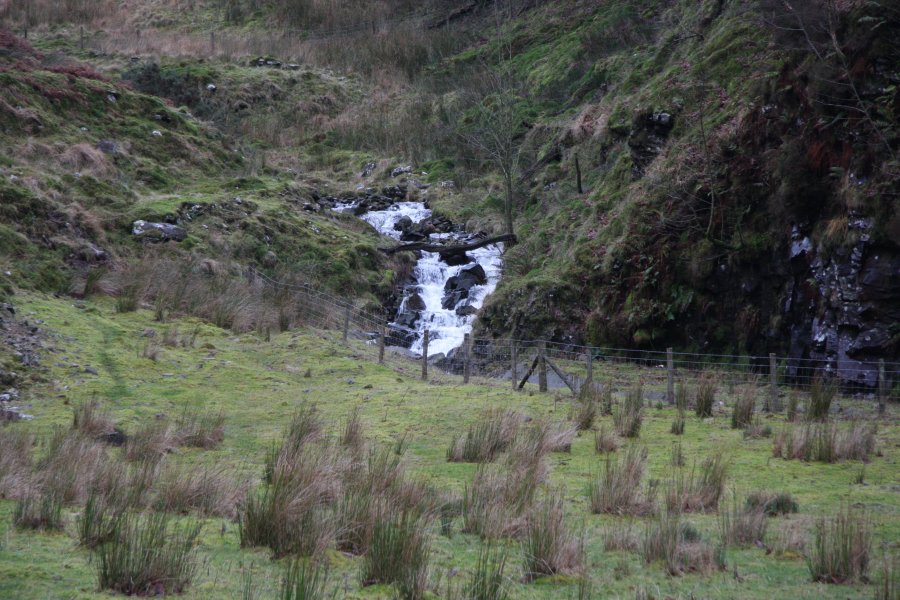 The base of Cwm Cas. There are some footpaths and a track here, separated by fences. I'm not sure of the best route back, but since there were two dying sheep at my feet as I took this picture, I was not in the mood to go exploring, and simply hopped a fence to get to the track, in order to find the farmer as quickly as possible. Staying on the left bank of the Afon Corrwg, the track leads directly into the village.
 At the edge of the village, the track crosses the Nant yr Allor, which is adorned with a series of waterfalls. They are only a little over 10 metres in total height, but are impressively powerful. Shortly afterwards, I located the farmer (the only person driving a proper old Landrover, of course), and was able to ease off the pace.
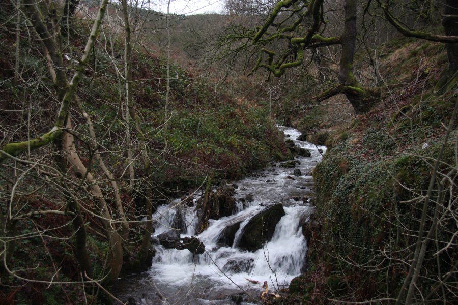 On the far side of the church, a small bridge crosses Nant Du, which has this small cascade upstream. Some further cascades can be seen high up the hillside upstream on the Nant Blaen-y-ty, but it had been a long day already, and they were deemed unworthy.
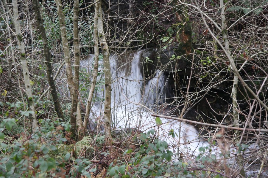 Just downstream of the bridge is a small waterfall, which can be seen from the nearby churchyard. It appears to have an undercut to the side, but this does not extend properly behind the waterfall, so it doesn't look possible to walk behind it. To be honest, I was so tired at this stage that I couldn't face hopping the wall to check it out. Maybe you can. I wanna go home!
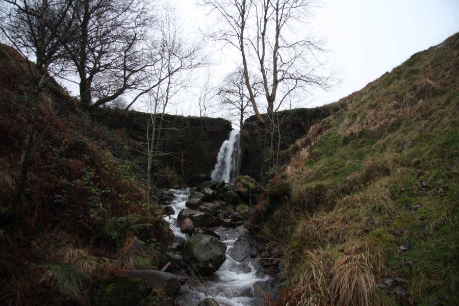 Very visible from the road near Duffryn in Cwm Afan, this 4 metre spout on the Nant Tryfal is actually a weir - admitedly a fairly natural-looking weir, but still just a weir. Pity.