Macgillycuddy's Reeks
The top of Ireland, at the bottom of Ireland.
Ireland is a lot like Wales, with mountains in many places, the tallest being a little over 1000 metres. It has a great coastline, and only a slightly higher amount of rain. It also has plenty of limestone and caves. (It even has a similar stone age and Celtic history, and British Empire takeover, but that's not relevant in this gallery, so ...) It does have more bogs and more lakes, but that's to be expected given its size. The main mountain difference is that the tallest are in the south instead of the north. This walk summits the tallest mountain; Carrauntoohil. At 1038 metres, it's slightly shorter than the top 4 tallest mountains in Wales, but has a very similar character. It's a significant climb that was far too much for the rest of the family, who went cycling instead.
When defining a mountain, the Nuttall approach (610 metres+ altitude, 15 metres+ prominence) most closely resembles the traditional British definition of mountain, represented in the now-more-common metric system. Note, however, that mountains in Ireland have not been catalogued under the Nuttall system, and instead details are only available for the Hewitt system (609.6 metres+ altitude, 30 metres+ prominence), though there is a site giving details of peaks, that seems to follow the Nuttall approach. Depending on which you use, Macgillycuddy's Reeks contains either the 8 tallest mountains (Nuttalls) or 7 tallest mountains (Hewitts) in Ireland, as well as the 10th-12th (Nuttalls), or 9th-10th (Hewitts) tallest.
I use the Nuttall approach for defining a mountain, but note that the Irish maps are of such poor quality that it is impossible to be sure about the mountain heights and prominence. Often they will invent contour lines that should not exist, or make incorrect guesses about features. Most features that you would expect to see on a mountain-area map (fences, lesser paths, marshes, etc.) are missing. The print quality is also bad enough that contours occasionally cannot be distinguished from the dots used to shade areas. In many cases, contours are not even labelled, so you cannot tell if you are looking at a peak or a depression (such as a shakehole or turlough).
 The main part of the Macgillycuddy's Reeks range. On the left are the Purple Mountains (topping out at Purple Mountain, 832 metres). In the clouds on the right are all the tallest peaks, including the only three mountains in Ireland to make it over 1000 metres. In between are the smaller major peaks in the range, each of which is over 900 metres. These are separated from the Purple Mountains by the Gap of Dunloe, an impressive 600-700 metre deep valley.
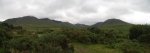 Starting up the large glacial valley of Hags Glen, with the the tallest peaks on the right, and the smaller major peaks on the left. The only visible summit in the middle is Cnoc na Toinne (845 metres), and earns neither a spot height nor a name on the map. Other mountains will be covered when their tops become visible.
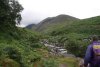 Ford in the Gaddagh River, running in the glen. In high flow, it can be much harder to cross, but even after several days of rain it was low enough. Incidentally, the other walker is Jim Bailey, a lone Scotsman who I bumped into in the car park, and who would provide good company while showing a much more interesting route up the mountain.
 Outflow channel cut through the glacial debris in the bottom of the valley.
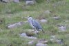 Heron. About the only large wild birds we saw in Ireland, which is almost completely devoid of birds of prey.
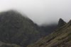 Our route leaves the main path at the Hags Teeth (the jagged spike on the right), and climbs up into a multi-tiered hanging valley called the Eagle's Nest. The final slope up can be seen as the green patch in the middle of this picture. As with most well established paths, it is not shown on the (useless) map.
 Hags Teeth.
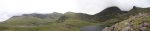 The corrie lakes of Lough Callee and Lough Gouragh at the head of the valley. The normal path passes between the lakes, and up to the lowest pass. More on that later. Our path heads up to the left of the Hags Teeth. The mountains will eventually show their tops, but as was said; a partially clothed woman is much more exciting than one who is completely naked. All in good time, have patience, and enjoy the tease.
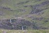 Waterfalls feeding Lough Callee.
 Waterfalls draining the Eagle's Nest.
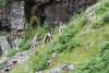 Wild mountain goats.
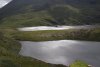 Light on the lakes. Note the small island. Being one of the few places the goats cannot reach, it is covered in lush vegitation.
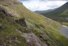 Our path, which for now clings to the cliff edge above Lough Gouragh. It requires a couple of scrambles, but they're fairly easy.
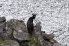 Nanny (I think) mountain goat.
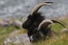 And her two male escorts. I wonder if such a phrase will get me strange search engine blocking ... if it helps, I was talking about billy mountain goats. One of the local towns holds an annual Puck Fair where they capture one of these, and parade it around in a cage as the Puck Goat. Poor animal. Strange people.
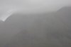 A brief shower of heavy rain sweeping quickly over the mountains.
 Bottom tier of the Eagle's Nest, and waterfalls leading to the next tier. The path scrambles up to the left of the stream. The Hags Teeth are made up from that impressively jagged ridge on the right.
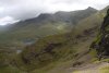 View back from the waterfalls, with the Heaven's Gate path beginning down on the right - it clings to the cliff edge to reach the main path a little above the top of the pass. Now, as for that ridge of mountains, it looks like one has finally appeared. The rest will follow. Have patience. On the far left is the 735 metre peak of Tomies Mountain in the Purple Mountains.
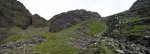 Above the second tier is another set of waterfalls leading up to the next tier.
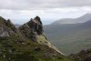 Top of the Hags Teeth.
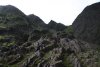 Twisted and folded rock beds.
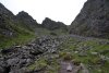 Upper scree slope leading to the high pass on the right. Carrauntoohil's peak is on the left. For scale (not that it will help), one of the grey dots at the top of the scree, at the base of the spike in the middle, is another walker. It's about 200 metres of climb to the pass.
 The Eagle's Nest corrie lake, with Beenkeragh behind it. Beenkeragh is the second tallest mountain in Ireland at 1010 metres.
 Light on the last of the Hag.
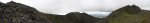 View from the high pass. On the left is Carrauntoohil (1038 metres), tallest in Ireland. In the middle of the picture are Caher's three summits. The middle one is the main one at 1001 metres, third tallest in Ireland. The spike summit on the right is a 975 metre mountain (using the Nuttall approach) called Caher West Top, which fails to be a Hewitt, making it the fifth tallest mountain in Ireland. The small rise on the left is not a mountain in either scale. On the right of the picture is Knockoughter (959 metres), which is the seventh tallest mountain and sixth tallest Hewitt in Ireland.
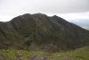 Caher's superb north face, dropping 530 metres to the lakes below.
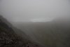 Then just as it looked like we might get to see the summit properly ...
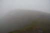 Summit path.
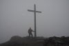 Cross on Carrauntoohil's summit. The maps seem unable to decide on a height. Some show 1040 metres, others show 1038 metres. Most reliable references use 1038. The map makers probably forgot to subtract the height from their feet to their eyes. Irish maps suck. Did I say that already?
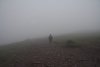 Descending the scree path. This is the route most people use to ascend the mountain from the low pass; Christ's Saddle. The multiple cairns are there to try to stop tourists killing themselves by falling down the face in conditions like this. In fact, the Killarney local guide book warns visitors "do not move until the bad weather has cleared". I wonder if that causes more rescues than it prevents, given that it can remain covered in cloud for a week or more.
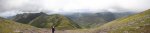 Incredible view over the Christ's Saddle pass. All of the smaller major peaks have now become visible. Tomies Mountain is the small spike in the distance on the left, then (height, Mountain rank, Hewitt rank); Cruach Mhór (932 metres, 11th, 10th), The Big Gun (939 metres, 10th, 9th), Knocknapeasta (988 metres, 4th, 4th), Maolán Buí (973 metres, 6th, 5th), slight bump of Cnoc an Chuillinn East Top (926 metres, 12th, n/a), Cnoc an Chuillinn (958 metres, 8th, 7th). After that is the wide Cnoc na Toinne (which the map incorrectly shows as about 830 metres) above the pass, then the spreading mass of mountains that continue in the range. More on them later.
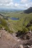 Looking down from Christ's Saddle. This is the top of the Devil's Ladder, a badly eroded and dangerous path that is used by almost all normal visitors. 10 years ago, this had apparently been grassed over, and not entrenched. I suppose I should now mention the problem with Irish countryside; there are no public rights of way, no public land, no access rights and no official footpaths. The land belongs to somebody, and they have final say in whether you are allowed there. While the local landowners do not seem to object to people climbing the tallest mountain in Ireland, they refuse to give permission for a proper path to be constructed. I am all in favour of infrequented wild paths, but when an eroded path is used so regularly that it poses a danger to everyone who uses it, it should be maintained properly.
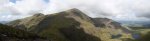 Superb view of the sunlight playing on Caher and Carrauntoohil, whose summit has finally become visible (the small wind shelter and cross can just be seen on the top). The drop to the lakes is about 700 metres. The mountain above the Hags Teeth is Knockbrinnea (854 metres). It is listed as the thirteenth tallest Hewitt, but actually fails to attain enough prominence to deserve it. It is, however, the sixteenth tallest mountain in Ireland.
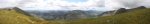 The rest of the Iveragh Peninsula mountains, viewed over the Black Valley, so named due to the mountains blocking its sunlight for most of the year. Though none of the mountains reaches 800 metres, the view is quite spectacular, with mountains stretching off into the distance like the Scottish Highlands. The obvious mountain in front of the camera is Broaghnabinnia (745 metres), with the tallest being the 784 metre Stumpa Duloigh just behind it. On the left and right are the edges of the main Macgillycuddy's Reeks range. In the far distance, the Caha Mountains can also be seen, of which the tallest is Hungry Hill at 685 metres.
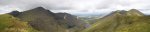 View over Hags Glen. With Beenkeragh now peering around Carrauntoohil, and only Knockoughter, The Big Gun and Cnoc an Chuillinn East Top being hidden, 8 of the 11 tallest mountains in Ireland can be seen in this one picture. You may also be able to see a small rectangular block on the summit of Cruach Mhór, which is actually a large shrine painstakingly built there.
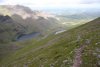 Top of the Zig Zags path down Cnoc na Toinne, which is becoming a popular way to avoid using the Devil's Ladder.
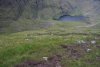 Sadly, it is now also suffering from lack of maintenance, and is turning into slippery bog mud. And it's a long way down there; at least 300 metres before it begins to level out.
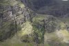 Sunlight playing on Carrantoohil's east face.
 And on the ribs of rock formed from exposed beds at its base.
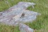 A female stonechat. I think.
 At the base of the Zig Zags is a patch of bog, barely visible as a path, identified by an arrow of stones. Wonder how long that will remain.
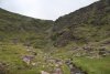 The main Devil's Ladder climb. It's really not much of a difficult climb. A bit of a boring slog perhaps, but not all that steep. Not that you'll see them, but there are at least four people in this picture on that 250 metre climb. We even met some starting out at 15:00 to do the 6 hour walk to the top and back in their luminous plimsolls. Perhaps they will use those to light up the path when it gets dark.
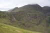 What makes it so dangerous is the volume of (often inexperienced) visitors who are badly eroding the path, freeing large numbers of rocks, and sending them hurtling down on others. Several injuries have occurred due to this. The once-ordinary coll also contains a small stream that helps wash away the disturbed mud, making the rocks even more likely to fall.
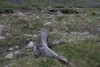 Tree stumps standing proud from the peat bog which burried them 8000 years ago.
 Such bog wood is stained rich reds and browns by the chemicals in the bog, but otherwise preserved by the acidic conditions. The preservation is truly impressive, given that these trees died before even the first stone age settlers arrived in Ireland.
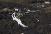 Ghosts of forest past.
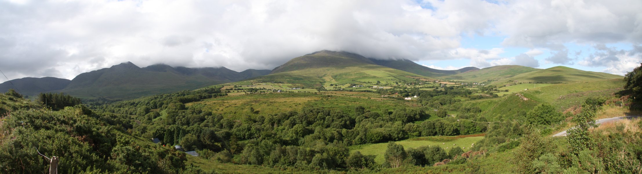 The main part of the Macgillycuddy's Reeks range. On the left are the Purple Mountains (topping out at Purple Mountain, 832 metres). In the clouds on the right are all the tallest peaks, including the only three mountains in Ireland to make it over 1000 metres. In between are the smaller major peaks in the range, each of which is over 900 metres. These are separated from the Purple Mountains by the Gap of Dunloe, an impressive 600-700 metre deep valley.
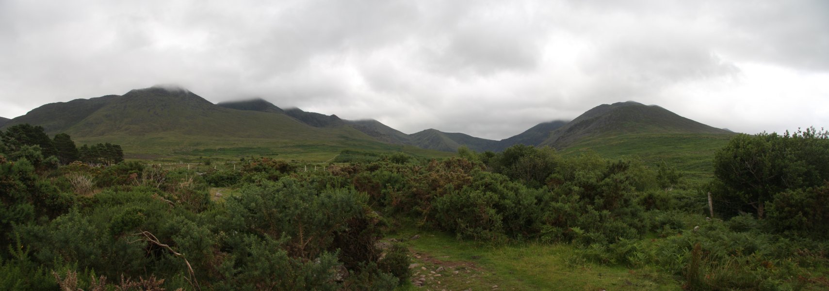 Starting up the large glacial valley of Hags Glen, with the the tallest peaks on the right, and the smaller major peaks on the left. The only visible summit in the middle is Cnoc na Toinne (845 metres), and earns neither a spot height nor a name on the map. Other mountains will be covered when their tops become visible.
 Ford in the Gaddagh River, running in the glen. In high flow, it can be much harder to cross, but even after several days of rain it was low enough. Incidentally, the other walker is Jim Bailey, a lone Scotsman who I bumped into in the car park, and who would provide good company while showing a much more interesting route up the mountain.
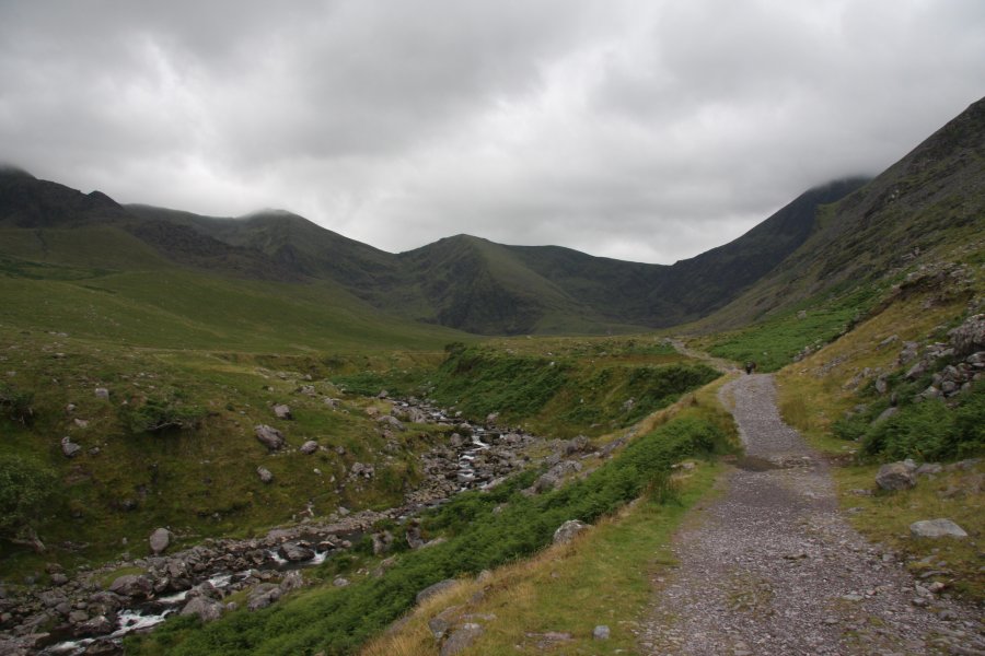 Outflow channel cut through the glacial debris in the bottom of the valley.
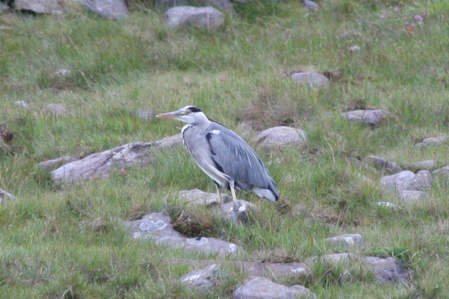 Heron. About the only large wild birds we saw in Ireland, which is almost completely devoid of birds of prey.
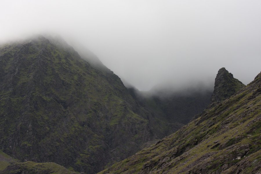 Our route leaves the main path at the Hags Teeth (the jagged spike on the right), and climbs up into a multi-tiered hanging valley called the Eagle's Nest. The final slope up can be seen as the green patch in the middle of this picture. As with most well established paths, it is not shown on the (useless) map.
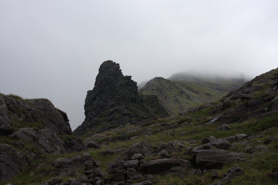 Hags Teeth.
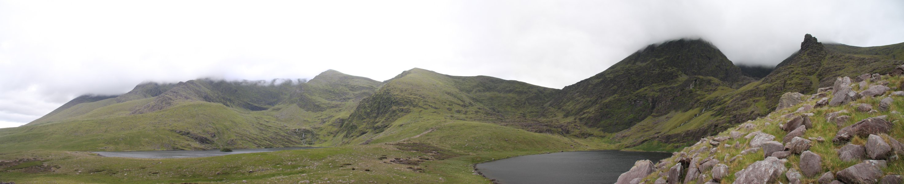 The corrie lakes of Lough Callee and Lough Gouragh at the head of the valley. The normal path passes between the lakes, and up to the lowest pass. More on that later. Our path heads up to the left of the Hags Teeth. The mountains will eventually show their tops, but as was said; a partially clothed woman is much more exciting than one who is completely naked. All in good time, have patience, and enjoy the tease.
 Waterfalls feeding Lough Callee.
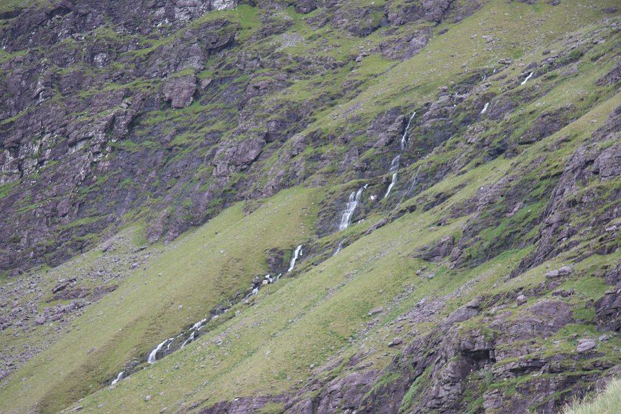 Waterfalls draining the Eagle's Nest.
 Wild mountain goats.
 Light on the lakes. Note the small island. Being one of the few places the goats cannot reach, it is covered in lush vegitation.
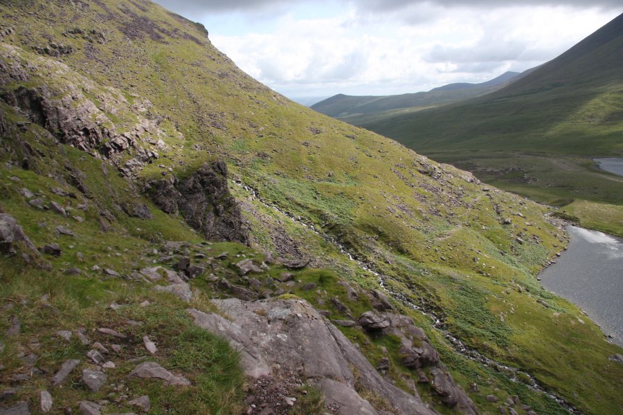 Our path, which for now clings to the cliff edge above Lough Gouragh. It requires a couple of scrambles, but they're fairly easy.
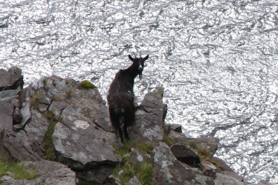 Nanny (I think) mountain goat.
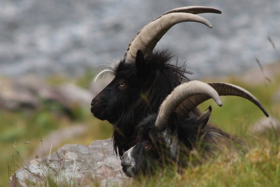 And her two male escorts. I wonder if such a phrase will get me strange search engine blocking ... if it helps, I was talking about billy mountain goats. One of the local towns holds an annual Puck Fair where they capture one of these, and parade it around in a cage as the Puck Goat. Poor animal. Strange people.
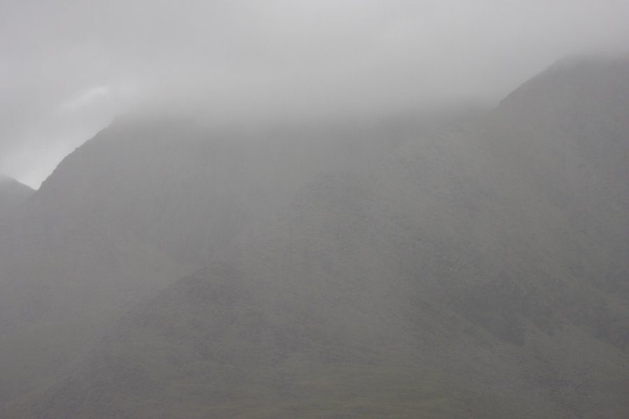 A brief shower of heavy rain sweeping quickly over the mountains.
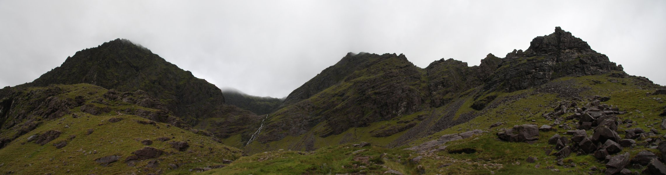 Bottom tier of the Eagle's Nest, and waterfalls leading to the next tier. The path scrambles up to the left of the stream. The Hags Teeth are made up from that impressively jagged ridge on the right.
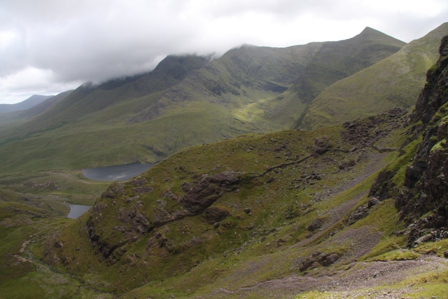 View back from the waterfalls, with the Heaven's Gate path beginning down on the right - it clings to the cliff edge to reach the main path a little above the top of the pass. Now, as for that ridge of mountains, it looks like one has finally appeared. The rest will follow. Have patience. On the far left is the 735 metre peak of Tomies Mountain in the Purple Mountains.
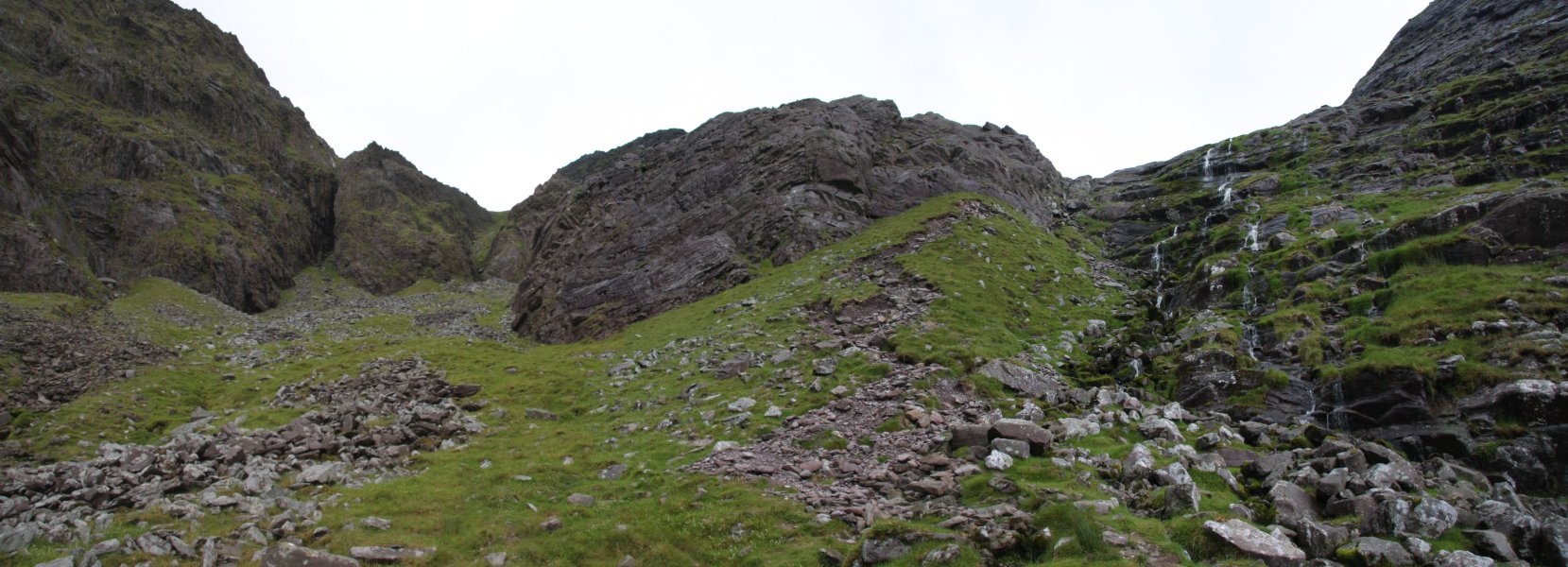 Above the second tier is another set of waterfalls leading up to the next tier.
 Top of the Hags Teeth.
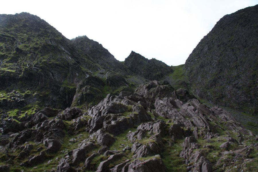 Twisted and folded rock beds.
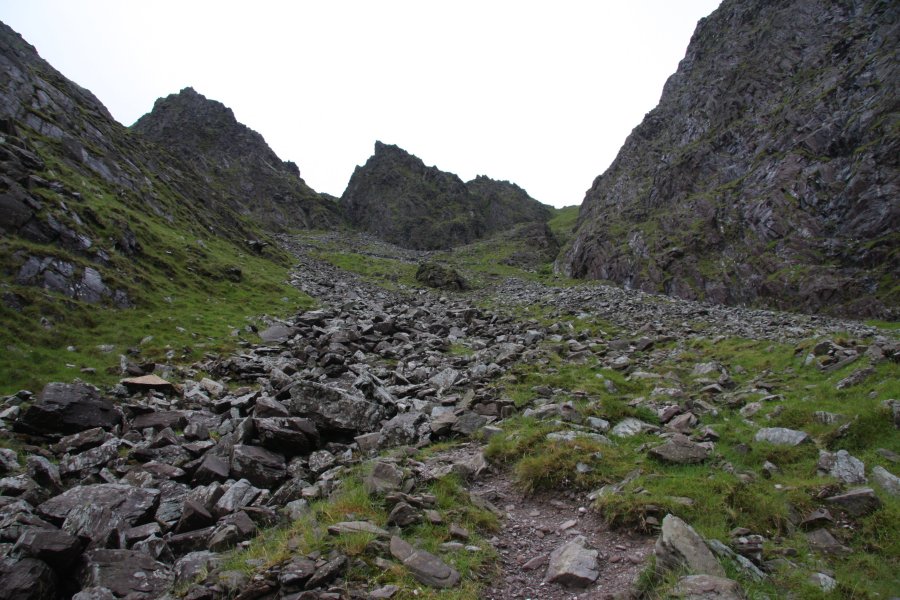 Upper scree slope leading to the high pass on the right. Carrauntoohil's peak is on the left. For scale (not that it will help), one of the grey dots at the top of the scree, at the base of the spike in the middle, is another walker. It's about 200 metres of climb to the pass.
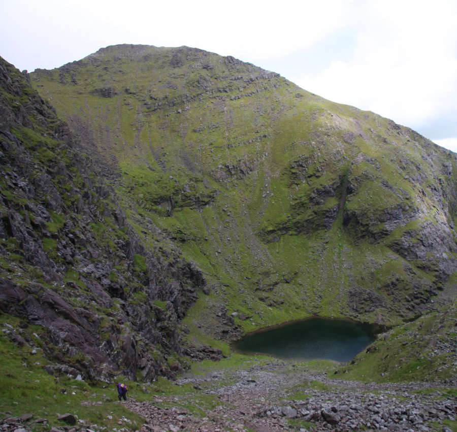 The Eagle's Nest corrie lake, with Beenkeragh behind it. Beenkeragh is the second tallest mountain in Ireland at 1010 metres.
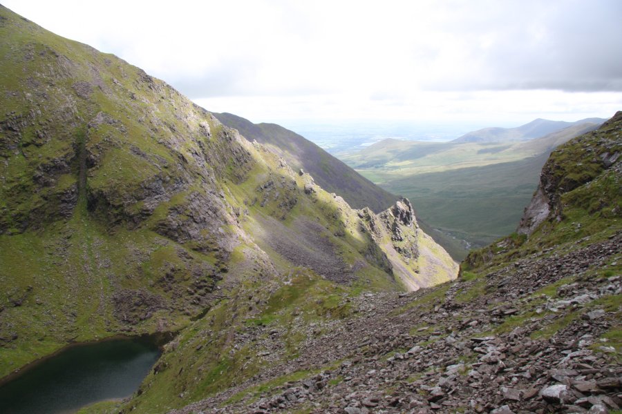 Light on the last of the Hag.
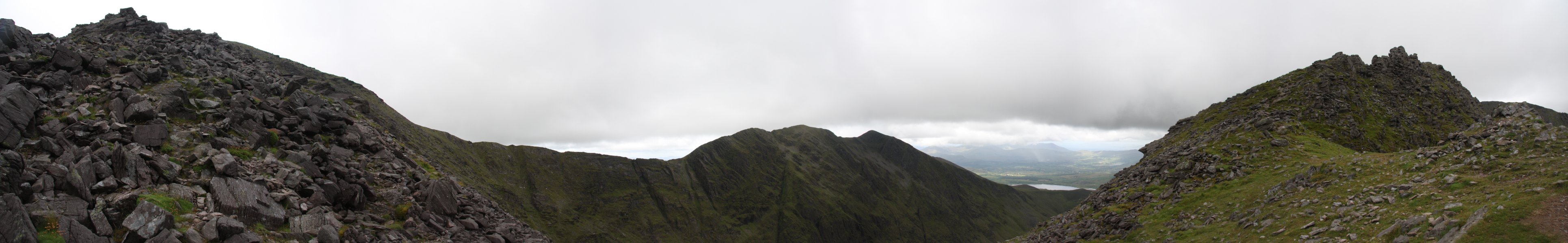 View from the high pass. On the left is Carrauntoohil (1038 metres), tallest in Ireland. In the middle of the picture are Caher's three summits. The middle one is the main one at 1001 metres, third tallest in Ireland. The spike summit on the right is a 975 metre mountain (using the Nuttall approach) called Caher West Top, which fails to be a Hewitt, making it the fifth tallest mountain in Ireland. The small rise on the left is not a mountain in either scale. On the right of the picture is Knockoughter (959 metres), which is the seventh tallest mountain and sixth tallest Hewitt in Ireland.
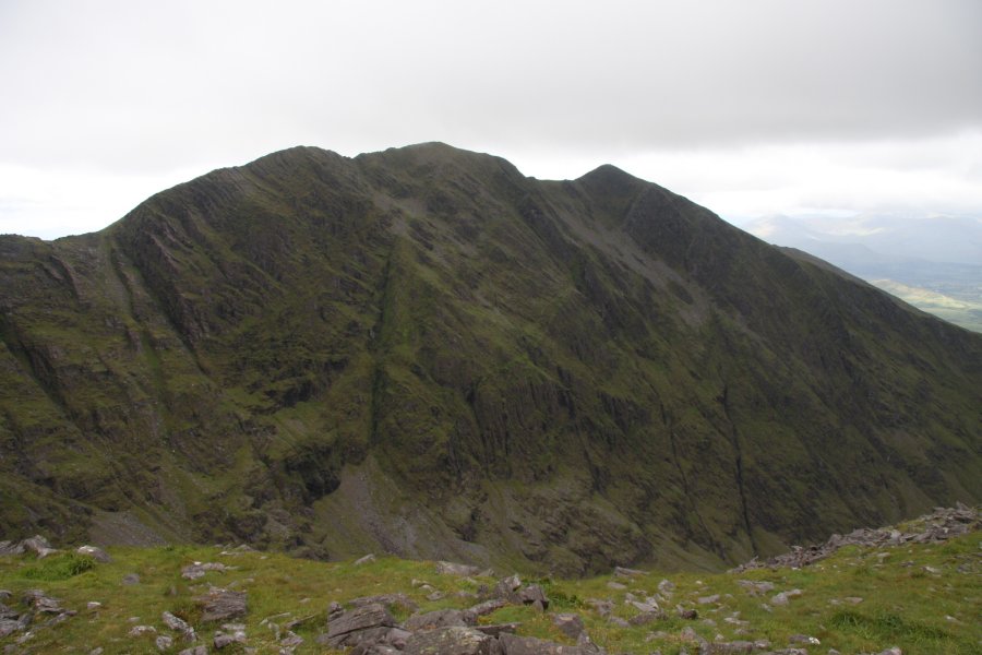 Caher's superb north face, dropping 530 metres to the lakes below.
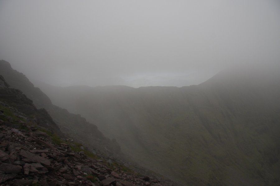 Then just as it looked like we might get to see the summit properly ...
 Summit path.
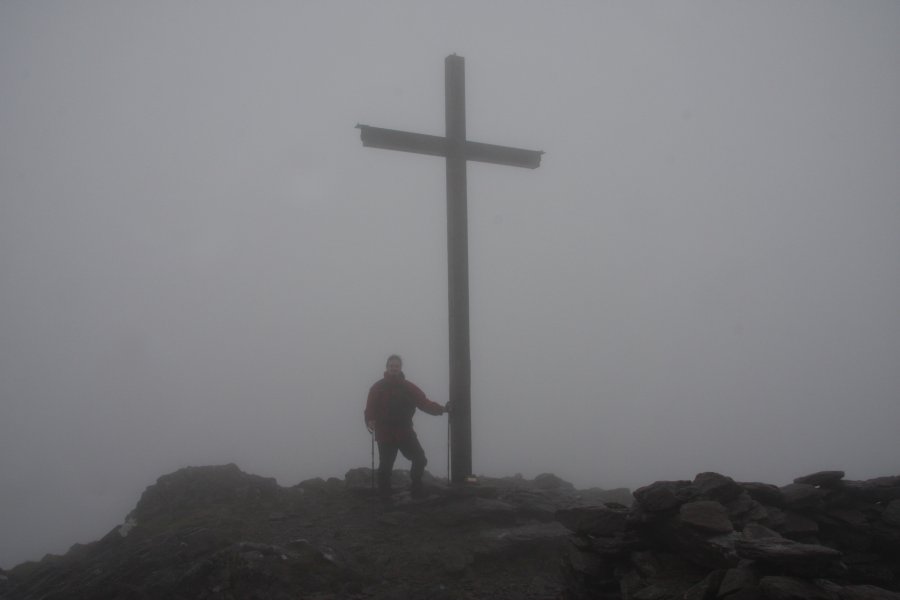 Cross on Carrauntoohil's summit. The maps seem unable to decide on a height. Some show 1040 metres, others show 1038 metres. Most reliable references use 1038. The map makers probably forgot to subtract the height from their feet to their eyes. Irish maps suck. Did I say that already?
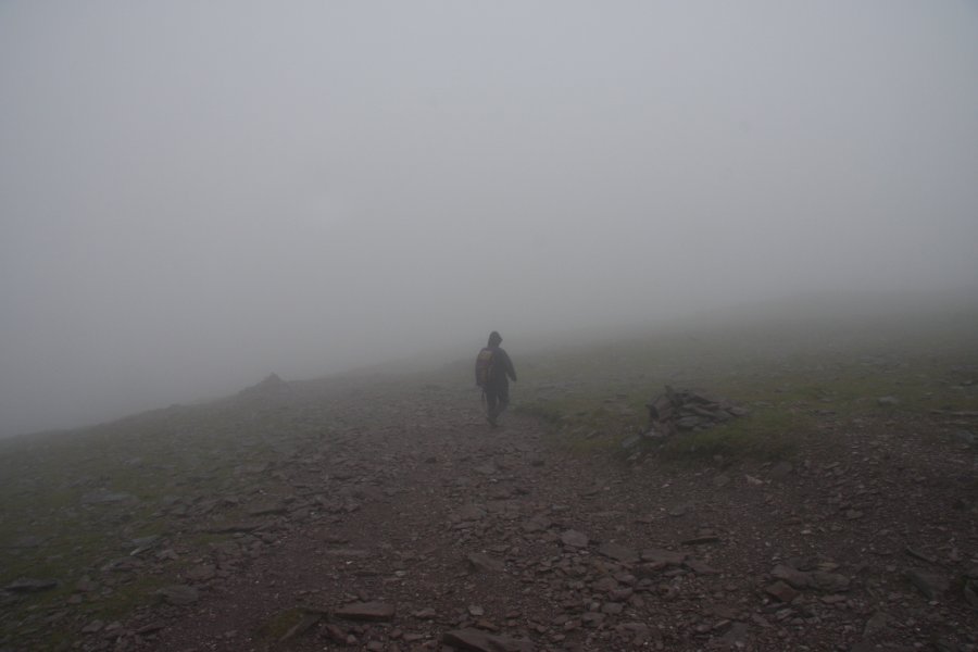 Descending the scree path. This is the route most people use to ascend the mountain from the low pass; Christ's Saddle. The multiple cairns are there to try to stop tourists killing themselves by falling down the face in conditions like this. In fact, the Killarney local guide book warns visitors "do not move until the bad weather has cleared". I wonder if that causes more rescues than it prevents, given that it can remain covered in cloud for a week or more.
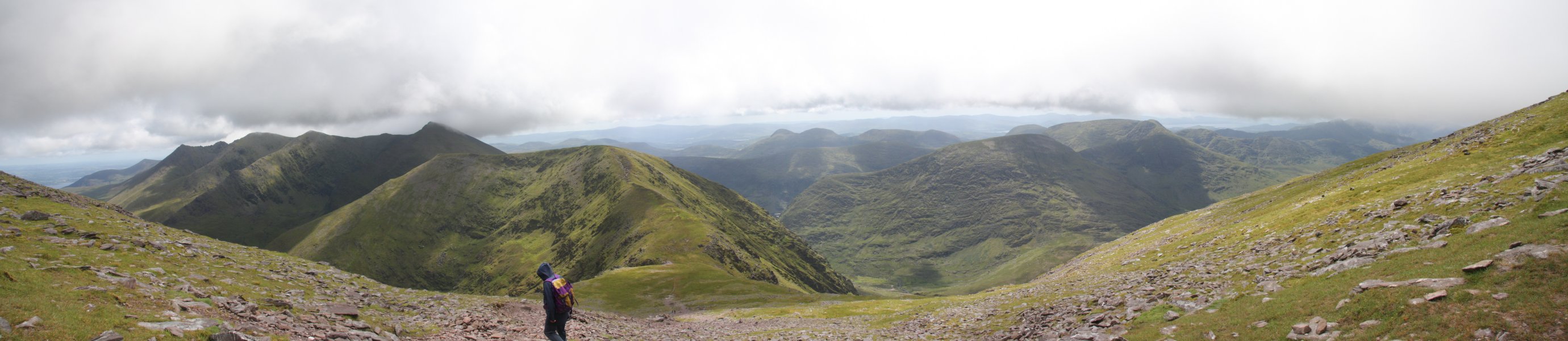 Incredible view over the Christ's Saddle pass. All of the smaller major peaks have now become visible. Tomies Mountain is the small spike in the distance on the left, then (height, Mountain rank, Hewitt rank); Cruach Mhór (932 metres, 11th, 10th), The Big Gun (939 metres, 10th, 9th), Knocknapeasta (988 metres, 4th, 4th), Maolán Buí (973 metres, 6th, 5th), slight bump of Cnoc an Chuillinn East Top (926 metres, 12th, n/a), Cnoc an Chuillinn (958 metres, 8th, 7th). After that is the wide Cnoc na Toinne (which the map incorrectly shows as about 830 metres) above the pass, then the spreading mass of mountains that continue in the range. More on them later.
 Looking down from Christ's Saddle. This is the top of the Devil's Ladder, a badly eroded and dangerous path that is used by almost all normal visitors. 10 years ago, this had apparently been grassed over, and not entrenched. I suppose I should now mention the problem with Irish countryside; there are no public rights of way, no public land, no access rights and no official footpaths. The land belongs to somebody, and they have final say in whether you are allowed there. While the local landowners do not seem to object to people climbing the tallest mountain in Ireland, they refuse to give permission for a proper path to be constructed. I am all in favour of infrequented wild paths, but when an eroded path is used so regularly that it poses a danger to everyone who uses it, it should be maintained properly.
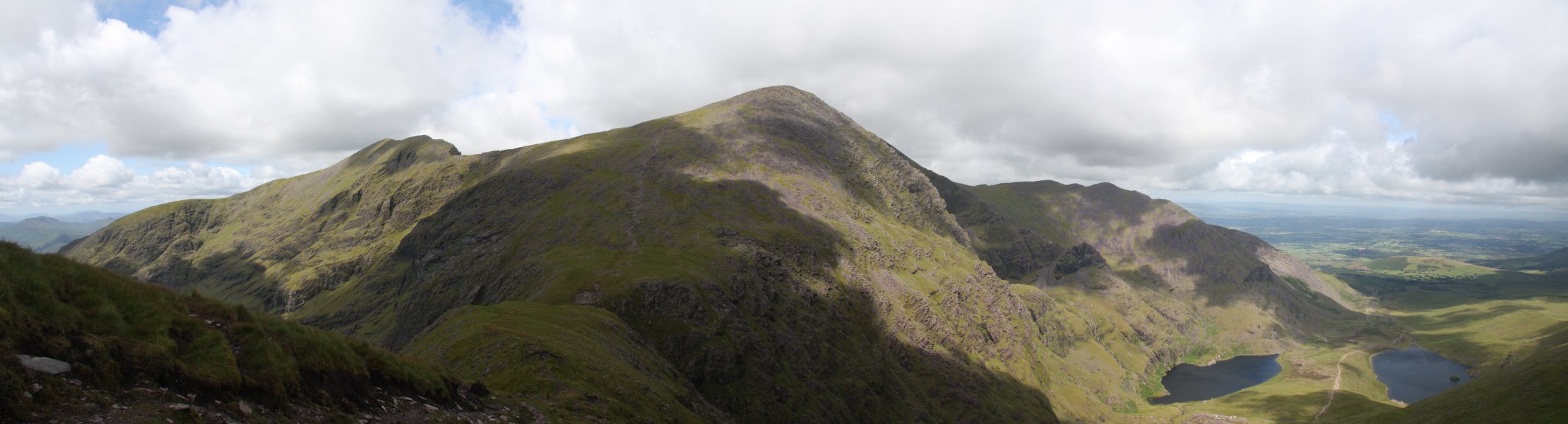 Superb view of the sunlight playing on Caher and Carrauntoohil, whose summit has finally become visible (the small wind shelter and cross can just be seen on the top). The drop to the lakes is about 700 metres. The mountain above the Hags Teeth is Knockbrinnea (854 metres). It is listed as the thirteenth tallest Hewitt, but actually fails to attain enough prominence to deserve it. It is, however, the sixteenth tallest mountain in Ireland.
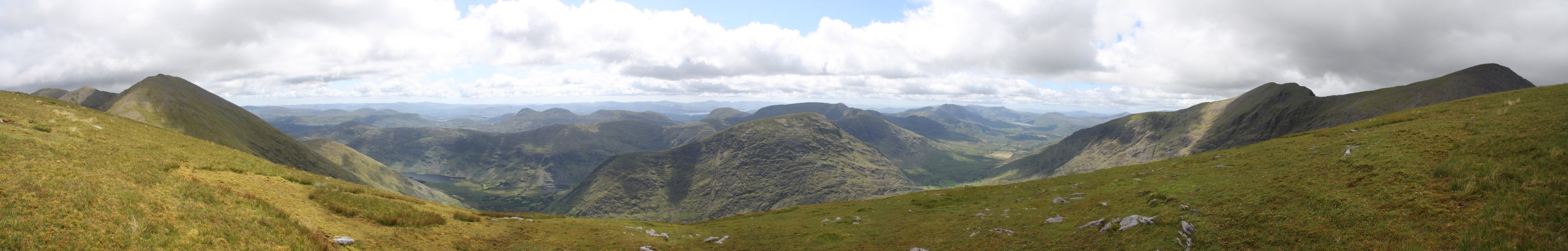 The rest of the Iveragh Peninsula mountains, viewed over the Black Valley, so named due to the mountains blocking its sunlight for most of the year. Though none of the mountains reaches 800 metres, the view is quite spectacular, with mountains stretching off into the distance like the Scottish Highlands. The obvious mountain in front of the camera is Broaghnabinnia (745 metres), with the tallest being the 784 metre Stumpa Duloigh just behind it. On the left and right are the edges of the main Macgillycuddy's Reeks range. In the far distance, the Caha Mountains can also be seen, of which the tallest is Hungry Hill at 685 metres.
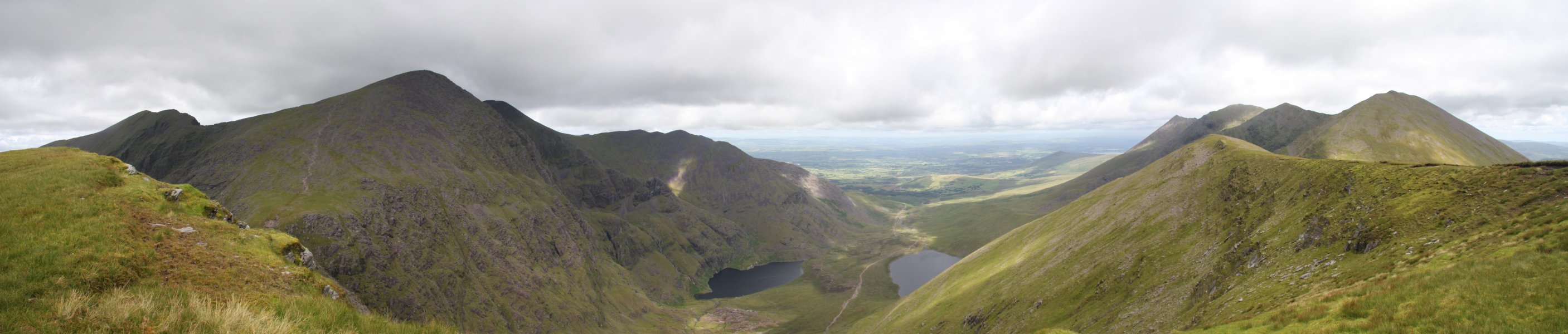 View over Hags Glen. With Beenkeragh now peering around Carrauntoohil, and only Knockoughter, The Big Gun and Cnoc an Chuillinn East Top being hidden, 8 of the 11 tallest mountains in Ireland can be seen in this one picture. You may also be able to see a small rectangular block on the summit of Cruach Mhór, which is actually a large shrine painstakingly built there.
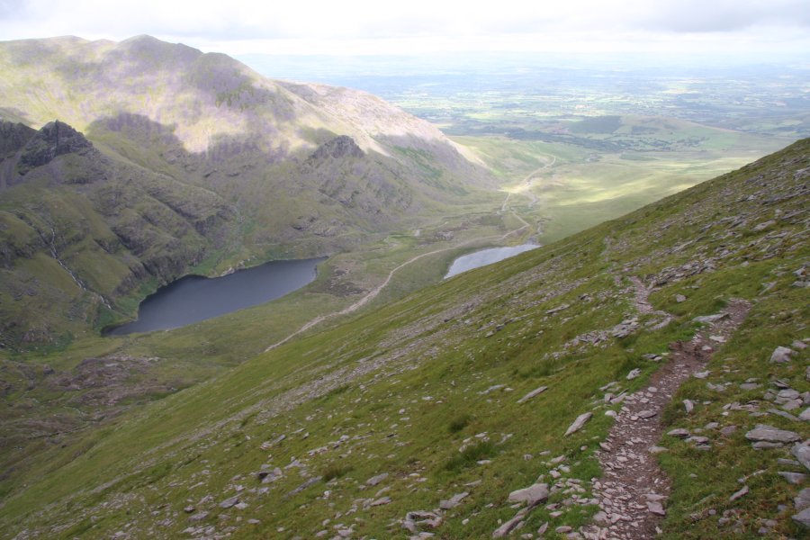 Top of the Zig Zags path down Cnoc na Toinne, which is becoming a popular way to avoid using the Devil's Ladder.
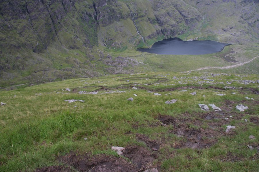 Sadly, it is now also suffering from lack of maintenance, and is turning into slippery bog mud. And it's a long way down there; at least 300 metres before it begins to level out.
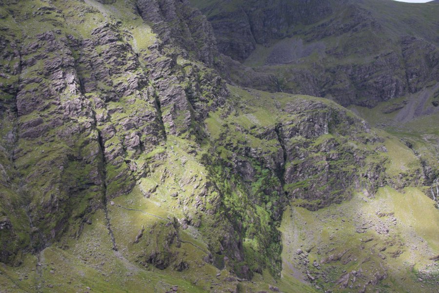 Sunlight playing on Carrantoohil's east face.
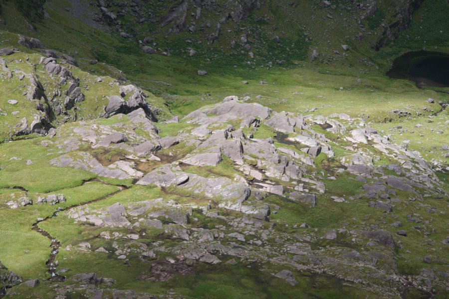 And on the ribs of rock formed from exposed beds at its base.
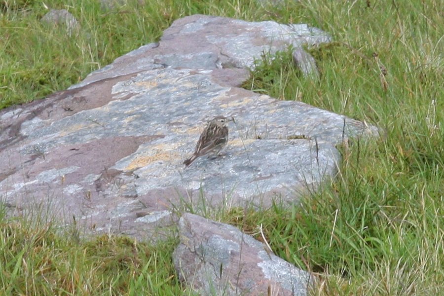 A female stonechat. I think.
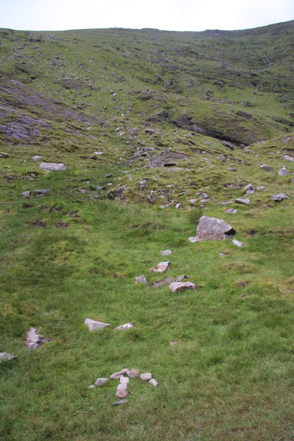 At the base of the Zig Zags is a patch of bog, barely visible as a path, identified by an arrow of stones. Wonder how long that will remain.
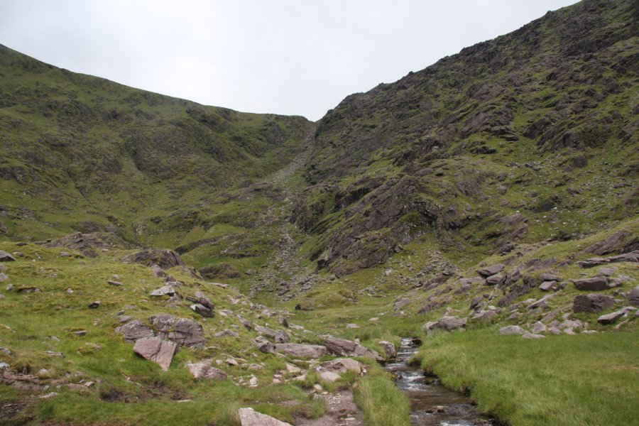 The main Devil's Ladder climb. It's really not much of a difficult climb. A bit of a boring slog perhaps, but not all that steep. Not that you'll see them, but there are at least four people in this picture on that 250 metre climb. We even met some starting out at 15:00 to do the 6 hour walk to the top and back in their luminous plimsolls. Perhaps they will use those to light up the path when it gets dark.
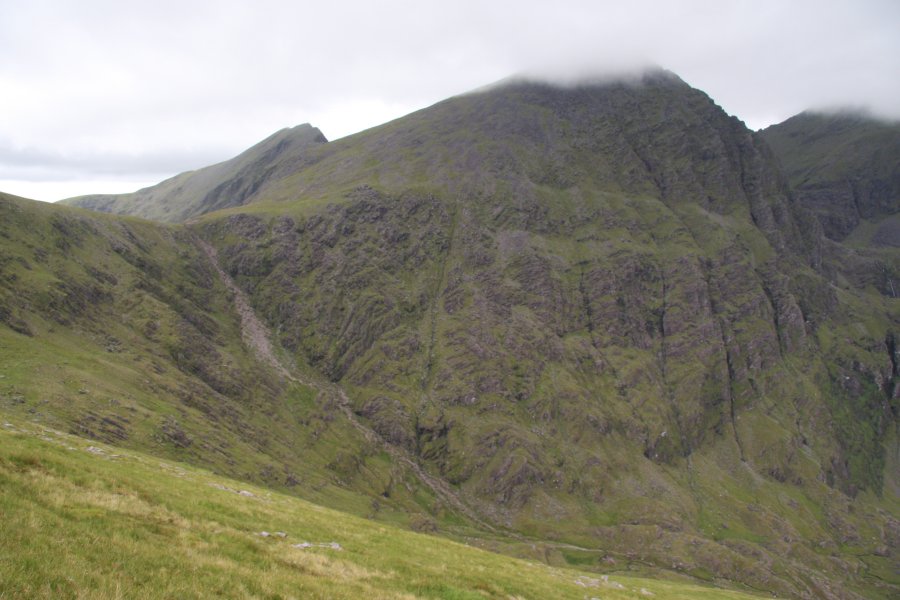 What makes it so dangerous is the volume of (often inexperienced) visitors who are badly eroding the path, freeing large numbers of rocks, and sending them hurtling down on others. Several injuries have occurred due to this. The once-ordinary coll also contains a small stream that helps wash away the disturbed mud, making the rocks even more likely to fall.
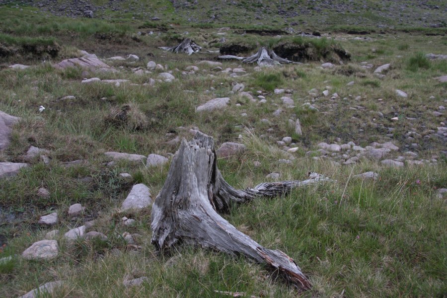 Tree stumps standing proud from the peat bog which burried them 8000 years ago.
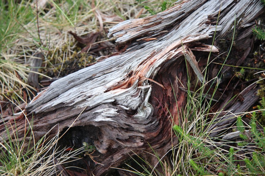 Such bog wood is stained rich reds and browns by the chemicals in the bog, but otherwise preserved by the acidic conditions. The preservation is truly impressive, given that these trees died before even the first stone age settlers arrived in Ireland.
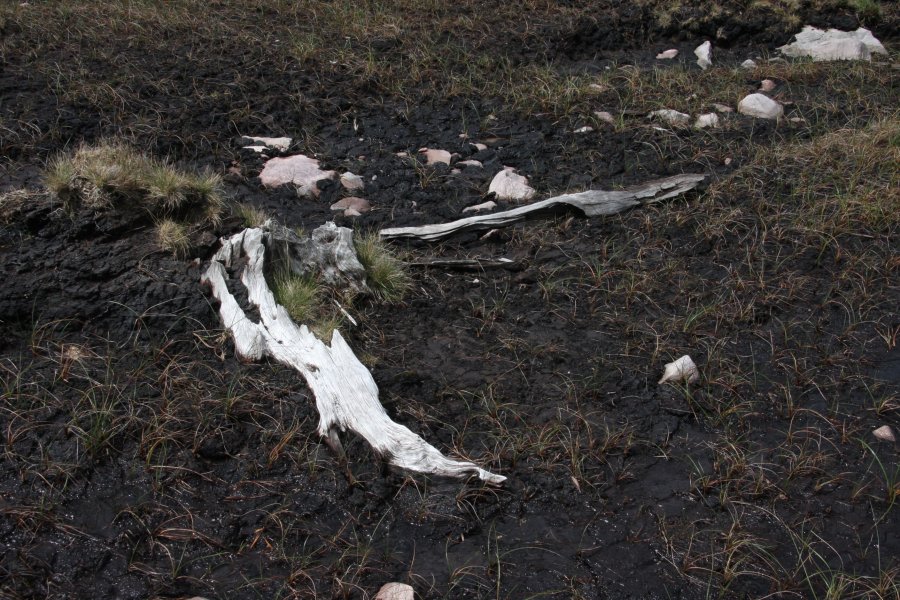 Ghosts of forest past.