The Rough With The Smooth 2010
Pwll Annie, Cyfarthfa Pwll Glas, Pwll-Du, Pwll Milast-fach, Llynfell Falls, Pwll-yr-Wydden, Nant y Llyn, Sgwd yr Argoed, Nant Bwch.
Pwll Annie
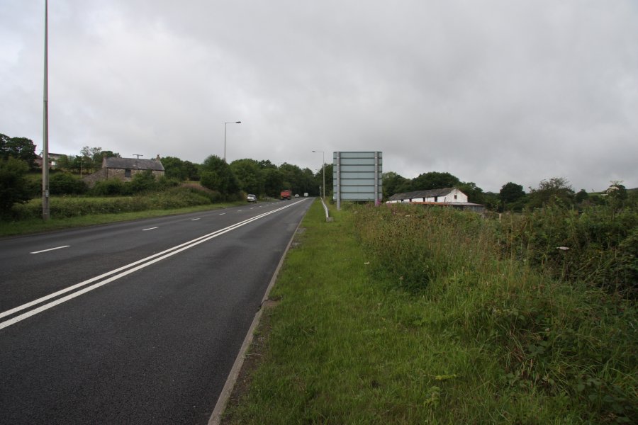
Pwll Annie is one of the large Fforest Fawr waterfalls, but far away from Waterfall Country, and virtually unknown. It is located right by Merthyr Tydfil, beside the A465 road to Hirwaun. The waterfall is guarded by tall, overhanging cliffs, muddy tops, and trees that barely hold onto the edges. There is no good viewpoint, and there is no proper access route. Do not expect to get a good view, and do not visit it at all if you don't have experience with these conditions. Above all, do not trust the maps for this area, which fail to show most of the hazards.
 As the A465 begins the climb up the hill from the A470 roundabout, the parking area is a patch of dirt behind the kerb on the left, near a house and barn. There is a subway that can then be used to cross the road, if needed. From there, head back down the road to the bridge over the Nant Ffrwd.
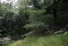 Just before the bridge, very carefully follow the edge of the concreted drop, down to the left, and cross the fence into the edge of a field. The fence runs along the top of the gorge, with at least 15 metres of cliff below it. The trees on the edge are not able to get a good enough hold, and some have ripped away the soil and slipped down into the gorge.
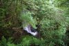 Pwll Annie appears quite suddenly as a gaping chasm, headed by the waterfall, which is around 14 or 15 metres high. It is possible to stand on the soil by the edge, but it overhangs, with the trees barely holding on. Be really careful. The view is annoyingly blocked by some of the trees. Perhaps it is better in winter, but the wetter weather will also make the sides even less stable.
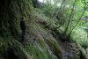 A revisit allowed us to find a descent route that worked for us. By crossing the head of the waterfall, and picking up a very poor path running by the fence on the far side, a gap in the crags on the far bank gives access to the steep slope. I warn you that you must not attempt this without plenty of experience in these conditions.
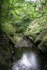 The bottom of the slope is steep or overhanging, but a fallen slab and tree allowed us to reach the bottom, just downstream of the waterfall's plunge pool.
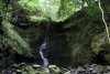 The view from the bottom makes the waterfall seem a little shorter, though surrounded by very impressive crags. A slippery ledge adorned with old stal and leaves makes it possible (though not advisable) to walk behind the waterfall.
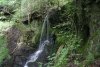 Reaching the ledge is hard enough, and the ledge itself is quite slippery. Although it is possible to walk there, I must stress that this is certainly not an easy waterfall to get behind, and the result of a fall from this height would be extremely serious. It is best to just enjoy these pictures, and not attempt to get there yourself.
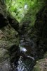 A short traverse over a little cascade downstream. The gorge appears to be the remains of a cave in the limestone shales, and every alcove is covered in old stal formations. Most of the textured rock on the left is actually flowstone covered in moss.
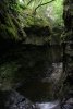 Then the next waterfall drops into the head of the canyon, and we could go no further.
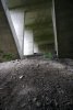 I had previously tried heading downstream to see if I could get into the gorge from the bottom. Under the bridge, it slopes perilously steeply down to the gorge, with the soil clearly unable to support itself properly. I cannot stress enough how risky it is to be here. Do not, under any circumstances, try to follow me.
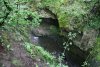 Then the ground disappears suddenly into a gaping hole, dropping well over 15 metres to the stream, and a cascade's plunge pool. Even though it is possible to get to the bottom further downstream, the main waterfall is not accessible from here.
 Instead, we rigged an abseil down from trees under the bridge. As described later, there are far, far better ways of getting down there, so please do not follow our route. The loose rocks at the top required plenty of care, and we were very happy to find the better approach, to avoid having to prusik out.
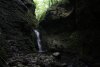 The lower waterfall in its superb canyon. The waterfall is about 5.5 metres tall, and the plunge pool is about the same depth. The overhanging lip appears to be the location of the old cave roof.
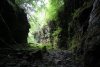 Downstream, the canyon widens, and opens out into a superb gorge, adorned with ferns and hanging ivy. Some distance downstream, the sides became shorter, until we were able to safely climb back out. However, again, there is a better access route described later.
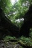 Looking up to the mouth of the canyon, spanned by the A465 bridge. From down here, it's hard to imagine just how invisible this valley is from above.
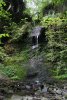 A lush little inlet waterfall, dropping 7 metres into the gorge.
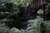 A 3 metre waterfall above it.
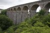 Now for the easier access route to the lower waterfall; beside the last section of dual carriageway on the A470, there is the impressive Cefn Coed viaduct, carrying the Taff Trail. Below it, there is a track (Tai Mawr Way) running under the road (it is possible to cross fences to get at this track from laybys on either side of the A470), between Gellideg and Cefn-coed-y-cymer's Cyfarthfa area. It can also be accessed from the Taff Trail near the western end of the viaduct.
 Between the A470 and the viaduct, the track passes over the Nant Ffrwd stream. It is possible for experienced river walkers to head upstream from this point, remaining with the stream as the gorge grows around it. There is no path. High water will need extra care, and watch out for falling rocks in all conditions, expecially under the A465 bridge, near the waterfall. Do not attempt to access Pwll Annie's main waterfall from this route.
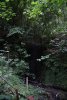 Pathetic inlet waterfall near Gellideg. That's it for the Nant Ffrwd, but if you are looking for more sights along the Taf Fawr, there is a little more to see (though no more spectacular waterfalls).
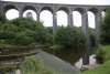 Only a short distance further down the track, it joins the Frwd/Pont-y-capel Road. On the other side of the Taf Fawr, it passes under the viaduct. Immediately on the downstream side of the viaduct (on the river's eastern bank), there is a path heading downstream.
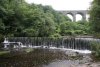 Second weir below the viaduct.
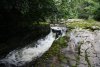 The map then shows a waterfall, but it's just a narrow channel with a few little drops. Not worthy.
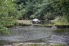 Just in case you forget where you are.
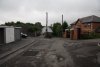 Back at Pont-y-capel road, just after the viaduct, a lane on the left leads up to a housing area, with a subway under the A465. This can also be reached on the other side from Grawen Lane, a tiny estate stuck on the side of the A465 slip road, shown here.
 At the end of the subway, a kissing gate leads down to a path running above the river.
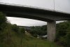 A465 and viaduct.
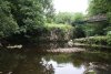 The path drops to cross the river at Pwll Taf.
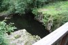 Though it's hard to see here, Pwll Taf is a cave resurgence, and the cave diving line begins under the tree.
Cyfarthfa Pwll Glas
The name appears on 1:10'000 maps as Pwll Glas. This must not be confused with the better known waterfall called Blue Pool/Pwll Glas, located just 3 km upstream on the same river, at Vaynor's Pontsarn. (Whose idea was it to use the same name for two entirely different waterfalls on the same stretch of river, eh?) To distinguish between them, I refer to this one as Cyfarthfa Pwll Glas, and the better known waterfall as Pontsarn Blue Pool/Pwll Glas.
The waterfall is marked as a weir on current maps. 100 years ago, an old leat ran above it, and the maps showed a weir as being used to supply the leat. Later maps then migrated the word "weir" to the waterfall instead - perhaps accidentally. The waterfall lies right beside the Cyfarthfa industrial estate on the Taf Fechan, below Cyfarthfa Castle's lake, between Pont y Cefn and the junction with the Taf Fawr. It is easiest seen from the industrial estate's car park (accessed down a lane from the A4054), in winter, when the foliage has died back. Alternatively, the nearby football ground has some heavily overgrown paths leading to its far bank, but these are hard to find.
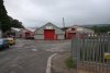 Cyfarthfa Industrial Estate. The waterfall lies on the river immediately below the start of the industrial estate.
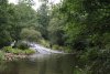 Cyfarthfa Pwll Glas. The waterslide appears to be natural, with a natural top. On the right side, the top of the waterfall was apparently tapped through a weir to supply a leat, which has since been destroyed.
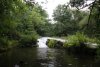 However, on either side, there are deep channels and cascades, which may be natural or may have been artificially dug out. They are too old for any obvious signs to remain. As a result, it is not clear if this is a truly natural waterfall, or one that has been significantly modified. Either way, it's nothing special, and not worth a dedicated trip.
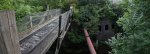 At the far end of the industrial estate is a path leading over the Pont y Cafnau bridge. This is the World's oldest surviving iron railway bridge, built in 1793, and also carries an aquaduct under the rails, which carried the water from the leat. It can be crossed to reach the Taff Trail near the Cyfarthfa Ironworks, offering a variety of walking routes that can be constructed.
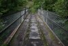 The rails, held in rail fasteners by wooden blocks. The rails carried narrow-gauge trams with simple, flat wheels, and the rails therefore have a large lip to keep the wheels in place.
Pwll-Du and Pwll Milast-fach
Making up the top of the Sychryd Gorge, but separated from the main gorge by the A465, these waterfalls are virtually unknown and hardly ever visited. Pwll-Du is marked on the 1:25'000 Explorer map, but is not correctly shown as a waterfall. Pwll Milast-fach appears only on the 1:10'000 maps. The start point is the third layby on the A465 dual carriageway section from Hirwaun to Glyn-neath.
Llynfell Falls
Llynfell Falls are located inside the Dan-yr-Ogof showcave complex, and that means, unfortunately, that a rather substantial fee needs to be paid to access them. Visits are best done as part of a visit to the impressive showcave. Immediately past the ticket booth, take the small, fenced path doubling back to the left, and then follow the stepped path down through the dinosaur park exhibits.
Pwll-yr-Wydden
Pwll-yr-Wydden is a large shakehole situated on the moorland above Dan-yr-Ogof. It is most easily accessed from the nearby Craig-y-Nos Castle, though there are other ways to access the same path, which are shown on the 1:25'000 Explorer maps. After wet weather (about a week of persistent rain is needed in summer - as with this visit), a small stream emerges from the outcrops above, and drops down a waterfall into the shakehole.
 Craig-y-Nos Castle, a mansion, not really a castle.
 Just opposite the castle is a noisy weir. Only a weir.
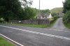 Head towards Glyntawe, and just after crossing a small stream, take a lane to the left, heading towards some houses. Pass through a farm yard, and up along the remains of a track towards a dry valley.
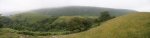
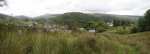 Superb view over the Tawe Valley. On the left are Cefn Cul (562 metres) and Fan Gyhirych (725 metres), in the middle is Craig y Rhiwarth, and on the right are Carreg Lwyd and the tops of Craig-y-Nos Castle.
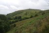 Cribarth ridge (426 metres). The Craig-y-Nos crags are down to the left.
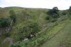 The dry valley.
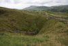 At the top of the valley is the massive Pwll-yr-Cawr shakehole. Imagine the cave chamber that collapsed to produce this - apparently, the shakeholes here are over the top of the Ashford Price's Hall and Gerrard Platten Hall chokes in Dan-yr-Ogof.
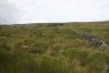 Head around the left side of the shakehole, and pick up the poorly defined path running beside the wall at the top of the shakehole's rim. The destination shakehole soon becomes visible ahead.
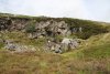 Pwll-yr-Wydden, a large shakehole in its own right, though a lot smaller than the previous one. The 9 metre waterfall, when it flows, comes down approximately below the wall. It can be seen here, though due to it being only a small stream, it may take some time to realise there is actually water there.
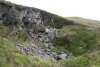 The stream flows under rocks for a while before sinking into the floor of the shakehole.
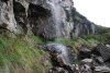 There is space to walk behind one side of the waterfall, but be warned that the wall of the shakehole is quite loose, and prone to collapse. Take care.
Nant y Llyn
Nant y Llyn is the stream draining Llyn y Fan Fawr in the Black Mountain, into the upper Tawe River. Just after Glyntawe, a narrow lane leads up the side of the Tawe towards Trecastle. After 2 km, it passes over a cattle grid, and becomes unfenced on one side. As it continues along the valley, it passes over some small bridges with stone walls. Just after the fourth of these is the parking area on the left, and Nant y Llyn is also clearly visible up to the left.
 Nant y Coetgae, a small stream near Nant y Llyn, with its own very small waterfalls. Not really good enough to deserve a dedicated walk.
 Cascade on the Tawe, at the confluence with Nant y Llyn.
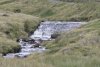 Waterslide on the Tawe.
 Upper cascade.
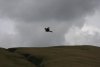 Red kite gliding over the river.
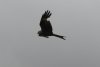 With my old camera, I dreamed of getting shots like this.
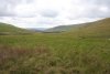 The upper Tawe, with the lower end of Fan Hir's immense scarp.
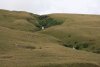 From the road, you can see the tops of about half of the waterfalls. From this angle, the clearly visible path on the right of the stream looks steep, but it's a lot easier than it looks.
 Ford the Tawe by the parking area, and pick up the path heading up the right side of Nant y Llyn. The first cascades quickly appear.
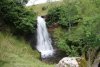 The first waterfall, about 5 metres high.
 Cascades, the upper of which is about 5 metres tall.
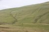 Looking back towards Maen Mawr, a standing stone and small stone circle, part of the Cerrig Duon site, apparently.
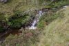 Another few little cascades.
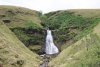 Then the main and very impressive waterfall. The big drop is only about 8 metres, but the dramatic wall gives it a very special character.
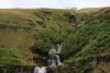 Cascades above the big drop.
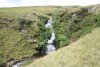 A little further up is this 7 metre beauty. This ends the chain of waterfalls since the main one, about 22 metres in total height.
 Another 5 metre waterfall.
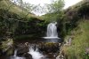 Small drop, big pool.
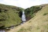 A trench then contains the tallest waterfall, at about 9.5 metres.
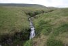 The next waterfall is the last of the large waterfalls, at about 4.5 metres. Behind it, Fan hir (761 metres) and Fan Brycheiniog (802 metres) begin to dominate the view.
 Becoming progressively smaller, just a few metres.
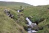 Little cascades.
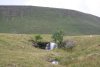 The last waterfall, identified as the one with a sheep beside it. That makes it recognisable, right?
 The path continues all the way to Llyn y Fan Fawr, at the base of Fan Brycheiniog, and from there, it is possible to join up with other waterfall routes in the area. (Picture borrowed from an earlier visit.)
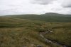 Looking over Cefn Cul to Fan Gyhirych, and the Beacons in the distance.
Blaengwrach and Sgwd yr Argoed
Despite their proximity to the famed Waterfall Country, these waterfalls have nothing in common with the waterfalls in that area. These waterfalls are fed only by small streams, and there are no proper paths to any of them. Getting to them easily ranks as one of the hardest routes I have done; the area was once a busy mining community, with various mining tracks, but that age has passed, and the undergrowth has taken over. Although I will give details of how to make it a little easier to get around, it still needs a lot of experience with navigating through this type of terrain. It also needs skin made from leather. I would suggest a visit in winter when the undergrowth has died back.
Be warned that the 1:25'000 Explorer maps covering the area are very badly out of date, and quite confusing. They frequently fail to show features like 20 metre cliffs, misrepresent narrow paths as dirt tracks, and do not show the path directions correctly. I will try to point out the important mistakes and give appropriate routes, but be prepared to use your own initiative.
The start point is in Blaengwrach, a village located on the side of the A465 in the Neath Valley. Head into the village, turn right at the mini-roundabout, take the next left (Heol y Felin), and park near the playground and scout hut.
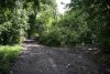 Walk up the road, taking the right branch when it splits just above the scout hut. The road soon becomes a track and an overgrown track leads off on the right. Take the track to the right - this area is not shown correctly on the map.
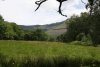 The other track gives a brief view of Craig y Pant, but don't worry, you will see it later anyway.
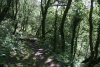 If you follow the wrong track, you can take the path to the right when it swings left, to join the correct path.
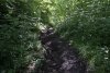 The proper track reaches the Nant Gwrach stream, and follows it to an invisible junction of streams, and a very visible junction of paths. The way on is the steep path (once a tramway incline) climbing up to the right between the two streams, following the Nant yr Argoed stream to the right. If you reach mining buildings, you have just gone the wrong way, but you may want to head there first in case you choose not to return down that stream.
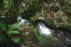 Little cascade beside the bottom of the incline.
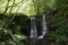 Upstream, and quite a way below the tramway, there is the sound of a waterfall, but it is only a weir, being slowly reclaimed by nature. There is no path to it, and a lot of undergrowth blocking the way.
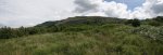 At the top of the incline, go through the gate, then look for a path heading up to the right, which picks up a new track, breaking out into the open. The Rhigos Mountains dominate the view: the tiny bump of Hirwaun Common, the green Y Foel-Chwern ridge, the bumpy tops of Mynydd Pen-y-cae (573 metres), and the long Cefn Grug ridge.
 On the far side of the Neath Valley are the Craig Clwyd cliffs of Hirfynydd (481 metres).
 The track swings left just before a fence, but to reach the waterfalls, you need to get into the field on the other side of that fence. Either cross it here, or follow the track around and cross into this field later. Either way, you need to get to the right side of the field, at the edge of the stream's woodland.
 There is no path down to the waterfall, so you need to work out the best place to descend really carefully into the valley. Take it slowly and watch out for crags and hidden drops. Head slowly upstream to the waterfalls.
 Sgwd yr Argoed only has a small stream falling about 6 metres, but its large alcove and rich, mossy sides make it quite attractive.
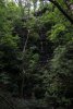 Immediately beside the main waterfall is this inlet waterfall, about 10 metres in total.
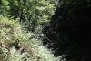 The only sane way upstream is to return to the track by the fields, and then take a path to the right to arrive at the Blaengwrach Farm. I tried to head upstream through what I can only describe as Hell on Earth - brambles as tall as myself, and rotting, fallen trees blocking the stream.
 The map showed something upstream - this had better be worth it. I stuck to stream level to make it easier, but repeatedly had to scramble through the branches of fallen trees. Progress was painfully slow, and I had already had more than enough of brambles ripping through my clothing.
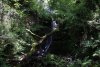 OK, no, it wasn't worth it. The waterfall on the Nant Ysgubor, as it joined the main stream.
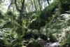 Looks like it might be getting easier, but up ahead, I had to jump onto the roots of fallen trees as the steep sides had collapsed along with the trees.
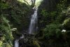 Finally, the last waterfall on the stream, about 5.5 metres high.
 To reach the waterfall safely, there's a short track heading to the right, behind Blaengwrach Farm. After passing the back of the farm on that track, follow the left side of the fence that heads over to the stream valley. The picture is the view looking back from that point. From there, a poorly defined path crosses a fence and follows the left side of another fence to drop down to the stream at the head of the waterfall. View it from above.
 The view towards Fforest Fawr; Fan Gyhirych, Fan Nedd (663 metres) and Fan Llia (632 metres).
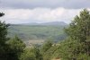 And the Black Mountain; Picws Du (749 metres), Fan Brycheiniog and Fan Hir.
 Return to the main track past Blaengwrach Farm, and follow it as it swings left, then continues in roughly the same direction, passing some other tracks, and turning some sharp corners, to arrive at these settlement tanks. Follow the track that skirts the right edge of these, passing through trees to reach open fields. Just up ahead is a massive quarry, but the way down is to the left.
 Follow the edge of the trees that line the Nant Selar stream, until it joins another stream. You should be able to see the next waterfalls at the junction.
 Instead, I followed some earlier fields down, before the settlement tanks.
 Common Blue Damselfly.
 Incredibly clear closeup of a tiny grasshopper. These were everywhere, and the grass around me would keep being knocked around by them in anticipation of my footsteps.
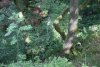 The map shows waterfalls at the junction of Nant Pen-y-cae and Nant Selar, but it completely fails to show the cliffs correctly. I had to make a rather tricky descent to the upper cascade to cross the stream, then descend the banks of Nant Selar, falling badly in the brambles for my trouble. The easier route (mentioned earlier) avoids all of this.
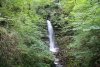 Nant Pen-y-cae drops quite dramatically for about 7 metres down the tall cliffs. Stay near the top of the trees above Nant Selar for another 200 metres until the path is forced to head into them. There is an official path that now stays high up in the valley to rejoin the tracks near the start of the walk. I dropped immediately into the stream, down the remains of a path.
 On the far bank, a tall waterfall drops 20 metres in steps down the cliffs. According to the map, neither the cliff nor the waterfall exist.
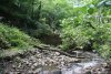 Just downstream is a breached dam, which had to be skirted to the right.
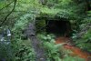 Crossing the stream brought me to a path beside a mine leeching iron.
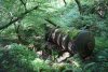 And an old boiler.
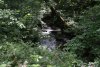 And a small cascade.
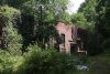 To arrive back at the old mine buildings.
 Falling into disrepair. That's an abandoned mechanical dumpster that has been "decorated" by the locals.
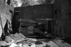 Decay.
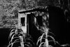 Shadows of grilled windows. The powder store.
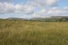 Meadow at Fforest Fawr, with Fan Fawr (734 metres) and Gwaun Cefnygarreg (457 metres) in front, and the Beacons behind.
Nant Bwch
At the other end of the national park, almost at the tip of the Black Mountains, there are almost no officially named waterfalls. The impressive valleys do contain many smaller waterfalls, but very few are worthy of attention. Sandwiched between Rhos Dirion and Lord Hereford's Knob is the Nant Bwch valley, which soon joins the Afon Honddu. For the short time that it runs below an impressive glacial scarp, it digs a gorge for itself, which contains one waterfall that is worth a visit.
From the A465 from Abergavenny to Hereford, take the little lane passing through Llanvihangel Crucorney, then from there, take the road towards Llantony Priory. Continue beyond it, turning sharp left to cross a narrow bridge, to eventually reach Capel-y-ffin. Turn left just before the village, onto an even smaller lane. After the lane crosses the river using an Irish ford (a very low bridge that becomes a ford in flood), park at any point that seems appropriate - I would suggest parking some way after passing through a gate, as there is more space there. Our route forms a loop that follows the lane for this short stretch.
 View of the impressive Tarren yr Esgob crags. We started the walk in very poor weather, with low cloud all day. It had only just managed to rise above the scarp, and was still drizzling.
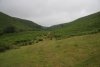 Head up the road to the Blaen-bwch farm, and continue past it along a path to the end of the fields. From there, the path heads up to the dramatic northern scarps of the Black Mountains, but our route loops earlier than that.
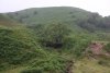 At Nant Ganol, the first stream after the fields ended, ford the stream and pick up a path running back along the other side, over the head of Nant Ganol's tiny waterfall.
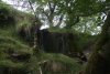 Continue heading back down the valley over the next little waterfall at Nant Isaf.
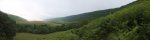 The path leads under the dramatic Tarren yr Esgob scarp, following a fence and old wall.
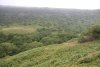 Just after the fence and wall end, the waterfalls are below. However, you must resist the temptation to descend to them. This picture, taken from the other side of the stream, shows the way down. Wait until the stream has turned away, and there is an open patch (seen here on the left with the bracken slowly advancing over it) on the left of the path. Head to the far side of that open patch, and then locate somewhere safe enough to descend the slope down to the river.
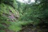 If you try to drop down too early, this is what awaits you.
 It is also possible to descend from the other side, but that also has crags to avoid, and requires crossing private fields.
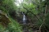 Head upstream to the Nant Bwch waterfall, which has no official name. It is actually two separate drops, of about 3 and 7 metres respectively. Then return to the path, and head to the left, around the left side of a little hill.
 Magpie platforms.
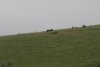 Wild ponies.
 Blue sky? Something must be wrong here.
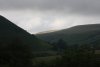 Lord Hereford's Knob, 689 metres, with some sunlight.
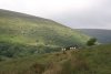 And on its Darren Lwyd ridge.
 A moment of light.
 The superb glacial Vale of Ewyas, now occupied by the Afon Honddu.
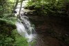 Drop down to the Talsarn farm, and turn left on the road. Follow it up to the Irish ford. Just downstream is this cascade, a few metres tall, hiding in the trees. Continue along the road to where you started.
 Bizarrely twisted bark on a chestnut tree in the Vale of Ewyas.
 Bark and burrs.
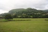 Hatterall Hill (531 metres) and Graig (350 metres).
Pwll Ffrwd
The Pwll Ffrwd information has been moved into a more extensive gallery.
 As the A465 begins the climb up the hill from the A470 roundabout, the parking area is a patch of dirt behind the kerb on the left, near a house and barn. There is a subway that can then be used to cross the road, if needed. From there, head back down the road to the bridge over the Nant Ffrwd.
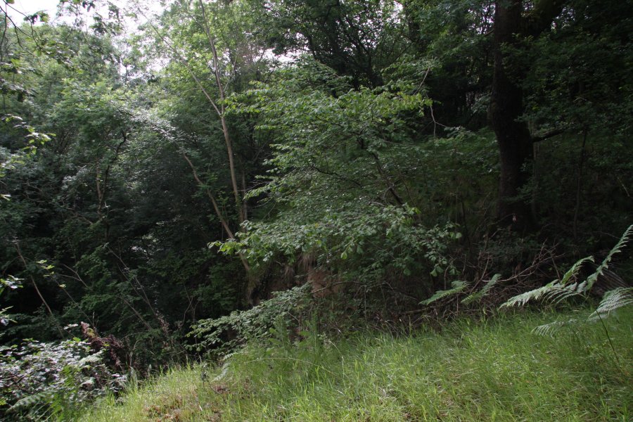 Just before the bridge, very carefully follow the edge of the concreted drop, down to the left, and cross the fence into the edge of a field. The fence runs along the top of the gorge, with at least 15 metres of cliff below it. The trees on the edge are not able to get a good enough hold, and some have ripped away the soil and slipped down into the gorge.
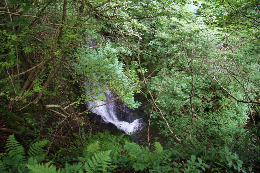 Pwll Annie appears quite suddenly as a gaping chasm, headed by the waterfall, which is around 14 or 15 metres high. It is possible to stand on the soil by the edge, but it overhangs, with the trees barely holding on. Be really careful. The view is annoyingly blocked by some of the trees. Perhaps it is better in winter, but the wetter weather will also make the sides even less stable.
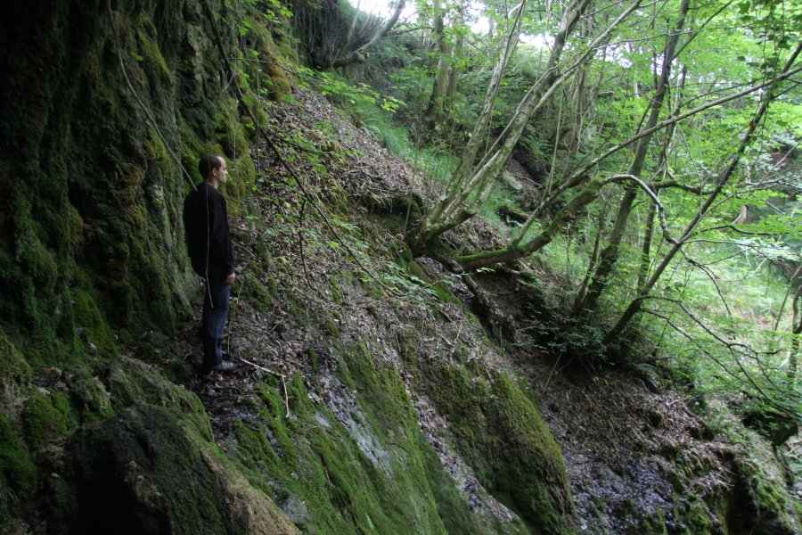 A revisit allowed us to find a descent route that worked for us. By crossing the head of the waterfall, and picking up a very poor path running by the fence on the far side, a gap in the crags on the far bank gives access to the steep slope. I warn you that you must not attempt this without plenty of experience in these conditions.
 The bottom of the slope is steep or overhanging, but a fallen slab and tree allowed us to reach the bottom, just downstream of the waterfall's plunge pool.
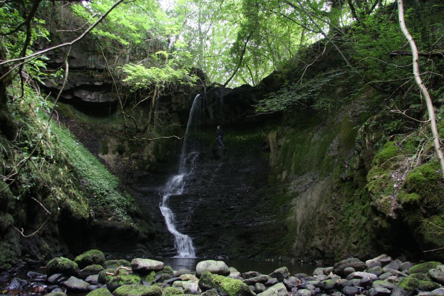 The view from the bottom makes the waterfall seem a little shorter, though surrounded by very impressive crags. A slippery ledge adorned with old stal and leaves makes it possible (though not advisable) to walk behind the waterfall.
 Reaching the ledge is hard enough, and the ledge itself is quite slippery. Although it is possible to walk there, I must stress that this is certainly not an easy waterfall to get behind, and the result of a fall from this height would be extremely serious. It is best to just enjoy these pictures, and not attempt to get there yourself.
 A short traverse over a little cascade downstream. The gorge appears to be the remains of a cave in the limestone shales, and every alcove is covered in old stal formations. Most of the textured rock on the left is actually flowstone covered in moss.
 Then the next waterfall drops into the head of the canyon, and we could go no further.
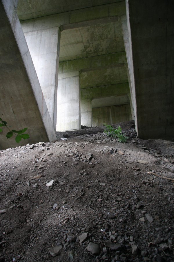 I had previously tried heading downstream to see if I could get into the gorge from the bottom. Under the bridge, it slopes perilously steeply down to the gorge, with the soil clearly unable to support itself properly. I cannot stress enough how risky it is to be here. Do not, under any circumstances, try to follow me.
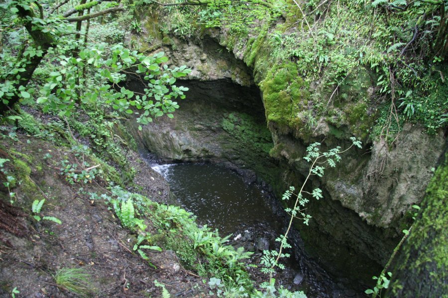 Then the ground disappears suddenly into a gaping hole, dropping well over 15 metres to the stream, and a cascade's plunge pool. Even though it is possible to get to the bottom further downstream, the main waterfall is not accessible from here.
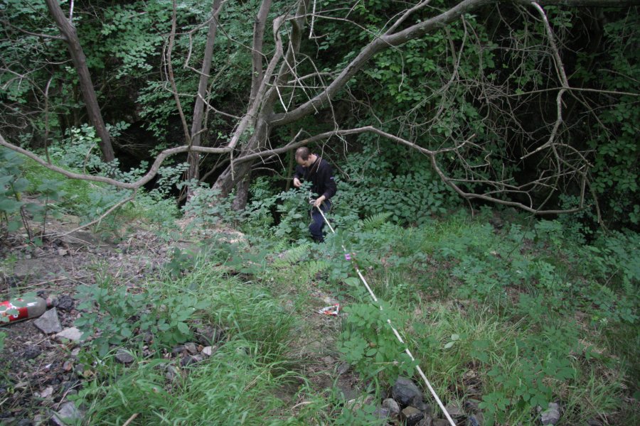 Instead, we rigged an abseil down from trees under the bridge. As described later, there are far, far better ways of getting down there, so please do not follow our route. The loose rocks at the top required plenty of care, and we were very happy to find the better approach, to avoid having to prusik out.
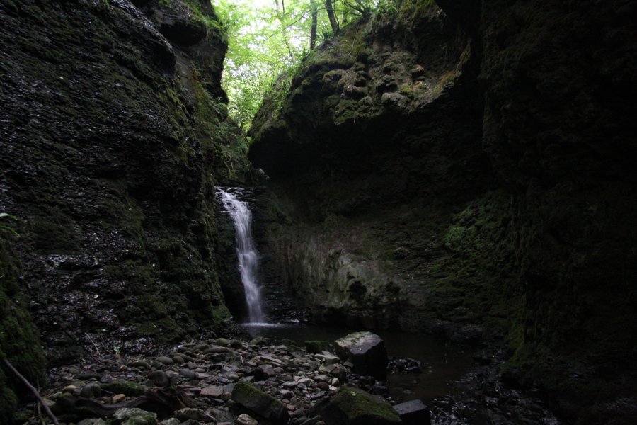 The lower waterfall in its superb canyon. The waterfall is about 5.5 metres tall, and the plunge pool is about the same depth. The overhanging lip appears to be the location of the old cave roof.
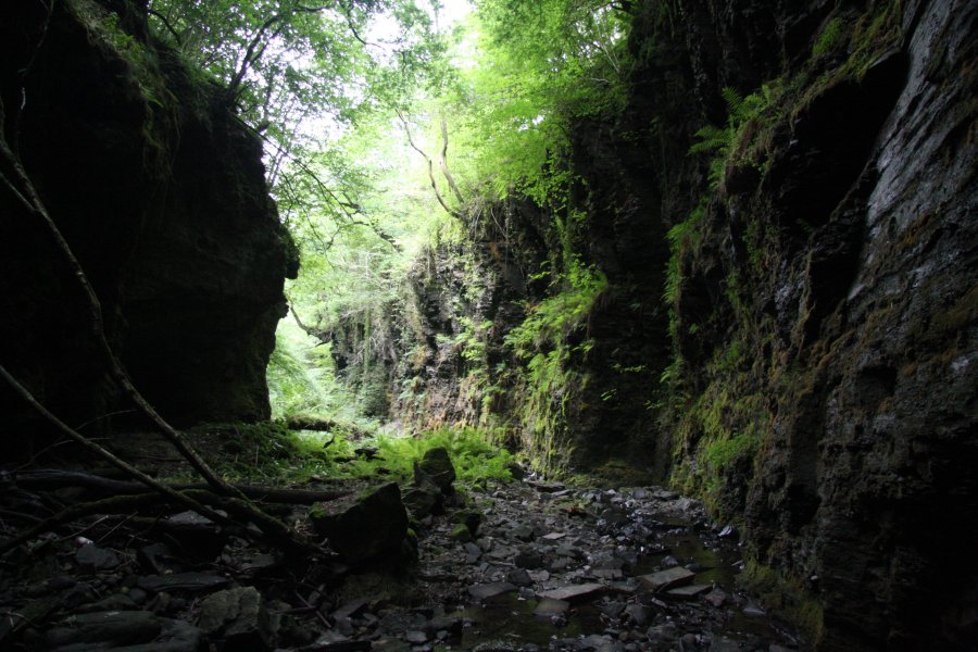 Downstream, the canyon widens, and opens out into a superb gorge, adorned with ferns and hanging ivy. Some distance downstream, the sides became shorter, until we were able to safely climb back out. However, again, there is a better access route described later.
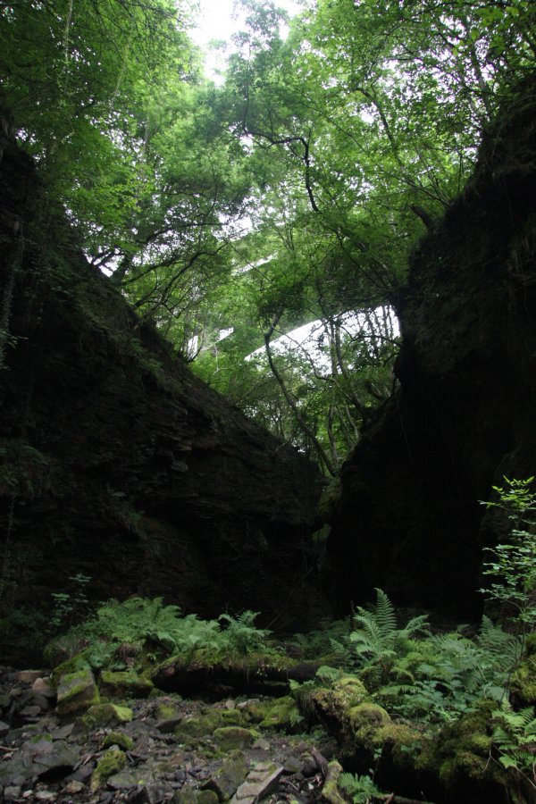 Looking up to the mouth of the canyon, spanned by the A465 bridge. From down here, it's hard to imagine just how invisible this valley is from above.
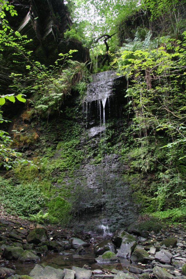 A lush little inlet waterfall, dropping 7 metres into the gorge.
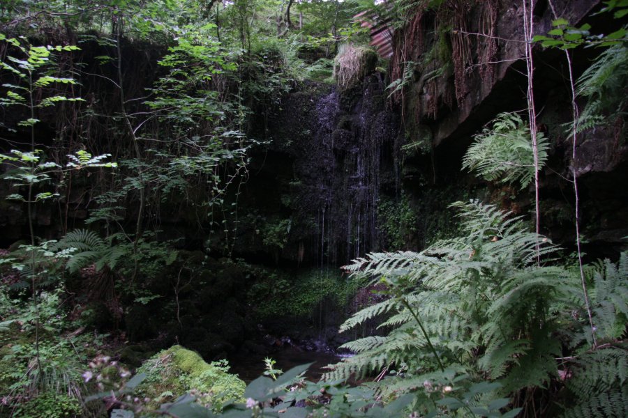 A 3 metre waterfall above it.
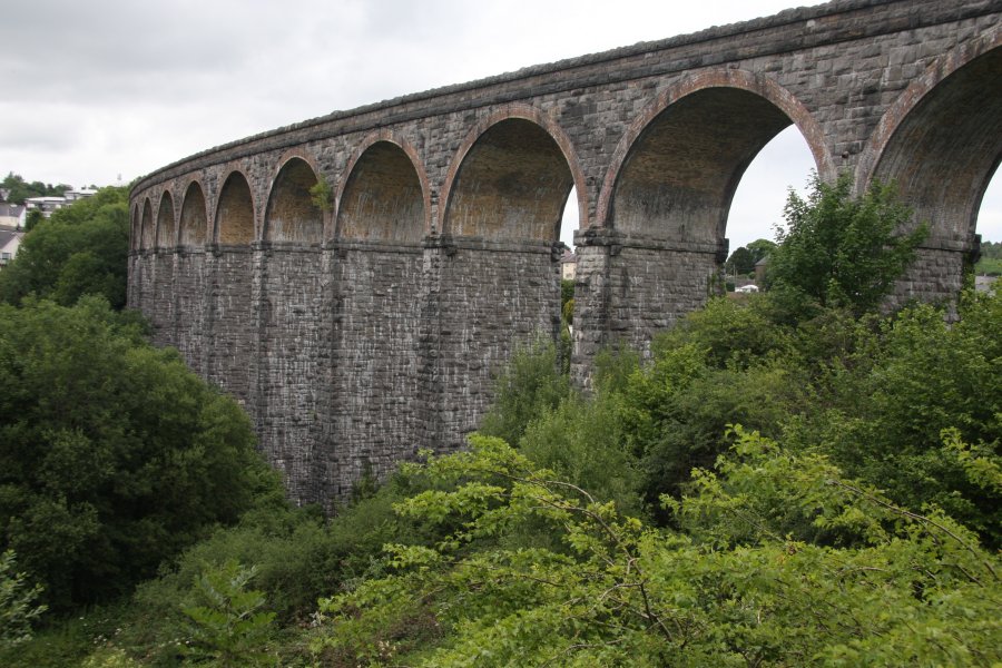 Now for the easier access route to the lower waterfall; beside the last section of dual carriageway on the A470, there is the impressive Cefn Coed viaduct, carrying the Taff Trail. Below it, there is a track (Tai Mawr Way) running under the road (it is possible to cross fences to get at this track from laybys on either side of the A470), between Gellideg and Cefn-coed-y-cymer's Cyfarthfa area. It can also be accessed from the Taff Trail near the western end of the viaduct.
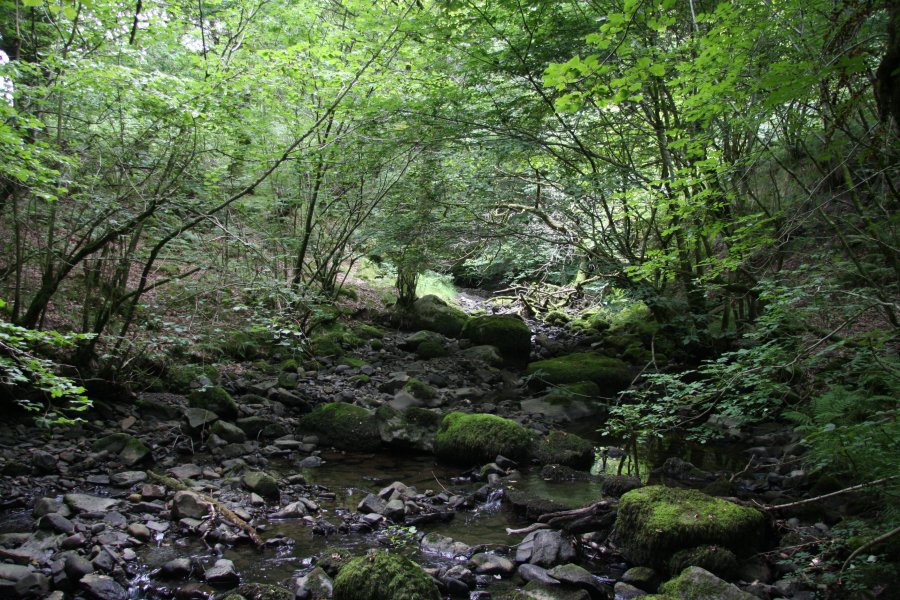 Between the A470 and the viaduct, the track passes over the Nant Ffrwd stream. It is possible for experienced river walkers to head upstream from this point, remaining with the stream as the gorge grows around it. There is no path. High water will need extra care, and watch out for falling rocks in all conditions, expecially under the A465 bridge, near the waterfall. Do not attempt to access Pwll Annie's main waterfall from this route.
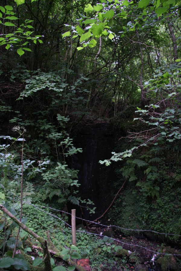 Pathetic inlet waterfall near Gellideg. That's it for the Nant Ffrwd, but if you are looking for more sights along the Taf Fawr, there is a little more to see (though no more spectacular waterfalls).
 Only a short distance further down the track, it joins the Frwd/Pont-y-capel Road. On the other side of the Taf Fawr, it passes under the viaduct. Immediately on the downstream side of the viaduct (on the river's eastern bank), there is a path heading downstream.
 Second weir below the viaduct.
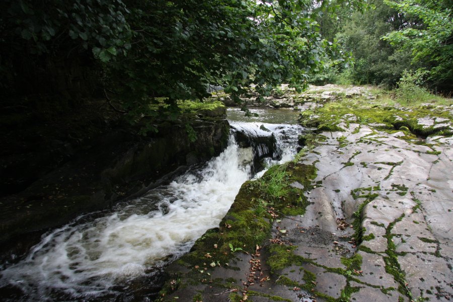 The map then shows a waterfall, but it's just a narrow channel with a few little drops. Not worthy.
 Just in case you forget where you are.
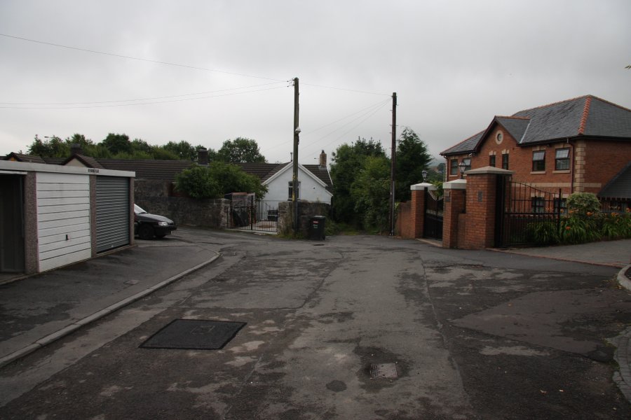 Back at Pont-y-capel road, just after the viaduct, a lane on the left leads up to a housing area, with a subway under the A465. This can also be reached on the other side from Grawen Lane, a tiny estate stuck on the side of the A465 slip road, shown here.
 At the end of the subway, a kissing gate leads down to a path running above the river.
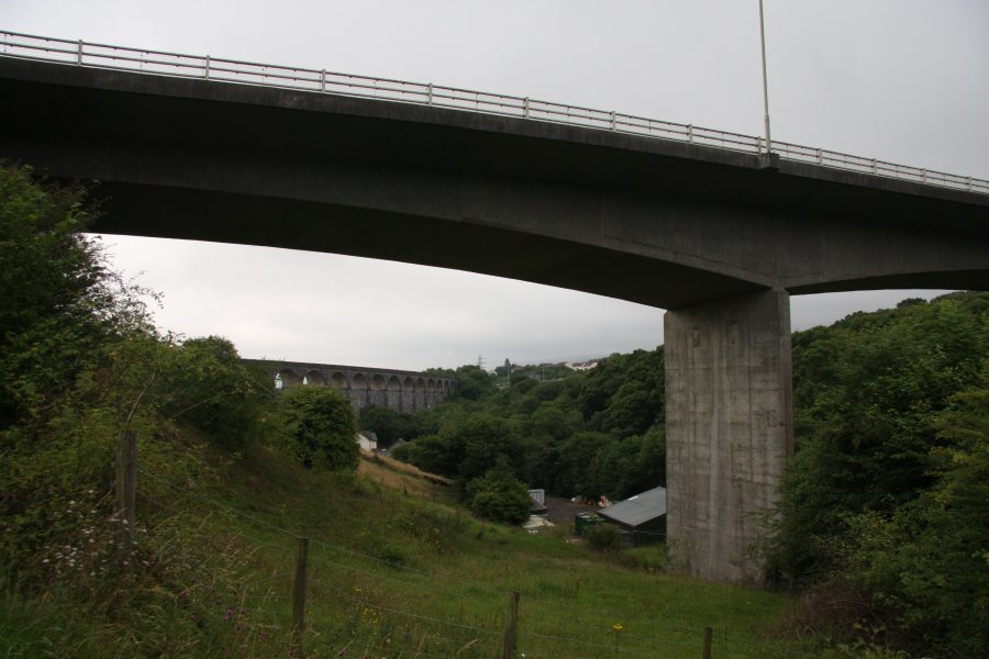 A465 and viaduct.
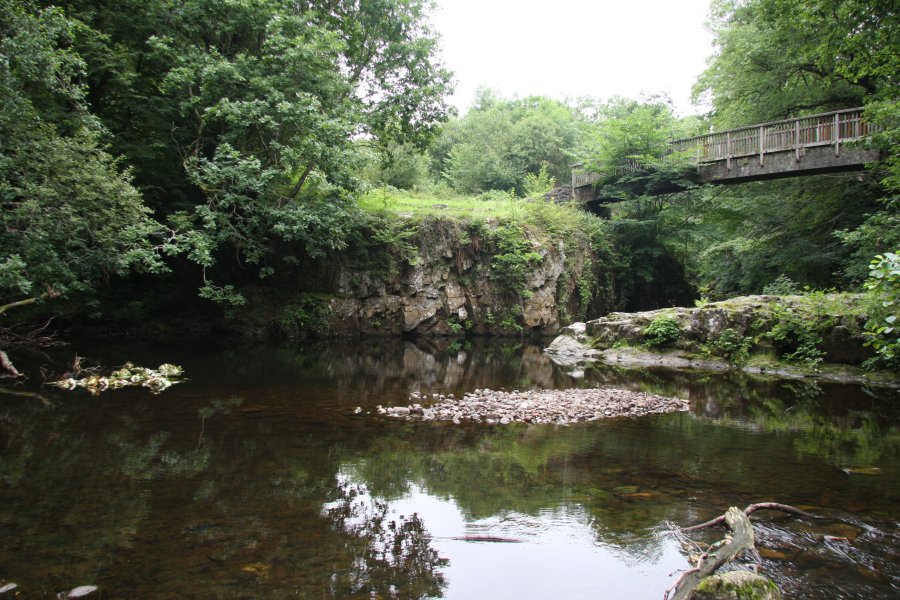 The path drops to cross the river at Pwll Taf.
 Though it's hard to see here, Pwll Taf is a cave resurgence, and the cave diving line begins under the tree.
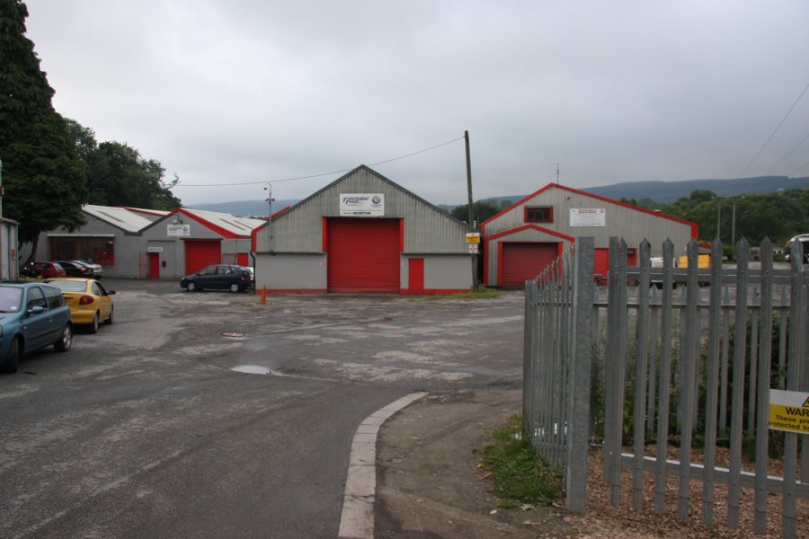 Cyfarthfa Industrial Estate. The waterfall lies on the river immediately below the start of the industrial estate.
 Cyfarthfa Pwll Glas. The waterslide appears to be natural, with a natural top. On the right side, the top of the waterfall was apparently tapped through a weir to supply a leat, which has since been destroyed.
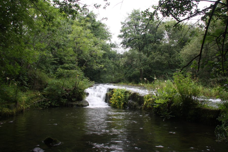 However, on either side, there are deep channels and cascades, which may be natural or may have been artificially dug out. They are too old for any obvious signs to remain. As a result, it is not clear if this is a truly natural waterfall, or one that has been significantly modified. Either way, it's nothing special, and not worth a dedicated trip.
 At the far end of the industrial estate is a path leading over the Pont y Cafnau bridge. This is the World's oldest surviving iron railway bridge, built in 1793, and also carries an aquaduct under the rails, which carried the water from the leat. It can be crossed to reach the Taff Trail near the Cyfarthfa Ironworks, offering a variety of walking routes that can be constructed.
 The rails, held in rail fasteners by wooden blocks. The rails carried narrow-gauge trams with simple, flat wheels, and the rails therefore have a large lip to keep the wheels in place.
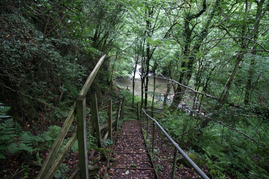 At the start of the layby, hidden behind the crash barrier, is this stepped path.
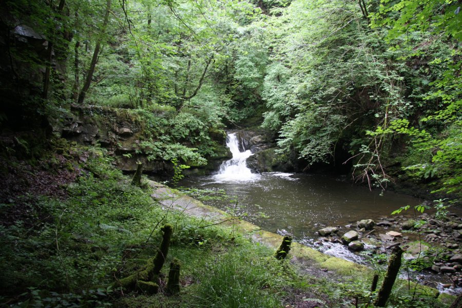 At the bottom is Pwll-Du, a small waterfall with a huge plunge pool. The outflow is then diverted under the road to continue down the main Sychryd waterfalls.
 To see the few more falls upstream, go back to the layby, and continue past the start of the layby onto a landscaped grassy area. Head diagonally over to the right to reach the fence.
 Cross the fence at an appropriate point and descend the steep slope to the river. There is a fence dropping down the slope at one point, which may provide a useful aid for descending.
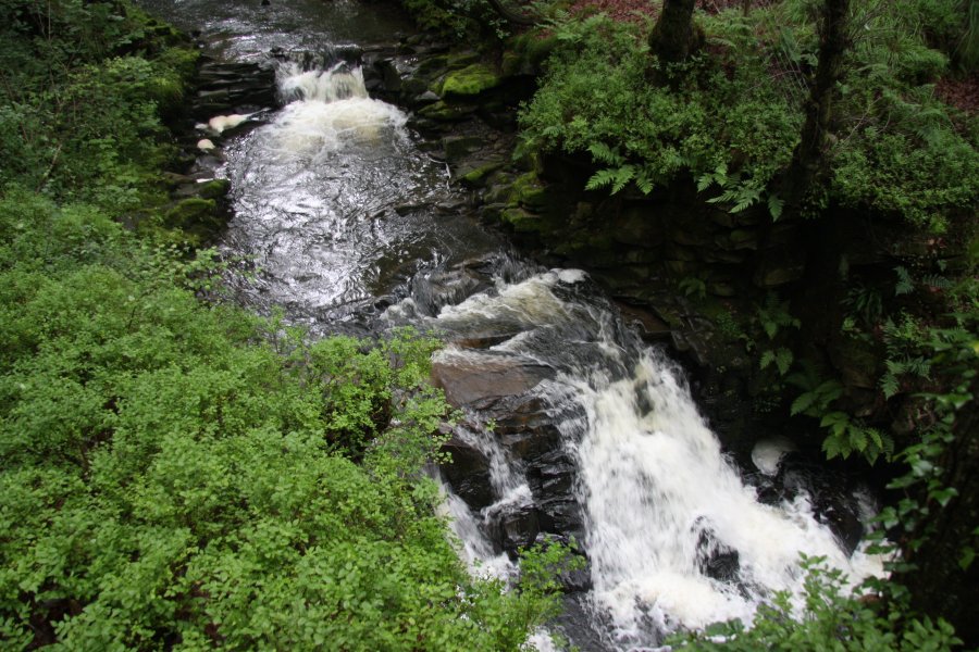 The slope lands at the junction of two streams, which combine to form the Sychryd. This immediately drops down some small cascades. The junction and cascades are called Pwll Milast-fach.
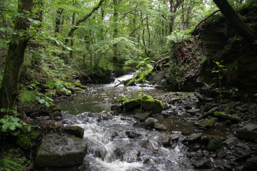 Small cascade on the Nant Llechau, just upstream of the junction.
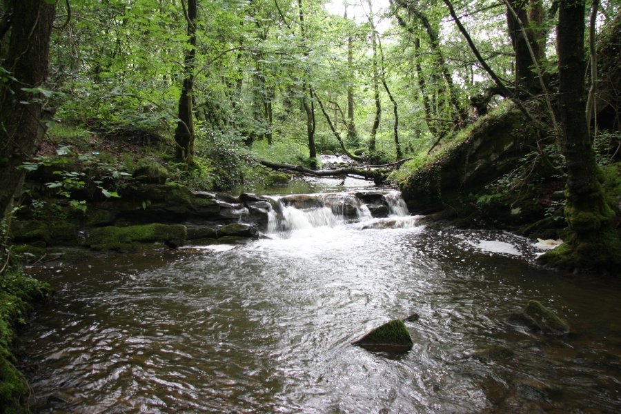 Similarly small cascades on the Nant Wyrfa.
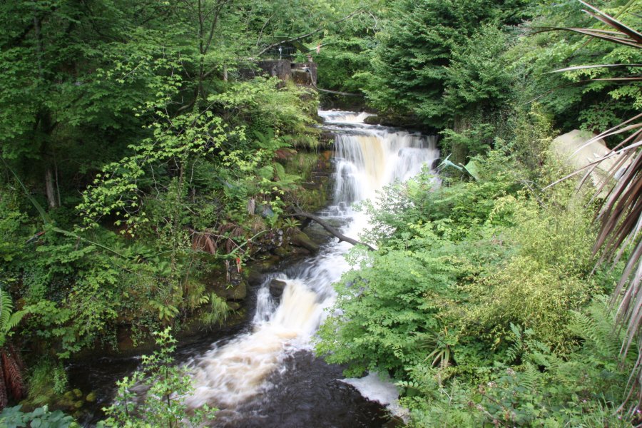 The steps end at a platform with this view of Llynfell Falls. The main drop is only about 5 metres high, and above that is a dam, with the overspill creating a weir, if only you could see it. Though you may not notice them all at first, there are 4 pteranodons (1 female, 3 male "longiceps"), a koolasuchus and an anchiceratops surrounding the waterfall. There's something you don't see very often in the wilder parts of Wales.
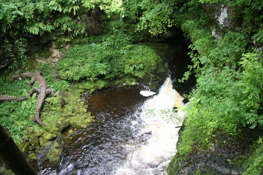 Just upstream is the resurgence entrance to Dan-yr-Ogof, source of the short Afon Llynfell (there is also a longer river with the same name in the same mountain range, at Cwmllynfell, but this is unrelated - the rivers eventually feed separately into the Afon Tawe).
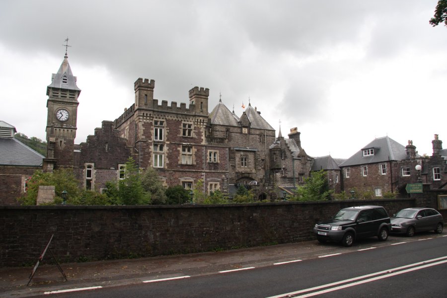 Craig-y-Nos Castle, a mansion, not really a castle.
 Just opposite the castle is a noisy weir. Only a weir.
 Head towards Glyntawe, and just after crossing a small stream, take a lane to the left, heading towards some houses. Pass through a farm yard, and up along the remains of a track towards a dry valley.
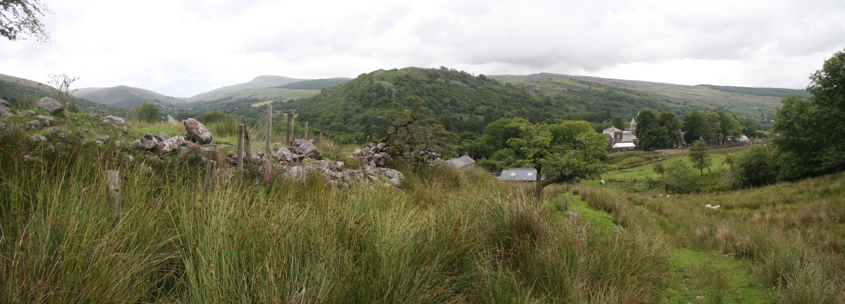 Superb view over the Tawe Valley. On the left are Cefn Cul (562 metres) and Fan Gyhirych (725 metres), in the middle is Craig y Rhiwarth, and on the right are Carreg Lwyd and the tops of Craig-y-Nos Castle.
 Cribarth ridge (426 metres). The Craig-y-Nos crags are down to the left.
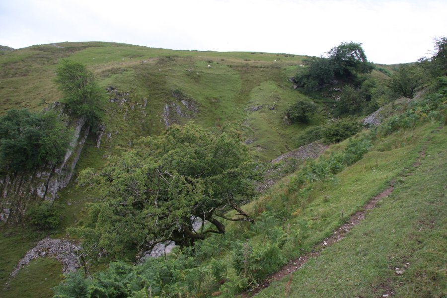 The dry valley.
 At the top of the valley is the massive Pwll-yr-Cawr shakehole. Imagine the cave chamber that collapsed to produce this - apparently, the shakeholes here are over the top of the Ashford Price's Hall and Gerrard Platten Hall chokes in Dan-yr-Ogof.
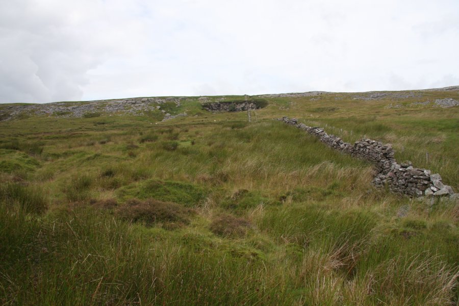 Head around the left side of the shakehole, and pick up the poorly defined path running beside the wall at the top of the shakehole's rim. The destination shakehole soon becomes visible ahead.
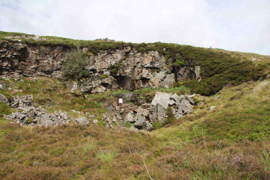 Pwll-yr-Wydden, a large shakehole in its own right, though a lot smaller than the previous one. The 9 metre waterfall, when it flows, comes down approximately below the wall. It can be seen here, though due to it being only a small stream, it may take some time to realise there is actually water there.
 The stream flows under rocks for a while before sinking into the floor of the shakehole.
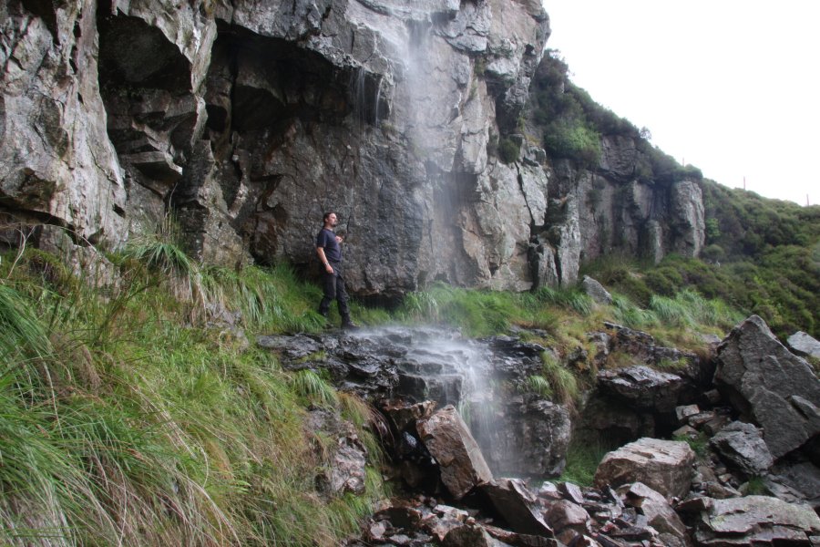 There is space to walk behind one side of the waterfall, but be warned that the wall of the shakehole is quite loose, and prone to collapse. Take care.
 Nant y Coetgae, a small stream near Nant y Llyn, with its own very small waterfalls. Not really good enough to deserve a dedicated walk.
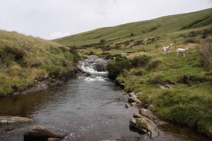 Cascade on the Tawe, at the confluence with Nant y Llyn.
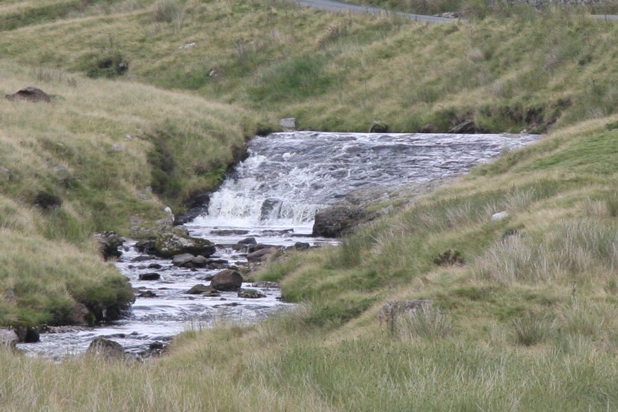 Waterslide on the Tawe.
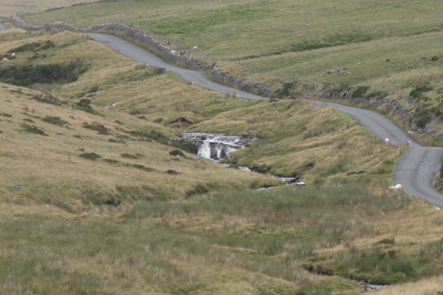 Upper cascade.
 Red kite gliding over the river.
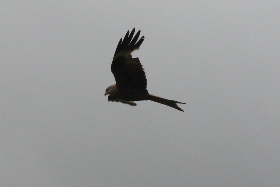 With my old camera, I dreamed of getting shots like this.
 The upper Tawe, with the lower end of Fan Hir's immense scarp.
 From the road, you can see the tops of about half of the waterfalls. From this angle, the clearly visible path on the right of the stream looks steep, but it's a lot easier than it looks.
 Ford the Tawe by the parking area, and pick up the path heading up the right side of Nant y Llyn. The first cascades quickly appear.
 The first waterfall, about 5 metres high.
 Cascades, the upper of which is about 5 metres tall.
 Looking back towards Maen Mawr, a standing stone and small stone circle, part of the Cerrig Duon site, apparently.
 Another few little cascades.
 Then the main and very impressive waterfall. The big drop is only about 8 metres, but the dramatic wall gives it a very special character.
 Cascades above the big drop.
 A little further up is this 7 metre beauty. This ends the chain of waterfalls since the main one, about 22 metres in total height.
 Another 5 metre waterfall.
 Small drop, big pool.
 A trench then contains the tallest waterfall, at about 9.5 metres.
 The next waterfall is the last of the large waterfalls, at about 4.5 metres. Behind it, Fan hir (761 metres) and Fan Brycheiniog (802 metres) begin to dominate the view.
 Becoming progressively smaller, just a few metres.
 Little cascades.
 The last waterfall, identified as the one with a sheep beside it. That makes it recognisable, right?
 The path continues all the way to Llyn y Fan Fawr, at the base of Fan Brycheiniog, and from there, it is possible to join up with other waterfall routes in the area. (Picture borrowed from an earlier visit.)
 Looking over Cefn Cul to Fan Gyhirych, and the Beacons in the distance.
 Walk up the road, taking the right branch when it splits just above the scout hut. The road soon becomes a track and an overgrown track leads off on the right. Take the track to the right - this area is not shown correctly on the map.
 The other track gives a brief view of Craig y Pant, but don't worry, you will see it later anyway.
 If you follow the wrong track, you can take the path to the right when it swings left, to join the correct path.
 The proper track reaches the Nant Gwrach stream, and follows it to an invisible junction of streams, and a very visible junction of paths. The way on is the steep path (once a tramway incline) climbing up to the right between the two streams, following the Nant yr Argoed stream to the right. If you reach mining buildings, you have just gone the wrong way, but you may want to head there first in case you choose not to return down that stream.
 Little cascade beside the bottom of the incline.
 Upstream, and quite a way below the tramway, there is the sound of a waterfall, but it is only a weir, being slowly reclaimed by nature. There is no path to it, and a lot of undergrowth blocking the way.
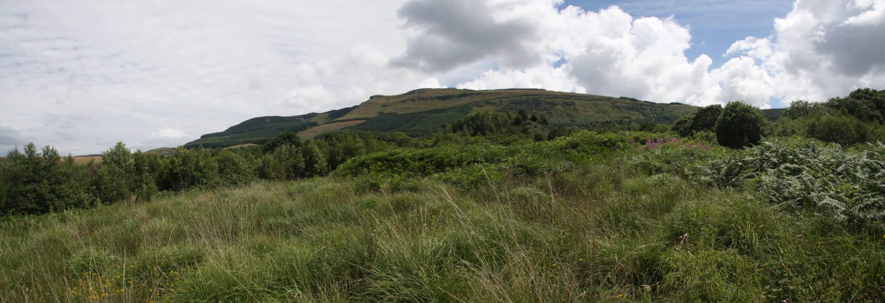 At the top of the incline, go through the gate, then look for a path heading up to the right, which picks up a new track, breaking out into the open. The Rhigos Mountains dominate the view: the tiny bump of Hirwaun Common, the green Y Foel-Chwern ridge, the bumpy tops of Mynydd Pen-y-cae (573 metres), and the long Cefn Grug ridge.
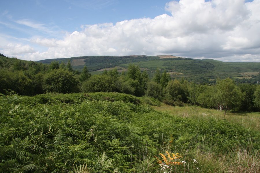 On the far side of the Neath Valley are the Craig Clwyd cliffs of Hirfynydd (481 metres).
 The track swings left just before a fence, but to reach the waterfalls, you need to get into the field on the other side of that fence. Either cross it here, or follow the track around and cross into this field later. Either way, you need to get to the right side of the field, at the edge of the stream's woodland.
 There is no path down to the waterfall, so you need to work out the best place to descend really carefully into the valley. Take it slowly and watch out for crags and hidden drops. Head slowly upstream to the waterfalls.
 Sgwd yr Argoed only has a small stream falling about 6 metres, but its large alcove and rich, mossy sides make it quite attractive.
 Immediately beside the main waterfall is this inlet waterfall, about 10 metres in total.
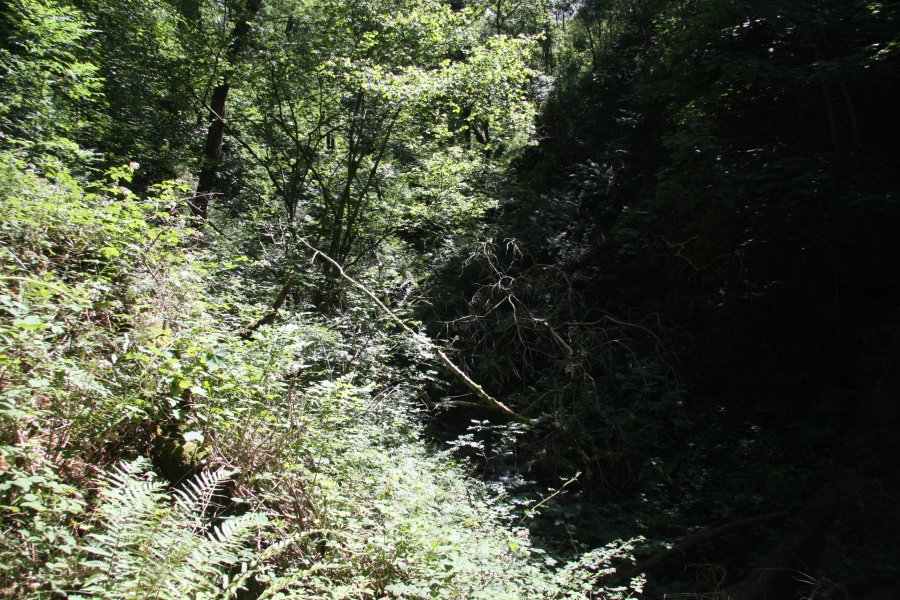 The only sane way upstream is to return to the track by the fields, and then take a path to the right to arrive at the Blaengwrach Farm. I tried to head upstream through what I can only describe as Hell on Earth - brambles as tall as myself, and rotting, fallen trees blocking the stream.
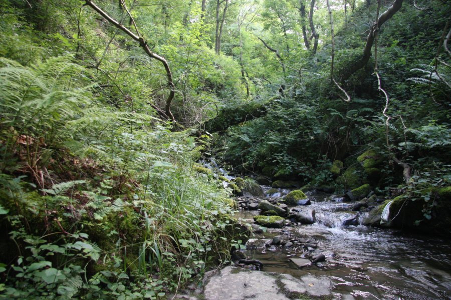 The map showed something upstream - this had better be worth it. I stuck to stream level to make it easier, but repeatedly had to scramble through the branches of fallen trees. Progress was painfully slow, and I had already had more than enough of brambles ripping through my clothing.
 OK, no, it wasn't worth it. The waterfall on the Nant Ysgubor, as it joined the main stream.
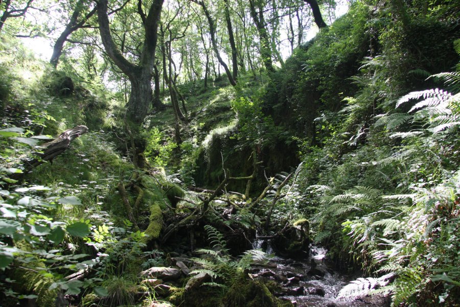 Looks like it might be getting easier, but up ahead, I had to jump onto the roots of fallen trees as the steep sides had collapsed along with the trees.
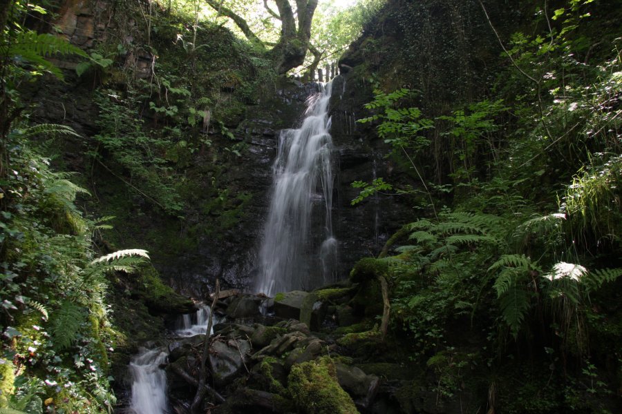 Finally, the last waterfall on the stream, about 5.5 metres high.
 To reach the waterfall safely, there's a short track heading to the right, behind Blaengwrach Farm. After passing the back of the farm on that track, follow the left side of the fence that heads over to the stream valley. The picture is the view looking back from that point. From there, a poorly defined path crosses a fence and follows the left side of another fence to drop down to the stream at the head of the waterfall. View it from above.
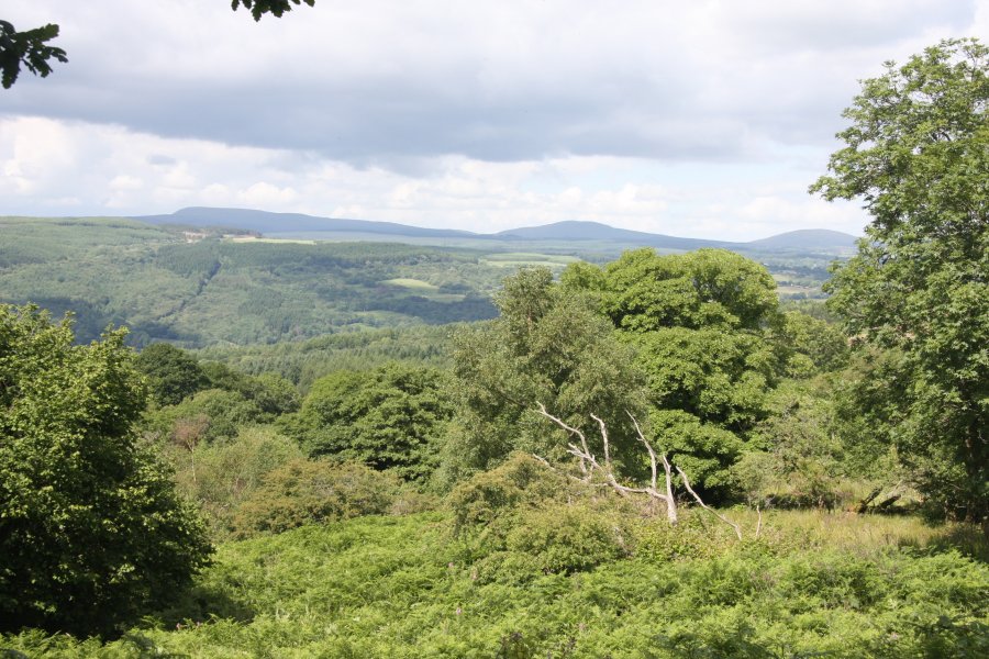 The view towards Fforest Fawr; Fan Gyhirych, Fan Nedd (663 metres) and Fan Llia (632 metres).
 And the Black Mountain; Picws Du (749 metres), Fan Brycheiniog and Fan Hir.
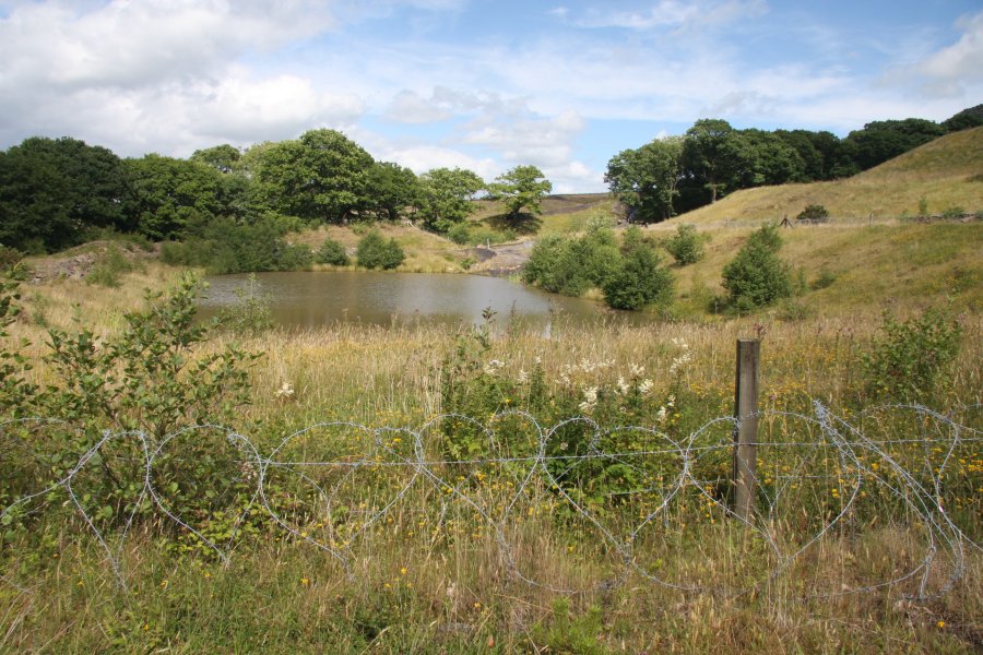 Return to the main track past Blaengwrach Farm, and follow it as it swings left, then continues in roughly the same direction, passing some other tracks, and turning some sharp corners, to arrive at these settlement tanks. Follow the track that skirts the right edge of these, passing through trees to reach open fields. Just up ahead is a massive quarry, but the way down is to the left.
 Follow the edge of the trees that line the Nant Selar stream, until it joins another stream. You should be able to see the next waterfalls at the junction.
 Instead, I followed some earlier fields down, before the settlement tanks.
 Common Blue Damselfly.
 Incredibly clear closeup of a tiny grasshopper. These were everywhere, and the grass around me would keep being knocked around by them in anticipation of my footsteps.
 The map shows waterfalls at the junction of Nant Pen-y-cae and Nant Selar, but it completely fails to show the cliffs correctly. I had to make a rather tricky descent to the upper cascade to cross the stream, then descend the banks of Nant Selar, falling badly in the brambles for my trouble. The easier route (mentioned earlier) avoids all of this.
 Nant Pen-y-cae drops quite dramatically for about 7 metres down the tall cliffs. Stay near the top of the trees above Nant Selar for another 200 metres until the path is forced to head into them. There is an official path that now stays high up in the valley to rejoin the tracks near the start of the walk. I dropped immediately into the stream, down the remains of a path.
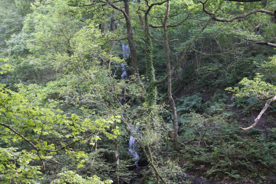 On the far bank, a tall waterfall drops 20 metres in steps down the cliffs. According to the map, neither the cliff nor the waterfall exist.
 Just downstream is a breached dam, which had to be skirted to the right.
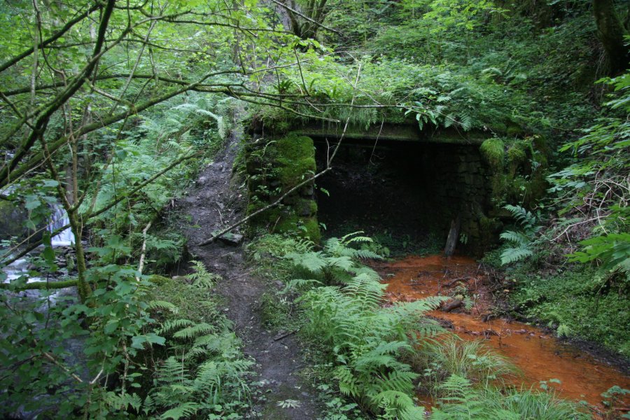 Crossing the stream brought me to a path beside a mine leeching iron.
 And an old boiler.
 And a small cascade.
 To arrive back at the old mine buildings.
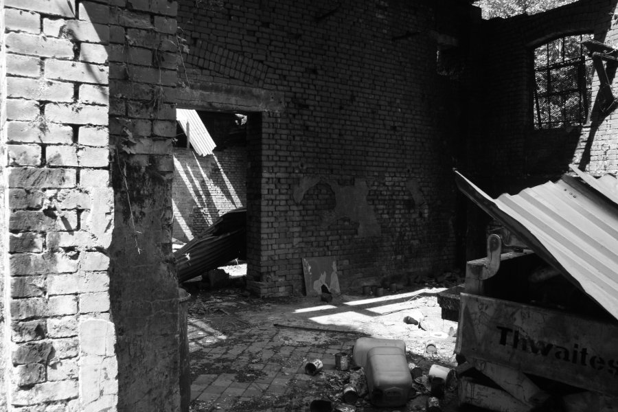 Falling into disrepair. That's an abandoned mechanical dumpster that has been "decorated" by the locals.
 Decay.
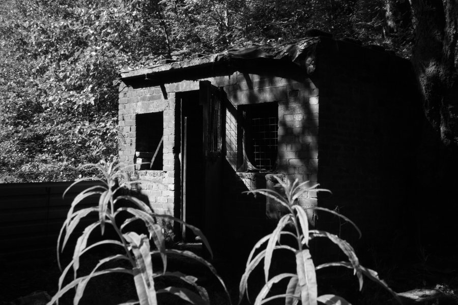 Shadows of grilled windows. The powder store.
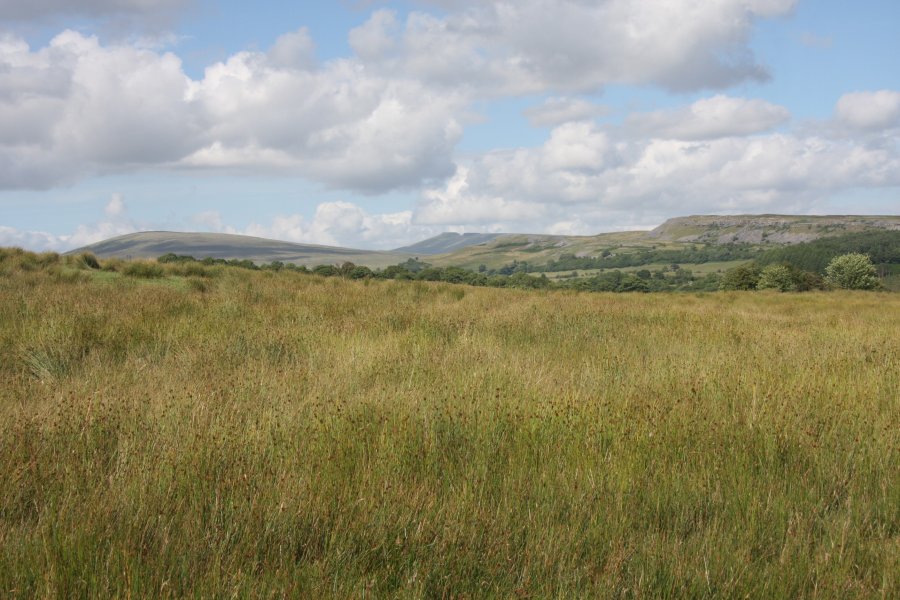 Meadow at Fforest Fawr, with Fan Fawr (734 metres) and Gwaun Cefnygarreg (457 metres) in front, and the Beacons behind.
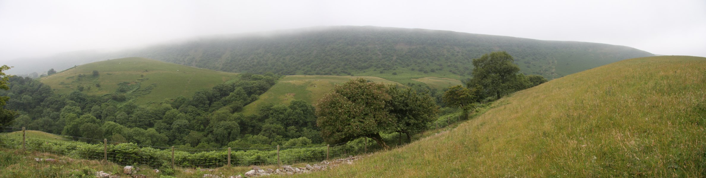 View of the impressive Tarren yr Esgob crags. We started the walk in very poor weather, with low cloud all day. It had only just managed to rise above the scarp, and was still drizzling.
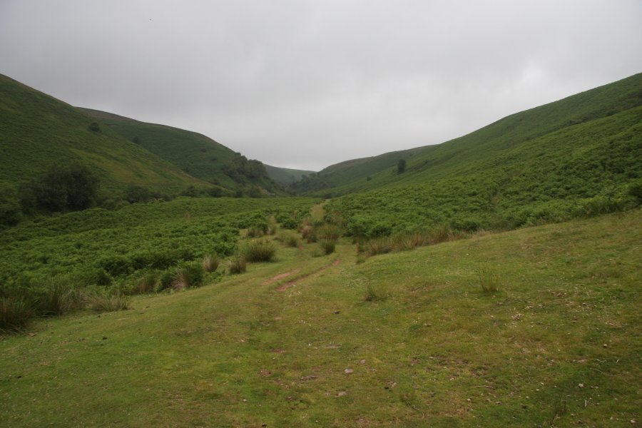 Head up the road to the Blaen-bwch farm, and continue past it along a path to the end of the fields. From there, the path heads up to the dramatic northern scarps of the Black Mountains, but our route loops earlier than that.
 At Nant Ganol, the first stream after the fields ended, ford the stream and pick up a path running back along the other side, over the head of Nant Ganol's tiny waterfall.
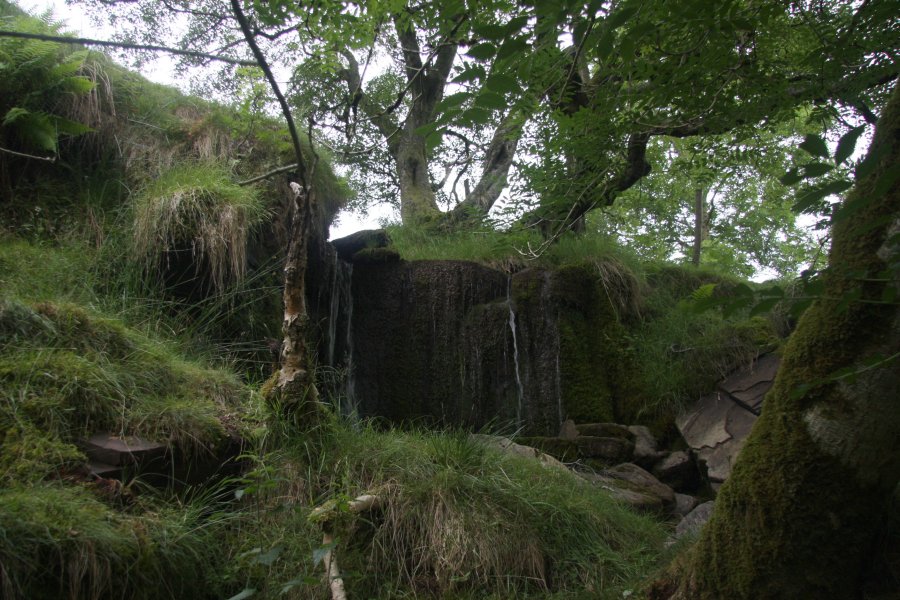 Continue heading back down the valley over the next little waterfall at Nant Isaf.
 The path leads under the dramatic Tarren yr Esgob scarp, following a fence and old wall.
 Just after the fence and wall end, the waterfalls are below. However, you must resist the temptation to descend to them. This picture, taken from the other side of the stream, shows the way down. Wait until the stream has turned away, and there is an open patch (seen here on the left with the bracken slowly advancing over it) on the left of the path. Head to the far side of that open patch, and then locate somewhere safe enough to descend the slope down to the river.
 If you try to drop down too early, this is what awaits you.
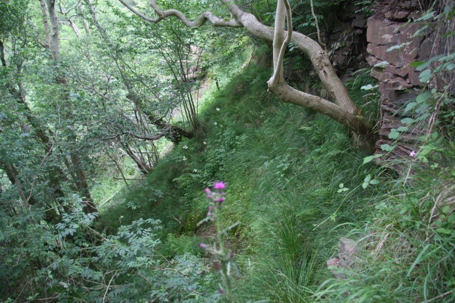 It is also possible to descend from the other side, but that also has crags to avoid, and requires crossing private fields.
 Head upstream to the Nant Bwch waterfall, which has no official name. It is actually two separate drops, of about 3 and 7 metres respectively. Then return to the path, and head to the left, around the left side of a little hill.
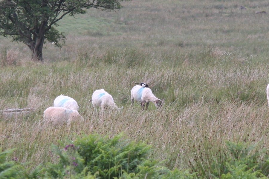 Magpie platforms.
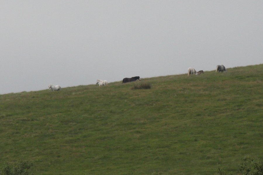 Wild ponies.
 Blue sky? Something must be wrong here.
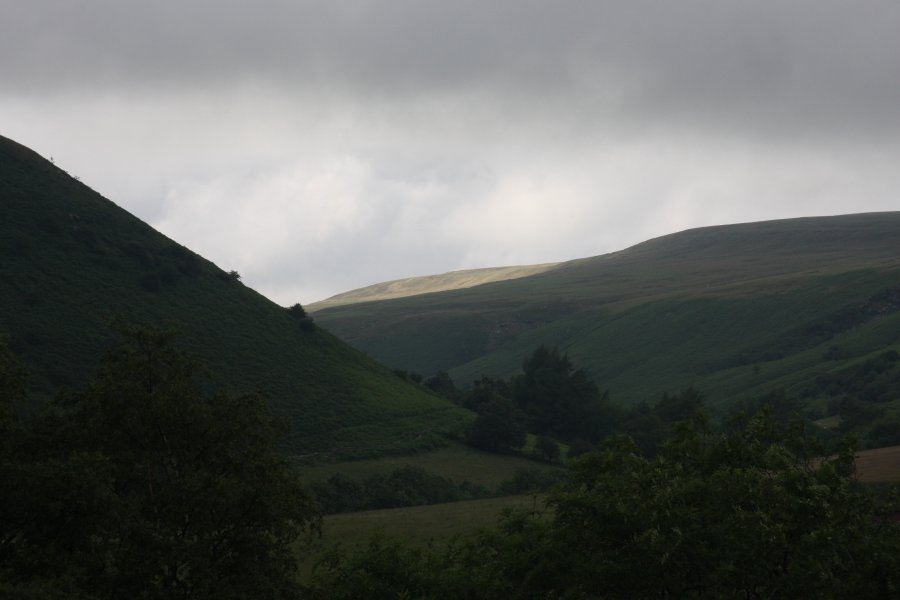 Lord Hereford's Knob, 689 metres, with some sunlight.
 And on its Darren Lwyd ridge.
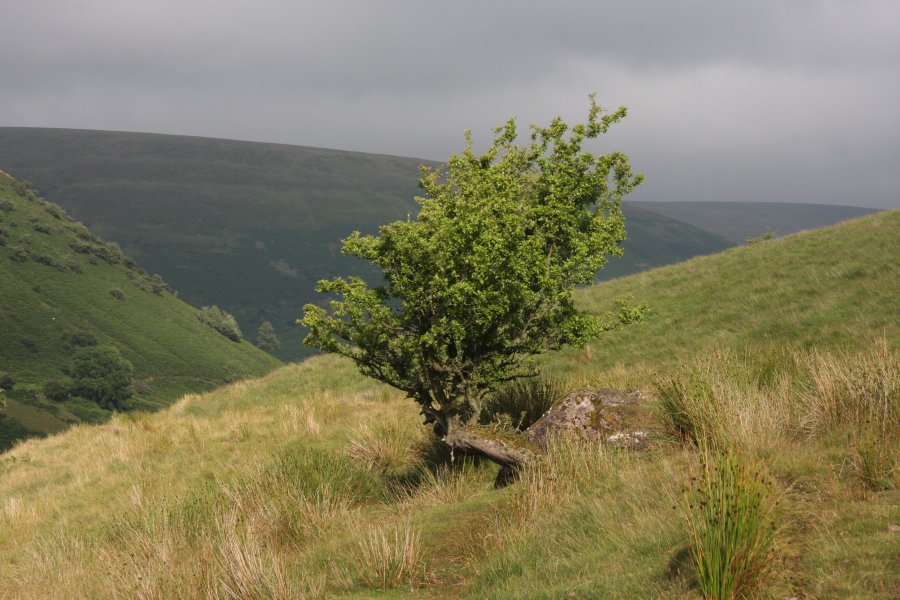 A moment of light.
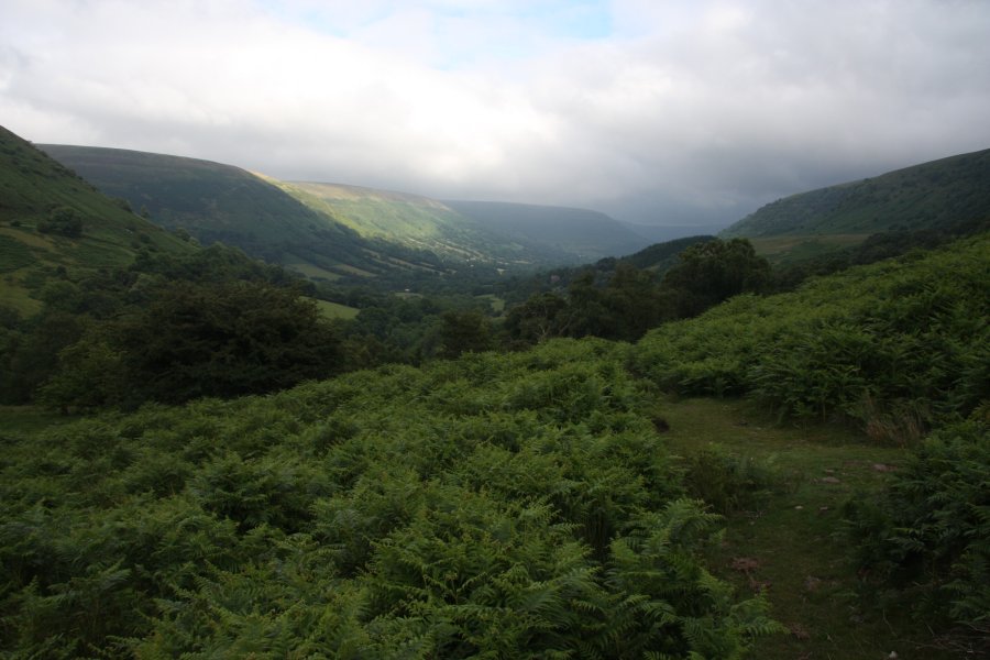 The superb glacial Vale of Ewyas, now occupied by the Afon Honddu.
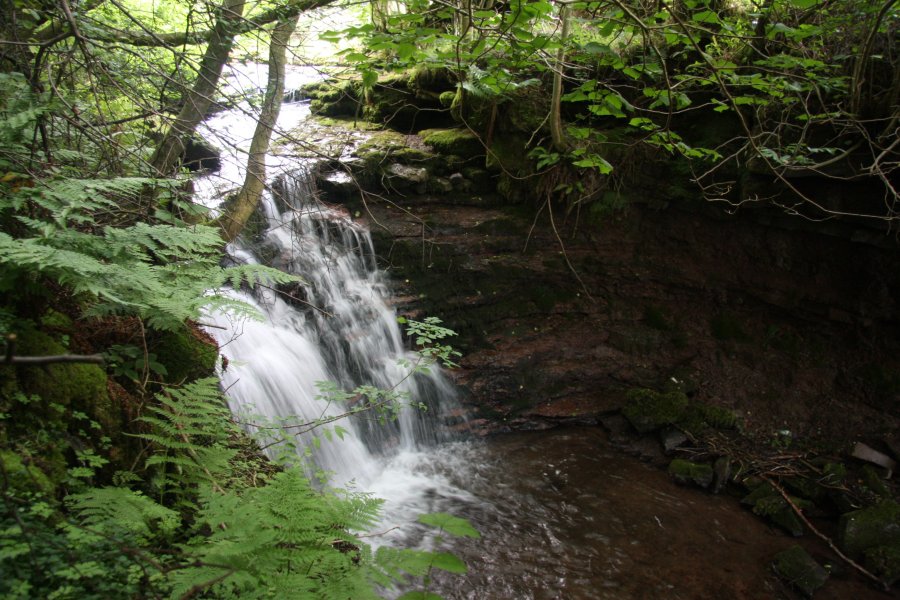 Drop down to the Talsarn farm, and turn left on the road. Follow it up to the Irish ford. Just downstream is this cascade, a few metres tall, hiding in the trees. Continue along the road to where you started.
 Bizarrely twisted bark on a chestnut tree in the Vale of Ewyas.
 Bark and burrs.
 Hatterall Hill (531 metres) and Graig (350 metres).