Secret Waters 2011
Hunting some of the more obscure Welsh waterfalls: Glangraig Waterfall, Rhaeadr Porth-llwyd, Afon Ddu, Afon Tuen, Craig y Llo, Craig y Ffrwd, Nant Ddeiliog Falls (and nearby Ffrwd Fawr), Cwm Dwfn Falls, Craig y Llyn, Cwm Cerrig-duon Falls, Pistyll y Ceunant. Oh, and the Dolanog Falls weir.
Glangraig Waterfall
There are several little waterfalls between Llangrannog and New Quay in West Wales. The majority of these are small streams falling off the sea cliffs, and have no safe approaches from above. In the majority of cases, these waterfalls are best seen from the dolphin-spotting boat trips that run down to Ynys-Lochtyn from New Quay. The only exception is the largest waterfall below the Glangraig farm, which can be clearly seen from the Ceredigion Coastal Path. My visit was made after heavy rain.
The shortest route to the waterfall is also the easiest, starting on the B4321 between Pontgarreg and Llangrannog. 700 metres after Pontgarreg, a lane doubles back on the right. There is some space to park on the junction, in front of a post box. A short distance down the lane, a smaller lane leads off on the left, heading down to the Glangraig farm. At a corner just before the farm, a footpath continues ahead, down towards the coast. The waterfall is situated in a tiny bay to the left, near where the path joins the main coastal path.
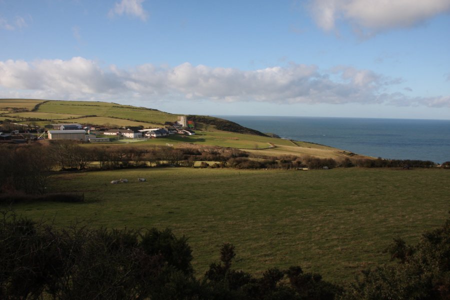
 The Urdd Centre, an activity camp for children, used by many Welsh schools. This part of Wales is almost completely bilingual, with speakers switching from English to Welsh and back again several times within a sentence, whenever a word is retrieved faster in the other language. The name of this site appears to be a deliberate attempt to produce the most unexpected Welsh pronunciation in as few letters as possible. The name sounds like "Irth" (with a voiced "th" like in "this"). They could have gone further and called it Llychwyfurdd, but the current name is perfect for duping English speakers into thinking that they can pronounce it.
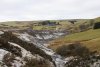
 Approaching the tiny bay. The unnamed stream can be seen separating two fields on the left.
 The waterfall has no official name, so I refer to it after the nearby farm; Glangraig Waterfall. Despite appearing perhaps 20 metres tall, the maps show that it actually drops about 40 metres, to land on the small beach. At high tide, it lands in the sea. It is possible to approach the base, but the slope becomes very slippery near the bottom. In the background are Pen y Badell (156 metres) with the Pendinaslochtyn hill fort on top, and the tidal peninsula of Ynys-Lochtyn.
 Directly below the path junction, a tiny alcove hides a sea cave and its waterfall. Though only about 5-10 metres high, it manages to be a proper sea cave behind a waterfall. However, there is no way to get down to it, and that vicious sea would make it far too risky to land a boat there. Sadly that means that even though this is one case where it would be possible to walk in a sea cave behind the waterfall, it would be too risky to reach it.
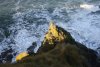 Light on the rocks near the sea cave.
 Further away from Llangrannog the coast is the Trwyn Crou peninsula, which has this tiny waterfall, seen here from a boat. Do not attempt to approach it from above.
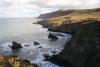 The view back down the coast from beneath the Urdd Centre, closer to Llangrannog. At the top of the 200 metre sea cliff is Penmoelciliau (216 metres). Beyond that is the point at New Quay. The unnamed bay with the sea stack and arch contains the Glangraig Waterfall at its far end.
 The stream flowing down from the Urdd Centre has its own 10 metre waterfall as it makes its last descent into the sea. It would not be possible to walk behind this one, even if it were possible to climb onto the ledge. Once again, this is seen from a boat. Do not attempt to approach it from above.
Rhaeadr Porth-llwyd
WARNING: The Afon Porth-llwyd is an extremely dangerous river. The water originates in two reservoirs, which cause the river to flash flood suddenly and without warning, with a flood pulse powerful enough to kill. Even in dry summer conditions, it is possible for the river to flash flood, if the water is not drawn to feed the turbines. The best advice I can give you is to stay a long way away from the river. The power station authorities have also made it very clear that they do not want anyone to risk their lives by walking along the river bed. Several signs point out the dangers, and advise the use of safe paths.
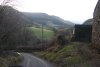
The river and waterfall are located at Dolgarrog, in the Conwy Valley. Under normal summer and winter conditions, the hydroelectric power station takes all of the water from the river, leaving it completely dry. Rhaeadr Porth-llwyd, the main waterfall, lies at the upper end of a deep gorge, protected from view by the difficult access, and the lethal river. Apart from the dribbles of water provided by small streams, the waterfall is normally dry. It is in autumn or winter that the river is most likely to carry water. This apparently happens most reliably in February, but can happen as early as October or November, needing about 3-4 days of heavy rain for the leats or reservoir to overflow. My visit was made with very careful planning, with guidance from the power station staff (Innogy PLC). It was made after several days of rain, but without the reservoir overflowing - the water was provided by an overflowing leat. My route was extremely hard, and should not be used as an access route. There are better ways to view the waterfalls.
The smaller waterfalls lie at the bottom end of the gorge, and the main waterfall lies at the top. To view the bottom ones, start at the disaster monument on the south bank of the river. Follow the path from the monument, staying near to the river whenever the path splits. Eventually the path dies, with a faint glimpse of the last of the lower waterfalls.
The main waterfall is much harder, requiring experience with walking around crags and through undergrowth, and I would advise a GPS with 1:25'000 scale maps to aid navigation. If you are unable to cope with the conditions, do not attempt to visit - even experienced visitors need to exercise extreme caution and great care. One option is as follows; Start at the bottom of the pipelines, at the side of the B5106. Walk up the right side of the pipes to the next road, then continue up the left side of the pipes, until a stile gives access to a footpath in the forest on the left, not long before the pipelines get much steeper. Follow this path as it zigzags steeply upwards. At the top of The Zigzags, use the stiles and paths to skirt around a large pipe junction. Locate a wall running horizontally on the far side of the pipes. Follow the upper (left) side of the wall, until it descends to a small stream and fence. Cross a stile and continue to follow the wall until it dies out. Try to continue carefully along the same line, taking great care to avoid the steep slopes, clambering down to lower ledges if needed, to reach a ledge overlooking the top of the waterfall. Following the fence (after crossing the stile) leads to the stepping stone river crossing above the waterfall. The path on the opposite bank, normally followed from the upper road down to the Conwy Valley, also offers obscured views. I advise against trying to see the lower steps of the waterfall. You follow these suggestions entirely at your own risk.
 After days of rain, all streams were in spate, and the rivers were at the point of bursting their banks. Within a few hours, this would turn into localised flooding, and by the next day, several roads were cut off.
 At Tal-y-Bont, a narrow lane winds its way very steeply up to the hanging valleys of the Carneddau.
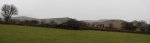 An eastern arm of the Carneddau; Pen y Castell (623 metres), Penygadair (507 metres) and the Pen-y-gaer hill fort, with Foel Lwyd (603 metres) and Tal y Fan (610 metres) in the background.
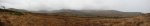 The mountains and hanging valleys at the eastern end of the Carneddau. From left to right are the long ridge of Moel Eilio (546 metres), Creigiau Gleision (678 metres), Creigiau Gleision North Top (634 metres), Pen Llithrig y Wrach (799 metres, looking like two mountains), Pen yr Helgi Du (833 metres), the long Craig Eigiau ridge (735 metres), Pen y Castell and Penygadair. The tallest of the eastern Carneddau are hidden in the rainclouds.
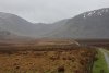 Filling the valley between Llithrig y Wrach and Craig Eigiau is the remains of a 1km long dam wall, with two very obvious breaches in it. The dam was built in 1910, to increase the size of the natural Llyn Eigiau, for use by the hydroelectric power station in Dolgarrog.
 On 2 November 1925, several days of very heavy rain caused water to undermine the Llyn Eigiau wall, and then suddenly breach it. Given the length, poor foundations, meagre thickness and shoddy construction of the dam, it's hardly surprising. Despite knowing of its poor quality, the company directors were not held responsible, as there was no regulation of the industry at the time. This incident would prompt the subsequent regulation of dam construction.
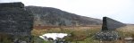 The breach caused the water to rapidly exit the reservoir. At the point of the breach, the wall is between 4 and 6 metres high (depending on the level of the peat bog). Over the course of a day, over 3 million tonnes (cubic metres) of water rapidly spilled through the breach.
 The water ripped a deep channel through the peat, down to the boulder clay below, extending to the river bed on the far side of the valley.
 The flood waters spread rapidly over the grasslands, without causing much damage.
 Some time later (after the floods had subsided), a second, much larger breach was intentionally made, to prevent the dam from ever retaining water again.
 A cascading stream draining Craig Eigiau. It drops some 300 metres down the cliffs, with the heavy rain making some temporary cascades upto 15 metres or more tall.
 Fed from the mountain streams (and currently also fed by tunnels from neighbouring reservoirs), Llyn Eigiau had reached overflowing level during my visit. The lake is now reduced back to its original size, and has a weir that maintains the level. Some of the water is tapped to supply Llyn Cowlyd, and the remainder continues downstream when the reservoir overflows.
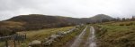 Moel Eilio's eastern ridge.
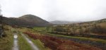 Situated under Moel Eilio is the smaller Coedty (or Coety) Reservoir. The 1925 floodwaters reached this point, and the combining water rapidly overpowered the older dam. It quickly burst under the load, and its 300 thousand tonnes of water joined the flood. The water raced down the gorge, onto the village below. The echoing sounds of the dam bursting was the only warning of what was about to happen.
 A series of leats (aquaducts) drain the surrounding hillsides, leaving almost no natural streams, and delivering all of the water to the various reservoirs. Many of these were also used in 1925. The water is then drawn off through the pipeline to supply the power station in the valley below.
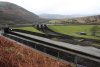 With the rebuilt (and much more substantial) reservoir, the leat has an overflow, but more importantly, the reservoir has its own overflow with tipper gates. These gates hold back the water until it starts to overflow, then they suddenly tip open, and send an impressively large amount of water (though of course much less than the 1925 disaster) flash flooding down the river. During my visit, the lower reservoir's water was quite low, despite the rain. However, by the next day, it was almost certainly overflowing.
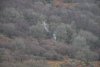 During my visit, the upper leat was overflowing, cascading down the hillside.
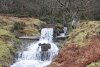 A bridge carries it over the lower leat, allowing this water to supply the river. This accounts for almost all of the water I would encounter in the river below.
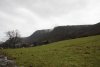 The river then flows very steeply down a deeply incised gorge through Coed Dolgarrog to the village of Dolgarrog, site of the 1925 village of Porth Llwyd.
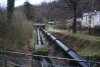 The water pipes carry the combined reservoir water down the slopes to the power station.
 Dolgarrog Power Station, with the remains of the aluminium works beside it. These were the original users of the water in 1925, and although the aluminium works were removed in 2007, the water continues to be used by the power station.
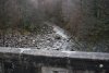 The river during my visit. In flood conditions, when the tipper gates are open, it can run high enough to cover the bottom of the trees. In those conditions, the river is lethal, and would have been too high for me to reach some of the photography points in the gorge.
 A memorial walk near the southern bank of the river in Dolgarrog now marks the site of the old village of Porth Llwyd. When the lower dam burst, the water raced down the gorge's waterfalls, collecting boulders as it went, and dumped them onto the village. Amazingly, only 10 adults and 6 children were killed, with the majority of the village having been saved by watching a film in the village assembly hall, and the 200 workers working late in the aluminium works.
 The village's reverend also proved to be a hero, warning residents as the earlier floodwaters arrived, and saving one child from the roof of a house, while his church was swept away with the water ringing the bell as it went. All of the dead were recovered, but the houses were buried under these boulders, or swept away. The river's course was also completely changed, moving from the southern side of the old village, to the northern side of it.
 The new waterfall created by the disaster, just upstream of the road. Note the concrete used on its right side to try to contain future floods.
 At the mouth of the gorge is the site of an old waterfall, now piled up with boulders. The largest of the boulders were dropped around here, with 6 boulders weighing about 500 tonnes each, the largest known visible boulder being about 7.3 x 6.4 x 4.6 metres in size - that's the size of a house.
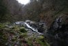 The waterfall at the mouth of the gorge. From here onwards, the river takes on a new look. All surfaces are washed completely clean of rocks by the 1925 flood, with the sides remaining quite well washed. The depth of this washing is the flash flooding depth caused by the reservoir tipper gates, with this 4 metre waterfall being completely covered by floodwater in those conditions.
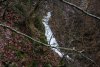 Shortly afterwards, the path up the left side of the gorge ends. The ledge quickly disappears, with a glimpse through the trees of the next set of cascades.
 Backtracking a long way made it possible to scramble up to the next ledge, but this also ran out quite quickly. Each time a ledge ended, I backtracked and scrambled up another level. You may notice the difference in the ages of the trees at different levels here - this will be covered later.
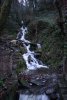
 The tallest single drop waterfall lies in the middle of the gorge, at about 15 metres tall.
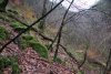 The going became easier as I reached the line of older trees. Below this level, all trees are less than 85 years old - anything older was ripped out by the 1925 flood.
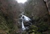 A return to river level brought me to the base of Rhaeadr Porth-llwyd. The tallest drop is only about 10 metres, but the total drop is an impressive 61 metres (according to the The Royal Geographical Society's investigation into the disaster). Despite its size, it only appears on the 1:10'000 scale maps, with the archaic spelling Rhaiadr Porth-llwyd. The waterfall has also been incorrectly referred to historically as Rhaiadr Mawr (these references also give the wrong location for the waterfall, placing it on the Afon Geirionydd, nearly 10 km away).
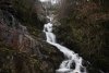 The upper benches of Rhaeadr Porth-llwyd. Reaching this point required another ascent of the steep banks in the forest. The clean washing shows that when the reservoir gates tip, the flash flooding water maintains an incredible depth of about 2 metres over the surface of this waterfall. During the 1925 flood, the water reached a whopping 14 metres of depth, ripping out any boulders that had been resting on the rock surface, and completely altering the waterfall's appearance.
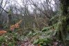 Time to get back up into the safe zone above the river, slowly climbing far enough up the 100 metre cliffs to reach somewhere navigable.
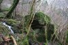 The old flood line, quite distinctive because there are boulders that were not dragged downstream to the village.
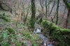 The wall and fence that mark the line of the old footpath.
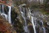 Following the line of the wall leads to a ledge overlooking the top of the waterfall.
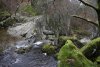 While following the fence leads to the stepping stone crossing above the waterfall. There are some large boulders here, as the 1925 flood didn't start ripping big boulders out until the head of the waterfall.
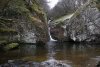 The stepping stone pool is topped by a 4 metre waterfall.
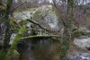 The bedrock in this area was fractured in many places by the force of the 1925 flood. This 10 metre high boulder may have pre-existed the flood, or may also have been broken off by it.
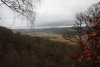 View towards the mouth of the Conwy Valley.
 By now, I had reached my limit of exertion, and it was time to head away from the gorge. I followed the wall back towards the more popular paths.
 Old beech trees.
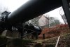 Pipe junction, where the pressured pipelines from the Coedty and Llyn Cowlyd reservoirs come together for their final descent.
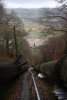 A very rapid descent.
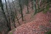 The top of The Zigzags.
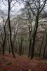 Locally, this path is infamous, and given how steep it is, that's not a surprise.
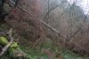 The pipelines are also incredibly steep, dropping over 100 metres at this angle.
 The right-hand pipe runs along the line of the old railway incline, used for the local quarries and reservoir building.
 Looking back up to the steepest section, where the railway incline also used to run, and where the engines were taken to service the upper tracks. It is a very impressive feat to get a steam engine up something that steep, especially as the engines would need to be pulled up using cables, as there was no toothed track.
For more details of the disaster, I recommend A Topographical Study Of The Flood-Swept Course Of The Porth Llwyd Above Dolgarrog, the Dolgarrog & Dam Disaster gallery and the Dolgarrog Disaster silent film.
Afon Ddu
The Afon Ddu is located at the southern end of Dolgarrog, with its source in the Llyn Cowlyd Reservoir, between Creigiau Gleision and Pen Llithrig y Wrach. Part of its flow is also piped to the Dolgarrog Power Station, and used as the Conwy Valley water supply. Like the Afon Porth-llwyd, it can flood quite suddenly, but seems to be trusted more, as it is frequently used by gorge walkers. This is perhaps due to the more normal spillway that it uses, as well as the long distance between the reservoir and gorge. Its water is also partly supplied by leats, but flow is generally very low in dry weather. The gorge walkers have named just about every feature that they encounter, but none of their names are official, or recognised outside of the gorge walking groups.
 The river splits into three strands to pass under the road, where there is a dedicated parking area.
 On the right bank of the river (looking upstream), a concreted access lane gives easy access for walkers. After zigzagging a couple of times, it crosses a cattle grid. At the next corner, leave the track and head over to the river to view the first waterfalls.
 The lower Afon Ddu waterfall.
 Gorge walkers climbing its bottom step, below the waterfall. They use the name The Narrows to refer to the miniature gorge that it lands in.
 Above it is a rough cascade. On its right side are some boulders that the gorge walkers squeeze between, which they call the Elephant's Bum. It is easiest for walkers to return to the lane to get beyond here.
 Just after the lane turns the corner, it passes two small buildings. Behind them, a steep wall and pipe can be followed upwards to a ledge overlooking...
 ...The tallest of the single drop waterfalls, this 12 metre beauty. Gorge walkers have no good name for it, simply referring to it as the big waterfall.
 Although the path in theory continues upstream, it becomes heavily overgrown, and you may prefer to return to the track. Hiding in the gorge below is a small scramble that gorge walkers call The Impossible Boulder.
 Back on the lane, it begins to climb at as much as 1-in-2 (50%).
 At the top, it reaches the water treatment works building. On the left side of this is a large, flat area.
 The flat area gives a fairly good view through the trees to the upper waterfalls, which total about 35 metres in height. There is no good point to take pictures, due to the forest and angle of the slope, so visits are best made in winter. Gorge walkers once again have no good name for this, referring to this section only as the upper gorge, with The Top Pool a little way upstream.
Afon Tuen
The Afon Tuen is located directly above Gyfarllwyd Falls (part of the Devil's Bridge/Pontarfynach waterfalls site), on the northern side of the Rheidol Gorge. It falls down the perilously steep crags of the gorge, and should not be approached from the northen bank. Due to the depth of the gorge, and the fact that this is one of the very few vertically-sided deep gorges in Mid Wales, viewing the waterfall must be done with great care. It is not visible from any of the normal tourist routes. Visits are best made in winter, once the trees have lost their leaves.
The 1:25'000 scale maps clearly show the location of Gyfarllwyd Falls, with a large cliff immediately to the east of it. At the northern end of that cliff is a small building (also marked), with a track leading to it. This is the view point. From Devil's Bridge, take the A4120 northeast towards Ponterwyd. Just after the forest ends and the fields begin, there are a series of abandoned cub huts on the left. The track starts just after these, and there is roadside parking about 250 metres further along the road.
 Moonset over the frosty fields near Aberystwyth.
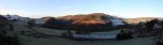 View over the upper part of the Rheidol Gorge at Tynyffordd. On the left is the 450 metre ridge separating the Mynach and Rheidol valleys. In the middle is Bryn Bras, rising to 397 metres, and on the right, about 1 km away, is Ponterwyd.
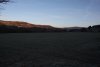 Fields at Erwbarfe Farm, with sunrise catching Bryn Bras on the left, and Pumlumon's Y Garn (684 metres) in the distance.
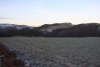 View over the last of the fields before Devil's Bridge. The target lies near the end of the woodland on the far bank of the gorge, while the power lines on the left sit over the access track.
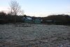 The old cub huts, a wonderful place to take pictures of decaying ruins. Sadly, this is all I took.
 The overgrown track leads down to the remains of the Swiss Cottage. The chimney and foundations remain, but the rest looks like a wooden shell that has been blown over.
 From the old back garden of the cottage, the waterfall can be seen through the trees. Directly underneath the cottage is a very steep slope and cliff, dropping 70 metres into the gorge. Take care, and unless you are able to cope with it, stay on the safer side of the fence.
 The unnamed Afon Tuen waterfall, dropping 70 metres in total, with the biggest drop being about 15 metres. To get this picture, I had to descend the upper slopes, with a 50 metre cliff below my perch. Not a nice place to be.
 Iconic red kite. No trip to Mid Wales is complete without it.
 Frost in the nearby Tarennig valley.
 Frost, not snow.
Craig y Llo
While the name (meaning "crag of the calf") clearly refers to the crag, and the waterfall is simply a side feature, the name has become commonly used to refer to the waterfall as well. This is one case where the waterfall has taken on the name of the crag, so it is included in my listings.
Craig y Ffrwd
The next major valley upstream along the Severn is the Nant Colwyn, sitting at the edge of the Hafren Forest. The name (meaning "crag of the torrent") clearly refers to a waterfall, but the map fails to show a waterfall at the correct location. It lies quite close to the lane running up the valley, with the easiest access route starting one field before the last farm on the access lane, before it enters the forest.
 Frost at Glynhafren in the Severn Valley.
 Glynhafren.
 The extensive Hafren Forest beginning in the Severn Valley.
 The public path starts at the edge of the field, with this gorgeous view down the Severn Valley. A flock of sheep mistook me for the farmer, and hurried over to ask for hay.
 Nant Colwyn, the white beard stream, with a small patch of mist rising from the valley.
 The path turns and drops into the forest. At the stream, turn right and head upstream, trying to avoid any fallen trees.
 The lowest of the waterfalls.
 The main Craig y Ffrwd waterfall, roughly 10 metres high.
 Small cascade upstream of the crags, marked on the map. It is not worth the effort to reach it, but if you feel the need to, approach it from the forestry above, and avoid ascending or descending the crags.
Nant Ddeiliog Falls and Ffrwd Fawr
Though overshadowed by Ffrwd Fawr (one of the most impressive of all waterfalls in Mid Wales), Nant Ddeiliog has a very beautiful series of waterfalls, which are worth a visit. Ffrwd Fawr, of course, dominates the views, and in fact, the route used by this walk gives the best possible views of the lower waterfalls below Ffrwd Fawr as well. Therefore, I recommend this route as a way to view Ffrwd Fawr.
There is a dedicated parking area at the Dylife Gorge viewpoint, on the lane running between Staylittle/Penffordd-las and Machynlleth. 400 metres before this, a track leads off the lane, heading along the eastern rim of the gorge. I recommend a trip in winter, so there will be less foliage blocking the views, and the water levels will be much higher.
 The abandoned mining community of Dylife (pronounced "duh-lee-veh").
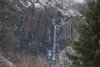 Ffrwd Fawr, the 40 metre sheer plunge waterfall at the head of the gorge.
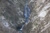 The lower falls of the Afon Twymyn, 12 and 4 metres high, respectively. These are most easily seen from the edges of the fields.
 The towering Craig y Maes crags on the left swing away, and the gorge widens, revealing a series of streams on its far side.
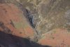 The most impressive of these is Nant Ddeiliog, which drops down the Nant Ddeiliog Falls, totalling about 50 metres for the upper set, and 30 metres for the lower set. The two tallest drops are about 18 metres tall each. The waterfall has no official name, so it is referred to here using the name of the stream.
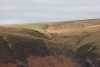 The stream is dammed upstream of the waterfalls, creating the Llyn Nantddeiliog reservoir. However, the reservoir wall has been breached, so that it no longer has any effect on the flow of the stream.
Cwm Dwfn Falls
Also on the lane running between Staylittle/Penffordd-las and Machynlleth, as the road begins to drop down from the Pumlumon plateau towards Machynlleth, it passes a deep valley on the right, which contains the waterfalls. There is roadside parking at various points. The easiest access route starts at the Cae Eithaf farm (the first farm by the road), following the track from there into the valley.
 The Tarren Hills, and Cadair Idris range in Snowdonia. The two main Tarrenau tops are Tarrenhendre (634 metres) and Tarren y Gesail (667 metres). The Cadair Idris tops are Mynydd Pencoed's Craig Cwm Amarch (791 metres), Penygadair (893 metres), Mynydd Moel (863 metres) and Gau Graig (764 metres).
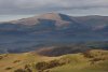 Tarren y Gesail.
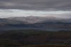 Cadair Idris.
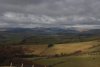 The Dyfi Hills and Aranau ranges. In the Dyfi hills range are Waun-oer (670 metres), Cribin Fawr (659 metres) and Maesglase (676 metres). In the Aranau range are Glasgwm (780 metres) with Aran Fawddwy (905 metres) just clipping the cloud.
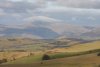 The Aranau. The tallest ridge on the right is Pen yr Allt Uchaf (620 metres), leading up via the Drysgol ridge to the main peaks.
 View over Cwm Dwfn. On the left is Moelfre, and on the right is Cerrig Gwynion (527 metres).
 Visible at the head of the valley are two of the deep scars. The main one on the right is Cwm Dwfn. The smaller one perched above it is Craig y Gath. A third deep scar is tucked down on the right, which does not appear to have a name.
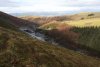 The track making its way up the valley.
 Rather than walk the long track, I descended the steep slope of Bwlch Coch, the small tongue of open access land extending down into the valley.
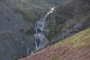 The unnamed scar contains a horsetail waterfall that is just short of 20 metres tall.
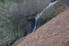 Some distance below it is a much better looking spout waterfall, which is a few metres tall.
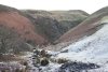 The path crosses a rotting bridge at the bottom of the valley, then begins to steeply climb up the other side. The view slowly opens out, depending on how high you get as to how well you can see into the valley.
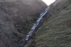 At the head of the valley is Cwm Dwfn Falls, a sloping horsetail waterfall (like most others in the area), about 30 metres tall. Sadly, it is north-facing, and is badly affected by sunlight at most times of day. The waterfall has no official name, so it is referred to here using the name of the valley.
 Cascades below the main waterfall.
Craig y Llyn
This walk was actually a bike ride to speed it up, as it was around 8 km in total, and the route was steep, mundane forestry tracks. Although it would be possible to devise more extensive routes, my route was the most convenient, with very good views. The area is extensively forested, without many convenient tracks, so other routes would almost certainly need to follow fire tracks. Many tracks are not shown on the maps, including the one that I used.
 The access route starts in Cwm Tafalog, the first major valley on the right when driving from Mallwyd towards Welshpool on the A458. The access lane begins with a steep downhill and uphill.
 Like the nearby Berwyn, this area is filled with pheasants; the most stupid of all defenseless birds. Not satisfied with giving away their hiding places by making stupid noises and flying off, one of them desperately tried to turn itself into dinner by intentionally jumping from a safe village pavement directly under the bumper of my car. When I managed to stop just in time, it flew off into the path of another oncoming car instead.
 Just after passing the Glan-yr-afon farm, a forestry track starts steeply off on the left, with some space to park.
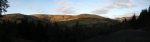 The track climbs steeply enough to make bike riding as slow as walking, but at least there are occasional good views over Cwm Tafalog. Shown here is Esgair Ddu (464 metres), with Foel Dugoed (439 metres) on the right.
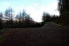 After zigzagging a couple of times, the main track reaches a junction, where the way on is to continue climbing ahead-right.
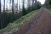 Why does it have to be steeper? Whenever there is a choice of routes, the way on is always the best track, that continues to climb upwards.
 The cold was now becoming a liability, turning every patch of water into ice. Sheet ice and bikes do not mix, and falling on ice is definitely not fun.
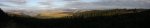 Cleared forest gave a superb view over the southeastern edge of Snowdonia. On the left is Maesglase, followed by Glasgwm, the Aranau in cloud (but with Gwaun y Llwyni's 685 metres, Esgeiriau Gwynion's 671 metres and Foel Rhudd's 659 metres sneaking under it), Mynydd Clywedog (532 metres), the forested top of Tir Rhiwiog (545 metres) and the forested plateau around Llyn Coch-hwyad.
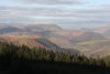 Maesglase, highlight of the Dyfi Hills.
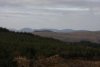 The Tarren Hills; Tarrenhendre, Tarren y Gesail and Graig Goch (586 metres).
 Pen y Brynfforchog (685 metres) and Glasgwm.
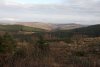 Mynydd Clywedog and Tir Rhiwiog, with a 598 metre ridge near Llanymawddwy in the distance between them. The next walk lies in the valley between the two main hills.
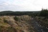 After a short down and up, the track reaches its high point near the summit of Mynydd Llyn Coch-hwyad. Ignore the track that heads off to the right, and continue downhill, towards the distant lake.
 As well as covering most of the track in sheet ice, the cold had grown in giant crystals under the gravel, lifting it up, and leaving a crunching, hollow surface.
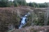 The track dies out at Nant Llyn Coch-hwyad, which introduces itself with a 5 metre cascade. It is no longer possible to ride a bike, so I left it behind for the next part.
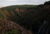 The stream then carves a gorge.
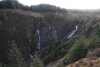 The large cliff at the start of the gorge is known as Craig y Llyn.
 The waterfall has no name of its own, but is clearly a major feature of the crag, so it takes on the same name; Craig y Llyn. It is around 15 metres tall in total, with the main drop being about 10 metres.
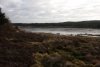 Following the stream upstream brought me to a track, where left reached Llyn Coch-hwyad. About 1 km south through the forest, the map shows a feature called Pwll Coch Bach, but this appears to be only a marsh. Similarly, the Nant Rhaeadr near Llyn Gwyddior appears not to have any significant waterfalls, despite its name.
 Returning along the track, and taking a right at the first junction, led along an ice-slicked path back to the junction near the top of Mynydd Llyn Coch-hwyad.
 Ice crystals, each over 10cm long, slowly shattering the walls of the track.
Cwm Cerrig-duon Falls
These are situated off the side of Cwm Dugoed, on the border of the Snowdonia National Park. There is no useful access route, as there are no nearby paths into the open access land containing the streams. My access route was from the A458, at the point where it leaves the national park at Pont Nant-y-dugoed.
 The only parking areas are in the driveways of the nearby farms. My access route was to follow a path along the edge of the field on the east side of Nant y Dugoed. The farmer seemed not to mind my using this route, but you should check for yourself before using it.
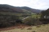 Cwm Dugoed.
 Once in the open access land, there are two paths heading up and down into the Nant y Dugoed valley. The upper path is the best for viewing the waterfalls.
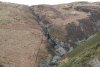 Cwm Cerrig-duon Falls were quite disappointing. The waterslides and cascades add up to 40 metres tall, but no drop is much bigger than 5 metres, and most of the water is taken out of the stream to supply a nearby turbine. The waterfall has no official name, so it is referred to here using the name of its valley.
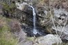 The only clean drop, under 5 metres tall.
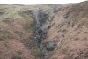 The map shows the top of the stream's descent as being a waterfall, but there is only a very small cascade, then a long rocky slope with the stream flowing under and around the boulders. Not worthy. Above the fence is a small dam used to draw off the water for the turbine.
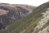 Near the upper end of the Nant y Dugoed valley, a rocky outcrop would prove a useful viewpoint to look into the head of the valley. Getting there involved wading through the deep gorse (with the associated painful pincushion effect).
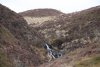 Tiny cascade at the head of the valley.
 Down below the junction of streams is this beautiful 6 metre cascade, but it's difficult to reach without becoming intimate with the gorse.
 Just below it is a 5 metre twin waterfall with a deep pool. This is also closely guarded by gorse.
Pistyll y Ceunant
This waterfall sits right beside the road that runs around Lake Vyrnwy (Llyn Efynwy). It lies on the southwest bank of the reservoir, about 3 km from the dam, about 1 km beyond the Llechwedd-dû parking area. There is roadside parking on either side of it. Although it is not as tall as the waterfalls at the other end of the reservoir, it has taller single drops, and certainly deserves attention. It is, however, a distraction for passing drivers. Visits are best made in winter, as the upper stages can be obscured by foliage in summer.
 The southeastern end of the Berwyn. On the left are the hills around Abertridwr, on the right is Rhialgwm (540 metres), with the main Berwyn in the distance between them.
 Approaching the lake.
 The massive Lake Vyrnwy dam, built out of stone in the 1880s. It was the first large stone-built dam in the UK, and the first in the World to have the spillway all the way across the dam itself (as opposed to a separate spillway at the side). The dam is supposedly 44 metres tall at the tops of its turrets, but is 26 metres high to the overspill, and 357 metres long. Perhaps the usually quoted 44 metres includes the depth of the foundations.
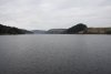 Lake Vyrnwy, a completely artificial reservoir, just over 7.5 km long.
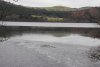 A large sheet of ice extending out into the lake.
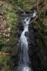 Nant y Maes, fairly typical for the streams feeding the lake. The bottom is a 5 metre cascade.
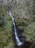 Pistyll y Ceunant. It is normally quoted as 40 metres, or 150 feet (45 metres) in height. However, the part of it visible from below is a little over 30 metres high, while the top (completely invisible from the road) is 66 metres above its base. I ascended the precarious slope on the left side of this, but I advise against using that approach. To see the upper benches, approach from the track above.
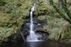 The single drop at the bottom (consisting of both the horsetail and plunge seen here) is 17 metres tall, but the reservoir removes some of that. Photos taken in low water show that despite looking black, the pool (which is in fact a spur of the lake, extending under the road) is only about 1 metre deep where the waterfall lands, with a cobble base. Therefore, it is normal for there to be 65 metres of waterfall, with this bottom single drop reduced to 16 metres.
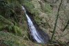 The upper part that is visible from the road is about 12-14 metres tall, pouring out of a gorge.
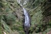 Hiding just inside the gorge is a 15 metre waterfall, landing on a rocky slope.
 Above it are some small cascades. The top of the main cascade is the top of the Pistyll y Ceunant waterfall.
 A few metres above the top of the cascade is the end of a forestry track from Llechwedd-dû. This can be used to approach the upper benches of the waterfall, but take care around the gorge, waterfall, and roadside cliffs.
Dolanog Falls
Since my route took me through the area, I paid a visit to Dolanog Falls. This is a large weir, and not a natural waterfall.
 The Urdd Centre, an activity camp for children, used by many Welsh schools. This part of Wales is almost completely bilingual, with speakers switching from English to Welsh and back again several times within a sentence, whenever a word is retrieved faster in the other language. The name of this site appears to be a deliberate attempt to produce the most unexpected Welsh pronunciation in as few letters as possible. The name sounds like "Irth" (with a voiced "th" like in "this"). They could have gone further and called it Llychwyfurdd, but the current name is perfect for duping English speakers into thinking that they can pronounce it.
 Approaching the tiny bay. The unnamed stream can be seen separating two fields on the left.
 The waterfall has no official name, so I refer to it after the nearby farm; Glangraig Waterfall. Despite appearing perhaps 20 metres tall, the maps show that it actually drops about 40 metres, to land on the small beach. At high tide, it lands in the sea. It is possible to approach the base, but the slope becomes very slippery near the bottom. In the background are Pen y Badell (156 metres) with the Pendinaslochtyn hill fort on top, and the tidal peninsula of Ynys-Lochtyn.
 Directly below the path junction, a tiny alcove hides a sea cave and its waterfall. Though only about 5-10 metres high, it manages to be a proper sea cave behind a waterfall. However, there is no way to get down to it, and that vicious sea would make it far too risky to land a boat there. Sadly that means that even though this is one case where it would be possible to walk in a sea cave behind the waterfall, it would be too risky to reach it.
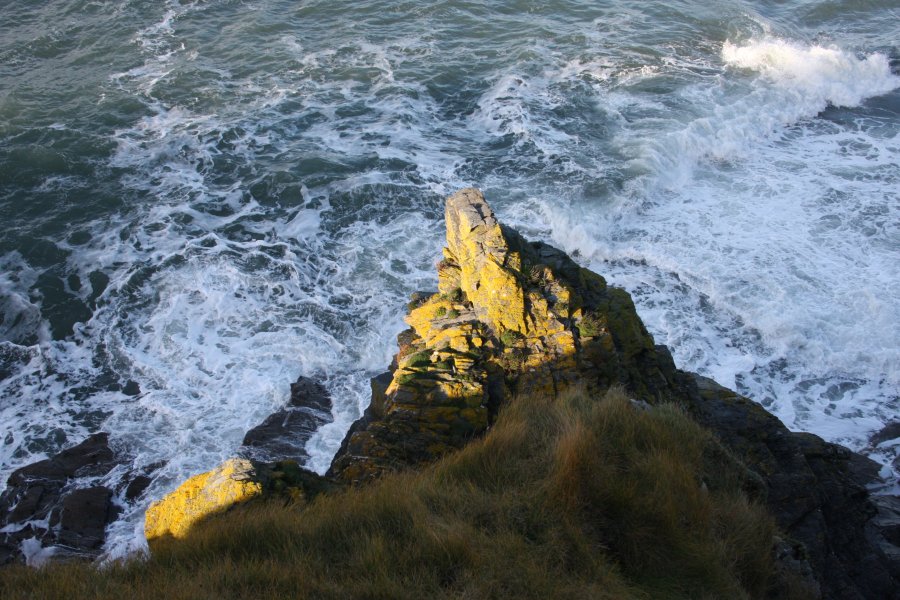 Light on the rocks near the sea cave.
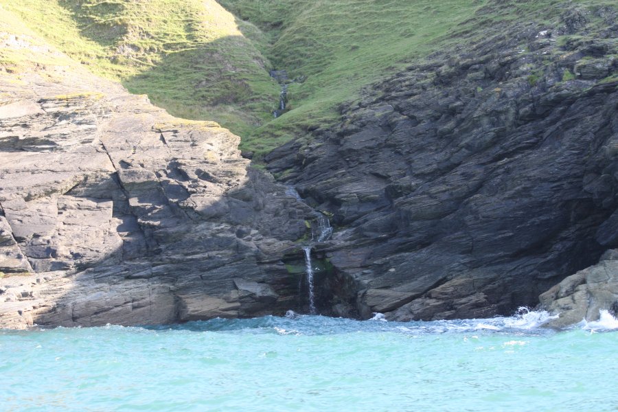 Further away from Llangrannog the coast is the Trwyn Crou peninsula, which has this tiny waterfall, seen here from a boat. Do not attempt to approach it from above.
 The view back down the coast from beneath the Urdd Centre, closer to Llangrannog. At the top of the 200 metre sea cliff is Penmoelciliau (216 metres). Beyond that is the point at New Quay. The unnamed bay with the sea stack and arch contains the Glangraig Waterfall at its far end.
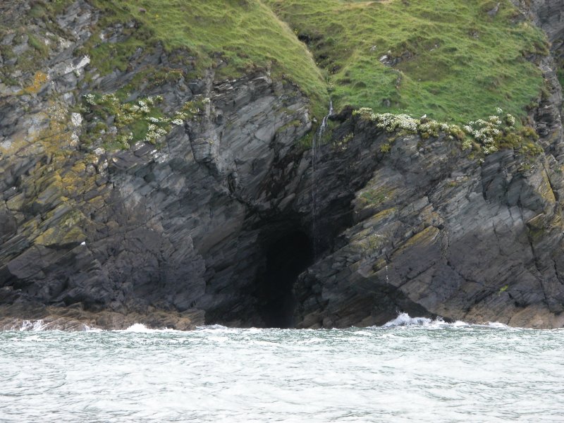 The stream flowing down from the Urdd Centre has its own 10 metre waterfall as it makes its last descent into the sea. It would not be possible to walk behind this one, even if it were possible to climb onto the ledge. Once again, this is seen from a boat. Do not attempt to approach it from above.
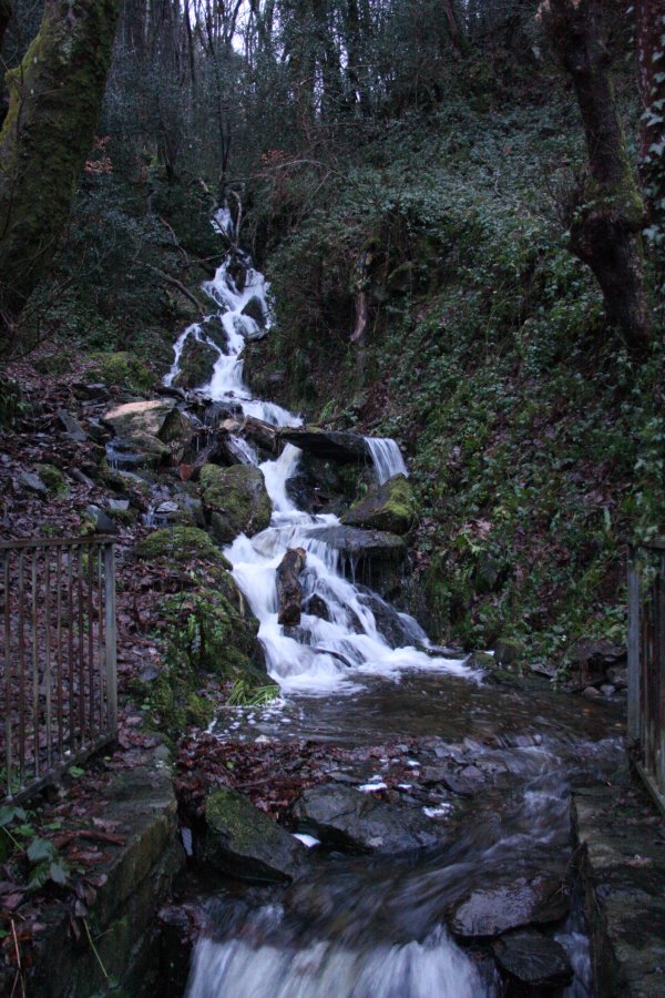 After days of rain, all streams were in spate, and the rivers were at the point of bursting their banks. Within a few hours, this would turn into localised flooding, and by the next day, several roads were cut off.
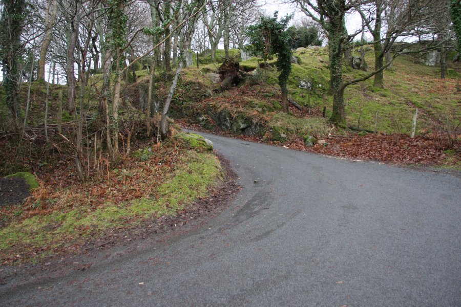 At Tal-y-Bont, a narrow lane winds its way very steeply up to the hanging valleys of the Carneddau.
 An eastern arm of the Carneddau; Pen y Castell (623 metres), Penygadair (507 metres) and the Pen-y-gaer hill fort, with Foel Lwyd (603 metres) and Tal y Fan (610 metres) in the background.
 The mountains and hanging valleys at the eastern end of the Carneddau. From left to right are the long ridge of Moel Eilio (546 metres), Creigiau Gleision (678 metres), Creigiau Gleision North Top (634 metres), Pen Llithrig y Wrach (799 metres, looking like two mountains), Pen yr Helgi Du (833 metres), the long Craig Eigiau ridge (735 metres), Pen y Castell and Penygadair. The tallest of the eastern Carneddau are hidden in the rainclouds.
 Filling the valley between Llithrig y Wrach and Craig Eigiau is the remains of a 1km long dam wall, with two very obvious breaches in it. The dam was built in 1910, to increase the size of the natural Llyn Eigiau, for use by the hydroelectric power station in Dolgarrog.
 On 2 November 1925, several days of very heavy rain caused water to undermine the Llyn Eigiau wall, and then suddenly breach it. Given the length, poor foundations, meagre thickness and shoddy construction of the dam, it's hardly surprising. Despite knowing of its poor quality, the company directors were not held responsible, as there was no regulation of the industry at the time. This incident would prompt the subsequent regulation of dam construction.
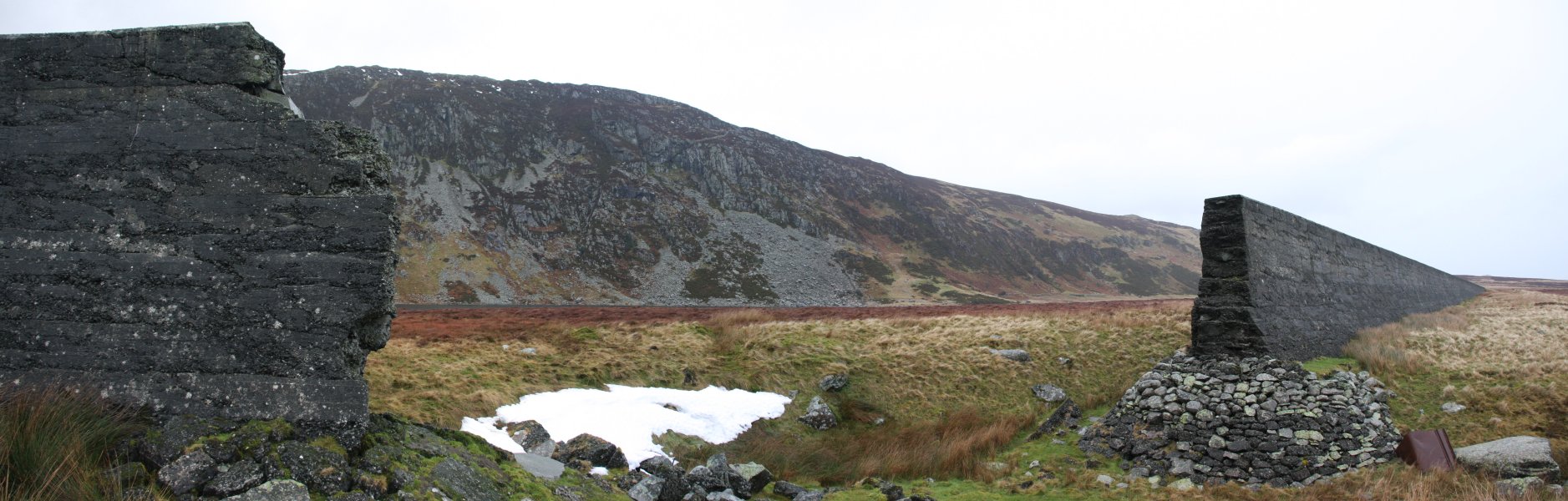 The breach caused the water to rapidly exit the reservoir. At the point of the breach, the wall is between 4 and 6 metres high (depending on the level of the peat bog). Over the course of a day, over 3 million tonnes (cubic metres) of water rapidly spilled through the breach.
 The water ripped a deep channel through the peat, down to the boulder clay below, extending to the river bed on the far side of the valley.
 The flood waters spread rapidly over the grasslands, without causing much damage.
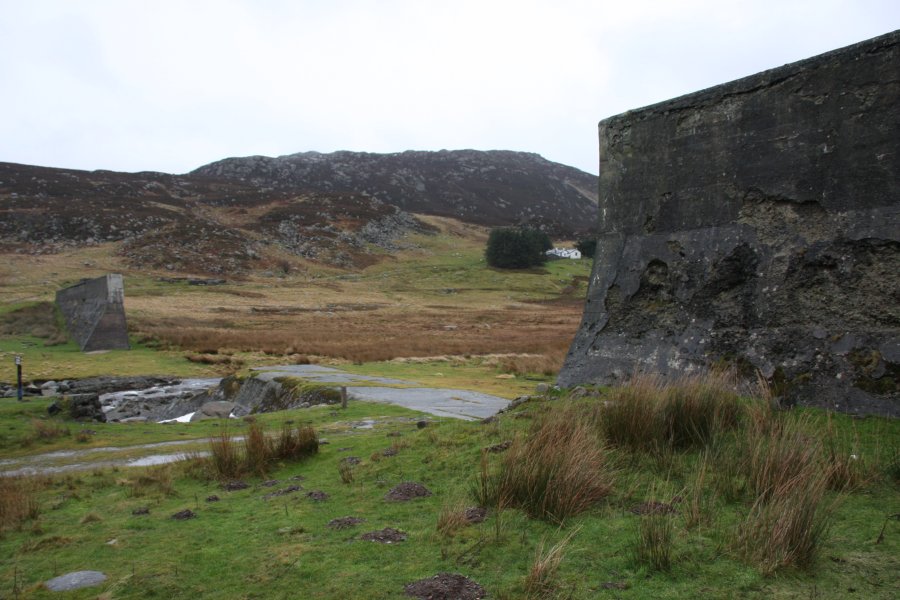 Some time later (after the floods had subsided), a second, much larger breach was intentionally made, to prevent the dam from ever retaining water again.
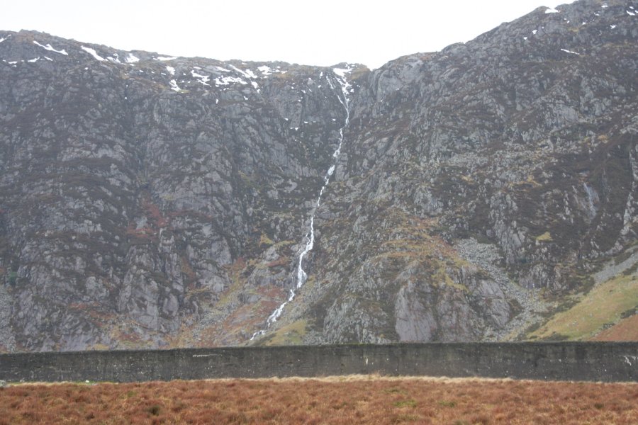 A cascading stream draining Craig Eigiau. It drops some 300 metres down the cliffs, with the heavy rain making some temporary cascades upto 15 metres or more tall.
 Fed from the mountain streams (and currently also fed by tunnels from neighbouring reservoirs), Llyn Eigiau had reached overflowing level during my visit. The lake is now reduced back to its original size, and has a weir that maintains the level. Some of the water is tapped to supply Llyn Cowlyd, and the remainder continues downstream when the reservoir overflows.
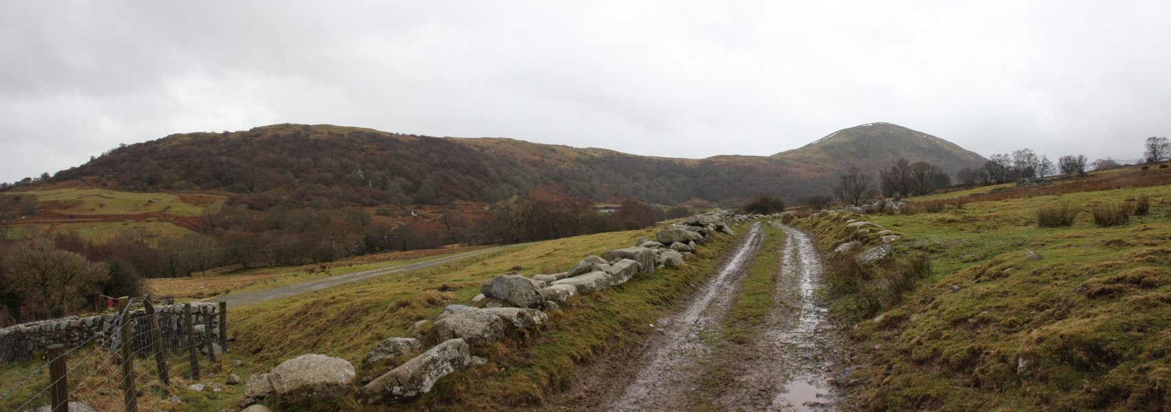 Moel Eilio's eastern ridge.
 Situated under Moel Eilio is the smaller Coedty (or Coety) Reservoir. The 1925 floodwaters reached this point, and the combining water rapidly overpowered the older dam. It quickly burst under the load, and its 300 thousand tonnes of water joined the flood. The water raced down the gorge, onto the village below. The echoing sounds of the dam bursting was the only warning of what was about to happen.
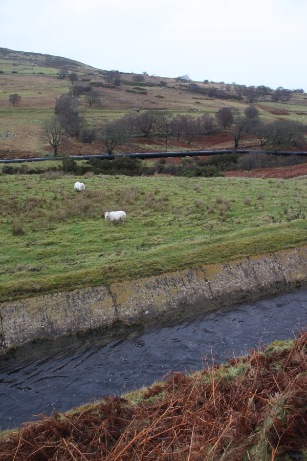 A series of leats (aquaducts) drain the surrounding hillsides, leaving almost no natural streams, and delivering all of the water to the various reservoirs. Many of these were also used in 1925. The water is then drawn off through the pipeline to supply the power station in the valley below.
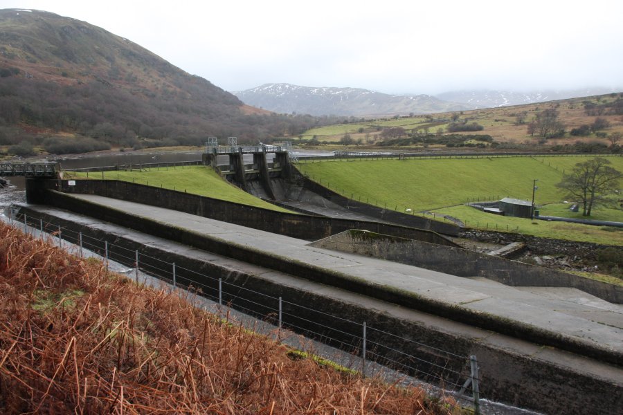 With the rebuilt (and much more substantial) reservoir, the leat has an overflow, but more importantly, the reservoir has its own overflow with tipper gates. These gates hold back the water until it starts to overflow, then they suddenly tip open, and send an impressively large amount of water (though of course much less than the 1925 disaster) flash flooding down the river. During my visit, the lower reservoir's water was quite low, despite the rain. However, by the next day, it was almost certainly overflowing.
 During my visit, the upper leat was overflowing, cascading down the hillside.
 A bridge carries it over the lower leat, allowing this water to supply the river. This accounts for almost all of the water I would encounter in the river below.
 The river then flows very steeply down a deeply incised gorge through Coed Dolgarrog to the village of Dolgarrog, site of the 1925 village of Porth Llwyd.
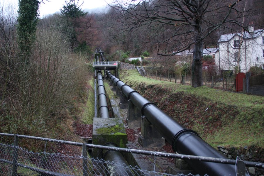 The water pipes carry the combined reservoir water down the slopes to the power station.
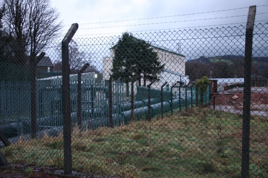 Dolgarrog Power Station, with the remains of the aluminium works beside it. These were the original users of the water in 1925, and although the aluminium works were removed in 2007, the water continues to be used by the power station.
 The river during my visit. In flood conditions, when the tipper gates are open, it can run high enough to cover the bottom of the trees. In those conditions, the river is lethal, and would have been too high for me to reach some of the photography points in the gorge.
 A memorial walk near the southern bank of the river in Dolgarrog now marks the site of the old village of Porth Llwyd. When the lower dam burst, the water raced down the gorge's waterfalls, collecting boulders as it went, and dumped them onto the village. Amazingly, only 10 adults and 6 children were killed, with the majority of the village having been saved by watching a film in the village assembly hall, and the 200 workers working late in the aluminium works.
 The village's reverend also proved to be a hero, warning residents as the earlier floodwaters arrived, and saving one child from the roof of a house, while his church was swept away with the water ringing the bell as it went. All of the dead were recovered, but the houses were buried under these boulders, or swept away. The river's course was also completely changed, moving from the southern side of the old village, to the northern side of it.
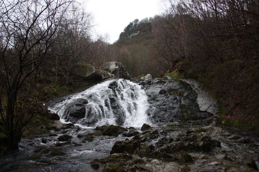 The new waterfall created by the disaster, just upstream of the road. Note the concrete used on its right side to try to contain future floods.
 At the mouth of the gorge is the site of an old waterfall, now piled up with boulders. The largest of the boulders were dropped around here, with 6 boulders weighing about 500 tonnes each, the largest known visible boulder being about 7.3 x 6.4 x 4.6 metres in size - that's the size of a house.
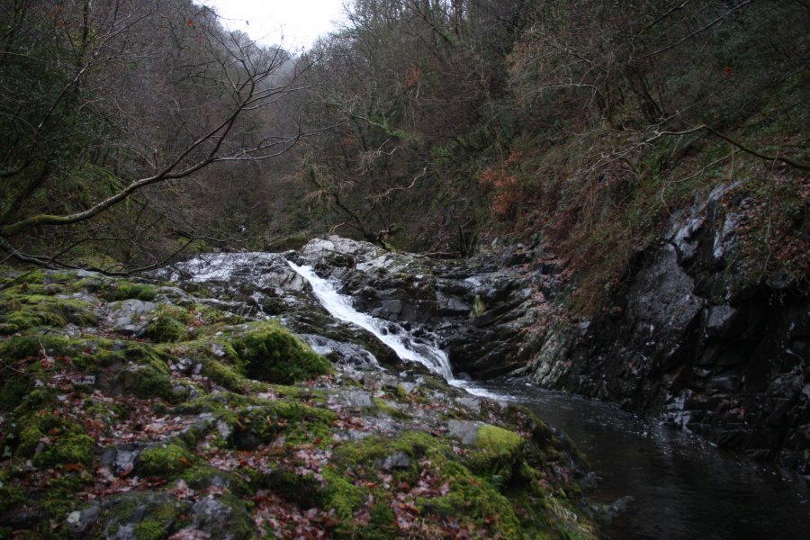 The waterfall at the mouth of the gorge. From here onwards, the river takes on a new look. All surfaces are washed completely clean of rocks by the 1925 flood, with the sides remaining quite well washed. The depth of this washing is the flash flooding depth caused by the reservoir tipper gates, with this 4 metre waterfall being completely covered by floodwater in those conditions.
 Shortly afterwards, the path up the left side of the gorge ends. The ledge quickly disappears, with a glimpse through the trees of the next set of cascades.
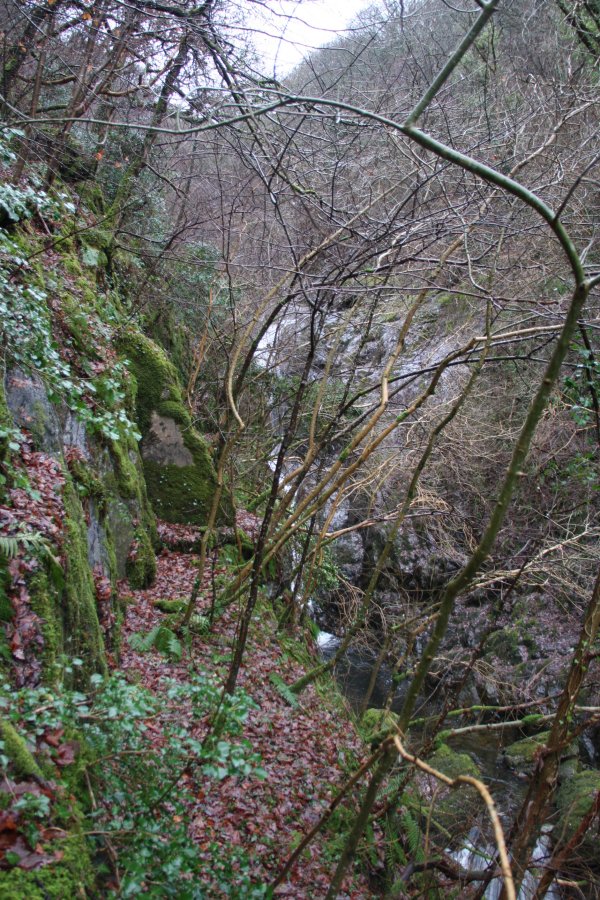 Backtracking a long way made it possible to scramble up to the next ledge, but this also ran out quite quickly. Each time a ledge ended, I backtracked and scrambled up another level. You may notice the difference in the ages of the trees at different levels here - this will be covered later.
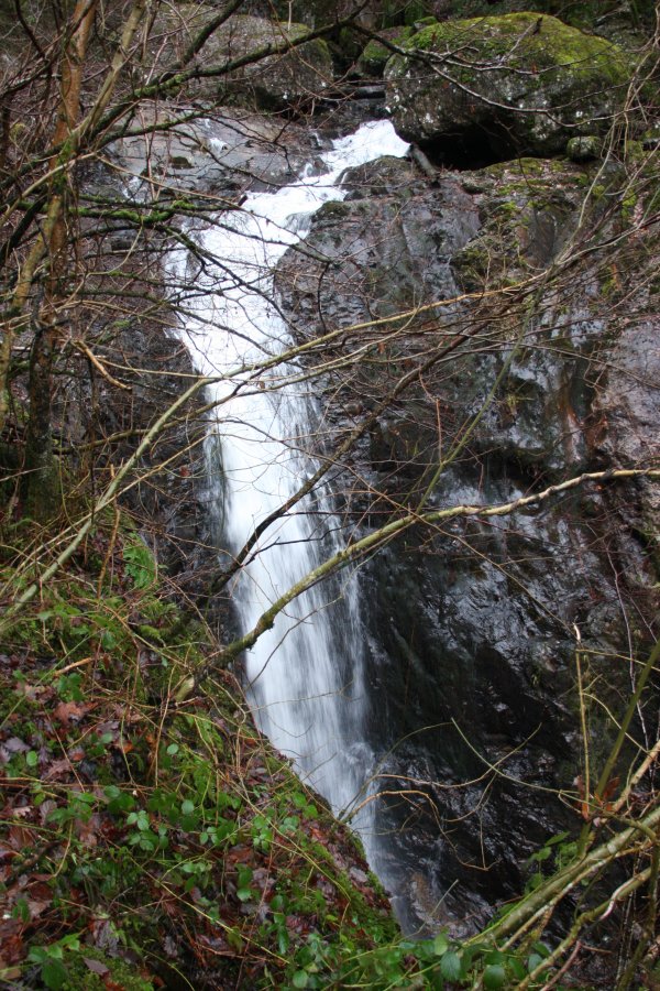 The tallest single drop waterfall lies in the middle of the gorge, at about 15 metres tall.
 The going became easier as I reached the line of older trees. Below this level, all trees are less than 85 years old - anything older was ripped out by the 1925 flood.
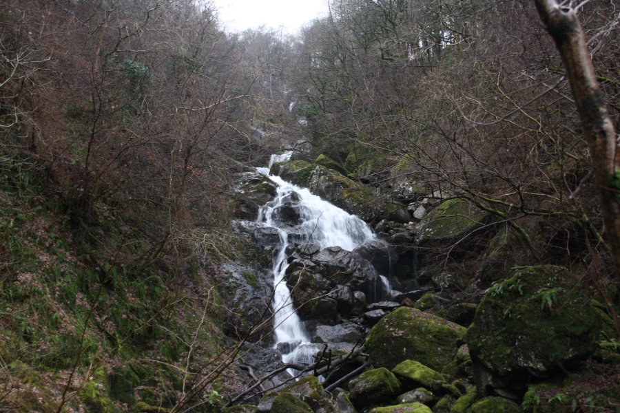 A return to river level brought me to the base of Rhaeadr Porth-llwyd. The tallest drop is only about 10 metres, but the total drop is an impressive 61 metres (according to the The Royal Geographical Society's investigation into the disaster). Despite its size, it only appears on the 1:10'000 scale maps, with the archaic spelling Rhaiadr Porth-llwyd. The waterfall has also been incorrectly referred to historically as Rhaiadr Mawr (these references also give the wrong location for the waterfall, placing it on the Afon Geirionydd, nearly 10 km away).
 The upper benches of Rhaeadr Porth-llwyd. Reaching this point required another ascent of the steep banks in the forest. The clean washing shows that when the reservoir gates tip, the flash flooding water maintains an incredible depth of about 2 metres over the surface of this waterfall. During the 1925 flood, the water reached a whopping 14 metres of depth, ripping out any boulders that had been resting on the rock surface, and completely altering the waterfall's appearance.
 Time to get back up into the safe zone above the river, slowly climbing far enough up the 100 metre cliffs to reach somewhere navigable.
 The old flood line, quite distinctive because there are boulders that were not dragged downstream to the village.
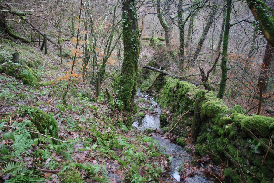 The wall and fence that mark the line of the old footpath.
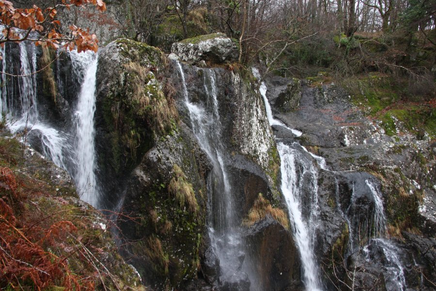 Following the line of the wall leads to a ledge overlooking the top of the waterfall.
 While following the fence leads to the stepping stone crossing above the waterfall. There are some large boulders here, as the 1925 flood didn't start ripping big boulders out until the head of the waterfall.
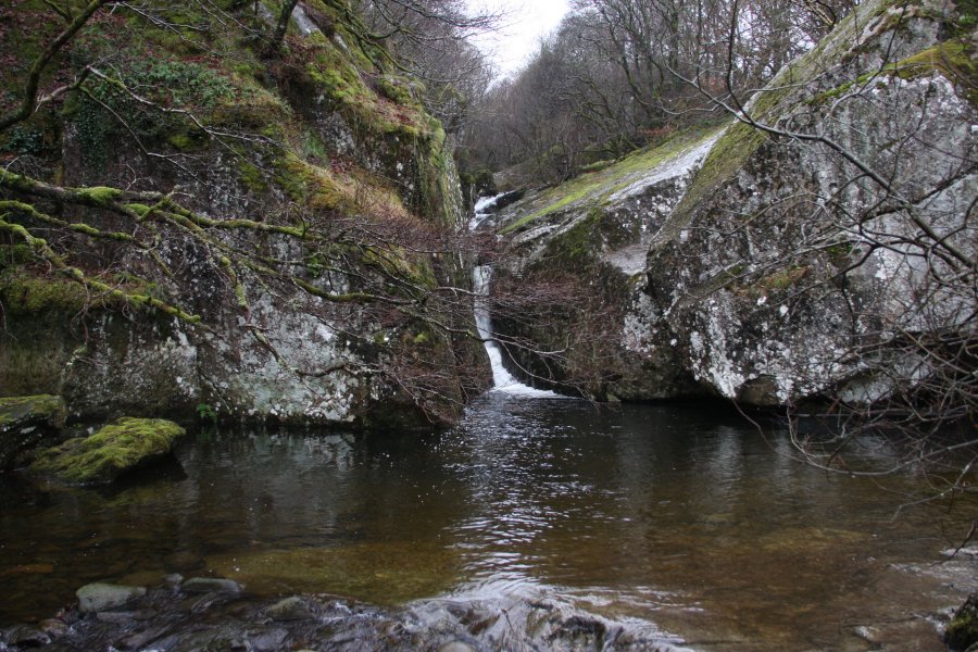 The stepping stone pool is topped by a 4 metre waterfall.
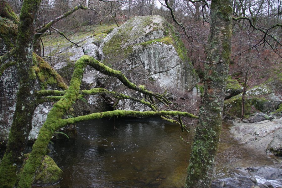 The bedrock in this area was fractured in many places by the force of the 1925 flood. This 10 metre high boulder may have pre-existed the flood, or may also have been broken off by it.
 View towards the mouth of the Conwy Valley.
 By now, I had reached my limit of exertion, and it was time to head away from the gorge. I followed the wall back towards the more popular paths.
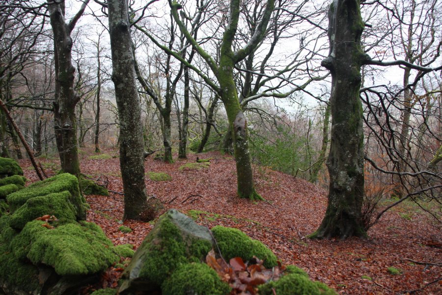 Old beech trees.
 Pipe junction, where the pressured pipelines from the Coedty and Llyn Cowlyd reservoirs come together for their final descent.
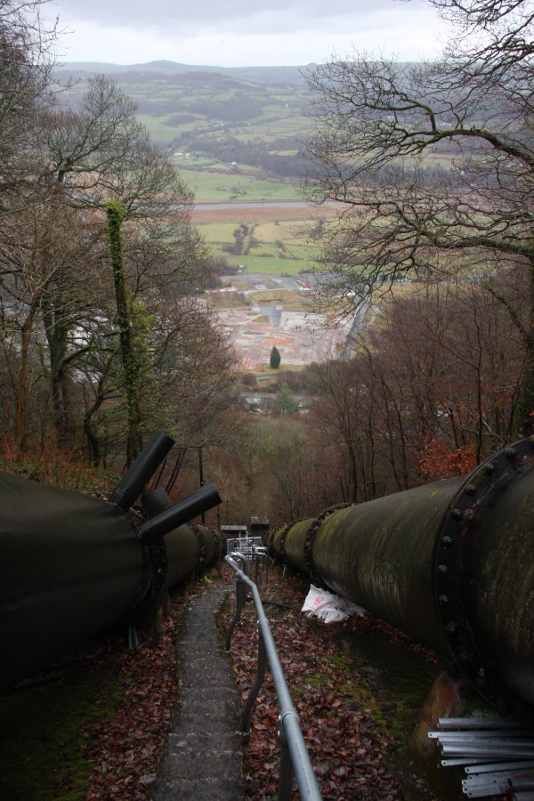 A very rapid descent.
 The top of The Zigzags.
 Locally, this path is infamous, and given how steep it is, that's not a surprise.
 The pipelines are also incredibly steep, dropping over 100 metres at this angle.
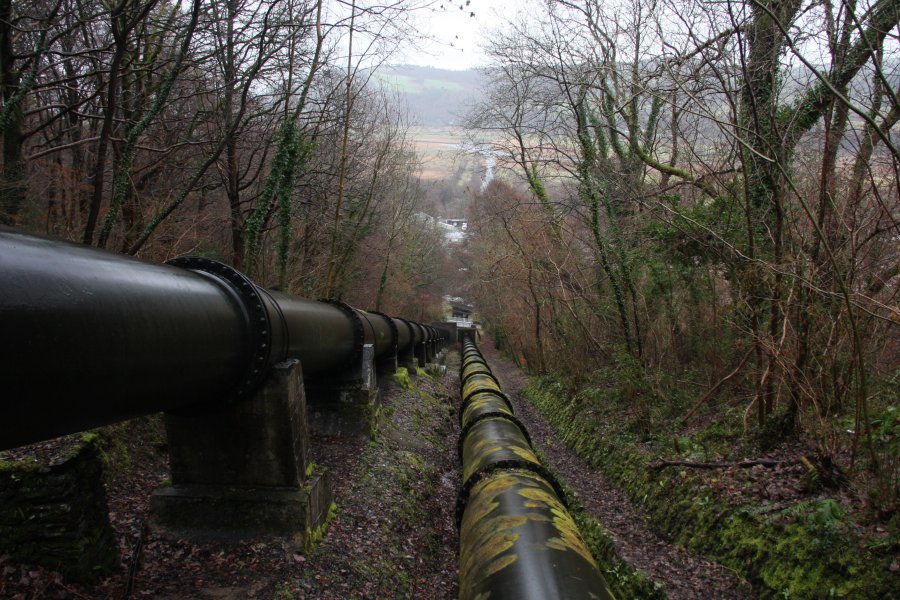 The right-hand pipe runs along the line of the old railway incline, used for the local quarries and reservoir building.
 Looking back up to the steepest section, where the railway incline also used to run, and where the engines were taken to service the upper tracks. It is a very impressive feat to get a steam engine up something that steep, especially as the engines would need to be pulled up using cables, as there was no toothed track.
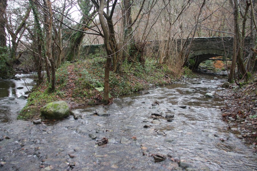 The river splits into three strands to pass under the road, where there is a dedicated parking area.
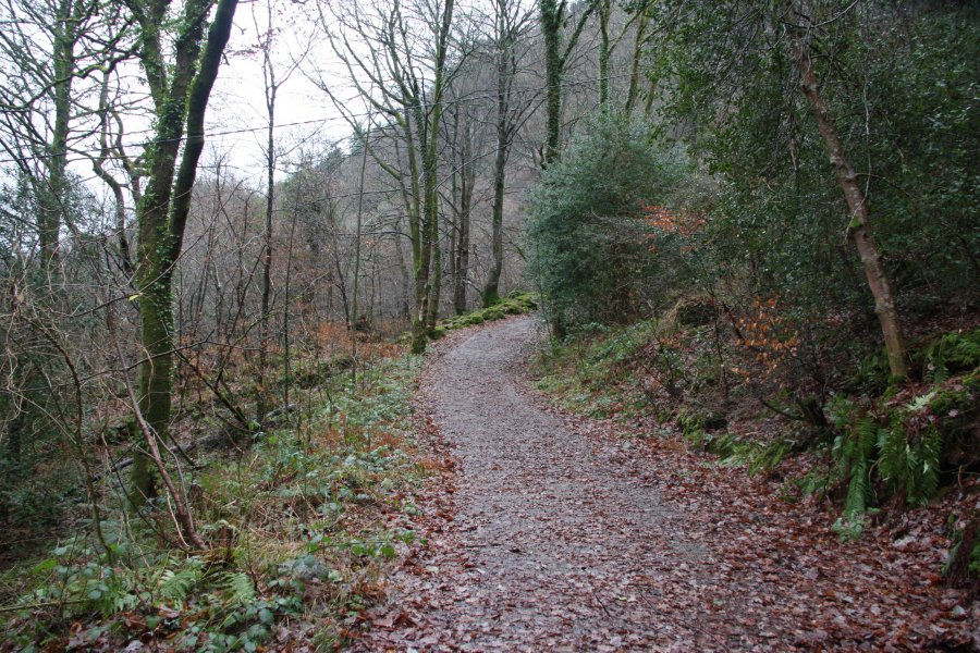 On the right bank of the river (looking upstream), a concreted access lane gives easy access for walkers. After zigzagging a couple of times, it crosses a cattle grid. At the next corner, leave the track and head over to the river to view the first waterfalls.
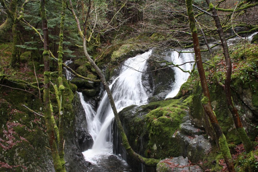 The lower Afon Ddu waterfall.
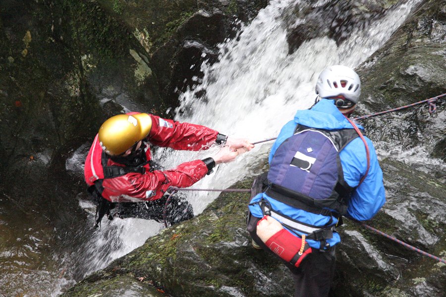 Gorge walkers climbing its bottom step, below the waterfall. They use the name The Narrows to refer to the miniature gorge that it lands in.
 Above it is a rough cascade. On its right side are some boulders that the gorge walkers squeeze between, which they call the Elephant's Bum. It is easiest for walkers to return to the lane to get beyond here.
 Just after the lane turns the corner, it passes two small buildings. Behind them, a steep wall and pipe can be followed upwards to a ledge overlooking...
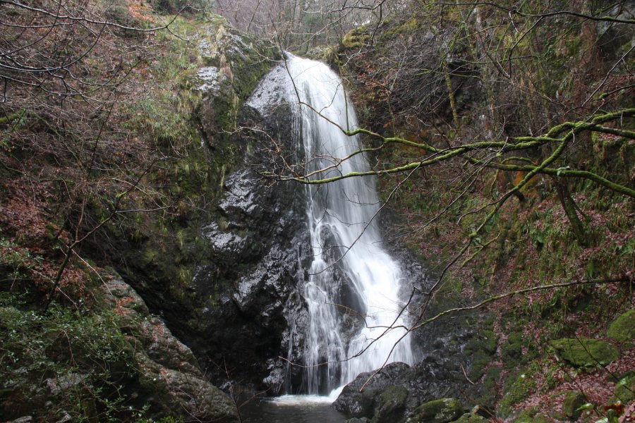 ...The tallest of the single drop waterfalls, this 12 metre beauty. Gorge walkers have no good name for it, simply referring to it as the big waterfall.
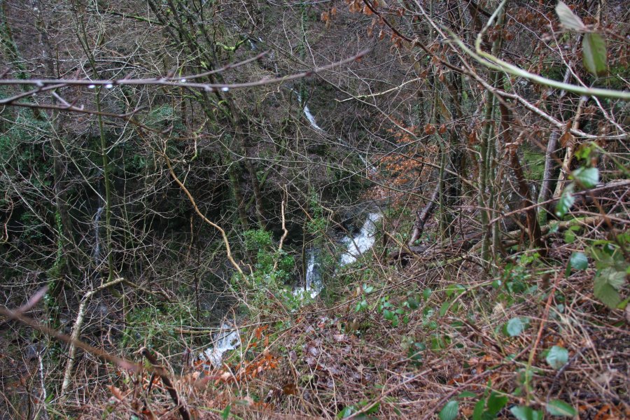 Although the path in theory continues upstream, it becomes heavily overgrown, and you may prefer to return to the track. Hiding in the gorge below is a small scramble that gorge walkers call The Impossible Boulder.
 Back on the lane, it begins to climb at as much as 1-in-2 (50%).
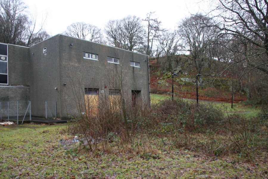 At the top, it reaches the water treatment works building. On the left side of this is a large, flat area.
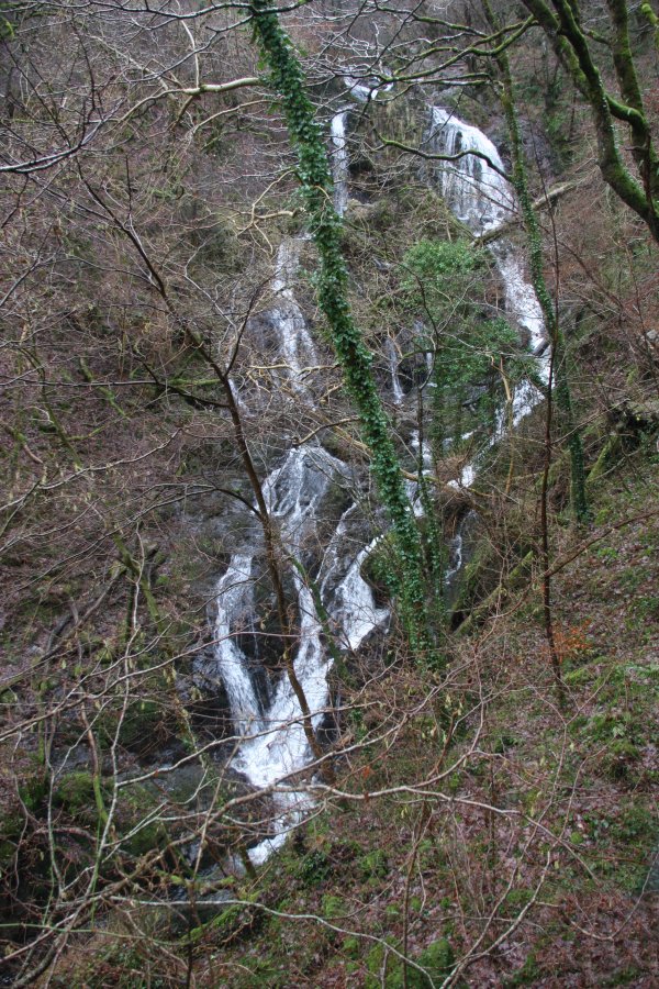 The flat area gives a fairly good view through the trees to the upper waterfalls, which total about 35 metres in height. There is no good point to take pictures, due to the forest and angle of the slope, so visits are best made in winter. Gorge walkers once again have no good name for this, referring to this section only as the upper gorge, with The Top Pool a little way upstream.
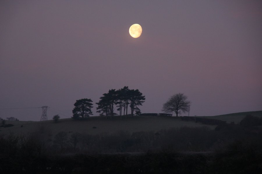 Moonset over the frosty fields near Aberystwyth.
 View over the upper part of the Rheidol Gorge at Tynyffordd. On the left is the 450 metre ridge separating the Mynach and Rheidol valleys. In the middle is Bryn Bras, rising to 397 metres, and on the right, about 1 km away, is Ponterwyd.
 Fields at Erwbarfe Farm, with sunrise catching Bryn Bras on the left, and Pumlumon's Y Garn (684 metres) in the distance.
 View over the last of the fields before Devil's Bridge. The target lies near the end of the woodland on the far bank of the gorge, while the power lines on the left sit over the access track.
 The old cub huts, a wonderful place to take pictures of decaying ruins. Sadly, this is all I took.
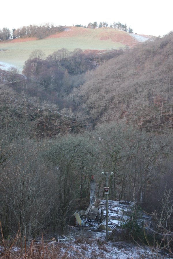 The overgrown track leads down to the remains of the Swiss Cottage. The chimney and foundations remain, but the rest looks like a wooden shell that has been blown over.
 From the old back garden of the cottage, the waterfall can be seen through the trees. Directly underneath the cottage is a very steep slope and cliff, dropping 70 metres into the gorge. Take care, and unless you are able to cope with it, stay on the safer side of the fence.
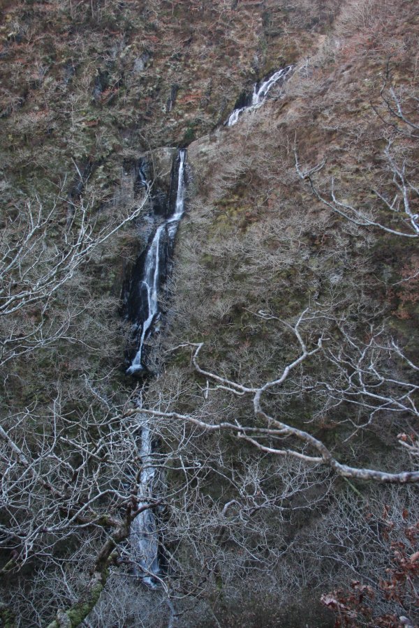 The unnamed Afon Tuen waterfall, dropping 70 metres in total, with the biggest drop being about 15 metres. To get this picture, I had to descend the upper slopes, with a 50 metre cliff below my perch. Not a nice place to be.
 Iconic red kite. No trip to Mid Wales is complete without it.
 Frost in the nearby Tarennig valley.
 Frost, not snow.
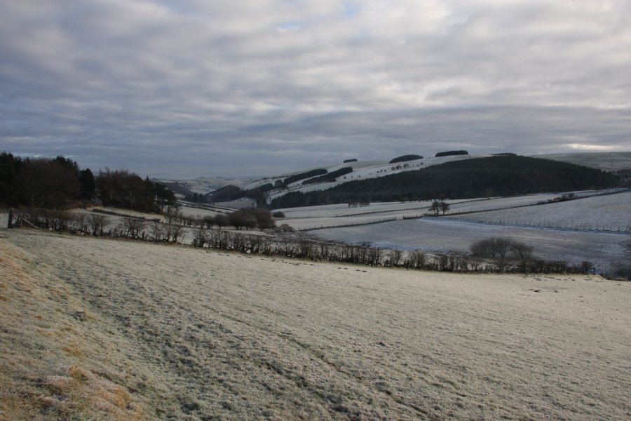 A narrow lane leads from the A44 in the upper Wye Valley to the main Hafren Forest access lane. For its second half, it descends the Nant Bronfelen valley to join the Severn Valley.
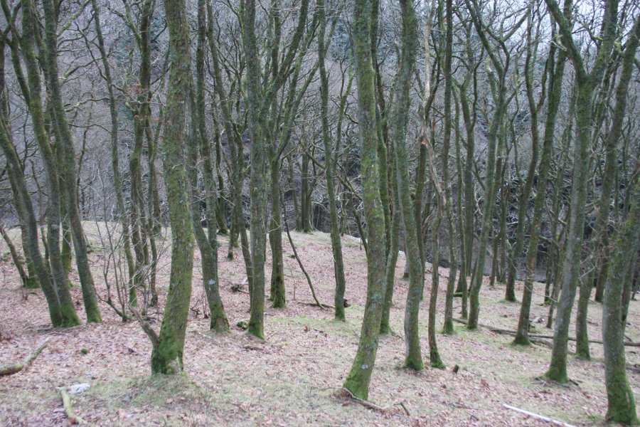 At the start of the small Coed y Beili forest, there is some space to park, with more space part way down the forest. The waterfalls lie at the upper end, but due to the large crag beside them, it is best to descend to the stream some distance downstream, and head upstream to view the waterfalls from below.
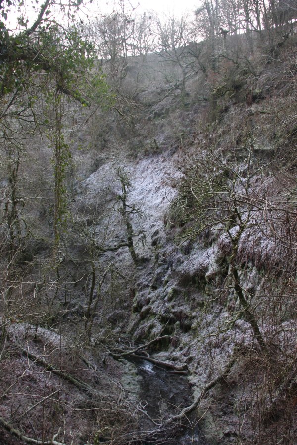 The Craig y Llo crag.
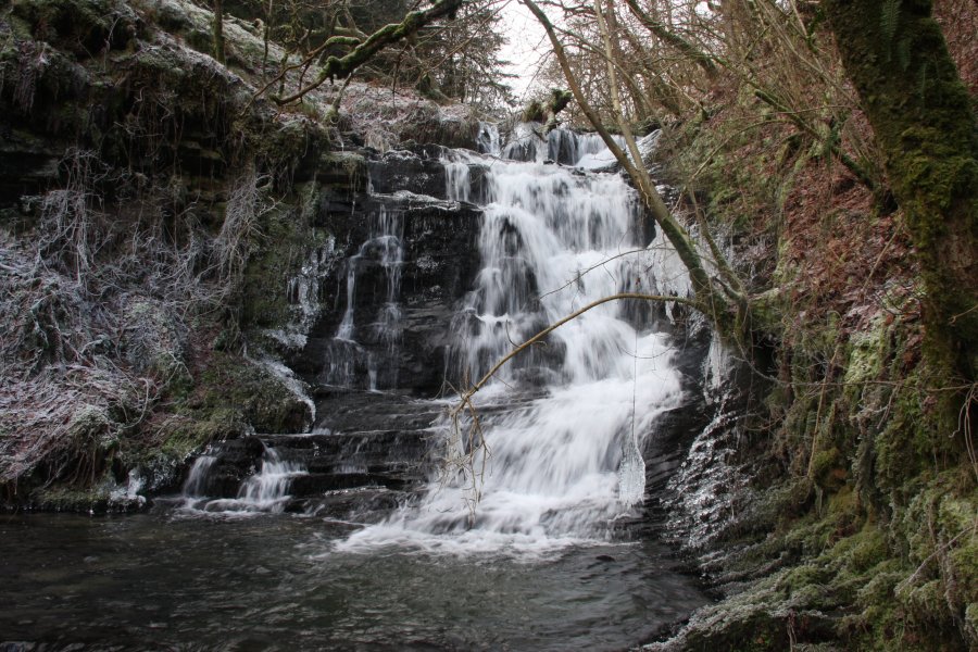 The upper drop of the Craig y Llo waterfall, about 6.5 metres tall.
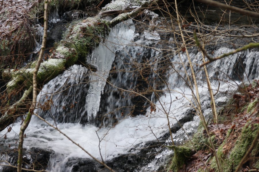 Icicles at the top.
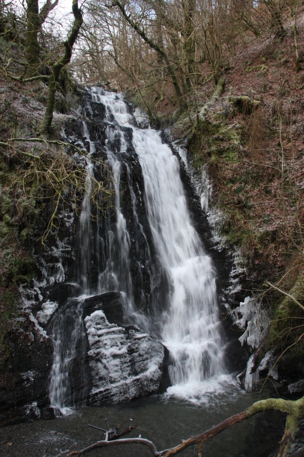 The graceful 10 metre lower drop of Craig y Llo.
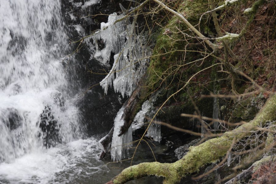 Icicles at the bottom.
 Frost at Glynhafren in the Severn Valley.
 Glynhafren.
 The extensive Hafren Forest beginning in the Severn Valley.
 The public path starts at the edge of the field, with this gorgeous view down the Severn Valley. A flock of sheep mistook me for the farmer, and hurried over to ask for hay.
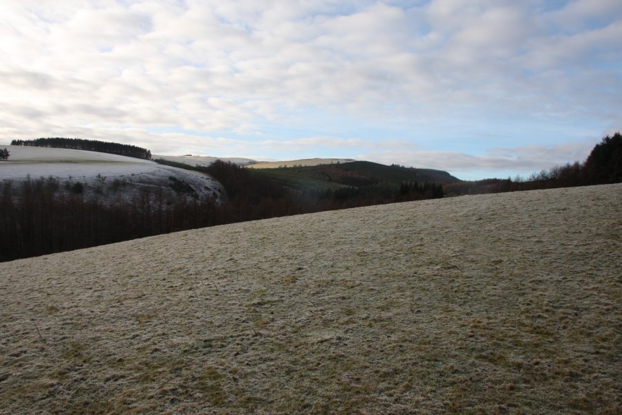 Nant Colwyn, the white beard stream, with a small patch of mist rising from the valley.
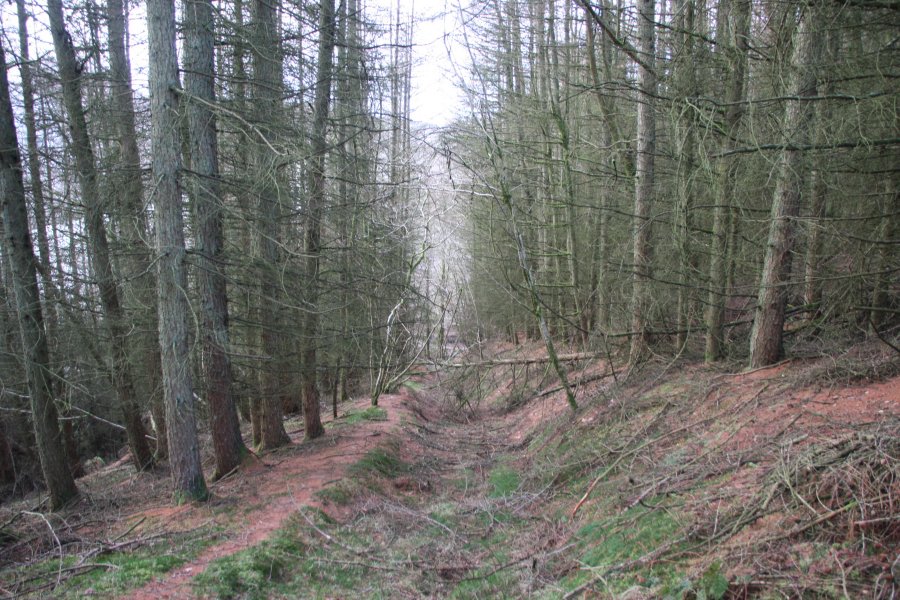 The path turns and drops into the forest. At the stream, turn right and head upstream, trying to avoid any fallen trees.
 The lowest of the waterfalls.
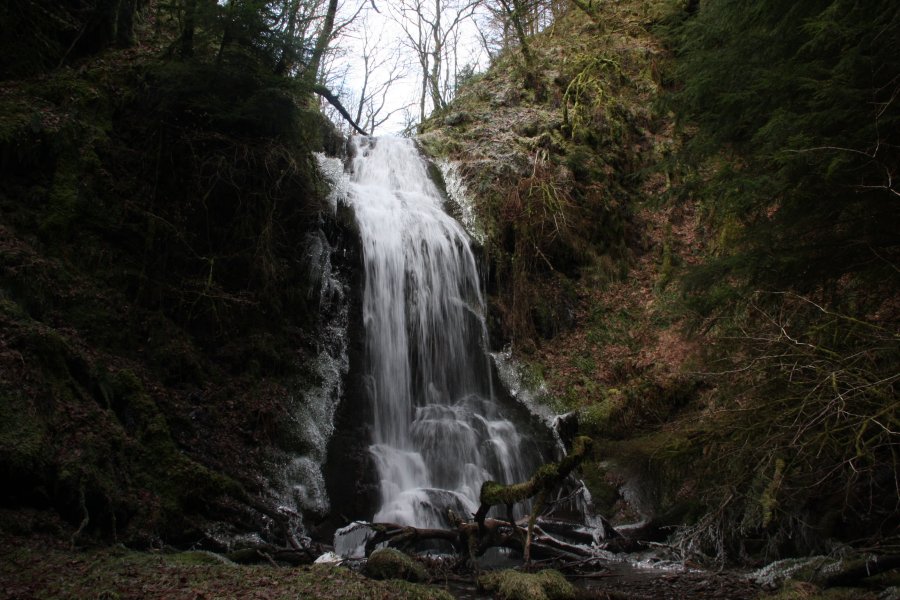 The main Craig y Ffrwd waterfall, roughly 10 metres high.
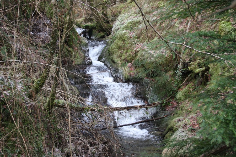 Small cascade upstream of the crags, marked on the map. It is not worth the effort to reach it, but if you feel the need to, approach it from the forestry above, and avoid ascending or descending the crags.
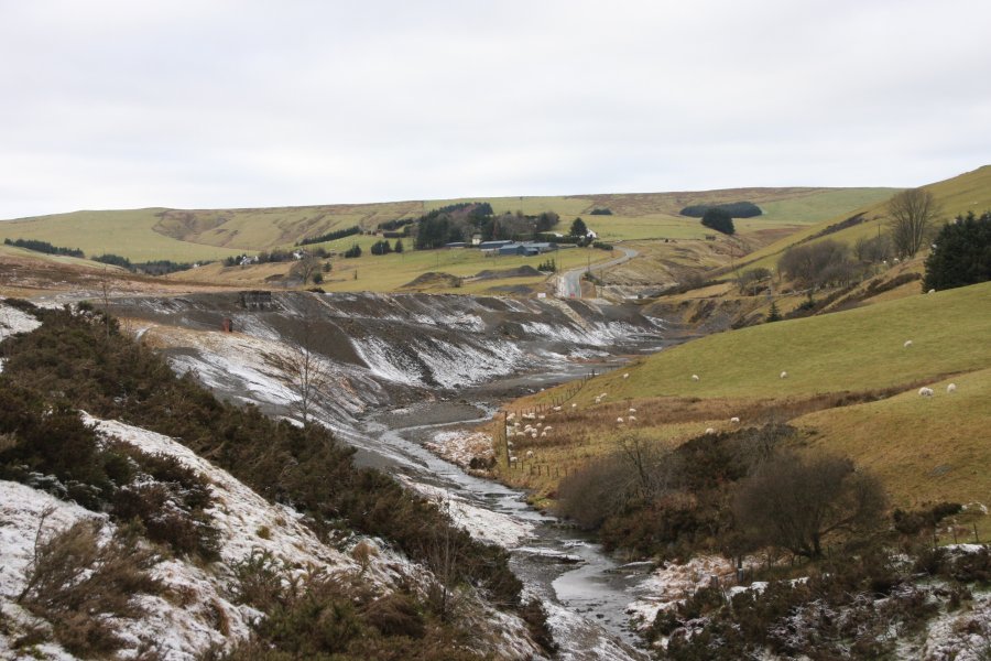 The abandoned mining community of Dylife (pronounced "duh-lee-veh").
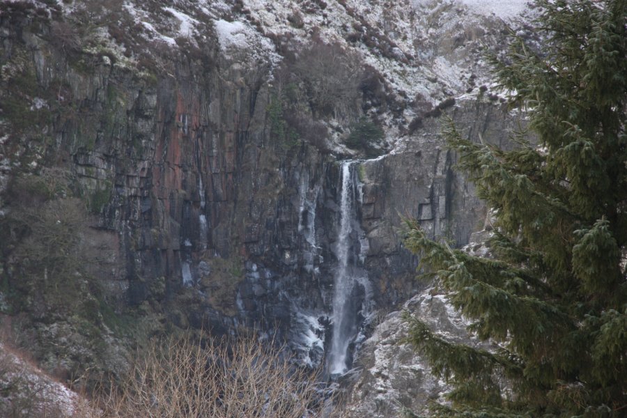 Ffrwd Fawr, the 40 metre sheer plunge waterfall at the head of the gorge.
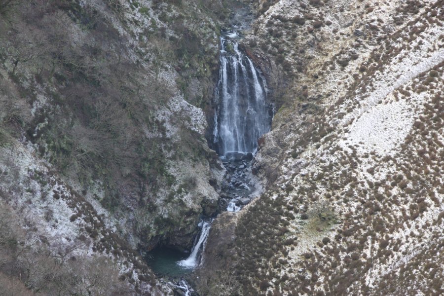 The lower falls of the Afon Twymyn, 12 and 4 metres high, respectively. These are most easily seen from the edges of the fields.
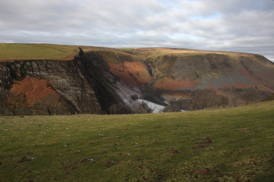 The towering Craig y Maes crags on the left swing away, and the gorge widens, revealing a series of streams on its far side.
 The most impressive of these is Nant Ddeiliog, which drops down the Nant Ddeiliog Falls, totalling about 50 metres for the upper set, and 30 metres for the lower set. The two tallest drops are about 18 metres tall each. The waterfall has no official name, so it is referred to here using the name of the stream.
 The stream is dammed upstream of the waterfalls, creating the Llyn Nantddeiliog reservoir. However, the reservoir wall has been breached, so that it no longer has any effect on the flow of the stream.
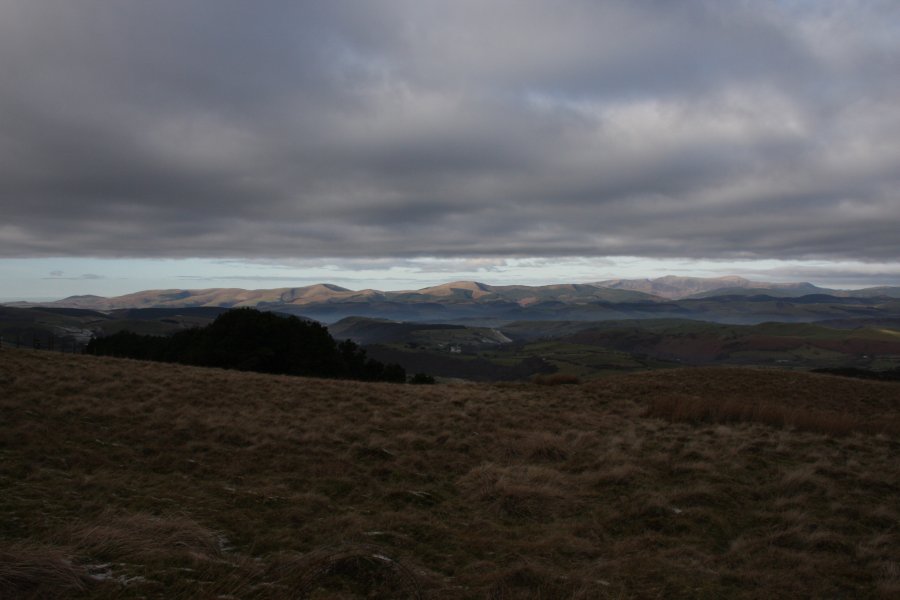 The Tarren Hills, and Cadair Idris range in Snowdonia. The two main Tarrenau tops are Tarrenhendre (634 metres) and Tarren y Gesail (667 metres). The Cadair Idris tops are Mynydd Pencoed's Craig Cwm Amarch (791 metres), Penygadair (893 metres), Mynydd Moel (863 metres) and Gau Graig (764 metres).
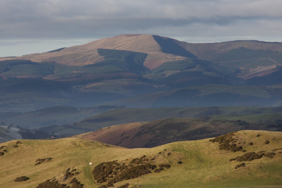 Tarren y Gesail.
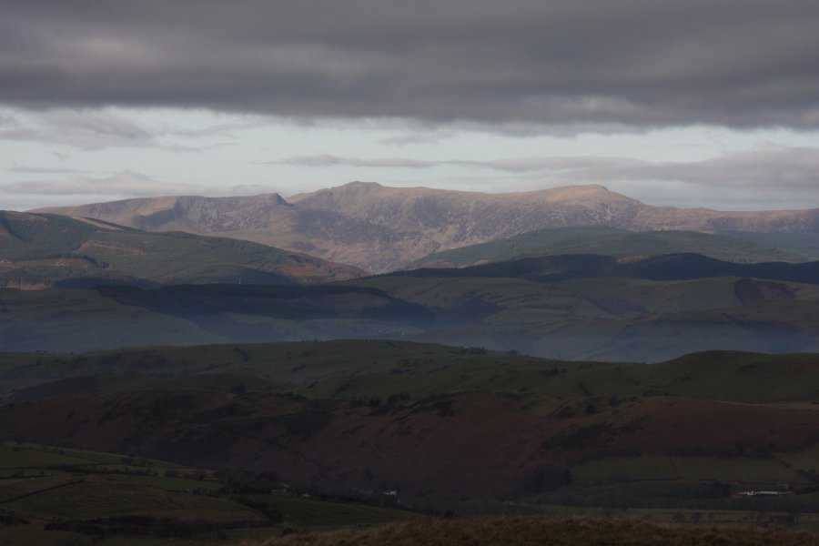 Cadair Idris.
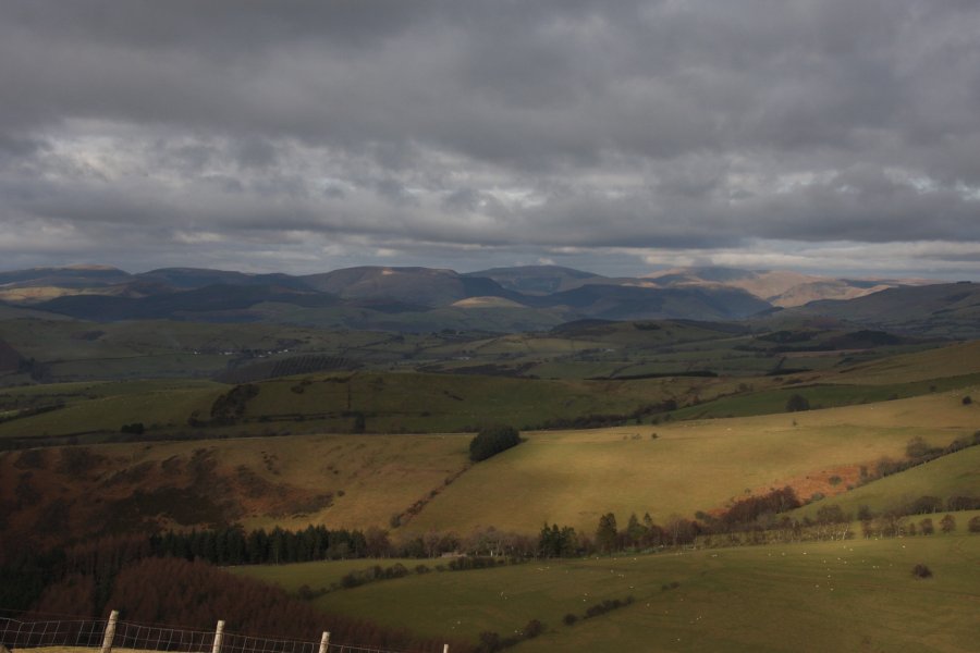 The Dyfi Hills and Aranau ranges. In the Dyfi hills range are Waun-oer (670 metres), Cribin Fawr (659 metres) and Maesglase (676 metres). In the Aranau range are Glasgwm (780 metres) with Aran Fawddwy (905 metres) just clipping the cloud.
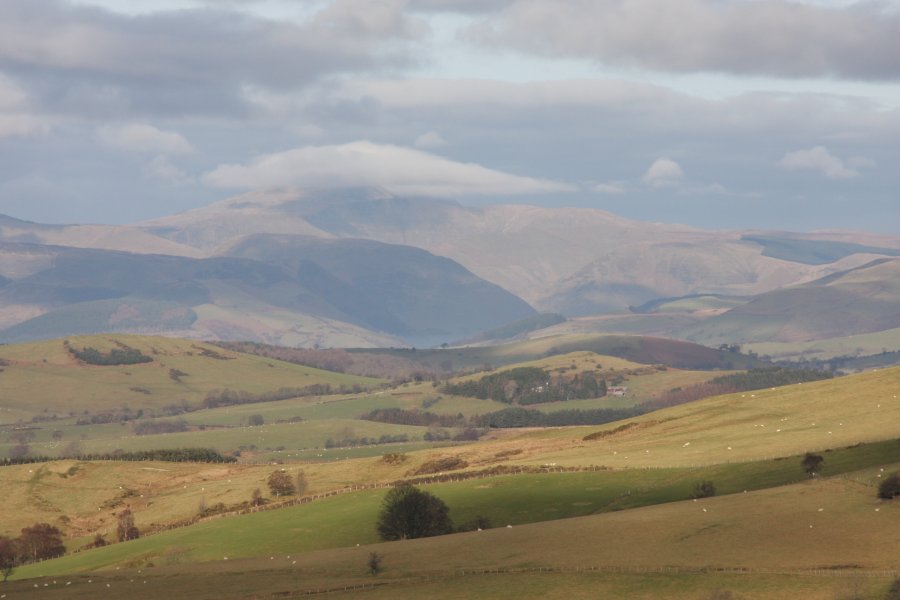 The Aranau. The tallest ridge on the right is Pen yr Allt Uchaf (620 metres), leading up via the Drysgol ridge to the main peaks.
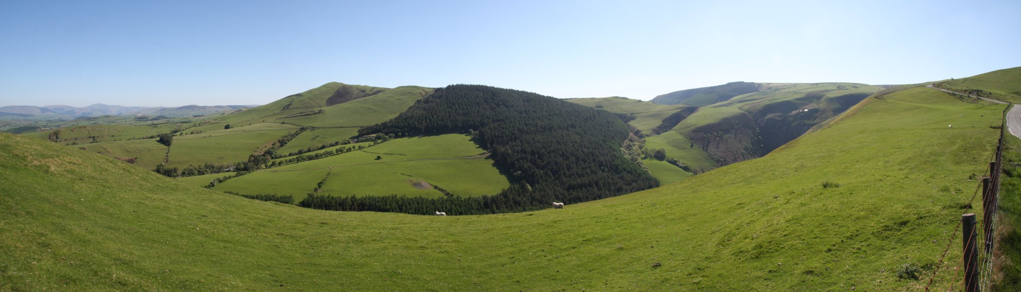 View over Cwm Dwfn. On the left is Moelfre, and on the right is Cerrig Gwynion (527 metres).
 Visible at the head of the valley are two of the deep scars. The main one on the right is Cwm Dwfn. The smaller one perched above it is Craig y Gath. A third deep scar is tucked down on the right, which does not appear to have a name.
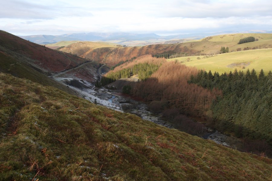 The track making its way up the valley.
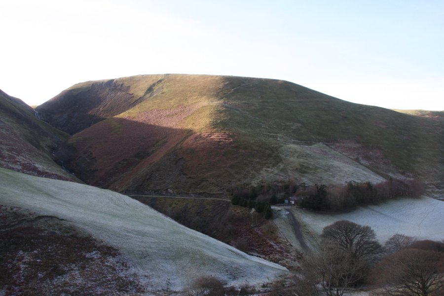 Rather than walk the long track, I descended the steep slope of Bwlch Coch, the small tongue of open access land extending down into the valley.
 The unnamed scar contains a horsetail waterfall that is just short of 20 metres tall.
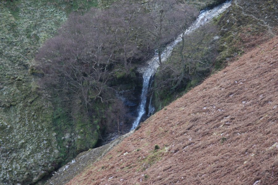 Some distance below it is a much better looking spout waterfall, which is a few metres tall.
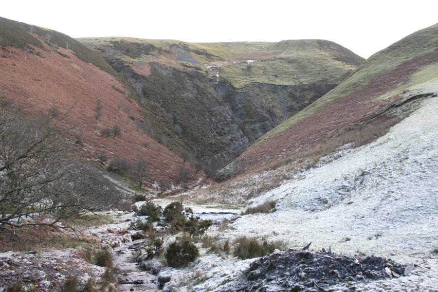 The path crosses a rotting bridge at the bottom of the valley, then begins to steeply climb up the other side. The view slowly opens out, depending on how high you get as to how well you can see into the valley.
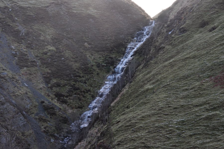 At the head of the valley is Cwm Dwfn Falls, a sloping horsetail waterfall (like most others in the area), about 30 metres tall. Sadly, it is north-facing, and is badly affected by sunlight at most times of day. The waterfall has no official name, so it is referred to here using the name of the valley.
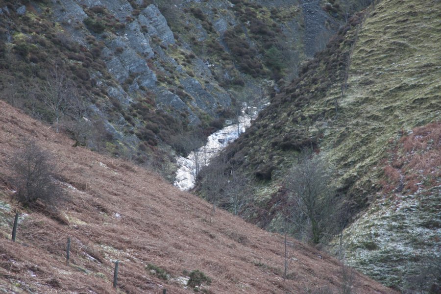 Cascades below the main waterfall.
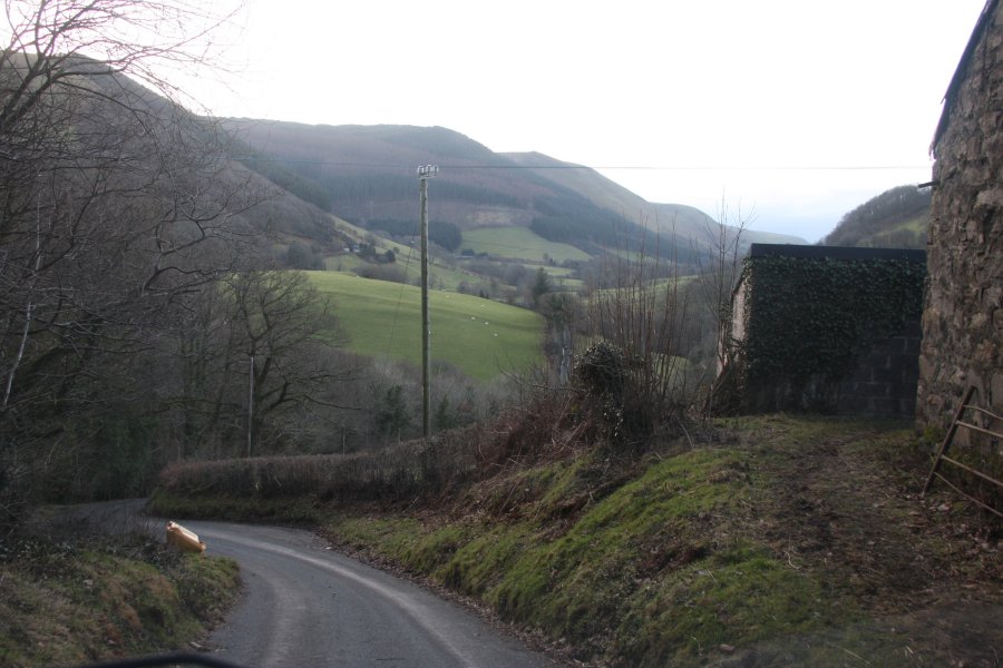 The access route starts in Cwm Tafalog, the first major valley on the right when driving from Mallwyd towards Welshpool on the A458. The access lane begins with a steep downhill and uphill.
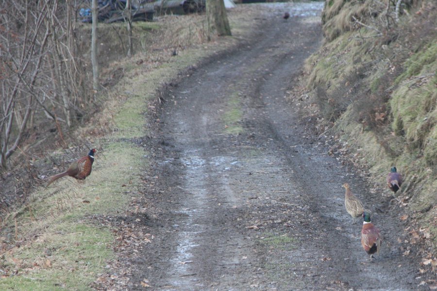 Like the nearby Berwyn, this area is filled with pheasants; the most stupid of all defenseless birds. Not satisfied with giving away their hiding places by making stupid noises and flying off, one of them desperately tried to turn itself into dinner by intentionally jumping from a safe village pavement directly under the bumper of my car. When I managed to stop just in time, it flew off into the path of another oncoming car instead.
 Just after passing the Glan-yr-afon farm, a forestry track starts steeply off on the left, with some space to park.
 The track climbs steeply enough to make bike riding as slow as walking, but at least there are occasional good views over Cwm Tafalog. Shown here is Esgair Ddu (464 metres), with Foel Dugoed (439 metres) on the right.
 After zigzagging a couple of times, the main track reaches a junction, where the way on is to continue climbing ahead-right.
 Why does it have to be steeper? Whenever there is a choice of routes, the way on is always the best track, that continues to climb upwards.
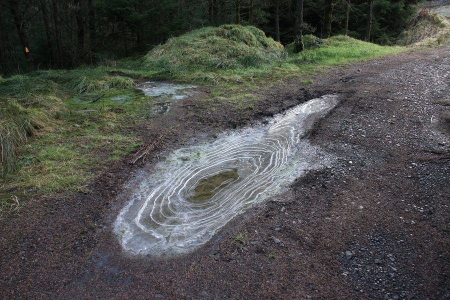 The cold was now becoming a liability, turning every patch of water into ice. Sheet ice and bikes do not mix, and falling on ice is definitely not fun.
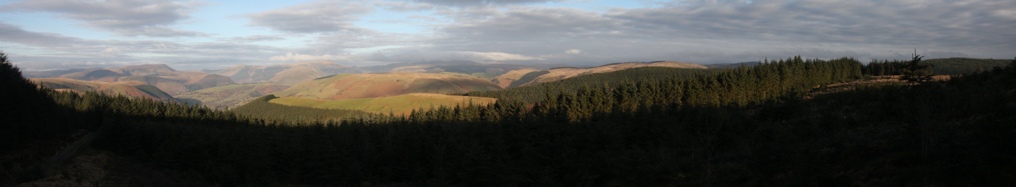 Cleared forest gave a superb view over the southeastern edge of Snowdonia. On the left is Maesglase, followed by Glasgwm, the Aranau in cloud (but with Gwaun y Llwyni's 685 metres, Esgeiriau Gwynion's 671 metres and Foel Rhudd's 659 metres sneaking under it), Mynydd Clywedog (532 metres), the forested top of Tir Rhiwiog (545 metres) and the forested plateau around Llyn Coch-hwyad.
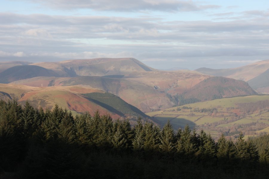 Maesglase, highlight of the Dyfi Hills.
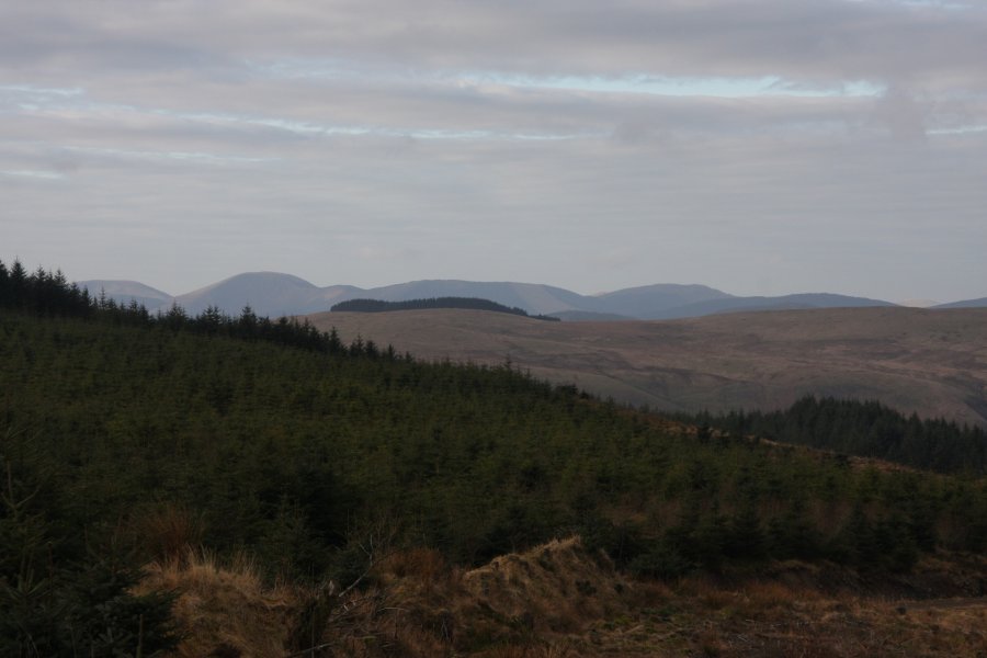 The Tarren Hills; Tarrenhendre, Tarren y Gesail and Graig Goch (586 metres).
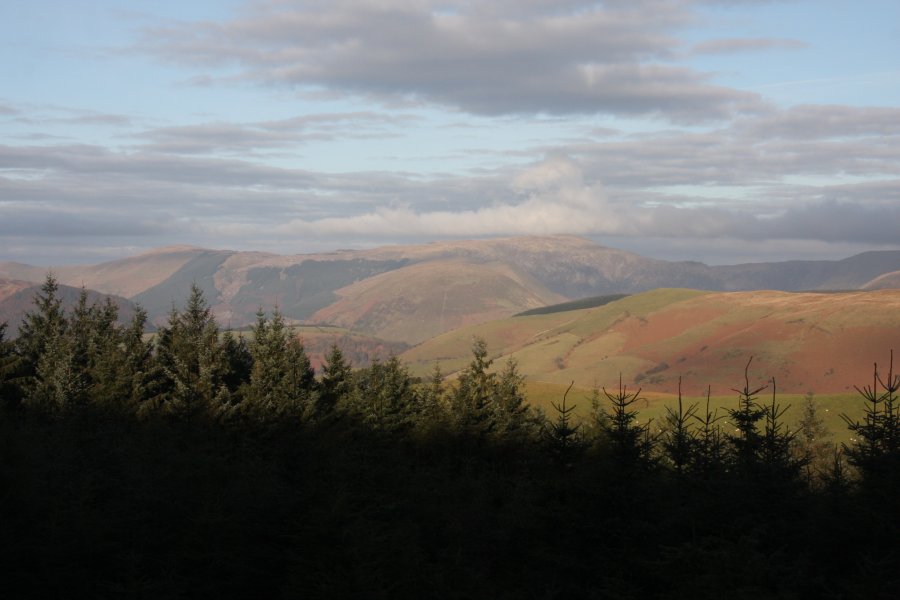 Pen y Brynfforchog (685 metres) and Glasgwm.
 Mynydd Clywedog and Tir Rhiwiog, with a 598 metre ridge near Llanymawddwy in the distance between them. The next walk lies in the valley between the two main hills.
 After a short down and up, the track reaches its high point near the summit of Mynydd Llyn Coch-hwyad. Ignore the track that heads off to the right, and continue downhill, towards the distant lake.
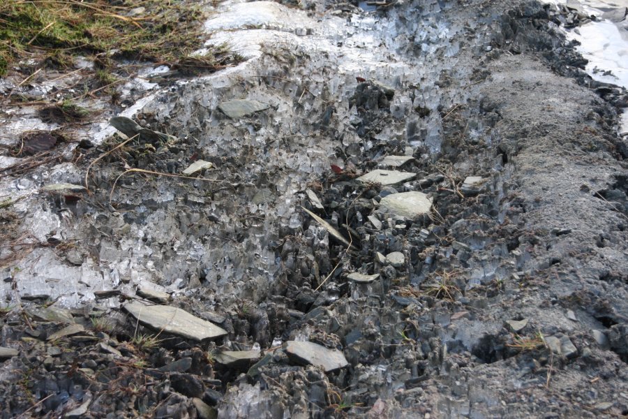 As well as covering most of the track in sheet ice, the cold had grown in giant crystals under the gravel, lifting it up, and leaving a crunching, hollow surface.
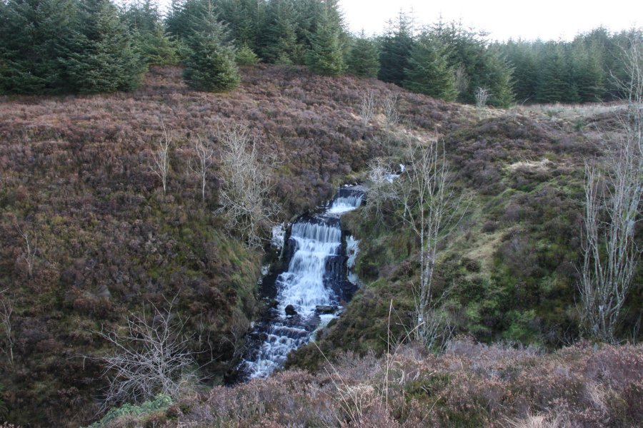 The track dies out at Nant Llyn Coch-hwyad, which introduces itself with a 5 metre cascade. It is no longer possible to ride a bike, so I left it behind for the next part.
 The stream then carves a gorge.
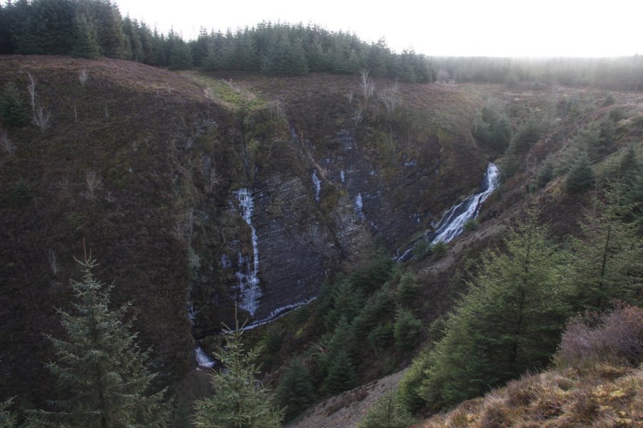 The large cliff at the start of the gorge is known as Craig y Llyn.
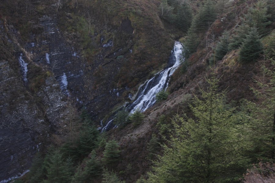 The waterfall has no name of its own, but is clearly a major feature of the crag, so it takes on the same name; Craig y Llyn. It is around 15 metres tall in total, with the main drop being about 10 metres.
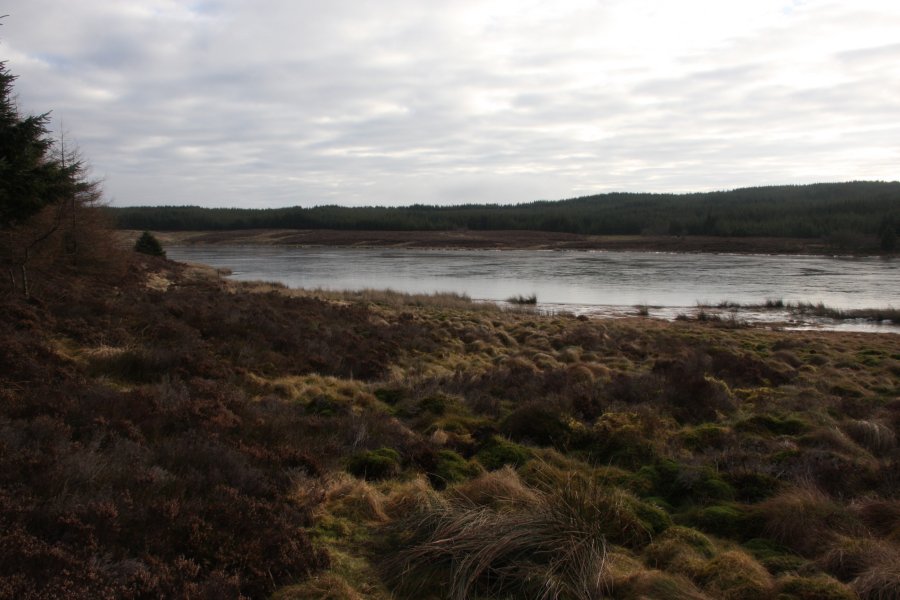 Following the stream upstream brought me to a track, where left reached Llyn Coch-hwyad. About 1 km south through the forest, the map shows a feature called Pwll Coch Bach, but this appears to be only a marsh. Similarly, the Nant Rhaeadr near Llyn Gwyddior appears not to have any significant waterfalls, despite its name.
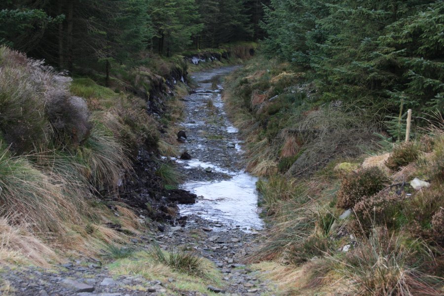 Returning along the track, and taking a right at the first junction, led along an ice-slicked path back to the junction near the top of Mynydd Llyn Coch-hwyad.
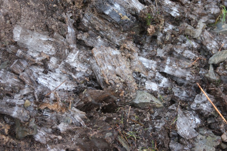 Ice crystals, each over 10cm long, slowly shattering the walls of the track.
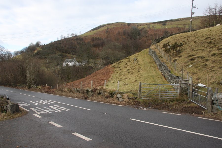 The only parking areas are in the driveways of the nearby farms. My access route was to follow a path along the edge of the field on the east side of Nant y Dugoed. The farmer seemed not to mind my using this route, but you should check for yourself before using it.
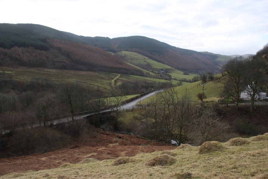 Cwm Dugoed.
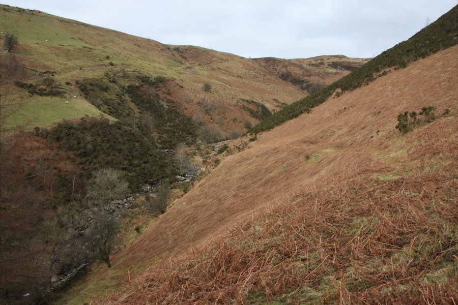 Once in the open access land, there are two paths heading up and down into the Nant y Dugoed valley. The upper path is the best for viewing the waterfalls.
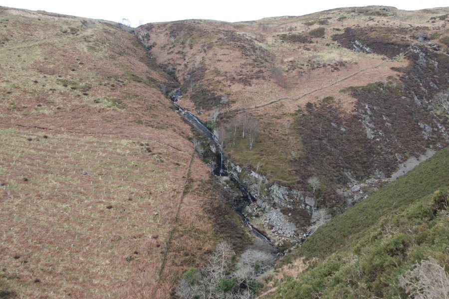 Cwm Cerrig-duon Falls were quite disappointing. The waterslides and cascades add up to 40 metres tall, but no drop is much bigger than 5 metres, and most of the water is taken out of the stream to supply a nearby turbine. The waterfall has no official name, so it is referred to here using the name of its valley.
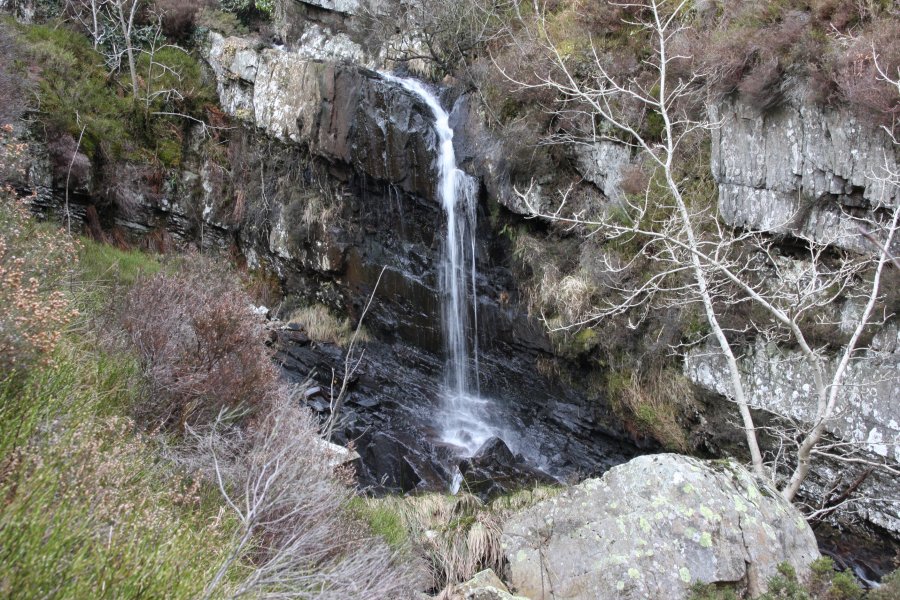 The only clean drop, under 5 metres tall.
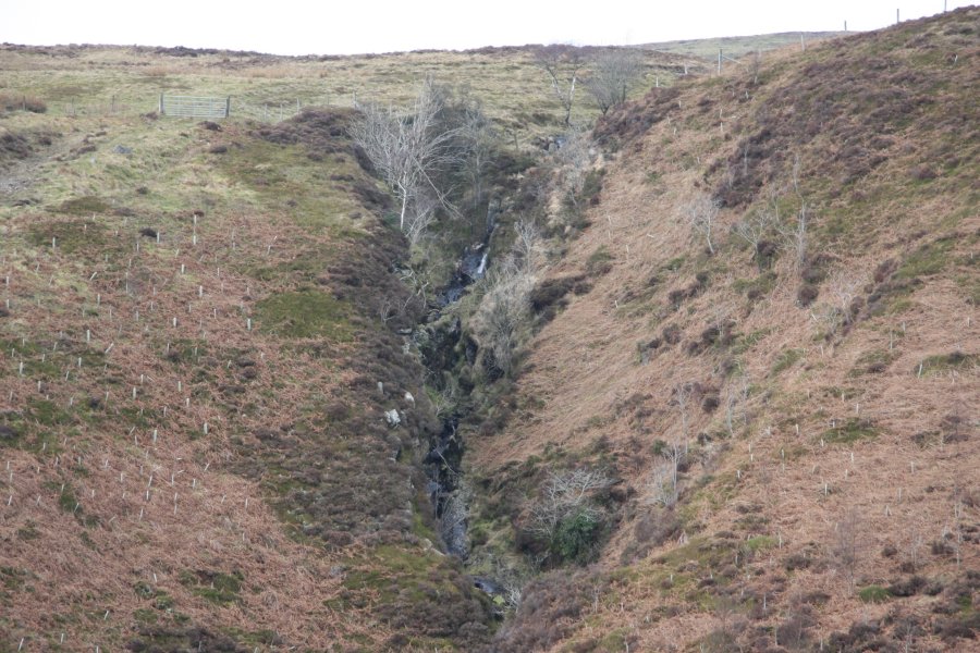 The map shows the top of the stream's descent as being a waterfall, but there is only a very small cascade, then a long rocky slope with the stream flowing under and around the boulders. Not worthy. Above the fence is a small dam used to draw off the water for the turbine.
 Near the upper end of the Nant y Dugoed valley, a rocky outcrop would prove a useful viewpoint to look into the head of the valley. Getting there involved wading through the deep gorse (with the associated painful pincushion effect).
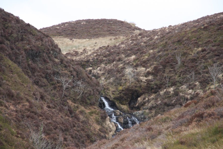 Tiny cascade at the head of the valley.
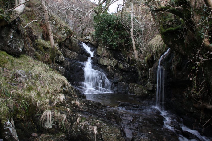 Down below the junction of streams is this beautiful 6 metre cascade, but it's difficult to reach without becoming intimate with the gorse.
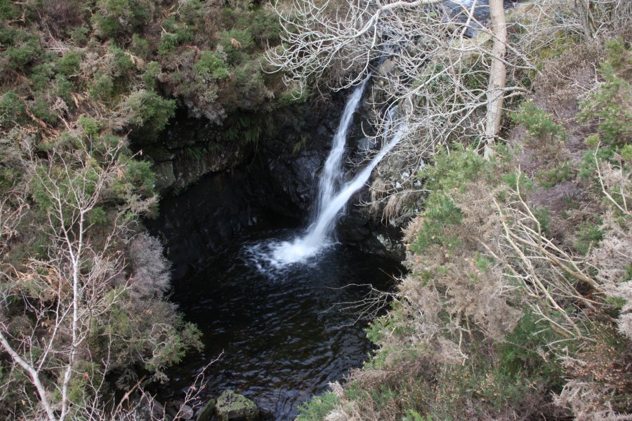 Just below it is a 5 metre twin waterfall with a deep pool. This is also closely guarded by gorse.
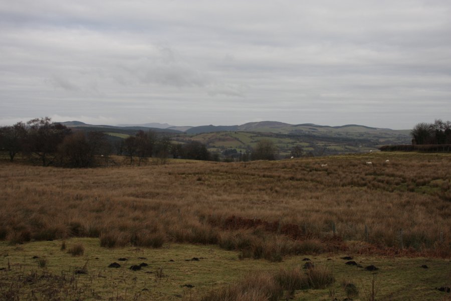 The southeastern end of the Berwyn. On the left are the hills around Abertridwr, on the right is Rhialgwm (540 metres), with the main Berwyn in the distance between them.
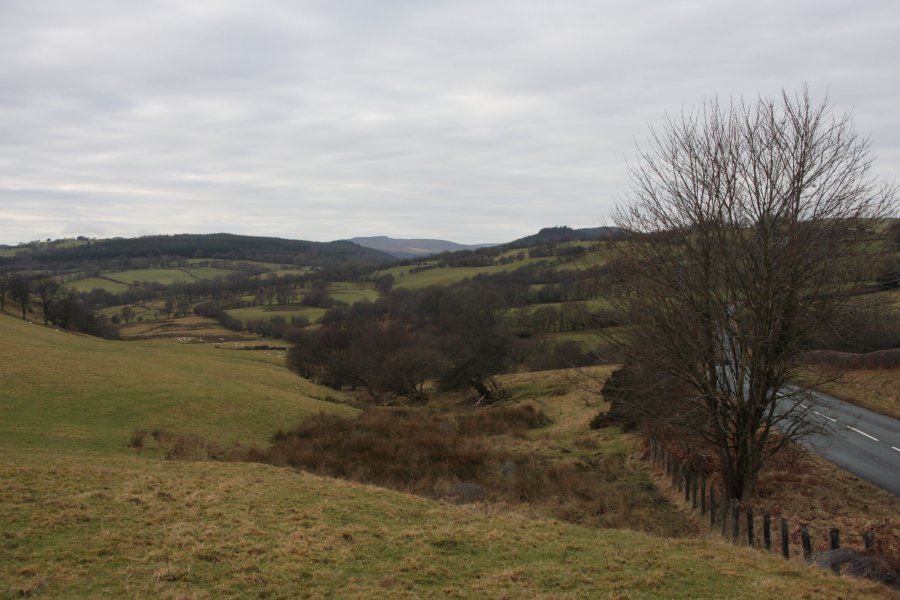 Approaching the lake.
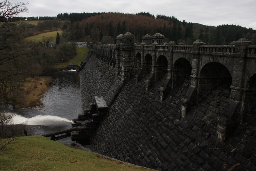 The massive Lake Vyrnwy dam, built out of stone in the 1880s. It was the first large stone-built dam in the UK, and the first in the World to have the spillway all the way across the dam itself (as opposed to a separate spillway at the side). The dam is supposedly 44 metres tall at the tops of its turrets, but is 26 metres high to the overspill, and 357 metres long. Perhaps the usually quoted 44 metres includes the depth of the foundations.
 Lake Vyrnwy, a completely artificial reservoir, just over 7.5 km long.
 A large sheet of ice extending out into the lake.
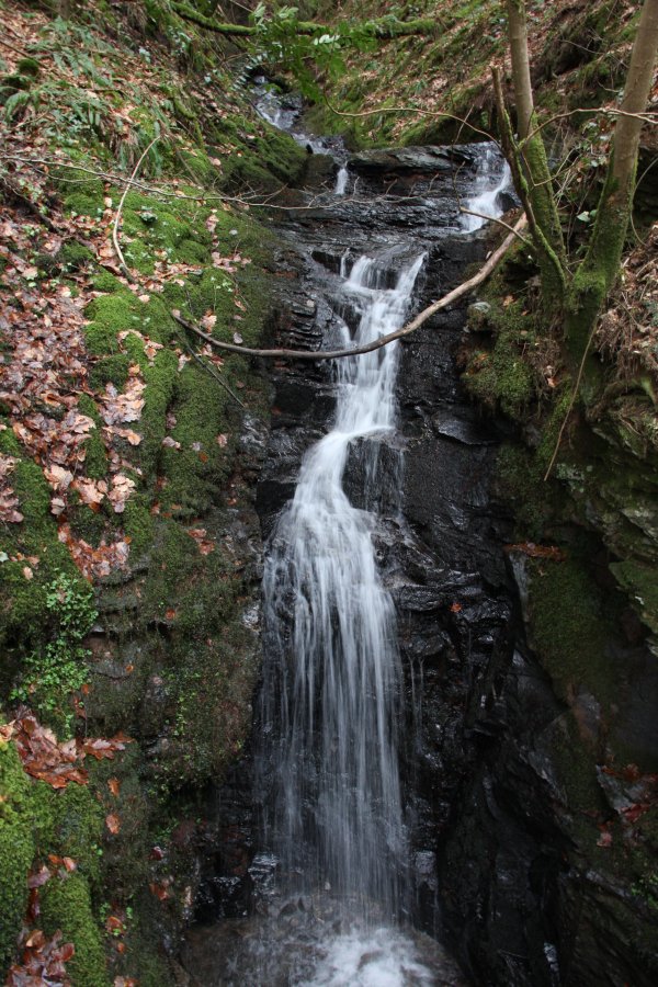 Nant y Maes, fairly typical for the streams feeding the lake. The bottom is a 5 metre cascade.
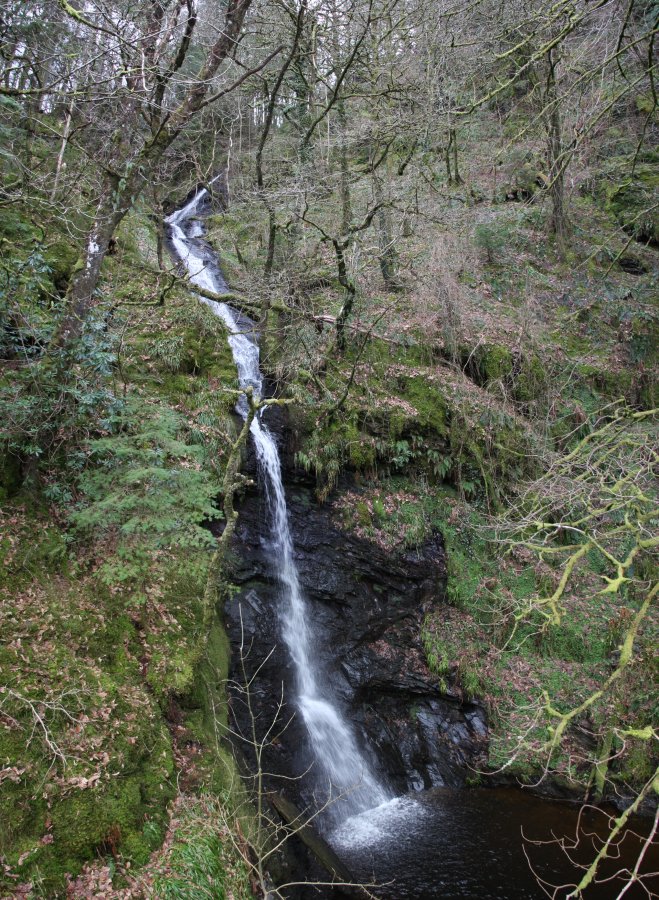 Pistyll y Ceunant. It is normally quoted as 40 metres, or 150 feet (45 metres) in height. However, the part of it visible from below is a little over 30 metres high, while the top (completely invisible from the road) is 66 metres above its base. I ascended the precarious slope on the left side of this, but I advise against using that approach. To see the upper benches, approach from the track above.
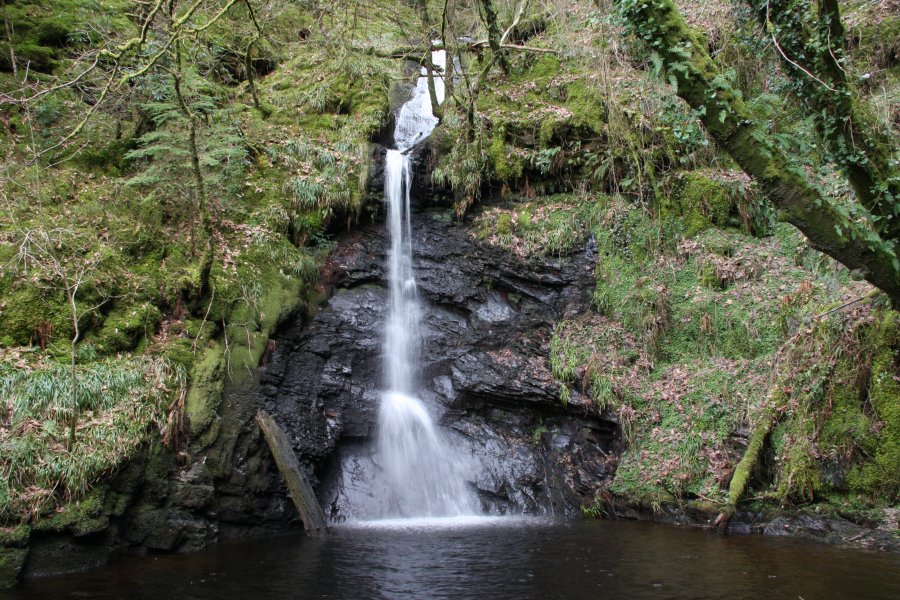 The single drop at the bottom (consisting of both the horsetail and plunge seen here) is 17 metres tall, but the reservoir removes some of that. Photos taken in low water show that despite looking black, the pool (which is in fact a spur of the lake, extending under the road) is only about 1 metre deep where the waterfall lands, with a cobble base. Therefore, it is normal for there to be 65 metres of waterfall, with this bottom single drop reduced to 16 metres.
 The upper part that is visible from the road is about 12-14 metres tall, pouring out of a gorge.
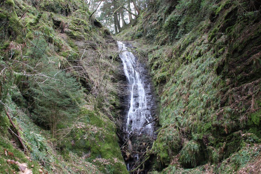 Hiding just inside the gorge is a 15 metre waterfall, landing on a rocky slope.
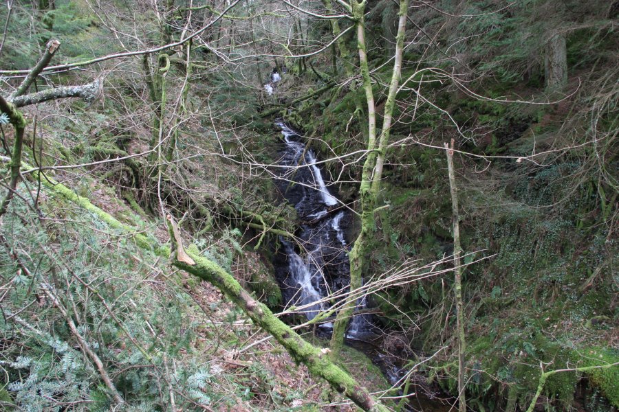 Above it are some small cascades. The top of the main cascade is the top of the Pistyll y Ceunant waterfall.
 A few metres above the top of the cascade is the end of a forestry track from Llechwedd-dû. This can be used to approach the upper benches of the waterfall, but take care around the gorge, waterfall, and roadside cliffs.
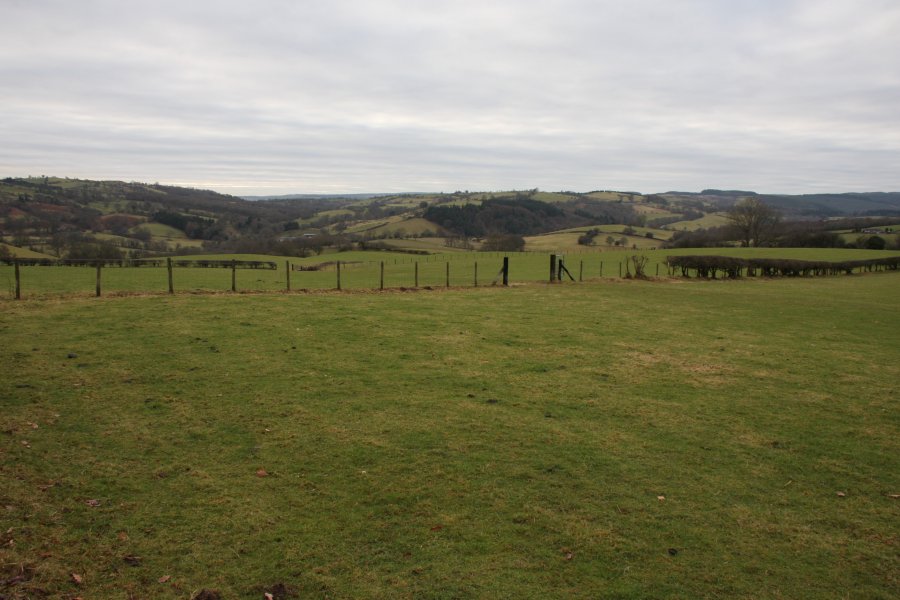 Fields around Dolanog.
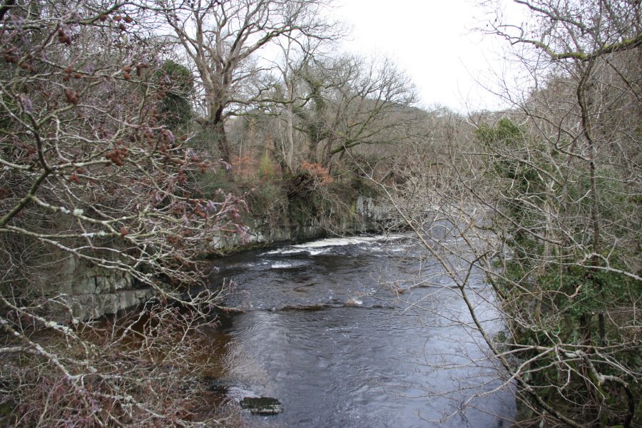 Dolanog Gorge, in the middle of the village. The B4382 passes alongside the river here, and the weir is visible from the road, where there is a small space to park.
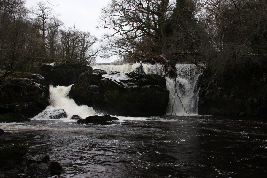 The right side of Dolanog Falls, about 6 metres high.
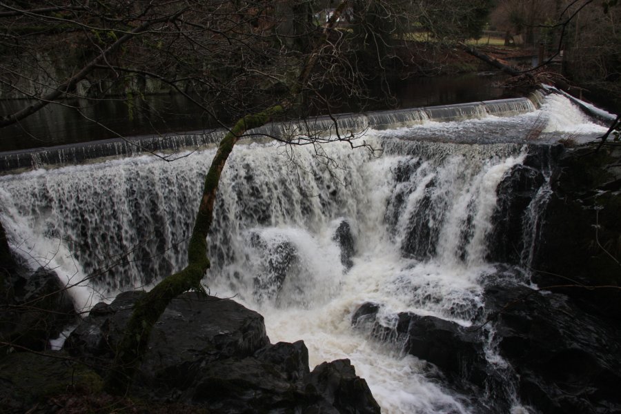 The left side is shorter at 4 metres, landing in a narrow section that would originally have been a powerful rapid.