Slaughter Stream Cave Kuwait Passage trip 23/02/2022
Unless otherwise stated, camera, setups, lighting, edits and gallery effects by Tarquin. Modelling and lighting at various points will be Mark Tringham and Tim Nichols.
The previous part of Kuwait Passage was photographed extensively in a previous gallery. This gallery is intended to continue the work of that previous gallery, to assist in assessing the speleogenesis (cave development) of this part of the cave. It is therefore somewhat lengthy. The trip was also for conservation purposes; cleaning up the tape and other debris that had been seen on the previous trip.
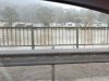 The trip was just after a series of storms, and it was still raining in Wales, including at Monmouth. The Wye at Monmouth had burst its banks, flooding some of the riverside buildings, and reaching the stilts of the houses on the floodplains 2 metres above the normal river level. There are supposed to be tall green banks on either side of the river here. But the Forest Of Dean had other ideas, and somehow remained dry.
 Snowdrops on Bicknor Street.
 Main Stream Passage 1 at Cross Stream Junction, which was significantly higher than normal, but not in flood.
Modelling by Tim, lighting by Tarquin and Tim
Main Stream Passage 1 at Cross Stream Junction, which was significantly higher than normal, but not in flood.
Modelling by Tim, lighting by Tarquin and Tim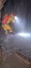 The cascading inlet in Main Stream Passage 1. This is where the water from Dry Sink enters, and just a week beforehand, Welsh Water had been intentionally polluting the cave with sewage. During our trip, the water was still very high, and it was not possible to avoid the spray. Hold your breath, rush through, and try not to think about it. Fortunately, the water is all natural runoff from the surface, so any pollution would have been heavily diluted by now.
Modelling by Tim, lighting by Tarquin and Tim
The cascading inlet in Main Stream Passage 1. This is where the water from Dry Sink enters, and just a week beforehand, Welsh Water had been intentionally polluting the cave with sewage. During our trip, the water was still very high, and it was not possible to avoid the spray. Hold your breath, rush through, and try not to think about it. Fortunately, the water is all natural runoff from the surface, so any pollution would have been heavily diluted by now.
Modelling by Tim, lighting by Tarquin and Tim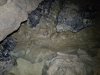 In Kuwait Passage, water had clearly flowed out of the Yud Scraper very recently, but the flooding appears not to have been too severe.
 A victim of the flooding. Apparently frogs don't all appreciate water.
Modelling by D. Ceased
A victim of the flooding. Apparently frogs don't all appreciate water.
Modelling by D. Ceased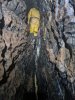 The photography started in earnest in Kuwait Passage, once we passed the point we had finished surveying at previously. It quickly became a lot more traversing high above the stream.
Modelling by Tim, lighting by Tarquin and Tim
The photography started in earnest in Kuwait Passage, once we passed the point we had finished surveying at previously. It quickly became a lot more traversing high above the stream.
Modelling by Tim, lighting by Tarquin and Tim The walls are decorated with many small helicites. Nothing particularly impressive, but nice to see, especially contrasted with the manganese stained walls.
 Helictites.
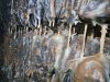 Straws in a seam.
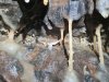 Helitites among the straws.
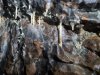 Helictites.
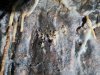 Helictites.
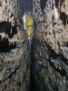 Still traversing.
Modelling by Tim, lighting by Tarquin and Tim
Still traversing.
Modelling by Tim, lighting by Tarquin and Tim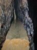 Then the crystal pools start. It is worth noting that the water here almost certainly comes from the calcited streamway in Tinkle Passage - part of Dog's Grave Passage. It is the same water that creates the Snow Garden, and is heavily laden with calcite. This also means that the water is relatively clean (it is used for drinking at the camp in Dog's Grave Passage), and helps to wash away any pollution that may appear during floods.
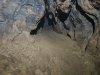 A small side passage in an oxbow. This is the first side passage that points towards Remelt Plant's Lower Series.
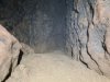 The passage ends in a sand dig. Lower Series is, however, 40 metres away, despite being at the correct height. Digging would be quite sustained.
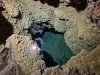 A sump pool in the crystal pools that is bypassed by the oxbow.
 Continuing crystal pools. Sadly, there is no way to avoid these, short of traversing on non-existent ledges, so you try to get through this section with as little damage as possible. The calcite repairs itself fairly fast, and the flooding washes away mud, so in most cases, damage is temporary.
Modelling by Tim, lighting by Tarquin and Tim
Continuing crystal pools. Sadly, there is no way to avoid these, short of traversing on non-existent ledges, so you try to get through this section with as little damage as possible. The calcite repairs itself fairly fast, and the flooding washes away mud, so in most cases, damage is temporary.
Modelling by Tim, lighting by Tarquin and Tim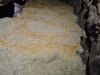 Crystal pool rims.
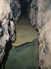 Deeper crystal pool.
 Rims of the deeper pool.
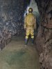 Clearly it would be impossible to avoid walking on the calcite here.
Modelling by Tim, lighting by Tarquin and Tim
Clearly it would be impossible to avoid walking on the calcite here.
Modelling by Tim, lighting by Tarquin and Tim Crystal pool detail.
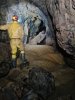 The large and most impressive gour dam near the end of the calcite flow.
Modelling by Tim, lighting by Tarquin and Tim
The large and most impressive gour dam near the end of the calcite flow.
Modelling by Tim, lighting by Tarquin and Tim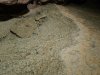 Top of the gour dam.
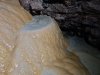 Smaller gour pools on the face of the gour dam.
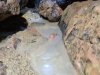 Newly formed calcite raft at the bottom of the gour dam. Somehow, this had managed to survive the most recent floods.
Lighting by Tarquin and Tim
Newly formed calcite raft at the bottom of the gour dam. Somehow, this had managed to survive the most recent floods.
Lighting by Tarquin and Tim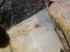 The rafts are thick and complete enough to have formed a crust over the pool.
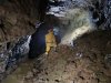 The large chamber near the end of Kuwait Passage, immediately after the gour dam. The rock pile is from digging the side passage up the slope on the right, and the alcoves in the far wall are a sloping fault, leaning at about 15°. This is the most likely place for Remelt Plant to reconnect with Kuwait Passage, which would form a fairly epic round trip. There is also an aven in the ceiling, but it looks distinctly blind. There is a loop closure uncertainty here, and it is possible that this lies directly below the fault chamber in Remelt Plant (whose floor dig is just 5 metres above the top of the aven here, but 10 metres away horizontally), but the positioning from the survey seems about right given the angle of the fault and the expected vertical separation of the passages.
Modelling by Tim, lighting by Tarquin, Tim and Mark
The large chamber near the end of Kuwait Passage, immediately after the gour dam. The rock pile is from digging the side passage up the slope on the right, and the alcoves in the far wall are a sloping fault, leaning at about 15°. This is the most likely place for Remelt Plant to reconnect with Kuwait Passage, which would form a fairly epic round trip. There is also an aven in the ceiling, but it looks distinctly blind. There is a loop closure uncertainty here, and it is possible that this lies directly below the fault chamber in Remelt Plant (whose floor dig is just 5 metres above the top of the aven here, but 10 metres away horizontally), but the positioning from the survey seems about right given the angle of the fault and the expected vertical separation of the passages.
Modelling by Tim, lighting by Tarquin, Tim and Mark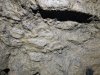 The ceiling is coated with flood debris, showing that even though this is over 9 metres above the sump level, it still sometimes floods to the ceiling.
 The start of the side passage, a crawl over mud.
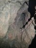 Aven at the start of the side passage, which pinches out. The haematite stained rocks are very reminiscent of those in the fault chamber which appears to lie directly above this passage, in the Upper Series of Remelt Plant. However, this aven is formed on a rift which does not line up with the fault in the chamber above, or in the chamber in Kuwait Passage.
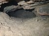 The side passages lowers.
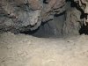 Lifting a little as it turns to match the direction of the fault, surveyed to be directly below the fault chamber.
 Nearing the end.
 The last section of the passage is taller, with a rift in the ceiling.
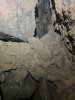 The rift is full of muddied rubble, but it seems to have a solid top, pinching out completely. So even though this is the closest point to the fault chamber in the Upper Series of Remelt Plant, it does not look like it will actually connect with a navigable size.
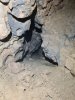 The continuing passage ahead, however, is at the perfect height, and perfect direction to connect with the end of the Lower Series of Remelt Plant, in 17 metres (according to the new survey). The passage is open with a cracked mud floor, but needs to be dug larger. It did not have a noticeable draught, even though a draught was detected earlier in Kuwait Passage, and on a previous trip at the end of Remelt Plant's Lower Series.
 Downstream from the chamber, the gradient increases dramatically, starting with a calcite cascade at the end of the chamber.
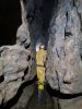 The continuing rift beyond the chamber.
Modelling by Tim, lighting by Tarquin and Tim
The continuing rift beyond the chamber.
Modelling by Tim, lighting by Tarquin and Tim The largest section of passage, which is sadly very short lived, and filled with ominous mud banks.
Modelling by Mark and Tim, lighting by Tarquin, Mark and Tim
The largest section of passage, which is sadly very short lived, and filled with ominous mud banks.
Modelling by Mark and Tim, lighting by Tarquin, Mark and Tim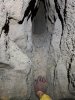 The ceiling above the mud banks has an aven which might look promising, and which sits 20 metres below a side rift in Remelt Plant's Upper Series. However, it has a tide mark of flood debris, showing that there is air above the highest water level. This is about 3 metres lower than the last chamber's ceiling where there was flood debris, so it should be completely underwater during a flood too. The water line suggests that this traps air, meaning that the air cannot escape elsewhere. As a result, it is likely to be blind. There was no draught.
Modelling by manus de Tim, lighting by Tarquin and Tim
The ceiling above the mud banks has an aven which might look promising, and which sits 20 metres below a side rift in Remelt Plant's Upper Series. However, it has a tide mark of flood debris, showing that there is air above the highest water level. This is about 3 metres lower than the last chamber's ceiling where there was flood debris, so it should be completely underwater during a flood too. The water line suggests that this traps air, meaning that the air cannot escape elsewhere. As a result, it is likely to be blind. There was no draught.
Modelling by manus de Tim, lighting by Tarquin and Tim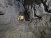 Above the mudbanks, and below the aven, is a side passage, that heads directly under Remelt Plant's Upper Series, and looks promising on the survey.
Modelling by Tim, lighting by Tarquin and Tim
Above the mudbanks, and below the aven, is a side passage, that heads directly under Remelt Plant's Upper Series, and looks promising on the survey.
Modelling by Tim, lighting by Tarquin and Tim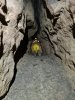 The passage starts off at a reasonable crawling size.
Modelling by Tim, lighting by Tarquin and Tim
The passage starts off at a reasonable crawling size.
Modelling by Tim, lighting by Tarquin and Tim The passage abruptly ends in mud fill. To the left, a small triangular passage continues with a cracked mud floor, just big enough to fit your arm in. This points towards the next side passage. There do not appear to be any other prospects, and there is no draught.
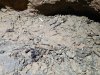 Flood debris in the side passage.
 The debris looks like bits of tissue (which might be expected in here), but it is actually mould on the twigs.
 A tiny millipede in the mud, barely 3 mm long, and completely lacking in pigment. It took only a few seconds to hide, so this was the best picture I could get.
Modelling by Milton
A tiny millipede in the mud, barely 3 mm long, and completely lacking in pigment. It took only a few seconds to hide, so this was the best picture I could get.
Modelling by Milton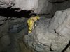 Beside the mudbanks is the way on, getting low again.
Modelling by Tim, lighting by Tarquin and Tim
Beside the mudbanks is the way on, getting low again.
Modelling by Tim, lighting by Tarquin and Tim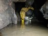 Wet feet and squelching mud in the low section.
Modelling by Tim, lighting by Tarquin and Tim
Wet feet and squelching mud in the low section.
Modelling by Tim, lighting by Tarquin and Tim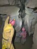 The ceiling rises, and another side passage leads off towards Remelt Plant.
Modelling by Tim and Mark, lighting by Tarquin, Tim and Mark
The ceiling rises, and another side passage leads off towards Remelt Plant.
Modelling by Tim and Mark, lighting by Tarquin, Tim and Mark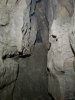 This passage requires a slippery climb and then a slide up a slippery mud slope. It is not worth the effort.
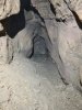 After a short crawl, it ends at a tiny triangular tube with a cracked mud floor, heading to the right, towards the last side passage. The two passages are almost certainly just an oxbow. There is no draught.
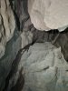 The chamber has an aven in the ceiling, which climbs fairly high. We could not tell whether it had a draught, since it was too far up.
Lighting by Tarquin and Tim
The chamber has an aven in the ceiling, which climbs fairly high. We could not tell whether it had a draught, since it was too far up.
Lighting by Tarquin and Tim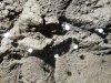 White balls in a tangled web on the walls. These look distinctly like cave spider egg sacs, but significantly smaller. This is over 1.5 km underground, from the nearest known sink or entrance. These are thought to be cavity spider egg sacs (Nesticus cellulanus).
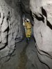 Last section of rift passage, now with deeper mud.
Modelling by Tim, lighting by Tarquin and Tim
Last section of rift passage, now with deeper mud.
Modelling by Tim, lighting by Tarquin and Tim A final set of ominous mud banks.
Modelling by Tim, lighting by Tarquin and Tim
A final set of ominous mud banks.
Modelling by Tim, lighting by Tarquin and Tim Wormcasts in the mud banks. There is obviously a lot of organic matter in this soil.
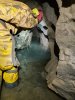 The stream then forms a canal, which quickly reaches the terminal Static Sump 4. Which is not static, since there is a stream flowing into it. The sump can be seen in the distant alcove on the right, where the water is chest deep.
Modelling by Tim, lighting by Tarquin and Tim
The stream then forms a canal, which quickly reaches the terminal Static Sump 4. Which is not static, since there is a stream flowing into it. The sump can be seen in the distant alcove on the right, where the water is chest deep.
Modelling by Tim, lighting by Tarquin and Tim On our way out, we took care of the other task, collecting all the debris that had been flooded through the cave. The vast majority was conservation tape that had been washed away by flood water, but there were also some sweet wrappers, and decomposed remnants of sanitary products that had been deposited in the cave by Welsh Water.
Modelling by Tim and Mark's wellies, lighting by Tarquin, Mark and Tim
On our way out, we took care of the other task, collecting all the debris that had been flooded through the cave. The vast majority was conservation tape that had been washed away by flood water, but there were also some sweet wrappers, and decomposed remnants of sanitary products that had been deposited in the cave by Welsh Water.
Modelling by Tim and Mark's wellies, lighting by Tarquin, Mark and Tim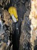 Tim also pushed through the tight end of the lower rift near Lights Out Chamber, collecting a few metres of conservation tape.
Modelling by Tim, lighting by Tarquin and Tim
Tim also pushed through the tight end of the lower rift near Lights Out Chamber, collecting a few metres of conservation tape.
Modelling by Tim, lighting by Tarquin and Tim After struggling along at floor level, he had to return and try again at ceiling level, then drop down to collect more tape before reaching the marginally larger part of the rift. Hero!
Modelling by Tim, lighting by Tarquin and Tim
After struggling along at floor level, he had to return and try again at ceiling level, then drop down to collect more tape before reaching the marginally larger part of the rift. Hero!
Modelling by Tim, lighting by Tarquin and Tim Tim's contributions then got added to the 50 metre length of tape that I had removed from the less extreme end of the same rift. This passage seems to be a magnet for flood debris.
Modelling by Tim, lighting by Tarquin and Tim
Tim's contributions then got added to the 50 metre length of tape that I had removed from the less extreme end of the same rift. This passage seems to be a magnet for flood debris.
Modelling by Tim, lighting by Tarquin and Tim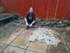 The total amount of debris we collected from the cave. The vast majority is conservation tape, which could all be recycled. The total amount was perhaps 60-70 metres. The smaller pile on the left is made up from decomposed foil and plastic wrappers, and the shards of various sanitary products and wipes that should never have been in Welsh Water's system in the first place, but which we can thank Welsh Water for dumping here. A good day's conservation work that did not feel much like fun, but at least the cave is a much nicer place now.
Camera by Becci Wilton-Jones, modelling by Tarquin
The total amount of debris we collected from the cave. The vast majority is conservation tape, which could all be recycled. The total amount was perhaps 60-70 metres. The smaller pile on the left is made up from decomposed foil and plastic wrappers, and the shards of various sanitary products and wipes that should never have been in Welsh Water's system in the first place, but which we can thank Welsh Water for dumping here. A good day's conservation work that did not feel much like fun, but at least the cave is a much nicer place now.
Camera by Becci Wilton-Jones, modelling by Tarquin
 The trip was just after a series of storms, and it was still raining in Wales, including at Monmouth. The Wye at Monmouth had burst its banks, flooding some of the riverside buildings, and reaching the stilts of the houses on the floodplains 2 metres above the normal river level. There are supposed to be tall green banks on either side of the river here. But the Forest Of Dean had other ideas, and somehow remained dry.
 Snowdrops on Bicknor Street.
 Main Stream Passage 1 at Cross Stream Junction, which was significantly higher than normal, but not in flood.
Modelling by Tim, lighting by Tarquin and Tim
Main Stream Passage 1 at Cross Stream Junction, which was significantly higher than normal, but not in flood.
Modelling by Tim, lighting by Tarquin and Tim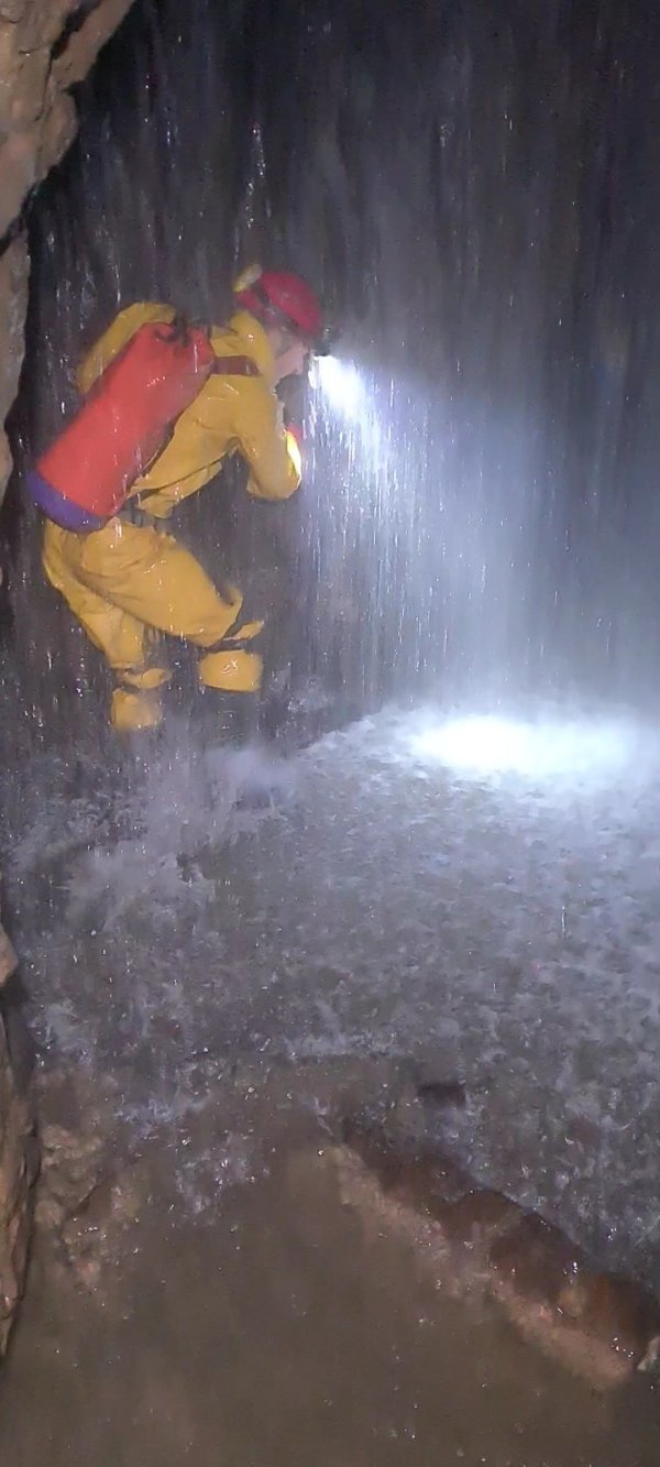 The cascading inlet in Main Stream Passage 1. This is where the water from Dry Sink enters, and just a week beforehand, Welsh Water had been intentionally polluting the cave with sewage. During our trip, the water was still very high, and it was not possible to avoid the spray. Hold your breath, rush through, and try not to think about it. Fortunately, the water is all natural runoff from the surface, so any pollution would have been heavily diluted by now.
Modelling by Tim, lighting by Tarquin and Tim
The cascading inlet in Main Stream Passage 1. This is where the water from Dry Sink enters, and just a week beforehand, Welsh Water had been intentionally polluting the cave with sewage. During our trip, the water was still very high, and it was not possible to avoid the spray. Hold your breath, rush through, and try not to think about it. Fortunately, the water is all natural runoff from the surface, so any pollution would have been heavily diluted by now.
Modelling by Tim, lighting by Tarquin and Tim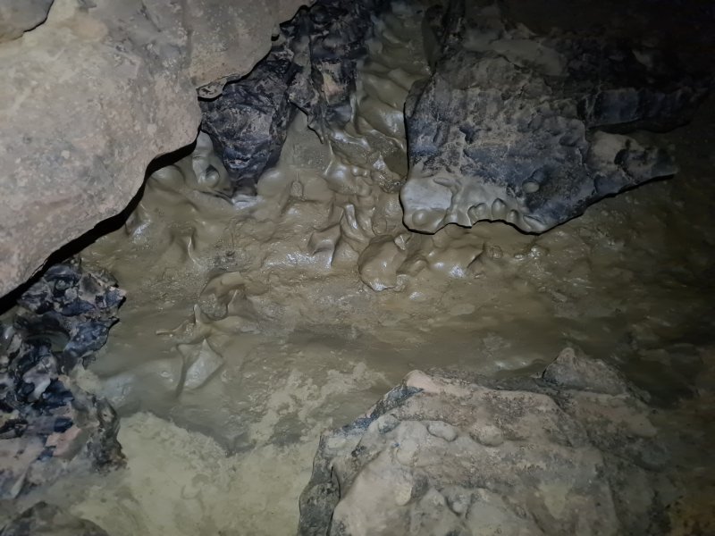 In Kuwait Passage, water had clearly flowed out of the Yud Scraper very recently, but the flooding appears not to have been too severe.
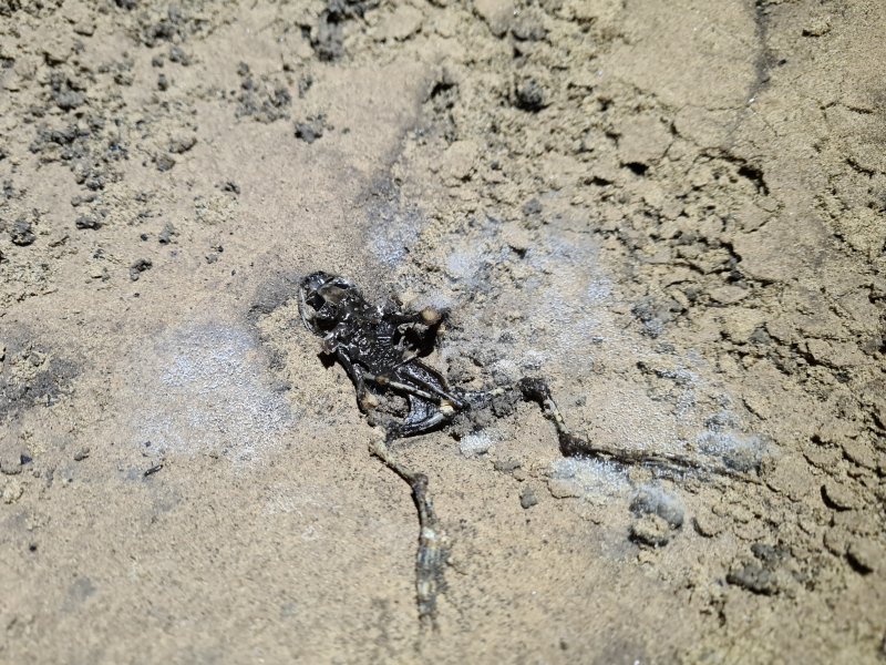 A victim of the flooding. Apparently frogs don't all appreciate water.
Modelling by D. Ceased
A victim of the flooding. Apparently frogs don't all appreciate water.
Modelling by D. Ceased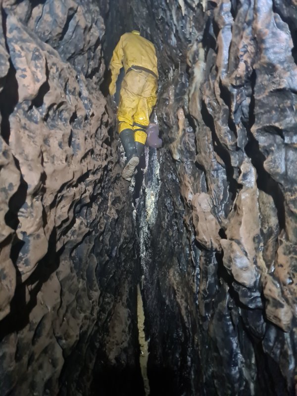 The photography started in earnest in Kuwait Passage, once we passed the point we had finished surveying at previously. It quickly became a lot more traversing high above the stream.
Modelling by Tim, lighting by Tarquin and Tim
The photography started in earnest in Kuwait Passage, once we passed the point we had finished surveying at previously. It quickly became a lot more traversing high above the stream.
Modelling by Tim, lighting by Tarquin and Tim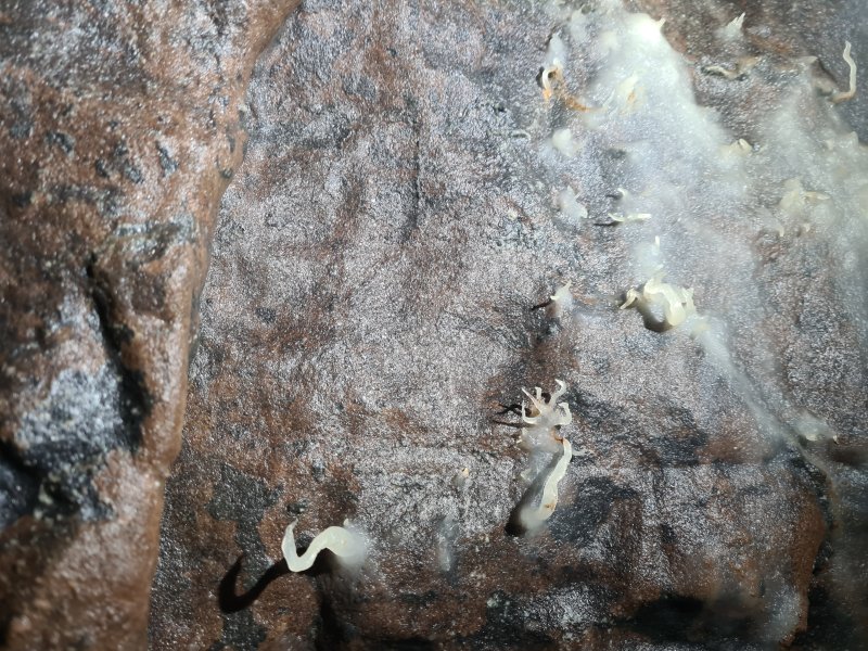 The walls are decorated with many small helicites. Nothing particularly impressive, but nice to see, especially contrasted with the manganese stained walls.
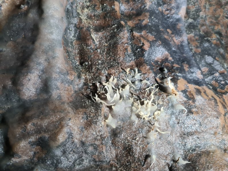 Helictites.
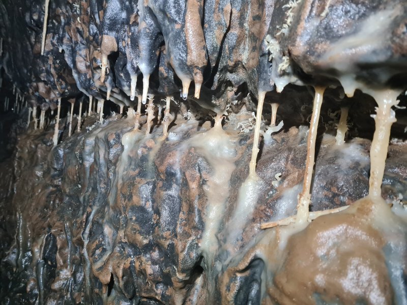 Straws in a seam.
 Helitites among the straws.
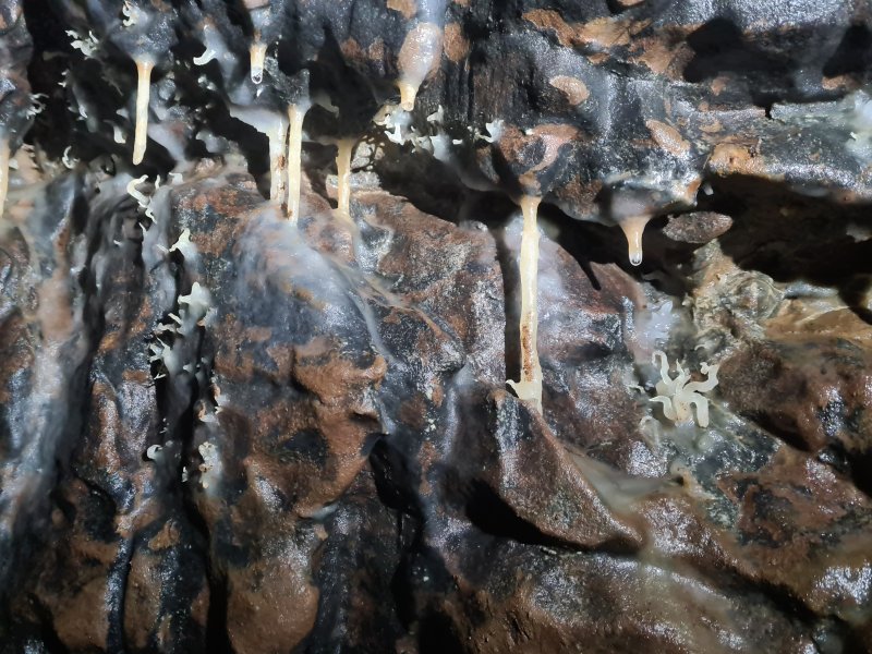 Helictites.
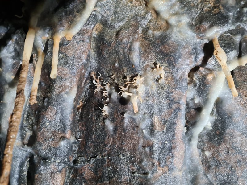 Helictites.
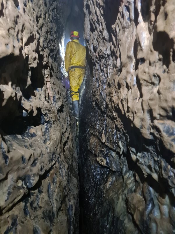 Still traversing.
Modelling by Tim, lighting by Tarquin and Tim
Still traversing.
Modelling by Tim, lighting by Tarquin and Tim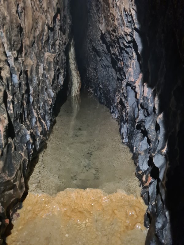 Then the crystal pools start. It is worth noting that the water here almost certainly comes from the calcited streamway in Tinkle Passage - part of Dog's Grave Passage. It is the same water that creates the Snow Garden, and is heavily laden with calcite. This also means that the water is relatively clean (it is used for drinking at the camp in Dog's Grave Passage), and helps to wash away any pollution that may appear during floods.
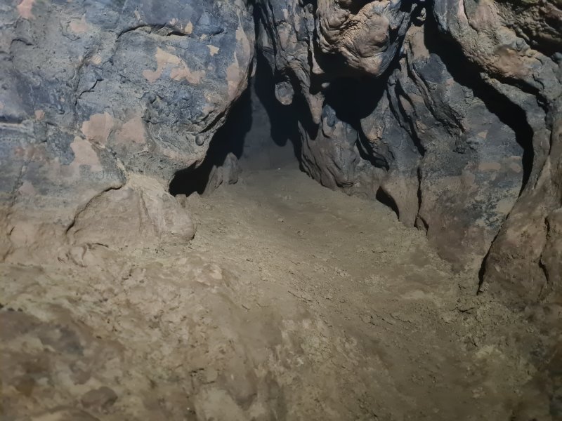 A small side passage in an oxbow. This is the first side passage that points towards Remelt Plant's Lower Series.
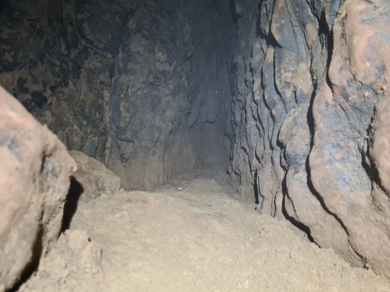 The passage ends in a sand dig. Lower Series is, however, 40 metres away, despite being at the correct height. Digging would be quite sustained.
 A sump pool in the crystal pools that is bypassed by the oxbow.
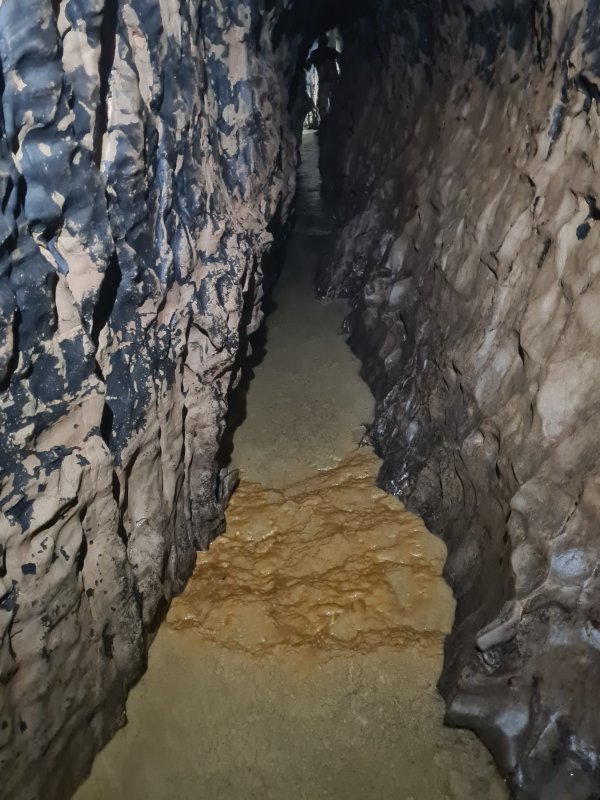 Continuing crystal pools. Sadly, there is no way to avoid these, short of traversing on non-existent ledges, so you try to get through this section with as little damage as possible. The calcite repairs itself fairly fast, and the flooding washes away mud, so in most cases, damage is temporary.
Modelling by Tim, lighting by Tarquin and Tim
Continuing crystal pools. Sadly, there is no way to avoid these, short of traversing on non-existent ledges, so you try to get through this section with as little damage as possible. The calcite repairs itself fairly fast, and the flooding washes away mud, so in most cases, damage is temporary.
Modelling by Tim, lighting by Tarquin and Tim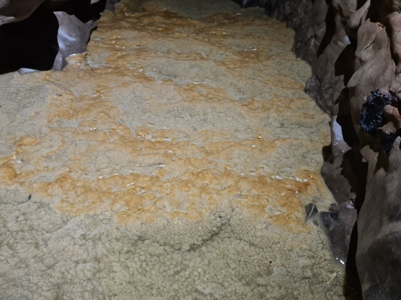 Crystal pool rims.
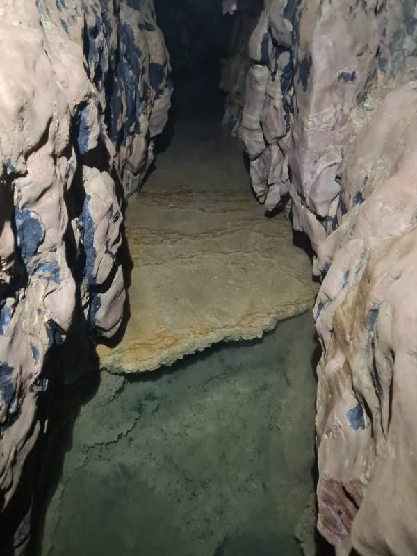 Deeper crystal pool.
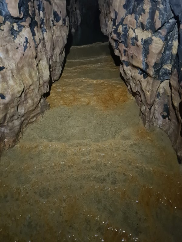 Rims of the deeper pool.
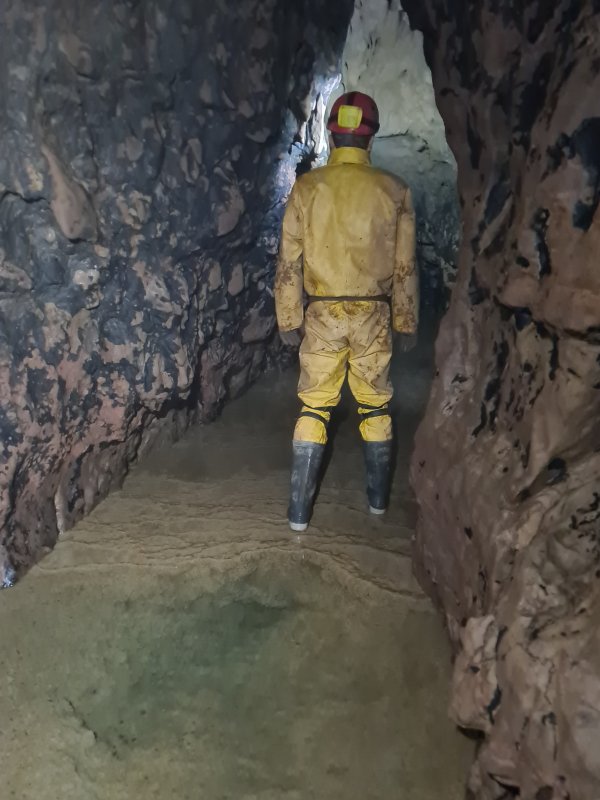 Clearly it would be impossible to avoid walking on the calcite here.
Modelling by Tim, lighting by Tarquin and Tim
Clearly it would be impossible to avoid walking on the calcite here.
Modelling by Tim, lighting by Tarquin and Tim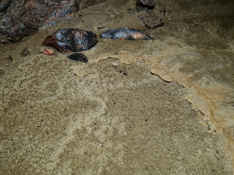 Crystal pool detail.
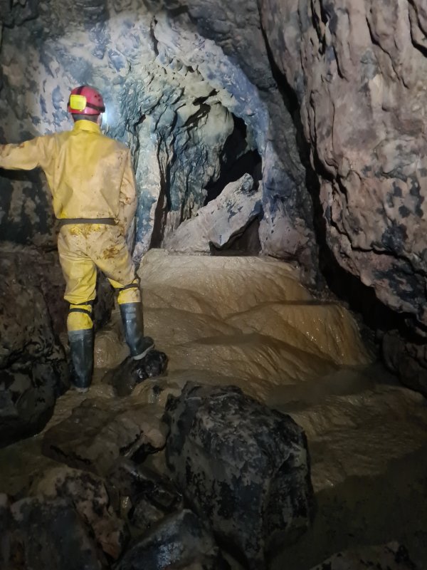 The large and most impressive gour dam near the end of the calcite flow.
Modelling by Tim, lighting by Tarquin and Tim
The large and most impressive gour dam near the end of the calcite flow.
Modelling by Tim, lighting by Tarquin and Tim Top of the gour dam.
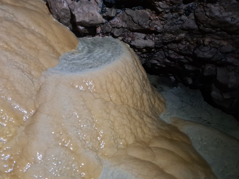 Smaller gour pools on the face of the gour dam.
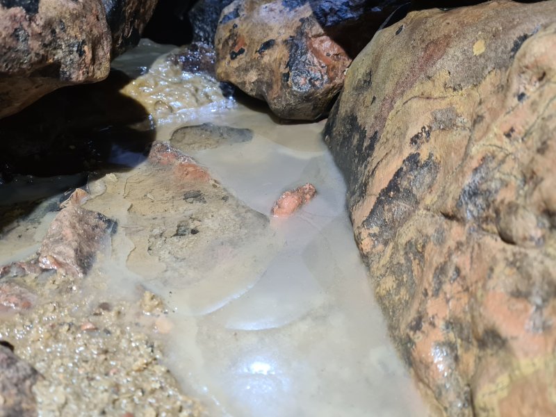 Newly formed calcite raft at the bottom of the gour dam. Somehow, this had managed to survive the most recent floods.
Lighting by Tarquin and Tim
Newly formed calcite raft at the bottom of the gour dam. Somehow, this had managed to survive the most recent floods.
Lighting by Tarquin and Tim The rafts are thick and complete enough to have formed a crust over the pool.
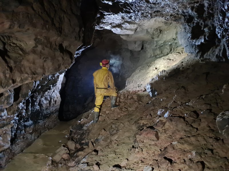 The large chamber near the end of Kuwait Passage, immediately after the gour dam. The rock pile is from digging the side passage up the slope on the right, and the alcoves in the far wall are a sloping fault, leaning at about 15°. This is the most likely place for Remelt Plant to reconnect with Kuwait Passage, which would form a fairly epic round trip. There is also an aven in the ceiling, but it looks distinctly blind. There is a loop closure uncertainty here, and it is possible that this lies directly below the fault chamber in Remelt Plant (whose floor dig is just 5 metres above the top of the aven here, but 10 metres away horizontally), but the positioning from the survey seems about right given the angle of the fault and the expected vertical separation of the passages.
Modelling by Tim, lighting by Tarquin, Tim and Mark
The large chamber near the end of Kuwait Passage, immediately after the gour dam. The rock pile is from digging the side passage up the slope on the right, and the alcoves in the far wall are a sloping fault, leaning at about 15°. This is the most likely place for Remelt Plant to reconnect with Kuwait Passage, which would form a fairly epic round trip. There is also an aven in the ceiling, but it looks distinctly blind. There is a loop closure uncertainty here, and it is possible that this lies directly below the fault chamber in Remelt Plant (whose floor dig is just 5 metres above the top of the aven here, but 10 metres away horizontally), but the positioning from the survey seems about right given the angle of the fault and the expected vertical separation of the passages.
Modelling by Tim, lighting by Tarquin, Tim and Mark The ceiling is coated with flood debris, showing that even though this is over 9 metres above the sump level, it still sometimes floods to the ceiling.
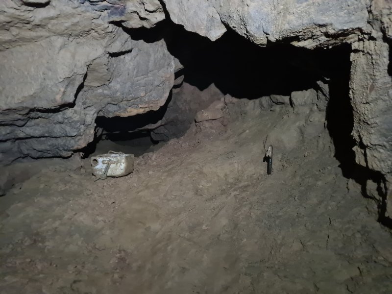 The start of the side passage, a crawl over mud.
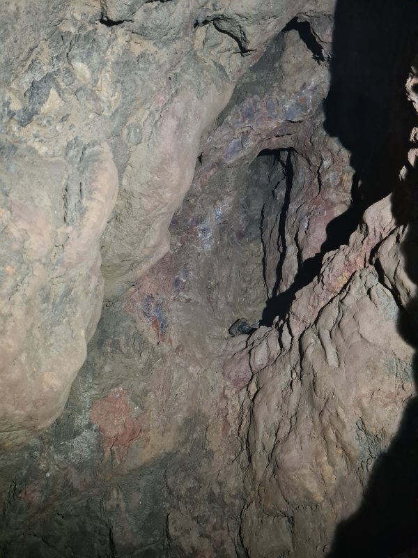 Aven at the start of the side passage, which pinches out. The haematite stained rocks are very reminiscent of those in the fault chamber which appears to lie directly above this passage, in the Upper Series of Remelt Plant. However, this aven is formed on a rift which does not line up with the fault in the chamber above, or in the chamber in Kuwait Passage.
 The side passages lowers.
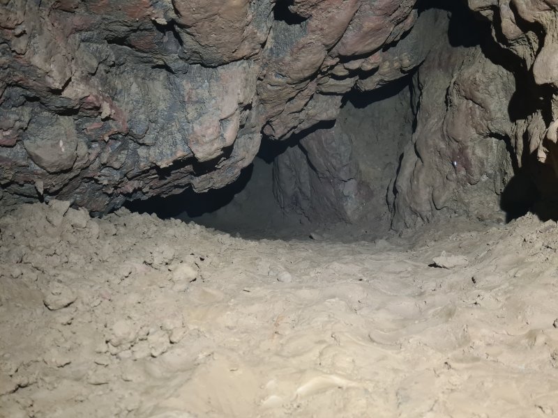 Lifting a little as it turns to match the direction of the fault, surveyed to be directly below the fault chamber.
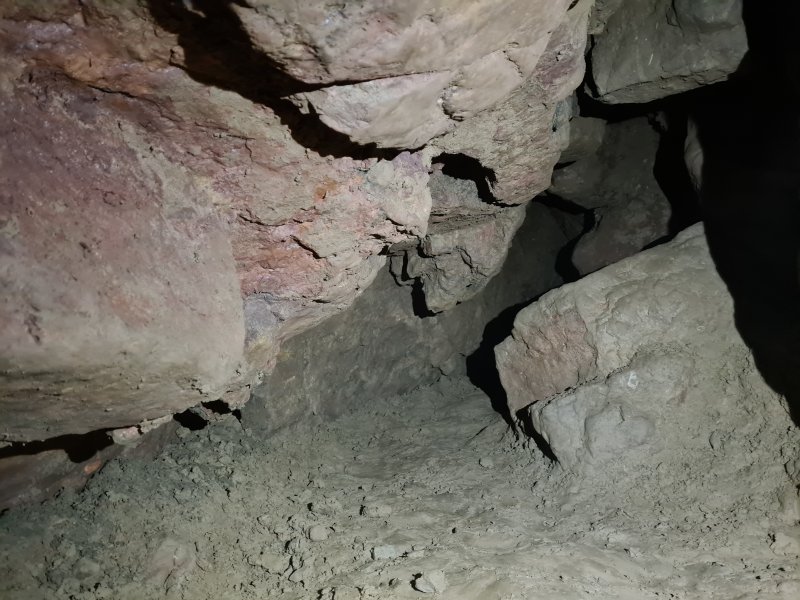 Nearing the end.
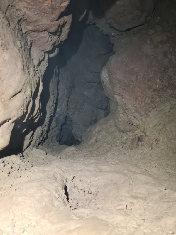 The last section of the passage is taller, with a rift in the ceiling.
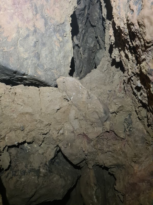 The rift is full of muddied rubble, but it seems to have a solid top, pinching out completely. So even though this is the closest point to the fault chamber in the Upper Series of Remelt Plant, it does not look like it will actually connect with a navigable size.
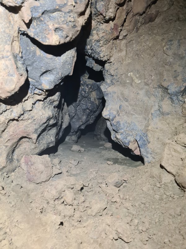 The continuing passage ahead, however, is at the perfect height, and perfect direction to connect with the end of the Lower Series of Remelt Plant, in 17 metres (according to the new survey). The passage is open with a cracked mud floor, but needs to be dug larger. It did not have a noticeable draught, even though a draught was detected earlier in Kuwait Passage, and on a previous trip at the end of Remelt Plant's Lower Series.
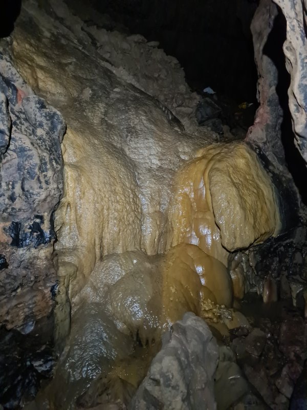 Downstream from the chamber, the gradient increases dramatically, starting with a calcite cascade at the end of the chamber.
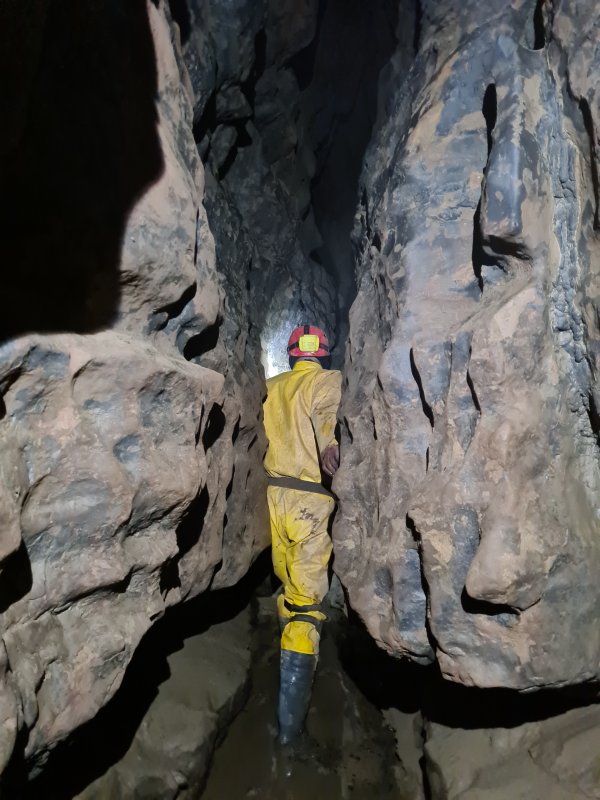 The continuing rift beyond the chamber.
Modelling by Tim, lighting by Tarquin and Tim
The continuing rift beyond the chamber.
Modelling by Tim, lighting by Tarquin and Tim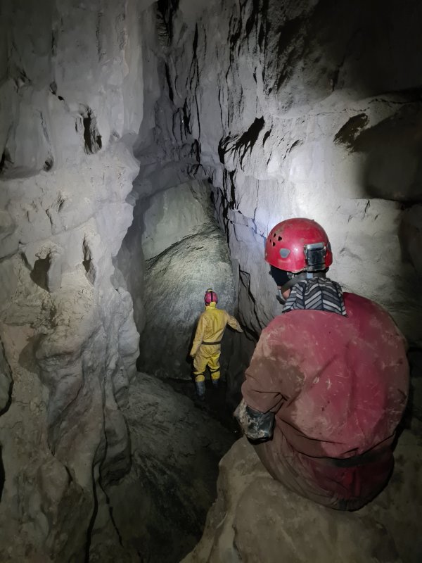 The largest section of passage, which is sadly very short lived, and filled with ominous mud banks.
Modelling by Mark and Tim, lighting by Tarquin, Mark and Tim
The largest section of passage, which is sadly very short lived, and filled with ominous mud banks.
Modelling by Mark and Tim, lighting by Tarquin, Mark and Tim The ceiling above the mud banks has an aven which might look promising, and which sits 20 metres below a side rift in Remelt Plant's Upper Series. However, it has a tide mark of flood debris, showing that there is air above the highest water level. This is about 3 metres lower than the last chamber's ceiling where there was flood debris, so it should be completely underwater during a flood too. The water line suggests that this traps air, meaning that the air cannot escape elsewhere. As a result, it is likely to be blind. There was no draught.
Modelling by manus de Tim, lighting by Tarquin and Tim
The ceiling above the mud banks has an aven which might look promising, and which sits 20 metres below a side rift in Remelt Plant's Upper Series. However, it has a tide mark of flood debris, showing that there is air above the highest water level. This is about 3 metres lower than the last chamber's ceiling where there was flood debris, so it should be completely underwater during a flood too. The water line suggests that this traps air, meaning that the air cannot escape elsewhere. As a result, it is likely to be blind. There was no draught.
Modelling by manus de Tim, lighting by Tarquin and Tim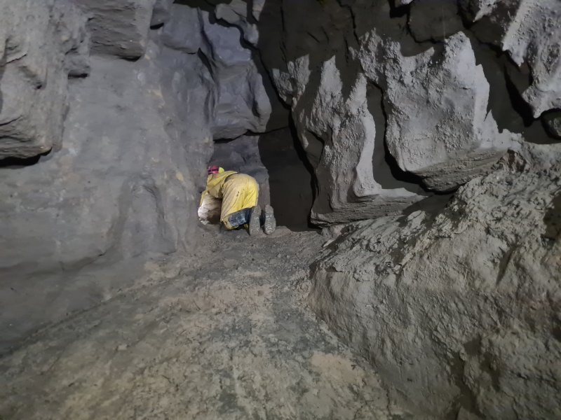 Above the mudbanks, and below the aven, is a side passage, that heads directly under Remelt Plant's Upper Series, and looks promising on the survey.
Modelling by Tim, lighting by Tarquin and Tim
Above the mudbanks, and below the aven, is a side passage, that heads directly under Remelt Plant's Upper Series, and looks promising on the survey.
Modelling by Tim, lighting by Tarquin and Tim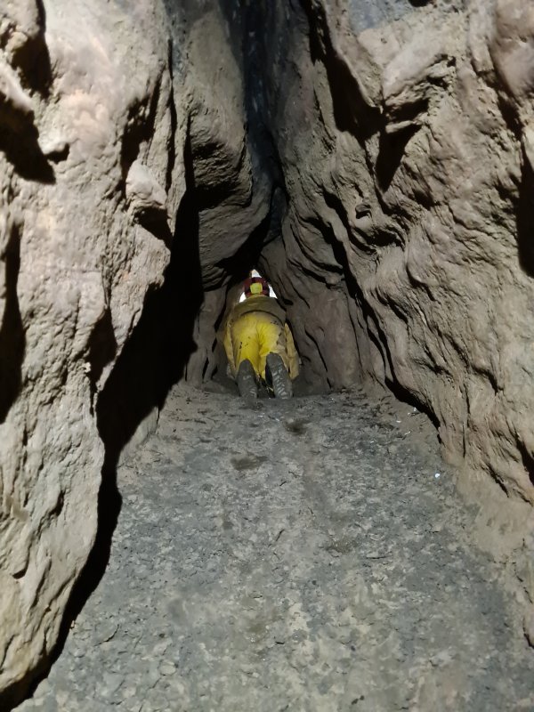 The passage starts off at a reasonable crawling size.
Modelling by Tim, lighting by Tarquin and Tim
The passage starts off at a reasonable crawling size.
Modelling by Tim, lighting by Tarquin and Tim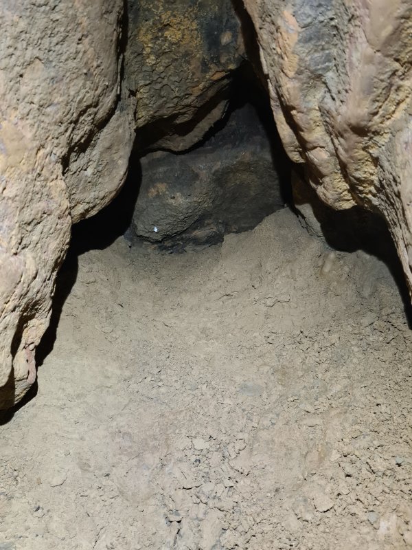 The passage abruptly ends in mud fill. To the left, a small triangular passage continues with a cracked mud floor, just big enough to fit your arm in. This points towards the next side passage. There do not appear to be any other prospects, and there is no draught.
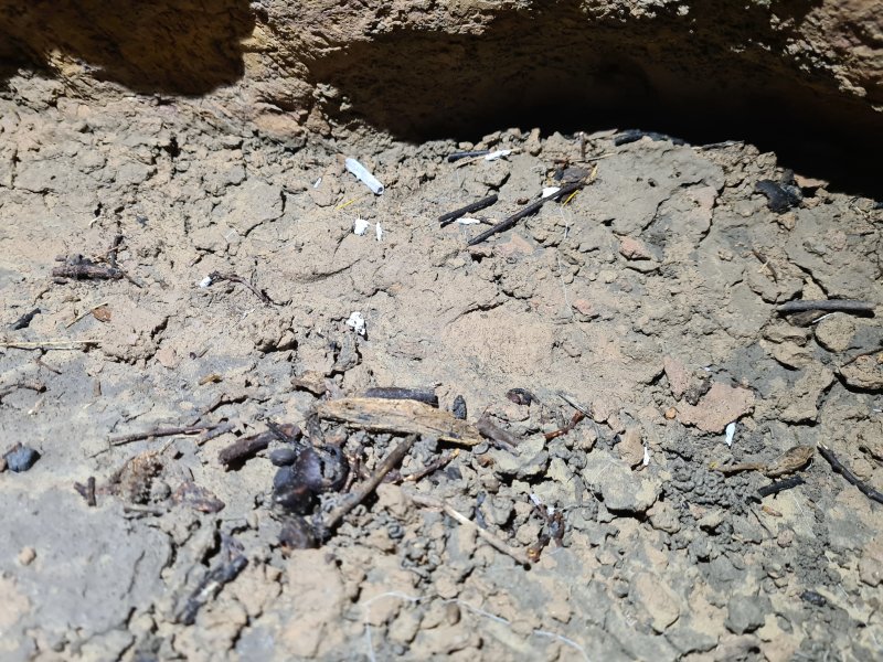 Flood debris in the side passage.
 The debris looks like bits of tissue (which might be expected in here), but it is actually mould on the twigs.
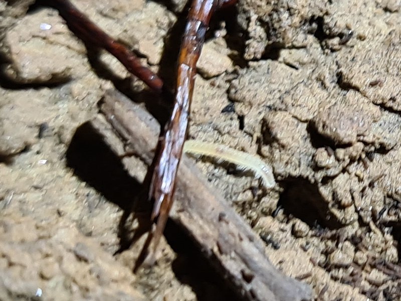 A tiny millipede in the mud, barely 3 mm long, and completely lacking in pigment. It took only a few seconds to hide, so this was the best picture I could get.
Modelling by Milton
A tiny millipede in the mud, barely 3 mm long, and completely lacking in pigment. It took only a few seconds to hide, so this was the best picture I could get.
Modelling by Milton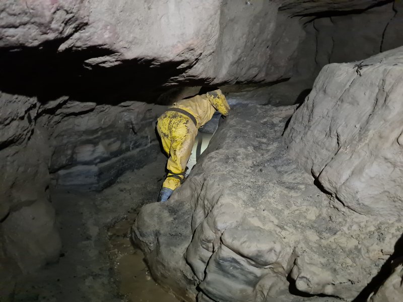 Beside the mudbanks is the way on, getting low again.
Modelling by Tim, lighting by Tarquin and Tim
Beside the mudbanks is the way on, getting low again.
Modelling by Tim, lighting by Tarquin and Tim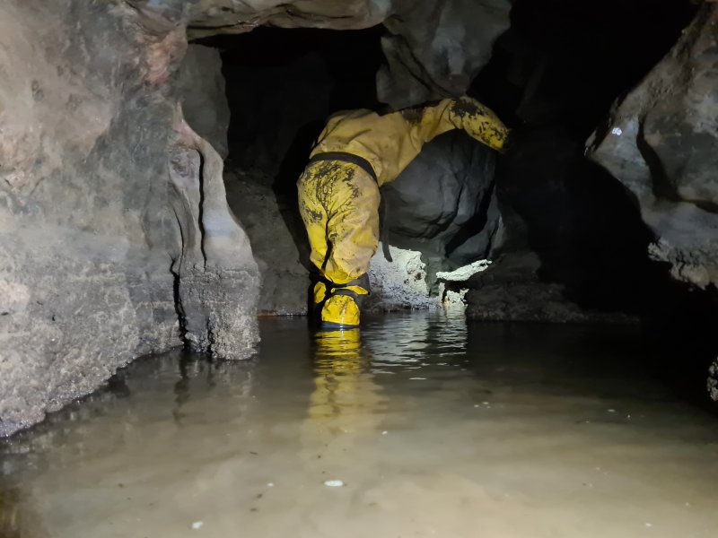 Wet feet and squelching mud in the low section.
Modelling by Tim, lighting by Tarquin and Tim
Wet feet and squelching mud in the low section.
Modelling by Tim, lighting by Tarquin and Tim The ceiling rises, and another side passage leads off towards Remelt Plant.
Modelling by Tim and Mark, lighting by Tarquin, Tim and Mark
The ceiling rises, and another side passage leads off towards Remelt Plant.
Modelling by Tim and Mark, lighting by Tarquin, Tim and Mark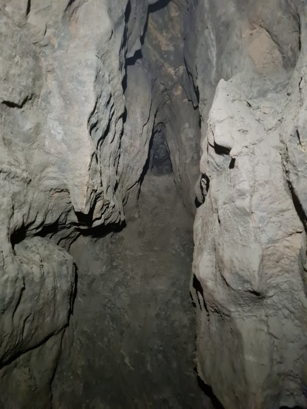 This passage requires a slippery climb and then a slide up a slippery mud slope. It is not worth the effort.
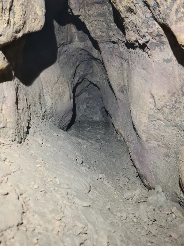 After a short crawl, it ends at a tiny triangular tube with a cracked mud floor, heading to the right, towards the last side passage. The two passages are almost certainly just an oxbow. There is no draught.
 The chamber has an aven in the ceiling, which climbs fairly high. We could not tell whether it had a draught, since it was too far up.
Lighting by Tarquin and Tim
The chamber has an aven in the ceiling, which climbs fairly high. We could not tell whether it had a draught, since it was too far up.
Lighting by Tarquin and Tim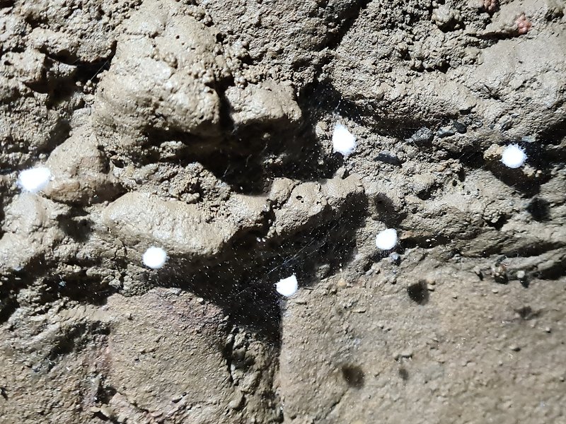 White balls in a tangled web on the walls. These look distinctly like cave spider egg sacs, but significantly smaller. This is over 1.5 km underground, from the nearest known sink or entrance. These are thought to be cavity spider egg sacs (Nesticus cellulanus).
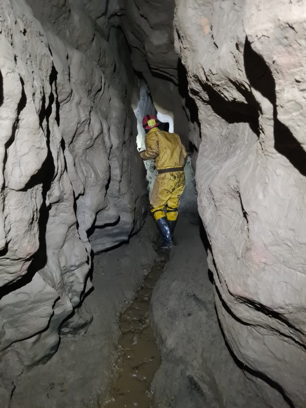 Last section of rift passage, now with deeper mud.
Modelling by Tim, lighting by Tarquin and Tim
Last section of rift passage, now with deeper mud.
Modelling by Tim, lighting by Tarquin and Tim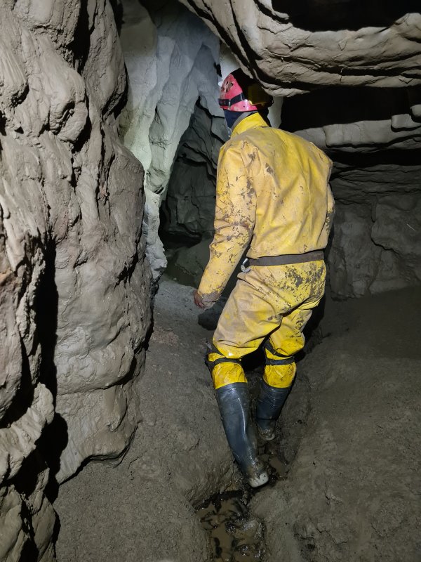 A final set of ominous mud banks.
Modelling by Tim, lighting by Tarquin and Tim
A final set of ominous mud banks.
Modelling by Tim, lighting by Tarquin and Tim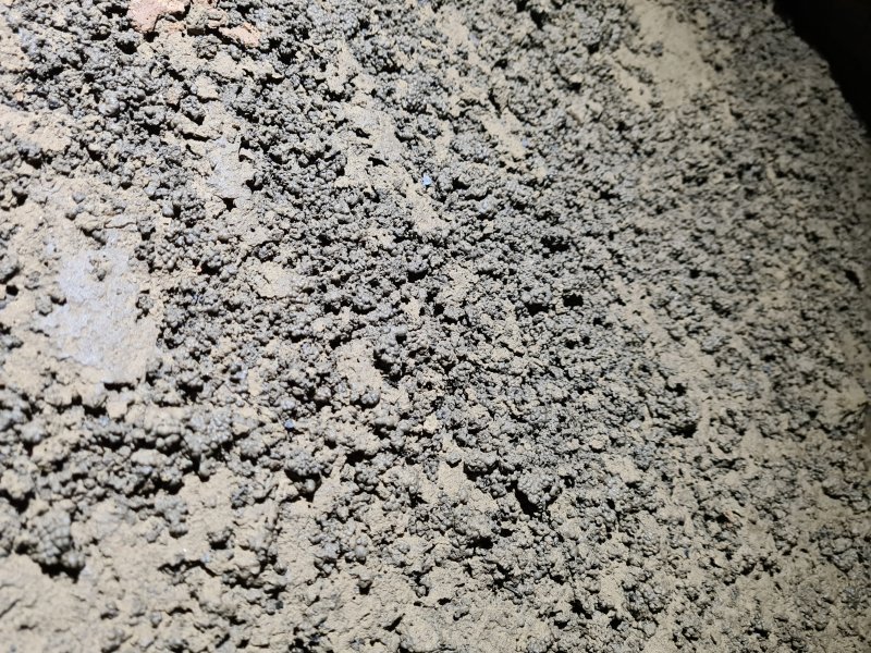 Wormcasts in the mud banks. There is obviously a lot of organic matter in this soil.
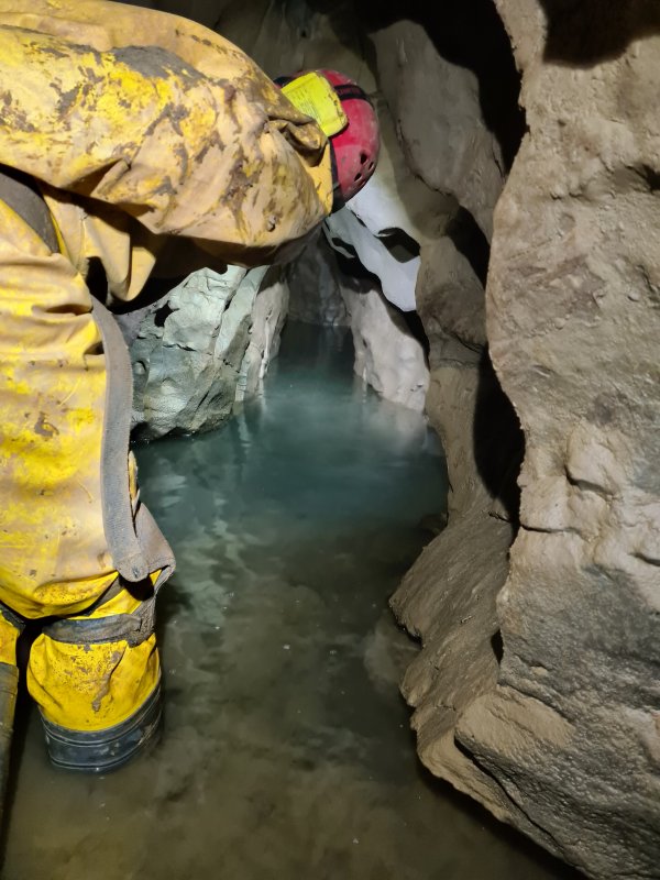 The stream then forms a canal, which quickly reaches the terminal Static Sump 4. Which is not static, since there is a stream flowing into it. The sump can be seen in the distant alcove on the right, where the water is chest deep.
Modelling by Tim, lighting by Tarquin and Tim
The stream then forms a canal, which quickly reaches the terminal Static Sump 4. Which is not static, since there is a stream flowing into it. The sump can be seen in the distant alcove on the right, where the water is chest deep.
Modelling by Tim, lighting by Tarquin and Tim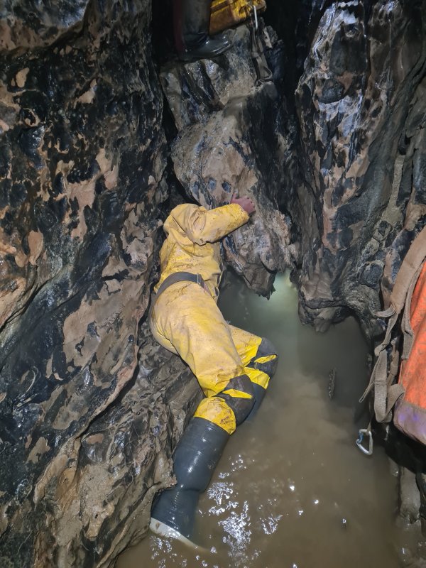 On our way out, we took care of the other task, collecting all the debris that had been flooded through the cave. The vast majority was conservation tape that had been washed away by flood water, but there were also some sweet wrappers, and decomposed remnants of sanitary products that had been deposited in the cave by Welsh Water.
Modelling by Tim and Mark's wellies, lighting by Tarquin, Mark and Tim
On our way out, we took care of the other task, collecting all the debris that had been flooded through the cave. The vast majority was conservation tape that had been washed away by flood water, but there were also some sweet wrappers, and decomposed remnants of sanitary products that had been deposited in the cave by Welsh Water.
Modelling by Tim and Mark's wellies, lighting by Tarquin, Mark and Tim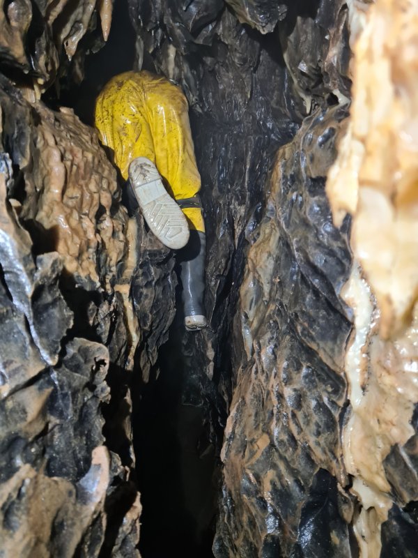 Tim also pushed through the tight end of the lower rift near Lights Out Chamber, collecting a few metres of conservation tape.
Modelling by Tim, lighting by Tarquin and Tim
Tim also pushed through the tight end of the lower rift near Lights Out Chamber, collecting a few metres of conservation tape.
Modelling by Tim, lighting by Tarquin and Tim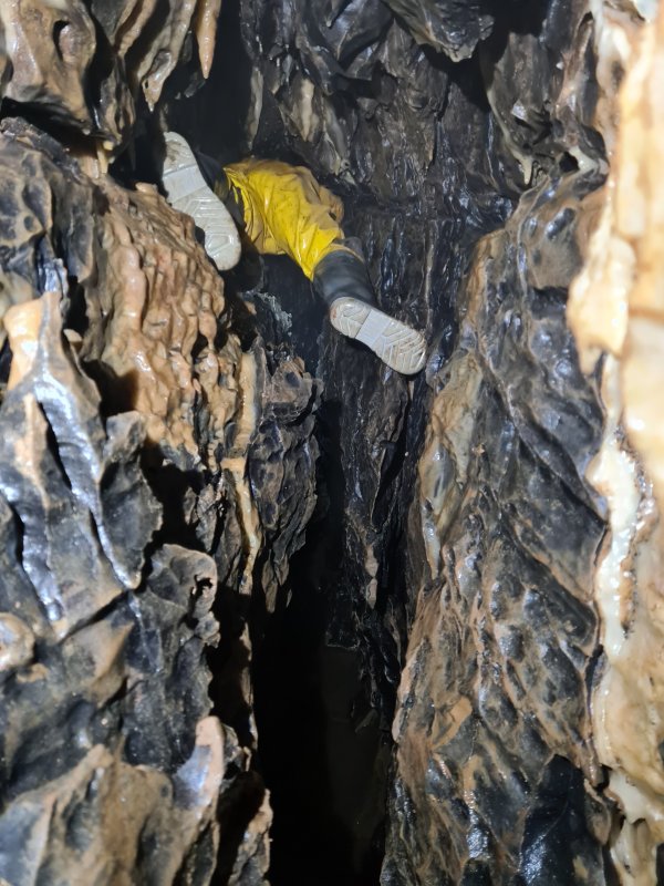 After struggling along at floor level, he had to return and try again at ceiling level, then drop down to collect more tape before reaching the marginally larger part of the rift. Hero!
Modelling by Tim, lighting by Tarquin and Tim
After struggling along at floor level, he had to return and try again at ceiling level, then drop down to collect more tape before reaching the marginally larger part of the rift. Hero!
Modelling by Tim, lighting by Tarquin and Tim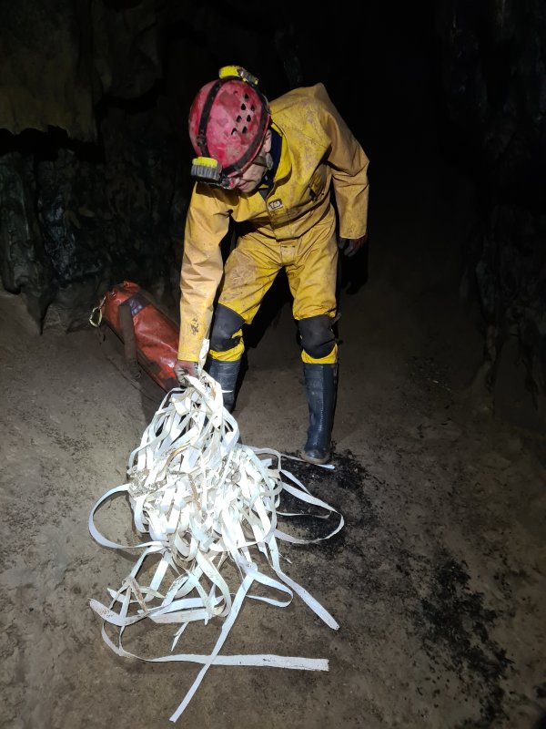 Tim's contributions then got added to the 50 metre length of tape that I had removed from the less extreme end of the same rift. This passage seems to be a magnet for flood debris.
Modelling by Tim, lighting by Tarquin and Tim
Tim's contributions then got added to the 50 metre length of tape that I had removed from the less extreme end of the same rift. This passage seems to be a magnet for flood debris.
Modelling by Tim, lighting by Tarquin and Tim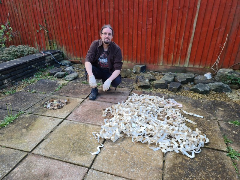 The total amount of debris we collected from the cave. The vast majority is conservation tape, which could all be recycled. The total amount was perhaps 60-70 metres. The smaller pile on the left is made up from decomposed foil and plastic wrappers, and the shards of various sanitary products and wipes that should never have been in Welsh Water's system in the first place, but which we can thank Welsh Water for dumping here. A good day's conservation work that did not feel much like fun, but at least the cave is a much nicer place now.
Camera by Becci Wilton-Jones, modelling by Tarquin
The total amount of debris we collected from the cave. The vast majority is conservation tape, which could all be recycled. The total amount was perhaps 60-70 metres. The smaller pile on the left is made up from decomposed foil and plastic wrappers, and the shards of various sanitary products and wipes that should never have been in Welsh Water's system in the first place, but which we can thank Welsh Water for dumping here. A good day's conservation work that did not feel much like fun, but at least the cave is a much nicer place now.
Camera by Becci Wilton-Jones, modelling by Tarquin