Slaughter Stream Cave Pirate Passage trip 23/04/2022
Unless otherwise stated, camera, setups, lighting, edits and gallery effects by Tarquin. Modelling and lighting at various points will be Tim Nichols, Ian Healey, Sencer Coltu and Mark Tringham.
This was a surveying trip aimed at resurveying the second half of Pirate Passage, as the resurveying project had encountered some significant errors in the survey beyond the duck, so the remaining passage needed a proper resurvey. The gallery is intended to assist in assessing the speleogenesis (cave development) of this part of the cave, and is therefore somewhat lengthy. The first part of Pirate Passage was covered in a previous gallery.
It is worth noting that this trip took place during a lengthy dry spell in spring, when the cave was expected to be very dry. It was not, however, in drought conditions.
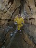 The Pirate Passage stream was dry, and the seasonal duck was a dry flat out crawl over gravel - it appeared to be a good day for surveying. The passage beyond the duck spends a lot of time shaped like this.
Modelling by Tim, lighting by Tarquin and Ian
The Pirate Passage stream was dry, and the seasonal duck was a dry flat out crawl over gravel - it appeared to be a good day for surveying. The passage beyond the duck spends a lot of time shaped like this.
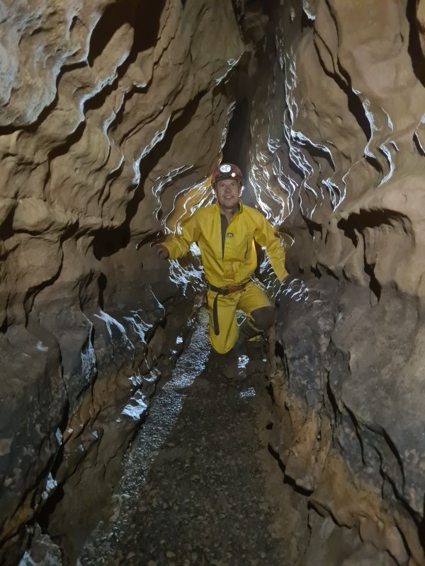
Modelling by Tim, lighting by Tarquin and Ian Shortly after the first major corner, the passage enlarges significantly for short distances.
Modelling by Ian, Sencer and Tim, lighting by Tarquin, Ian, Sencer and Mark
Shortly after the first major corner, the passage enlarges significantly for short distances.
Modelling by Ian, Sencer and Tim, lighting by Tarquin, Ian, Sencer and Mark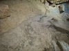 Recent tide mark, a stark reminder of just how much water flows through this passage when it is active.
Lighting by Tarquin and Tim
Recent tide mark, a stark reminder of just how much water flows through this passage when it is active.
Lighting by Tarquin and Tim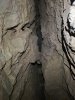 Tall rift aven in the ceiling. These become increasingly common along the next section of passage, as the fault (which the passage follows) opens out more.
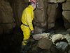 Wide junction. To the left are rift and crawling sized oxbows.
Modelling by Tim, lighting by Tarquin, Ian and Tim
Wide junction. To the left are rift and crawling sized oxbows.
Modelling by Tim, lighting by Tarquin, Ian and Tim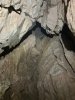 One of the other avens, where the oxbow rejoins, was shown as having a possible passage at the top on the old survey. I climbed high enough to prove that the top closed down completely. However, a short passage existed about 3 metres up, heading slightly to the right of the main ongoing passage. This filled with mud after 4 metres, and appeared not to be worth digging, as it was only an enlargement on a branch of the fault. Below it was a shorter rift on the same fault.
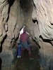 Smoothly curved walls of the rift. This area had several substantial errors in the original survey data, and that meant that the entire section after the duck will be resurveyed during this project. The errors displaced the passage by over 50 metres, added corners and bends that do not actually exist, exaggerated the passage dimensions, and showed inaccurate cross sections. It is worth noting again that the original survey was conducted at an incredible pace, and the data was surprisingly good considering that pace, so it earns my respect in spite of its errors.
Modelling by Mark, lighting by Tarquin and Mark
Smoothly curved walls of the rift. This area had several substantial errors in the original survey data, and that meant that the entire section after the duck will be resurveyed during this project. The errors displaced the passage by over 50 metres, added corners and bends that do not actually exist, exaggerated the passage dimensions, and showed inaccurate cross sections. It is worth noting again that the original survey was conducted at an incredible pace, and the data was surprisingly good considering that pace, so it earns my respect in spite of its errors.
Modelling by Mark, lighting by Tarquin and Mark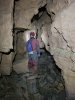 A wider part of the rift, with breakdown.
Modelling by Mark, lighting by Tarquin and Mark
A wider part of the rift, with breakdown.
Modelling by Mark, lighting by Tarquin and Mark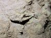 A slightly crushed fossil Ctenacanthus dorsal spine, muddied by passing cavers. Blood vessel holes are visible on the left, and the characteristic granulated lines could be seen from below. This is the bone that held up the dorsal fin of a Ctenacanthus proto-shark. (This is in the walll of the passage near the zig-zag shortly before the major fault.)
 One of the most significant side passages off the major fault, a small rift that doubles back to the left, along the line of the fault. It closes down within a few metres. Pirate Passage does not like to have side passages.
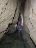 The hading (slant) of the major fault, seen at its start. This fault seems to carry an iron ore vein with it.
Modelling by Mark, lighting by Tarquin and Mark
The hading (slant) of the major fault, seen at its start. This fault seems to carry an iron ore vein with it.
Modelling by Mark, lighting by Tarquin and Mark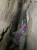 Examining avens in the major fault.
Modelling by Mark, lighting by Tarquin and Mark
Examining avens in the major fault.
Modelling by Mark, lighting by Tarquin and Mark Ctenacanthus dorsal spine in a rock at the foot of the fault.
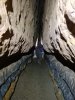 Narrower section of the major fault.
Modelling by Mark, lighting by Tarquin and Mark
Narrower section of the major fault.
Modelling by Mark, lighting by Tarquin and Mark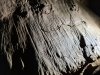 Surge mark mud formations at head height. The passage most likely does not flood this severely any more.
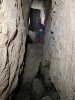 A giant section of the passage, with huge fallen boulders. This is the largest piece of Pirate Passage.
Modelling by Mark, lighting by Tarquin and Mark
A giant section of the passage, with huge fallen boulders. This is the largest piece of Pirate Passage.
Modelling by Mark, lighting by Tarquin and Mark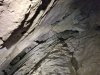 The ceiling soars far up. The passages beyond this section are far smaller than before, so there is likely to have been some influx of water at this point. The easternmost end of this rift could not be seen to end conclusively, and although there is no obviously open passage at the top, this is perhaps the most likely place for there to be one
Lighting by Tarquin and Mark
The ceiling soars far up. The passages beyond this section are far smaller than before, so there is likely to have been some influx of water at this point. The easternmost end of this rift could not be seen to end conclusively, and although there is no obviously open passage at the top, this is perhaps the most likely place for there to be one
Lighting by Tarquin and Mark Reaching the way on requires a climb beneath a poised mousetrap.
Modelling by Sencer, lighting by Tarquin and Sencer
Reaching the way on requires a climb beneath a poised mousetrap.
Modelling by Sencer, lighting by Tarquin and Sencer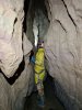 After leaving the major fault. This is where the survey started for the day.
Modelling by Tim, lighting by Tarquin and Tim
After leaving the major fault. This is where the survey started for the day.
Modelling by Tim, lighting by Tarquin and Tim We spotted that the passage ahead on the first major left bend had not been pushed, and set about digging into it. The old survey simply showed a tight passage possibly continuing to the right.
Modelling by Tim, lighting by Tarquin and Tim
We spotted that the passage ahead on the first major left bend had not been pushed, and set about digging into it. The old survey simply showed a tight passage possibly continuing to the right.
Modelling by Tim, lighting by Tarquin and Tim The squeeze into the passage is not particularly tight, but may need re-digging if flooding washes the silt back.
Modelling by Tarquin's hind limb
The squeeze into the passage is not particularly tight, but may need re-digging if flooding washes the silt back.
Modelling by Tarquin's hind limb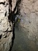 The passage we broke into does not do what the survey shows, so we are fairly sure that we were the first to enter it. The entire floor is made up from mud, covered completely in worm casts. Several worms were visible. This picture was taken during the initial exploration.
Modelling by Tim, lighting by Tarquin and Tim
The passage we broke into does not do what the survey shows, so we are fairly sure that we were the first to enter it. The entire floor is made up from mud, covered completely in worm casts. Several worms were visible. This picture was taken during the initial exploration.
Modelling by Tim, lighting by Tarquin and Tim After several metres, a low arch needed some more digging, turning it into a passable squeeze.
Modelling by Tim
After several metres, a low arch needed some more digging, turning it into a passable squeeze.
Modelling by Tim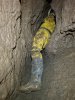 Beyond the squeeze, the passage continued, but soon became narrower.
Modelling by Tim, lighting by Tarquin and Tim
Beyond the squeeze, the passage continued, but soon became narrower.
Modelling by Tim, lighting by Tarquin and Tim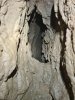 Sadly, the next tight spot was too tight, and the continuing rift could be seen to be much tighter than before. It would need a dig below the tight spot to get into it, but we did not have the time during this trip, so it would have to wait for the next one. At about 27 metres long, this is already the equal longest side passage in the eastern branch of Pirate Passage, matching the length of the side passage in Minaret Passage. At its end, it is just about to intersect the major fault, and could possibly find a continuation of the passage in it.
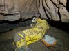 Back in Pirate Passage, the next right corner had a sand bank that concealed a narrow rift. We dug it open to confirm that the rift was too narrow, and pinched out.
Modelling by Tim, lighting by Tarquin and Tim
Back in Pirate Passage, the next right corner had a sand bank that concealed a narrow rift. We dug it open to confirm that the rift was too narrow, and pinched out.
Modelling by Tim, lighting by Tarquin and Tim One of the worms in the surrounding soil. These are everywhere around here, and all of them looked like this. I have not been able to identify the species, but the yellow banding is very distictive, as is the dark head end and light tail end. It does not seem to match any of the normal earthworm species that we see in caves (which are usually pink). The colours look like an anecic worm, but the size is relatively small, at under 10 cm. This was the largest one I saw. Perhaps they are all immature Aporrectodea longa, and the bigger adults (who make those large casts) are all hidden below.
Modelling by William
One of the worms in the surrounding soil. These are everywhere around here, and all of them looked like this. I have not been able to identify the species, but the yellow banding is very distictive, as is the dark head end and light tail end. It does not seem to match any of the normal earthworm species that we see in caves (which are usually pink). The colours look like an anecic worm, but the size is relatively small, at under 10 cm. This was the largest one I saw. Perhaps they are all immature Aporrectodea longa, and the bigger adults (who make those large casts) are all hidden below.
Modelling by William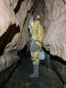 Just before the formations.
Modelling by Tim, lighting by Tarquin and Tim
Just before the formations.
Modelling by Tim, lighting by Tarquin and Tim The formations. The only formations in the entire passage.
Lighting by Tim
The formations. The only formations in the entire passage.
Lighting by Tim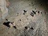 The drip pocket mud formations below them, exposed by the frequent flooding to look like termite mounds.
 The formations include some rather small helictites.
 I will allow you to decide what this looks like.
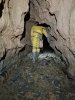 After the formations.
Modelling by Tim, lighting by Tarquin and Tim
After the formations.
Modelling by Tim, lighting by Tarquin and Tim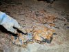 What looked like richly coloured rock, but is actually richly coloured mud.
Modelling by Tim's pointing device, lighting by Tarquin and Tim
What looked like richly coloured rock, but is actually richly coloured mud.
Modelling by Tim's pointing device, lighting by Tarquin and Tim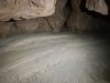 Sand bank on a major left bend. As with almost all of these, there is a stub of a side passage here, that immediately closes down.
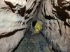 After the left bend.
Modelling by Tim, lighting by Tarquin and Tim
After the left bend.
Modelling by Tim, lighting by Tarquin and Tim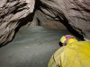 The passage then lowers to a crawl, and reaches the double right bends. This is the first bend, which has a narrow side rift, which pinches out after just a few metres.
Modelling by Tim, lighting by Tarquin and Tim
The passage then lowers to a crawl, and reaches the double right bends. This is the first bend, which has a narrow side rift, which pinches out after just a few metres.
Modelling by Tim, lighting by Tarquin and Tim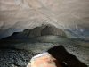 The second right bend, which has a more domed side passage. At this point, the passage picks up a very clear fault again, and seems to follow faults for the rest of its length that we visited.
 Standing space! Oh, but the way on is that low arch ahead. Back to crawling.
Modelling by Tim, lighting by Tarquin and Tim
Standing space! Oh, but the way on is that low arch ahead. Back to crawling.
Modelling by Tim, lighting by Tarquin and Tim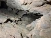 An aven opens up on the fault. It is about 9 metres tall, and I climbed high enough to prove that the top conclusively ends. However, there was a possible high level continuing over the passage, seen beween the rocks on the left here. To see if it went, I would have needed to climb up to those potentially loose rocks, and I was already several metres off the floor. This was not the sort of place to go climbing any higher, without any protection. It is a very long way back home from here. A later aven might possibly connect back to it.
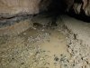 Immediately afterwards, something unexpected appeared; a stream, which was sinking into the floor. On our exit, where we had displaced enough water to make it reach this point in a large quantity, we saw it visibly flowing into gaps in the floor, which bubbled away as the water sank. Interestingly, the water upstream from here was visibly flowing, and that means that the water must have a completely independent route to get further downstream, since it is never seen again in this passage. The closest known inlet to this point is East Stream Inlet; maybe that is where the water rejoins the known cave.
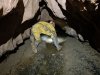 Upstream, the passage became a wet crawl. It was possible to avoid the water by crawling on the mud to the side, but you are going to get soaked beyond here if there is any flowing water, so it is best to just accept it, and get wet. On this particular trip, the surveying team did not progress any further upstream, and only Tim and I went through this part, to explore any potential leads and leave instructions for the surveying team.
Modelling by Tim, lighting by Tarquin and Tim
Upstream, the passage became a wet crawl. It was possible to avoid the water by crawling on the mud to the side, but you are going to get soaked beyond here if there is any flowing water, so it is best to just accept it, and get wet. On this particular trip, the surveying team did not progress any further upstream, and only Tim and I went through this part, to explore any potential leads and leave instructions for the surveying team.
Modelling by Tim, lighting by Tarquin and Tim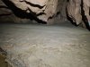 The next left bend, where the old survey shows a mud bank. There is a tiny side rift not shown on the old survey.
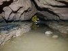 Another wet crawl.
Modelling by Tim, lighting by Tarquin and Tim
Another wet crawl.
Modelling by Tim, lighting by Tarquin and Tim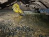 The next corner is shown as having a pool on the old survey, though during this visit, the pool started before the corner (seen here), not after it (as shown on the old survey). This is the first crawl where you are forced to get arms and knees wet; there is no avoiding it any more.
Modelling by Tim, lighting by Tarquin and Tim
The next corner is shown as having a pool on the old survey, though during this visit, the pool started before the corner (seen here), not after it (as shown on the old survey). This is the first crawl where you are forced to get arms and knees wet; there is no avoiding it any more.
Modelling by Tim, lighting by Tarquin and Tim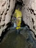 Walking sized passage after the pool. Enjoy it while it lasts.
Modelling by Tim, lighting by Tarquin and Tim
Walking sized passage after the pool. Enjoy it while it lasts.
Modelling by Tim, lighting by Tarquin and Tim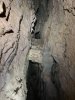 A last fault aven. Beyond here, it reverts to being crawling sized, and getting wet is inevitable.
Lighting by Tarquin and Tim
A last fault aven. Beyond here, it reverts to being crawling sized, and getting wet is inevitable.
Lighting by Tarquin and Tim Gypsum frosted rock on a sharp left bend. Again, there is a side passage that immediately closes down.
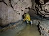 It is about 160 metres to the Jupiter Extension, and the wet crawling has now begun in ernest.
Modelling by Tim, lighting by Tarquin and Tim
It is about 160 metres to the Jupiter Extension, and the wet crawling has now begun in ernest.
Modelling by Tim, lighting by Tarquin and Tim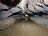 The vast majority of this passage is a lengthy crawl in water. Presumably, this would need to be dry in order for the Jupiter Extension to be accessible, which means summer drought conditions. The further you progress, the fewer resting spots exist out of the water, and the lower the ceiling gets. There are a couple of avens where momentary standing is possible, but that just prolongs the agony. The former grandure of the passage is well and truly gone.
Modelling by Tim, lighting by Tarquin and Tim
The vast majority of this passage is a lengthy crawl in water. Presumably, this would need to be dry in order for the Jupiter Extension to be accessible, which means summer drought conditions. The further you progress, the fewer resting spots exist out of the water, and the lower the ceiling gets. There are a couple of avens where momentary standing is possible, but that just prolongs the agony. The former grandure of the passage is well and truly gone.
Modelling by Tim, lighting by Tarquin and Tim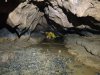 The passage becomes a very lengthy canal. In a couple of places, the airspace was low enough to earn a wet cheek, and by the end, only my shoulders were dry. There are no further pictures because using a camera in those conditions is very difficult, and it is not really fair for the model. I stopped just before the first of two right bends, just 10 metres from the Jupiter Extensions bedding, because Tim had reported that those 10 metres included a duck where he had to lie on his back in order to breathe. The ceiling continued only just above the water into the Jupiter Extensions. I needed my dry shoulders. Our bow waves had already been enough to make some of the low sections uncomfortable. The flow washing back and forward around us made it hard to work out how much water was actually flowing here, but it did seem to have increased significantly compared with how it had been earlier in the wet section. This is a pretty miserable piece of passage.
Modelling by Tim, lighting by Tarquin and Tim
The passage becomes a very lengthy canal. In a couple of places, the airspace was low enough to earn a wet cheek, and by the end, only my shoulders were dry. There are no further pictures because using a camera in those conditions is very difficult, and it is not really fair for the model. I stopped just before the first of two right bends, just 10 metres from the Jupiter Extensions bedding, because Tim had reported that those 10 metres included a duck where he had to lie on his back in order to breathe. The ceiling continued only just above the water into the Jupiter Extensions. I needed my dry shoulders. Our bow waves had already been enough to make some of the low sections uncomfortable. The flow washing back and forward around us made it hard to work out how much water was actually flowing here, but it did seem to have increased significantly compared with how it had been earlier in the wet section. This is a pretty miserable piece of passage.
Modelling by Tim, lighting by Tarquin and Tim
 The Pirate Passage stream was dry, and the seasonal duck was a dry flat out crawl over gravel - it appeared to be a good day for surveying. The passage beyond the duck spends a lot of time shaped like this.
Modelling by Tim, lighting by Tarquin and Ian
The Pirate Passage stream was dry, and the seasonal duck was a dry flat out crawl over gravel - it appeared to be a good day for surveying. The passage beyond the duck spends a lot of time shaped like this.
Modelling by Tim, lighting by Tarquin and Ian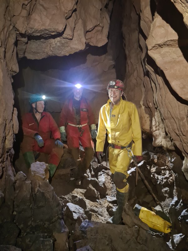 Shortly after the first major corner, the passage enlarges significantly for short distances.
Modelling by Ian, Sencer and Tim, lighting by Tarquin, Ian, Sencer and Mark
Shortly after the first major corner, the passage enlarges significantly for short distances.
Modelling by Ian, Sencer and Tim, lighting by Tarquin, Ian, Sencer and Mark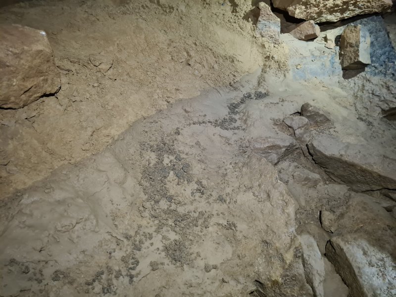 Recent tide mark, a stark reminder of just how much water flows through this passage when it is active.
Lighting by Tarquin and Tim
Recent tide mark, a stark reminder of just how much water flows through this passage when it is active.
Lighting by Tarquin and Tim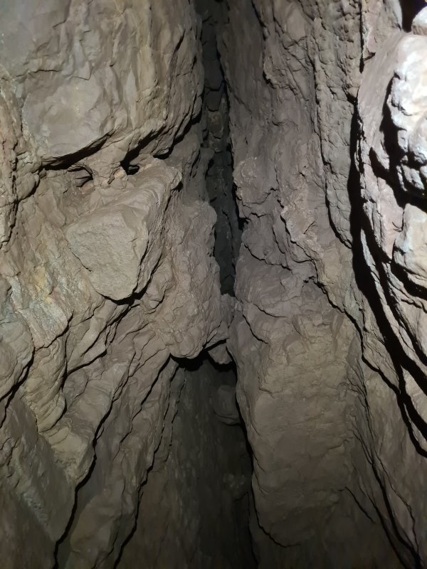 Tall rift aven in the ceiling. These become increasingly common along the next section of passage, as the fault (which the passage follows) opens out more.
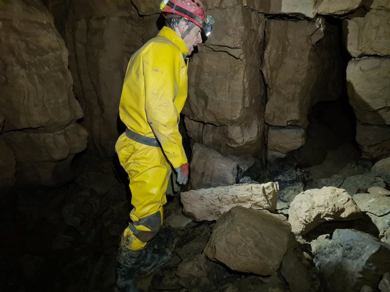 Wide junction. To the left are rift and crawling sized oxbows.
Modelling by Tim, lighting by Tarquin, Ian and Tim
Wide junction. To the left are rift and crawling sized oxbows.
Modelling by Tim, lighting by Tarquin, Ian and Tim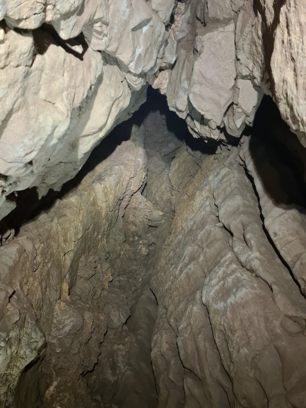 One of the other avens, where the oxbow rejoins, was shown as having a possible passage at the top on the old survey. I climbed high enough to prove that the top closed down completely. However, a short passage existed about 3 metres up, heading slightly to the right of the main ongoing passage. This filled with mud after 4 metres, and appeared not to be worth digging, as it was only an enlargement on a branch of the fault. Below it was a shorter rift on the same fault.
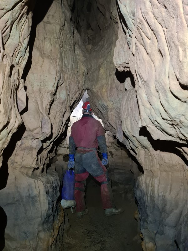 Smoothly curved walls of the rift. This area had several substantial errors in the original survey data, and that meant that the entire section after the duck will be resurveyed during this project. The errors displaced the passage by over 50 metres, added corners and bends that do not actually exist, exaggerated the passage dimensions, and showed inaccurate cross sections. It is worth noting again that the original survey was conducted at an incredible pace, and the data was surprisingly good considering that pace, so it earns my respect in spite of its errors.
Modelling by Mark, lighting by Tarquin and Mark
Smoothly curved walls of the rift. This area had several substantial errors in the original survey data, and that meant that the entire section after the duck will be resurveyed during this project. The errors displaced the passage by over 50 metres, added corners and bends that do not actually exist, exaggerated the passage dimensions, and showed inaccurate cross sections. It is worth noting again that the original survey was conducted at an incredible pace, and the data was surprisingly good considering that pace, so it earns my respect in spite of its errors.
Modelling by Mark, lighting by Tarquin and Mark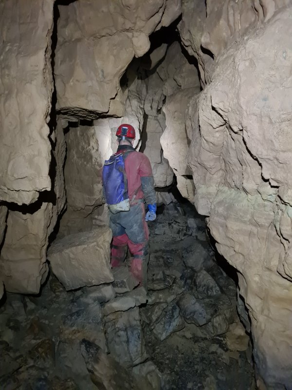 A wider part of the rift, with breakdown.
Modelling by Mark, lighting by Tarquin and Mark
A wider part of the rift, with breakdown.
Modelling by Mark, lighting by Tarquin and Mark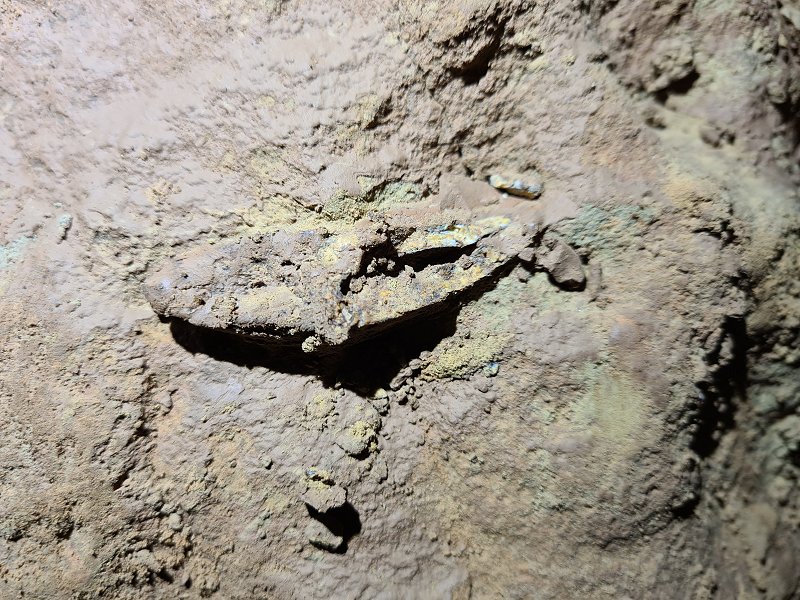 A slightly crushed fossil Ctenacanthus dorsal spine, muddied by passing cavers. Blood vessel holes are visible on the left, and the characteristic granulated lines could be seen from below. This is the bone that held up the dorsal fin of a Ctenacanthus proto-shark. (This is in the walll of the passage near the zig-zag shortly before the major fault.)
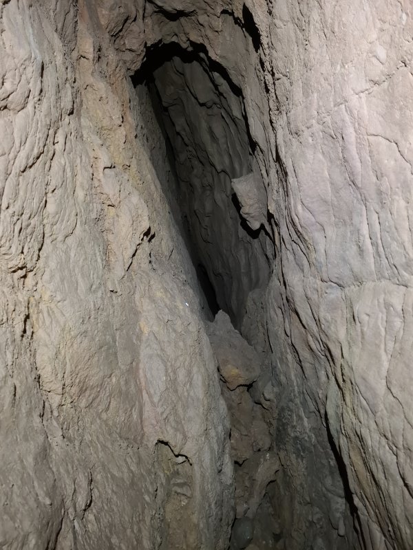 One of the most significant side passages off the major fault, a small rift that doubles back to the left, along the line of the fault. It closes down within a few metres. Pirate Passage does not like to have side passages.
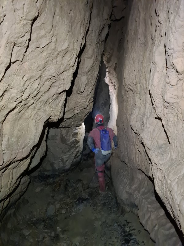 The hading (slant) of the major fault, seen at its start. This fault seems to carry an iron ore vein with it.
Modelling by Mark, lighting by Tarquin and Mark
The hading (slant) of the major fault, seen at its start. This fault seems to carry an iron ore vein with it.
Modelling by Mark, lighting by Tarquin and Mark Examining avens in the major fault.
Modelling by Mark, lighting by Tarquin and Mark
Examining avens in the major fault.
Modelling by Mark, lighting by Tarquin and Mark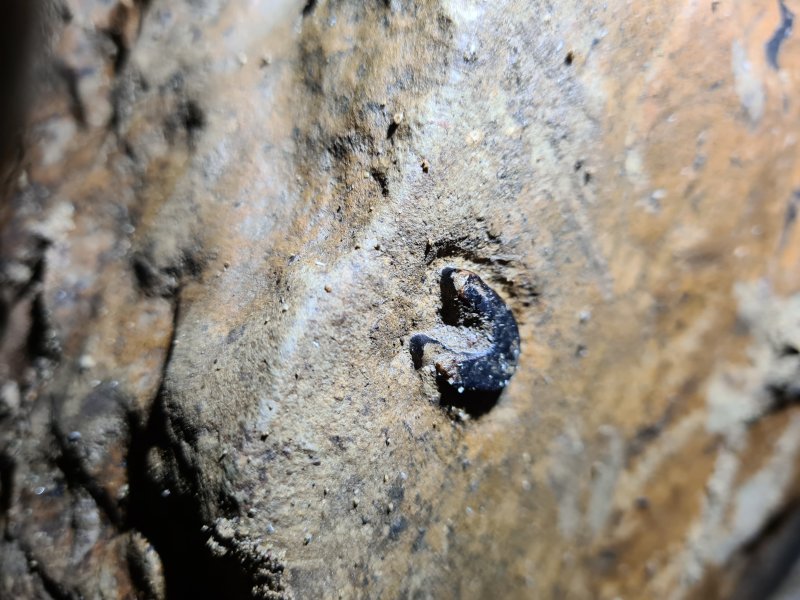 Ctenacanthus dorsal spine in a rock at the foot of the fault.
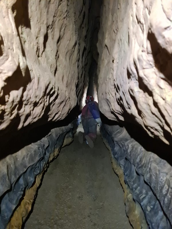 Narrower section of the major fault.
Modelling by Mark, lighting by Tarquin and Mark
Narrower section of the major fault.
Modelling by Mark, lighting by Tarquin and Mark Surge mark mud formations at head height. The passage most likely does not flood this severely any more.
 A giant section of the passage, with huge fallen boulders. This is the largest piece of Pirate Passage.
Modelling by Mark, lighting by Tarquin and Mark
A giant section of the passage, with huge fallen boulders. This is the largest piece of Pirate Passage.
Modelling by Mark, lighting by Tarquin and Mark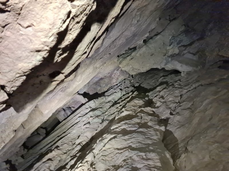 The ceiling soars far up. The passages beyond this section are far smaller than before, so there is likely to have been some influx of water at this point. The easternmost end of this rift could not be seen to end conclusively, and although there is no obviously open passage at the top, this is perhaps the most likely place for there to be one
Lighting by Tarquin and Mark
The ceiling soars far up. The passages beyond this section are far smaller than before, so there is likely to have been some influx of water at this point. The easternmost end of this rift could not be seen to end conclusively, and although there is no obviously open passage at the top, this is perhaps the most likely place for there to be one
Lighting by Tarquin and Mark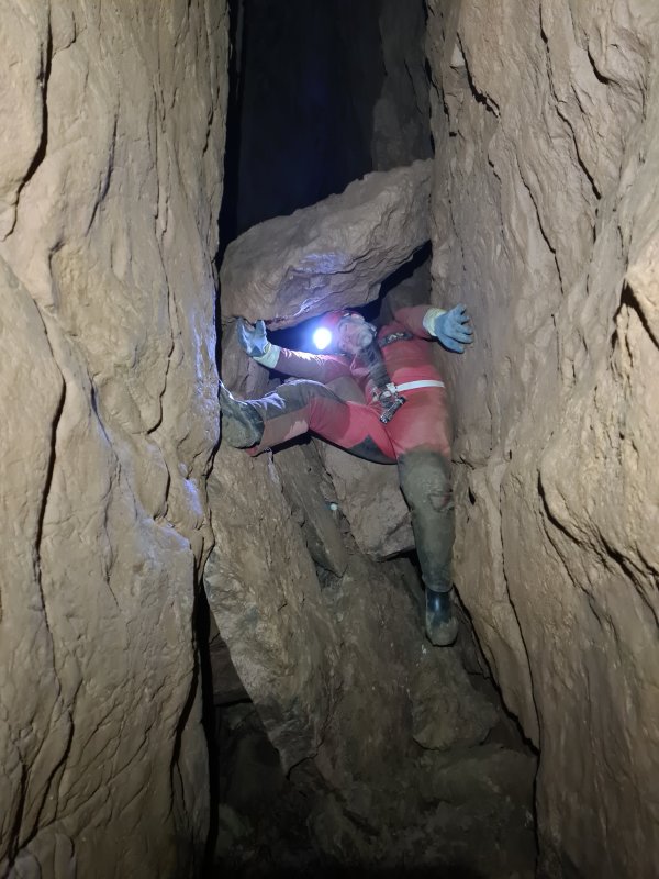 Reaching the way on requires a climb beneath a poised mousetrap.
Modelling by Sencer, lighting by Tarquin and Sencer
Reaching the way on requires a climb beneath a poised mousetrap.
Modelling by Sencer, lighting by Tarquin and Sencer After leaving the major fault. This is where the survey started for the day.
Modelling by Tim, lighting by Tarquin and Tim
After leaving the major fault. This is where the survey started for the day.
Modelling by Tim, lighting by Tarquin and Tim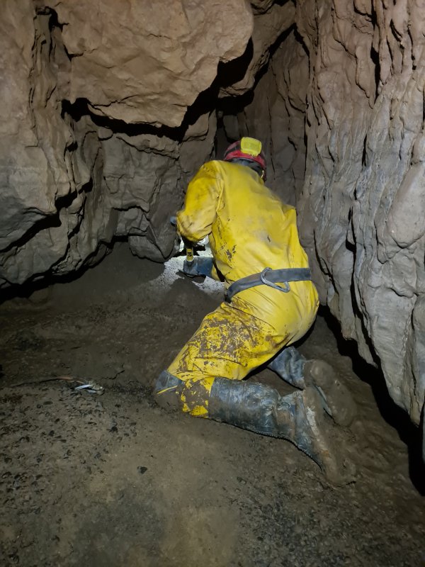 We spotted that the passage ahead on the first major left bend had not been pushed, and set about digging into it. The old survey simply showed a tight passage possibly continuing to the right.
Modelling by Tim, lighting by Tarquin and Tim
We spotted that the passage ahead on the first major left bend had not been pushed, and set about digging into it. The old survey simply showed a tight passage possibly continuing to the right.
Modelling by Tim, lighting by Tarquin and Tim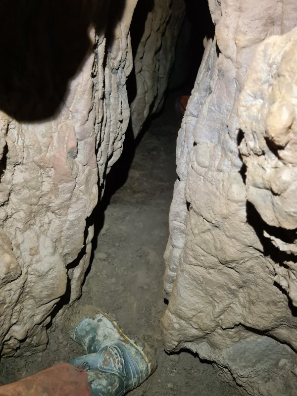 The squeeze into the passage is not particularly tight, but may need re-digging if flooding washes the silt back.
Modelling by Tarquin's hind limb
The squeeze into the passage is not particularly tight, but may need re-digging if flooding washes the silt back.
Modelling by Tarquin's hind limb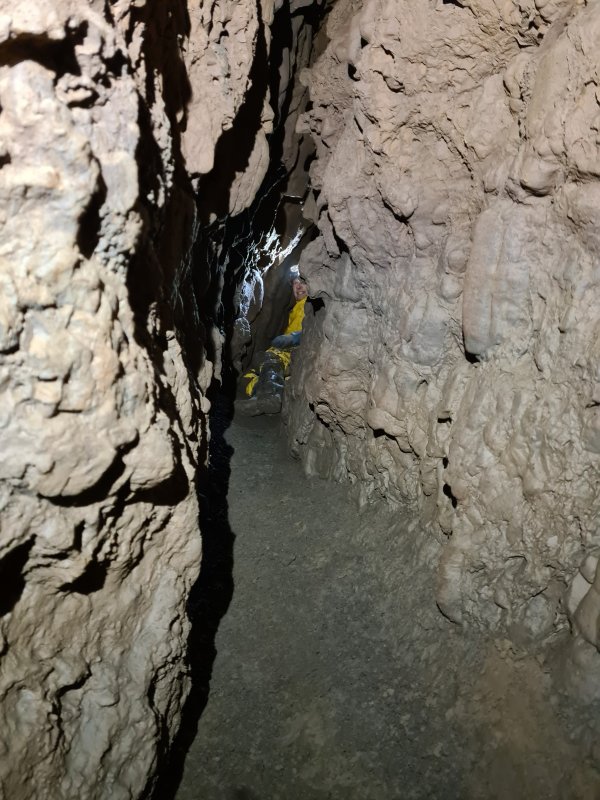 The passage we broke into does not do what the survey shows, so we are fairly sure that we were the first to enter it. The entire floor is made up from mud, covered completely in worm casts. Several worms were visible. This picture was taken during the initial exploration.
Modelling by Tim, lighting by Tarquin and Tim
The passage we broke into does not do what the survey shows, so we are fairly sure that we were the first to enter it. The entire floor is made up from mud, covered completely in worm casts. Several worms were visible. This picture was taken during the initial exploration.
Modelling by Tim, lighting by Tarquin and Tim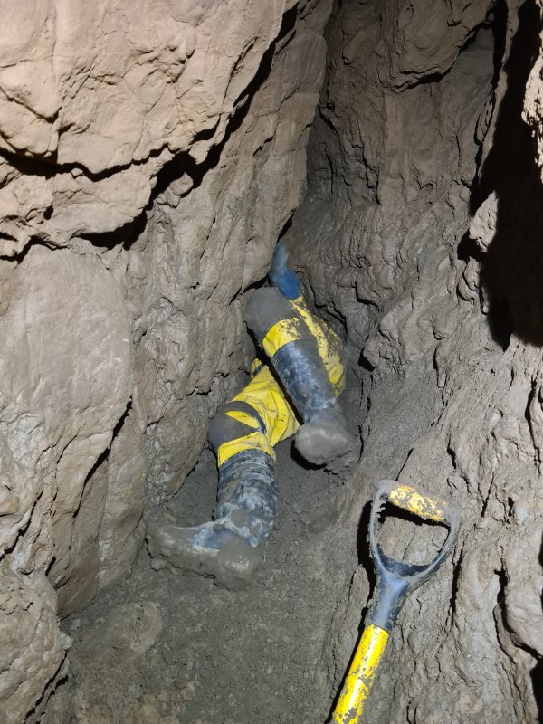 After several metres, a low arch needed some more digging, turning it into a passable squeeze.
Modelling by Tim
After several metres, a low arch needed some more digging, turning it into a passable squeeze.
Modelling by Tim Beyond the squeeze, the passage continued, but soon became narrower.
Modelling by Tim, lighting by Tarquin and Tim
Beyond the squeeze, the passage continued, but soon became narrower.
Modelling by Tim, lighting by Tarquin and Tim Sadly, the next tight spot was too tight, and the continuing rift could be seen to be much tighter than before. It would need a dig below the tight spot to get into it, but we did not have the time during this trip, so it would have to wait for the next one. At about 27 metres long, this is already the equal longest side passage in the eastern branch of Pirate Passage, matching the length of the side passage in Minaret Passage. At its end, it is just about to intersect the major fault, and could possibly find a continuation of the passage in it.
 Back in Pirate Passage, the next right corner had a sand bank that concealed a narrow rift. We dug it open to confirm that the rift was too narrow, and pinched out.
Modelling by Tim, lighting by Tarquin and Tim
Back in Pirate Passage, the next right corner had a sand bank that concealed a narrow rift. We dug it open to confirm that the rift was too narrow, and pinched out.
Modelling by Tim, lighting by Tarquin and Tim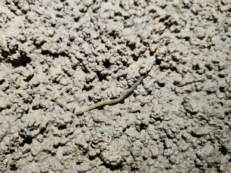 One of the worms in the surrounding soil. These are everywhere around here, and all of them looked like this. I have not been able to identify the species, but the yellow banding is very distictive, as is the dark head end and light tail end. It does not seem to match any of the normal earthworm species that we see in caves (which are usually pink). The colours look like an anecic worm, but the size is relatively small, at under 10 cm. This was the largest one I saw. Perhaps they are all immature Aporrectodea longa, and the bigger adults (who make those large casts) are all hidden below.
Modelling by William
One of the worms in the surrounding soil. These are everywhere around here, and all of them looked like this. I have not been able to identify the species, but the yellow banding is very distictive, as is the dark head end and light tail end. It does not seem to match any of the normal earthworm species that we see in caves (which are usually pink). The colours look like an anecic worm, but the size is relatively small, at under 10 cm. This was the largest one I saw. Perhaps they are all immature Aporrectodea longa, and the bigger adults (who make those large casts) are all hidden below.
Modelling by William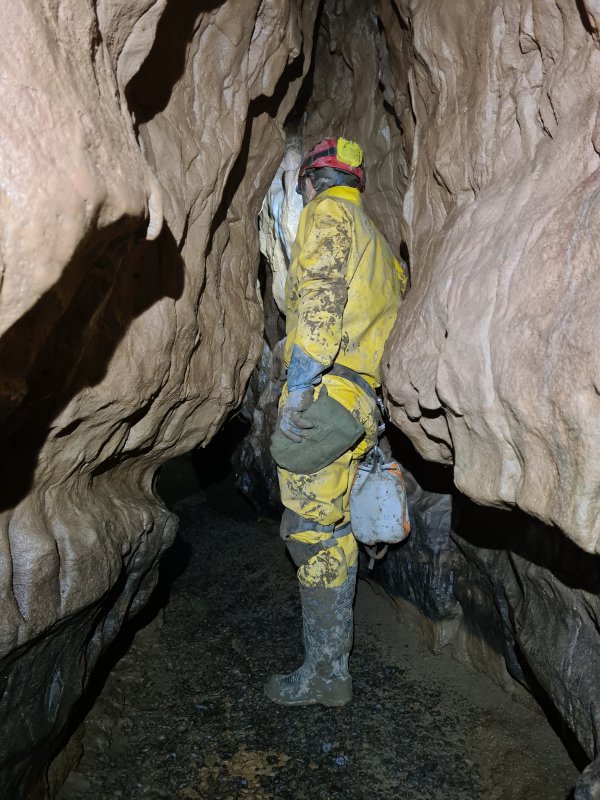 Just before the formations.
Modelling by Tim, lighting by Tarquin and Tim
Just before the formations.
Modelling by Tim, lighting by Tarquin and Tim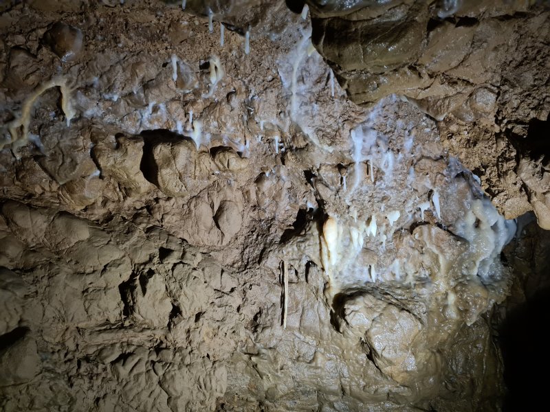 The formations. The only formations in the entire passage.
Lighting by Tim
The formations. The only formations in the entire passage.
Lighting by Tim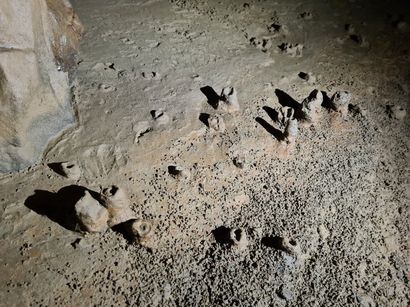 The drip pocket mud formations below them, exposed by the frequent flooding to look like termite mounds.
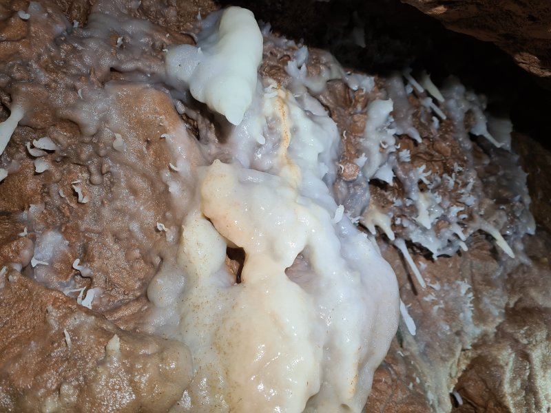 The formations include some rather small helictites.
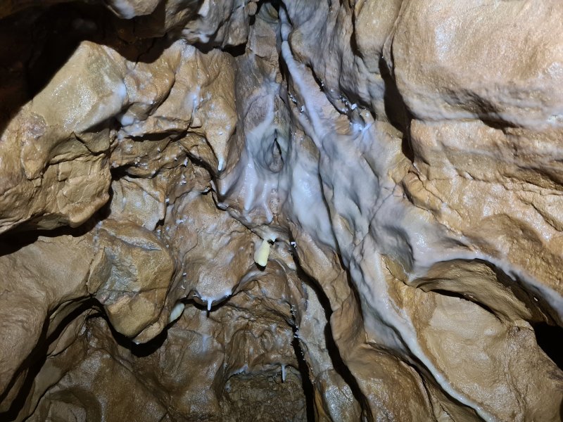 I will allow you to decide what this looks like.
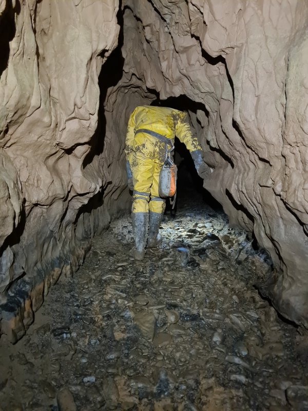 After the formations.
Modelling by Tim, lighting by Tarquin and Tim
After the formations.
Modelling by Tim, lighting by Tarquin and Tim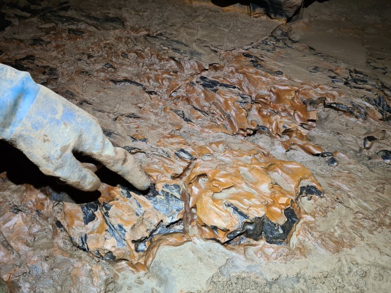 What looked like richly coloured rock, but is actually richly coloured mud.
Modelling by Tim's pointing device, lighting by Tarquin and Tim
What looked like richly coloured rock, but is actually richly coloured mud.
Modelling by Tim's pointing device, lighting by Tarquin and Tim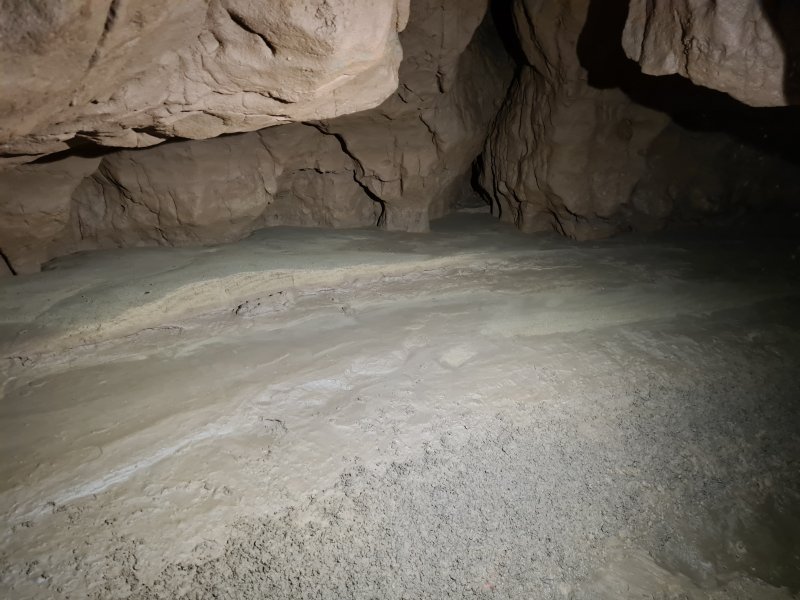 Sand bank on a major left bend. As with almost all of these, there is a stub of a side passage here, that immediately closes down.
 After the left bend.
Modelling by Tim, lighting by Tarquin and Tim
After the left bend.
Modelling by Tim, lighting by Tarquin and Tim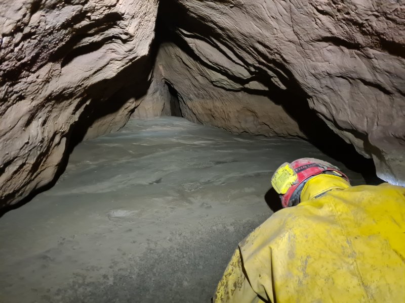 The passage then lowers to a crawl, and reaches the double right bends. This is the first bend, which has a narrow side rift, which pinches out after just a few metres.
Modelling by Tim, lighting by Tarquin and Tim
The passage then lowers to a crawl, and reaches the double right bends. This is the first bend, which has a narrow side rift, which pinches out after just a few metres.
Modelling by Tim, lighting by Tarquin and Tim The second right bend, which has a more domed side passage. At this point, the passage picks up a very clear fault again, and seems to follow faults for the rest of its length that we visited.
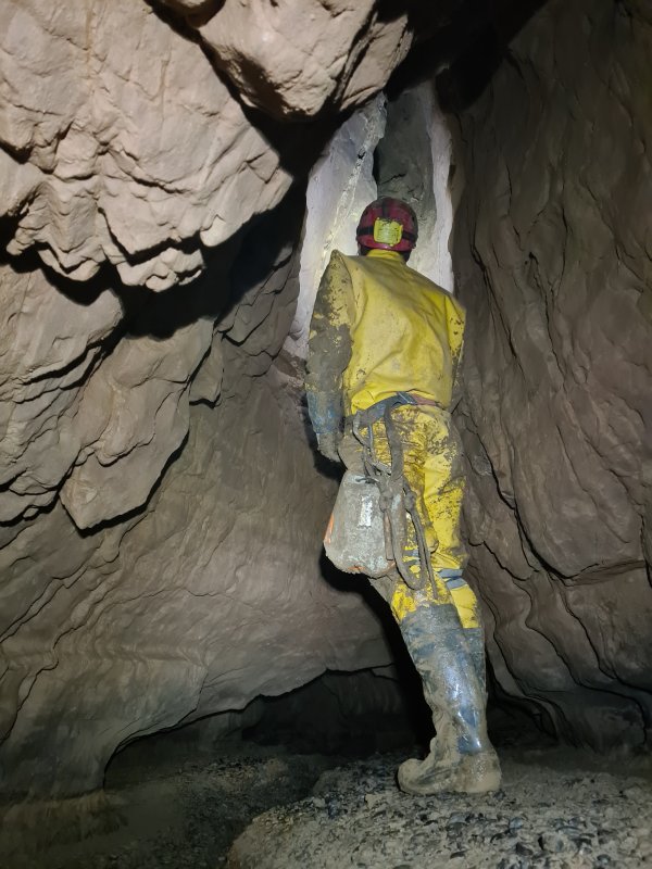 Standing space! Oh, but the way on is that low arch ahead. Back to crawling.
Modelling by Tim, lighting by Tarquin and Tim
Standing space! Oh, but the way on is that low arch ahead. Back to crawling.
Modelling by Tim, lighting by Tarquin and Tim An aven opens up on the fault. It is about 9 metres tall, and I climbed high enough to prove that the top conclusively ends. However, there was a possible high level continuing over the passage, seen beween the rocks on the left here. To see if it went, I would have needed to climb up to those potentially loose rocks, and I was already several metres off the floor. This was not the sort of place to go climbing any higher, without any protection. It is a very long way back home from here. A later aven might possibly connect back to it.
 Immediately afterwards, something unexpected appeared; a stream, which was sinking into the floor. On our exit, where we had displaced enough water to make it reach this point in a large quantity, we saw it visibly flowing into gaps in the floor, which bubbled away as the water sank. Interestingly, the water upstream from here was visibly flowing, and that means that the water must have a completely independent route to get further downstream, since it is never seen again in this passage. The closest known inlet to this point is East Stream Inlet; maybe that is where the water rejoins the known cave.
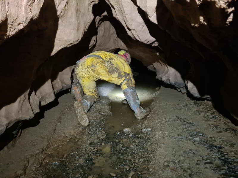 Upstream, the passage became a wet crawl. It was possible to avoid the water by crawling on the mud to the side, but you are going to get soaked beyond here if there is any flowing water, so it is best to just accept it, and get wet. On this particular trip, the surveying team did not progress any further upstream, and only Tim and I went through this part, to explore any potential leads and leave instructions for the surveying team.
Modelling by Tim, lighting by Tarquin and Tim
Upstream, the passage became a wet crawl. It was possible to avoid the water by crawling on the mud to the side, but you are going to get soaked beyond here if there is any flowing water, so it is best to just accept it, and get wet. On this particular trip, the surveying team did not progress any further upstream, and only Tim and I went through this part, to explore any potential leads and leave instructions for the surveying team.
Modelling by Tim, lighting by Tarquin and Tim The next left bend, where the old survey shows a mud bank. There is a tiny side rift not shown on the old survey.
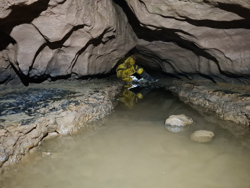 Another wet crawl.
Modelling by Tim, lighting by Tarquin and Tim
Another wet crawl.
Modelling by Tim, lighting by Tarquin and Tim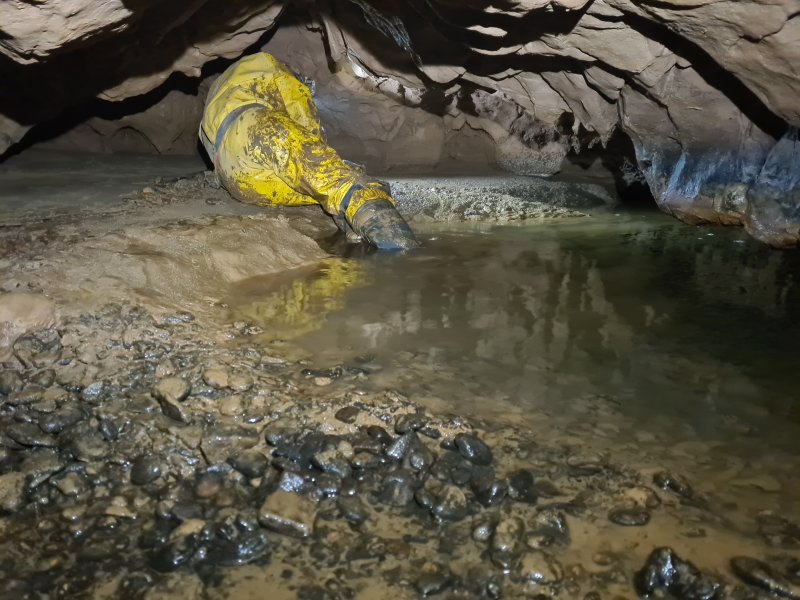 The next corner is shown as having a pool on the old survey, though during this visit, the pool started before the corner (seen here), not after it (as shown on the old survey). This is the first crawl where you are forced to get arms and knees wet; there is no avoiding it any more.
Modelling by Tim, lighting by Tarquin and Tim
The next corner is shown as having a pool on the old survey, though during this visit, the pool started before the corner (seen here), not after it (as shown on the old survey). This is the first crawl where you are forced to get arms and knees wet; there is no avoiding it any more.
Modelling by Tim, lighting by Tarquin and Tim Walking sized passage after the pool. Enjoy it while it lasts.
Modelling by Tim, lighting by Tarquin and Tim
Walking sized passage after the pool. Enjoy it while it lasts.
Modelling by Tim, lighting by Tarquin and Tim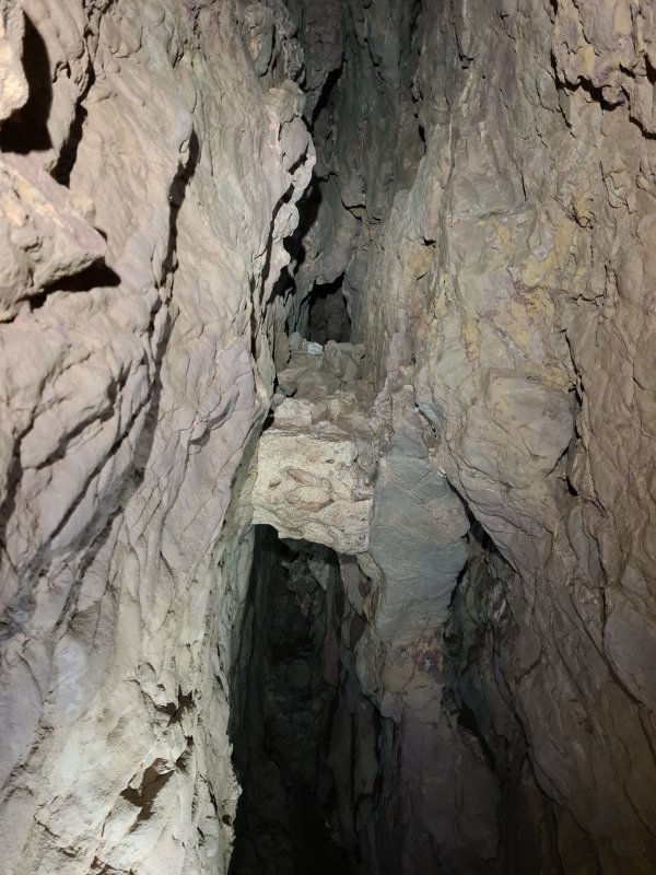 A last fault aven. Beyond here, it reverts to being crawling sized, and getting wet is inevitable.
Lighting by Tarquin and Tim
A last fault aven. Beyond here, it reverts to being crawling sized, and getting wet is inevitable.
Lighting by Tarquin and Tim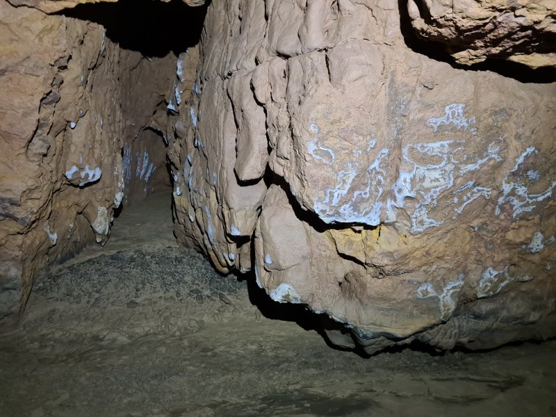 Gypsum frosted rock on a sharp left bend. Again, there is a side passage that immediately closes down.
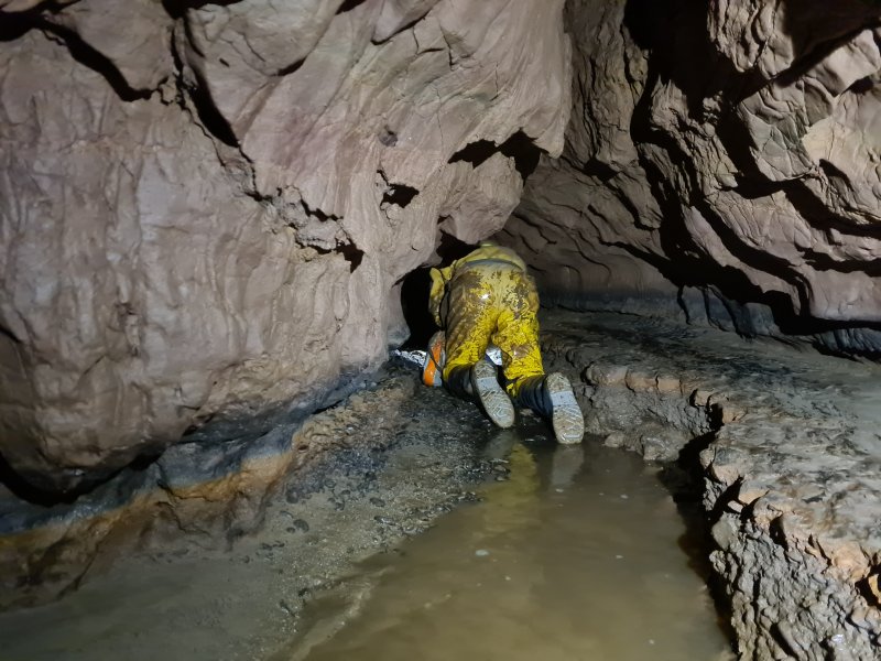 It is about 160 metres to the Jupiter Extension, and the wet crawling has now begun in ernest.
Modelling by Tim, lighting by Tarquin and Tim
It is about 160 metres to the Jupiter Extension, and the wet crawling has now begun in ernest.
Modelling by Tim, lighting by Tarquin and Tim The vast majority of this passage is a lengthy crawl in water. Presumably, this would need to be dry in order for the Jupiter Extension to be accessible, which means summer drought conditions. The further you progress, the fewer resting spots exist out of the water, and the lower the ceiling gets. There are a couple of avens where momentary standing is possible, but that just prolongs the agony. The former grandure of the passage is well and truly gone.
Modelling by Tim, lighting by Tarquin and Tim
The vast majority of this passage is a lengthy crawl in water. Presumably, this would need to be dry in order for the Jupiter Extension to be accessible, which means summer drought conditions. The further you progress, the fewer resting spots exist out of the water, and the lower the ceiling gets. There are a couple of avens where momentary standing is possible, but that just prolongs the agony. The former grandure of the passage is well and truly gone.
Modelling by Tim, lighting by Tarquin and Tim The passage becomes a very lengthy canal. In a couple of places, the airspace was low enough to earn a wet cheek, and by the end, only my shoulders were dry. There are no further pictures because using a camera in those conditions is very difficult, and it is not really fair for the model. I stopped just before the first of two right bends, just 10 metres from the Jupiter Extensions bedding, because Tim had reported that those 10 metres included a duck where he had to lie on his back in order to breathe. The ceiling continued only just above the water into the Jupiter Extensions. I needed my dry shoulders. Our bow waves had already been enough to make some of the low sections uncomfortable. The flow washing back and forward around us made it hard to work out how much water was actually flowing here, but it did seem to have increased significantly compared with how it had been earlier in the wet section. This is a pretty miserable piece of passage.
Modelling by Tim, lighting by Tarquin and Tim
The passage becomes a very lengthy canal. In a couple of places, the airspace was low enough to earn a wet cheek, and by the end, only my shoulders were dry. There are no further pictures because using a camera in those conditions is very difficult, and it is not really fair for the model. I stopped just before the first of two right bends, just 10 metres from the Jupiter Extensions bedding, because Tim had reported that those 10 metres included a duck where he had to lie on his back in order to breathe. The ceiling continued only just above the water into the Jupiter Extensions. I needed my dry shoulders. Our bow waves had already been enough to make some of the low sections uncomfortable. The flow washing back and forward around us made it hard to work out how much water was actually flowing here, but it did seem to have increased significantly compared with how it had been earlier in the wet section. This is a pretty miserable piece of passage.
Modelling by Tim, lighting by Tarquin and Tim