Northern Waterfalls Round VI
Maesglase Waterfall (again), Pistyll y Graig-ddu, Pistyll Cim, Rhaeadr Blaenhafren, Rhaeadr Peiran (getting behind it this time), Mossy Seat Falls, Nant y Gwaith Falls (again), Nant Cwm-du Falls (again), Nant y Cae Falls. The end of the initial phase of the waterfalls project.
It has been a long project. Given the effort involved, I am happy to say that this gallery represents the last step in the initial phase of the waterfalls project. From now on, I will no longer actively seek out important waterfalls to include in the list of waterfall walks. I hope.
Maesglase Waterfall
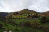 Maesglase (676 metres), by Dinas Mawddwy, seen here from the Ffridd Gulcwm lane.
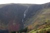 High flow at Maesglase waterfall, one of the tallest waterfalls in Wales at 160 metres (with the tallest single drop being 85 metres, and the second tallest being 34 metres), plus 60 metres of cascading stream. With the roadside trees now leafless, it is visible momentarily through the branches from the A470, though almost nobody will notice it.
 Also visible from the A470, this time from the steep slope heading up to the nearby high pass, is a set of cascades on an unnamed tributary to the Afon Cerist. None are very big, and at most they are just 20 metres tall in total, with one section being a little less than 10 metres of that.
Pistyll y Graig-ddu
 Starting at the tiny redbrick church in the village of Tycrwyn on the B4393, head away from the stream, and take the concreted bridleway starting at the farm on the left.
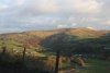
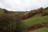 The forests above Tycrwyn.
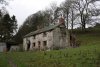 The waterfalls are situated in a small woodland belonging to the local farm, and we would normally seek permission from the landowner, just in case. However, that didn't seem to be productive here. It's anyone's guess who - if anyone - owns this land now. Follow the track to the right at the farm, and then continue up the little valley.
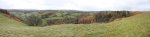 View over the Nant y Graig-ddu valley. The waterfalls are in the woodland on the right. Once in this field, the track splits. Take the left fork, and follow it until it reaches the stream. From there, head downstream along a track on the left bank. For most visitors, the waterfalls should be viewed through the trees from this track, and as such, they are best visited in winter.
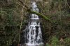 The Nant y Graig-ddu stream immediately begins with a series of pretty cascades dropping 15 metres through the undergrowth.
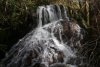 Beautifully lit 5 metre cascade on Nant y Graig Ddu.
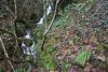 A side stream has some cascades that are partially visible from the upper track, but we wanted to get closer for pictures. There were, of course, no paths anywhere around here, so this was our route; brambles, moss and leaf litter clinging above the stream.
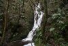 The main waterfall on the side stream, around 9 metres tall.
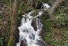 It then tumbles another 5 metres to join the main stream.
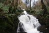 Shortly afterwards, the top waterslide of Pistyll y Graig-ddu begins, dropping around 7 metres.
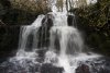 Followed by the middle part of Pistyll y Graig-ddu, a 5 metre waterfall. This proved impossible to climb, a little too far to safely jump the unclimbable part, and very hard to get around. If you must approach it, it would be better to do so from below, climbing up from below the waterfalls.
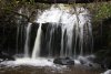 Pistyll y Graig-ddu ends at this 5 metre cascade and waterfall. And finally, it seems to offer something rarely seen up here...
 Yes, there is easily enough space to fit behind it, and it's nice and dry back there too.
 Unfortunately, the weeks of rain meant that it required full waterproofs, but I suspect that in lower flow, it would be easier to get behind, and probably even possible to remain dry. From the base, a relatively simple path ... er ... a fairly flat stream bank with less undergrowth than everywhere else, leads to the lower track.
 Nant y Graig-ddu then tumbles down a 4 metre cascade.
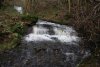 And then the map marks another waterfall. Why, I wonder?
 Nant y Graig-ddu.
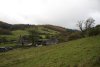
 Field near Tycrwyn.
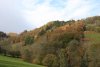 Tycrwyn colours.
Pistyll Cim
It's marked on the 1:25'000 and even the 1:50'000 maps, but I had managed to miss it when visiting another waterfall at the end of the Llŷn Peninsula. It appears in climbing guides, diving guides and an old book, and the OS maps show it as having potentially nearly 20 metres of height to drop from the sea cliffs. But nobody seemed to have taken pictures, or at least none were found by search engines. I should have taken that as a sign, but had to check, of course.
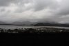 Flooded fields by Pothmadog - normally there is just one main river channel here.
 Porth Ceiriad near Abersoch. The Nant-y-big campsite allows visitors to park just above the beach, though the cost is quite steep for a patch of dirt without any security guard. Perhaps the cost covers the loss of land as the sea slowly eats it.
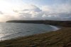 Trwyn Llech-y-doll.
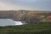 Evening light on Pared-mawr, the 100 metre cliff above Porth Ceiriad.
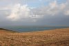 Shades of yellow and blue from Trwyn yr Wylfa.
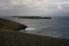 St Tudwal's Island East and West.
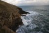 Waves crashing on the cliffs known to climbers as Black Pete. The waterfall is best seen from above those cliffs, but watch out for the path - little more than a sheep track - which becomes exceptionally muddy and very slippery, threatening to tip you down those cliffs.
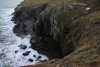 A farmer's feeding trough overflows into a narrow gully, which then dribbles down the cliff for something like 5 or 6 metres, to splash on a ledge above the sea. That's Pistyll Cim, in flood conditions, after weeks of heavy rain. You could make a better waterfall by urinating off the cliff. This waterfall was not worthy of my time, and it's not worthy of yours either. It's certainly not worthy of a name on the map. Save yourself the hours of driving it takes to get down the peninsula and back, and go elsewhere. Or pick it up while visiting something else in the area. Or just ignore it.
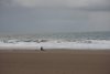 Wistfully waiting for the waves to pick up.
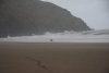 Then another heavy downpour chases us off the beach. There's something humorous about a surfer, in a wetsuit, sheltering from the rain.
Rhaeadr Blaenhafren
This walk was actually a bike ride to speed it up, as it was around 5.5 km in total, we had other places to be, and daylight was limited.
Rhaeadr Peiran, Mossy Seat Falls
 Rhaeadr Peiran, in better foliage conditions than on my last visit, allowing both parts of the waterfall to be seen at the same time. The water levels are high, but not quite high enough for the overflow channel on the left to become active. Time to test out a theory.
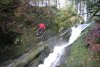 The sides are not really safe enough for scrambling down (though it was possible on the way out, it's certainly not a recommended approach), so a quick abseil dropped onto the ledge beside the main waterfall.
 On the last visit, it looked as if perhaps the churning plunge pool was shallower than it might first appear, and perhaps could be waded. The walking pole never touched the bottom, however. It turns out that the pool slopes very steeply down from the shingle bank, and is far too deep to walk through.
 So that left only one option; abseil into it. A nearby tree provided a rather unpleasant belay, and the descent required a lot of swinging (with occasional dousing under the waterfall each time a swing was not aimed correctly) to reach the shingle bank. This is a lot of hard work, considering that there are many easier waterfalls to get behind.
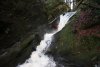 Eventually, one swing finally landed just on the edge of the shingles as they sloped away into the pool. There is enough space back there to stand and walk around a little in the alcove, and it is mostly dry, apart from the odd dribbles and the spray from that awesome thundering waterfall. What an experience. Still, it is important to remember not to let go of the rope, or it will be washed out of reach. Now change over, and prusik out.
 Cascade on the Afon Ystwyth at Pont Dologau. From here, take the track to the right, around a field, then turn left at a junction of tracks.
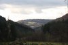 Evening light on Coed Maenarthur.
 Afon Ystwyth looking like Canada or Alaska. You could almost imagine a brown bear blundering through the trees, and stopping to fish for salmon.
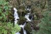 The track soon arrives at the Mossy Seat Falls. This is the lower part, and probably will not look so good in lower flow.
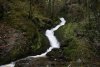 A steep path up just beyond the stream leads to a bridge and viewpoint for the best part of the Mossy Seat Falls. The largest single section is only about 10 metres, but the cascades just keep going.
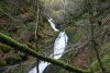 And going.
 Before finally topping out at about 50 metres above the track.
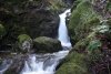 Down below the track, the cascades continue, ending 60 metres above the top.
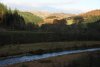 Light on Coed Hafod, and the edges of Pen y Garn (610 metres).
 Salmon-coloured trees in Coed Hafod.
Nant y Gwaith Falls, Nant Cwm-du Falls and Nant y Cae Falls
 The Esgair Milwyn ridge of Geifas (572 metres). From here, it's just a drive up the Ystwyth valley to see the rest of the waterfalls, which are scattered along the valley sides. While it is possible to walk from the nearby Ffrwd Milwyn, the path does not make it all the way up the valley, and the road is pretty much the only place to see the waterfalls from.
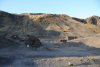 Tips and buildings at the Ystwyth quarries. Note the waterfall at the top-right.
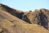 The top two stages of Nant y Gwaith Falls, each around 20 metres high.
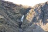 The 26 metre lower section, and cascades that end 100 metres below the top.
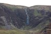 Nant Cwm-du Falls, now with much better lighting than last time. 60 metres tall, with a 36 metre single horsetail, split for the last 25 metres.
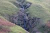 Another surprise; Nant y Cae Falls, about 45 metres tall in total, with all single drops less than 20 metres.
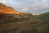 Colours of the upper Ystwyth, between Yr Allt (486 metres) and Esgair Elan.
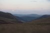 View into the Wye Valley, from the top of Nant y Sarn.
 Sunset over Crugyn Ci (533 metres).
 Maesglase (676 metres), by Dinas Mawddwy, seen here from the Ffridd Gulcwm lane.
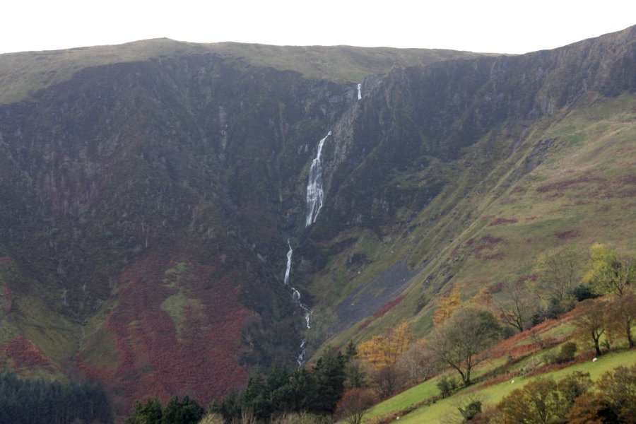 High flow at Maesglase waterfall, one of the tallest waterfalls in Wales at 160 metres (with the tallest single drop being 85 metres, and the second tallest being 34 metres), plus 60 metres of cascading stream. With the roadside trees now leafless, it is visible momentarily through the branches from the A470, though almost nobody will notice it.
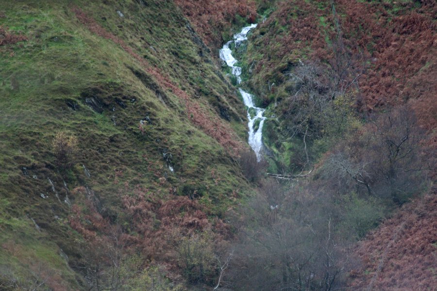 Also visible from the A470, this time from the steep slope heading up to the nearby high pass, is a set of cascades on an unnamed tributary to the Afon Cerist. None are very big, and at most they are just 20 metres tall in total, with one section being a little less than 10 metres of that.
 Starting at the tiny redbrick church in the village of Tycrwyn on the B4393, head away from the stream, and take the concreted bridleway starting at the farm on the left.
 The forests above Tycrwyn.
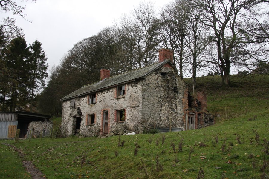 The waterfalls are situated in a small woodland belonging to the local farm, and we would normally seek permission from the landowner, just in case. However, that didn't seem to be productive here. It's anyone's guess who - if anyone - owns this land now. Follow the track to the right at the farm, and then continue up the little valley.
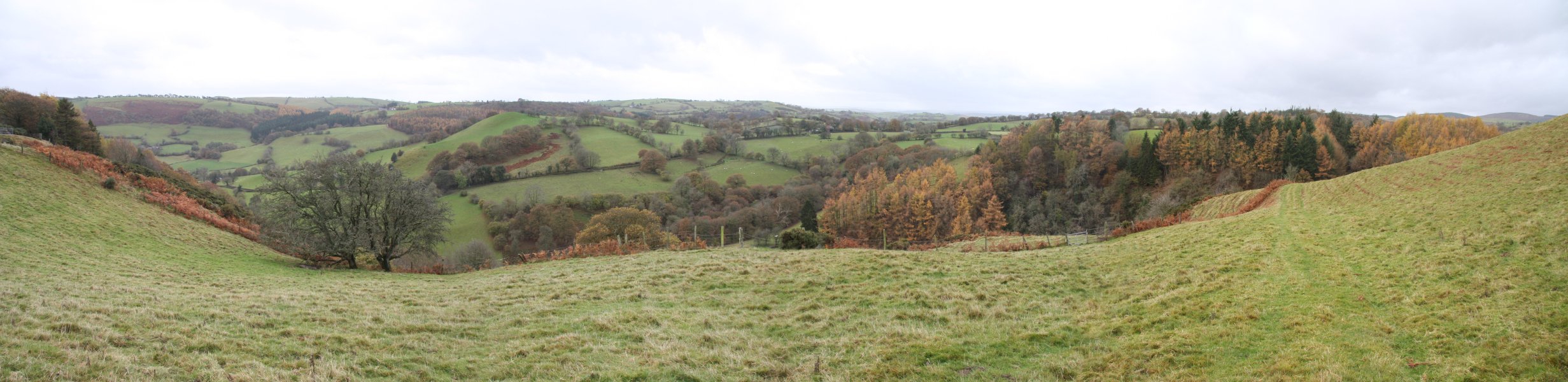 View over the Nant y Graig-ddu valley. The waterfalls are in the woodland on the right. Once in this field, the track splits. Take the left fork, and follow it until it reaches the stream. From there, head downstream along a track on the left bank. For most visitors, the waterfalls should be viewed through the trees from this track, and as such, they are best visited in winter.
 The Nant y Graig-ddu stream immediately begins with a series of pretty cascades dropping 15 metres through the undergrowth.
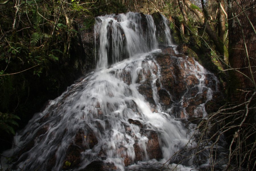 Beautifully lit 5 metre cascade on Nant y Graig Ddu.
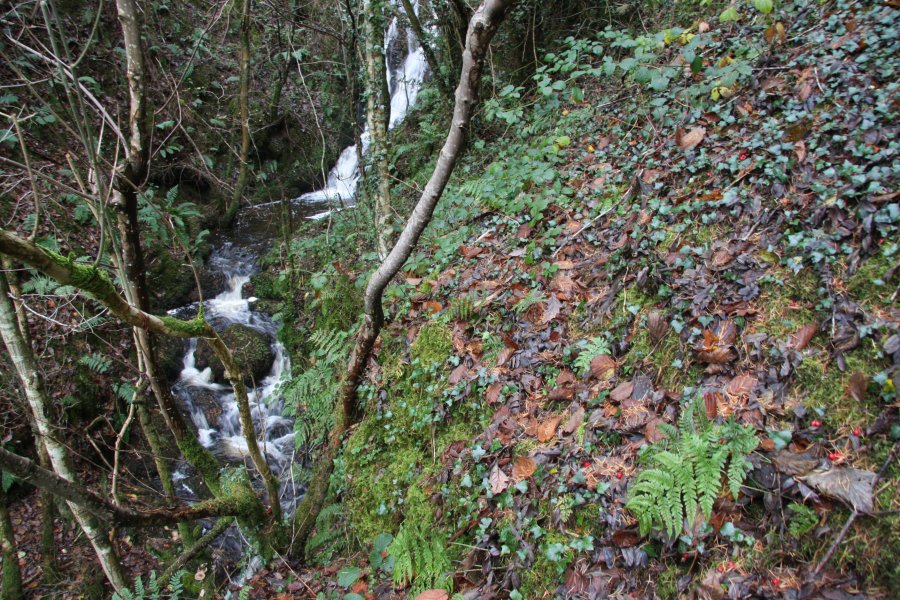 A side stream has some cascades that are partially visible from the upper track, but we wanted to get closer for pictures. There were, of course, no paths anywhere around here, so this was our route; brambles, moss and leaf litter clinging above the stream.
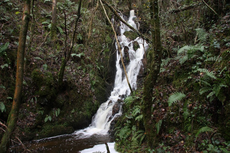 The main waterfall on the side stream, around 9 metres tall.
 It then tumbles another 5 metres to join the main stream.
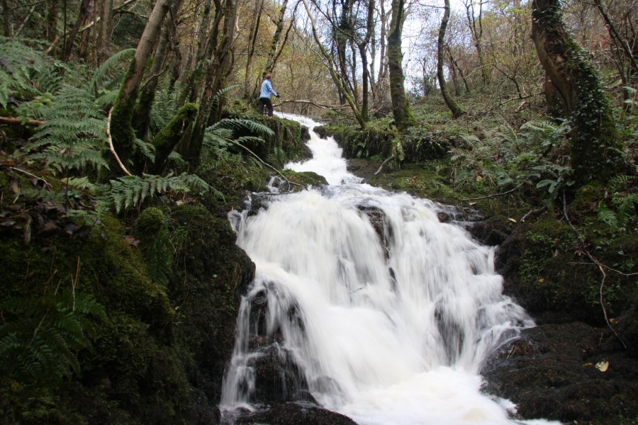 Shortly afterwards, the top waterslide of Pistyll y Graig-ddu begins, dropping around 7 metres.
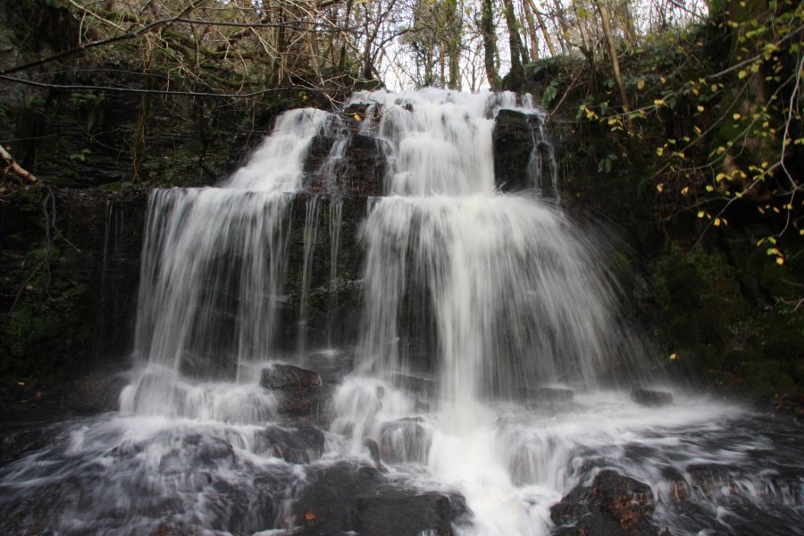 Followed by the middle part of Pistyll y Graig-ddu, a 5 metre waterfall. This proved impossible to climb, a little too far to safely jump the unclimbable part, and very hard to get around. If you must approach it, it would be better to do so from below, climbing up from below the waterfalls.
 Pistyll y Graig-ddu ends at this 5 metre cascade and waterfall. And finally, it seems to offer something rarely seen up here...
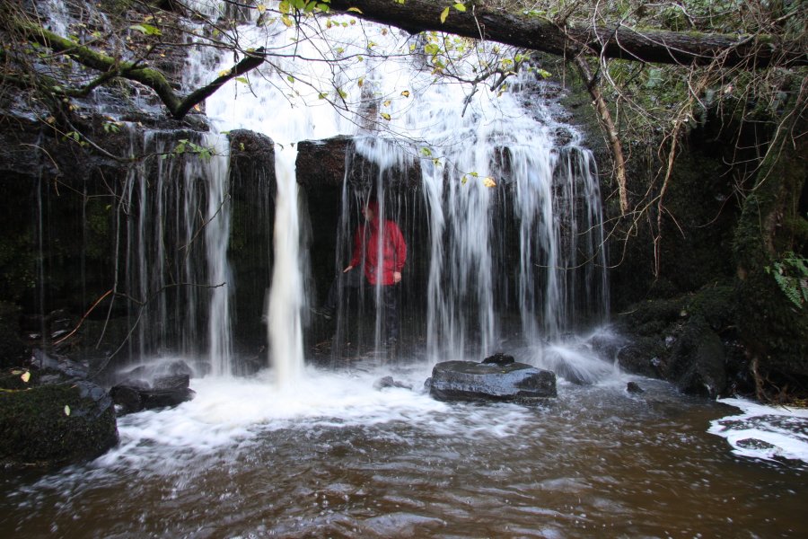 Yes, there is easily enough space to fit behind it, and it's nice and dry back there too.
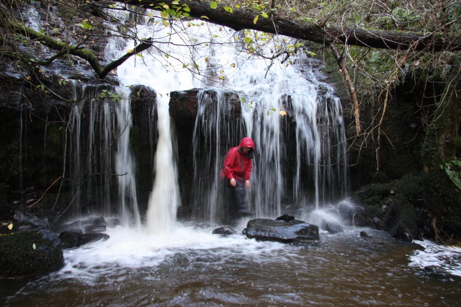 Unfortunately, the weeks of rain meant that it required full waterproofs, but I suspect that in lower flow, it would be easier to get behind, and probably even possible to remain dry. From the base, a relatively simple path ... er ... a fairly flat stream bank with less undergrowth than everywhere else, leads to the lower track.
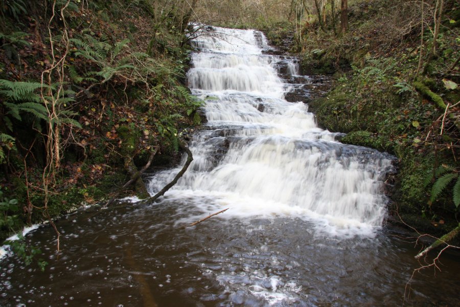 Nant y Graig-ddu then tumbles down a 4 metre cascade.
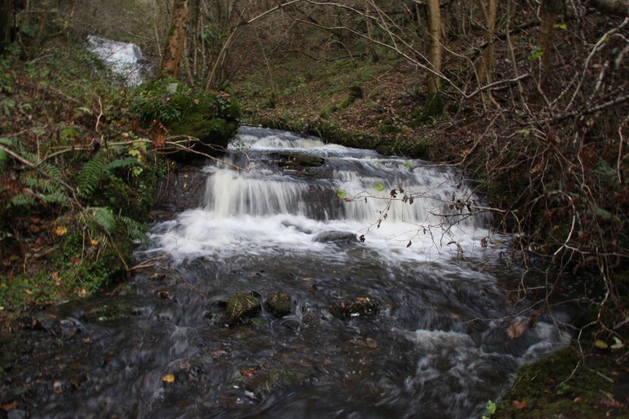 And then the map marks another waterfall. Why, I wonder?
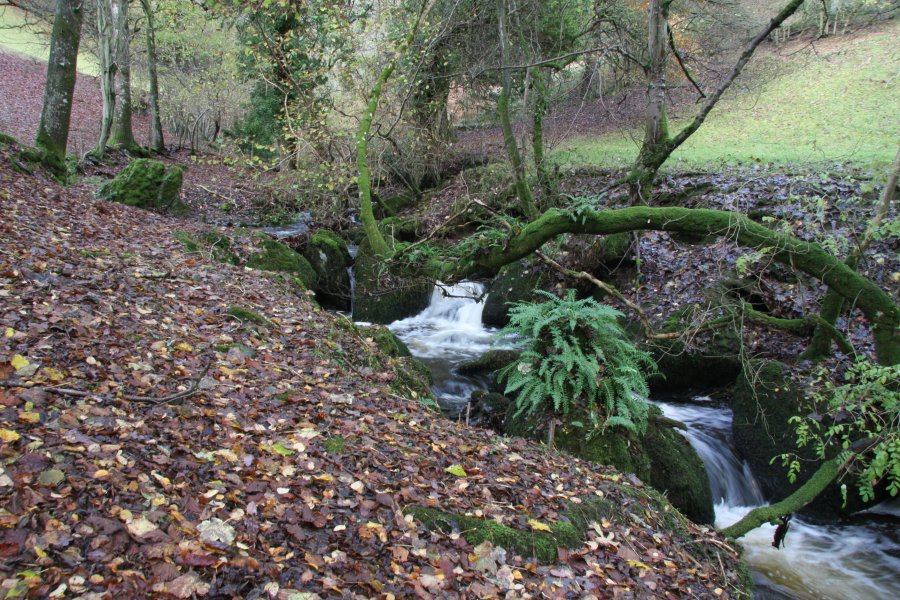 Nant y Graig-ddu.
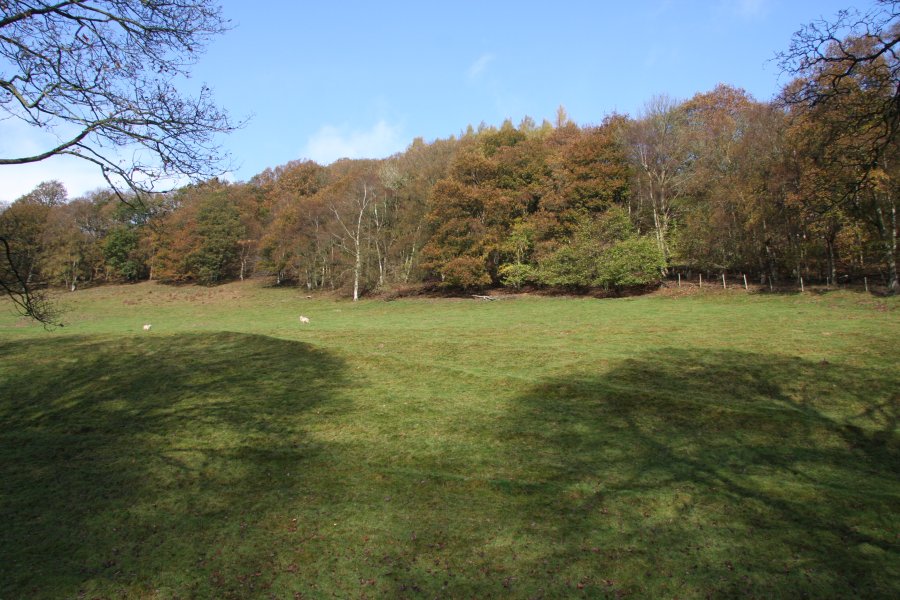 Field near Tycrwyn.
 Tycrwyn colours.
 Flooded fields by Pothmadog - normally there is just one main river channel here.
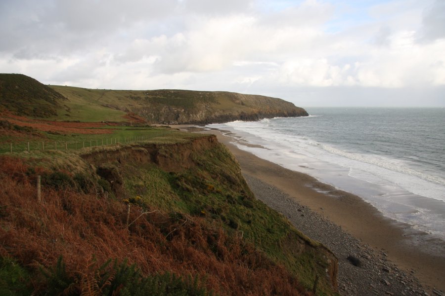 Porth Ceiriad near Abersoch. The Nant-y-big campsite allows visitors to park just above the beach, though the cost is quite steep for a patch of dirt without any security guard. Perhaps the cost covers the loss of land as the sea slowly eats it.
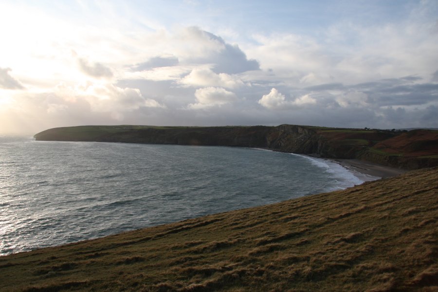 Trwyn Llech-y-doll.
 Evening light on Pared-mawr, the 100 metre cliff above Porth Ceiriad.
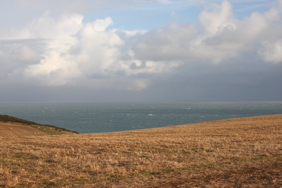 Shades of yellow and blue from Trwyn yr Wylfa.
 St Tudwal's Island East and West.
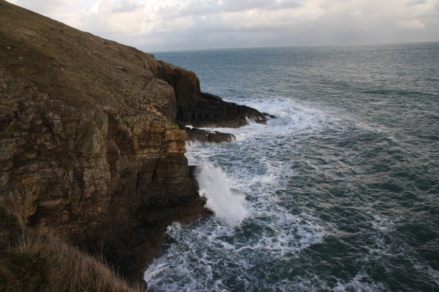 Waves crashing on the cliffs known to climbers as Black Pete. The waterfall is best seen from above those cliffs, but watch out for the path - little more than a sheep track - which becomes exceptionally muddy and very slippery, threatening to tip you down those cliffs.
 A farmer's feeding trough overflows into a narrow gully, which then dribbles down the cliff for something like 5 or 6 metres, to splash on a ledge above the sea. That's Pistyll Cim, in flood conditions, after weeks of heavy rain. You could make a better waterfall by urinating off the cliff. This waterfall was not worthy of my time, and it's not worthy of yours either. It's certainly not worthy of a name on the map. Save yourself the hours of driving it takes to get down the peninsula and back, and go elsewhere. Or pick it up while visiting something else in the area. Or just ignore it.
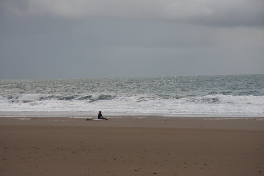 Wistfully waiting for the waves to pick up.
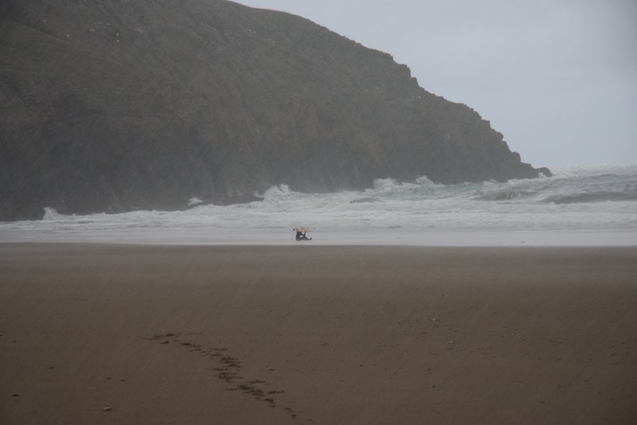 Then another heavy downpour chases us off the beach. There's something humorous about a surfer, in a wetsuit, sheltering from the rain.
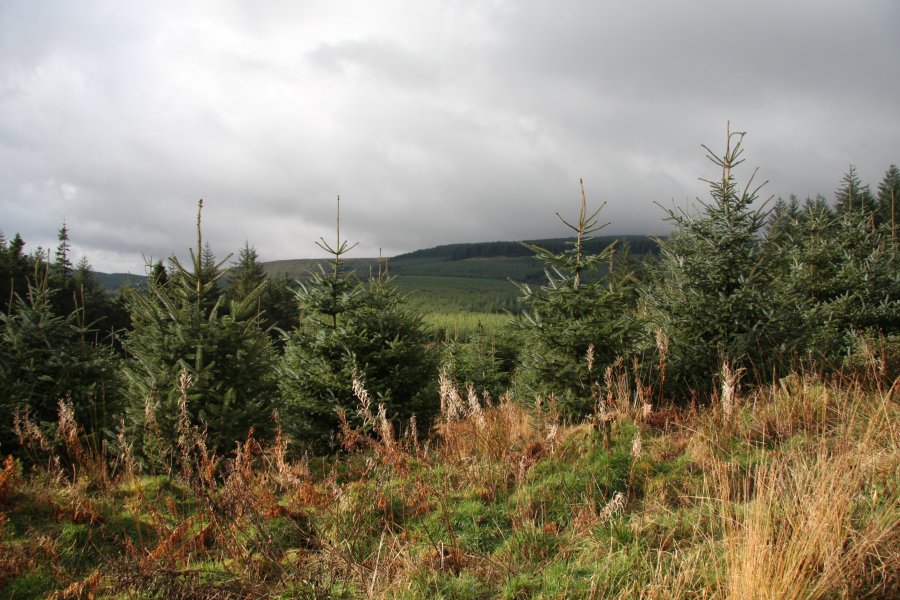 We started in the Hafren Forest at a small parking area just up the road from the main car park where the road starts heading away from the River Severn. Simply head from there along the obvious track to arrive at the waterfall on the Severn.
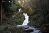
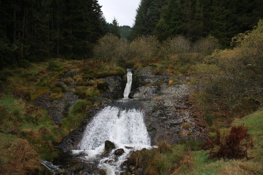 Rhaeadr Blaenhafren (sometimes written as Rhaeadr Blaen Hafren). It's around 5 or 6 metres tall, with the two halves separated by a couple of deep plunge pools.
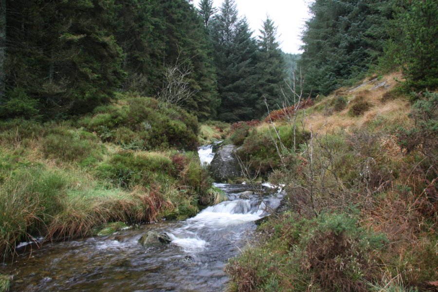 Smaller cascades upstream of the waterfall.
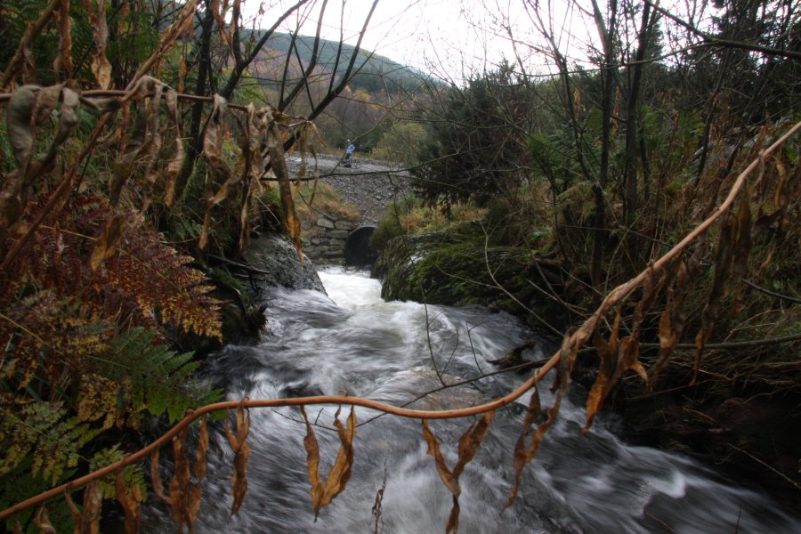 Looking down Rhaeadr Blaenhafren to the access track.
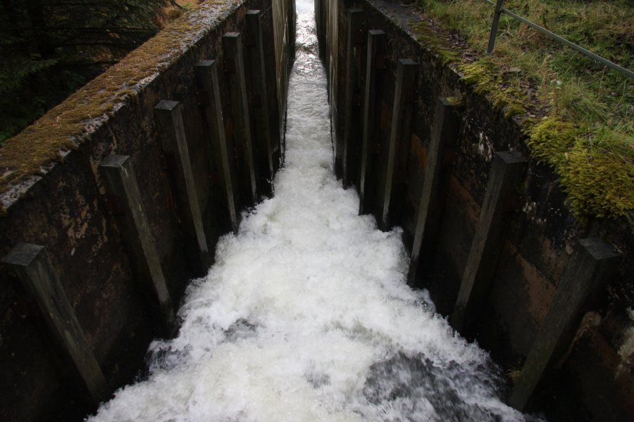 Flume in false perspective.
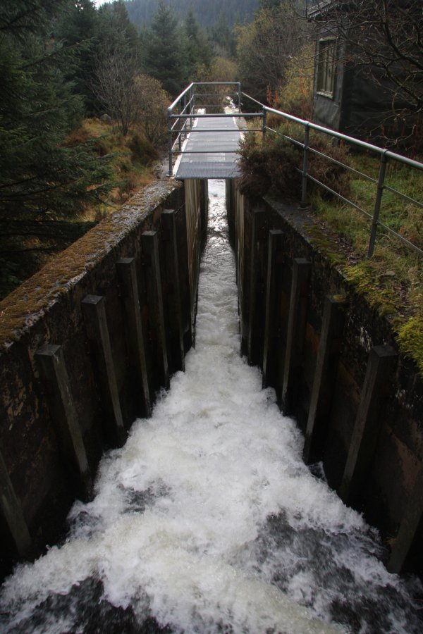 Contextual view. I don't like it as much as the previous one, but it may make more sense to you this way.
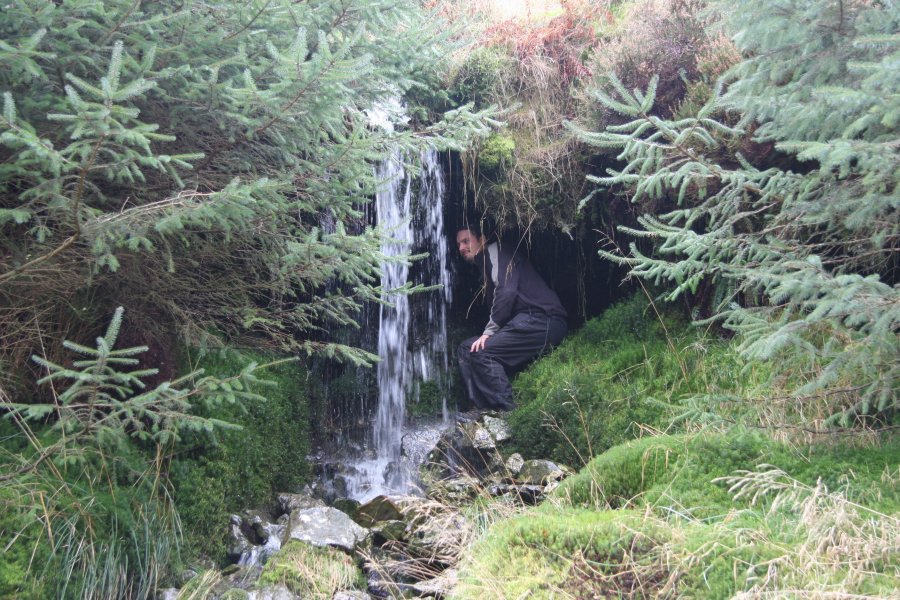 A little stream by the nearby Severn Break-its-neck waterfall tumbles over a drop, with an alcove that allowed me to crouch in the dribbles behind it. However, this is not listed as a waterfall that you can walk behind, for two reasons. Firstly, it is not a natural waterfall - the stream is falling over the edge of a forestry track cutting. Secondly, it is highly unstable - the roof is the broken rocks from the cutting activity, held together by grass and moss. It will not remain here for long.
 Rhaeadr Peiran, in better foliage conditions than on my last visit, allowing both parts of the waterfall to be seen at the same time. The water levels are high, but not quite high enough for the overflow channel on the left to become active. Time to test out a theory.
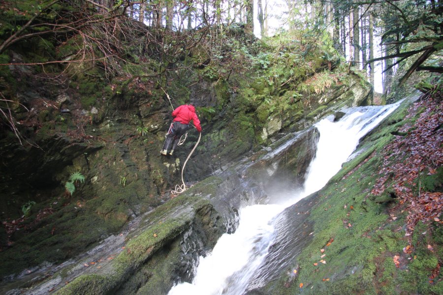 The sides are not really safe enough for scrambling down (though it was possible on the way out, it's certainly not a recommended approach), so a quick abseil dropped onto the ledge beside the main waterfall.
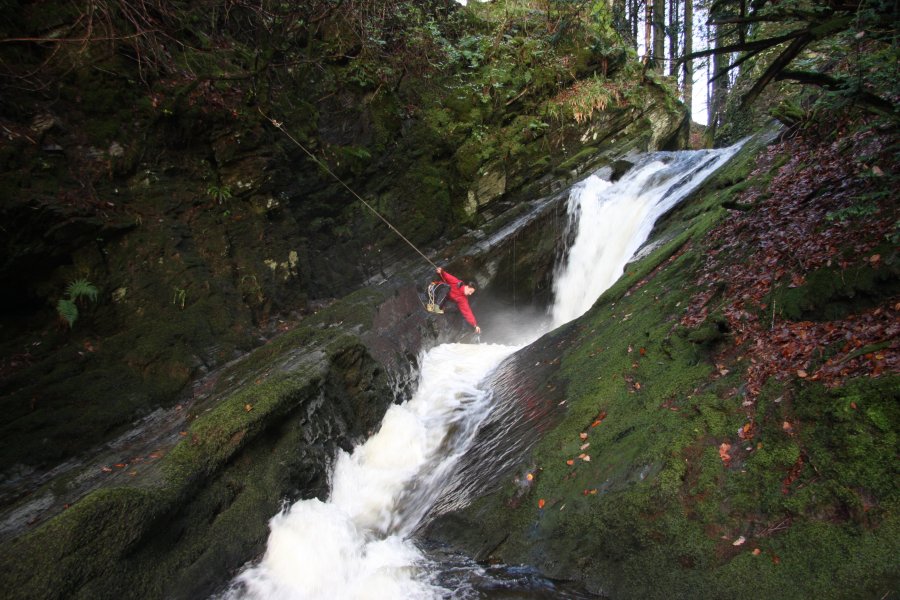 On the last visit, it looked as if perhaps the churning plunge pool was shallower than it might first appear, and perhaps could be waded. The walking pole never touched the bottom, however. It turns out that the pool slopes very steeply down from the shingle bank, and is far too deep to walk through.
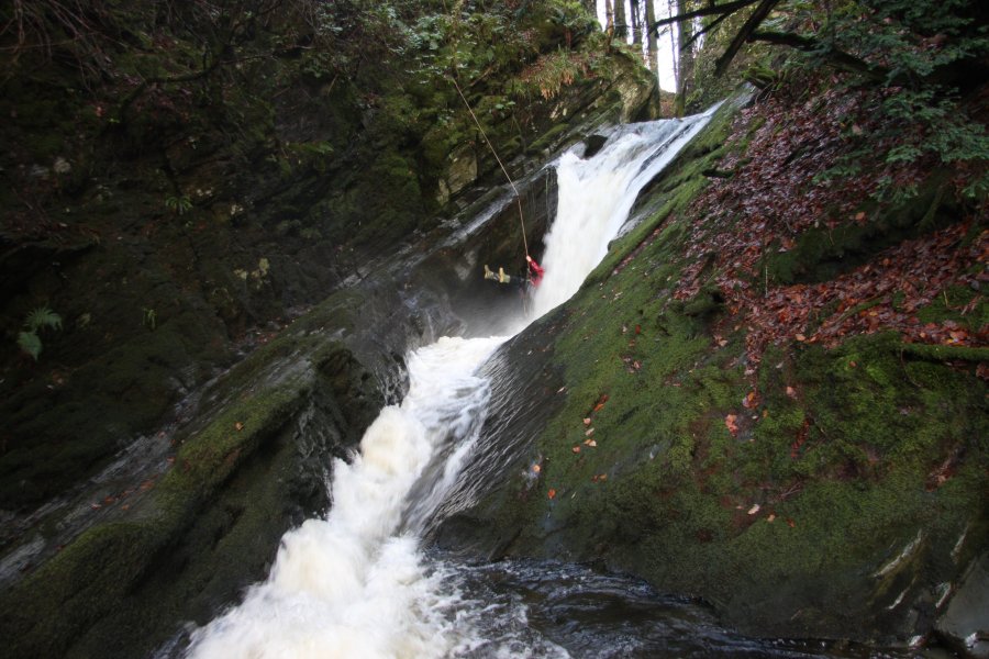 So that left only one option; abseil into it. A nearby tree provided a rather unpleasant belay, and the descent required a lot of swinging (with occasional dousing under the waterfall each time a swing was not aimed correctly) to reach the shingle bank. This is a lot of hard work, considering that there are many easier waterfalls to get behind.
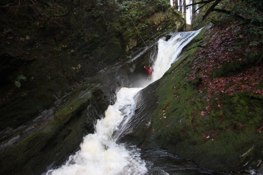 Eventually, one swing finally landed just on the edge of the shingles as they sloped away into the pool. There is enough space back there to stand and walk around a little in the alcove, and it is mostly dry, apart from the odd dribbles and the spray from that awesome thundering waterfall. What an experience. Still, it is important to remember not to let go of the rope, or it will be washed out of reach. Now change over, and prusik out.
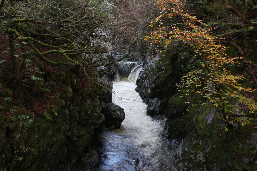 Cascade on the Afon Ystwyth at Pont Dologau. From here, take the track to the right, around a field, then turn left at a junction of tracks.
 Evening light on Coed Maenarthur.
 Afon Ystwyth looking like Canada or Alaska. You could almost imagine a brown bear blundering through the trees, and stopping to fish for salmon.
 The track soon arrives at the Mossy Seat Falls. This is the lower part, and probably will not look so good in lower flow.
 A steep path up just beyond the stream leads to a bridge and viewpoint for the best part of the Mossy Seat Falls. The largest single section is only about 10 metres, but the cascades just keep going.
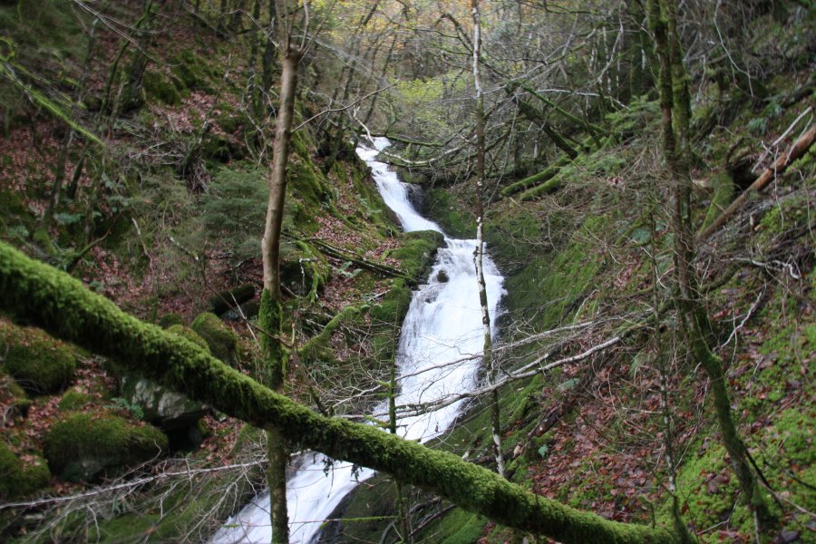 And going.
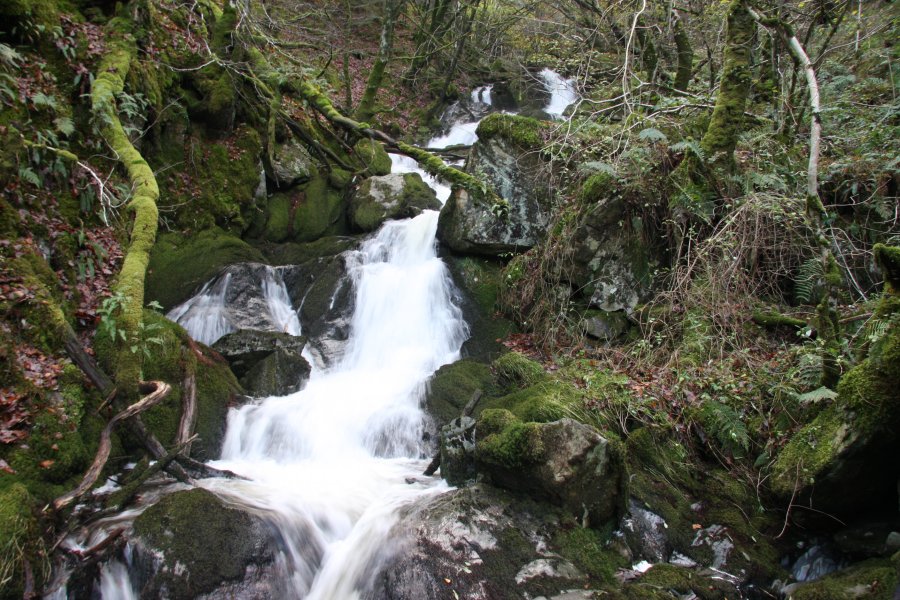 Before finally topping out at about 50 metres above the track.
 Down below the track, the cascades continue, ending 60 metres above the top.
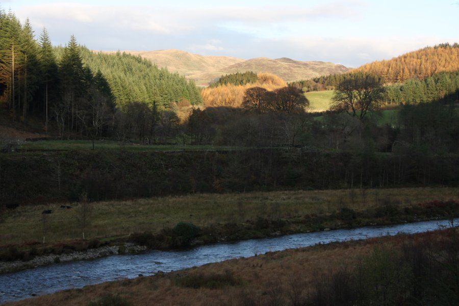 Light on Coed Hafod, and the edges of Pen y Garn (610 metres).
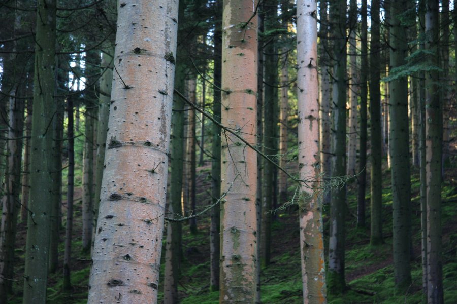 Salmon-coloured trees in Coed Hafod.
 The Esgair Milwyn ridge of Geifas (572 metres). From here, it's just a drive up the Ystwyth valley to see the rest of the waterfalls, which are scattered along the valley sides. While it is possible to walk from the nearby Ffrwd Milwyn, the path does not make it all the way up the valley, and the road is pretty much the only place to see the waterfalls from.
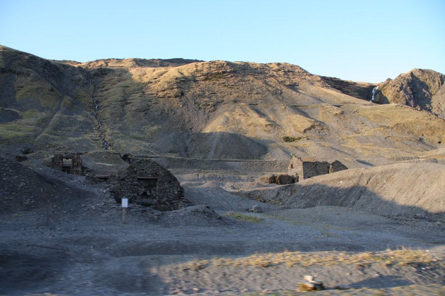 Tips and buildings at the Ystwyth quarries. Note the waterfall at the top-right.
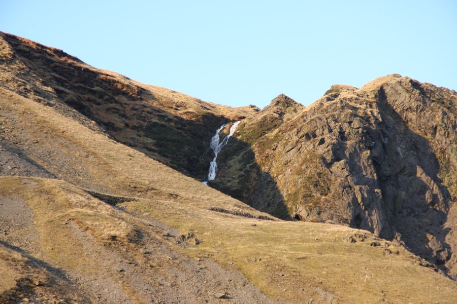 The top two stages of Nant y Gwaith Falls, each around 20 metres high.
 The 26 metre lower section, and cascades that end 100 metres below the top.
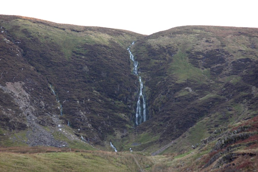 Nant Cwm-du Falls, now with much better lighting than last time. 60 metres tall, with a 36 metre single horsetail, split for the last 25 metres.
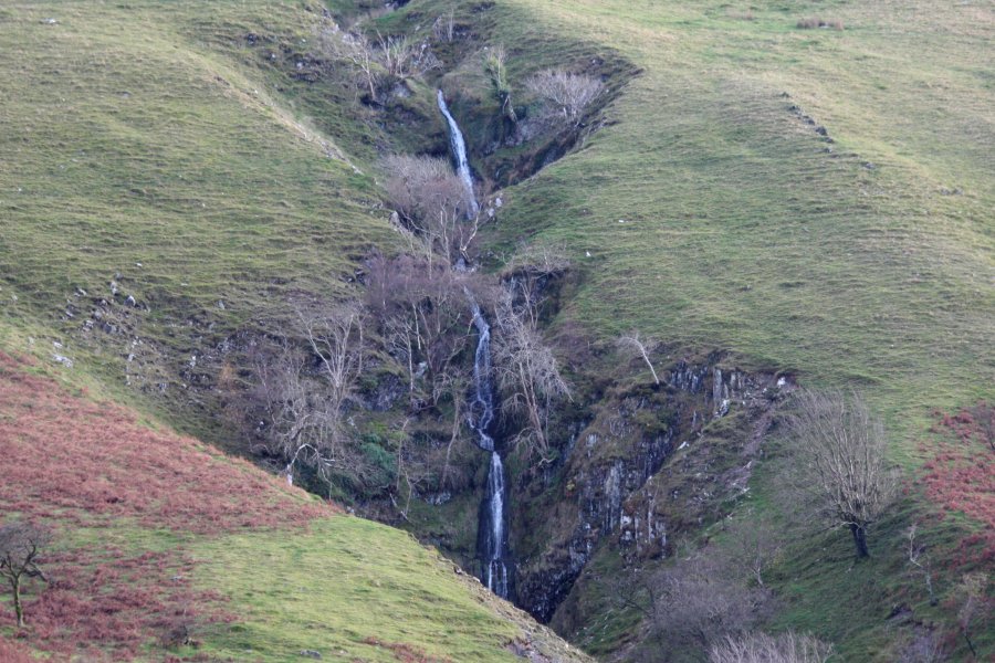 Another surprise; Nant y Cae Falls, about 45 metres tall in total, with all single drops less than 20 metres.
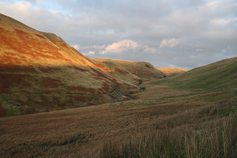 Colours of the upper Ystwyth, between Yr Allt (486 metres) and Esgair Elan.
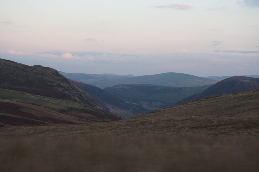 View into the Wye Valley, from the top of Nant y Sarn.
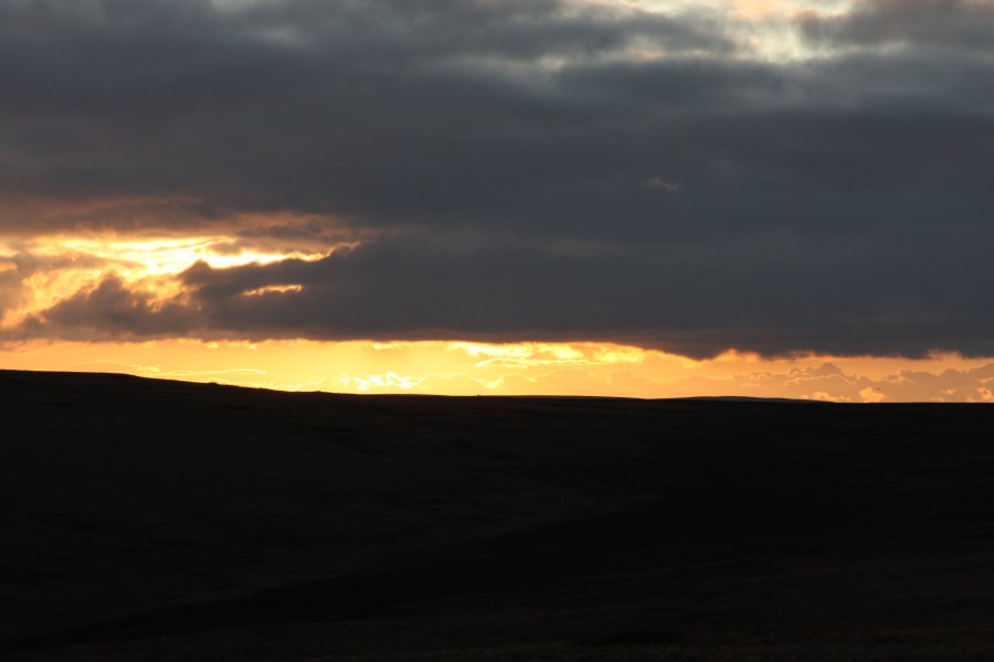 Sunset over Crugyn Ci (533 metres).