Waterfalls 2008
Blaenrhondda, Blaen-y-Glyn, Blaencwm, Sgwd Einion Gam and Afon Hepste. 5 walks, 4 days. And may I say "ouch". Then add Upper Sychryd and Clydach Gorge as well a few days later.
After getting to know all of the normal waterfall walks around the Brecon Beacons National Park, it became apparent that one - Blaen-y-Glyn (or Blaen-y-glyn or Blaen y glyn, depending on the map) - had not been completed, as we had stopped at the first major waterfall, not realising there were many more above it. In addition, a desire to visit the mountains at the head of the Rhondda valley had caused me to notice that the map pointed to a waterfall walk - a good excuse to visit the area.
Blaenrhondda
We tried once, following the weather forecast that gave us mostly overcast at 900 metres. It was foggy down to 300 metres, with just 20 metres visibility. Not enough. So we tried again, and got fog down to 500 metres, with hard blowing drizzle below that, threatening to cover the camera with water. At least it would keep the waterfalls topped up. It would have to do.
Blaenrhondda is the head of the Rhondda valley, the best known of the South Wales coal mining valleys, boasting four complete pit heads, and countless other artifacts. From end to end, the valley is a continuous town of mining terraces, nominally separated into different town names. Only at Blaenrhondda do the towns end.
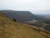
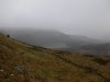 The steep scarps of Craig y Llyn. On a good day, this is a fantastic view. Hidden in the fog is the 600 metre summit, over the partly artificial lake Llyn Fawr (imaginatively named "big lake"), and managed forest. The summit is the highest point in South Wales that is not in the Brecon Beacons National Park.
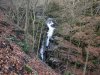
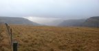 The dramatic Blaenrhondda, beside the car park. The first town - Treherbert - starts in the middle of the picture. It has two more waterfalls in the valley beyond the steep buttress (Pen-pych) to the right; Blaencwm. Our route follows the main route in reverse, crossing the field to the right, instead of following the obvious path. This is a sensible choice given the weather, but be warned that there is no path. You just go wherever seems best, and hope you find the gate at the other side.
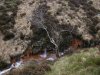 Springs feeding Nant Garreg-lwyd, staining the rocks with iron oxide (you know, rust).
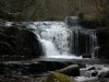
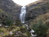 The Nant Melyn waterfall, the main waterfall normally visible from the road, and the most impressive of all waterfalls on the route.
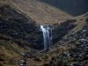 A side stream, Nant Carnfoesen, contains its own little waterfall. The path (if it deserves such a title) leads up only to the Nant Melyn waterfall, but this one is visible from that path. Normally, good photos would be easily possible from the path, but the rain was making that quite difficult.
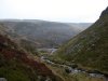 Garreg Lwyd (not to be confused with the mountain that has the same name in the nearby national park), the cliff on the other side of the valley. The two streams from the waterfalls flow into the tiny reservoir seen here, and would make the lower waterfalls far more significant, but sadly the water is tapped at the reservoir, and only Nant Garreg-lwyd is allowed to continue as the Rhondda Fawr.
 Following the path on the left bank of the Rhondda Fawr, we reach the impressive clifftop view of the industrial area. The map shows the river appearing and disappearing, even though this is not limestone. This is why; the massive ridge spanning the valley is all mining debris. We follow the clifftop to the left until it is possible to descend to two buildings, at the blocked entrance to a tunnel.
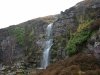 Just above the tunnel is the main waterfall of Nant Drysiog.
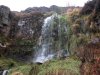 Hidden behind a pipeline below it is another small waterfall.
 And below the buildings is the last Nant Drysiog waterfall, littered with old and new rubbish, but looking quite nice in this well-framed picture.
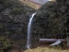 A short walk back below the cliff reaches the main Rhondda Fawr waterfall, with the remains of a steam engine boiler. The boiler has been subjected to idiotic graffiti, which I must admit I found so ugly, I had to edit it out of this picture.
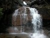 Below it is another waterfall, which is not easily accessible, but can also be seen from the path - a dismantled tramway - leading to the previous waterfall.
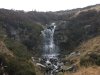 Returning to the main Nant Drysiog waterfall, then taking the zig-zagging path on the other side. It heads up to a connection with the clifftop path, then swings right almost invisibly beside the remains of a wall. It climbs up to the base of this waterfall, where a proper path heads to the left to the car park - passing the remains of a very old village, and several disposed cars. What a nice ending.
It turns out we missed the waterfalls around Pen Pych in Blaencwm, but the weather had deteriorated too much by now, and with the cloudbase dropped to 350 metres, nothing would be visible. They could have a dedicated trip another day. Instead, we aimed for the national park, and a full mountain range to the east, where the weather was significantly better ... er ... where the cloudbase was still above the waterfalls.
Blaen-y-Glyn
Almost unheard of by most visitors to the national park, this contains the best set of waterfalls outside of the popular Waterfall Country area. The Nant Bwrefwr part is followed by the Beacons Way, though that misses most of the bigger waterfalls, choosing instead to follow the pretty little ones. We had photographed these for the wallpapers gallery, but stopped at the first main waterfall in the Caerfanell/Blaen-y-Glyn valley - the one ignored by the Beacons Way. Today we would complete the set.
The easiest way to see all of the waterfalls is to start at the car park at the start of the path up Craig y Fan Ddu. Head beside the Nant Bwrefwr stream, up to the top of the fenced section, to see the first three sets of waterfalls. Then turn around and from the car park, head down the left side of the Nant Bwrefwr stream to see many more sets of waterfalls to reach the main path at the bottom. There is another waterfall on the other side of the path. Turn left, then take a branch to the right to the base of the main waterfall. Cross the bridge, and turn right. Head downstream past a few waterfalls, until the one that has a man-made weir at its top. Turn around and head back up past the main waterfall, keeping the river on your left. Follow the path all the way to the top waterfall. Return the way you came.
The path gets very muddy in places, so if you're a wuss, park at the bottom car park, just before the road crosses the river. Then walk up the left bank of the river (most of the waterfalls are badly obscured). Take a quick detour to view the main waterfall just after Nant Bwrefwr joins from the left. Then rejoin the path and head upstream on the left bank, until the path swings left, and a poor quality path continues ahead, beside a style to the right. Stop here, and try to see the waterfall ahead. Even young children can make it this far.
 The lowest waterfall, with the man-made weir at its top.
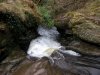 Water chute (looks best from the top).
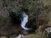 A little waterfall signifies Nant Bwrefwr joining from the left.
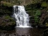 Just above it is Nant Bwrefwr's bottom waterfall, tucked just out of sight of the easier path on the other side.
 The cascades on the other side of the path, the first part of Nant Bwrefwr seen by those following the Beacons Way.
 Upstream of the Nant Bwrefwr confluence, the first waterfall in the Caerfanell/Blaen-y-Glyn valley is this double waterfall.
 The upper of the double-waterfall.
 Then the obvious and impressive main waterfall (taken in much higher water conditions).
 Where the easy path ends is this cascade.
 Almost obscured from the easy path, and separated from the muddy path by a slope covered in deep mud, is this graceful secluded waterfall.
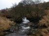 A small cascade above the waterfall.
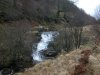 A slightly larger cascade above it.
 Though really a cascade, this one earns the label "waterfall" on the map.
 Cascade.
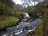 Cascade.
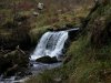 Cascade.
 Cascade. Does anyone look at file names, I wonder.
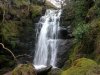 The valley develops a narrow gorge, which ends at this waterfall - significantly bigger than anything since the main waterfall, and well worth the effort and mud to get here.
 Looking back down the Caerfanell/Blaen-y-Glyn valley. The name is quite confusing, as the river is called Caerfanell at its top and bottom, and Blaen-y-Glyn while it passes through the forest, as well as one of the branches at the top. Since it seems nobody can make up their minds, I call it both, and hope you are left as confused as I am.
Blaencwm
Two days later, the drizzle had stopped, and the weather forecast correctly predicted a cloudbase of 600 metres, enough to see my way around Blaencwm. Since I was planning on visiting some areas without proper paths, I was not accompanied by the proper-path-users, and had to go alone. Probably took some risks I should not have done, but the pictures were well worth it. I will give suggestions on what parts may be safely reached in the comments accompanying the pictures. You follow these suggestions at your own risk.
 The 180 metre scarp of Craig y Llyn. The trails from the clouds are just catching the top of the mountain ... er ... metric hill - just.
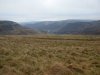 Blaenrhondda.
 The view over to Blaencwm, beside Pen-pych.
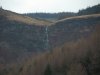 The tiny town of Blaencwm is dominated by this escarpment, and the Berw Nant yr Ychen waterfall (often mislabelled as the Pen Pych waterfall). There is ample parking on the Penpych Woodland Park site, part way along the valley. From there, the path heads the wrong way then zig zags up the side, before aiming uphill for the waterfalls. Even a wheelchair could follow the first part of the path, though it might need help to get past the barrier at the car park.
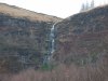 The trees are kept clear in a couple of places, giving a good view of the Berw Nant yr Ychen, which I am told is called the Virgin Falls by ice climbers. Despite normally having very little water, it would appear to be the tallest waterfall in the area, with a the visible parts having a total height of nearly 30 metres (making its total height greater than Sgwd Henrhyd). However, it is significantly broken into three significantly separate sections, with the largest being about 15 metres.
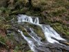 Below the main path, another path fails to get a good view of these cascades, but if you don't mind getting your feet wet, they're not far upstream of the lower path's bridge.
 The stream here is called Nant Berw Wion (above the waterfalls it is called Nant Lluest). We were not able to find what Wion means, but berw means "boiling". Cywion means chicks. Perhaps it's a really odd mutation and this is the stream of boiling chicks. But perhaps not. (It is of course more likely to be a normal mutation of the name Gwion, so it would be the stream of Gwion's boiling [liquid].)
 The easy main path ends at a balcony with a view of the main waterfall. Right under it is a noisy cascade that sounds big and impressive, but is just this obscured little thing. From this point on, the path is still easy enough for children, but not usable by wheelchairs any more.
 The small cascade above the balcony.
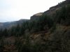 Crags on the escarpment above Blaencwm, rising about 300 metres over the town.
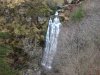 A little further up the path is the lower main waterfall, whose cascade would normally be hidden behind trees in summer.
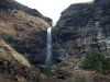 The dominating Pen Pych waterfall, the only one any of the summer visitors seem to remember. This view comes from the balcony. The waterfall is quoted as 70 feet - around 21 metres. On the 1:10'000 map it appears as Berw Wion, but locals simply refer to it as the Pen Pych waterfall.
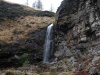 The path passes within easy reach of the waterfall base.
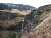 The cliff makes a dominating amphetheatre surrounding the waterfall. The path heads over towards Pen-pych (the mountain), and can be followed to eventually meet up with the clifftop view mentioned in the Blaenrhondda walk, at a bridge over the Rhondda Fawr.
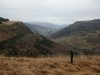 Instead, I take a path in the opposite direction, and cross the stream at the head of the waterfall - the path is basically the remains of a forestry track. Hidden rocks, branches and puddles, with tall grass covering them. The second half - after crossing Nant yr Ychen - is not suitable for small children. Stream crossings may be too dangerous depending on water levels.
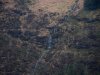 Small waterfalls draining Cawsa Carn-saer. "Carn" in this context probably means "notorious" not "cairn", making this "Cheese of the Notorious carpenter". I think somebody might have been having a joke with the surveyors... Of course, it could also mean "curds of the cairn mason", as in, the place that supplies the person who builds cairns with stone (assuming curds metaphorically means supplies-of-the-trade). But really, it is a bizzare name.
 The route ends at Nant y Gwair, a small stream (the third proper stream crossing so far). There is no path along the stream here, and given the nature of tree felling, the difficulty can be increased by fallen branches. Upstream is followable - stop just after a small but significant stream joins from the left.
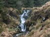 The upstream direction is shown on the 1:25'000 map as having waterfalls. This is the upper one.
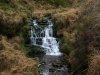 Small cascade below it.
 A small waterfall, with all the characteristics of a large waterfall, shrunk down to 2 metres.
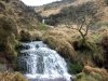 Cascade.
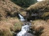 The downstream direction looks easy at first, and starts with some small cascades.
 Cascades.
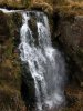 Then the water plunges into a narrow canyon, down a proper waterfall. The map does not show a waterfall, and for a good reason that I want to reiterate. Approaching these waterfalls is dangerous. The terrain makes it extremely hard to get a reliable hold, and even harder to see where such holds might be. Enjoy the pictures, but do not try to copy me.
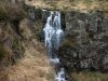 The canyon waterfall.
 Immediately below it is a larger waterfall. This one was very hard to reach, requiring a partial descent of the cliff, relying on heather for handholds - do not try to get to this viewpoint.
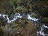 Below the tiny balcony I had reached, several smaller cascades continued downwards.
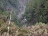 A long way below my balcony (see where the tops of the trees are), the stream cascaded down another drop. It didn't sound like a proper waterfall though, and I was not prepared to risk getting down to it to find out.
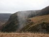 As I walked back, a lonely cloud slowly climbed up through the trees, to meet the cloudbase just above.
Sgwd Einion Gam
The next day ...
This waterfall is normally ignored when doing the Elidir Trail, which concentrates on the Nedd Fechan waterfalls, and only Sgwd Gwladus on the river Pyrddin. But plenty of people sing the praises of the graceful Sgwd Einion Gam, while simultaneously telling you that you'd have to be nuts to visit it. Why? Well, because you have to cross the river, without a bridge. One in particular made it sound so dire that it would be enough to put anyone off visiting it, suggesting you have to wade in the river to reach it.
It does not deserve this reputation. They're wrong. I managed the entire walk in elevated winter water levels, and the water never made it more than a few inches up my walking boots. Sure, you do have to cross the river, and if you're a wuss (or you're wearing trainers), then it's not for you. But if you have even the most basic river crossing ability (you know, standing on stones in a shallow section) then you should easily be able to make it. Suggestion followed at your own risk. Of course.
 Follow the Sgwd Gwladus path from Pontneddfechan. When the junction between the Nedd Fechan and Pyrddin is reached, cross the Pyrddin, and follow its right bank, to reach the top of Sgwd Gwladus. Here it becomes obvious why river crossings are needed; the cliffs swap from side to side of the gorge, with the river against the base. Every time the cliff swaps sides, cross the river.
 The first river crossing, clearly not as fierce as it is made out to be. A pair of walking poles certainly helps with balancing on the slippery stones, but they're not needed.
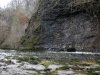
 One of the many little waterfalls that adorn the sides of the gorge.
 The third crossing. Remember that this is winter water level. After a while of dry weather, the water is even lower, but the waterfall is not so good. In flood conditions, it would be much more difficult, and you choose to follow the route at your own discretion.
 The gorge narrows, and the waterfall can be seen ahead. For the best view, you need to cross to the right bank here. I used this convenient fallen tree, but there are enough rocks to cross using those instead, though the water is a little deeper if you slip in.
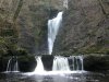 The impressive waterfall is guarded by this small cascade with its deep plunge pool. This shot needed me to cross the river again to take the picture, but for normal viewing, there is a path a couple of metres up on the right side of the pool. It looks impossible from a distance, but is easily followed (or at least, I had no trouble with it). The upper part that looks like a distant waterfall much higher up, is actually just the sky.
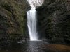 Once level with the base of the main waterfall, cross the river again to get to the viewpoint. The situation is hard to convey in a picture; the experience of being in a narrow canyon, with this thundering waterfall towering over you, thrusting the wind through the canyon, and the spray into your face. It's an awesome feeling being here, overshadowed by the power of the water. Those who describe this as a graceful or pretty little waterfall, went here in the wrong conditions, with only a low amount of water.
Afon Hepste
The Hepste is well known for Sgwd yr Eira, the most popular waterfall in South Wales. However, like most of its visitors, I had failed to look any further than that one waterfall. Given how easy most of them are to reach, this is a shame, because it has many other excellent waterfalls. Since it's in the same area as Sgwd Einion Gam, I went from one to the other within the same day, and managed to complete both walks within 4 hours of walking/photographing time (ignoring the short drive in between).
 I started in Penderyn, though that's really not needed, unless you want to view the first waterfall shown here - the main waterfalls can all be seen while visiting Sgwd yr Eira. The path starts here at this triangle of roads (the path is at the end of the road on the left seen here). The 1:25'000 Explorer map shows an access information point in the middle of the triangle. I tried asking the chickens, but they did not have any useful information to share.
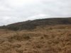 The path begins following an obvious track, skirting the edge of Moel Penderyn (371 metres). After a while, the path branches off to the right, then a choice of the old path leaving to the right, and the new path heading left. The old path is extremely boggy (marsh over half a metre deep) and should not be used (how do I know that, you may well ask). The new path crosses an open area, then reaches a fence, which it then follows.
 Once within sight of the top of the gorge, the fence turns sharp right towards the gorge, with the path continuing ahead directly to Sgwd yr Eira. Crossing a style and heading diagonally across the field reaches the first waterfall, and a relatively easy descent into the gorge. The old path along the gorge follows the fence then turns left at its next corner, slowly descending into the gorge - this path is in very poor condition - barely a sheep track, and has been diverted.
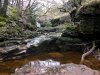 A short section of dry valley in the gorge, with the entrance to Ogof Tram Trucks - part of the Ogof Afon Hepste system - in the pool in the picture. The cave system is almost entirely divers-only.
 "Upstream", a waterfall with very little water plunges into a deep pool, where the water disappears. This is the stereotypical cave-behind-the-waterfall, as just behind the left side of the waterfall is the entrance to Ogof Tarddiant Hepste - another part of the same cave system. Although this would appear to make it possible to crouch in the cave behind part of the veil, the veil only extends far enough for that at times when the water level is too dangerous to attempt it.
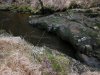 "Downstream", a narrow slot issuing a vast volume of water is the Hepste Resurgence, where the water from various sinks along the river returns to the river.
 Cascades on the reconstituted river.
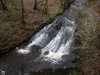 The gorge base cannot be followed without appropriate equipment, so I stayed on the cliff top, descending repeatedly on the steep, slippery, moss-covered slopes to get pictures of various cascades. It's not really worth it, but sometimes it feels nice to be perched far above the river taking pictures like this.
 Another descent, another cascade.
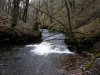 Deceptive. It looks like the sides might be followable at low level, but the sides keep becoming tall cliffs again.
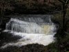 Sloping cascade. I was getting very tired of the repeated ascents and descents of the gorge by now - even with the old path now having made it half way down the side.
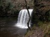 After joining the main path, it descends to Sgwd yr Eira (which was previously confusingly referred to as the Upper Cilhepste Fall, or just the Cilhepste Fall), passing behind it on the now re-opened path. Once on the right bank (facing downstream), I started looking for the way to the lower waterfalls. I asked a few regular visitors, who all failed to locate the path. Some who were sitting on the path said it could not be followed to the waterfalls. One pointed up to the top of the path up to Sgwd Clun Gwyn, saying there was a way down from there. There wasn't. The map agreed. It was wrong. The path is easy; once at river level on the right bank, just stay at river level. It leads directly to the top of the next waterfall. For the last two, a short scramble down a rocky patch leads to convenient viewpoints in front of the waterfalls. So easy, and yet always ignored.
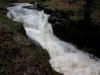 Cascade at the start of the waterfalls.
 Upper Cilhepste Fall. Or ... Oh, stupid names. Whatever. Since Sgwd yr Eira now has a proper name, this one is now the Upper Cilhepste Fall. Accept it.
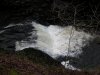 Cascade below the upper waterfall.
 Cilhepste Falls. Like Sgwd Einion Gam, the viewpoint experiences the full power of this waterfall. Even in low water conditions, it is always foaming and white, thundering into a narrow canyon, blowing the spray into your face.
 From power to grace. The Lower Cilhepste Fall. The river now becomes subdued, and joins the Mellte, heading for Pontneddfechan.
Upper Sychryd
A little recovery time later...
The Sychryd is usually ignored by everybody, basically because the way into the gorge is a side path on the Four Waterfalls walk. The lower gorge, cascade and waterfall are all quite pretty, though not as majestic as the main walk's waterfalls. Above the gorge was an unknown quantity. The map shows no paths, but two waterfalls, the upper of which even has a name; Pwll y Crochan (the cauldron pool), which would normally imply that it's worth a visit. On one side and high above is a main road. On the other is open access land, but without any path to reach it from the top. It turns out there is a stepped path, probably from a layby on the main road. I approached from the open access side, via several fields.
 Pwll y Crochan is actually a boring little cascade with a long plunge pool, in a low-walled canyon, not worthy of the detour to see it. Viewing it involves hanging onto trees on the edge of the canyon. Half way up the stepped path is a dismantled railway line, which I mistakenly assumed would be the easy way downstream. Turned out it was heavily overgrown, and quite unpleasant.
 Frosted twigs on the path.
 Where the railway began to climb up, I dropped down to the river, beside this bank of mossy icicles.
 Just downstream was the far better waterfall, the only waterfall worth visiting upstream of the Sychryd Gorge. It seems there might be a path from the gorge to this waterfall, staying not far above the river.
 Heading back upstream, the path heads through the open access land, eventually joining the main footpath above.
Clydach Gorge
I lived above here for well over 10 years, and only ever managed to visit the caving part of the gorge. Today I would complete the gorge, looking for the other waterfalls that were shown on the map. The map does not show it, but there is a path to them from Danycoed, on the left bank of the river (the map shows it heading up to the quarry, naming the forest as Coed Ffyddlwn - that's news to me - but there is also a path that goes directly up to the waterfalls).
 The river plunges down a cascade (mostly hidden by a fallen tree) into a canyon below the path.
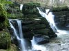 Just above the cascade, the path passes right by the top of this graceful waterfall, which seems to be formerly known as Pwll Crochan.
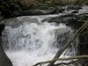 The map shows another waterfall. The path becomes unmaintained, then fizzles out, requiring clambering over fallen trees, around outcrops, through brambles, and finally a river crossing to get to the waterfall. Turns out it's a pathetic little cascade, with the view blocked by a large fallen tree. It's really not worth the effort involved in getting here. I checked all the way up to the Devil's Waterfall (along an equally bad path) just to make sure there was nothing else worth looking at.
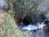 Near the top of the Clydach Gorge, the river falls down a pothole waterfall, and disappears into a short adit through the caprock called Coal Tar Cave.
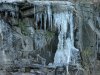 A frozen little waterfall near the adit.
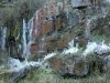 Just a little downstream, more streams cascade over the cave, partially frozen, with frozen plants looking like bizzare arthropods.
 Another view.
 The waterfalls over the adit resurgence, the site of what was once the Pistyll Mawr waterfall.
 The steep scarps of Craig y Llyn. On a good day, this is a fantastic view. Hidden in the fog is the 600 metre summit, over the partly artificial lake Llyn Fawr (imaginatively named "big lake"), and managed forest. The summit is the highest point in South Wales that is not in the Brecon Beacons National Park.
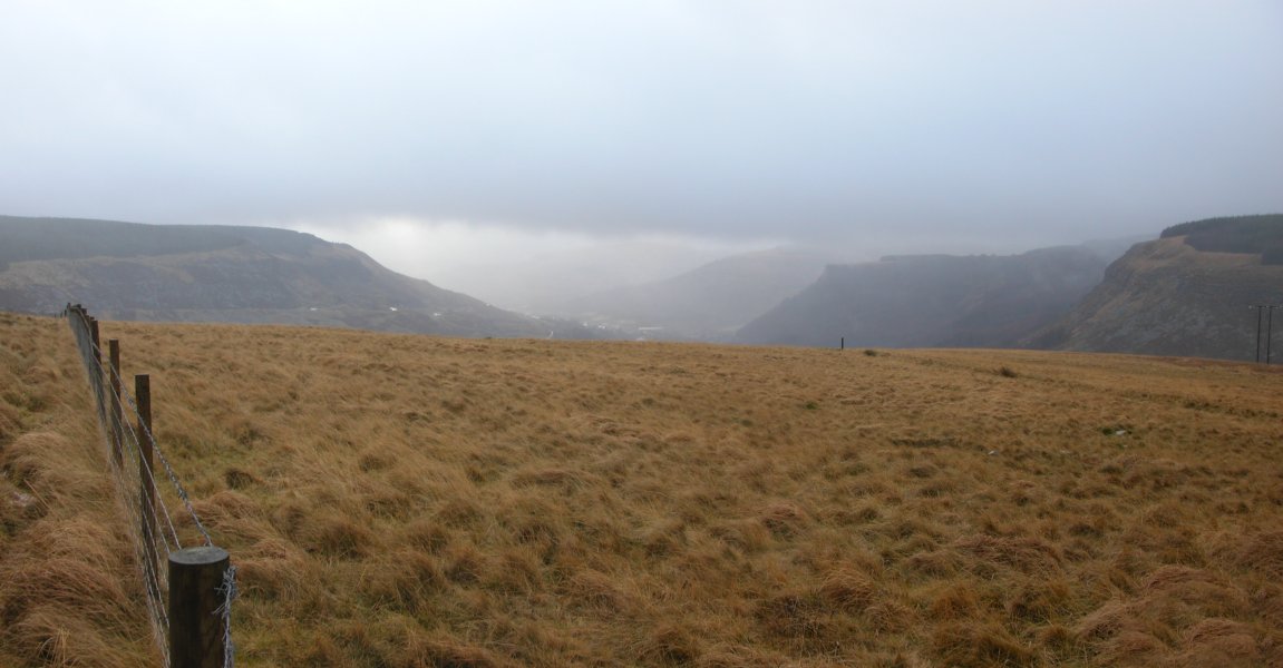 The dramatic Blaenrhondda, beside the car park. The first town - Treherbert - starts in the middle of the picture. It has two more waterfalls in the valley beyond the steep buttress (Pen-pych) to the right; Blaencwm. Our route follows the main route in reverse, crossing the field to the right, instead of following the obvious path. This is a sensible choice given the weather, but be warned that there is no path. You just go wherever seems best, and hope you find the gate at the other side.
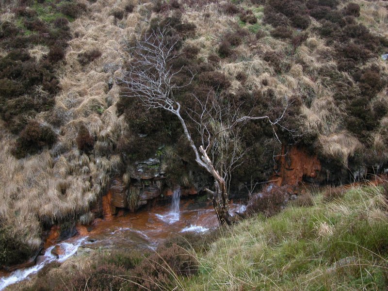 Springs feeding Nant Garreg-lwyd, staining the rocks with iron oxide (you know, rust).
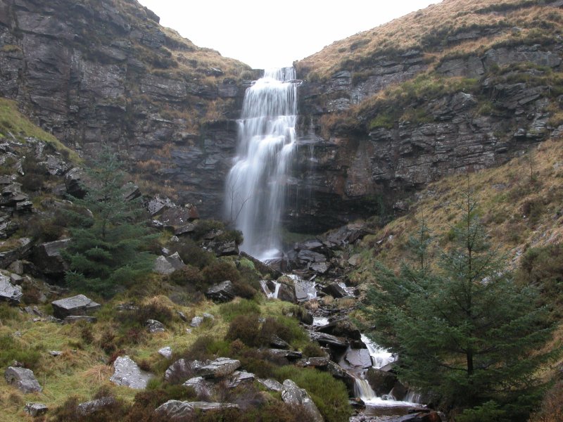 The Nant Melyn waterfall, the main waterfall normally visible from the road, and the most impressive of all waterfalls on the route.
 A side stream, Nant Carnfoesen, contains its own little waterfall. The path (if it deserves such a title) leads up only to the Nant Melyn waterfall, but this one is visible from that path. Normally, good photos would be easily possible from the path, but the rain was making that quite difficult.
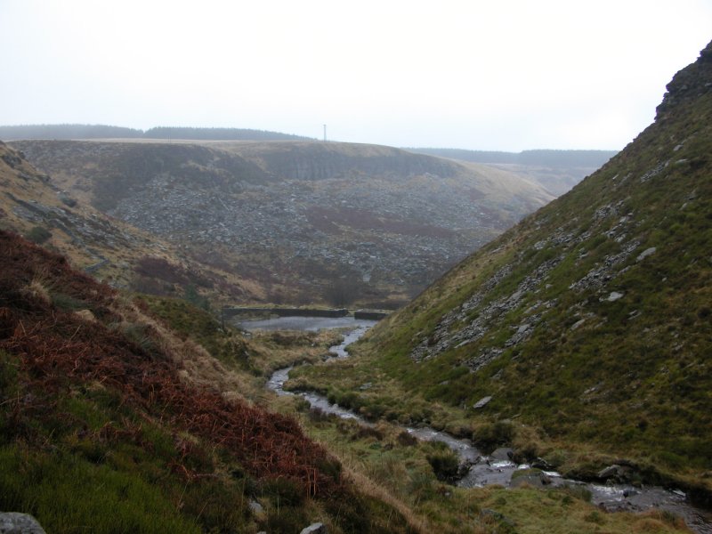 Garreg Lwyd (not to be confused with the mountain that has the same name in the nearby national park), the cliff on the other side of the valley. The two streams from the waterfalls flow into the tiny reservoir seen here, and would make the lower waterfalls far more significant, but sadly the water is tapped at the reservoir, and only Nant Garreg-lwyd is allowed to continue as the Rhondda Fawr.
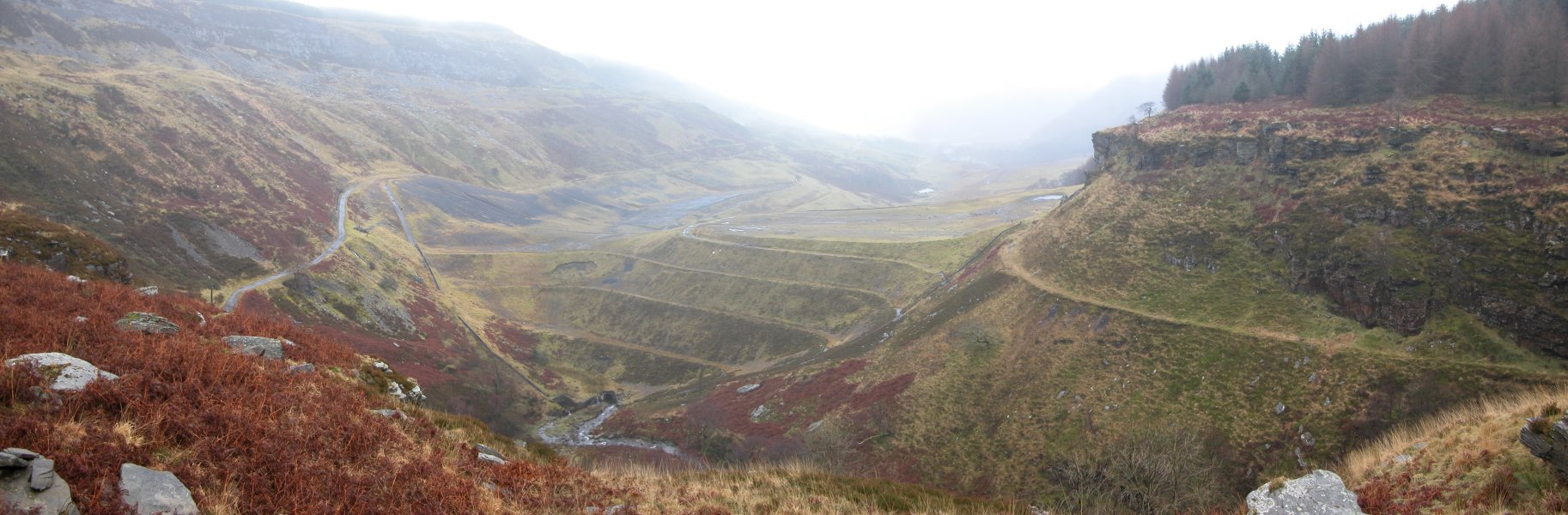 Following the path on the left bank of the Rhondda Fawr, we reach the impressive clifftop view of the industrial area. The map shows the river appearing and disappearing, even though this is not limestone. This is why; the massive ridge spanning the valley is all mining debris. We follow the clifftop to the left until it is possible to descend to two buildings, at the blocked entrance to a tunnel.
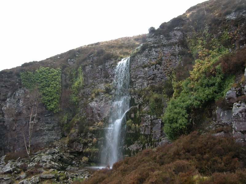 Just above the tunnel is the main waterfall of Nant Drysiog.
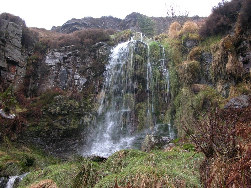 Hidden behind a pipeline below it is another small waterfall.
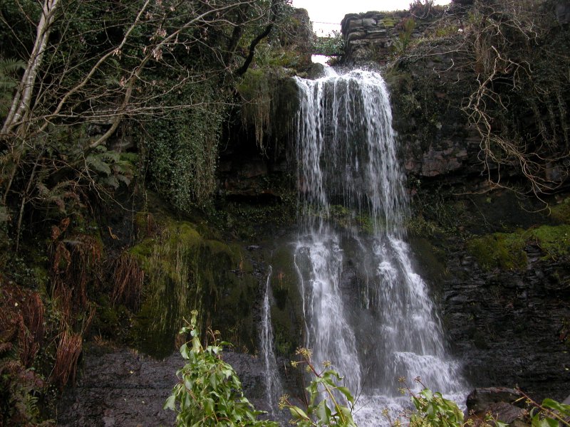 And below the buildings is the last Nant Drysiog waterfall, littered with old and new rubbish, but looking quite nice in this well-framed picture.
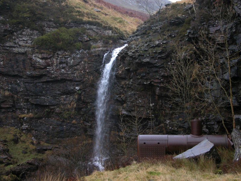 A short walk back below the cliff reaches the main Rhondda Fawr waterfall, with the remains of a steam engine boiler. The boiler has been subjected to idiotic graffiti, which I must admit I found so ugly, I had to edit it out of this picture.
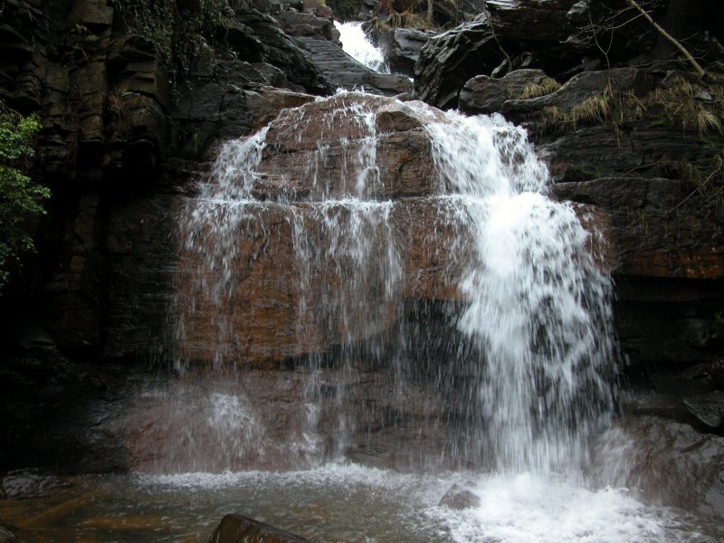 Below it is another waterfall, which is not easily accessible, but can also be seen from the path - a dismantled tramway - leading to the previous waterfall.
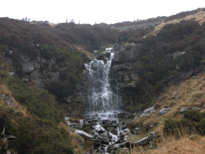 Returning to the main Nant Drysiog waterfall, then taking the zig-zagging path on the other side. It heads up to a connection with the clifftop path, then swings right almost invisibly beside the remains of a wall. It climbs up to the base of this waterfall, where a proper path heads to the left to the car park - passing the remains of a very old village, and several disposed cars. What a nice ending.
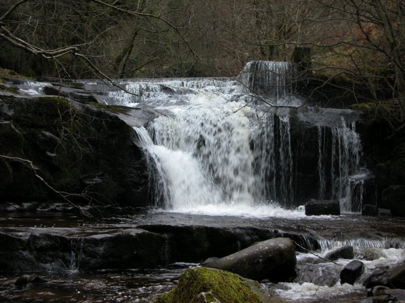 The lowest waterfall, with the man-made weir at its top.
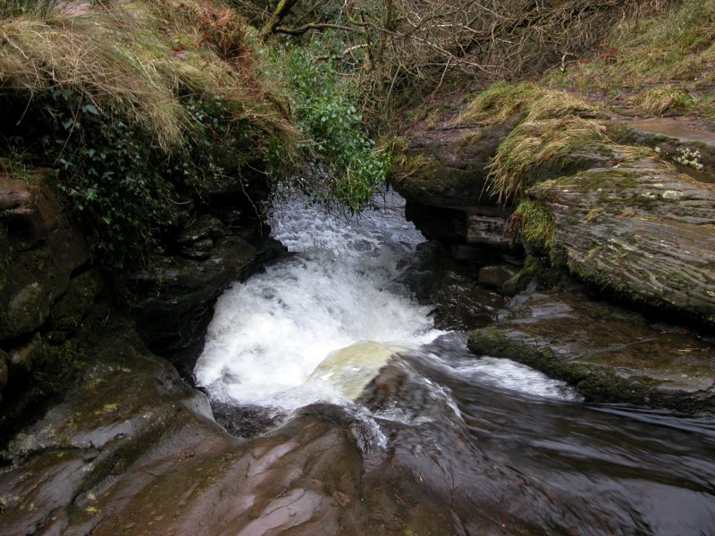 Water chute (looks best from the top).
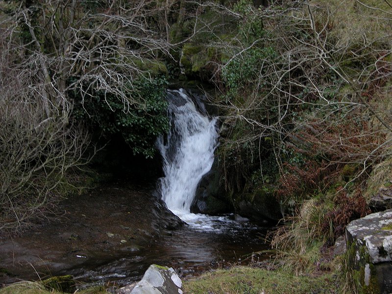 A little waterfall signifies Nant Bwrefwr joining from the left.
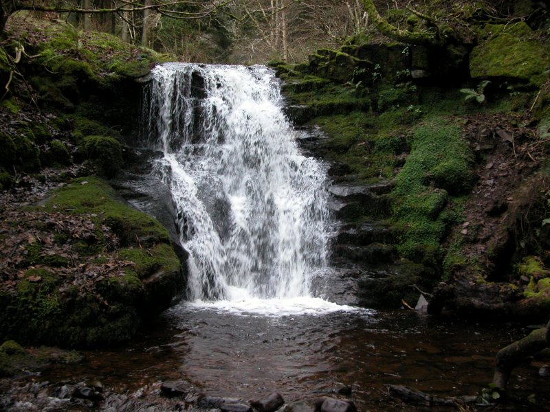 Just above it is Nant Bwrefwr's bottom waterfall, tucked just out of sight of the easier path on the other side.
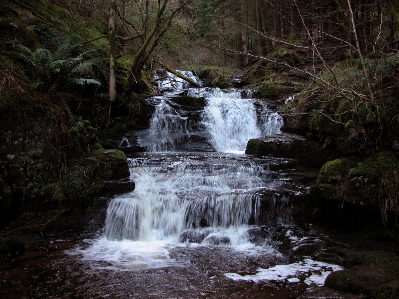 The cascades on the other side of the path, the first part of Nant Bwrefwr seen by those following the Beacons Way.
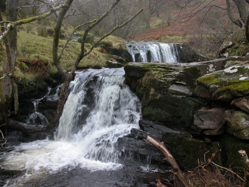 Upstream of the Nant Bwrefwr confluence, the first waterfall in the Caerfanell/Blaen-y-Glyn valley is this double waterfall.
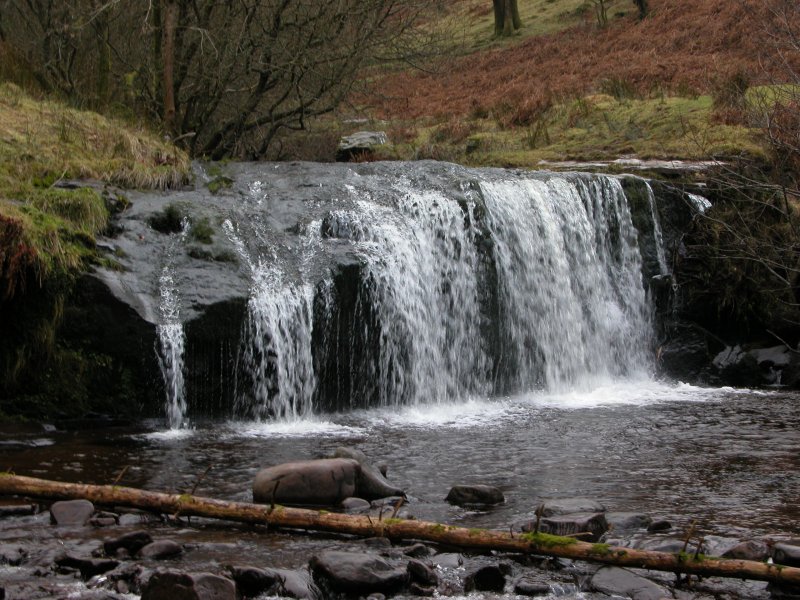 The upper of the double-waterfall.
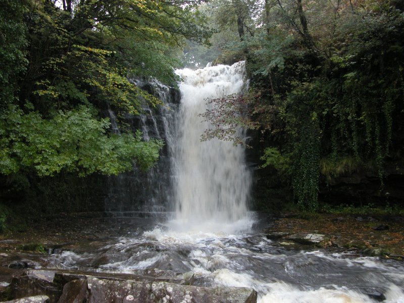 Then the obvious and impressive main waterfall (taken in much higher water conditions).
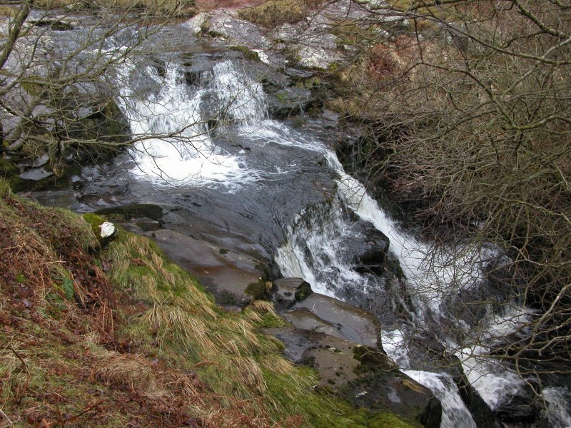 Where the easy path ends is this cascade.
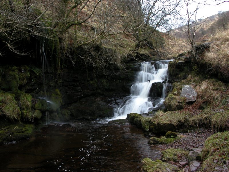 Almost obscured from the easy path, and separated from the muddy path by a slope covered in deep mud, is this graceful secluded waterfall.
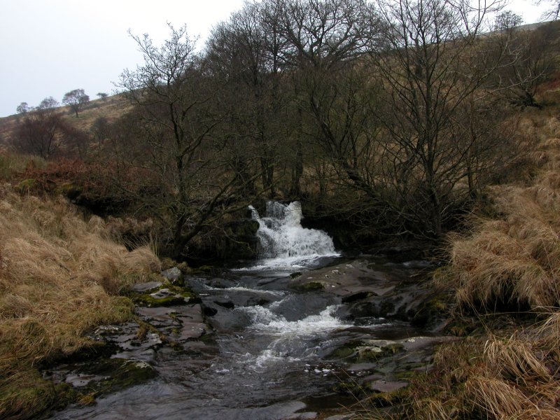 A small cascade above the waterfall.
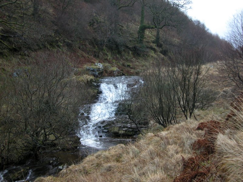 A slightly larger cascade above it.
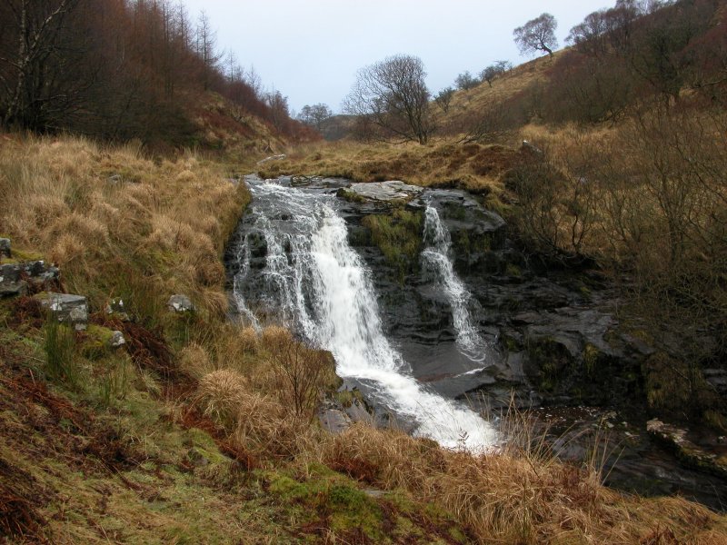 Though really a cascade, this one earns the label "waterfall" on the map.
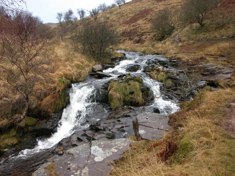 Cascade.
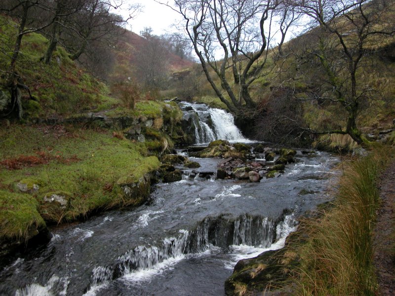 Cascade.
 Cascade.
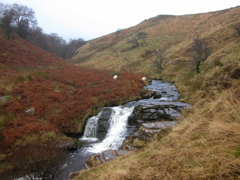 Cascade. Does anyone look at file names, I wonder.
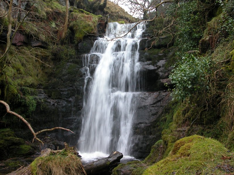 The valley develops a narrow gorge, which ends at this waterfall - significantly bigger than anything since the main waterfall, and well worth the effort and mud to get here.
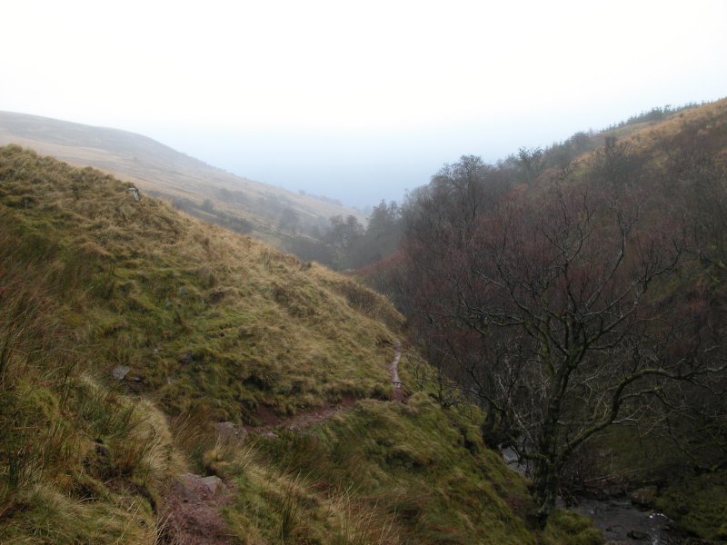 Looking back down the Caerfanell/Blaen-y-Glyn valley. The name is quite confusing, as the river is called Caerfanell at its top and bottom, and Blaen-y-Glyn while it passes through the forest, as well as one of the branches at the top. Since it seems nobody can make up their minds, I call it both, and hope you are left as confused as I am.
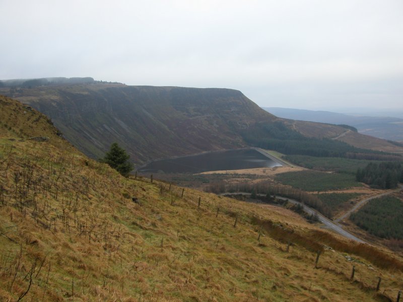 The 180 metre scarp of Craig y Llyn. The trails from the clouds are just catching the top of the mountain ... er ... metric hill - just.
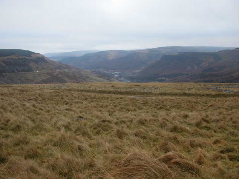 Blaenrhondda.
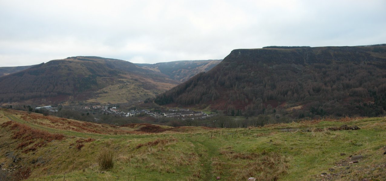 The view over to Blaencwm, beside Pen-pych.
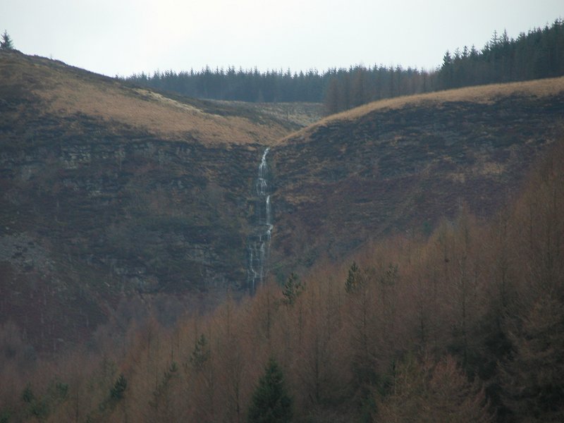 The tiny town of Blaencwm is dominated by this escarpment, and the Berw Nant yr Ychen waterfall (often mislabelled as the Pen Pych waterfall). There is ample parking on the Penpych Woodland Park site, part way along the valley. From there, the path heads the wrong way then zig zags up the side, before aiming uphill for the waterfalls. Even a wheelchair could follow the first part of the path, though it might need help to get past the barrier at the car park.
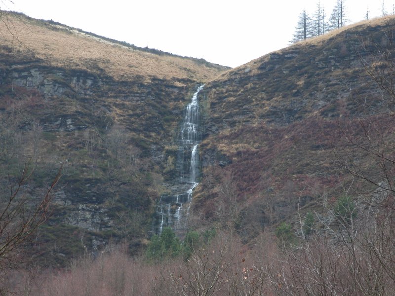 The trees are kept clear in a couple of places, giving a good view of the Berw Nant yr Ychen, which I am told is called the Virgin Falls by ice climbers. Despite normally having very little water, it would appear to be the tallest waterfall in the area, with a the visible parts having a total height of nearly 30 metres (making its total height greater than Sgwd Henrhyd). However, it is significantly broken into three significantly separate sections, with the largest being about 15 metres.
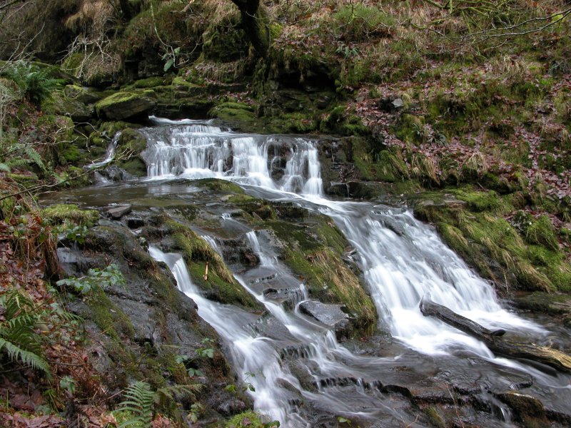 Below the main path, another path fails to get a good view of these cascades, but if you don't mind getting your feet wet, they're not far upstream of the lower path's bridge.
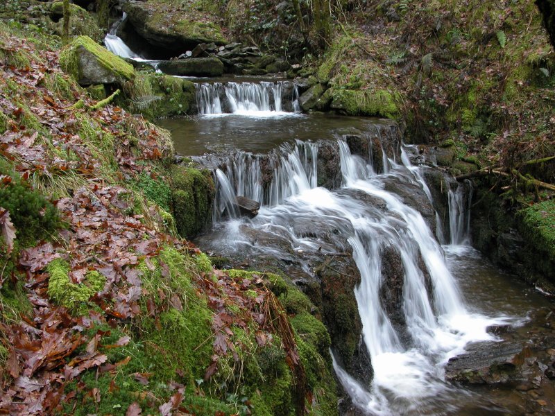 The stream here is called Nant Berw Wion (above the waterfalls it is called Nant Lluest). We were not able to find what Wion means, but berw means "boiling". Cywion means chicks. Perhaps it's a really odd mutation and this is the stream of boiling chicks. But perhaps not. (It is of course more likely to be a normal mutation of the name Gwion, so it would be the stream of Gwion's boiling [liquid].)
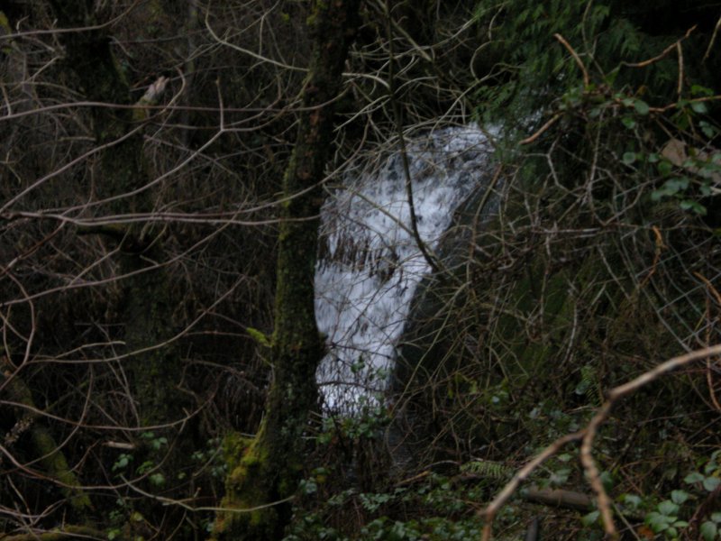 The easy main path ends at a balcony with a view of the main waterfall. Right under it is a noisy cascade that sounds big and impressive, but is just this obscured little thing. From this point on, the path is still easy enough for children, but not usable by wheelchairs any more.
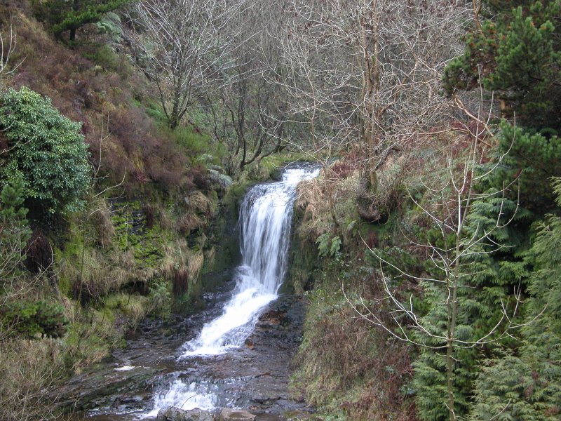 The small cascade above the balcony.
 Crags on the escarpment above Blaencwm, rising about 300 metres over the town.
 A little further up the path is the lower main waterfall, whose cascade would normally be hidden behind trees in summer.
 The dominating Pen Pych waterfall, the only one any of the summer visitors seem to remember. This view comes from the balcony. The waterfall is quoted as 70 feet - around 21 metres. On the 1:10'000 map it appears as Berw Wion, but locals simply refer to it as the Pen Pych waterfall.
 The path passes within easy reach of the waterfall base.
 The cliff makes a dominating amphetheatre surrounding the waterfall. The path heads over towards Pen-pych (the mountain), and can be followed to eventually meet up with the clifftop view mentioned in the Blaenrhondda walk, at a bridge over the Rhondda Fawr.
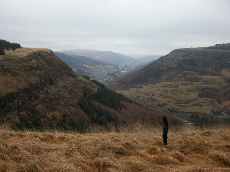 Instead, I take a path in the opposite direction, and cross the stream at the head of the waterfall - the path is basically the remains of a forestry track. Hidden rocks, branches and puddles, with tall grass covering them. The second half - after crossing Nant yr Ychen - is not suitable for small children. Stream crossings may be too dangerous depending on water levels.
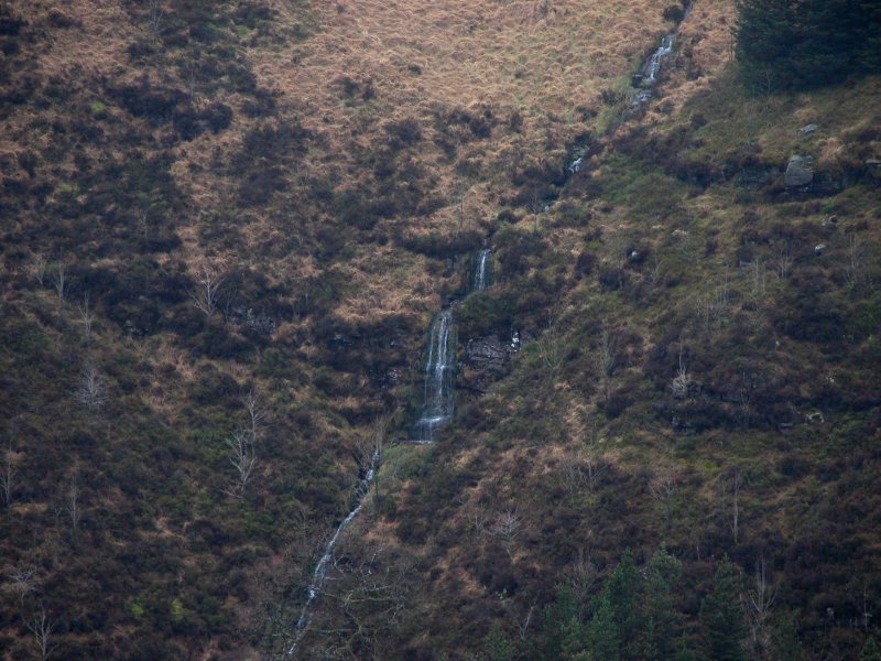 Small waterfalls draining Cawsa Carn-saer. "Carn" in this context probably means "notorious" not "cairn", making this "Cheese of the Notorious carpenter". I think somebody might have been having a joke with the surveyors... Of course, it could also mean "curds of the cairn mason", as in, the place that supplies the person who builds cairns with stone (assuming curds metaphorically means supplies-of-the-trade). But really, it is a bizzare name.
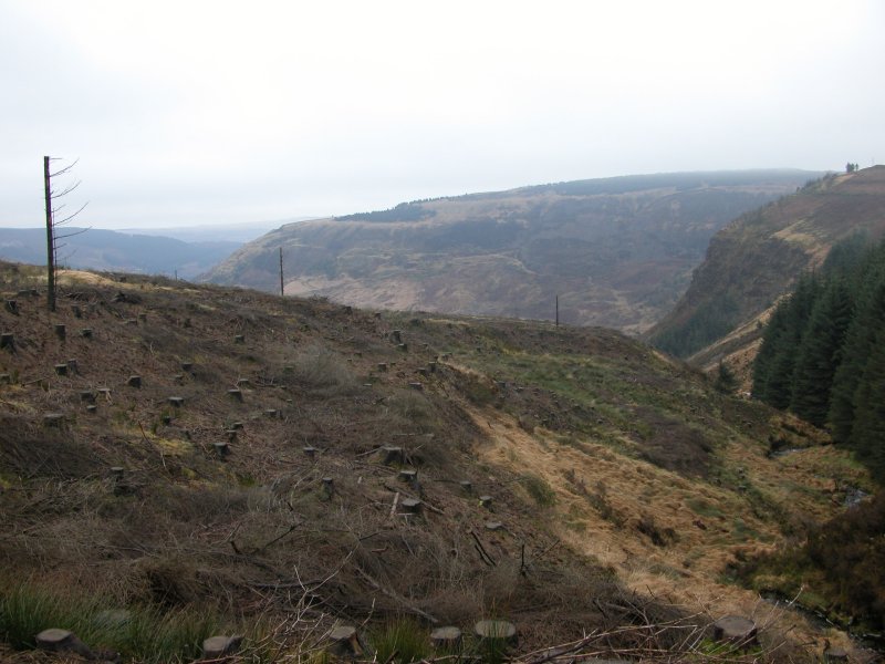 The route ends at Nant y Gwair, a small stream (the third proper stream crossing so far). There is no path along the stream here, and given the nature of tree felling, the difficulty can be increased by fallen branches. Upstream is followable - stop just after a small but significant stream joins from the left.
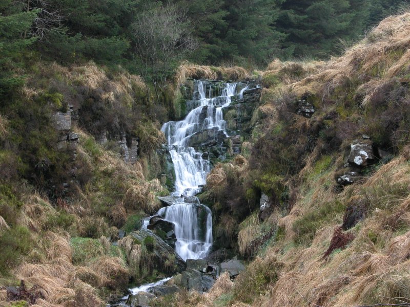 The upstream direction is shown on the 1:25'000 map as having waterfalls. This is the upper one.
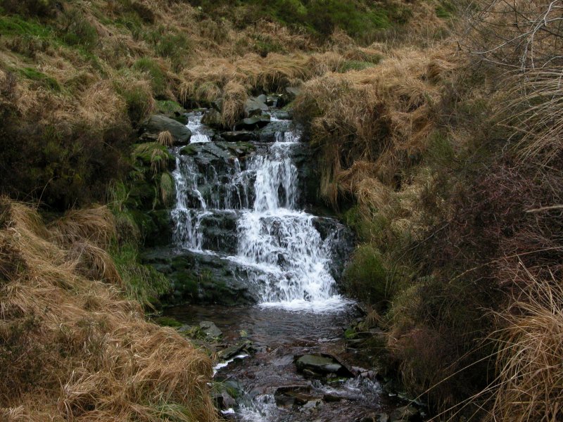 Small cascade below it.
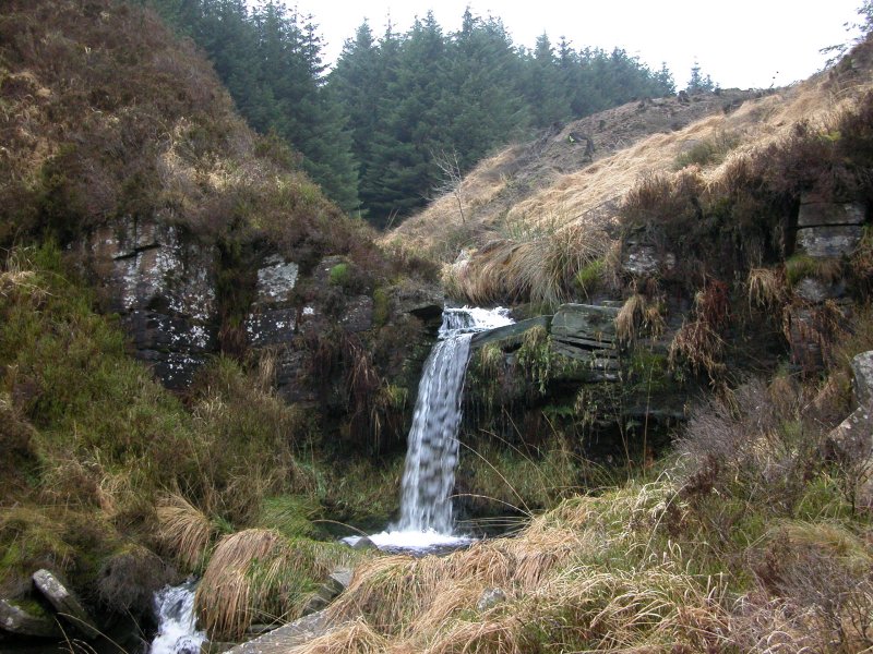 A small waterfall, with all the characteristics of a large waterfall, shrunk down to 2 metres.
 Cascade.
 The downstream direction looks easy at first, and starts with some small cascades.
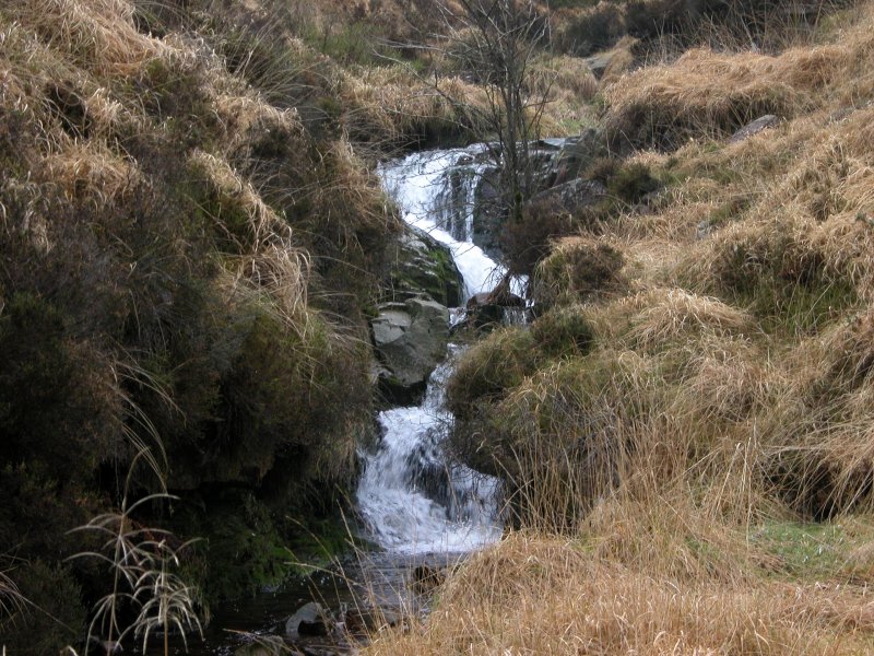 Cascades.
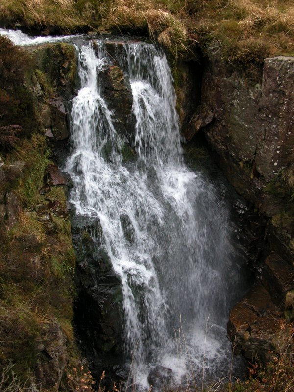 Then the water plunges into a narrow canyon, down a proper waterfall. The map does not show a waterfall, and for a good reason that I want to reiterate. Approaching these waterfalls is dangerous. The terrain makes it extremely hard to get a reliable hold, and even harder to see where such holds might be. Enjoy the pictures, but do not try to copy me.
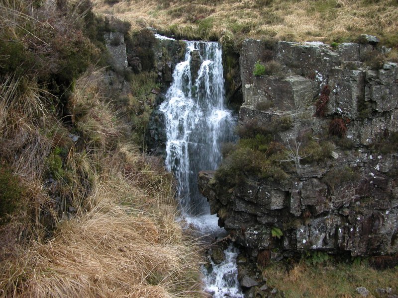 The canyon waterfall.
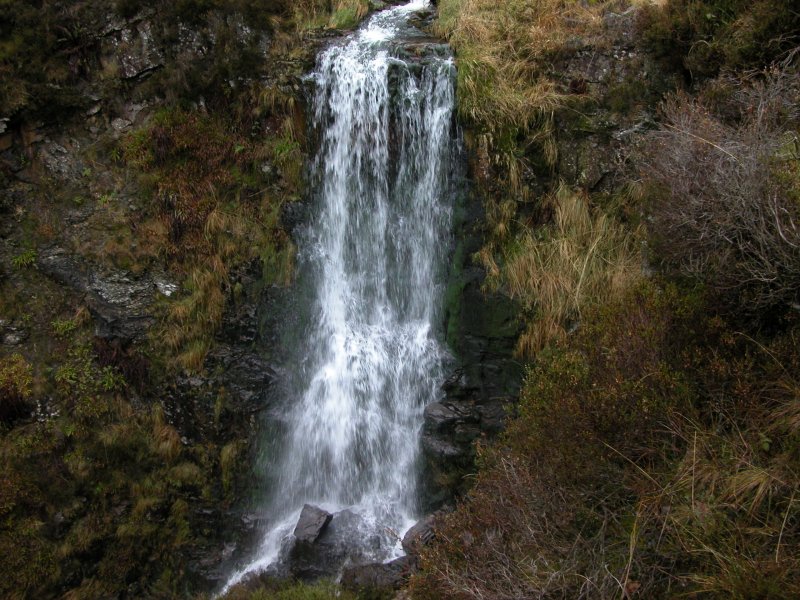 Immediately below it is a larger waterfall. This one was very hard to reach, requiring a partial descent of the cliff, relying on heather for handholds - do not try to get to this viewpoint.
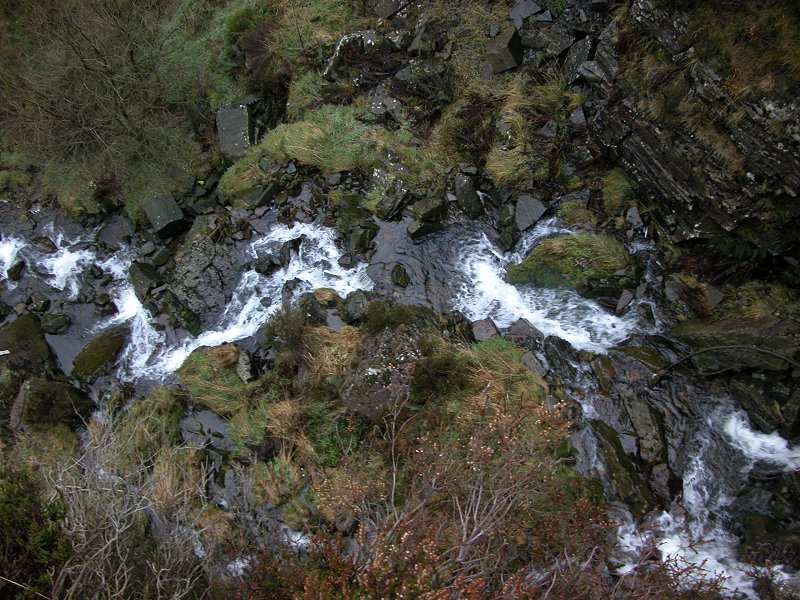 Below the tiny balcony I had reached, several smaller cascades continued downwards.
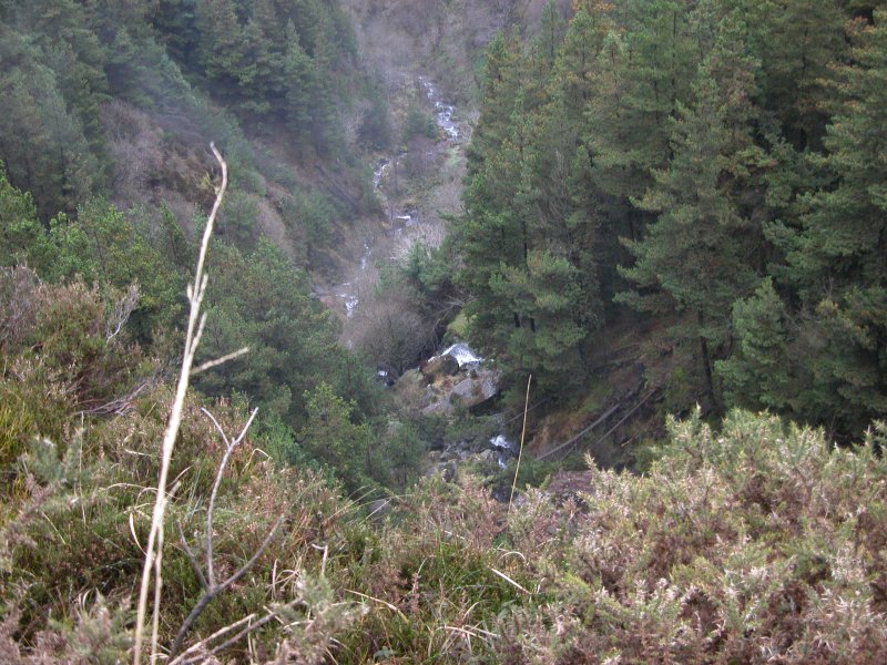 A long way below my balcony (see where the tops of the trees are), the stream cascaded down another drop. It didn't sound like a proper waterfall though, and I was not prepared to risk getting down to it to find out.
 As I walked back, a lonely cloud slowly climbed up through the trees, to meet the cloudbase just above.
 Follow the Sgwd Gwladus path from Pontneddfechan. When the junction between the Nedd Fechan and Pyrddin is reached, cross the Pyrddin, and follow its right bank, to reach the top of Sgwd Gwladus. Here it becomes obvious why river crossings are needed; the cliffs swap from side to side of the gorge, with the river against the base. Every time the cliff swaps sides, cross the river.
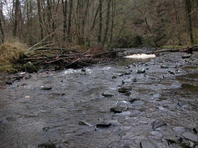 The first river crossing, clearly not as fierce as it is made out to be. A pair of walking poles certainly helps with balancing on the slippery stones, but they're not needed.
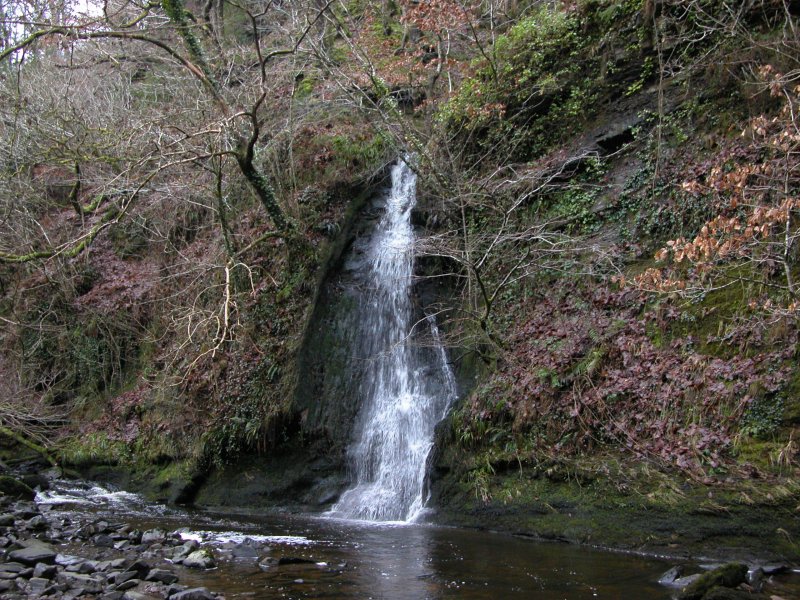 One of the many little waterfalls that adorn the sides of the gorge.
 The third crossing. Remember that this is winter water level. After a while of dry weather, the water is even lower, but the waterfall is not so good. In flood conditions, it would be much more difficult, and you choose to follow the route at your own discretion.
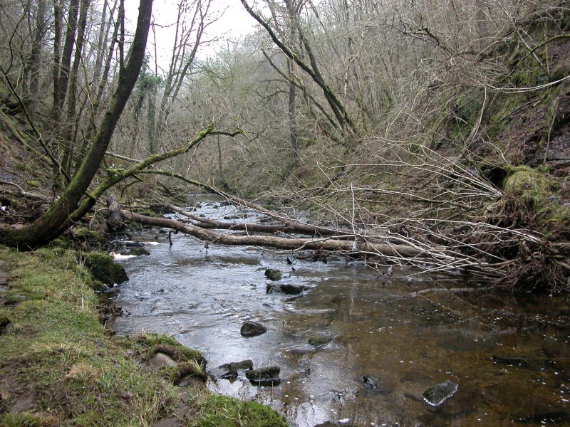 The gorge narrows, and the waterfall can be seen ahead. For the best view, you need to cross to the right bank here. I used this convenient fallen tree, but there are enough rocks to cross using those instead, though the water is a little deeper if you slip in.
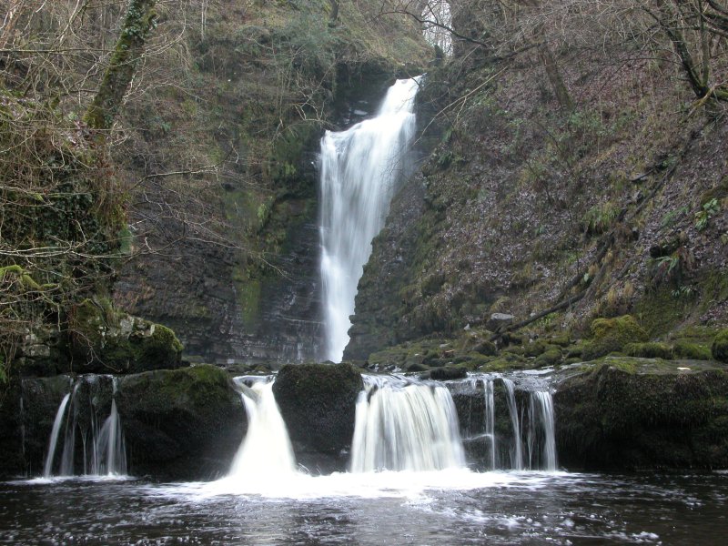 The impressive waterfall is guarded by this small cascade with its deep plunge pool. This shot needed me to cross the river again to take the picture, but for normal viewing, there is a path a couple of metres up on the right side of the pool. It looks impossible from a distance, but is easily followed (or at least, I had no trouble with it). The upper part that looks like a distant waterfall much higher up, is actually just the sky.
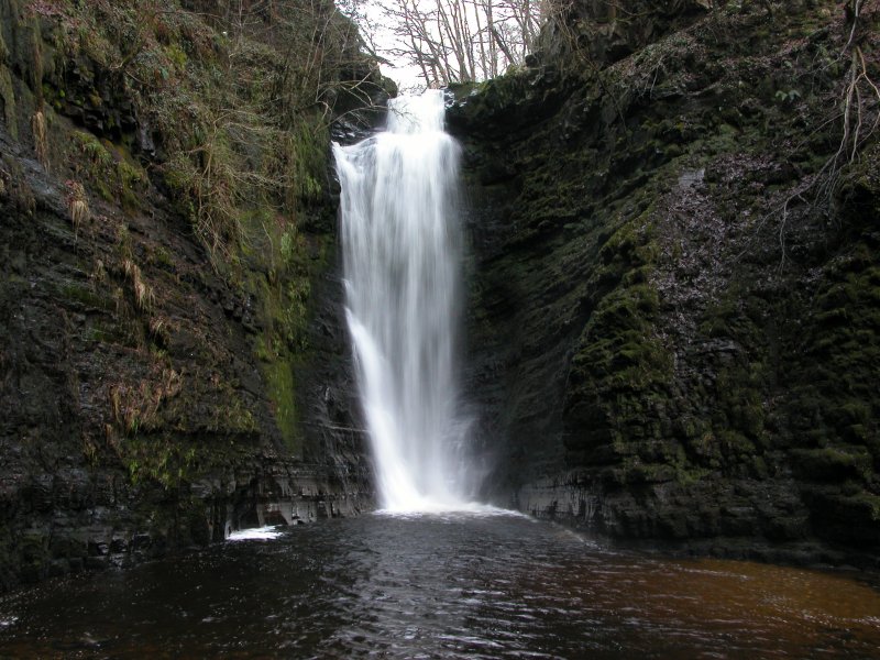 Once level with the base of the main waterfall, cross the river again to get to the viewpoint. The situation is hard to convey in a picture; the experience of being in a narrow canyon, with this thundering waterfall towering over you, thrusting the wind through the canyon, and the spray into your face. It's an awesome feeling being here, overshadowed by the power of the water. Those who describe this as a graceful or pretty little waterfall, went here in the wrong conditions, with only a low amount of water.
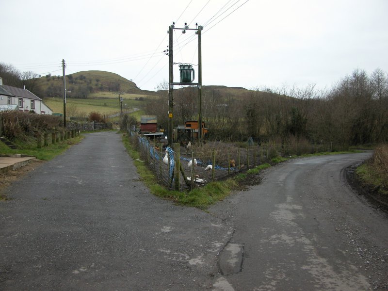 I started in Penderyn, though that's really not needed, unless you want to view the first waterfall shown here - the main waterfalls can all be seen while visiting Sgwd yr Eira. The path starts here at this triangle of roads (the path is at the end of the road on the left seen here). The 1:25'000 Explorer map shows an access information point in the middle of the triangle. I tried asking the chickens, but they did not have any useful information to share.
 The path begins following an obvious track, skirting the edge of Moel Penderyn (371 metres). After a while, the path branches off to the right, then a choice of the old path leaving to the right, and the new path heading left. The old path is extremely boggy (marsh over half a metre deep) and should not be used (how do I know that, you may well ask). The new path crosses an open area, then reaches a fence, which it then follows.
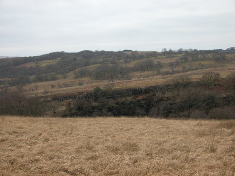 Once within sight of the top of the gorge, the fence turns sharp right towards the gorge, with the path continuing ahead directly to Sgwd yr Eira. Crossing a style and heading diagonally across the field reaches the first waterfall, and a relatively easy descent into the gorge. The old path along the gorge follows the fence then turns left at its next corner, slowly descending into the gorge - this path is in very poor condition - barely a sheep track, and has been diverted.
 A short section of dry valley in the gorge, with the entrance to Ogof Tram Trucks - part of the Ogof Afon Hepste system - in the pool in the picture. The cave system is almost entirely divers-only.
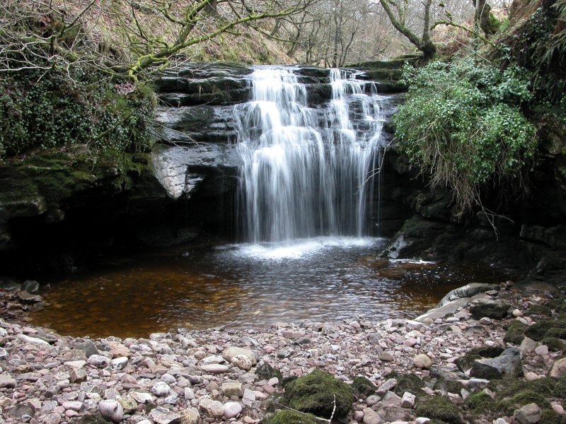 "Upstream", a waterfall with very little water plunges into a deep pool, where the water disappears. This is the stereotypical cave-behind-the-waterfall, as just behind the left side of the waterfall is the entrance to Ogof Tarddiant Hepste - another part of the same cave system. Although this would appear to make it possible to crouch in the cave behind part of the veil, the veil only extends far enough for that at times when the water level is too dangerous to attempt it.
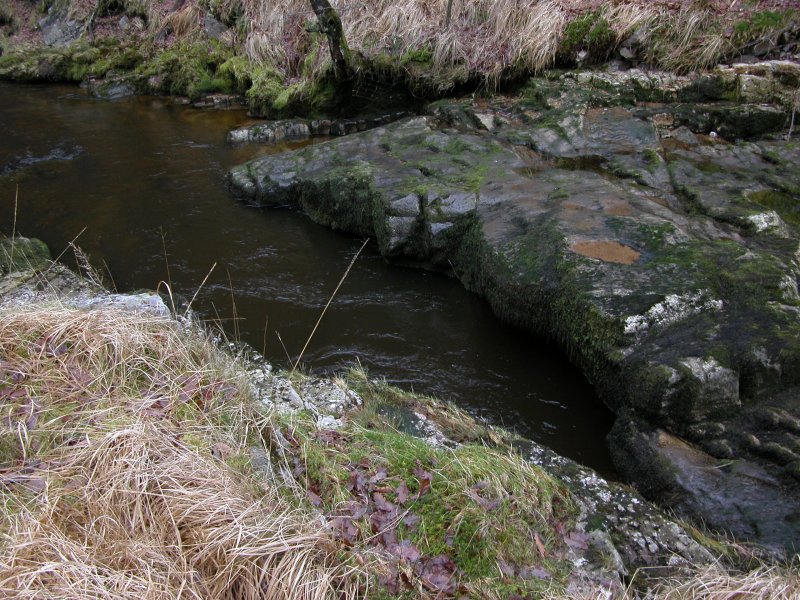 "Downstream", a narrow slot issuing a vast volume of water is the Hepste Resurgence, where the water from various sinks along the river returns to the river.
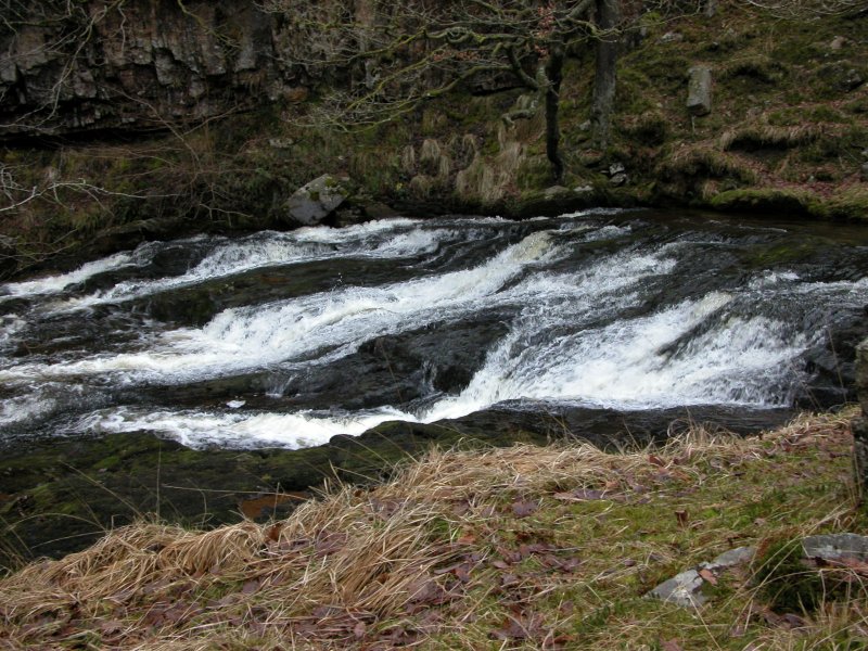 Cascades on the reconstituted river.
 The gorge base cannot be followed without appropriate equipment, so I stayed on the cliff top, descending repeatedly on the steep, slippery, moss-covered slopes to get pictures of various cascades. It's not really worth it, but sometimes it feels nice to be perched far above the river taking pictures like this.
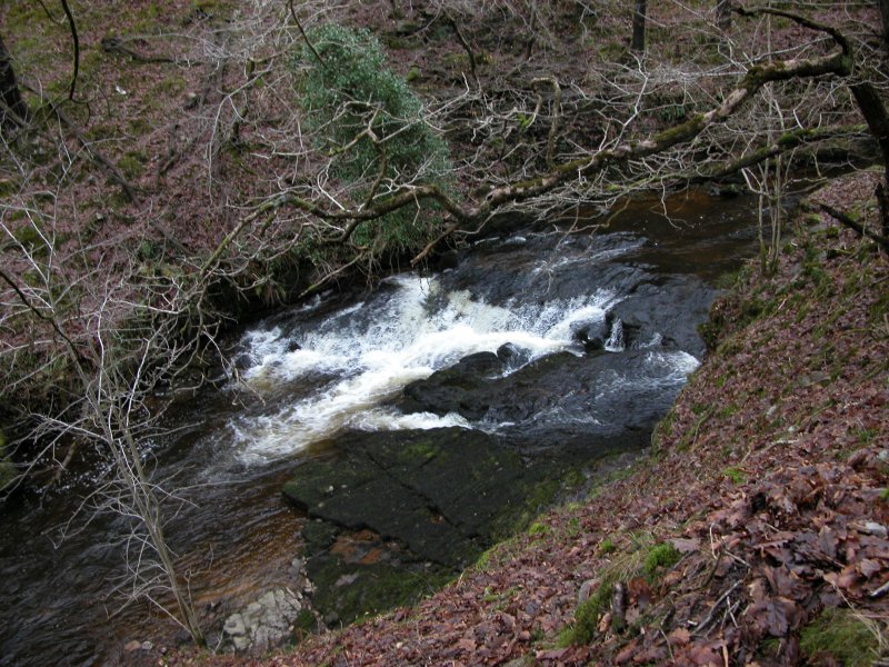 Another descent, another cascade.
 Deceptive. It looks like the sides might be followable at low level, but the sides keep becoming tall cliffs again.
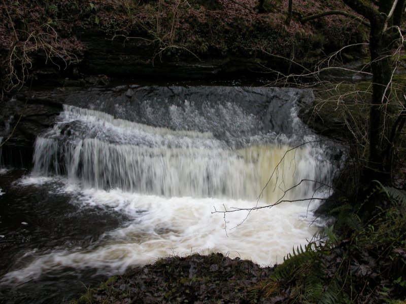 Sloping cascade. I was getting very tired of the repeated ascents and descents of the gorge by now - even with the old path now having made it half way down the side.
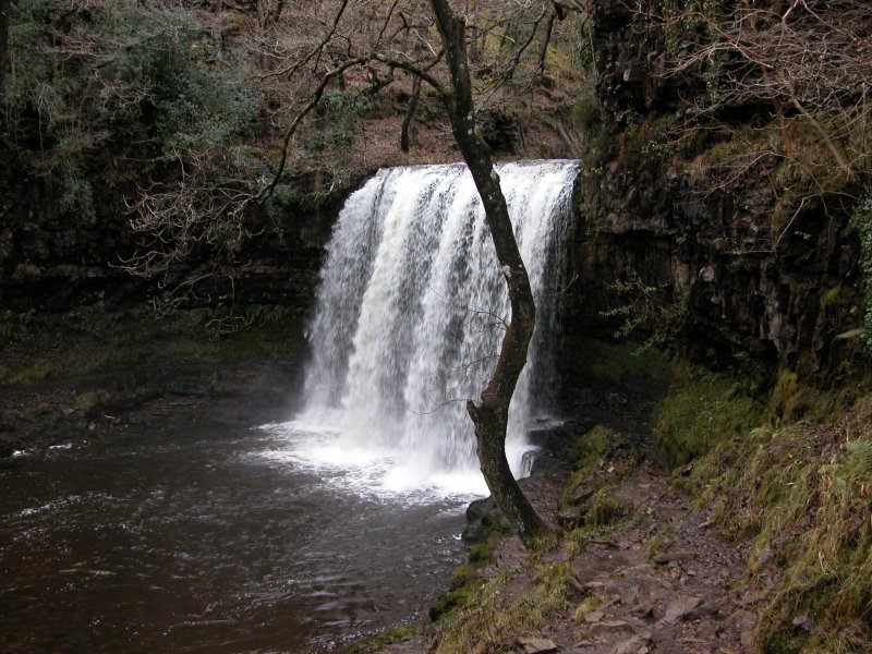 After joining the main path, it descends to Sgwd yr Eira (which was previously confusingly referred to as the Upper Cilhepste Fall, or just the Cilhepste Fall), passing behind it on the now re-opened path. Once on the right bank (facing downstream), I started looking for the way to the lower waterfalls. I asked a few regular visitors, who all failed to locate the path. Some who were sitting on the path said it could not be followed to the waterfalls. One pointed up to the top of the path up to Sgwd Clun Gwyn, saying there was a way down from there. There wasn't. The map agreed. It was wrong. The path is easy; once at river level on the right bank, just stay at river level. It leads directly to the top of the next waterfall. For the last two, a short scramble down a rocky patch leads to convenient viewpoints in front of the waterfalls. So easy, and yet always ignored.
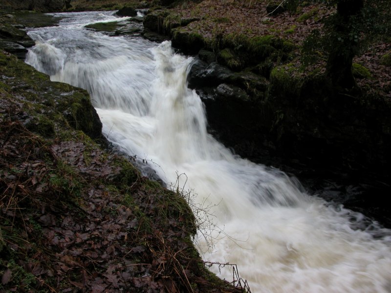 Cascade at the start of the waterfalls.
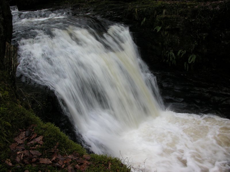 Upper Cilhepste Fall. Or ... Oh, stupid names. Whatever. Since Sgwd yr Eira now has a proper name, this one is now the Upper Cilhepste Fall. Accept it.
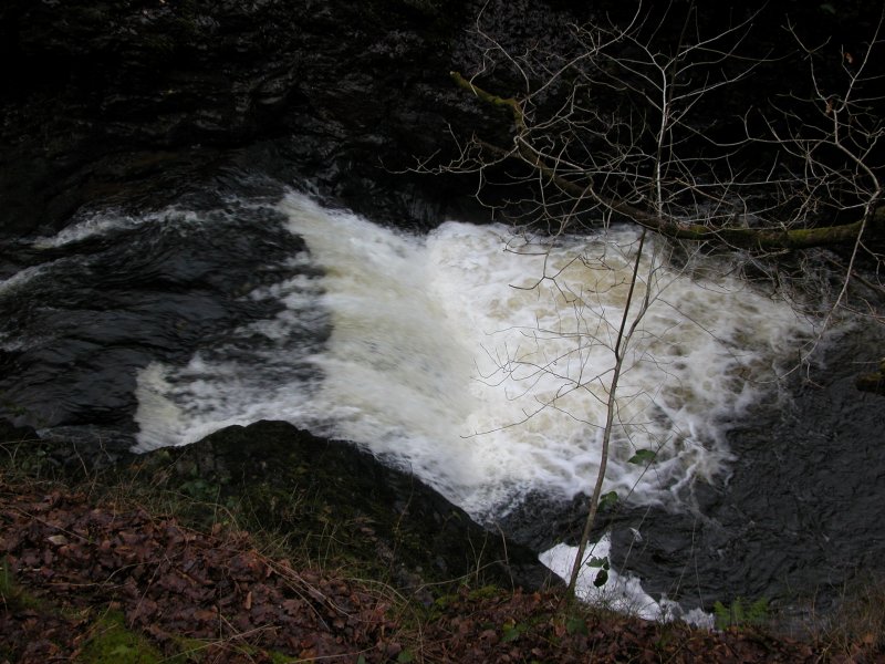 Cascade below the upper waterfall.
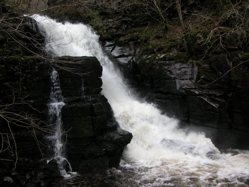 Cilhepste Falls. Like Sgwd Einion Gam, the viewpoint experiences the full power of this waterfall. Even in low water conditions, it is always foaming and white, thundering into a narrow canyon, blowing the spray into your face.
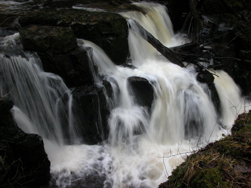 From power to grace. The Lower Cilhepste Fall. The river now becomes subdued, and joins the Mellte, heading for Pontneddfechan.
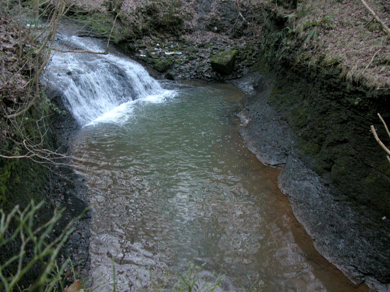 Pwll y Crochan is actually a boring little cascade with a long plunge pool, in a low-walled canyon, not worthy of the detour to see it. Viewing it involves hanging onto trees on the edge of the canyon. Half way up the stepped path is a dismantled railway line, which I mistakenly assumed would be the easy way downstream. Turned out it was heavily overgrown, and quite unpleasant.
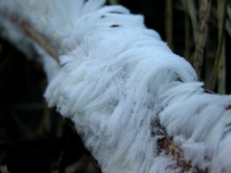 Frosted twigs on the path.
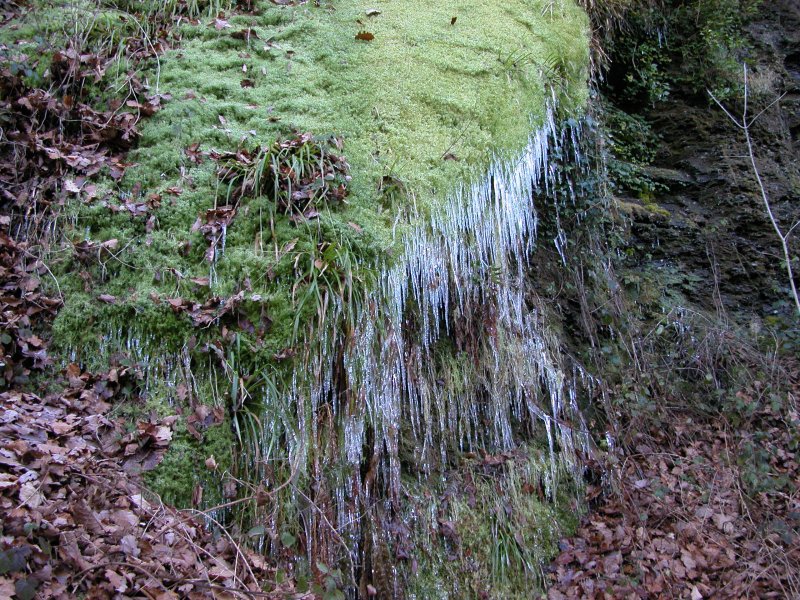 Where the railway began to climb up, I dropped down to the river, beside this bank of mossy icicles.
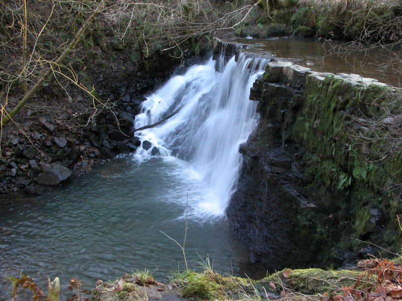 Just downstream was the far better waterfall, the only waterfall worth visiting upstream of the Sychryd Gorge. It seems there might be a path from the gorge to this waterfall, staying not far above the river.
 Heading back upstream, the path heads through the open access land, eventually joining the main footpath above.
 The river plunges down a cascade (mostly hidden by a fallen tree) into a canyon below the path.
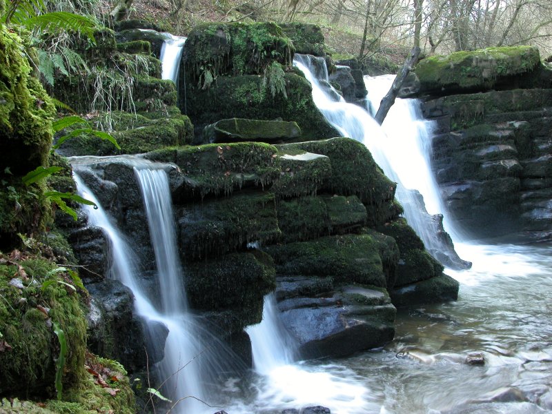 Just above the cascade, the path passes right by the top of this graceful waterfall, which seems to be formerly known as Pwll Crochan.
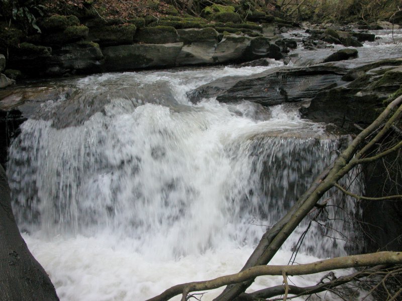 The map shows another waterfall. The path becomes unmaintained, then fizzles out, requiring clambering over fallen trees, around outcrops, through brambles, and finally a river crossing to get to the waterfall. Turns out it's a pathetic little cascade, with the view blocked by a large fallen tree. It's really not worth the effort involved in getting here. I checked all the way up to the Devil's Waterfall (along an equally bad path) just to make sure there was nothing else worth looking at.
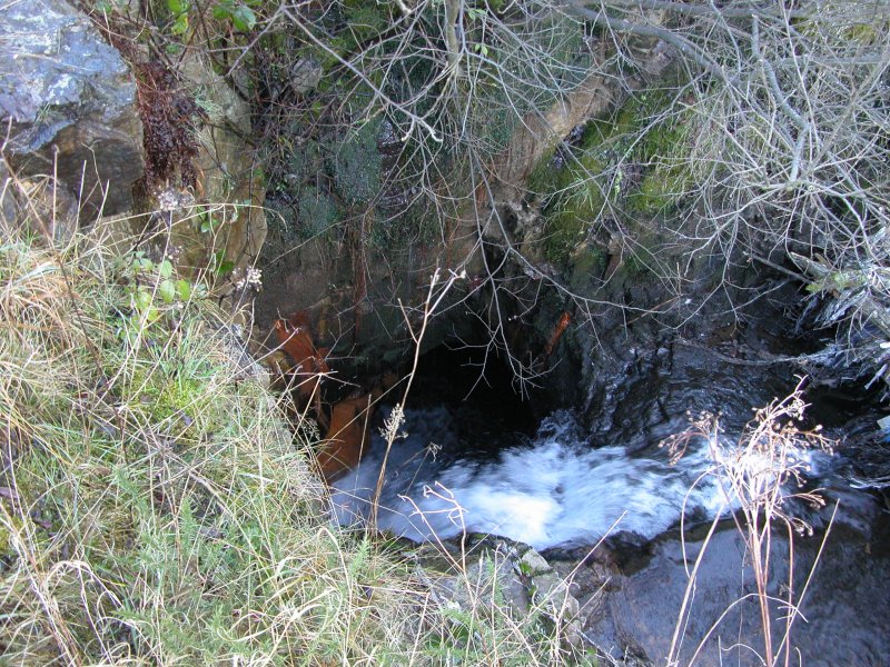 Near the top of the Clydach Gorge, the river falls down a pothole waterfall, and disappears into a short adit through the caprock called Coal Tar Cave.
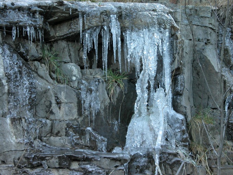 A frozen little waterfall near the adit.
 Just a little downstream, more streams cascade over the cave, partially frozen, with frozen plants looking like bizzare arthropods.
 Another view.
 The waterfalls over the adit resurgence, the site of what was once the Pistyll Mawr waterfall.