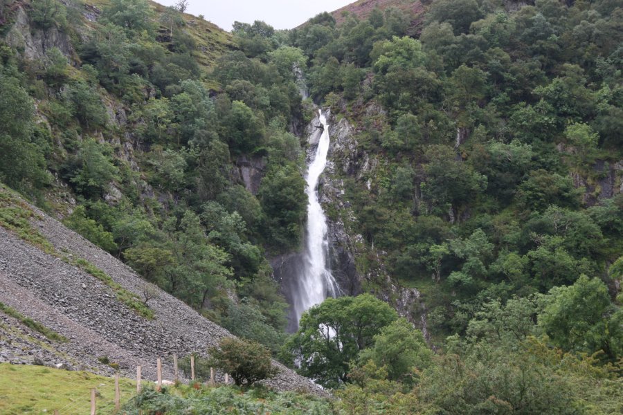
Including Aber Falls/Rhaeadr Fawr, Rhaeadr Fach/Rhaeadr-bach.
From Cardiff, take the A470 to Conwy. From Conwy, take the A55 Westbound (initially signposted to Conwy). At junction 13, exit towards Abergwyngregyn, and immediately go straight ahead at the crossroads. Take the first right, signposted to the waterfalls. After just over half a mile, park either before crossing the bridge, or turn right into the picnic area afterwards. A fee is charged for parking. SH 6623 7200.
The majority of this route follows the North Wales Path, leaving it near the end of the loop. Route markers may therefore be followed where available.
If you parked before the bridge, take the path that leads ahead when the road turns left to cross the bridge, follow it to a footbridge over the river, and turn right on the track on the other side. If you parked in the picnic area, walk back down the access track, past a small path crossing a footbridge on the left, to the major track junction near the river, and turn left.
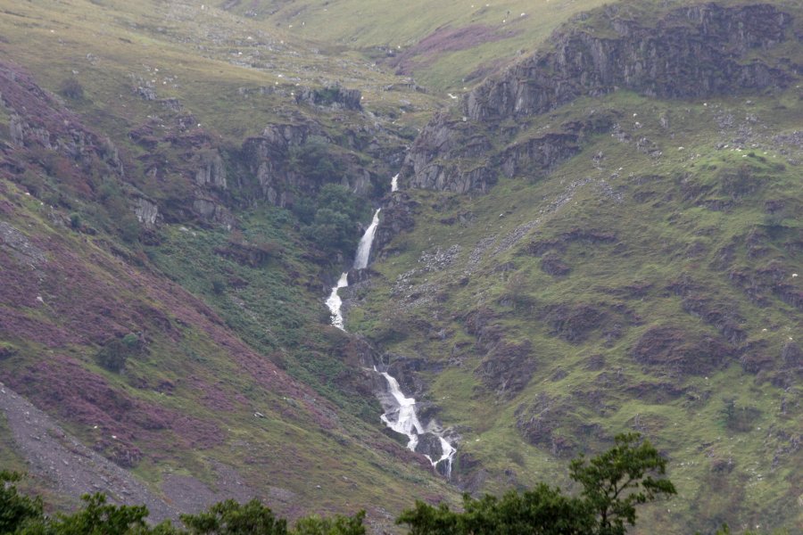
Either way you should now be on the correct track. Shortly afterwards, the track splits. Take the right branch. Follow the track for 2 km, passing a footbrdge to the right shortly before the end, to the base of the main waterfall of Aber Falls; Rhaeadr Fawr. For various parts of the path, another set of waterfalls should be visible on another stream to the right; Rhaeadr-bach (or Rhaeadr Fach when spoken normally).
As an optional extension for experienced walkers, it is possible to approach the top of the waterfall, where there are many more waterfalls. Other walkers should skip this paragraph. Before reaching the footbridge, a stepped path branches off on the left, then rejoins. 100 metres later, pick up a path that doubles back on the left, ascending the steep slope below a clump of trees to the edge of some forestry. Turn hard right and locate a path crossing the scree slope (several strands of path cross it at various heights, all joining up afterwards), slowly ascending to the top of Rhaeadr Fawr, where there are several smaller waterfalls. Follow this path with great care, as it is quite exposed. Return to the main path below the waterfall.
Note that I have not followed the paths beyond here, and their grading has not been confirmed. A map is advised. Return to the bridge path, and follow it over the river below the waterfall. It swings left to reach the base of the waterfall again. Take the path to the right shortly before the waterfall, which crosses a footbridge at the base of Rhaeadr-bach. Continue following the path, ignoring smaller paths, as it curves right to head back down the valley, eventually climbing above the valley's woodland, and running along the bottom of fields as a more substantial track. It passes under some pylons, then 750 metres later, the track splits, just after entering another field. Take the right branch, finally leaving the North Wales Path's route.
350 metres later, shortly before the track turns a hairpin bend, take a path to the right, to run down the field, parallel to the track's new direction. (There are a couple of other paths before it, but these double back much harder to the right.) The path is well defined, and drops all the way down to valley bottom. Another path joins from the left, and 30 metres later, the path joins the road. Turn right onto the road. Follow it back to the start of the walk.
| Waterfall | Grid reference | GPS coordinates | Image |
|---|---|---|---|
| Aber Falls/Rhaeadr Fawr | SH 66845 70024 | 53.210549°N, 3.995345°W | |
| Rhaeadr Fach/Rhaeadr-bach | SH 66485 69647 | 53.207072°N, 4.000574°W | |
Whilst every care has been taken in the compilation of this description, neither the author nor his fellow walkers can accept responsibility for loss or injury arising from any errors, omissions or inaccuracies in this description. This description is intended as a guide only, and you should select a route to suit your own abilities, at your own discretion. Ability requirements are a guide only. Route maps are approximated. You follow this description at your own risk.