Including Rhaeadr y Bedd, Llyn yr Oror.
From Cardiff, take the A470 to Betws-y-Coed. From Betws-y-Coed, take the A5 towards Llangollen. After passing through Pentrefoelas, take the A543 to the left, towards Denbigh. After 5 miles (soon after having crossed a river in the middle of a moorland), turn left onto a narrow lane signposted to Rhyd-y-Bedd. For Rhaeadr y Bedd, follow the lane past the Llyn Aled reservoir, cross over the upstream end of the Aled Isaf reservoir, and park just before the dam. SH 9155 5974. For Llyn yr Oror, continue over the Aled Isaf reservoir dam until a road doubles back hard on the right after 1.5 miles. Take the road on the right, and park on the grass verge at the left bend shortly before the road crosses a cattle grid, where it becomes a farm track. SH 9217 6188.
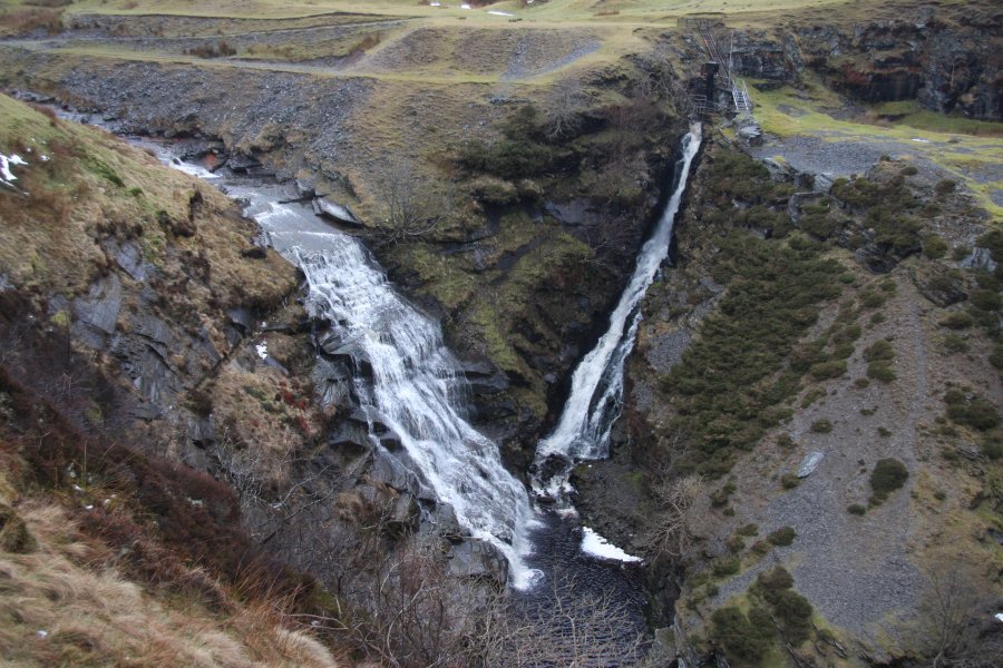
The two sets of waterfalls need quite different conditions. Rhaeadr y Bedd is at the mercy of the Aled Isaf reservoir. If the reservoir is overflowing, both of its waterfalls will run, and look quite impressive. If the reservoir does not overflow, only the outflow waterfall will run, and the main waterfall will be dry. The reservoir usually overflows in winter, especially after long periods of rain. Llyn yr Oror needs exactly the opposite conditions if you want to get close to it, as it is guarded by some scrambles into the river bed. You should choose your approach carefully to suit the conditions, and always be prepared for the water levels to increase if the reservoir starts overflowing.
Rhaeadr y Bedd lies almost immediately downstream of the dam. Walk down to the river below the dam (on the right side when facing downstream - the same side as the parking area), and pick up the path that heads along the right side of the river from there. It soon skirts the top of the gorge, and the waterfalls can be seen from there, with the main waterfall on the left, and the outflow waterfall on the right. Below them is a weir. The walk ends once you have got far enough along the top of the gorge to see the waterfall. Return the same way.
If you would like to extend the route, most of the moorland around the reservoirs is open access and you could create your own walking route across it. In addition, there is a public right of way on the far bank of the river, leading to the access track to Llyn yr Oror, but I do not recommend visiting these as part of the same walk due to the different weather conditions they require. These options are not included in this walking route, and are not graded.
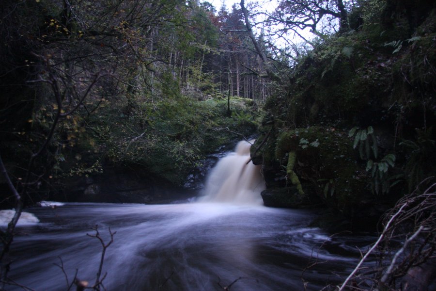
Llyn yr Oror lies on private land which is being carefully managed for environmental reasons by the landowners, with potential dangers on the site such as active forestry felling, and shooting for wildlife management. It is essential that visitors seek permission before attempting to access the site, to ensure that these dangers can be minimised when visitors are present. Prospective visitors can contact me using the details on the homepage, and I can pass on the contact details of the owners. The waterfall itself is quite difficult to access, and can only be visited by expert visitors.
The exact access route will need to be agreed with the owners, but perhaps the simplest possibility is to approach from the Clwydian Way. From the parking area, continue down the track over the cattle grid, turning right when it splits (at the Clwydian Way). After 150 metres, take a track to the left which passes through a gateway into private land (make sure you have permission), running along the side of a shallow, dry valley. The shallow valley soon gains a little stream. After 200 metres, the track splits, shortly before a wider section. Take the right branch, which descends past an overgrown track on the right, until it runs above the river.
When appropriate, descend the bank to reach the river. Follow the river bank upstream to reach the junction of the little stream and the river; the Llyn yr Oror waterfall may be seen a short distance upstream. To get in a better viewing position, carefully scramble down the crag at the end of the little stream, to reach the river bed, if water levels allow. Return the same way.
| Waterfall | Grid reference | GPS coordinates | Image |
|---|---|---|---|
| Rhaeadr y Bedd/Rhaeadr Fawr | SH 91568 59927 | 53.125448°N, 3.621894°W | |
| Llyn yr Oror | SH 92572 61436 | 53.139210°N, 3.607402°W | |
Whilst every care has been taken in the compilation of this description, neither the author nor his fellow walkers can accept responsibility for loss or injury arising from any errors, omissions or inaccuracies in this description. This description is intended as a guide only, and you should select a route to suit your own abilities, at your own discretion. Ability requirements are a guide only. Route maps are approximated. You follow this description at your own risk.