Including Washpool Falls and Water-break-its-neck - Llugwy.
From Cardiff, take the A470 to Builth Wells. From Builth Wells, take the third turnoff at the roundabout, along the A483 to Llanbister. From Llanbister, turn right onto the B4356 towards Presteigne. After just over 5 miles, at the first proper crossroads, where both side roads appear to be public roads, turn left towards the Llugwy Farm. (If you pass under a stone railway bridge, you have just gone too far.) Park near the Irish ford near the farm, or if there is not enough space, park on the grass verge at the crossroads. SO 1845 7290.
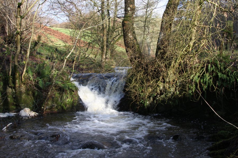
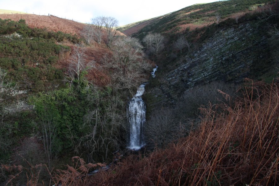
Follow the track over the Irish ford. Immediately after the farm entrance, there is a side track to the left. Just a few metres along it, the river can be seen dropping down the tiny Washpool Falls. Return to the main track (the right-most one) and follow it uphill to a track junction. Turn left, then take the first gate to the left into a field, and head over the field to the left to reach the edge of the Llugwy valley, where the field begins to slope more steeply. Turn right and follow the top edge of the steep slope (which is lined with gorse bushes), parallel to the main valley, slowly dropping down towards a deeply incised valley on the right. Hidden in a clump of trees is the Water-break-its-neck waterfall. (Access through that last field is allowed by the landowner.)
Since you're already up in the hills, you might as well walk up some of them. Return to the last track, and follow it to the left, through some forestry, to a junction of tracks, where Beacon Hill can be seen on the far side of a valley ahead. Take the track to the left, running along the outside edge of the forestry. It slowly skirts the head of the valley, ignoring various side tracks on both sides, to aim towards Beacon Hill. Just after passing the far corner of some fields, a path to the left leads up to the top of Beacon Hill. Return the way you came to complete the walk.
| Waterfall | Grid reference | GPS coordinates | Image |
|---|---|---|---|
| Washpool Falls | SO 18440 72977 | 52.348773°N, 3.198784°W | |
| Water-break-its-neck | SO 18282 73605 | 52.354394°N, 3.201256°W | |
Whilst every care has been taken in the compilation of this description, neither the author nor his fellow walkers can accept responsibility for loss or injury arising from any errors, omissions or inaccuracies in this description. This description is intended as a guide only, and you should select a route to suit your own abilities, at your own discretion. Ability requirements are a guide only. Route maps are approximated. You follow this description at your own risk.