
Including Pont-y-Pair Falls and Rhaeadr Garth.
From Cardiff, take the A470 to Betws-y-Coed, then the A5 into the Betws-y-Coed village centre. Just in front of the well renowned Hen Siop Pont Y Pair chip shop, turn right onto the B5106, signposted to Trefriw. Turn left at the other end of the bridge, then park in the parking area on the right, where a fee is charged for parking (there are many others in the village if needed, or free roadside parking in some places, such as further along the A5). SH 7916 5676.
WARNING: This route is no longer possible, as the Miners Bridge was washed away during flooding in 2020. Until the bridge has been reconstructed, the alternative route is to follow the road back over Pont-y-Pair, turn right on the B5106 and follow it until the speed limit changes to national speed limit. Take the path to the right, to reach the river, where just upstream are some cascades. Return to the road, and skip the next two paragraphs.
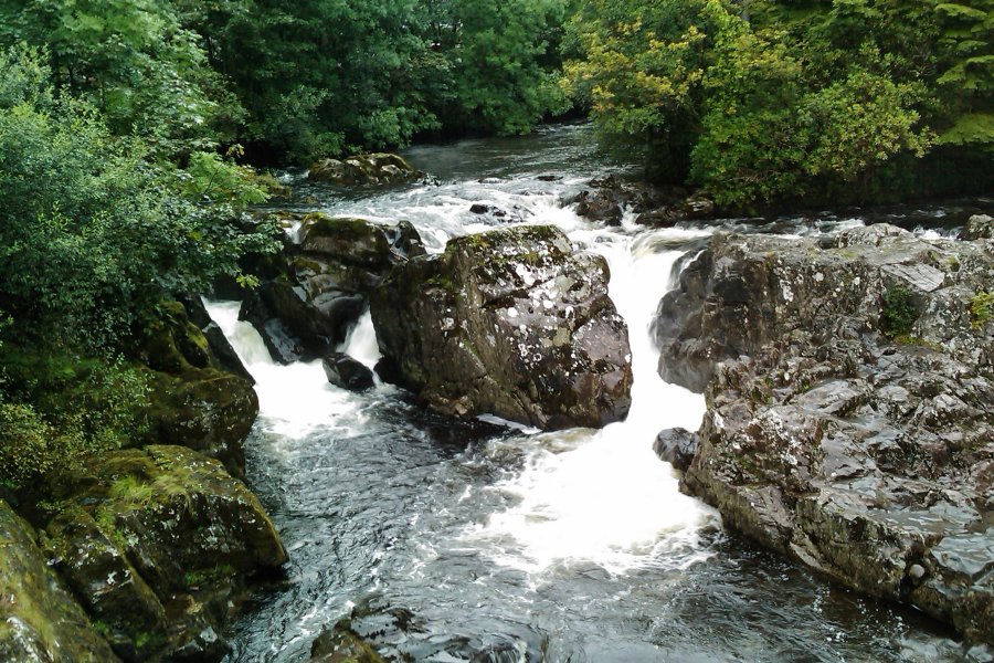
The Pont-y-Pair Falls lie under the last road bridge you crossed, and can be seen from the bridge, or from the river bank directly opposite the parking area. On the flat rock slabs on the riverbank beside the parking area is a 53 hole rock cannon - holes drilled into the rock, filled with black powder and used as fireworks. When you have seen what you want, follow the path running upstream along the right bank of the river (in front of the parking area). After the raised walkways end near a picnic area, take the riverside path hidden behind the picnic tables, which soon enters fields. After 700 metres it starts to develop a cliff beneath the path, and fairly soon, the Miners Bridge footbridge can be seen descending to the left. Be warned that in flood, this bridge can become completely swamped by water, and must not be used. Cross the footbridge, and take the path that climbs back up above the cliffs on the far bank to reach a junction.
Take a quick detour to the right. Shortly after another path joins from the left, look for a relatively flat area on the right without any undergrowth, which serves as a viewing platform for some cascades in the river. Then return to the junction. Follow the path that is now to the right (ahead when coming from the Miners Bridge) out to the main road.
Cross the main road into a small lane on the far side, and almost immediately take another small lane to the right. Follow this to a small parking area, where there is a path on the left. Follow it through the woods to Rhaeadr Garth. Beyond that, the path joins a track. Turn left on the track, then left again at the next track junction, onto a smaller path. Follow the path, which becomes a lane after a gate, out to the junction with the main road (the same junction as before). Turn right.
Follow the road down into the village, turning left onto the B5106. Cross the Pont-y-Pair bridge over the Pont-y-Pair Falls, and turn left to return to the start of the walk.
| Waterfall | Grid reference | GPS coordinates | Image |
|---|---|---|---|
| Pont-y-Pair Falls | SH 79131 56721 | 53.093967°N, 3.806452°W | |
| Rhaeadr Garth | SH 77619 56631 | 53.092814°N, 3.828984°W | |
Whilst every care has been taken in the compilation of this description, neither the author nor his fellow walkers can accept responsibility for loss or injury arising from any errors, omissions or inaccuracies in this description. This description is intended as a guide only, and you should select a route to suit your own abilities, at your own discretion. Ability requirements are a guide only. Route maps are approximated. You follow this description at your own risk.