Including Ffrwd Ferin and Nant Chwarelmelyn.
From Cardiff, take the A470 to the Llangurig roundabout. From Llangurig, take the first turnoff (left) at the roundabout, onto the A44 towards Aberystwyth. After passing the highest point at Eisteddfa Gurig, the road turns some tight bends as it drops to the bottom of the valley (a couple of small roads leave off on the first bend). As the froad completes its descent, a tiny lane doubles back hard on the left, near some houses. Follow it to the first farm track on the right, and find a verge to park on, out of the way of farm traffic. SN 7799 8190.
The waterfalls are tucked into a well hidden gorge in the middle of a very boggy moorland. The paths in the area are very poorly marked, and flawless navigation is required. Map reading ability and good visibility are essential.
Head up the track to the farm. At the back of the farm, take the track that climbs up to the left behind some trees. It zigzags up, staying on the left bank of a stream when it splits. It crosses a stile then heads diagonally up to the right, passing close to the top of the main stream. Beyond here, it largely disappears, so head directly up the slope, and drop off the other side to reach the side of the largest Llynnoedd Ieuan lake.
Head to the right, around the end of the lake, to cross the lake's outflow. From here, the intention is to head roughly southeast towards the open valley, but there are many sheep tracks, and the correct path may be hard to locate. Starting shortly after the outflow, it initially appears to head back along the other side of the lake before almost immediately turning right and swinging a few zigzags to aim rougly along a bearing of 130°, to reach a fence running just in front of the stream draining the next lakes. (If you can't find it, just walk along a bearing of 130° from the outflow, to reach the fence.) It turns right to follow the fence. When the fence turns right, cross a stile ahead.
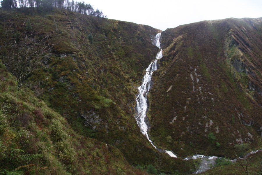
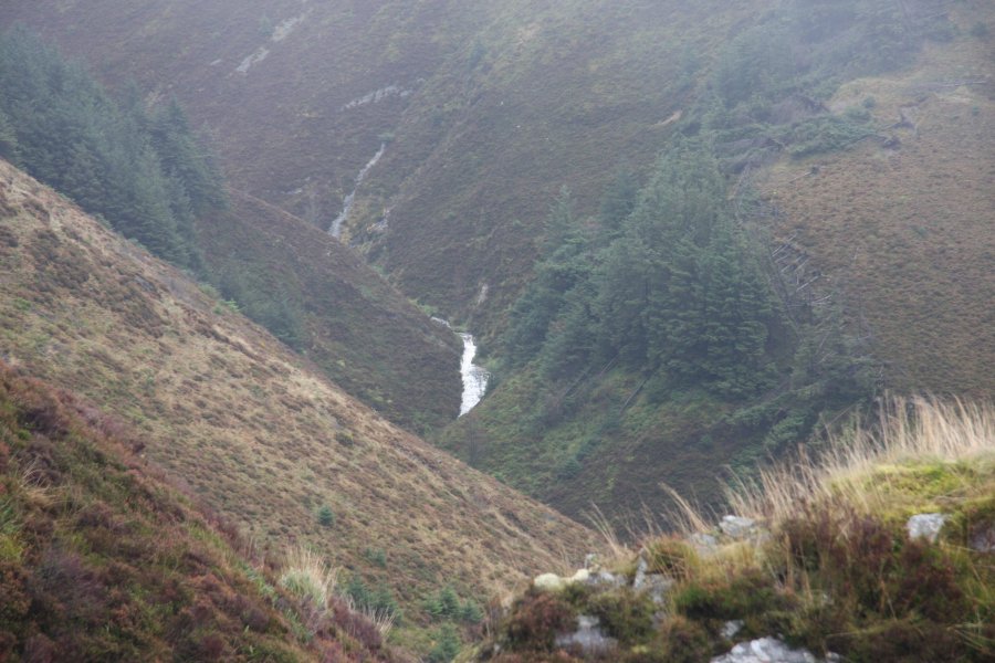
Beyond the fence, two streams join, with the one on the right being the outflow from the lake you walked past. The path crosses the stream to the right before the stream junction, then follows the combined streams down to the edge of a chasm. The stream falls down the dramatic Ffrwd Ferin (also known as Rhaeadr Myherin) in a series of cascades and horsetails, and these can be seen with care from above. Across the chasm to the left, the tributary Nant Chwarelmelyn can be seen tumbling down some small waterfalls. From here, the path skirts the right side of a thin line of trees, before entering the forest and largely disappearing.
For the best view of Ffrwd Ferin (experts only), skirt the rim of the chasm, duck through the forest's trees to get a bit further down, and find somewhere safe enough for you to approach the edge of the chasm again. It is very exposed, and a long way down. Down below, the river turns a corner, then heads down the next set of water slides, though not as dramatically as before.
Although the path can in theory be followed a very long way down the valley from here, this waterfall route does not continue any further. Return the same way you came.
| Waterfall | Grid reference | GPS coordinates | Image |
|---|---|---|---|
| Ffrwd Ferin/Rhaeadr Myherin | SN 79745 80720 | 52.411223°N, 3.769389°W | |
| Nant Chwarelmelyn | SN 80215 80515 | 52.409484°N, 3.762409°W | |
Whilst every care has been taken in the compilation of this description, neither the author nor his fellow walkers can accept responsibility for loss or injury arising from any errors, omissions or inaccuracies in this description. This description is intended as a guide only, and you should select a route to suit your own abilities, at your own discretion. Ability requirements are a guide only. Route maps are approximated. You follow this description at your own risk.