Including the Afon Ceiriog waterfalls.
From Cardiff, take the A470 to Builth Wells, then the A483 to Oswestry, then the A5 to the Gledrid roundabout. Take the second turnoff into Chirk. From Chirk, turn left onto the B4500 into the Ceiriog Valley. Follow it all the way to Llanarmon Dyffryn Ceiriog. Just past the West Arms pub, turn right, signposted to Swch-cae-rhiw on the village square signpost. Follow the lane for 2.5 miles, to a point where the track ahead continues without a proper road surface, and a sign states that there is no parking in the turning area. Return a short way down the road, and park on the narrow verge. SJ 1299 3551.
Walk to the end of the road, where the track continues ahead, and a farm track leaves on the right. Take the farm track, and follow it past the farm and up a steep incline. Just after passing through a gate beyond a clump of trees, the best approach for the waterfalls is to drop carefully down the sloping side of the valley, and picking up sheep tracks that descend to the river. Up above, the path splits at the top of the crags, with the right branch following the top of the crags - this path fails to get a good view of most of the waterfalls, but may be useful for returning.
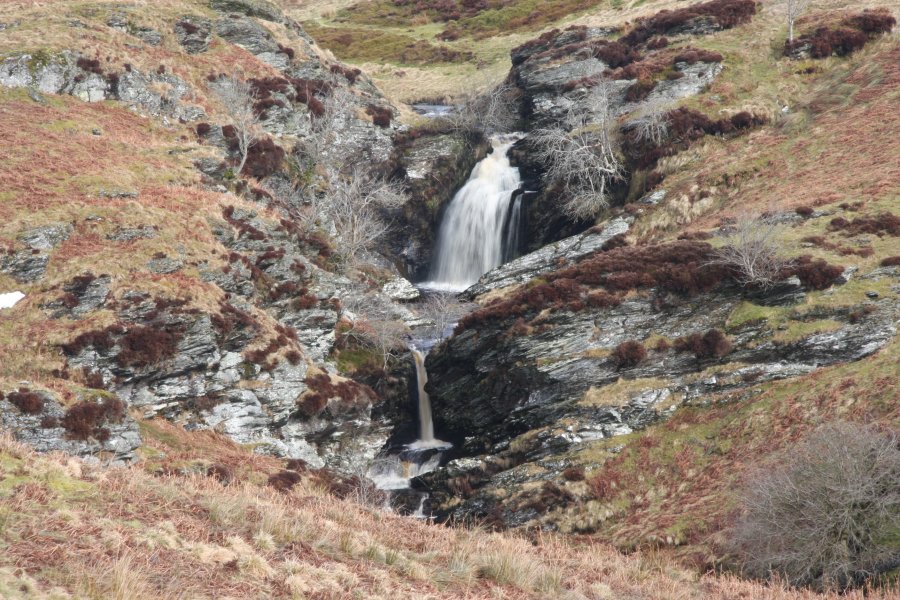
Down in the valley, head upstream, following the left bank of the river. The first main waterfall appears, surrounded by large crags. The crags are fenced off. Follow the fence up to the top of the crags on the left, then stay at the top of the fence as it heads upstream over a small gorge. Follow the fenceline to the next set of waterfalls, then above those, follow the river bank to see the final two. To return, the path above the crags is probably the best option, dropping down to the farm when the incline is reached.
However, for a change of scenery, there is an alternative path on the far bank. Find somewhere to ford the river, and follow the obvious path that heads down the valley. When level with the farm, this enters private land, although it has become established as a path. You should obtain permission accordingly. When it reaches some stone sheepfolds, there is a footbridge on the right that crosses the river, back to the road. Turn right to return to the start of the walk.
| Waterfall | Grid reference | GPS coordinates | Image |
|---|---|---|---|
| Afon Ceiriog | SJ 13014 36577 | 52.919540°N, 3.295197°W | |
Whilst every care has been taken in the compilation of this description, neither the author nor his fellow walkers can accept responsibility for loss or injury arising from any errors, omissions or inaccuracies in this description. This description is intended as a guide only, and you should select a route to suit your own abilities, at your own discretion. Ability requirements are a guide only. Route maps are approximated. You follow this description at your own risk.