Including Rhaeadr Cynfal.
From Cardiff, take the A470 to Llan Ffestiniog. Just after passing under the railway bridge, there is a parking area on the right (if needed, there is also some parking space at the far end of the village, near the church). SH 7038 4189.
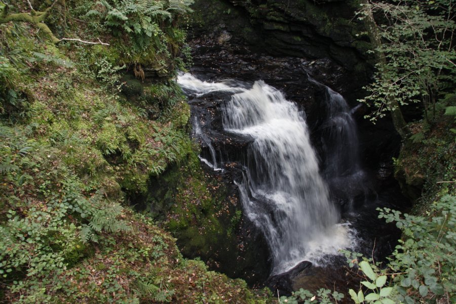
On the opposite side of the main road is a narrow lane with a signpost pointing the way to Rhaeadr Cynfal. Follow the lane, ignoring the school on the right and continuing past the houses ahead-left. It turns into a track and descends through a few fields. Just before the track ends in a field containing a small building, enter the field ahead-left instead; the field to the left of the one that contains the building. The path then follows the upper edge of that field, swinging slowly left. At the far end, it passes into the next few fields, following the same fence/wall line, to enter the forest of the Ceunant Cynfal valley. The path splits, with one path heading directly down to the gorge. Follow it down to the Rhaeadr Cynfal viewpoint, which looks through a window in the rock into the waterfall.
Head back up the way you came. Before leaving the forest, take the path on the right, which descends back to the edge of the gorge and follows it upstream, passing the distinctive Huw Llwyd's Pulpit stack in the middle of the gorge (the eponymous seventeenth century wizard used to preach from here). It reaches a footbridge over the gorge which offers a good view down it. The main walk ends here - return the same way.
Expert river walkers may wish to cross the bridge and turn right at the junction on the other side, following the path downstream until level with Rhaeadr Cynfal. Then very carefully descend the bank to a small buttress just downstream of Rhaeadr Cynfal, where it is possible to see the lower waterfalls below it. This is a very risky position, perched above the gorge. I advise against attempting it, as the lower waterfalls are not really worth the risk.
| Waterfall | Grid reference | GPS coordinates | Image |
|---|---|---|---|
| Rhaeadr Cynfal | SH 70429 41180 | 52.952304°N, 3.930080°W | |
Whilst every care has been taken in the compilation of this description, neither the author nor his fellow walkers can accept responsibility for loss or injury arising from any errors, omissions or inaccuracies in this description. This description is intended as a guide only, and you should select a route to suit your own abilities, at your own discretion. Ability requirements are a guide only. Route maps are approximated. You follow this description at your own risk.