
Including Ciloerwynt Falls and Ciloerwynt Lower Falls.
From Cardiff, take the A470 to Rhayader. From Rhayader, turn left onto the B4518 at the wonky junction with the clock tower in the town centre, towards the Elan Valley. Follow it past the first dam. Take the first left, to cross a bridge over the reservoir (actually a sunken dam). Turn left at the end, and follow the road past the end of the reservoirs (where a lane heads off to the left). After here, a fence lines the fields on the left. When the fence ends after about 0.7 miles (the last field has a gateway just before the fence ends), there is some space to park in a lay-by just afterwards on the right. (There is a lay-by with a gate at one point on the left during the fenced section, but this is not the end of the fence - keep going.) SN 8902 6217.
(If you don't have time for the full walk, it is also possible to drive up to the Ciloerwynt Falls by continuing along the road until the edge of the waterfall can be seen by a big rock outcrop. The main waterfall cannot be properly seen from the road, so walk over to the rock outcrop from the little parking area on the right. SN 8852 6268.)
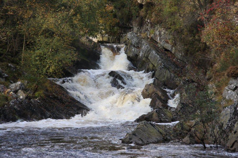
These waterfalls are at the mercy of the Claerwen reservoir. If the reservoir releases water, the waterfalls are quite spectacular. If the reservoir does not release water, they can be mere dribbles (unless the other rivers are running high). The releases of water are more likely in winter, but no promises - it can be quite random. Similarly, if visiting in low water, be prepared for a sudden rise in water levels. Keep clear of the river channel.
From the lay-by, head back to the end of the fence (now on the right), and go through the gate at the fence's end to get into the last field. Cross it diagonally towards the river, and cross a footbridge over deep water. Head down the far river bank to the Ciloerwynt Lower Falls. Descend the bank to see it, but remember that flash floods are possible, and you should not get too close to the river channel.
When you're done, head away from the river to pick up the track running 100 metres from the river bank. Follow it to the right for just over 1 km to reach the Ciloerwynt Falls. Continue past these for 2 km to a ford over a large tributary river, beneath the immense Claerwen dam (look up into the little valley on the left for some smaller waterfalls). Ignore the ford and use the footbridge a little upstream to cross the river, then follow the road from the farm to cross the reservoir outflow. Follow the road out of the parking area, heading downstream for 2.5 km to reach the start of the walk.
| Waterfall | Grid reference | GPS coordinates | Image |
|---|---|---|---|
| Ciloerwynt Lower Falls | SN 89142 61957 | 52.244595°N, 3.625106°W | |
| Ciloerwynt Falls | SN 88402 62750 | 52.251572°N, 3.636202°W | |
Whilst every care has been taken in the compilation of this description, neither the author nor his fellow walkers can accept responsibility for loss or injury arising from any errors, omissions or inaccuracies in this description. This description is intended as a guide only, and you should select a route to suit your own abilities, at your own discretion. Ability requirements are a guide only. Route maps are approximated. You follow this description at your own risk.