Including Cwm Rhaeadr Waterfall, Rhaeadr Rhosan and Merchon Falls.
From Cardiff, take the A470 to Brecon. From Brecon, take the second turnoff at the roundabout, along the A40 to Llandovery. From Llandovery, turn right on the A483 towards Builth Wells. Turn left at the staggered crossroads, signposted to Cilycwm. Some distance after passing under a railway bridge, take the second proper left to cross the river, and continue through Cilycwm. The road then crosses a stone bridge, and the next farm on the left is Glangwenlais (access route for Merchon Falls). SN 7532 4078. Soon after this, the road dips down to cross another stream at a fairly tight S-bend. Shortly afterwards is the dedicated Cwm Rhaeadr forestry parking area on the left. SN 7652 4223.
This walk is best done early in the morning, to get the best daylight in the first two valleys. Rhosan in particular is so narrow that it only gets sunlight at around 10:00 am.
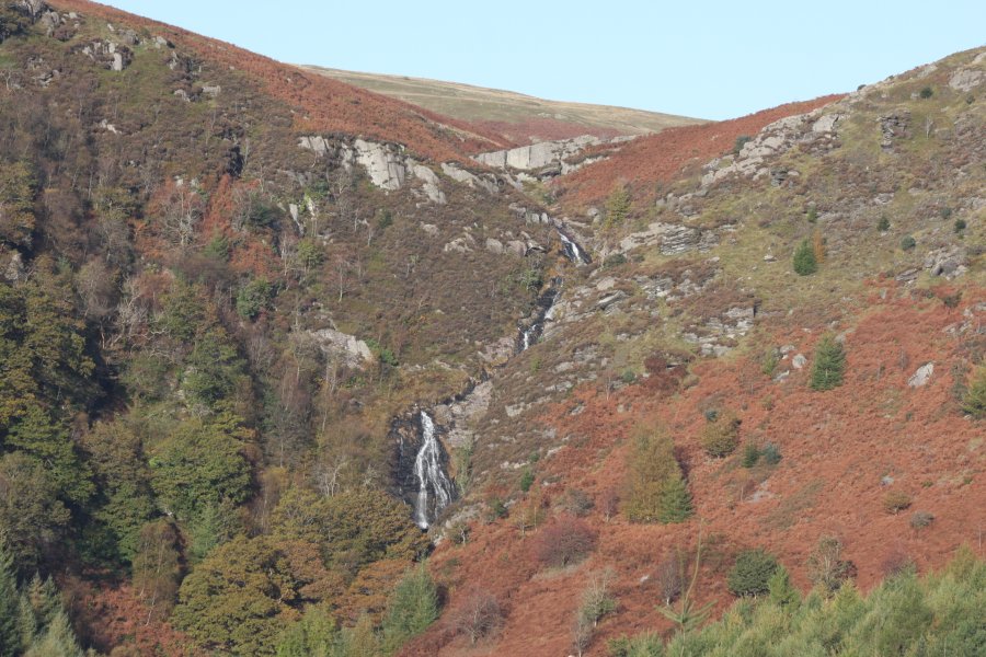
From the parking area, take the main dirt track past the upper parking area. It swings left (you can cut the corner with a footpath), then forks. Take the right fork. As it climbs gently, it dips into two tiny side valleys, each with a hairpin. After the second tiny valley, the trees clear, and there is an excellent viewpoint over the unnamed main waterfall, where the Nant y Rhaeadr flows over the Craig y Rhaeadr crag into the Cwm Rhaeadr valley. The short walk is to turn around here and return to the parking area, having missed out on the other waterfalls, and never having to leave the forestry tracks.
For the longer walk, return to the last hairpin, and take a side path to the right down into the valley. Follow it down to the track, then continue along that to the right towards the waterfall. It crosses the outflow stream, where a path heads upstream along the left bank, climbing up to the hidden parts of the waterfall, which are about as tall in total as the parts that can be seen from the upper track.
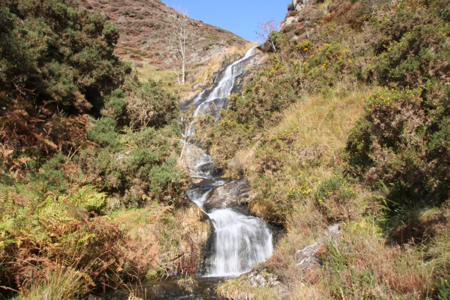
Return to the track that crosses the outflow stream, turn right, and follow it to the Cwm Rhaeadr barn. Just behind it, take a track to the right, and when that ends, take a path to the right up to a gate into open countryside. The path to the left heads into the Nant Rhosan Valley. Just before it dips down to cross the (normally dry at this point) stream bed, a sheep track on the right offers the easiest views of the main waterfalls. Take care though, since it is a poorly defined track, and the valley sides are very steep.
Once you have seen everything you want to see, head back towards where you entered the open countryside. Just before it, a damp path on the right leads down to the road past fields. At the road at the end, you have a choice; either you can head to the left, back to the parking area, or you can head right to continue to Merchon Falls. (It is of course possible to walk back to the parking area and then drive closer to the Glangwenlais farm, saving about 3 km of walking in total.)
At the Glangwenlais farm track (now on the right), head up the track to the farm. Continue through their yard (through the gate just to the right of the house - the 1:25'000 map is poorly drawn, but the owners are helpful if you get it wrong). Once through the gate leading out through their yard, take the kissing gate to the bridge crossing the Gwenlais River. Just after this, turn right into the next farm yard, and onto the path behind it. The path leads out to a dirt track. Turn right and follow the track for several hundred metres.
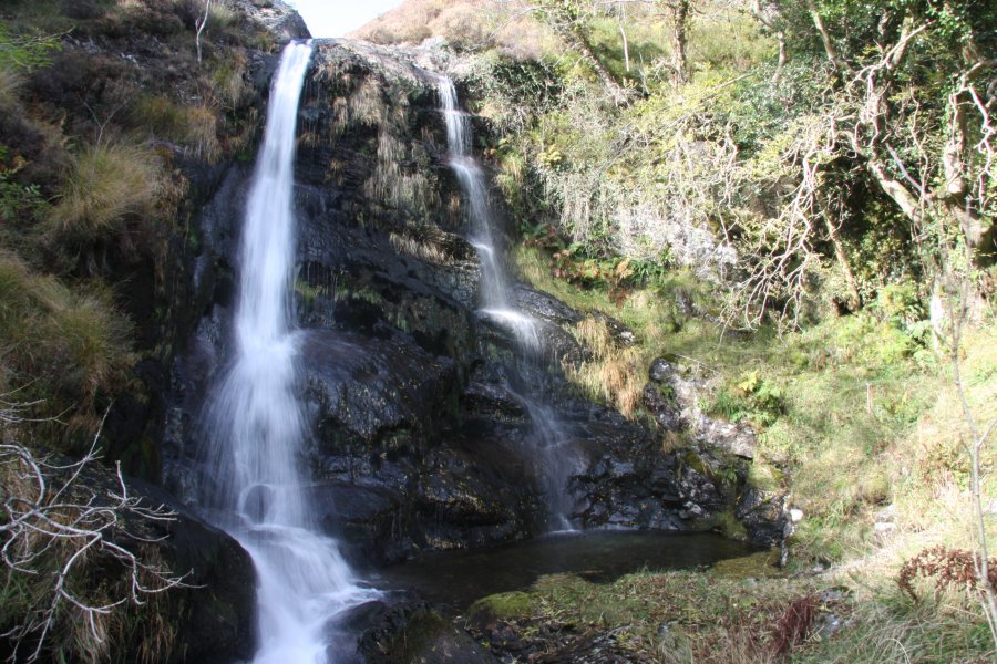
Cross the river via the road bridge. Just beyond is a house at Eithin. After this, the track splits, where the bridge to the left is a concessionary footpath. Cross the bridge and follow the edge of the Merchon (the river to the left) until it meets a tree-lined fence heading up to the right. Follow the fence up to the remains of the Cwm-Merchon farm. Go through the farm, staying near the top of the fields. At the end, a gateway marks the start of the open access land. Continue along the path that initially runs along the top of the fields, to the remains of a tiny quarry. From there, there is no good path, though the first waterfall can be reached without too much difficulty. The larger one above it needs a bit more work to get to, and the one above that can be reached with great difficulty by fighting with the undergrowth. Return using the same route to the road, turn left, and follow the road to return to the parking area.
| Waterfall | Grid reference | GPS coordinates | Image |
|---|---|---|---|
| Cwm Rhaeadr Waterfall | SN 75530 43705 | 52.077672°N, 3.817675°W | |
| Rhaeadr Rhosan | SN 75129 42790 | 52.069359°N, 3.823188°W | |
| Merchon Falls | SN 73247 41837 | 52.060368°N, 3.850275°W | |
Whilst every care has been taken in the compilation of this description, neither the author nor his fellow walkers can accept responsibility for loss or injury arising from any errors, omissions or inaccuracies in this description. This description is intended as a guide only, and you should select a route to suit your own abilities, at your own discretion. Ability requirements are a guide only. Route maps are approximated. You follow this description at your own risk.