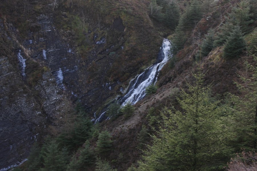
Including Craig y Llyn.
From Cardiff, take the A470 to Mallwyd (at the edge of the Snowdonia National Park). From Mallwyd, take the A458 towards Welshpool. After 2 miles, at a crossroads, turn right onto a tiny lane (the first proper road on the right since Mallwyd). It descends steeply into the valley. After passing a stone cottage on the left, with a long, converted stone shed (and a distinctive arched doorway), park at the next forestry track on the left. SH 8931 1021.
Follow the main forestry track (ignore little side tracks). After zigzagging a couple of times, it reaches a Y-junction, where the way on is to continue climbing ahead-right. After a lengthy climb, it reaches a junction on a sharp corner, where the way on is a very steeply climbing track on the right. Continue climbing ahead at the next junction, to reach the top of the plateau. Depending on tree felling status, there can be some great views from here. Ignore the next track on the right on the plateau, and begin a gentle descent. The track dies just before a stream. (There is a bridge made from rotten logs on the right, but don't use it yet.)
Follow the edge of the stream's valley downstream to the left, at the edge of the forestry. The tall cliff of Craig y Llyn can be seen on the other side, and the waterfall drops in front of it. Return to the track, and cross the stream (using the rotten bridge if you trust it enough), and continue in the same direction as the track to reach the next branch of the stream. Follow the stream upstream to reach a track (or take the next fire track - a big gap in the trees - on the right to reach the track). Turn left along the track and follow it to the next left bend. On the right is Llyn Coch-hwyad.
When you have seen what you want of the lake, return to the track, and head back the way you came. This time, continue past the stream outflow and fire track, and wait for the next proper track on the right. Follow that to reach the junction on the top of the plateau. Turn left, and follow the track back down to the start of the walk.
| Waterfall | Grid reference | GPS coordinates | Image |
|---|---|---|---|
| Craig y Llyn | SH 91557 10996 | 52.685764°N, 3.605712°W | |
Whilst every care has been taken in the compilation of this description, neither the author nor his fellow walkers can accept responsibility for loss or injury arising from any errors, omissions or inaccuracies in this description. This description is intended as a guide only, and you should select a route to suit your own abilities, at your own discretion. Ability requirements are a guide only. Route maps are approximated. You follow this description at your own risk.