
Including Pistyll Crawnon and Darren Ddu/Pyrgad Falls.
From Cardiff, take the A470 to the end of Merthyr Tydfil. From Merthyr Tydfil, take the A465 to the Tredegar roundabout. Take the first turnoff through Trefil, and onwards between the moorlands. While it was previously possible to drive most of the way to the waterfalls, access down the road has since been revoked, so park before the barrier just after the Trfil village. SO 1189 1309. (Previously the road could be followed to a small stone obelisk, close to a forestry plantation, where a track branches off to the right. SO 1094 1515.) Be warned that this area has an exceptionally bad reputation for car crime, so don't leave anything at all in the car - not even a first aid kit.
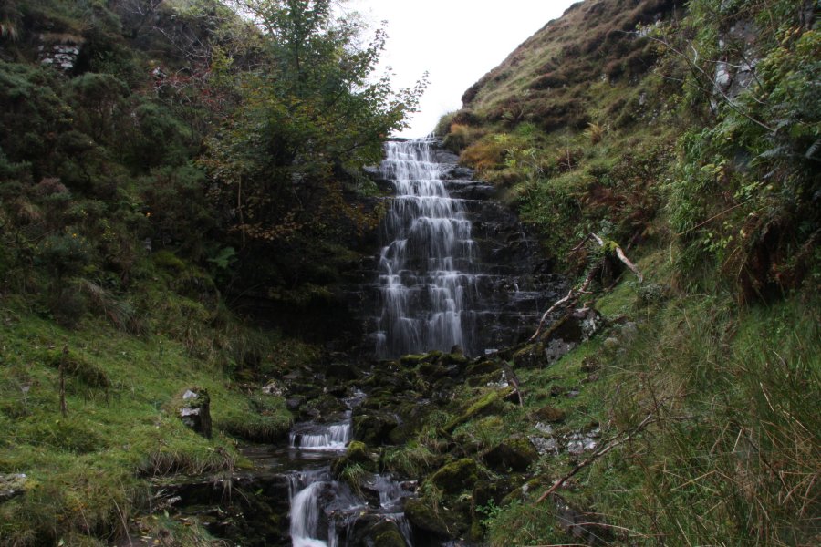
This walk is only for experienced walkers, who are used to walking without paths, and who are able to descend steep slopes or crags without equipment. Follow the road onwards for about 2 km, continuing ahead when it branches, to a small stone obelisk, close to a forestry plantation, then take a track that branches off to the right. The track initially heads to the right of the forestry plantation, then swings hard left to enter it. Instead of following the track when it swings left, head ahead-left towards a deep gully. The Darren Ddu/Pyrgad Falls waterfalls start at the top end of the gully, but the best are further down, so descend into the gully with care, and follow it downstream. When the forestry reaches the stream on the left, and a small stream enters from that side, head up the edge of the forestry to reach the track. If desired, head down the track to its first significant corner, where another waterfall can be seen on the left. Return back to the road at the top of the track, at the obelisk.
Follow the road to the right, to the edge of the forestry, and pick up another track running along its top, on the right side of the road. Stay at the top edge of the forestry for 800 metres, where a grassy track branches off to the right. Follow the grassy track, remaining at the top of the forestry, until the path passes over the infant Afon Crawnon after 700 metres. The Pistyll Crawnon waterfall lies immediately under the path, but needs a tricky descent down the crags to reach it. My descent route was about 30 metres before the stream, but you must choose what works best for you. Cavers descend the crag about 20 metres after the bridge. Another option is to take the path that descends some distance further on, and backtrack to the waterfall.
Beyond the Afon Crawnon, the path continues as a descending tramway, which has suffered from small collapses, passing a stream early on, a dry valley some time later on, and then a small stream with waterfalls shortly afterwards. The waterfall walk ends here, but the path may optionally be followed for a long way beyond here, picking up various ridgeway paths and tracks, to reach the Tor y Foel hill.
| Waterfall | Grid reference | GPS coordinates | Image |
|---|---|---|---|
| Darren Ddu/Pyrgad Falls | SO 10992 15579 | 51.831706°N, 3.293091°W | |
| Pistyll Crawnon | SO 09536 14923 | 51.825576°N, 3.314043°W | |
Whilst every care has been taken in the compilation of this description, neither the author nor his fellow walkers can accept responsibility for loss or injury arising from any errors, omissions or inaccuracies in this description. This description is intended as a guide only, and you should select a route to suit your own abilities, at your own discretion. Ability requirements are a guide only. Route maps are approximated. You follow this description at your own risk.