Including too many waterfalls to count.
From Cardiff, take the A470 past Merthyr Tydfil towards Brecon. After passing the tiny village of Nant-ddu, the road climbs up to look over the Cantref Reservoir. Parking is in a lay-by near the far end of the reservoir. SN 9941 1613.
This walk requires a 1:25'000 scale map, a compass, and experience with how to use them for navigation. It also requires water levels to be low enough for you to be comfortable with fording the streams as needed. There are no paths for most of the route, and it is suggested for experienced walkers only. For best results, the top of the mountain ridge should be clear of cloud, to allow navigation between the valleys.
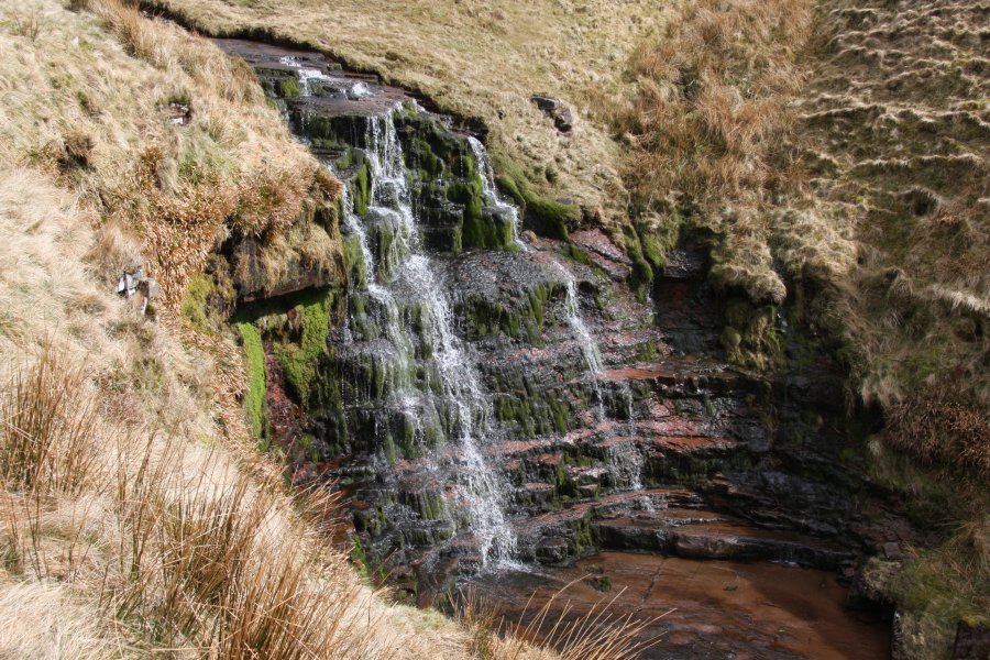
The walk begins on the eastern side of the A470, at the Nant Crew Bridge, at the upstream end of the Cantref Reservoir. A stile gives access to the right bank of the stream. Follow the stream for a very, very long way, crossing it when needed. The top three waterfalls come in quick succession, as a 2 metre cascade, an 8 metre waterfall in an almost circular amphitheatre, and a 2 metre shelf waterfall. Once you have reached the top waterfall (roughly SO 0082 1925), turn right, and walk on a bearing of 155° for 1.5 km. Avoid any crags at the top of the ridge, cross over the Gwaun Nant Ddu moorland, and arrive at the Nant Ddu valley (roughly SO 0148 1790).
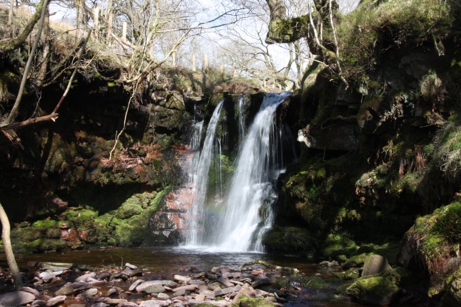
Descend carefully into the valley, and head downstream past almost endless waterfalls. It is generally easier to remain on the right bank until the stream starts to dig some proper gorges, where it becomes better to be on the left. Once you are level with some fields and a large forestry plantation on the right, you are still upstream of the best waterfalls. Continue on the left bank. The land eventually becomes private at a fence. The best way on is probably to cross the river and enter the forestry on the far bank (you may need to hop over fences). Continue downstream past some weirs, until the last waterfall is encountered below a pipeline bridge. Ascend through the forestry to reach a track, and follow it to the left, to eventually reach the A470 at Nant-ddu. Walk along the roadside to the right, passing a small waterfall on the Nant Goch, to reach the lay-by from the start of the walk.
| Waterfall | Grid reference | GPS coordinates | Image |
|---|---|---|---|
| Nant Crew | SO 00322 18612 | 51.857163°N, 3.448759°W | |
| Nant Ddu | SO 00738 15865 | 51.832547°N, 3.441932°W | |
Whilst every care has been taken in the compilation of this description, neither the author nor his fellow walkers can accept responsibility for loss or injury arising from any errors, omissions or inaccuracies in this description. This description is intended as a guide only, and you should select a route to suit your own abilities, at your own discretion. Ability requirements are a guide only. Route maps are approximated. You follow this description at your own risk.