Including Ffrwd Milwyn and Bryn Mor.
From Cardiff, take the A470 to Rhayader. From Rhayader, turn left onto the B4518 at the wonky junction with the clock tower in the town centre, towards the Elan Valley. At the edge of Rhayader, turn right onto a lane, signposted to Aberystwyth. Follow it up over the hills, through the upper Elan Valley, and down into the Ystwyth valley. The village of Cwmystwyth starts at the first houses in the valley, but continue past the immense spoil heaps of the Cwmystwyth lead mine and a few isolated houses, to reach more houses at the proper village. Take the first left, which is immediately before the first houses of the proper village. Park on the roadside at the start of the lane, or if needed, just after crossing the bridge below. SN 7899 7383.
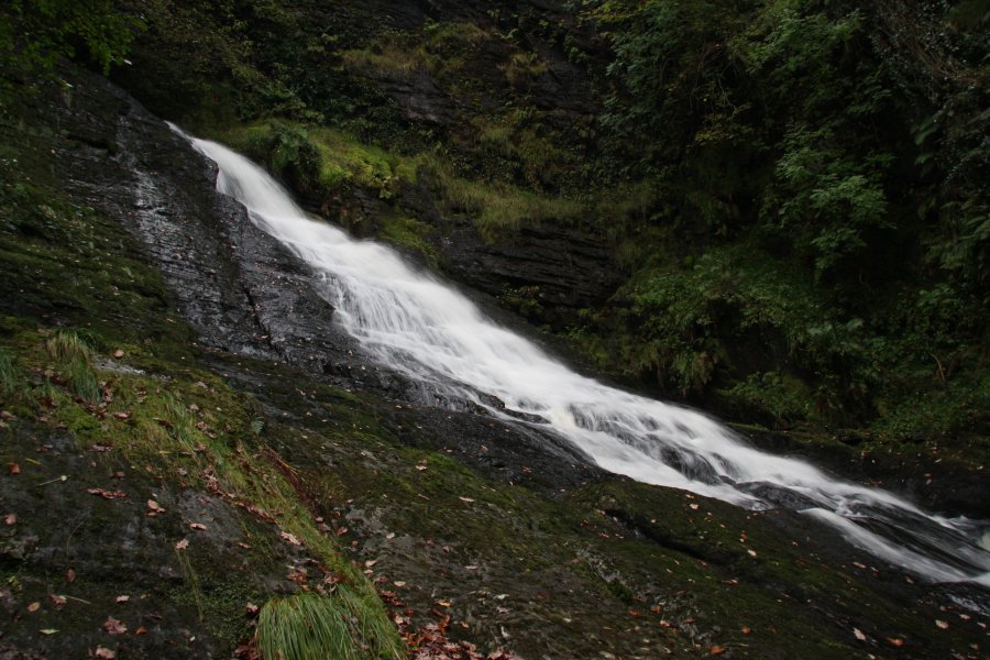
Head down the lane to reach a bridge at the bottom, where there are some waterfalls on the left side of the bridge, as the Nant Milwyn joins the Afon Ystwyth. Turn left after the bridge, following the track. The track bends to the right, then bends to the right again. On the second bend, take the footpath on the left that heads directly up the left side of the farm ahead. Take the track that continues in the same direction beyond the farm, and ignore the footpath that soon leads off on the left, continuing along the track. When the track turns to the left, Ffrwd Milwyn is in the woodland below ahead-right. There is an upper plunge fall, followed by a long horsetail waterslide. Take care when descending to it. (The waterfall lies on the farmland belonging to the previous farm, and the very gracious landowner - Bryn Mor - permits access, though you should of course obtain permission for yourself.)
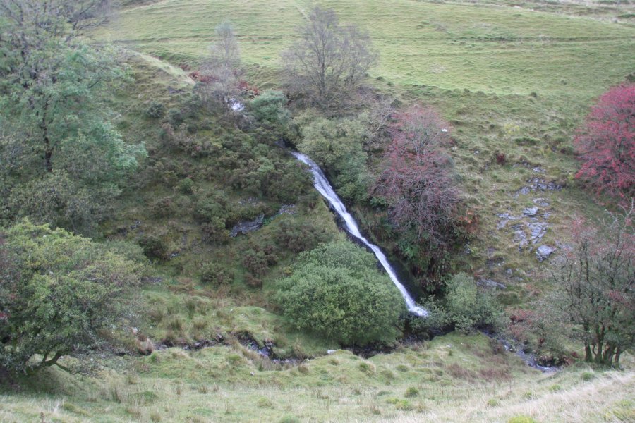
Return to the parking area, and continue past it up to the main valley road. Turn left and follow the road through the village. After passing the main village houses and reaching a few more scattered houses, the road crosses a stream. Turn right onto a track (which currently has a footpath sign). Follow it up to a farm and continue past the farm on a grassy track to enter a field. Stay on the edge of the little stream valley on the right until the Bryn Mor waterfall (named after the landowner) can be seen entering from the far bank. Just beyond it, cross a bridge to the right, and follow the path over another bridge to reach a lane. Turn right and follow the lane down to the main village. Turn left, then right to return to the start of the walk.
| Waterfall | Grid reference | GPS coordinates | Image |
|---|---|---|---|
| Ffrwd Milwyn | SN 79052 73214 | 52.343623°N, 3.776861°W | |
| Bryn Mor | SN 78739 74584 | 52.355864°N, 3.781949°W | |
Whilst every care has been taken in the compilation of this description, neither the author nor his fellow walkers can accept responsibility for loss or injury arising from any errors, omissions or inaccuracies in this description. This description is intended as a guide only, and you should select a route to suit your own abilities, at your own discretion. Ability requirements are a guide only. Route maps are approximated. You follow this description at your own risk.