Including the Devil's Punchbowl, Mynach Falls, Gyfarllwyd Falls and Afon Tuen.
From Cardiff, take the A470 to the Llangurig roundabout. From Llangurig, take the first turnoff (left) at the roundabout, onto the A44 towards Aberystwyth. At Ponterwyd, turn left on the A4120 towards Devil's Bridge. At Devil's Bridge, there is dedicated parking on the left, at the start of the village. SN 7425 7711.
The waterfalls at Devil's Bridge are arguably the best in the area, and the tourism industry knows it. The waterfalls are privately managed by the Devil's Bridge Falls company, and a fee is charged to view the sites. In fact, a separate fee is charged for the Devil's Punchbowl section and the Mynach Falls section. To be fair, the fee is not ridiculous, and the paths are excellently maintained, with largely well placed viewpoints. Current prices and opening hours can be found on the Devils Bridge Falls site. The entrances for both walks are on the road just past the parking area.
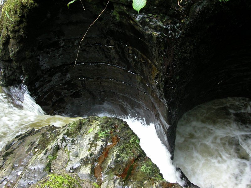
I suggest starting with the Devil's Punchbowl. The path is very formal, and really does not need any description. Just follow it. The Devil's Punchbowl consists of a few cascades charging into the tiny gorge below the triple layered bridges of the Devil's Bridge.
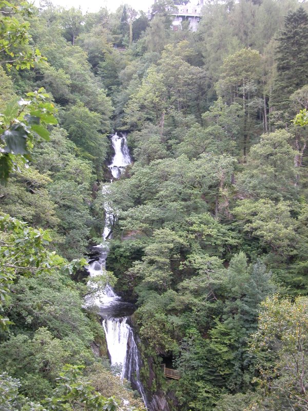
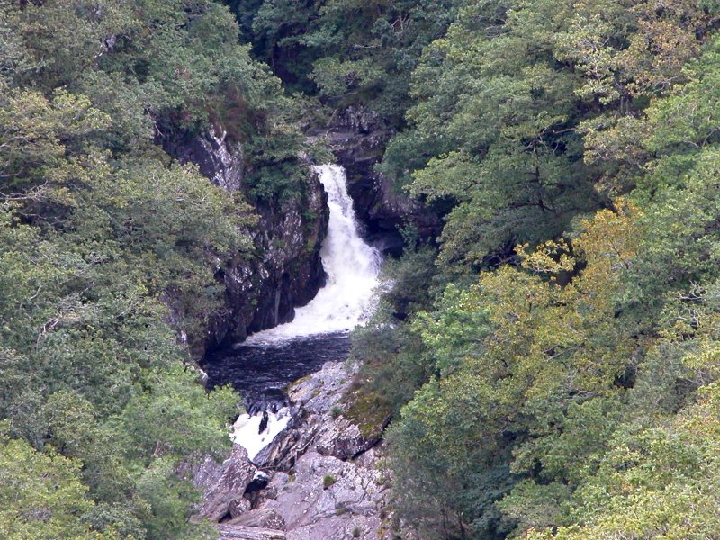
The Mynach Falls walk is much longer. Initially it heads down the right side of the stream, with some viewpoints. It then crosses the stream and ascends the other side, very close to the superb waterfalls. At various points, the Gyfarllwyd Falls can be seen at the bottom of a dramatic gorge in the next valley, just before the two rivers combine. It may also be possible to see it from the road just past the bridge, but this depends on tree growth.
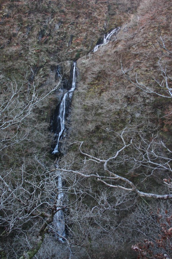
The last part of the area's walks is for experienced walkers only. Head from the parking area out of the village, away from the bridge. After 600 metres, there is a collection of derelict huts in a field on the left. Just past these, the second gateway on the left leads onto a grassy path running on the right side of a private field. Follow the path as it swings right then left to drop to the edge of the woods. From there it turns slightly left and descends through undergrowth to the remains of a destroyed house (the Swiss Cottage). Staying within the fenced area around that house, the Afon Tuen waterfalls can be seen through the trees on the far side of the gorge. Best viewed in Winter. Do not cross the fence to approach the edge of the gorge, as it drops away quite suddenly, and it is a very long way down.
| Waterfall | Grid reference | GPS coordinates | Image |
|---|---|---|---|
| Devil's Punchbowl/Crochan y Diafol | SN 74181 77011 | 52.376644°N, 3.849750°W | |
| Mynach Falls/Rhaeadr Mynach | SN 74176 77192 | 52.378269°N, 3.849891°W | |
| Gyfarllwyd Falls | SN 74235 77578 | 52.381751°N, 3.849170°W | |
| Afon Tuen | SN 74177 77665 | 52.382519°N, 3.850054°W | |
Whilst every care has been taken in the compilation of this description, neither the author nor his fellow walkers can accept responsibility for loss or injury arising from any errors, omissions or inaccuracies in this description. This description is intended as a guide only, and you should select a route to suit your own abilities, at your own discretion. Ability requirements are a guide only. Route maps are approximated. You follow this description at your own risk.