
Including Dolgoch Falls Rhaeadr Isaf and Dolgoch Falls Rhaeadr Uchaf.
From Cardiff, take the A470 to the roundabout at Cemmaes Road. From Cemmaes Road, ether take A489 to Machynlleth then the A487 towards Dolgellau to its junction with the B4405 at Minffordd, or take the A470 to its junction with the A487 then take the A487 to the left to its junction with the B4405 at Minffordd (Minffordd has no village sign, and the A470-A487 junction is two thirds of the way between Dinas Mawddwy and Dolgellau). From Minffordd, take the B4405 towards Tywyn. Follow it for 7 miles to the Dolgoch Falls hotel on the left, where there is ample parking space. A fee is charged for parking. SH 6492 0467.
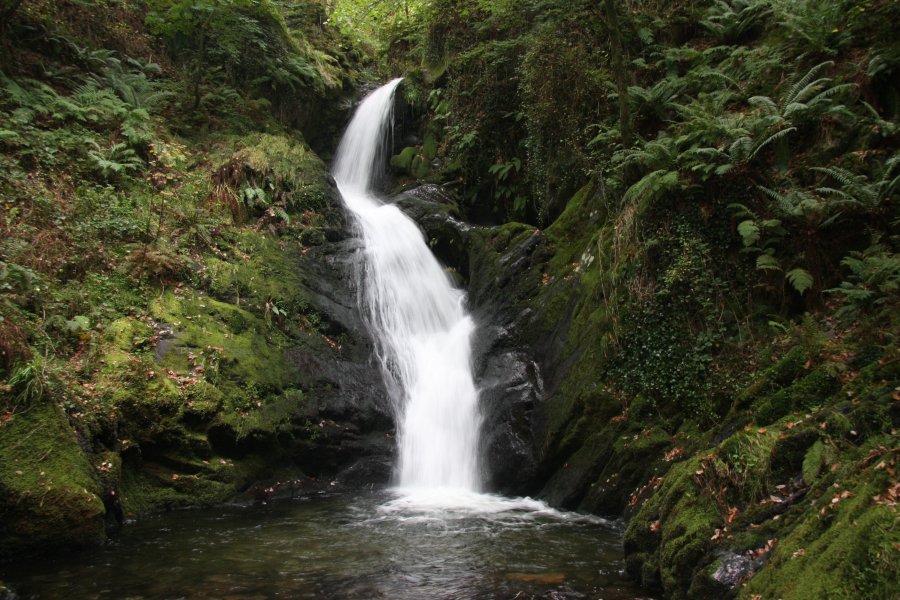
Follow the lane leading past the parking area towards the buildings. Go past the buildings, and under the railway bridge, to arrive at the Dolgoch Falls Rhaeadr Isaf waterfall. A path leads up on the left. Keep close to the stream whenever it splits, as there are many other waterfalls and cascades. The path leads upwards, past several old mine workings. Dolgoch Falls Rhaeadr Uchaf presents itself as a series of tall waterfalls, where the path leads up steep steps to get above them. Turn right at the top. The stream then calms down for a while, before a bridge spans it below the final waterfall.
More experienced visitors may wish to scramble up the poor path on the left of the last waterfall, leading out into open countryside. Ascend the left bank a little to see the tributary stream tumbling down a surprisingly tall set of waterfalls on the right bank.
This marks the end of the watefalls route, so head back down the same way to the top of the bottom waterfall, where another bridge spans the stream. Cross it to see a tall (but rather poor) tributary stream waterfall, and continue along that path to reach a bridge back to the main path below the waterfalls. Turn left and follow it back to the parking area. (On the way back from the top, above Rhaeadr Uchaf, there is an alternative path down; continue ahead instead of dropping back down the steep steps on the left. This leads back to the top of the bottom waterfall. I don't see much point in using it, as it just avoids the stream that you are here to see. Maybe you might feel like a change of scenery though.)
| Waterfall | Grid reference | GPS coordinates | Image |
|---|---|---|---|
| Dolgoch Falls Rhaeadr Isaf/Pistyll Arian | SH 65057 04352 | 52.620116°N, 3.994792°W | |
| Dolgoch Falls Rhaeadr Uchaf | SH 65467 04240 | 52.619211°N, 3.988694°W | |
Whilst every care has been taken in the compilation of this description, neither the author nor his fellow walkers can accept responsibility for loss or injury arising from any errors, omissions or inaccuracies in this description. This description is intended as a guide only, and you should select a route to suit your own abilities, at your own discretion. Ability requirements are a guide only. Route maps are approximated. You follow this description at your own risk.