Including Afon Dringarth, V Falls.
From Cardiff, take the A470 to the end of Merthyr Tydfil. From Merthyr Tydfil, take the A465 to the left towards Hirwaun, follow it over the hill, and down to the next roundabout. Take the second turnoff to the next roundabout. Take third turnoff, to reach Penderyn. From Penderyn, drive north through it along the A4059 until there are some lay-bys in an open area, usually with an ice-cream van in summer. Turn left along a road sign-posted to Ystradfellte. Follow it for just over 2 miles, to the access lane for the Ystradfellte Reservoir on the right, which clearly states that there is no access. Shortly afterwards is another track on the right, which is a public right of way. Park nearby if using the access track route. SN 9379 1406. For the open access route, continue until the road crosses the first of two bridges. Find somewhere to park. SN 9360 1434.
Note that the main waterfall has no official access, and the landowners would like to keep it that way. If you wish to visit the main waterfall, you will need their permission, but note that they really value their privacy. You should consider simply leaving the waterfall alone, as it is not really worthy of disturbing them. Either way, you will need a current 1:25'000 scale map that shows the footpaths and access land, and you must know how to use it.
If attempting to obtain permission for the main waterfall, follow the track until it joins the main access track. Continue along it (or the footpaths that lead from it) to the Pen-fathor Uchaf and Pen-fathor Isaf farms, where you can ask for permission to access the main waterfall. If you get permission, continue past the farms to a stream that passes below the track. The V Falls are a short distance upstream to the right. Continue along the track through the first field, and half way through the second, then find a place to cross the field to the left to reach the main Afon Dringarth waterfall. A smaller cascade is upstream at the end of the farmland. It is essential that you do not attempt to continue beyond this point into the mountains, even though you have now reached open access land, as that would upset the landowners who had given you permission to view the main waterfall.
If using only the open access land (thereby failing to see the main waterfall), take the track to the right between the two bridges to the Nantywenynen farm. Turn left and follow the track that continues as a public right of way. This passes two fields on the right, the second of which has a wide line of trees at its far end. It then continues along a long curve to the right, slowly skirting a large field on the right. At its far end, just before the track passes through a gate, enter the field on the right through a gateway (the OS maps at this point show the public right of way crossing walls, but it is better to use gates). Stick to the left wall of the next field (which almost immediately turns a sharp corner to the left, then curves back to the right), and then pass through a gate on the left into another field. Head to the right, along the right edge of the field, to pass the edge of a small conifer plantation which soon appears on the right. Continue along the edge of the field to reach a gate on the right, where the field to the right ends (close to the Tai-canol farm).
Turn ahead-left (ignoring the paths that emerge from the gateway - this part of the route does not have a well-developed path), heading almost directly North, to cut off the corner of the current field, and pick up a track that runs along its edge. Keep the wall on your right side, passing into another field. Stay with the wall until a fence forces you to keep a short distance away from it, then follow that fence until a new fenced track finally leaves ahead, taking the wall with it. Follow the new track. At the end of the fenced/walled section, the track enters another open field. Turn right to reach the remains of the Blaen-tringarth farm. Pass the farm, where the path curves to the left and descends the slope to river level. You have now reached the open access land.
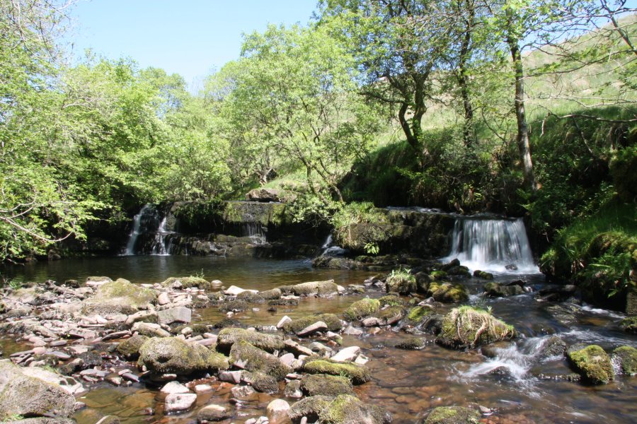
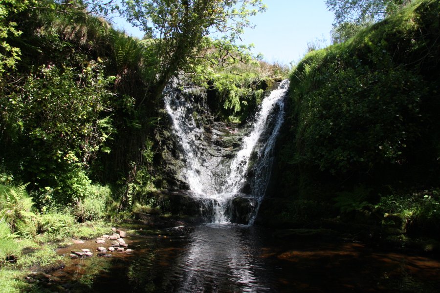
Cross the footbridge over the river, then follow the river to the right to reach a fence at the upper cascade, which is at the edge of the open access land. The main waterfall lies a few hundred metres downstream, on private land - do not attempt to access it from here. To access the tributary waterfalls, follow the fence and wall along the edge of the open access land, heading away from the river, passing over the reservoir access track, and continuing uphill. Eventually it swings right and encounters the Nant yr Esgyrn stream. Follow this downstream, passing a junction with another stream on the left, to the junctions of several streams, and find somewhere to carefully descend into the junction, where the V Falls are located. Note that I have not personally used this route, so you will need to ensure that you follow the map, and do not rely only on my instructions to locate public rights of way.
| Waterfall | Grid reference | GPS coordinates | Image |
|---|---|---|---|
| Afon Dringarth | SN 94303 16106 | 51.833531°N, 3.535357°W | |
| V Falls | SN 94632 15622 | 51.829243°N, 3.530437°W | |
Whilst every care has been taken in the compilation of this description, neither the author nor his fellow walkers can accept responsibility for loss or injury arising from any errors, omissions or inaccuracies in this description. This description is intended as a guide only, and you should select a route to suit your own abilities, at your own discretion. Ability requirements are a guide only. Route maps are approximated. You follow this description at your own risk.