Including Dulas Gorge Falls, Rhaeadr Wen and Rhaeadr Ddu.
From Cardiff, take the A470 to the Llangurig roundabout. From Llangurig, take the second turnoff (right) at the roundabout, continuing on the A470. After 5 miles it reaches the Llanidloes roundabout. Take the first turnoff (left) to enter Llanidloes on the B4518. At the little roundabout, take the third exit (right), then just after crossing the bridge, turn left to continue on the B4518 towards Staylittle. Ignore the two roads that lead off on the left immediately after passing through Staylittle. Shortly after the next cluster of houses, take a road to the left, signposted to Machynlleth. After passing the village of Dylife, the road climbs up onto a plateau. Near the far side of the plateau, a road sign points down to a nature reserve on the left. Although it is theoretically a byway, the deep puddles and large bumps are too much for most cars, so park at the start of the access track. SN 8373 9523.
Alternatively, if the track conditions permit it, drive down the track for 800 metres, to where another track heads back on the right. The parking space is immediately afterwards on the right. SN 8322 9471.
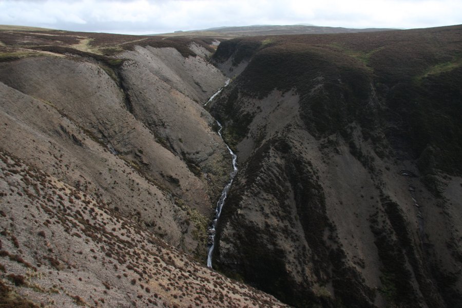
From the start of the access track, follow it into the reserve. After 800 metres, a very obvious side track heads back on the right towards a hill at the edge of the plateau. (The alternative parking space lies immediately beyond this.) Head in a direction roughly half way between the two tracks, across open ground towards the edge of a very deep chasm - the gorge of the Afon Dulas. When you get to the fence that surrounds the sudden dropoff into the chasm, head to the right, following the fence above the Creigiau Esgairfochnant crags until the fence turns a corner to the right. At various points along the fence, you can see the Dulas Gorge Falls dropping into the gorge on the left. There is more white water down in the gorge, but the best stuff is at the top. Treat the edge with extreme caution, as it is quite friable - one step too close and you could end up down the bottom. Keep on the safer side of the fence. Once you have seen what you want, go back to the main track and turn right.
After 500 metres from the track junction, another track leads off on the right, which is the way to the Glaslyn lake. Continue past it for a little over 600 metres to a fork in the track. Take the right branch, and after 500 metres, the track turns a sharp bend to the left, where two grassy tracks lead off ahead-right. Take the left-hand grassy track, which initially heads towards the next gaping chasm, before turning a little to the right, and ending up at the corner of a fenced, grassy pasture, where the path continues ahead into the pasture.
Instead of continuing into the pasture, cross the fence on the left about 100 metres before the pasture, to the gain the stream that descends into the valley to the left. Follow the right bank of the stream heading downstream. Not far from the fence, the stream turns a bend to the left (ignore a path crossing the stream), then a bend to the right, before tumbling down into the craggy valley - be very careful of the drops ahead. At the head of the crags, immedately after the right bend, a path crosses the stream. Head to the right along that path, which runs along the top of the exposed Tarren Gesail cliffs, before turning right to head away from the cliffs - stop here. (The path continues to the valley bottom, where the views of the streams could be much better, but the path has become overgrown, and is not part of this route.)
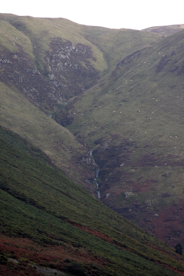
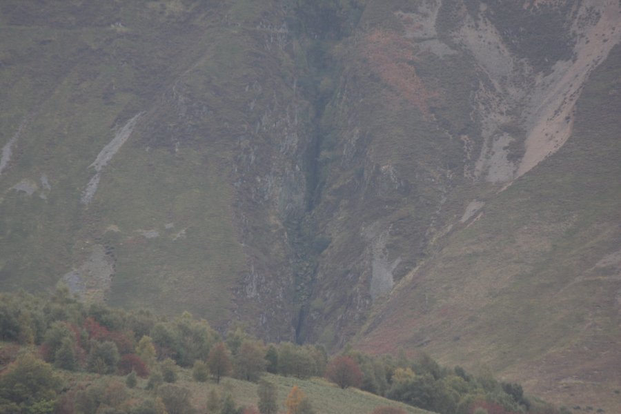
Just across the valley on the far left, the Rhaeadr Wen stream tumbles out of a deep ravine, and down the dramatic Tarren Bwlch-gwyn scarp. The name applies to the stream, not the relatively poor cascades, which do not develop into very significant waterfalls. Just to the right of that, a deep black cleft supposedly carries the Rhaeadr Ddu stream, but there is nothing to be seen in the cleft, and certainly no waterfall. The view of it from Tarren Gesail is not perfect, but even from an ideal location down in the valley, the stream does not have anything better to offer.
Once you have seen enough, return to the fenced area, and follow the path into the pasture (which may contain cattle and electric fences). Cross it diagonally in a northeasterly direction, towards the lake (the far corner of the pasture may not yet be visible, so aim in roughly the right direction until it comes into view). Follow the bank of the lake in a clockwise direction - to the left when facing the lake, crossing the lake's outflow near the other side. At the far side of the lake, in the middle of a beach, pick up the lake's access track. Follow the track back to the main track, turn left, and follow the main track back to the start of the walk.
| Waterfall | Grid reference | GPS coordinates | Image |
|---|---|---|---|
| Dulas Gorge Falls | SN 83016 94752 | 52.538023°N, 3.726252°W | |
| Rhaeadr Wen | SN 81512 93443 | 52.525935°N, 3.747949°W | |
| Rhaeadr Ddu | SN 81121 93363 | 52.525131°N, 3.753681°W | |
Whilst every care has been taken in the compilation of this description, neither the author nor his fellow walkers can accept responsibility for loss or injury arising from any errors, omissions or inaccuracies in this description. This description is intended as a guide only, and you should select a route to suit your own abilities, at your own discretion. Ability requirements are a guide only. Route maps are approximated. You follow this description at your own risk.