Including Llynfell Falls, Pwll-yr-Wydden and Sgwd Ddu.
From Cardiff, take the A470 to the end of Merthyr Tydfil. From Merthyr Tydfil, take the A465 to the left towards Hirwaun, follow it over the hill, and down to the next roundabout. Take the second turnoff, remaining on the A465, to the next roundabout. Take the second turnoff onto the A465 dual carriageway. Take the first exit off the road after about 4.5 miles, onto the A4109. Follow the A4109 (which becomes the A4221 on the plateau) to the end of the road at Abercraf. Turn right onto the A4067. Follow it to the Dan-yr-Ogof Caves site (the main parking area is reached by turning left at the T-junction not far inside the site entrance). SN 8428 1617. Note that if you are not planning to visit the showcaves site, you should not use their parking area. There are nearby grass verges, a side road 200 metres further down the road, and a lay-by 750 metres further down the road.
Pwll-yr-Wydden needs a significant amount of rainfall for the waterfall to appear. Unfortunately, this can also cause the Afon Haffes to flood below Sgwd Ddu, blocking access to the lower waterfalls. You should choose the optimum weather conditions to suit your needs.
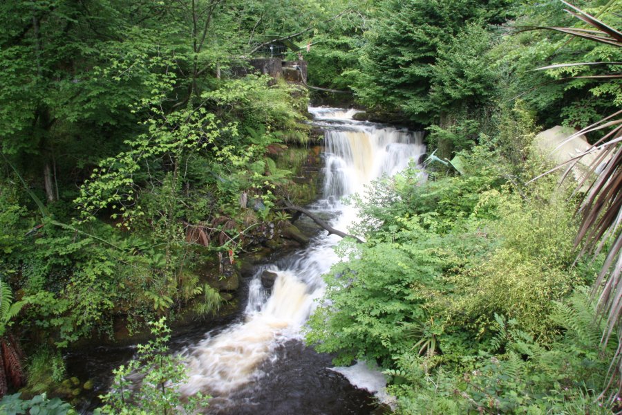
The first waterfall lies inside the Dan-yr-Ogof Showcaves site, and this means you will probably have to pay the entrance fee to see it. Just past the ticket booth, down on the left is a stepped path down to a platform overlooking Llynfell Falls, which sits below a large weir. There is also a cascade at the cave's resurgence, which can be seen from the entrance to the Dan-yr-Ogof showcave. (There are also some fake waterfalls in both main showcaves.)
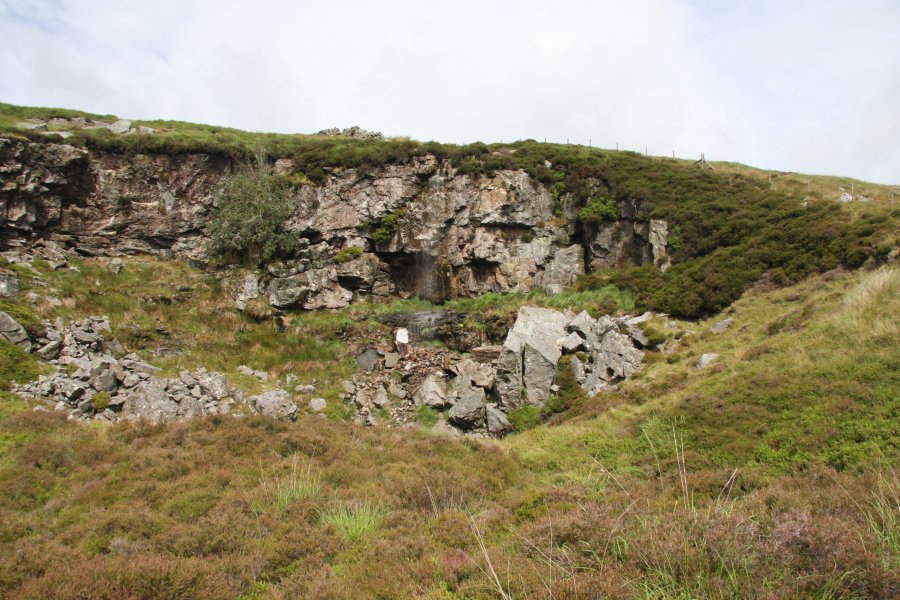
The proper walk starts from the far end of the showcaves site, near the farm and campsite. This would be the road to the right at the T-junction not far inside the site entrance. It is a public right of way, so walkers may use this path even if they are not visiting the showcaves. 150 metres along this road, the footpath leads off on the left. Follow it up fairly steeply until it does a hairpin bend by some sheepfolds, then follow the next section up a very long slope beside a wall and fence. It does some zigzags by a quarry before resuming the previous line. At the top of the slope, a poorly defined path doubles back to the right (remember this point), and the wall becomes comparatively level. Continue along the top of the wall for about 1 km to reach the enormous Pwll-y-Cawr shake hole, which has another wall running through its middle. Follow the far side of that wall uphill to reach the next large shake hole; Pwll-yr-Wydden. The waterfall falls down its upper side.
Return to the top of the slope mentioned previously, and take the path that previously doubled back on the right. Several other paths branch off on both sides, but the desired path stays in roughly the same direction, climbing gently until it becomes much more substantial (almost the size of a dirt track), and swings left. It now becomes the main path traversing the extensive moorland. Eventually, it stops climbing, and drops into the Waun Fignen Felen depression, giving a great view over the extensive Black Mountain range. Leave the path at this point, head right, and skirt the right side of the massive Waun Fignen Felen Sink. Continue in that direction to reach the Afon Haffes river.
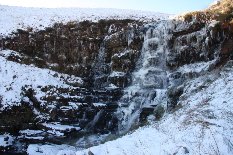
Assuming you reached it early enough (if the valley is not yet any more than 5 metres deep), the waterfalls should be downstream, starting with a few cascades, then the large Sgwd Ddu. At this point, you need to decide which route to use to descend. You can return the way you came, missing the lower waterfalls. You can descend to the stream if water levels permit, fording the river and carefully skirting plunge pools as needed to head downstream. Or you can follow the upper edge of the valley, which will block the view of the lower waterfalls. None of the lower waterfalls are as impressive as Sgwd Ddu, but they are still quite attractive in their own right.
If following the river down, you will need to locate a small path near its end, leading from the river to the sheepfolds near the start of the walk. Pick up the path there, and descend back to the Dan-yr-Ogof site, and the end of the walk.
| Waterfall | Grid reference | GPS coordinates | Image |
|---|---|---|---|
| Llynfell Falls | SN 83890 16039 | 51.830860°N, 3.686388°W | |
| Pwll-yr-Wydden | SN 83015 15768 | 51.828241°N, 3.698989°W | |
| Sgwd Ddu | SN 82935 17973 | 51.848041°N, 3.700896°W | |
Whilst every care has been taken in the compilation of this description, neither the author nor his fellow walkers can accept responsibility for loss or injury arising from any errors, omissions or inaccuracies in this description. This description is intended as a guide only, and you should select a route to suit your own abilities, at your own discretion. Ability requirements are a guide only. Route maps are approximated. You follow this description at your own risk.