
Including Rhaeadr Peiran, Cavern Cascade and Mossy Seat Falls.
From Cardiff, take the A470 to the Llangurig roundabout. From Llangurig, take the first turnoff (left) at the roundabout, onto the A44 towards Aberystwyth. At Ponterwyd, turn left on the A4120 towards Devil's Bridge. From Devil's Bridge, turn left onto the B4574 towards Cwmystwyth. After 2.5 miles, take a shortcut to the right, signposted to Hafod, which bypasses an awkward junction. Turn right at the end of the shortcut, and arrive at the Hafod forest parking area on the left in less than half a mile. SN 7680 7367.
There are several named routes through this forest, most of which pick up some of the waterfalls, the details of which can be found on the forest's information site, or on information signs in the parking area. The route described here covers all of the waterfalls, though it misses out on the area's other attractions. You may choose to rearrange the route accordingly. You may also want to bring a torch for the Cavern Cascade.
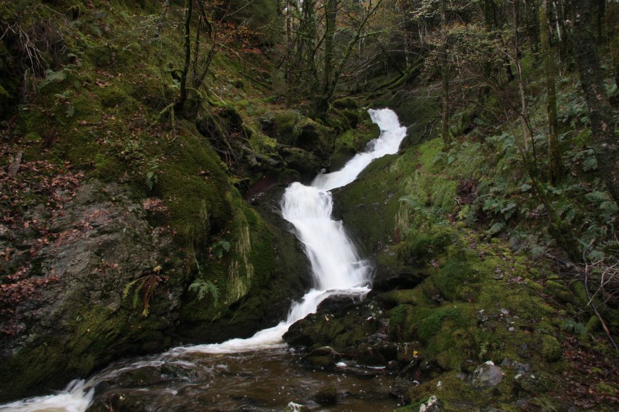
Take the path that heads along the right side of the church (the far end of what is known as the Lady's Walk). Follow the blue signed route through the forest, ignoring a path to the right, and zigzagging to diagonally cross a larger track. The path then reaches the distinctive double step Rhaeadr Peiran. At the bottom of the waterfall, follow the path downstream to a junction with a larger track, where to the left is the way to Pont Dologau. Another waterfall lies just downstream, which can be reached using a small path on the other side of the track.
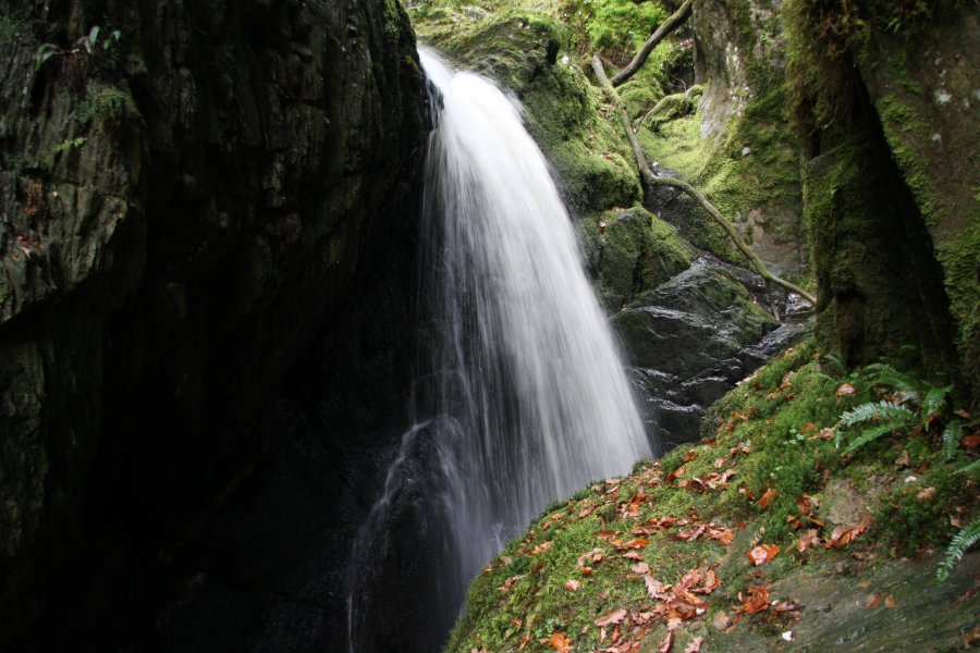
Return to the track, and head past the house to Pont Dologau. On the opposite side of the gorge, the Nant Gau falls down an attractive waterfall into the Ystwyth. On the other side of the bridge, the track splits. Turn right, then take a footpath that soon appears on the left, along the edge of a field, to continue up the Nant Gau, along the Gentleman's Walk. Remain on the right bank of the stream, passing several little waterfalls, to arrive at a mined tunnel. Follow it (it is not really a mine, but a 200 year old grotto), to a window into the side of the Cavern Cascade.
Return to the track, and turn left. After 500 metres, turn very sharply left at a junction of tracks and follow it until it arrives at a significant stream. Immediately below is a small waterfall, while the main Mossy Seat Falls are above the track. A rather poor path leads up the right bank of the stream to an upper path, where there is the best view of the waterfalls. The route ends here, so return same way. If you want to extend the route, use the map or information leaflets to locate appropriate paths.
| Waterfall | Grid reference | GPS coordinates | Image |
|---|---|---|---|
| Rhaeadr Peiran/Peiran Falls | SN 76984 73546 | 52.346146°N, 3.807324°W | |
| Cavern Cascade/Robber's Cave/Lefel Lampwll/Rhaeadr y Ceunant | SN 77466 72716 | 52.338795°N, 3.799949°W | |
| Mossy Seat Falls/Rhaeadr 'Mossy Seat' | SN 76120 72773 | 52.339005°N, 3.819715°W | |
Whilst every care has been taken in the compilation of this description, neither the author nor his fellow walkers can accept responsibility for loss or injury arising from any errors, omissions or inaccuracies in this description. This description is intended as a guide only, and you should select a route to suit your own abilities, at your own discretion. Ability requirements are a guide only. Route maps are approximated. You follow this description at your own risk.