
Including Mill Falls and Spuhler's Folly/Pwll yr Hesg.
From Cardiff, take the A470 to Brecon. From Brecon, take the fourth turnoff at the roundabout and follow the A40 to the right to the next roundabout. Take the third turnoff (to the right again), and follow the A40 to Bwlch. Shortly after the steep section beyond Bwlch, take the B4560 ahead, while the A40 does a bend to the left. For Mill Falls take the first lane to the right, and park on a verge just before the first house on the right, where it ceases to be a public highway. SO 1448 2029. For Spuhler's Folly/Pwll yr Hesg, follow the B4560 until it crosses the river Usk to arrive in Llangynidr. SO 1521 2025. Find somewhere useful to park (if needed, follow the road to the B4558, and turn left to reach a parking area on the right).
Head back to the bridge over the Usk. Immediately before it, on the right, a path heads downstream. Follow it for a bit under 1 km to Spuhler's Folly, a short fall into the Pwll yr Hesg pool. The fall is merely a small drop in the river, and not a proper waterfall, though it presents a significant obstacle to canoeists. Continue beyond the fall for another 1 km until a path leads to the right, away from the riverbank, to reach a lane. Follow the lane to the right to reach a bridge over a canal after 500 metres. Follow the canal tow path to the right, passing a farm bridge, to reach a road bridge after 1 km. Follow the road to the right to arrive back at the start of the walk, or follow the road to the left then turn left at the B4558 junction, to arrive back at the parking area.
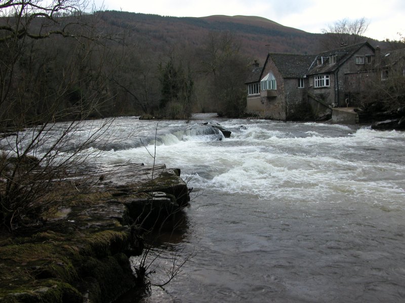
The Mill Falls have no official access route. Although the river is a right of way for canoeists, there is no right of way for walkers. A few rights of way lead to the river, but none are in useful locations for the falls. Perhaps the best approach is from the lane off the B4560. Continue to follow the lane on foot, taking a left down the track to the Buckland Old Mill, which is currently run as a holiday cottage. Request permission from the owners, and with luck you should be able to see the falls from the private footbridge in their grounds. Since the falls are merely a canoeing feature and not a proper waterfall, they may not be worth the effort.
| Waterfall | Grid reference | GPS coordinates | Image |
|---|---|---|---|
| Spuhler's Folly/Pwll yr Hesg | SO 15862 20262 | 51.874557°N, 3.223577°W | |
| Mill Falls | SO 13478 20125 | 51.872960°N, 3.258163°W | |
Whilst every care has been taken in the compilation of this description, neither the author nor his fellow walkers can accept responsibility for loss or injury arising from any errors, omissions or inaccuracies in this description. This description is intended as a guide only, and you should select a route to suit your own abilities, at your own discretion. Ability requirements are a guide only. Route maps are approximated. You follow this description at your own risk.