Including Pistyll Gwyn - Afon Pumryd.
From Cardiff, take the A470 to Dinas Mawddwy. From Dinas Mawddwy, turn right onto a road signposted to Dinas Mawddwy (even though you are already in it) and the Red Lion pub, on a left bend. Turn right at the crossroads by the Y Llew Goch (Red Lion) pub. Follow the lane for 4 miles to Llanymawddwy, and park in the dedicated parking area on the right between two churches. SH 9028 1899.
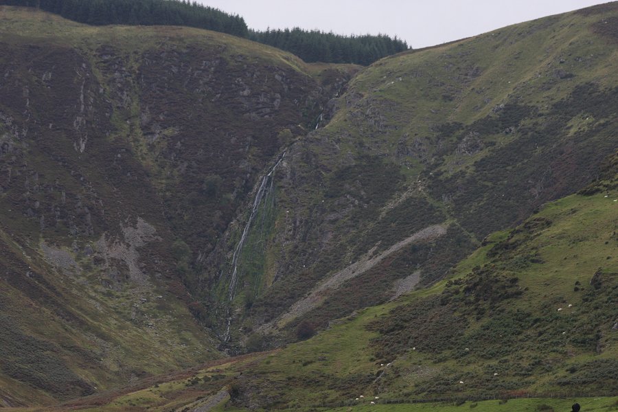
Walk back to the previous church (to the left when looking at the road from the parking area), and take the path to the right just beyond it. Follow it up to join an exceptionally steep concrete track. It soon becomes level, and turns left, after which the exceptionally tall Pistyll Gwyn waterfall can be clearly seen at the head of its valley. Beginners can follow the track until it ends, then turn around.
The track runs quite straight up the valley, before turning some bends around a meander in the river. Just after the bends (about 50 metres before the track turns into a path), a path for experienced walkers slopes down on the right, reaching the river a little upstream of the end of the track. Cross the river using a metal pole as a bridge. Head a little downstream on the other side, where the path climbs up to a field, with a grassy path further up the field. Turn left on the grassy path to continue up the valley. After leaving the fields, the path crosses three streams. After the third of these, there is a poorly defined path junction, and a stepping stone crossing the river below. Continue ahead to the base of the waterfall.
Back to the junction, there is an optional, very exposed path that heads up beside the third stream, which gains an upper route to the top of the waterfall.
Either return the same way, or from the track junction, head down to the river to the stepping stone crossing. Cross the river and a stile, where a path on the far bank heads downstream, to gain the end of the track from the start of the walk. Return down the track to the village.
| Waterfall | Grid reference | GPS coordinates | Image |
|---|---|---|---|
| Pistyll Gwyn | SH 88464 19609 | 52.762531°N, 3.654376°W | |
Whilst every care has been taken in the compilation of this description, neither the author nor his fellow walkers can accept responsibility for loss or injury arising from any errors, omissions or inaccuracies in this description. This description is intended as a guide only, and you should select a route to suit your own abilities, at your own discretion. Ability requirements are a guide only. Route maps are approximated. You follow this description at your own risk.