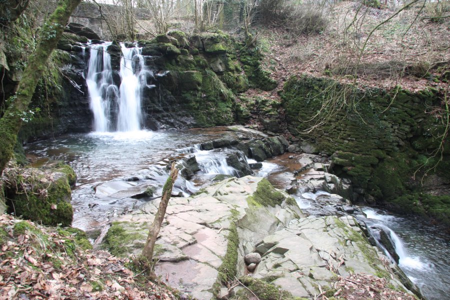
Including Ffrwd-grech Waterfall.
From Cardiff, take the A470 to the A40 roundabout at Brecon. Take the third turnoff into Brecon on the B4601. From Brecon, take Ffrwdgrech Road, which doubles back on the right after 0.3 miles, and quickly becomes a narrow lane. When the road does a 3-way fork, take the middle road. At the next fork (a 2-way), take the road to the right. This soon descends a little to cross a bridge. Parking for the Ffrwd-grech Waterfall is immediately before the bridge. SO 0210 2641. For the upper Cwm Llwch waterfalls, continue for some way, passing a road on the right, to reach a staggered cross-roads. Take the road ahead-right, and follow it until it reaches a large parking area, just after passing through a gate. SO 0066 2452.
At the Ffrwd-grech parking area, head downstream on the right bank to see the Ffrwd-grech Waterfall, which is immediately below the road. Three further little waterfalls are upstream of the road, the first two of which can be reached using a path on the left bank. The last one requires walking upstream without a path, but is probably not worth the effort unless you really want to see it.
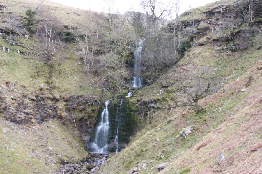
For the upper set of waterfalls, follow the track that continues up the valley from the large parking area, staying on the right side of the main stream. This passes some old cottages before climbing increasingly steeply up towards Corn Du, with the Cwm Llwch waterfalls visible ahead-left for part of its climb. Once it passes through the final field, and out into the open access land, a path to the left leads around the slope to the streams (the main waterfalls are on the second stream, but the first also has some small ones). Head carefully down the left bank downstream to get a better view of the big waterfalls, and upstream to see several smaller ones.
In such a stupendous area, it would be a real shame not to return to the main path, and follow it up Craig Cwm Llwch to the top of Corn Du. If it helps, just above the top waterfall is a path heading to the right, rejoining the main path at a higher level. Enjoy.
| Waterfall | Grid reference | GPS coordinates | Image |
|---|---|---|---|
| Ffrwd-grech Waterfall | SO 02077 26432 | 51.927761°N, 3.425508°W | |
| Cwm Llwch | SO 00619 22777 | 51.894651°N, 3.445649°W | |
Whilst every care has been taken in the compilation of this description, neither the author nor his fellow walkers can accept responsibility for loss or injury arising from any errors, omissions or inaccuracies in this description. This description is intended as a guide only, and you should select a route to suit your own abilities, at your own discretion. Ability requirements are a guide only. Route maps are approximated. You follow this description at your own risk.