Including Amarch Fall and Cadair Cataracts.
From Cardiff, take the A470 to the roundabout at Cemmaes Road. From Cemmaes Road, ether take A489 to Machynlleth then the A487 towards Dolgellau to its junction with the B4405 at Minffordd, or take the A470 to its junction with the A487 then take the A487 to the left to its junction with the B4405 at Minffordd (Minffordd has no village sign, and the A470-A487 junction is two thirds of the way between Dinas Mawddwy and Dolgellau). From Minffordd, take the B4405 towards Tywyn.
For the main walk, almost immediately turn right on the first road, into the dedicated parking area for the main walk, just after the bus stop. A fee is charged for parking. SH 7323 1150.
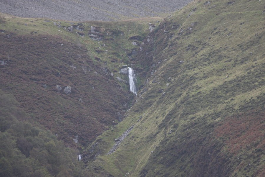
For Amarch Fall, continue along the B4405 to a point roughly half way along the Tal-y-llyn lake, where there is a grass verge on the right that can be used for parking, next to a gate. SH 7185 0988.
Walk a little further along the road using the pavement, until the trees are out of the way. The Amarch Fall can be seen high up in the valley on the far side of the lake.
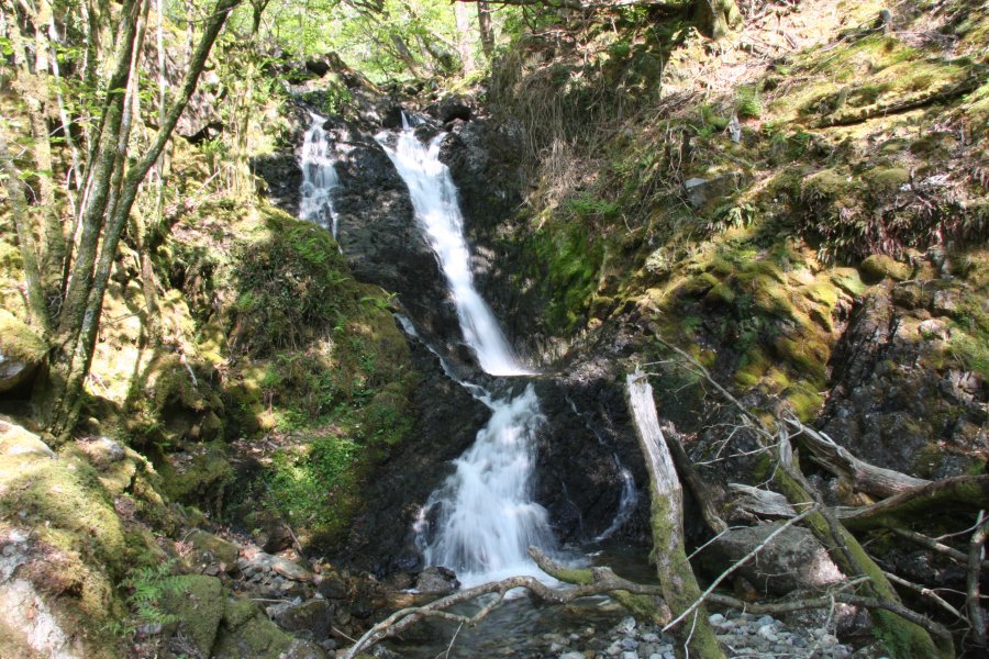
Head out of the back of the Minffordd parking area, near the toilet block. Follow the tree-lined avenue to the front of the buildings, then the gravel path to the left from there, that crosses the Nant Cadair stream and turns right just afterwards to follow it upstream. The path becomes quite steep as it climbs a long way out of the valley. The Cadair Cataracts start almost immediately at the bottom of the climb, initially tucked under the path, but occasionally quite obviously visible. The path eventually breaks out of the woodland, and becomes quite far from the stream. There are more waterfalls hidden in the stream's cleft, but these are best left alone. Higher up, the path passes over the last set of cascades before it enters the hanging valley.
Beyond this point, the path swings left, far from the stream, and climbs much more gently into the valley, ending at the majestic Llyn Cau corrie lake, between the towering Craig Cau cliffs of Mynydd Pencoed and Penygadair, the top of the Cadair Idris ridge. Although the mountain path continues up the left side, eventually following the entire rim of Craig Cau, the waterfall walk ends at the lake. Return the same way.
| Waterfall | Grid reference | GPS coordinates | Image |
|---|---|---|---|
| Cadair Cataracts | SH 72845 11696 | 52.687982°N, 3.882652°W | |
| Amarch Fall | SH 71058 10868 | 52.680120°N, 3.908749°W | |
Whilst every care has been taken in the compilation of this description, neither the author nor his fellow walkers can accept responsibility for loss or injury arising from any errors, omissions or inaccuracies in this description. This description is intended as a guide only, and you should select a route to suit your own abilities, at your own discretion. Ability requirements are a guide only. Route maps are approximated. You follow this description at your own risk.