Including Sgwd Henrhyd and Needle Falls.
From Cardiff, take the A470 to the end of Merthyr Tydfil. From Merthyr Tydfil, take the A465 to the left towards Hirwaun, follow it over the hill, and down to the next roundabout. Take the second turnoff, remaining on the A465, to the next roundabout. Take the second turnoff onto the A465 dual carriageway. Take the first exit off the road after about 4.5 miles. Continue ahead at the traffic lights along the A4109, and up onto the plateau. After passing through the lower speed section at Dyffryn Cellwen, take the road to the right, signposted to Coelbren and the Henrhyd Waterfalls. At the end of the road, turn right, again following signs to the waterfalls. After passing through the village, at the end of the road, turn left. After a short distance, park at the Henrhyd Falls parking area, on the left. SN 8533 1207.
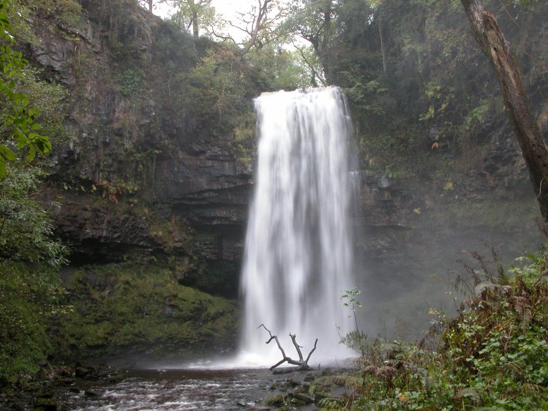
From the parking area, an obvious path heads down into the Nant Llech gorge. At the bottom, it joins another path. Take the route to the left, which soon reaches a bridge over the stream. Cross the bridge, and continue upstream to the base of the impressive Sgwd Henrhyd. An unofficial path on the right leads to the large ledge behind the waterfall. (A stepped path a little way back to the right is an alternative route to Coelbren.)
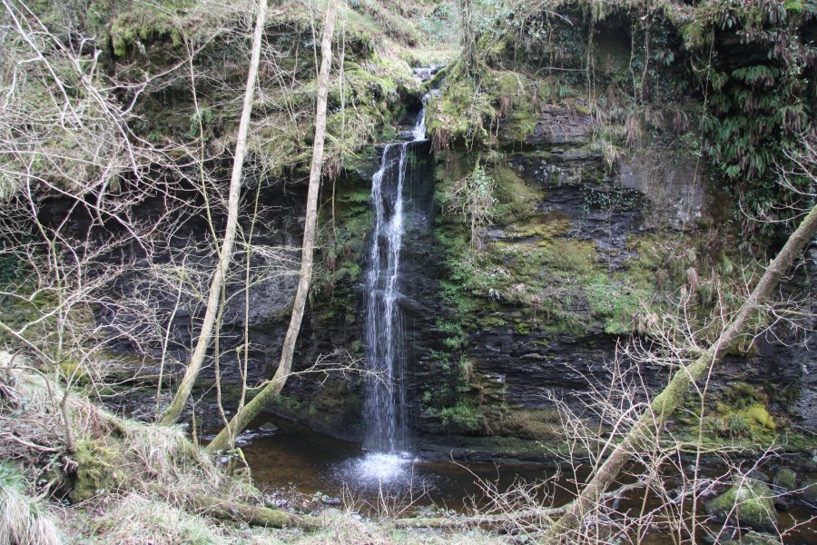
Return over the bridge to the junction of paths, and this time head in the other direction, following the right bank, heading downstream. This quickly passes over the top of a pretty little waterfall, with another one lying just downstream of it. Stay with the path, which slowly climbs above the stream. At one point, a splashing inlet waterfall can be heard on the far bank, not long after the path has passed over a small bridge. The only way to see this properly is to leave the path and stumble down the bank to the river. The waterfall is the relatively tall Needle Falls. Return to the path.
Eventually, the path drops back down to river level, at the old Melin-Llech mill. There is another waterfall on the left here. The stream then makes its way down some smaller cascades, before the path joins a road. If you want to take an alternative route back, head to the right along the road, climbing up with an occasional view over the beautiful Tawe (Swansea) Valley. After far too long - about 1.5 km, the road reaches a junction, where the way on is to continue steeply up to the right. After 1 km, this arrives back at the parking area.
| Waterfall | Grid reference | GPS coordinates | Image |
|---|---|---|---|
| Sgwd Henrhyd | SN 85388 11928 | 51.794223°N, 3.663298°W | |
| Needle Falls | SN 84610 11960 | 51.794350°N, 3.674585°W | |
Whilst every care has been taken in the compilation of this description, neither the author nor his fellow walkers can accept responsibility for loss or injury arising from any errors, omissions or inaccuracies in this description. This description is intended as a guide only, and you should select a route to suit your own abilities, at your own discretion. Ability requirements are a guide only. Route maps are approximated. You follow this description at your own risk.