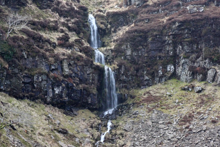
Including Tarren Rhiw-maen Falls.
From Cardiff, take the A470 to the Pontypridd junction, and follow signs for the Rhondda Valleys and Rhondda Heritage Park. This should take you through the mess of the A4058. Once past Pontypridd, ignore signs for the Rhondda Heritage park, and just stick with the A4058, all the way to Treorchy. From Treorchy, at an understated junction by The Stag pub, turn left onto the A4061, signposted to Bridgend. Not long after passing the station, turn left onto the A4061 again. Not far along here, turn right, again onto the A4061, again signposted to Bridgend. The road climbs up the ridge via some impressive hairpin bends. Just as you approach the top, at a junction with the A4107, parking is on the left. SS 9394 9459. If needed, there is additional parking slightly further on, and some more on the A4107.
If you are only planning on viewing the waterfalls from the road, continue along the A4061 past the next sharp bend, down into the next valley. As the road does one of the most extreme hairpin bends in Wales, the waterfalls are on the crags above the road. SS 9271 9471.
For the walking route, take the path heading up the grassy bank on the left side of the A4107, and follow it to pick up the path running along the top of the Craig Ogwr cliffs, above the continuing A4061 (not the off-roader tracks that repeatedly head away from the cliffs, try to ignore them). Follow the path to the end of Craig Ogwr, where the Tarren Rhiw-maen Falls can be seen tumbling down the Tarren Rhiw-maen cliffs. After the path crosses a stream above the road's hairpin bend, it heads away from the cliffs, crossing fields to arrive at a dirt/concrete track (or if you arrive at the A4107, you went too far to the right - follow the A4107 to reach the dirt/concrete track). Turn left and follow the dirt/concrete track. When it splits, take the left-most branch (leaving the dirt/concrete track), and follow it to a corner, then turn right. This gives some good views over Blaengarw.
The track ends and a path continues to reach another messy path - torn up by offroaders - running along the ridge (where you can continue onwards to the next hill if desired, but that is not considered part of this route). Turning right on the messy path leads via the masts on the top of Werfa back to the track junction. Follow the dirt/concrete track back to the road. Turn right and follow the left verge of the road back towards the parking area, passing superb views over the Graig Fâch and Graig-fawr scarps. At the closest point to the scarp edge, where there is a layby, pick up a path running along the right side of the road. When this gains more off-roader tracks, follow them back to the parking areas.
| Waterfall | Grid reference | GPS coordinates | Image |
|---|---|---|---|
| Tarren Rhiw-maen Falls | SS 92601 94677 | 51.640607°N, 3.553428°W | |
Whilst every care has been taken in the compilation of this description, neither the author nor his fellow walkers can accept responsibility for loss or injury arising from any errors, omissions or inaccuracies in this description. This description is intended as a guide only, and you should select a route to suit your own abilities, at your own discretion. Ability requirements are a guide only. Route maps are approximated. You follow this description at your own risk.