Including Pistyll y Ceunant and its hidden upper sections.
From Cardiff, take the A470 to Mallwyd (at the edge of the Snowdonia National Park). From Mallwyd, take the A458 towards Welshpool. After 10 miles, just before Llangadfan, take the B4395 to the left towards Llanfyllin. After 7 miles, take the B4393 doubling back very hard on the left, towards Lake Vyrnwy. Follow it to the reservoir's dam, and cross the dam, turning right at the far end. After just over a mile, the Llechwedd-du picnic area on the right offers parking for the upper waterfall sections. SJ 0018 2021. Just over half a mile beyond this, the road crosses a small stone bridge, where the waterfall can be seen immediately to the left, and there is some parking space on the left shortly afterwards. SH 9929 2077.
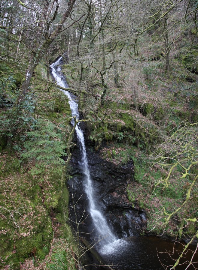
For the appearance that the waterfall is best known for, view it from the road bridge. The upper sections cannot be seen from here, and they are hazardous to reach from here.
To view the upper sections, walk along the road from the Llechwedd-du picnic area, heading away from the dam. Take the lane to the left, and follow it up between some buildings, to where it swings sharply left. Shortly afterwards, a very heavily overgrown track (which may appear to be nothing more than a grassy patch) doubles back on the right. Follow it for 250 metres to a very overgrown junction, where a fire track (forest clearing) starts on the right, a path doubles back on the left, and the path ahead splits into two. Continue along the path ahead-right, running just above the fire track. The path, which runs along the overgrown remains of a track, crosses a stream after 300 metres, then dies after another 250 metres, just before the next stream.
The waterfalls begin immediately in the stream, continuing downstream to the right. Be really careful, and skirt the right side of each crag to see each waterfall in turn. When you reach the top of the final waterfall, dropping into the arm of the reservoir extending below the road, stop. Do not try to descend to the road from here - it's a long drop. Return the way you came, using the track above.
| Waterfall | Grid reference | GPS coordinates | Image |
|---|---|---|---|
| Pistyll y Ceunant | SH 99424 20634 | 52.773896°N, 3.492330°W | |
Whilst every care has been taken in the compilation of this description, neither the author nor his fellow walkers can accept responsibility for loss or injury arising from any errors, omissions or inaccuracies in this description. This description is intended as a guide only, and you should select a route to suit your own abilities, at your own discretion. Ability requirements are a guide only. Route maps are approximated. You follow this description at your own risk.