Including Pistyll y Gaseg.
From Cardiff, take the A470 past Dolgellau until it turns right off itself, and the road ahead becomes the A487. Continue along the A487 to Porthmadog. From Porthmadog, take the A497 to Pwllheli. From Pwllheli, take the A499 to Llanbedrog. From Llanbedrog, take the B4413 to Aberdaron. From Aberdaron, continue to follow the road, now downgraded to an unclassified road. Take the second proper road (not farm tracks) to the right, which is at a staggered crossroads. Follow it through the Ysgo farm which spans both sides of the road, and which also has a large pond on the left. 250 metres beyond a small church, just before the next junction, park in a small parking area on the right side of the road. SH 2122 2694.
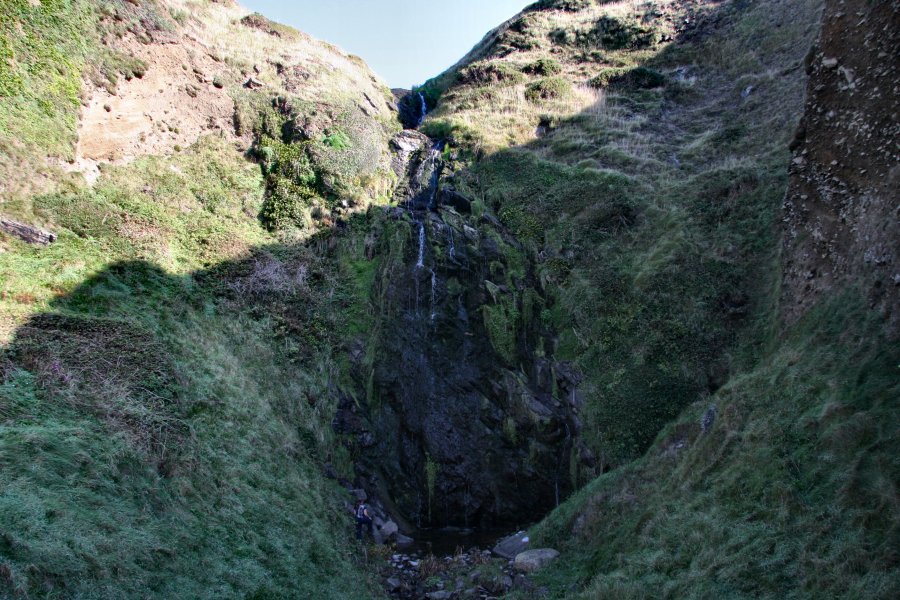
Return down the lane past the church (away from the junction) to reach the Ysgo farm, which spans both sides of the road. Immediately after the lane crosses a small stream at the farm, turn left onto a farm track leading past some barns. After 35 metres, follow the footpath leading off the left side of the track, which crosses a stream, then heads down its left bank. Take the right branck when it forks, to remain near the left bank of the stream. Soon after the stream falls down into a wide hollow on the right, take a path on the right which leads down steps to the beach. Look to the right just before the beach to see the Pistyll y Gaseg waterfall in the hollow. It needs several days of heavy rain (and preferably a visit on a cloudy day) to appear at its best. There are supposedly other waterfalls along the cliffs, but none are of any significance.
Return to the path junction above the waterfall, and turn right. Turn left when it joins another path, swinging into the next stream valley. Cross the stream, then take the path leading up its right side (ignore a path that splits off to the left almost immediately, which just crosses the stream again). Eventually it crosses to the left bank of the stream (ignore a path climbing up to a field on the left), crosses back, then arrives at a road. Go left, then left again at the junction just beyond, to reach the start of the walk.
| Waterfall | Grid reference | GPS coordinates | Image |
|---|---|---|---|
| Pistyll y Gaseg | SH 20828 26542 | 52.806585°N, 4.659568°W | |
Whilst every care has been taken in the compilation of this description, neither the author nor his fellow walkers can accept responsibility for loss or injury arising from any errors, omissions or inaccuracies in this description. This description is intended as a guide only, and you should select a route to suit your own abilities, at your own discretion. Ability requirements are a guide only. Route maps are approximated. You follow this description at your own risk.