
Including Pwll-y-Wrach, Pwll-y-Wrach Lower Waterfall and Cwm Trappi Waterfalls.
From Cardiff, take the A470 to Brecon. From Brecon, take the fourth turnoff at the roundabout, along the A40 to the next roundabout. Take the second turnoff, along the A470. When the A470 turns left off the current road, continue ahead along the A483 to Bronllys, turning right at the first roundabout (third turnoff) to reach the A479 roundabout. Take the third turnoff (right) to Talgarth. From Talgarth, at the roundabout junction with the B4560, turn left onto High Street, then turn right at The Bridge End Inn, just before crossing the river, onto Bell Street. Stay with it as it leaves Talgarth, passes fields and a small housing estate, then breaks back into countryside. A small parking area soon appears on the right, with a gateway leading into the forest. Ignore it and park at the next one instead, which appears soon afterwards. SO 1619 3280.
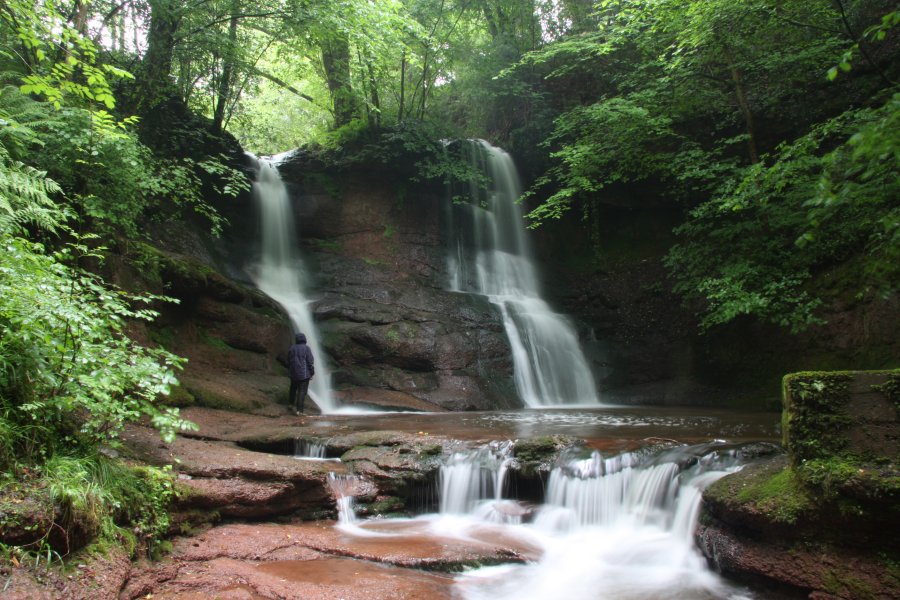
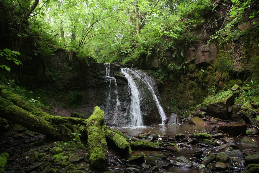
Go through the gate into the forest, where there is a sloping path heading gently to the left (supposedly for disabled access) and a stepped path heading more steeply downwards. Select whichever path you prefer, to descend to the path running just above the stream. Both waterfalls lie upstream of the parking area (to the left when looking into the parking area from the road). The stepped path is the preferred one for seeing the Lower Waterfall, as the other only makes it to the river after passing it (if needed, backtrack to reach it, or see it after returning from the upper one). Follow the path upstream to see the Lower Waterfall, and the main Pwll-y-Wrach waterfall, identifiable as it has two very distinct streams falling into the same plunge pool. The path continues upstream to a couple more cascades.
Return to where the stepped path joined the bottom path, where a small path leads to the river. If water levels permit, ford the river, and continue along the path on the other side, heading downstream. After a while, it swings left and heads uphill. A little way up, take a small path down on the right, to the bank of the smaller stream; Cwm Trappi. The path here is pretty poor, and you need to regularly leave it and walk up the stream banks to get to the best viewpoints. Cwm Trappi has 4 small waterfalls, of which the third is quite poor, with the path deteriorating more and more until it disappears into the undergrowth.
| Waterfall | Grid reference | GPS coordinates | Image |
|---|---|---|---|
| Pwll-y-Wrach Lower Waterfall | SO 16617 32620 | 51.985754°N, 3.215611°W | |
| Pwll-y-Wrach | SO 16934 32667 | 51.986224°N, 3.211008°W | |
| Cwm Trappi Waterfalls | SO 16337 32444 | 51.984130°N, 3.219645°W | |
Whilst every care has been taken in the compilation of this description, neither the author nor his fellow walkers can accept responsibility for loss or injury arising from any errors, omissions or inaccuracies in this description. This description is intended as a guide only, and you should select a route to suit your own abilities, at your own discretion. Ability requirements are a guide only. Route maps are approximated. You follow this description at your own risk.