Including Pwll Uffern.
From Cardiff, take the A470 to Brecon. From Brecon, take the second turnoff at the roundabout, along the A40 to Llandovery. From Llandovery, turn right on the A483 towards Builth Wells. Turn left at the staggered crossroads, signposted to Cilycwm and Rhandir-mwyn. About a mile after passing through Rhandir-mwyn (several miles from Llandovery), there is a side road to the left at a triangular junction, signposted to Cilycwm. About a mile later, take the next road that forks off to the left, just before a fairly large parking area, signposted to Troedyrhiw. Follow the lane (which can be disturbingly narrow at times, with a drop below it, and precious few passing spaces) to its end. Shortly after a steep uphill (with grit bins) it turns a hairpin bend to the left and becomes private. Find somewhere to park on the roadside (before the hill if needed). SN 7717 4791.
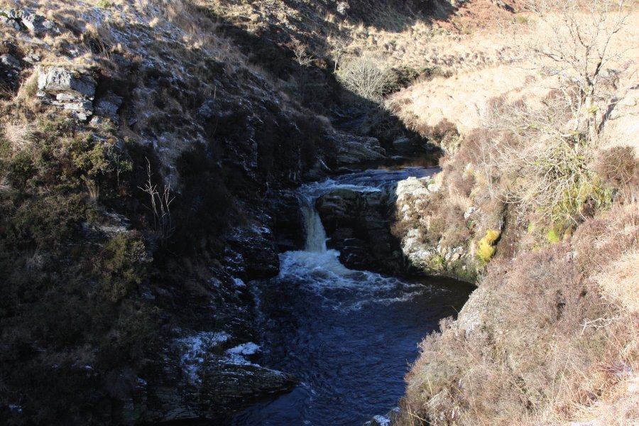
Follow the road as it turns into a track, and passes the right side of the farm. After a short way, on the far bank, you may be able to make out a series of waterfalls on a small stream. Stay with the track as it crosses the Afon Doethie to reach another farm at the mouth of the Afon Pysgotwr's deep gorge. From here, the track climbs very steeply to the moorland, then crosses it. As it swings right and begins to descend into the Afon Pysgotwr Fawr valley, leave the track near a small quarry and head down to the river. Very carefully follow it downstream to reach the Pwll Uffern waterfalls. Just beyond the first waterfall, the Afon Pysgotwr Fach joins from the far side, with a series of waterfalls on both rivers and at the junction. Be extremely careful, as there is no truly safe viewpoint.
Return the way you came.
If you would like to try to get alternative views (only for experts), the quickest approach is to bring tall waterproof boots, use them to ford the Afon Pysgotwr and Afon Pysgotwr Fach rivers at an appropriate point upstream of their waterfalls, and very carefully follow the far bank of the Afon Pysgotwr Fach downstream to locate viewpoints. Take great care. Alternatively, it is possible to continue up the track to the next farms where there is a bridge over the Afon Pysgotwr (the Afon Pysgotwr Fach still needs to be forded), but this would add about 8 km of extra walking, so is not the suggested approach.
| Waterfall | Grid reference | GPS coordinates | Image |
|---|---|---|---|
| Pwll Uffern | SN 74634 49906 | 52.133191°N, 3.833026°W | |
Whilst every care has been taken in the compilation of this description, neither the author nor his fellow walkers can accept responsibility for loss or injury arising from any errors, omissions or inaccuracies in this description. This description is intended as a guide only, and you should select a route to suit your own abilities, at your own discretion. Ability requirements are a guide only. Route maps are approximated. You follow this description at your own risk.