
Including Pistyll Rhyd-y-meinciau and Pistyll Eunant.
From Cardiff, take the A470 to Mallwyd (at the edge of the Snowdonia National Park). From Mallwyd, take the A458 towards Welshpool. After 10 miles, just before Llangadfan, take the B4395 to the left towards Llanfyllin. After 7 miles, take the B4393 doubling back very hard on the left, towards Lake Vyrnwy. Follow it to the far end of the reservoir. For the main walk, just after a road leaves on the right towards Bala, park in the Rhiwargor parking area on the right. SH 9637 2408.
For driving to Pistyll Eunant, continue along the road past the Rhiwargor parking area. After 2 km take the next proper road to the right, and follow it for 1.8 km, to where the fields on the left end. The Pistyll Eunant waterfalls can be seen in the stream ahead, and one further cascade lies below the road at the end of the last field. There is a small area to park. SH 9459 2298. (Beyond here, the mountain road can be followed as a shortcut down to Dinas Mawddwy via a road with superb views, but a sustained, steep downhill, which can overheat the brakes of many cars.)
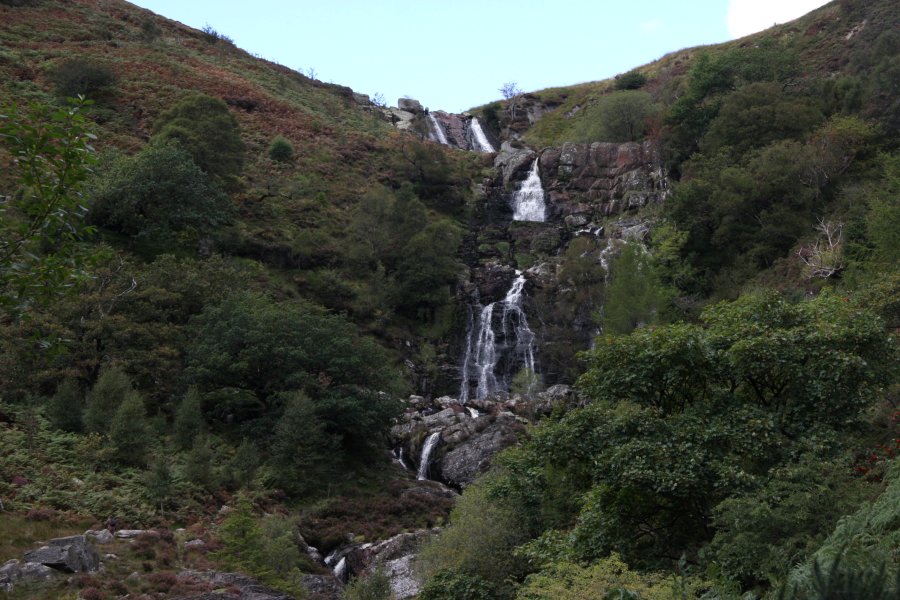
Head along the path that leads off to the right at the back of the parking area (as seen from its entrance). This leads over to the river, and follows it upstream to the multi-step cascades of Pistyll Rhyd-y-meinciau. On the left side of the waterfall, there is a muddy path that leads up to the top benches of the cascades.
If you want a change of scenery on the way back, it is possible to ford the river below the waterfall, if conditions allow it, to pick up a track on the other side. (Alternatively, a bridge shortly before the waterfall can be used to reach the other bank below the waterfall.) After 600 metres, a path to the right leads to a footbridge crossing the river. Turn left on the path at the other end to return to the parking area, and the end of the walk.
It is also possible to walk to Pistyll Eunant from here, as an extended on-road walk. Leave the parking area and turn right on the road. After 2 km take the next proper road to the right, and follow it for 1.8 km, to where the fields on the left end. The Pistyll Eunant waterfalls can be seen in the stream ahead, and one further cascade lies below the road at the end of the last field. Return the same way.
The land between Pistyll Eunant and Pistyll Rhyd-y-meinciau is open access, and in theory it would be possible to walk over the moorland from one to the other to create a loop. However, there are no paths over the heather covered moorland, making progress very difficult. This option is not considered part of the walk.
| Waterfall | Grid reference | GPS coordinates | Image |
|---|---|---|---|
| Pistyll Rhyd-y-meinciau/Rhiwargor Falls | SH 95276 24653 | 52.809222°N, 3.555081°W | |
| Pistyll Eunant/Eunant Waterfalls | SH 94478 23105 | 52.795156°N, 3.566415°W | |
Whilst every care has been taken in the compilation of this description, neither the author nor his fellow walkers can accept responsibility for loss or injury arising from any errors, omissions or inaccuracies in this description. This description is intended as a guide only, and you should select a route to suit your own abilities, at your own discretion. Ability requirements are a guide only. Route maps are approximated. You follow this description at your own risk.